Tag: Department of Transportation

  • Flying cars

    Flying cars

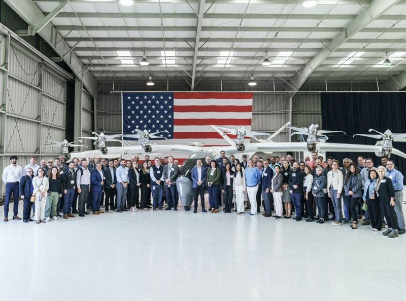
    The U.S. government has visibly and physically conveyed its interest in getting air taxis into operation, through a visit of 70 people — attached to the newly formed Advanced Air Mobility (AAM) Coordination group — to Archer Aviation. The group talked with the executives of the company developing the “Midnight’ air-taxi aircraft and watched a flight test.

    The AAM group includes members from leading government agencies concerned with making and keeping this segment of aviation successful, including the Federal Aviation Administration (FAA), the Department of Transportation (DOT), the National Aeronautics and Space Administration (NASA), the Department of Defense (DOD) and other agencies.

    AAM group visits Archer Aviation. (Image: Archer Aviation)
    AAM group visits Archer Aviation. (Image: Archer Aviation)

    Gathering the views of Archer and other electric vertical takeoff and landing (eVTOL) developer executives should be an essential part of the AAM group’s information collection task. And while it’s great to see that the interagency group has every intention of promoting the AAM concept of air taxis, it would perhaps be better if the group also had access to representatives of manufacturers, developers, and those with UAS experience. It’s clear that we need to start by spreading the word, but also by including people in the group who have dedicated themselves to bringing these capabilities to market — that may make the process more efficient.

    Along the way, it may also help to understand that the processes we have used in the past to get airframes like this into passenger carrying operations might not work well with this new industry. It’s understandable that it should take a lengthy period to assess, verify, qualify and certify such vehicles in the name of safety, but if companies run out of cash and fold in the interim — which is highly likely with this “start-up industry” — then shouldn’t we be looking for a better way to get these guys off the ground?

    No one wants safety to be sacrificed, but could there be some way to streamline, speed up, or simplify the process without skipping essential steps — a way to get new technology into use before it’s obsolete, or a lack of start-up money dooms its progress? The forecast for the economy in the near future is in the billions of dollars. So, providing funding to improve the current processes does make sense. DOD has started to put serious effort into speeding up its acquisition process and has empowered the Defense Innovation Unit (DIU) to find quicker ways to bring commercial technologies into defense.

    The processes used to bring new technologies into use are tried and proven, but they are lengthy. In defense, if our opposition can field things quicker than we do, they have an edge in strategy, tactics and a higher probability of winning in battle. These countries are using the same approaches in the commercial world too, and we need to be wary that they may also have a greater chance of winning the “economic war.”

    Nevertheless, Archer in California and others such as Joby, also in California, and Liliam in Germany, plod on through varying stages of FAA and European Union Aviation Safety Agency (EASA) certification paths. An example of the effort that a company has been required to put into fulfilling the requirements of a certification agency is that of Lilium, which first applied for its Design Organization Approval (DOA) in 2017, is still churning through the qualification efforts and does not expect approval until 2025. Of course, the answer is “Don’t get on the certification ‘hamster-wheel’ unless you can stand the journey.” However, we do want these systems and vehicles to make it in order to overcome some of the traffic nightmare that we are living through in our major cities and to contribute to the growth in the economy.

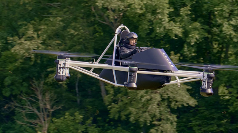
    Meanwhile, the great hope (even expectation) of the “flying car” is being kept alive by Doroni in Miami with its two seat H1 eVTOL. Having largely burnt through its $3.6 million StartEngine launch money, Doroni is looking for its second round of funding to build more prototypes and join the certification race. However, other single seat eVTOL flying cars have taken the easier route to certify under the FAA Ultralight category.

    Doroni H1 prototype. (Image: Doroni)
    Doroni H1 prototype. (Image: Doroni)

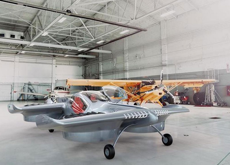
    The H1 has semi-autonomous capability, which Doroni claims will make its eVTOL easy to fly, and allow general sales to any car driver. With air bags, an aerodynamic fuselage — which generates lift — 10 independent propulsion systems (four double prop ducted fans and two forward thrust props), an airframe that can behave as a parachute and “dissipate energy” in case of a crash, and landing gear, the H1 also has multiple independent batteries — all aimed at safety, which will help make it through certification verification. So, if you happen to have the $250,000 proposed sale price and are willing to wait on the completion of FAA certification, you could own your own “flying car.”

    Doroni just announced that they have already made 50 test flights within their manufacturing facility along that test and qualification road.


    Meanwhile, Ryse Aerotech in Ohio, recently demonstrated a manned test flight of its single seat Recon eVTOL — billed as an aid to farmers, with a top speed around 58 mph, a range of about 25 miles and with the right FAA clearance it could even reach an altitude of 700 ft — an airborne ATV for inspecting crops and the like.

    Recon manned test flight in June 2023. (Image: Ryse Aerotech)
    Recon manned test flight in June 2023. (Image: Ryse Aerotech)

    The path to market that Ryse has selected, however, should see more vehicles in earlier use than Doroni’s H1. All you may need is a driver’s license to take off in a Recon because it’s qualified as an Ultralight craft — just buy and fly. Beware, you cannot fly anywhere near an airport or after dark. FAA has restrictions on Ultralight craft.

    So, progress on the semi-autonomous “flying-car” front and a plea to consider the economic benefits and to look to how to improve the efficiency of the existing certification process — not a request to cut corners, rather a request to speed up the processes and save this start-up industry before it goes broke.

  • Hoptroff livestreams GNSS vulnerabilities roundtable

    Hoptroff livestreams GNSS vulnerabilities roundtable

    Hoptroff will host its thought leadership industry roundtable, “GNSS, the time is up,” on March 21. The virtual roundtable will explore the impact of escalating GNSS vulnerabilities to business continuity and how organizations can best protect business-critical operations.

    “Businesses and financial institutions need to accept and start planning how they are going to mitigate the risks associated with GNSS,” said Tim Richards, CEO at Hoptroff. “This livestream roundtable will allow business and financial institutional decision-makers to better understand the impact and disruption GNSS vulnerabilities can have on their bottom line, and why they need to act now.”

    The roundtable is an opportunity for those in the financial and business sector to learn more about the status of GPS, the growing potential risks from increased jamming, spoofing and cyberattacks, what disruption looks like, and the new technologies available to provide complementary positioning, navigation and timing (PNT) technologies to help mitigate risk.

    “GNSS vulnerabilities create serious consequences for critical infrastructure,” said Richard Hoptroff, founder and chief time officer at Hoptroff. “To effectively mitigate these threats, complementary PNT solutions need to be deployed.”

    The event will be moderated by Robert Hampshire, deputy assistant secretary for Research and Technology, U.S. Department of Transportation.

    Speakers at the roundtable event include:

    • Robert Hampshire – Deputy Assistant Secretary for Research and Technology, U.S. Department of Transportation
    • Diana Furchtgott-Roth – Heritage Foundation and George Washington University
    • Judah Levine – Fellow, National Institute of Standards and Technology (NIST)
    • Karen Van Dyke – Director for PNT, U.S. Department of Transportation
    • Steve Suarez – Global Head of Innovation, Financial Services
    • Kathryn Condello – Senior Director, National Security/ Emergency Preparedness, Lumen Technologies
    • Richard Hoptroff – Founder and Chief Time Officer, Hoptroff

    Areas of discussion at the roundtable include:

    • The rising GNSS vulnerabilities and the potential consequences of GNSS disruption such as service outages, errors, or inaccuracies.
    • Example use cases where GNSS vulnerabilities can have a significant impact on your business continuity.
    • How to enable new resilient complementary technologies for your disaster recovery plans.
    • How to start utilizing these technologies today in your real-life applications such as precision timing for global financial services.
    • Practical advice for businesses on reducing GNSS risk in financial transactions, fraud detection, compliance and data integrity.

    Those interested in attending the livestream roundtable can sign up on the Hoptroff website.

  • Who runs GPS?

    Who runs GPS?

    Who Runs GPS

    Nearly 50 years ago, in December 1973, the Defense Systems Acquisition Review Council approved the Navstar Global Positioning System for entry into Phase I of development. Since then, through its development, deployment and continuing modernization, GPS has grown into a complex program. It is operated by the Department of Defense based on legislation from Congress, executive orders from the White House, and policies established jointly with the Department of Transportation. It supports U.S. military missions as well as myriad scientific, commercial and consumer applications around the planet. Of course, the last category, with its billions of users, now dwarfs all the other ones combined.

    The GPS program, with an annual budget of nearly $2 billion and no user fees, is a gift from U.S. taxpayers to the world. It has staff in Washington, D.C.; at the Pentagon in Arlington, Virginia; at Schriever Space Force Base, Colorado; at the Space Systems Command at Los Angeles Air Force Base, California; at Cape Canaveral, Florida; at the U.S. Coast Guard Navigation Center in Alexandria, Virginia; and at GPS ground antennas in additional locations around the world. From the White House to Congress to aerospace companies, from military officers to civilian civil servants, from policy makers to engineers, from the East Coast to the West Coast to remote islands in the Pacific, Indian  and Atlantic Oceans, GPS is a vast enterprise — most of which is little known even to people in the industry and virtually unknown to the public.

    The Global Positioning System is a vast and mostly unknown enterprise. This section — the first in an occasional series of authoritative reference pieces in this magazine — aims to clarify who does what to maintain GPS as a fantastic global utility. The relevant missions of agencies or units are in italics.

    After I researched and drafted the piece, I asked the experts listed below to review it and provide corrections and additions. While grateful for their substantial feedback, I take sole responsibility for any remaining errors or omissions.

    Thank you to the following experts:

    • Harold W. Martin III, Director, Space-Based Positioning, Navigation & Timing, National Coordination Office
    • Michael J. Dunn, Capability Area Integrator for PNT, Space Systems Command, United States Space Force
    • Lt. Col. Robert O. Wray, Commander, 2nd Space Operations Squadron, United States Space Force
    • Scott R. Calhoun, Commanding Officer, Navigation Center, United States Coast Guard
    • Paul Benshoof, Technical Director, 746th Test Squadron (AFMC), Central Inertial and GPS Test Facility
    • Bernard Gruber, Senior Director, Northrop Grumman

    Please return to this page periodically to read corrections and updates to this special section. If you spot any significant inaccuracies or omissions, please bring them to my attention by writing to me at [email protected].

  • Details of September’s CGSIC meeting released, DeLaPena to speak

    Details of September’s CGSIC meeting released, DeLaPena to speak

    The 62nd meeting of the U.S. government’s Civil GPS Service Interface Committee (CGSIC) will be held Sept. 19–20 in the Hyatt Regency Denver at the Colorado Convention Center, before the annual ION GNSS+ conference.

    It will be hosted by the U.S. Department of Transportation (DOT) and the U.S. Coast Guard Navigation Center (NAVCEN). DOT serves as the civil lead for GPS and chairs the CGSIC in this capacity. NAVCEN is assigned duties as Deputy Chair and Executive Secretariat for the CGSIC.

    On Sept. 19, the CGSIC subcommittees for Timing, International Information, and Survey, Mapping, and Geosciences will meet. A summary of these meetings will be presented to the CGSIC Plenary Session on Sept. 20.

    Photo:
    Cordell DeLaPena, Program Executive Officer for Military Communications and PNT Space Systems Command

    Keynote speaker for the plenary session is Cordell DeLaPena, program executive officer for Military Communications and Positioning, Navigation, and Timing, Space Systems Command, Los Angeles Air Force Base.

    The agendas for the CGSIC subcommittee and plenary sessions will include presentations on the operational status and modernization of the GPS constellation of satellites, U.S. space-based positioning, navigation and timing (PNT) policy, GPS augmentation systems, and information related to U.S. engagement with other international GNSS as well as a variety of interesting applications of the use of GPS.

    Several new briefings are part of the plenary session this year, including a presentation from NASA on the role of GPS in support of the next lunar mission. Also, the Department of Homeland Security will provide an update on the activities of the Office of Infrastructure Protection, Positioning, Navigation, and Timing Program Management Office.

    This year’s meeting will be live-streamed over the internet. For those who are unable to travel, the meetings can be accessed with the links below.

    The agenda for the meeting is available; all CGSIC presentations will be available there for viewing online shortly after the meeting ends. As a reminder, all CGSIC meetings are free and open to the public.

    Surveying, Mapping and Geo-Sciences Subcommittee
    Sept. 19, 9 a.m. – 12:30 p.m. MDT
    Chair: John Galetzka, NGS
    Co-Chair: Neill Winn, NPS

    https://vimeo.com/event/2298510/f73d8f14a5

    International Information Subcommittee
    2–5 p.m. MDT
    Chair: John Wilde, CEO, Spacekeys

    https://vimeo.com/732131682/cc3618c8f4

    Timing Subcommittee
    2–5 p.m. MDT
    Chair: Patricia Larkoski, The MITRE Corporation
    Co-Chair: Bijunath Patla, NIST

    https://vimeo.com/732129866/117e64cded

    Plenary Session
    Sept. 20, 9 a.m. – 5 p.m.
    Chair: Karen Van Dyke, DOT
    Deputy Chair: Cpt. Scott Calhoun, USCG

    https://vimeo.com/event/2298510/f73d8f14a5


  • Rep. Wexton working behind the scenes to secure GPS and backups

    Rep. Wexton working behind the scenes to secure GPS and backups

    Rep. Jennifer Wexton
    Rep. Jennifer Wexton

    Reading her biography, you might not think that Jennifer Wexton, U.S. Representative for Virginia’s Tenth District, would be very connected to technology issues. As an attorney and government leader, she has spent a lot of time advocating for families, veterans and federal workers.   

    Yet she is also co-founder of the Congressional Task Force on Digital Citizenship and has become an advocate for protecting the nation’s vital positioning, navigation and timing (PNT) services.  

    “We all use GPS every day whether we know it or not, and we need to ensure it stays the gold standard for satellite navigation,” she said. “But as the National Security Council said last year, it has become a single point of failure for America. So much of our critical infrastructure depends on GPS, from the navigation apps on our phones to the military to our financial and energy sectors, and it is past time that we address its critical vulnerabilities and develop and implement reliable backup technologies.” 

    Wexton says that she has been aware of and concerned about the issue almost since the day she took her seat in Congress.  

    “I am a member of the House Appropriations subcommittee that oversees funding for the Department of Transportation, and civil GPS and PNT issues fall squarely in DOT’s jurisdiction,” she said. “In 2018, Congress passed a law requiring DOT to ensure we have a backup for GPS, and we updated that law earlier this year to ensure that all appropriate types of technologies are included in this effort. I don’t know how we can be comfortable with autonomous drones and self-driving cars if we don’t have technologies in place to support and back up GPS. They are certainly available.” 

    The fact that her district includes a huge swath of Virginia’s high-tech corridor has added to her knowledge of the problem and range of possible solutions. In addition to many big names in technology and government contracting, several smaller companies focusing on resilient PNT have offices in her district. These include Echo Ridge, Hellen Systems, Satelles and UrsaNav. All four participated in the Department of Transportation’s Complementary PNT and GPS Backup Technologies Demonstration.  

    Adding to her concern are increasing threats to GPS satellites and signals. At a recent hearing with DOT Secretary Pete Buttigieg, she mentioned Russia’s anti-satellite tests and ongoing GPS jamming in Ukraine as examples. 

    “And that might not even be the worst of it,” she later said. “We need to be cognizant of Chinese capabilities in cyber and in space. They have shown how they can physically grab one satellite with another and toss it out of orbit.” 

    At the hearing, she gently prodded Secretary Buttigieg about DOT’s progress toward protecting the nation.  

    “…in the FY-22 Omnibus we created a program which is housed at DOT and provided $15M to help develop the needed requirements and standards and conduct additional testing. […] How’s it going?” 

    Buttigieg temporized saying the department was working on the Congressional tasking in the appropriation with the funding available. That tasking focused on testing and developing standards as opposed to contracting for signals to begin making one or more alternatives to GPS widely available for adoption.  

    Funding for such an effort has been problematic since a 2018 law required DOT to establish a timing backup for GPS. Administrations have justified inaction by saying that Congress had not funded the effort. Yet hill staff report that for several years administration representatives vigorously opposed any funding at all during annual budget development negotiations. The $15M to establish the program within DOT this fiscal year, which Wexton supported, was the first time any allocation had been made. 

    Rep. Wexton is also a big supporter of GPS modernization. “GPS is the gold standard for satellite navigation and America’s gift to the world,” she said. “We have to continually modernize it to support both military and civil uses. That’s a no-brainer.” 

    She also sees deploying alternative timing and navigation systems a step to making GPS more secure. “Unlike the Russians and Chinese, we don’t have one or more systems widely deployed domestically if GPS is unavailable for some reason. This makes GPS satellites and signals prime targets for our adversaries, terrorists, and criminals. Having one or more alternatives will create redundancy and make GPS a much less attractive target.” 

    Providing one or more alternatives that could be widely adopted could be a relatively inexpensive proposition for the government, certainly when compared to the cost for GPS. More than $2 billion was appropriated for GPS operations and modernization this year. Industry sources estimate that contracts for the suite of alternative PNT sources described in the 2021 DOT report would cost a small percentage of that. 


    Dana A. Goward is President of the Resilient Navigation and Timing Foundation.

  • Open PNT Industry Alliance advocates for alternative PNT in Appropriations Act

    Open PNT Industry Alliance advocates for alternative PNT in Appropriations Act

    Open PNT logoThe Open PNT Industry Alliance (OPIA) issued a statement regarding the recently approved U.S. Fiscal Year 2022 Appropriations Act. The alliance advocates for support of alternative positioning, navigation and timing (PNT) services.

    In its statement, the 21 corporate members express support for the funding provided to the Department of Transportation to pursue alternative forms of PNT.

    The OPIA also highlights a change to the National Timing Resilience and Security Act that eliminates the “land-based” technology requirement. The consensus among members is that the adjustment was needed so that the law would allow for multiple forms of PNT, a concept that aligns with the diverse technology principles of the coalition.

    Below is the full text of the statement.


    The Consolidated Appropriations Act for Fiscal Year 2022 (H.R. 2471) promotes robust positioning, navigation, and timing (PNT) technologies and preserves competition that drives innovation in the market.

    Important Funding for PNT Services

    The FY 2022 Appropriations Act, passed by the U.S. Congress and signed into law by President Biden on March 15, 2022, provides $15 million for the U.S. Department of Transportation (U.S. DOT) to establish a program that will support the U.S. government’s pursuit of many types of alternative PNT. The legislation aligns with U.S. DOT’s January 2021 “Complementary PNT and GPS Backup Technologies Demonstration Report” and summarizes how the funding will be applied.

    OPIA encourages U.S. DOT to apply this funding to procure alternative PNT services and supplementary solutions that will protect critical infrastructure. Our members are prepared to engage civil government officials and critical infrastructure owners and operators to match needs with solutions.

    Critical Change to Existing PNT Law

    The National Timing Resilience and Security Act of 2018 (NTRSA) focused attention on the need to reinforce GPS. Congress subsequently recognized that NTRSA would be harmful to the commercial PNT market. The FY 2022 Appropriations Act revises the NTRSA to align with the U.S. DOT’s 2021 report that “the best strategy for achieving resilient PNT service is to pursue multiple technologies to promote diversity in the PNT functions that support transportation and other critical infrastructure sectors.”

    This straightforward change to the NTRSA is as follows:

    “Section 312(a) of title 49 United States Code, shall be amended by striking ‘land-based,’ after ‘operation of a’.” When the revised objective of the NTRSA is read in context, it is evident that the law is now fully inclusive of multiple forms of alternative PNT:

    Subject to the availability of appropriations, the Secretary of Transportation shall provide for the establishment, sustainment, and operation of a land-based, resilient, and reliable alternative timing system (1) to reduce critical dependencies and provide a complement to and backup for the timing component of the Global Positioning System (referred to in this section as “GPS”); and (2) to ensure the availability of uncorrupted and non-degraded timing signals for military and civilian users in the event that GPS timing signals are corrupted, degraded, unreliable, or otherwise unavailable.

    This move by Congress comports with the findings of the U.S. DOT’s report on PNT which state that “suitable and mature technologies are available in the private sector and offer owners and operators of critical infrastructure a diverse array of complementary PNT services to meet their GPS backup needs. Because such needs are application-specific, GPS resilience across all critical infrastructure sectors will require a plurality of diverse PNT technologies to meet multiple use cases.”

    The commonsense modification to the NTRSA allows multiple alternatives to GPS and other global navigation satellite systems (GNSS) to deliver against a complex and ever-expanding set of institutional and end-user requirements.

    The alignment with OPIA’s bedrock principles is clear:

      • A diverse technological landscape offers varied operational characteristics to support all critical infrastructure sectors.
      • True resilience requires diversity that a sole-source technology cannot meet in terms of reliability, performance, and the flexibility to address evolving attack prevention and threat response needs.
      • The ingenuity of the private sector marketplace will drive the emergence of multiple cost-effective GPS/GNSS alternatives that evolve according to technological innovations and market dynamics.

    Open PNT Industry Alliance members provide what critical infrastructure needs for resilience: alternative forms of PNT that complement GPS/GNSS as well as augmentation services, security solutions, and hardware/software for time synchronization, navigation and location applications.

  • GPS backup funding continues Trump’s admire-the-problem approach

    GPS backup funding continues Trump’s admire-the-problem approach

    Headshot: Dana Goward
    Dana Goward, President, Resilient PNT Foundation

    The appropriation for fiscal year 2022 enacted this month included $15M for “Position navigation and timing [PNT] technologies and global positioning system [GPS] backup” in the Department of Transportation (DOT) budget. At first glance, this might seem like a small but important step toward establishment of the system or systems President Bush mandated in 2004, the Obama administration promised in 2015, and called for by law in 2018.

    Make no mistake, having the issue mentioned in the act is a very positive step. Unfortunately, a careful read of the report that came with the appropriations act shows the funds are not for solving, but for continuing to admire, the problem.

    Here’s what the appropriation report says (in italics) and what it means. This is based on our reading of the text and conversations with hill insiders who said they had a tough battle with the administration to get any funding or mention of PNT or “GPS backup” in the budget at all.

    “The agreement provides $15,000,000 to establish a program…” – This is not really a lot of funding for any federal effort. It is enough to hire several people, set up an office, and maybe do a few studies.

    “…that leads to wide adoption of multiple technologies that provides the necessary GPS backup and complementary PNT as identified by the Department’s report.” The report referred to is DOT’s January 2021 report to Congress on the GPS Backup Technology Demo.

    Notice that the appropriation language talks about “[leading] to wide adoption of multiple technologies.” It makes no mention of establishing any systems or signals.

    Theoretically, this might be done by following the path in the Trump administration’s 2020 Executive Order on responsible use of PNT. The order addresses critical infrastructure and encourages such users to protect themselves with alternate PNT services they find on their own.

    DOT might try this with all users to achieve “wide adoption,” though there are many obstacles. Principal among these is that GPS is free while commercial services are not. Providers of alternative PNT services have long recognized that it is impossible for them to compete with free GPS and argued that the government needs to be the customer.

    “…Funding will enable, among other things…” An interesting turn of phrase that seems to say, ‘you must do all of this, but if you have any money left over you can do other things.’ This is pretty much a throw-away phrase since, with this worklist, they won’t have money left over for anything else. In fact, they will probably come up short.

    “…the development of safety-critical PNT requirements and standards…” In other words, study the problem some more. Developing requirements and standards is important, but it doesn’t provide anything for the United States to use when Putin jams GPS or there is a huge solar storm.

    “…vulnerability and performance testing…” Again, more study and little to no progress implementing solutions.

    “…certification protocols for safety-critical functions”… Still more study.

    “…the procurement of services as deemed appropriate by the Department…” Some might see this as a ray of hope. It could, conceivably, allow DOT to contract for PNT signals from space, fiber, or terrestrial broadcast and move toward establishing one or more systems. Unfortunately, $15M isn’t much for such an effort, even if DOT didn’t have to also create an office and do all the required studies and standards. In this context “services” almost certainly means contracted staff to help with administration and hiring think tanks.

    “…and user adoption models in order to facilitate the responsible use of resilient PNT services to meet Federal requirements for widespread adoption.”

    Since there are no “federal requirements for widespread adoption” to meet, this seems like another throwaway phrase that someone thought sounded actiony and proactive.

    Additionally, we are not sure what a “user adoption model” is.

    The best translation we can come up with is “DOT must figure out how to get Americans to adopt alternate PNT services that are either expensive or haven’t been invented yet. All in the absence of a government mandate for them to do so.”

    Most in the PNT community have long recognized the need to “get the bullseye off of GPS” by making it a less attractive target, while at the same time protecting the nation against a wide variety of threats to satellites and signals. For them, the language in this year’s appropriation bill can be discouraging.

    Yet there is some reason for hope. At least the problem was discussed in the bill, and some money was put toward it, regardless of how flawed the underlying assumptions and mandated actions might be.

    Maybe we should all take comfort in the old Hollywood maxim – “It doesn’t matter what they say as long as they are still talking about you.” Let’s all keep the conversation going.

  • NextNav, Satelles collaborate on Bay Area alternative PNT testbed

    NextNav, Satelles collaborate on Bay Area alternative PNT testbed

    Technology evaluation capabilities inaugurated in demonstration for U.S. Department of Homeland Seurity

    NextNav and Satelles Inc. have partnered on an alternative positioning, navigation and timing (PNT) testbed in the San Francisco Bay area.

    Designed and managed by NextNav with a timing source from Satelles, the testbed creates scenarios and conditions to rigorously test the precision and resilience of alternative PNT solutions, allowing technologies to be evaluated in the absence of signals from GPS and other GNSS.

    NextNav used the testbed to demonstrate the precision and resilience of the company’s TerraPoiNT network in a GPS-denied environment using STL from Satelles as its absolute timing source. This demonstration for the U.S. Department of Homeland Security (DHS) showcased the timing accuracy and resilience of TerraPoiNT, which delivered timing synchronization better than 50 nanoseconds in urban and semi-urban settings.

    As a source of GPS/GNSS-independent time that the U.S. National Institute of Standards and Technology (NIST) determined is highly consistent with Coordinated Universal Time (UTC) — including in deep indoor environments — STL provided the timing signal for the demo instead of GPS.

    The advent of the alternative PNT testbed is timely given the recent publication of “Understanding Vulnerabilities of Positioning, Navigation, and Timing” by the Cybersecurity and Infrastructure Security Agency (part of DHS). This important CISA publication urges owners and operators of critical infrastructure to adopt the responsible use of PNT as defined in Executive Order 13905. The new testbed will be used to demonstrate applications for emergency services, telecommunications, financial markets, the electrical grid, and other critical infrastructure sectors.

    “Demonstrating the accuracy and resilience of alternative PNT solutions is integral in validating the capabilities of alternative PNT solutions and, ultimately, increasing adoption across use cases and applications,” said Ashu Pande, TerraPoiNT VP at NextNav. “With the development of this testbed, we can emulate real world deployment scenarios and can more effectively instill confidence across the PNT industry in the viability of alternate PNT solutions.”

    “The development of this testbed will enable the rigorous, transparent, and replicable testing of alternative PNT solutions,” said Christina Riley, VP of Commercial PNT at Satelles. “We’re excited to be integrated as the GNSS-independent timing reference for this alternative PNT testbed and are looking forward to continuing our collaborative work to build stronger PNT solutions to augment GPS globally.”

    The U.S. Department of Transportation categorized TerraPoiNT from NextNav and STL from Satelles as the top-ranked PNT systems in its technology demonstration report released in January. The testbed collaboration between these complementary alternative PNT service providers underscores the companies’ commitment to promoting the adoption of multiple technologies that complement and augment GPS/GNSS to protect the operations of critical infrastructure.

    Image: imaginima/iStock / Getty Images Plus
    Image: imaginima/iStock/Getty Images Plus/Getty Images
  • NV5 Geospatial adds lidar system for highway-speed mapping

    NV5 Geospatial adds lidar system for highway-speed mapping

    Photo: Riegl
    Photo: Riegl

    NV5 Geospatial has acquired the new Riegl VMX-2HA dual-scanner mobile mapping system. The system will initially deploy in utility and transportation projects and enable NV5 Geospatial to collect highly accurate, feature-rich data at highway speeds.

    The flexibility, ease of setup, and smaller footprint will also allow the use of the VMX-2HA on various platforms, including boats, all-terrain vehicles and trains.

    The VMX-2HA delivers mobile point clouds at a resolution of 1,000 to 4,000 points per square meter (pops) and 0.08-foot vertical accuracy in terms of 95% confidence intervals. It also features a high-speed 10 GigE link, which supports reliable data acquisition of up to 2 million measurements per second and image data from all integrated cameras.

    NV5 Geospatial will launch the VMX-2HA as part of a mapping project for a large U.S. utility company and implement it for work being done for the U.S. Department of Transportation.


  • $17M proposed for DOT resilient PNT initiatives

    $17M proposed for DOT resilient PNT initiatives

    Photo: E4C/E+/Getty Images
    Photo: E4C/E+/Getty Images

    The U.S. Office of Management and Budget (OMB) seeks to extend Trump policies and repeal timing law counter to its own study and industry input

    The Biden administration’s budget proposal delivered to Congress last week includes $17 million for the small Department of Transportation (DOT) office responsible for leading civil positioning, navigation and timing (PNT) efforts for the nation. This is a marked increase over the $2 million allocated in 2020 and estimated $5 million being spent this fiscal year.

    At the same time, it seeks to repeal the National Timing Resilience and Security Act of 2018 that mandated DOT establish a terrestrial timing backup for GPS. This, despite the findings of a recently published RAND study completed for the Department of Homeland Security (DHS), and other input from a telecommunications industry group.

    Proposed Spending

    The administration’s budget proposes $17 million for the DOT Office of Research and Technology to be split among three areas of effort.

    Monitoring and detection. The first is a $3.5 million “(GNSS) performance monitoring and interference detection” project. This is a one-time request that is expected to be followed by a request for $1 million in yearly funding to maintain and operate the capability.

    While these may not seem like sufficient funds to many, DOT is tasked with working with other departments and agencies, and to leverage existing capabilities. The National Geospatial-Intelligence Agency (NGA) is specifically named as an important partner with DOT in this effort. NGA already has responsibility for issuing worldwide navigation warnings for U.S. interests. It also has access to a wide variety of information that could be used for the project.

    Signal authentication. Another $3.5 million is proposed for Executive Order (EO) 13905 Implementation and GPS Signal Authentication. The EO was issued in February 2020. It seeks to leverage market forces and education to create additional sources of PNT and encourage users to access them. This approach has been criticized by many as unworkable without extensive regulation and mandates for users, while still not addressing the majority of American companies and users.

    $1.5 million of this $3.5 million will go to further implement the EO through development of a “PNT threat space model” and otherwise support inter-department PNT profile and research and development efforts.

    $2 million would be allocated for a one-time investment in GPS signal authentication to “result in the development and validation of requirements for data and signal authentication capability for civil GPS,” reads the proposal. DOT has regularly requested much greater sums to establish civil signal monitoring, leading many to believe the requirements are already well known. One industry observer suggested this could be “a study in lieu of action.”

    GPS Backup. $10 million would be spent for “GPS Backup/Complementary PNT Technologies Research,” essentially follow-on studies to the DOT GPS Backup Technologies Demonstration. “These efforts will further develop PNT modeling, simulation, and testing tools, as well as standards and performance monitoring tools needed to evaluate integration of diverse positioning, navigation, and/or timing technologies into end-user applications. This work will also support development of cyber-secure receivers,” reads the proposal.

    Proposed Repeal of Timing Law

    More surprising to many than the significant increase in proposed funding is inclusion of a proposal to repeal the National Timing Resilience and Security Act of 2018 (NTRSA).

    One congressional staff member expressed shock at seeing that provision. “The act was the epitome of thoughtful, bipartisan congressional effort,” the staff member said. “It was co-sponsored in the Senate by Markey and Cruz, for crying out loud. You can’t get more bipartisan than that. To have this dumped on us without any notice or consultation is amazing. It is not something I would expect from this White House. I am not sure how serious a proposal it is.”

    Some observers on the hill and elsewhere have opined that, rather than the repeal proposal being a well-vetted administration policy, it is an effort by OMB staff held over from the previous administration to carry forward and preserve President Turmp’s Executive Order 13905 and other PNT policies. Rather than focusing on establishing a GPS backup capability, they instead urged PNT users to find and pay for alternatives on their own.

    Harsh Tone, False Assertions

    Compounding the surprise is the exceptionally harsh tone in the proposal, and assertions that many claim are outright false.
    Among the problems with the language seen by observers is its assertion that NTRSA seeks to establish a single backup for GPS services.

    “It’s unclear to me where such an assertion is supported in the record,” said Greg Winfree, former Assistant Secretary at DOT in the Obama administration. “NTRSA requires the department to incorporate findings from the GPS back-up demonstration program. That project found a variety of systems are needed to protect America,” he said. “NTRSA does require establishment of at least one system, which is incredibly important. Without at least one alternative in place, GPS is one of highest priority targets for our enemies. We have to get the bullseye off of GPS. NTRSA does that.”

    This point on national security was reinforced by Scott Pace, head of the Space Policy Institute at George Washington University (GWU). Pace was executive director for the Space Council in the Trump administration. At a recent GWU webinar on the topic, he commented that having an alternative to GPS will contribute to national security and improve global stability. It will “lower the pressure on us to escalate and respond” should GPS satellites be damaged, or services disrupted, he said.

    China, Russia, and other nations have terrestrial PNT alternatives to GNSS already in operation. This imbalance creates strategic and tactical problems for the United States, according to many analysts.

    The proposed budget also describes NTRSA’s goal of providing at least one backup as “inefficient, anti-competitive and potentially harmful to the existing market for back-up/complementary PNT services.”

    “Exactly the opposite is true,” according to Diana Furchtgott-Roth, GWU economics professor. Until January of this year, she led civil PNT issues within the Trump administration as a Deputy Assistant Secretary for Research and Technology at DOT. “DOT’s Complementary PNT and GPS Backup Technologies Demonstration Report, published in January, specifically stated that a variety of technologies are needed to complement GPS. What is the most cost-efficient in an urban area is not necessarily the most cost-efficient in a rural or maritime area.”

    “PNT is a utility used by every American. Having affordable complementary service available to people in rural and urban areas is the height of efficiency. It is unquestionably in the interests of national and economic security. In fact, access to at least one alternative should be free so to encourage adoption and best protect the nation,” she said.

    “GPS is now a free service provided by the government, and the government is responsible for making sure that it is reliable. GPS outages would cause harm across a broad range of economic activities, including emergency services, general aviation, pipelines, and the electricity grid,” according to Furchtgott-Roth.

    No-So-New and Contradictory Research

    The proposal to repeal NTRSA cites “recent federal analyses” as part of its justification. One of these is likely a report done for the Department of Homeland Security (DHS) by the RAND Corporation. Touted in a press release last month as “new research” and labeled “Published 2021,” the work was actually completed in 2019. DHS representatives have said the delay in publication was needed for review and approval.

    Yet the report was the basis for a DHS report to Congress submitted in April 2020. This has caused some to opine that its publication was timed to reinforce OMB’s effort to repeal NTRSA. “You don’t submit reports to Congress based on un-reviewed, un-approved material,” said a retired DHS official. “The timing of its release is clearly deliberate.”

    The study, “Analyzing a More Resilient National Positioning, Navigation, and Timing Capability,” takes a cost-benefit approach to the issue. One of its high-level findings is that government investment in a duplicate, GPS-like backup capability is not warranted.

    At the same time, it found that government investment in a national timing network, such as the one mandated by the NTRSA, is likely warranted. Saying that a complete backup for all GPS services in all parts of the country is not cost-beneficial, the study says there are some “…federal initiatives that do appear to be cost effective or close to cost effective.” These include “Timing-only backup through fiber/FirstNet, eLoran, or STL [Satelles].”

    According to the retired DHS official, this directly contradicts OMB’s assertion that NTRSA should be repealed. “Either they didn’t read the whole thing, or they counted on most people not reading farther than the top-level recommendations,” he said. “And those top recommendations were clearly selected to match OMB’s desired outcome.”

    Telecommunications Industry Cites Need for NTRSA Provisions

    The May 2021 “Report to the President on Communications Resiliency” also runs counter to claims made in the budget proposal. In it, the president’s National Security Telecommunications Advisory Committee (coordinated by DHS) cites the need for GPS alternatives in telecommunications and urges President Biden to fund them. It specifically mentions the need for a national timing architecture, and cites the provisions of NTRSA several times as a step in the right direction.

    The industry group Alliance for Telecommunications Solutions also sent letters in May to congressional leaders urging funding for GPS alternatives.

    Continuing the Discussion

    Congress has become increasingly dissatisfied with executive branch actions on resilient PNT over the last decade.

    The most recent evidence of this is an extensive and highly critical report of the Department of Defense’s approach to PNT resilience released May 10 by the Government Accountability Office (GAO). Among its recommendations was to not rely on GPS as a primary PNT source but look to more resilient technologies.

    While President Trump’s 2020 Executive Order did not make precisely the same recommendation to civil users, it did focus on “responsible use” of PNT and transitioning to using additional, non-GPS dependent sources.

    The question still under discussion is how far the government should go to support such a transition.

    Seasoned observers regularly comment that Congress has the “power of the purse” and every president’s budget is “dead on arrival” regardless of which party controls the White House.

    It seems clear that resilient PNT will be a topic of lively debate between the Congress and the White House, as well as internally on the hill, for the foreseeable future.


    Controversial GAO report on DOD nav webinar June 15

  • ‘Take the bullseye off GPS before it’s too late!’ — PNT leaders at GWU webinar

    ‘Take the bullseye off GPS before it’s too late!’ — PNT leaders at GWU webinar

    A May 5 webinar about the GPS Backup Technology Demonstration by the U.S. Department of Transportation (DOT) provided valuable insights about the project and intended way forward for PNT efforts in the department.

    It also evolved into a policy discussion with former government leaders saying establishing alternative positioning, navigation, and timing (PNT) systems would make GPS safer by “taking the bullseye off,” and that “the time is now, before it is too late.”

    The webinar, titled “What Technologies Can Secure GPS?”, was hosted by the Space Policy Institute at George Washington University (GWU). A bipartisan constellation of civil PNT stars gathered to participate in the event.

    Featured in the webinar were:

    • introductory remarks by Robert Hampshire, chief scientist for the U.S. Department of Transportation (DOT). He has also been nominated to be DOT’s assistant secretary for research and technology.
    • a presentation by Karen Van Dyke, director, Positioning, Navigation and Timing for DOT, and Andrew Hansen of DOT’s Volpe Transportation Systems Center.
    • discussion of the issues by Diana Furchtgott-Roth, adjunct professor at GWU and a DOT deputy assistant secretary during the Trump administration, and Greg Winfree, director of the Texas Transportation Institute at Texas A&M University and DOT assistant secretary during the Obama administration, both of whom led civil PNT issues for the federal government during their time in office.
    • Scott Pace, director of GWU’s Space Policy Institute, serving as moderator; he was executive secretary of the Space Council during the Trump administration.

    Hampshire opened the event with an address that touched on Biden administration themes of “building back better,” modernizing infrastructure, reducing transportation deaths, making transportation more efficient, and preserving America’s technological leadership. All of these were linked to the need to improve PNT resiliency and reliability.

    Robert Hampshire, U.S. DOT chief scientist, speaking at GWU webinar on May 5. (Image RNT Foundation)
    Robert Hampshire, U.S. DOT chief scientist, speaking at GWU webinar on May 5. (Image RNT Foundation)

    Backup tech demo did not close any doors

    Van Dyke and Hansen then gave a presentation on the results of the department’s technology demonstration project.
    Van Dyke pointed out that, while “GPS backup” may be a popular term, we need complementary capabilities that come into play not just when GPS is unavailable but work alongside it and provide additional capability and resilience all the time.

    She also mentioned that the department is well aware there are more candidate technologies than those selected for the demonstration. Companies offering other ways of providing PNT will not be excluded from future consideration and efforts just because they were not part of the demonstration project.

    Also, while the government collected the data during the demonstrations, she acknowledged that the effort was designed to “showcase the technologies in their best light.” Further study, stress testing, and evaluation will be needed for any system or technology that might be of interest to the government.

    Key elements in the demos

    Hansen discussed the particulars of how the technology demonstrations were conducted and some of the results. While the department evaluated 14 measures of effectiveness during the project, Hansen said that two were key — accuracy and coverage per unit of infrastructure.

    All the technologies demonstrating timing showed accuracy that would be useful across a wide range of applications, he said. Positioning accuracy, though, varied from a “ones of meters to around 300 meters” depending on the technology.

    Hansen said that coverage per unit of infrastructure varied exceptionally between the technologies. These included satellite systems that provide global coverage with a fixed infrastructure, and radio frequency systems with widely different coverage areas per transmitter.

    He also observed that the technology demonstration project was not the end of the department’s technical inquiries. In fact, some of its results—such as eLoran performance in an underground scenario—were unexpected and are being further examined.

    Transportation has some of the most stringent PNT requirements for accuracy, integrity, availability, and reliability, he said. And not all safety-critical transportation requirements may be met by market-based business models. Commercial systems lack the open standards and specifications that have made GPS so useful and widely adopted. Hansen said that the department will be working on these issues going forward, as well as performance monitoring for alternative systems.

    A recurring theme throughout the webinar from all participants was that there is no single solution, no silver bullet, to achieve sufficient national PNT resilience. A systems-of-systems approach was needed. In Hansen’s words “a plurality of complementary systems” is required to ensure PNT reliability and safety, as well as efficient transportation.

    Take the bullseye off GPS! — An urgent national security issue

    While agreeing with the systems-of-systems approach, Greg Winfree pointed out that a first step still needs to be taken. He said that the nation has known about the need for alternate PNT since a 2001 report by DOT’s Volpe Center. Twenty years later, still no long overdue first step has been taken.

    Just establishing the first alternative and complementary system, Winfree said, will make GPS and the United States much safer. “We need to take the bullseye off of GPS,” he said. GPS is so critically important to this country that it is a very attractive target for those who would do us harm. Having even one just alternative in place would make it much less of a target.

    Diana Furchtgott-Roth pointed out that China, Russia, Iran and others have terrestrial systems that complement space-based PNT. About establishing alternatives, she said “The time is now, before it’s too late.”

    Provisions in the United States National Space Policy provide that “[a]ny purposeful interference with or an attack upon the space systems of the United States or its allies that directly affects national rights will be met with a deliberate response at a time, place, manner, and domain of our choosing.”

    Scott Pace also commented that an having an alternative to GPS will contribute to national security and improve global stability. It will “lower the pressure on us to escalate and respond” should GPS satellites be damaged, or services disrupted, he said.

    Next steps

    One of the questions posed at the end of the session was about actions and expected accomplishments in alternate PNT at DOT in the next 18 months. When could the first alternative system be expected?

    The DOT technology demonstration report recommended that the department work next to develop standards and requirements for alternative systems. Current government employees were appropriately reluctant to say much more.

    Calling upon her recent experience in government, however, Diana Furchtgott-Roth that said she believed that the department needed time to stress test technologies, develop standards and finalize requirements. Since many capable technologies were mature, some already in operation, she thought the first capability could be up and running within a year after that.

    The only missing element according to Furchtgott-Roth is funding, and the focus needs to be on motivating Congress to provide it. The stage is set, she said, with all parties agreeing on the importance of resilient PNT.

    She observed that it is very difficult to get the two parties in Congress to agree, and to pass legislation. Yet this has happened three times in support of establishing GPS alternatives. And PNT is such a critical capability that the entire executive branch even came together to protect it last year opposing the FCC’s decision in the Ligado Networks application.

    She also related that, when she was in office, she requested $15M for the current fiscal year to do needed stress testing and standards development, but the funding did not appear in the budget.

    One reason could have been questions she was asked about whether it is the government’s job to pay for an alternative to GPS, she said.

    As a conservative economist her answer was and is a resounding “Yes.” The national need is beyond the business model of one company or private entity. That is something also suggested in DOT’s report on the tech demo.

    Also, “enormous value and vast efficiencies” come from one entity funding such a utility, she said. “Just as the government funds national defense, it should also provide a complement to GPS.”

    George Washington University’s Space Policy Institute reports a recording of the webinar will be posted on YouTube within the next week.


    Dana A. Goward is President of the Resilient Navigation and Timing Foundation.

  • GWU hosts webinar on DOT GPS backup demos

    GWU hosts webinar on DOT GPS backup demos

    Top-level current, former PNT leaders to discuss findings

    A “Who’s Who” of positioning, navigation, and timing (PNT) leaders will gather virtually at 11 a.m. PDT/2 p.m. EDT on May 5 to discuss findings of the U.S. Department of Transportation’s (DOT) GPS Backup Technology Demonstration, which took place in 2020.

    Included in the “What Technologies Can Secure GPS?” webinar will be DOT Research and Technology leaders from the Obama and Trump administrations, Greg Winfree and Diana Furchtgott-Roth, and currently serving career DOT officials Karen Van Dyke and Andrew Hansen.

    Robert Hampshire, current DOT Acting Assistant Secretary for Research and Technology, will make his first public appearance discussing PNT issues.

    The event is sponsored by George Washington University’s Space Policy Institute and moderated by Scott Pace. Pace served as the executive director for the Space Council in the last administration. In that capacity, he was responsible for a series of directives and policies impacting PNT in the United States.

    Describing the plan for the event, the formal announcement states, “Three separate laws have required the U.S. Department of Transportation (DOT) to back up and complement the Global Positioning System, subject to congressional appropriations. To provide a roadmap, in January the department released its Complementary PNT and GPS Backup Technologies Demonstration Report.”

    The program will open with remarks from Scott Pace, director of the Space Policy Institute, who will also moderate the discussion. Hampshire will offer introductory remarks. Van Dyke and Hansen will follow up with a presentation of the report. George Washington University Adjunct Professor Diana Furchtgott-Roth and the Texas Transportation Institute’s Greg Winfree will provide comments.”

    A question-and-answer session will follow the addresses and discussion.

    The event is free and open to the public, though advance registration is required. Registrants will receive a Zoom link. The webinar will also be recorded.

    Register for the webinar here.


    Feature photo: Monty Johnson of OPNT demonstrates precise time transfer through 100 kilometers of spooled fiber-optic cable. (Photo: RNT Foundation)