The Federal Aviation Administration on Jan. 16 issued a warning to pilots to “exercise caution” when flying over the Pacific Ocean in parts of Latin America due to potential military activities. Areas cited include the eastern Pacific Ocean near Mexico, Central America and parts of South America.
A series of Notices to Airmen (NOTAMs) issued by the FAA state, “Potential risks exist for aircraft at all altitudes, including during overflight and the arrival and departure phases of flight.” The alerts are in effect for 60 days. NOTAMs are issued routinely in any region where there are hostilities nearby.
The U.S. Federal Aviation Administration (FAA) has warned all pilots to “exercise caution” when flying in the airspace over Venezuela “due to the worsening security situation and heightened military activity,” reports ABC News. Possible risks include GNSS jamming and spoofing.
The FAA message said the unspecified threats “could pose a potential risk to aircraft at all altitudes” as well planes taking off and landing in the country and even aircraft on the ground.
The warning comes as the Trump administration has ramped up pressure on Venezuelan President Nicolás Maduro. The Trump administration also has carried out a series of strikes on small boats in the Caribbean Sea and eastern Pacific Ocean that it accuses of ferrying drugs to the U.S., killing more than 80 people since the campaign began in early September.
The Ford aircraft carrier and several destroyers were just the latest addition to the largest U.S. force assembled in the Caribbean Sea near Venezuela in generations. The Trump administration does not see Maduro, who faces charges of narcoterrorism in the U.S., as the legitimate leader of the South American country.
To echo the Association for Uncrewed Vehicle Systems International’s (AUVSI) pleas to Congress, a prolonged government shutdown could impact recent efforts to establish stronger counter-UAS protection for sensitive establishments across the U.S. and forestall key Federal Aviation Administration (FAA) hiring plans to support safe drone integration into the U.S. National Airspace System.
Nothing is good about having roughly 750,000 people out of work and stalling their buying contributions to the American economy, not to mention that air traffic controllers, Border Patrol agents and other essential services are still working without pay. Hopefully common sense will prevail and the government will reopen soon.
Originally known as the Boeing Airpower Teaming System or “Loyal Wingman,” the Boeing Australia MQ-28A Collaborative Combat Aircraft has been rechristened. Developed jointly by Boeing and the Royal Australian Air Force, the MQ-28A was not entered in the U.S. CCA competition and has remained fully employed in Australia with its team. Now referred to as the “Ghost Bat” — a name inspired by a north Australian flying bat by the same name, which uses “multi-spectral sensors” to hunt and learn in packs together — the name is a fitting analogy for the anticipated role of the MQ-28A.
Ghost Bat taxies at RAAF base Woomera in Australia. (Credit: Beoing)
Flying since February 2021, the Ghost Bat has made significant steps toward operational readiness. Using AI-powered intelligence to perform autonomously, Ghost Bat has a replaceable nose section, each fitted with different sensor suites appropriate for different missions.
With eight vehicles now available for a comprehensive operational verification test, in June and four months ahead of schedule, Ghost Bat completed a series of flights at both Woomera and Tindal bases in northern Australia. Capabilities demonstrated included autonomous missions, multi-ship operations and teaming with an E-7A Wedgetail early warning aircraft — including data fusion between multiple MQ-28A Ghost Bat aircraft and the crewed Wedgetail. The aircraft has flown for 150 hours and has accomplished more than 20,000 hours of virtual and ground testing. Able to find, fix, track and target, MQ-28A has proven its capability to carry out essential pieces of the air combat role — remaining elements include engage and assess, which will involve carrying air-to-air missiles later in 2025.
This apparently brings the Boeing MQ-28A close to operational capability and ready for volume manufacturing. The eight aircraft have been built at an automated manufacturing facility in Melbourne, where two improved versions are currently being built that incorporate improvements developed through the testing phase, and a combined GPS/INS system will replace the commercial GPS on the aircraft. Ground has meanwhile been broken on a 100,000-square-foot high-volume manufacturing plant in the Wellcamp Aerospace and Defence Precinct in Queensland — expected to be complete within three years.
While electric vertical take-off and landing (eVTOL) air-taxis under development progress towards certification by FAA and other agencies, introductory trials are also underway and agreements for future collaboration are being made all over around the world. While major players such as airlines and manufacturers have invested heavily to provide the capital for eVTOL development and manufacturing, one such agreement appears to be in trouble.
Lilium jet eVTOL (Credit: Lilium)
Lilium, a jet eVTOL developer, and GlobeAir, an existing operator of an Austrian fixed-wing business aviation operation, signed a memorandum of understanding in September 2022. GlobeAir posted an article on its website that said it saw the agreement with Lilium as a step toward the “next generation of regional air mobility” and that it intended to buy 12 jet-powered Lilium eVTOL aircraft “to operate in Northern Italy and the French Riviera.” GlobeAir was also reported to have supported the inclusion of several potential key local suppliers to participate in the build of Lilium aircraft.
Lilium went bankrupt in October 2024, and its assets and intellectual property have been up for bids. Emerging briefly from bankruptcy protection, Lilium again ended up broke and on the auction block in February 2025. Vaeridion has already purchased Lilium’s battery facility, and Ambitious Air Mobility is close to a deal to acquire the rest.
The CEO of GlobeAir has now told the magazine Aviation Week in an interview that he expects the whole eVTOL adventure to fail, given the cost of not only vehicle development and construction but also the landing and charging infrastructure needed. Other hurdles include the level of test and verification and excessive levels of documentation — overall being “highly regulated, with low margins.” It’s an unfortunate, perhaps premature assessment from an existing fixed-wing operator who contracts out last-mile passenger transitions to third-party helicopter operators.
So, there is another mixed bag of going ons in the world of unmanned and derivative eVTOL aircraft – hopefully following the restoration of funding for the government, paused programs will be restored to extend counter UAS defenses across the U.S., Ghost Bat will complete its combat engage and assess phases and there will be much better news on the eVTOL front.
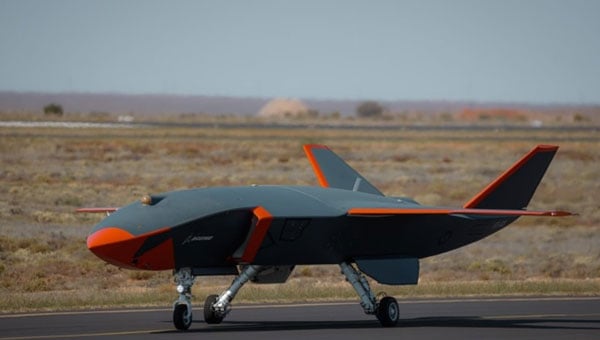
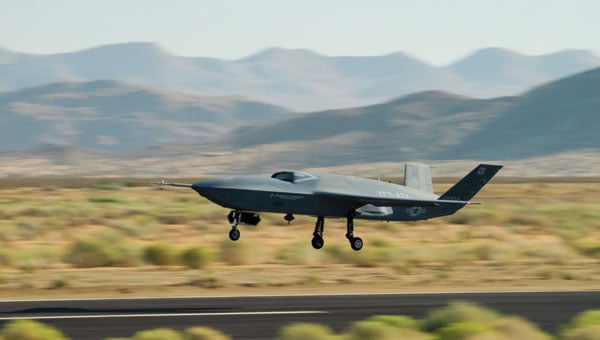
General Atomics Aeronautical Systems Inc. (GA-ASI) is in the news again, as it got its prototype version of the U.S. Air Force (USAF) Collaborative Combat Aircraft (CCA) into the air for the first time, with an anticipated lengthy flight test campaign to follow. This latest CCA iteration, refered to as the YFQ-42A CCA, was derived from an earlier jet-powered XQ-67A Off-Board Sensing Station, a platform that enabled the company to not only develop and build but also fly this latest aircraft in just one year.
GA-ASI CAA makes first flight Aug. 27, 2025. (Credit: GA-ASI)
The UAV features significant autonomous capabilities developed over nearly five years of training using the MQ-20 Avenger unmanned jet aircraft. The strategy of beginning with a company-developed baseline aircraft (Avenger), securing USAF support for an initial derivative and then for the YFQ-42A CCA, appears to be accelerating development of the Loyal Wingman concept toward USAF operational manned-unmanned airborne teaming.
Previously, in July, GA-ASI began preparations to enable friendly European countries to rapidly participate in the future CCA-capabilites by teaming with its German affiliate General Atomics Aerotec Systems GmbH (GA-ATS). The agreement appears to enable high-volume local manufacture of a European CCA, and press releases have implied that potential content is expected to be provided by other high-tech local suppliers.
Following earlier reports that Reliable Robotics (RR) has been busy automating all phases of aircraft operations, including a Cessna Caravan cargo aircraft, USAF has awarded RR a $17.4 million contract to install a Reliable Autonomy System (RAS) in another Cessna. The resulting automated Cessna 208A Caravan is to be used in an estimated two-year program toward obtaining FAA certification that should enable flight within the U.S. National Airspace System (NAS). The system has been demonstrated — with a remote pilot in the loop — to be able to take an aircraft from startup on the ramp, through taxi, takeoff, en route flight, landing and taxi return to the ramp for unloading.
RR autonomous Cessna 208B takes off from Mojave Air and Space Port, California, on Aug. 8, 2024. (Credit: RR)
Cessna Caravans have been heavily used for cargo transport across the U.S. (and around the world) with a range of 1000 miles, carrying up to 1000 lb of cargo. The RR certification program is intended to allow these types of automated unmanned commercial and military operations on a regular basis throughout FAA controlled US airspace, alongside manned aircraft. Flying military unmanned aircraft in the NAS currently requires extremely highly-coordinated, continuous activity. The hope is that eventually it could become an easier more regular form of autonomous cargo/people air transport.
The cost of the continuing war in Ukraine may be affecting the Russian economy — a major drone manufacturer apparently is facing bankruptcy despite Russia currently using thousands of drones in attacks on Ukraine. The situation is difficult to understand, but this is an expensive war.
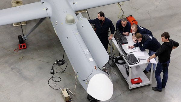
However it appears that, AO Kronshtadt, one of the major drone suppliers in Russia is also beset by civil lawsuits from several organizations to which it owes lots of rubles. Its Orion and an updated version Inokhodets drone are apparently somewhat similar to the US MQ-9 Reaper UAV.
AO Kronstadt employees assemble the Russian Orion UAV. (Credit: open source)
Russia has apparently converted the Orion/Inkhodets medium-altitude surveillance drone into a strike version, but with limited success. Nevertheless, Kronshtadt apparently has made some progress, selling an export version in Asia.
Meanwhile, Russia still is apparently producing up to 6,000 Shahed one-way drones per month by another manufacturer in the Alabuga Special Economic Zone at a unit cost of around $70,000. This is significantly lower than drones that were originally purchased from Iran at $370,000 each.
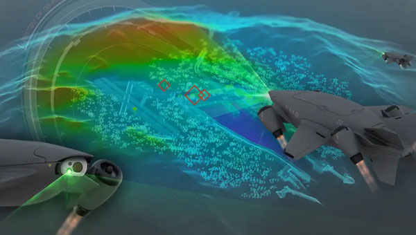
The U.S. Federal Government through its transport agencies apparently has the exclusive right to control drones, including bringing malicious UAVs down from the sky. Most people understand that the Federal Aviation Administration (FAA) regulates who flies what and where, but who is in charge of reducing and removing drone threats? It may have been difficult to understand during recent unauthorized overflights of military installations on the East Coast why someone didn’t shoot down the offending drones.
Now, a group of police agencies has approached members of Congress to ask for the right to “detect, track, identify and mitigate” the unlawful, negligent or malicious use of drones that threaten public safety. Citing a number of incidents — including drone incursions at airports and other incidents where unmanned aircraft have interfered with firefighting and disaster response, instances where law enforcement activities have been overflown and disrupted, and the practice of using drones to drop drugs, guns and mobile phones into prisons — the law enforcement group sees a need for permission to engage. With several major events scheduled across the U.S., it likely is time to support law enforcement with the appropriate powers needed to protect the public.
It is true that several bills are already pending before Congress to enable state, local, tribal and territorial law enforcement agencies to find, identify and possibly mitigate inappropriate drone activity, but the group is urging action now. And they clearly demonstrate the need to be able to stop drone activity when necessary — the federal government cannot cover the whole country all the time, so it makes more sense to adequately train law enforcement and to distribute authorized local mitigation activity whenever it is found to be necessary.
So a mixed bag this month — progress for the U.S. Collaborative Combat Aircraft initiative, more steps toward automation for air cargo transport, problems for one Russian drone supplier while others increase volume and the United States seeks options for better defense against them, and U.S. law enforcement seeks the capability to help mitigate drone incursions where they are not wanted — plenty of different angles to consider around unmanned aerial vehicles.
FAA regulations require drone enthusiasts and commercial operators to equip their unmanned aircraft with approved remote identification (RID) capability. Following the FAA’s deadline on March 24, 2024, each registered drone in U.S. airspace is required to transmit its location, operator information, altitude, velocity and registration code. This data can be utilized to identify the drone’s operator. Additionally, most drones will need to include a timestamp for data synchronization and an emergency status indicator if necessary.
As a concession to purely recreational drone flyers, the FAA allows local organizations to designate and register an area as a reserved location for drone flying — an FAA-recognized Identification Area (FRIA) — and drones flown only in such locations are exempt from the RID regulation. As of September 2023, manufacturers are required to only sell drones with RID capability, and owners of older drones can purchase RID devices to add to their equipment. Some come with an internal GPS, but others connect to existing onboard GNSS receivers.
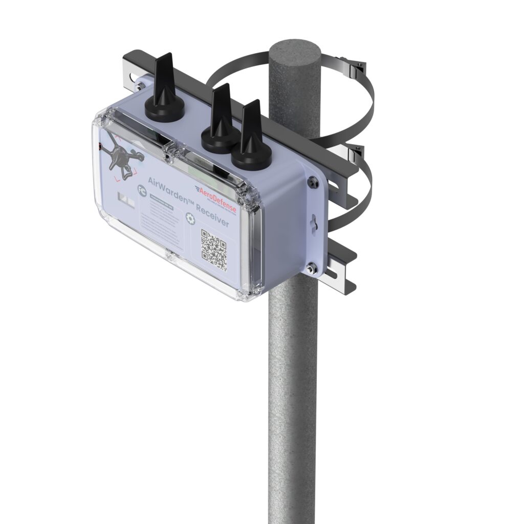
Given this RID-equipped population of drones, AeroDefense in Oceanport, New Jersey, has come up with an inexpensive way of locating legal drones and providing tracking information by providing an area monitoring system. Drone incursions into controlled airspace are not all malicious in nature— in fact, most have turned out to be accidental. So, a low-cost capability, such as the AirWarden Essential system, can be helpful to many facilities wishing to know what drones are in their airspace.
An AirWarden receiver mounted on a pole with a clear view of the sky above the monitored area can capture broadcast transmissions from drones flying overhead. the information is transmitted to a display system that highlights RID-equipped drones in the monitored area, showing not only the altitude and direction of the drones but also the operator’s identity and the location from which the drone was launched. The data can be downloaded to the internet, so facility personnel can also receive incursion warnings remotely, if they happen to be away from the facility. Otherwise, the system provides real-time alerts to your chosen display, along with a tracking history and the location of the launch point.
AeroDefense identifies several key locations for this system, including correctional facilities, venues such as stadiums and large outdoor gathering spots, airports, military bases, critical infrastructure such as power and water distribution centers, and industrial complexes.
What about non-RID drones, which can spy on technology, gather sensitive information, conduct reconnaissance of military facilities, smuggle contraband into correctional facilities, or even damage infrastructure? These drones can operate outside the law and evade FAA regulations. AirWarden indeed offers extensions that facilitate RF detection of both drone control and data transmissions, along with tracking the direction of drone movement. Combined with radar, the system becomes a robust detection solution for both RID and non-RID drones.
Mayman Aerospace in Long Beach, California, has developed a jet-powered vertical take-off and landing (VTOL) cargo drone. It needs only 10’ x 10’ to take off and land, and in flight, it is claimed to be able to reach 500mph (Mach 0.75) and operate at 20,000 ft.
Razor VTOL drone with vectoring jet-powered thrust. (Photo: Mayman)
The Razor VTOL features gimballed, jet-powered thrust for takeoff and landing and a high-speed sprint speed for fast deliveries on the battlefield. The initial application might be for the Department of Defense, but Mayman anticipates that other commercial applications already exist for rapid 50-lb cargo transit.
And Mayman describes other capabilities as including artificial GPS-denied navigation and autonomous control for reliability and accuracy in areas where signal jamming is present. The aircraft has an automatic abort/land capability in the event of catastrophic failure.
This new intelligent vehicle appears capable of various applications, including fast cargo transit, Intelligence, Surveillance, Target Acquisition and Reconnaissance (ISTAR), disaster recovery, serving as a low-cost maneuverable airborne target for pilot training and even functioning as an attack drone.
While recent sky-filled drone incursions have been highly reported and publicized, another means to help detect and locate their operators cannot come at a better time. The AirWarden system appears to have a lot of promise, notwithstanding that radar, RF and acoustic detection systems may also be required for “illegal” drones. Thrust-vectoring, cargo carrying and autonomy in a drone are not just a novel combination, these capabilities do appear to have a great deal of promise for both military and commercial operations.
The Federal Aviation Administration (FAA) has partnered with the Naval Air Warfare Center Aircraft Division (NAWCAD) to initiate steps toward approving Controlled Reception Pattern Antennas (CPRAs) for use in aircraft. This collaboration addresses GPS/GNSS jamming and spoofing threats, with the current focus on a Request for Information (RFI) to study anti-jamming and anti-spoofing technologies. The RFI, published on SAM.gov, aims to identify and evaluate vendors’ antenna technologies for potential integration into civilian aircraft.
CPRAs could significantly mitigate terrestrial-based GPS/GNSS jamming and spoofing, enhancing aviation safety by preserving situational awareness and reducing pilot workload during disruptions. The technology’s effectiveness in neutralizing ground-based threats positions it as a critical tool for maintaining reliable navigation systems.
RFI details and next steps
NAWCAD is leading the RFI process, which includes hosting industry days and establishing Cooperative Research and Development Agreements for testing hardware and evaluating performance. Responses to the RFI are due by May 26, 2025, at 5:00 PM EST, with questions accepted until April 25, 2025. Data from the RFI and subsequent testing will inform updated Minimum Operational Performance Standards for GPS/GNSS antennas and cockpit displays.
Dana Goward, president of the Resilient Navigation and Timing Foundation, noted that this is a great first step, but cautioned that widespread adoption of CPRAs in commercial aircraft will take a long time due to the lengthy FAA approval and certification processes, along with the significant financial investment and effort required to install CRPAs in airplanes.
Although CPRAs address terrestrial threats, space jamming continues to be a critical concern. Adversaries often outpace countermeasures, necessitating continuous innovation to keep up with advancing threats.
FAA safety alert highlights risks
The FAA issued Safety Alert for Operations (SAFO) 24002 on Jan. 1, 2024, to alert operators and manufacturers about the risks of GPS/GNSS disruptions. The alert emphasized the potential for increased pilot workload and safety risks due to situational awareness loss during jamming or spoofing incidents.
On Jan. 17, 2025, the State Department proposed removing CPRAs from the U.S. Munitions List (USML), shifting their regulation to the Commerce Department’s Export Administration Regulations (EAR). This change, effective Sept. 15, 2025, aligns CRPA export controls with other dual-use technologies, streamlining their adoption. A 60-day public comment period is open via regulations.gov.
The ping200XR TSO has received TSO-C112e and TSO-C166b for transponder and ADS-B functionality — TSO-C188b for its internal pressure altimeter, and TSO-C145e for the integral aviation GPS.
It is a compact Mode S ADS-B transponder with an integrated GPS receiver, measuring 47 x 72 x 10mm and weighing just 52 grams. This device combines the functionality of a transponder and GPS into a single unit, making it suitable for airspace access and operations involving certified aircraft.
The ping200XR facilitates seamless integration into national and international airspace systems by enabling aircraft detection by secondary surveillance radar (SSR), traffic collision avoidance systems (TCAS), and ADS-B IN receivers. Additionally, it has received technical standard order (TSO) certification from the FAA, ensuring that it meets specific performance standards established by the aviation regulatory body.
The ping200XR can be used in high-altitude aircraft and balloons operating in Class A airspace and above. With the new TSO certifications, the device can now be utilized in regions that mandate such approvals, including Europe, the United Kingdom, Australia and New Zealand. This certification also makes the ping200XR TSO a viable option for aircraft pursuing type certification, such as electric vertical take-off and landing (eVTOL) and Advanced Air Mobility (AAM) platforms. The certified version is scheduled to become available for purchase starting in September 2024.
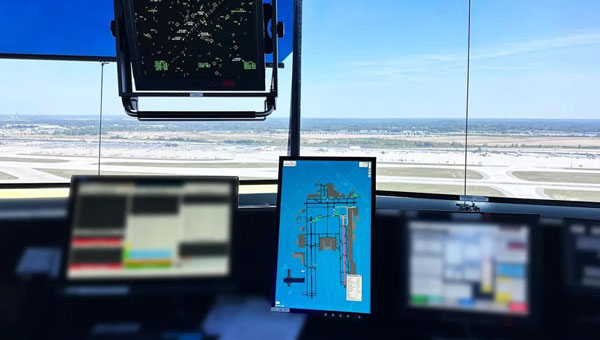
uAvionix has successfully installed and approved its surface situational awareness systems at two major U.S. airports: Indianapolis International Airport (IND) and Austin-Bergstrom International Airport (AUS). Developed in collaboration with Capital Sciences, the systems have passed the Service Acceptance Test (SAT) and will be operational for Air Traffic Control (ATC) starting June 30, 2024.
“This milestone marks the first approvals under the Federal Aviation Administration (FAA) Surface Awareness Initiative (SAI), part of a broader effort to enhance runway safety across the nation,” said Christian Ramsey, chief commercial officer for uAvionix.
The uAvionix systems use the Automatic Dependent Surveillance-Broadcast (ADS-B) service called FlightLine, which offers controllers real-time, precise depictions of aircraft and vehicles on the airport surface. This technology seeks to improve situational awareness and reduce the risk of runway incursions.
The delivery of the FlightLine systems to IND and AUS was completed and accepted within a 90-day timeframe, thanks to close collaboration with the FAA, National Air Traffic Control Association (NATCA), Indianapolis Airport Authority and AUS.
Each airport also installed several of uAvionix’s VTU-20 ADS-B Vehicle Movement Area Transmitters (VMATs) on airport vehicles. The VTU-20 is an FAA-approved system that allows vehicles operating on runways and taxiways to be electronically seen by the tower and aircraft equipped with ADS-B In technologies, further reducing the risk of runway incursions.
Following the success of these implementations, uAvionix will continue working with the FAA to expand the capability to other airports nationwide.
Key benefits of the enhanced system include:
Improved real-time tracking of aircraft and vehicles on the airfield.
Increased safety and efficiency in all weather conditions.
Decreased risk of runway incursions due to timely and accurate data.
SandboxAQ has released AQNav, designed for navigation across air, land and sea when GPS signals are jammed or unavailable.
As of June 2024, AQNav has logged more than 200 flight hours and 40 sorties across multiple regions of the world on four different aircraft types, ranging in size from single-engine planes to large military transport aircraft.
AQNav is a geomagnetic navigation system that uses proprietary artificial intelligence (AI) algorithms, powerful quantum sensors and the Earth’s crustal magnetic field. The system seeks to provide an un-jammable, all-weather, terrain-agnostic, real-time navigation solution in situations where GPS signals are unavailable, denied or spoofed.
The system uses extremely sensitive quantum magnetometers to acquire data from Earth’s crustal magnetic field, which exhibits geographically unique patterns – similar to a human fingerprint. AQNav uses AI algorithms to compare this data against known magnetic maps, allowing the system to quickly and accurately find its position. Due to the high sensitivity of quantum sensors, AI algorithms are applied to improve the signal-to-noise ratio, removing any mechanical, electrical or other interference that would impact the system’s ability to acquire its location.
It is available globally and can be used in air, land and sea applications. The system does not rely on visual ground features or satellite transmissions to function and is not affected by weather conditions.
AQNav operates at room temperature, requires no shielding and has a small form factor that can be integrated into a wide variety of platforms, from multi-engine airliners to UAVs. Its passive technology emits no electronic signals, which reduces the aircraft’s detectability.
AQNav seeks to increase useful navigation for aircraft navigating within the frameworks of regulatory bodies such as the International Civil Aviation Organization and the Federal Aviation Administration (FAA). SandboxAQ and its partners are continuing to explore a broad range of use cases for both commercial and defense applications.
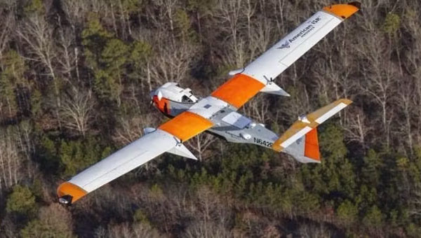
American Aerospace, an Iridium partner, has received a waiver from the Federal Aviation Administration (FAA) to conduct UAV surveillance of critical infrastructure in California’s San Joaquin Valley for Chevron, an oil and gas company.
Enabled by Iridium’s global L-Band satellite connectivity, AATI’s AiRanger UAV will conduct remote aerial surveillance of the energy company’s pipeline and production facilities. Iridium’s network offers beyond visual line of sight (BVLOS) connectivity, including remote command and control (C2) and detect and avoid (DAA) capabilities. The UAV will send information via Iridium satellites to conduct routine inspections.
Iridium partner Blue Sky Network customized and integrated its SkyLink 7100 voice, data and BVLOS terminal on the UAVs. The SkyLink 7100 offers continuous tracking and C2 capabilities for aviation and UAV operations.
The AiRanger is the first UAV to comply with industry standards for the DAA system and meet FAA BVLOS operation requirements. This achievement aims to pave the way for broader use of BVLOS UAVs to enhance situational awareness, reduce inspection costs and maximize value.
Iridium STL is being deployed by L3Harris to protect critical FAA data center infrastructure. (Photo: Iridium)
Iridium Communications has entered a five-year agreement with L3 Harris. Under the agreement, Iridium will provide its satellite time and location (STL) service to more than three dozen L3Harris-operated communications network backbone nodes and a similar number of Federal Aviation Administration (FAA) facilities throughout the United States.
L3Harris, responsible for operating a private network for the FAA, provides voice, data and video communications for the National Airspace System operations and mission support functions. Given the critical nature of timing synchronization within the L3Harris communications network, particularly for supporting various critical infrastructure applications, the Iridium STL service plays a pivotal role in the overall network timing architecture by eliminating dependencies on GPS as the primary timing source.
The solution for L3Harris includes compact devices provided by Adtran’s Oscilloquartz division, which are designed to receive Iridium STL signals. These devices seamlessly integrate into the network and meet nationwide network timing synchronization requirements.
In April 2024, Iridium acquired Satelles, a secure satellite-based time and location service provider.
AUVSI XPONENTIAL 2024 will be held April 22 to 25 at the San Diego Convention Center in San Diego, California.
The event’s key themes include infrastructure and operations, technical research and development, data and analytics, cybersecurity and policy and regulations. The conference will feature keynotes, educational sessions, specialized workshops, and an XPO Hall with more than 30 exhibit categories with technologies across air, land and maritime sectors.
XPONENTIAL attracts more than 7,500 attendees each year, who attend more than 200 educational sessions as part of the full conference. The current keynote sessions include innovators with diverse perspectives and backgrounds who will speak on pressing topics and address key questions affecting the autonomous community.
Confirmed speakers include:
Doug Beck
Director, Defense Innovation Unit
Operationalizing DIU 3.0
Responsible for accelerating the Department of Defense (DoD) adoption of commercial technology through the military, Beck will discuss how defense agencies and industry can collaborate to strengthen national security. This session will be moderated by Courtney Albon, emerging technology reporter for Defense News and C4ISRNET.
Michael Brasseur
Chief Strategy Officer, Saab Inc.
To Create, To Make, To Shape
Drawing upon his role in implementing Saab’s future capabilities strategy, Brasseur’s presentation will address how individuals and organizations can foster an environment of continuous improvement and advancement.
Hal Brands, Ph.D.
Henry A. Kissinger, professor of global affairs, Johns Hopkins School of Advanced International Studies
Advancing Technologies and Their Role in World Affairs
Using his knowledge in foreign policy, international relations and security strategy, Brands will help leaders conceptualize strategies to safeguard national interests and organizations to navigate geopolitical challenges.
Henrik I. Christensen, Ph.D.
Qualcomm chair of robotics and professor, computer science, director of contextual robotics institute, UC San Diego
Looking Ahead: Robotics and Artificial Intelligence
Henrik will explore the future of these technologies and how stakeholders can form strategies that capitalize on emerging opportunities.
Harry Yeff (aka Reeps One)
AI Artist and AI for Good Activist
Undoing a Narrative of Fear
Yeff, a London-born, neurodivergent artist, will share how we can foster a constructive dialogue on responsibly integrating technologies such as artificial intelligence (AI) and autonomy. His performance art pieces, integrated with AI and voice technology, have been exhibited internationally and garnered more than 100 million online views worldwide.
Additionally, a Federal Aviation Administration (FAA) Panel titled “Getting to Go,” will cover safety standards, implementation challenges and obstacles to technology development and testing. Panelists include three representatives from the FAA: Timothy Arel, chief operating officer of the air traffic organization, Marc Nichols, chief counsel and Laurence Wildgoose, assistant administrator for policy, international affairs and environment.
Matt McCardle, head of global regulatory affairs and strategy at Amazon Prime Air will moderate the discussion.
GPS World staff will be attending the conference. To follow our live coverage, click here.
More speakers will be announced in the coming weeks. Click here to learn more and register.