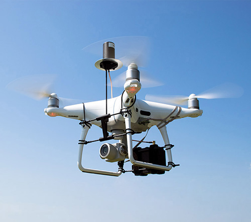
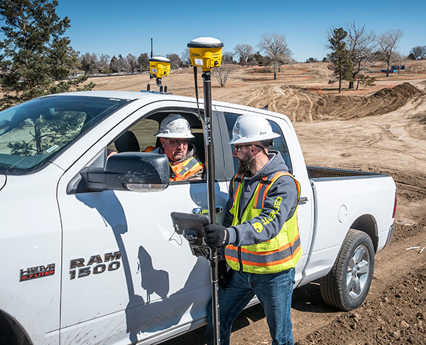
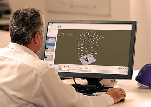
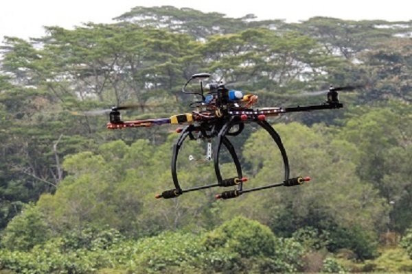
DJI Phantom 4 Pro with Loki PPK system. (Photo: GeoCue)
GeoCue Group (via its wholly owned AirGon subsidiary) has completed the integration of the DJI Phantom 4 Pro RTK (P4R) into its AirGon Sensor Processing Suite (ASPSuite).
ASPSuite is a post-processing solution for GeoCue’s Loki direct geopositioning system for DJI and other manufacturer’s drones.
ASPSuite enables integration of the P4R with third-party L1/L2 GNSS base stations such as systems from Septentrio, Leica, Trimble, Topcon, CHC and others in a high accuracy post-process kinematic (PPK) workflow.
In addition to PPK processing, ASPSuite includes support for options often required in engineering-grade surveys such as:
vertical transforms (such as ellipsoid to country-specific geoids)
creation of and transformation between collection datums and local coordinate systems (site calibration)
application of antenna static and dynamic lever arm corrections
full support for Loki direct geopositioning systems.
The DJI D-RTK-2 base station (optionally available) for the P4R can only be used in RTK mode, and then only if it is being sited on a known location. The D-RTK-2 does not currently allow access to an observation file, preventing it from being stationed using an online positioning service such as OPUS, AUSPOS, Canadian Geodetic Survey services and so forth. An additional consideration in the integration into ASPSuite is that professional surveyors already have the survey kit that they need incorporated into this workflow.
GeoCue is offering camera calibration services for the P4R for customers who wish to do minimal or control-free high-accuracy mapping projects (the DJI “calibration” is an image de-warping algorithm, not a proper photogrammetric calibration). A test of a GeoCue-calibrated P4R using an OPUS-positioned base station and ASPSuite achieved about 4-cm horizontal and 5-cm vertical network accuracy (RMSE) with no ground control points.
A roundup of recent products in the GNSS and inertial positioning industry from the December 2018 issue of GPS World magazine.
OEM
Combination antenna
Long-range connectivity
Photo: Molex
The Molex highly compact 2.4/5-GHz combination GPS/Wi-Fi ceramic antenna is designed to be a cost-competitive solution covering the full GNSS band, 1.561 to 5.85 GHz. The triple-band ceramic antenna has Wi-Fi HaLow compatibility and is interference-resistant, supporting larger but lower (900-MHz) frequency ranges than 2.4/5-GHz connections. It also operates with lower power over longer ranges than 2.4/5-GHz Wi-Fi. Advanced Wi-Fi applications the internet of things, connected cars, smart homes and smart cities.
The MSB1054 multi-receiver module requires no external components, meeting needs of smartwatches, fitness trackers, logistics and navigation. Its Flash memory saves navigation data to optimize performance and provide a hot start. The ability to receive signals from several satellite systems significantly reduces the time to first fix. The module provides a built-in RF-front end (SAW filter, low-noise amplifier) as well as a temperature-compensated crystal oscillator (TCXO), so no external component is required other than an antenna. It measures 5.8 × 6.2 × 1 millimeters and uses 3.4 mA current in low-power mode, such as for tracking.
The GE310-GNSS is an internet of things (IoT) module with GSM/GPRS, multi-constellation satellite positioning and Bluetooth functionality in a 270-millimeter-squared form factor. It meets European demand for GSM/GPRS compact form factors and is part of Telit’s migration-support program that helps customers leverage 2G’s low cost and broad coverage while preparing for 4G and 5G. The GE310 enables OEMs and system integrators in asset management, utilities and telematics to meet the strong demand for low-cost, highly compact devices without tradeoffs in performance, reliability and functionality, particularly in regional markets such as Europe, where 2G is forecast to remain in strong growth in number of IoT connections for many years.
With multi-sensor fusion positioning and orientation
Photo: Unicore
The CLAP-B multi-GNSS/MEMS integrated inertial navigation board features a miniaturized high-performance inertial measurement unit (IMU) on a compact high-performance GNSS board. The high-accuracy GNSS positioning coupled with a high-precision gyro and accelerometer provides stable, continuous 3D position, velocity and attitude, as well as original acceleration and angular velocity measurements, even in GNSS-denied environments. CLAP (Concurrent Localization & Attitude Pilot) technology is a high-precision multi-sensor fusion positioning and orientation technology developed by Unicore. The board is compact, light weight and has low power consumption. It is designed for ease of integration and mass production, and is suitable for autonomous driving, smart surveying and UAVs.
The UNI-GR1 RTK GNSS receiver offers highly accurate heading and positioning output. It can be connected to any device through Wi-Fi, mobile data, radio, USB or serial cable. It simultaneously tracks GPS L1/L2/L5, GLONASS L1/L2, Galileo E1/E5a/E5b and Beidou B1/B2/B3 on 432 channels. The receiver has a built-in level, a LED ring driven by a nine-degrees-of-freedom inertial measurement unit. Users can configure numerous settings such as real-time kinematic, or begin surveying immediately with a smartphone or laptop.
Dynamic tilt functionality has been added to the Trimble SPS986 GNSS smart antenna. The dynamic tilt upgrade allows for faster data collection to enable construction surveyors to create larger digital terrain models faster and with improved accuracy. It can capture higher accuracy measurements on steeper slopes from a moving vehicle and more accurate volume measurements to save time and money on material planning. The dynamic tilt measurement mode also auto-measures antenna height. From inside the vehicle, contractors can set the height of the antenna and quickly interrogate surface models using the real-time 3D surface display in Trimble Siteworks field software.
The Skycatch Edge1 is an on-premise data processing and GNSS base station optimized for the Skycatch Explore1 and DJI Phantom 4 RTK drones. Field teams can fly a drone, process the data and receive centimeter-level data output in 30 minutes or less, directly to a tablet, without the need for internet or cellular connectivity. 2D maps and 3D point clouds can be shared from the tablet. The Edge1 includes built-in WiFi, LTE and reliable sub-5-centimeter accuracy, and delivers high-quality data output. It is also capable of running deep learning algorithms to extract more insights from collected data in near real time.
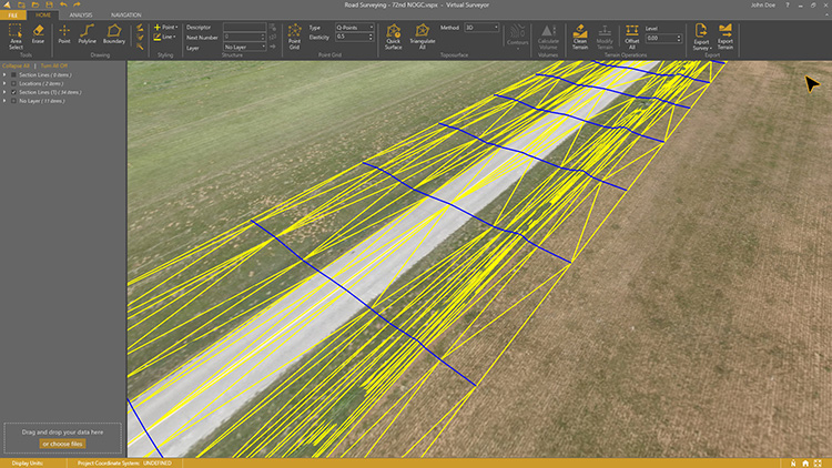
Drone surveying software Virtual Surveyor now eliminates the need for clients to use third-party applications to prepare data for processing. Version 6.1 handles on-the-fly projections that previously required a separate software package to set the data in the proper coordinate system. It bridges the gap between UAV photogrammetric processing applications and engineering computer-aided design (CAD) packages. The software generates an interactive onscreen environment with UAV orthophotos and digital surface models where the surveyor selects survey points and breaklines to define the topography, creating highly accurate topographic products for CAD input up to five times faster than otherwise possible. Surveyors can drag and drop all kinds of files into Virtual Surveyor: points, raster, vectors and point clouds. The point clouds are converted to a DSM for manipulation and processing, dramatically accelerating the time required to generate the CAD model.
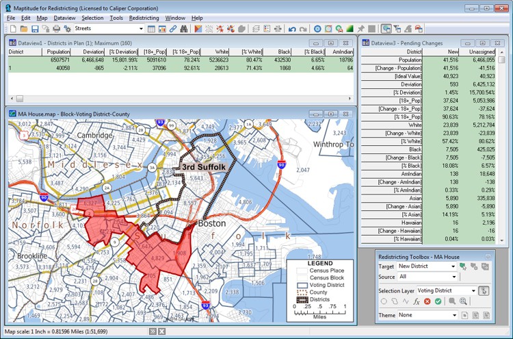
Includes Efficiency Gap Measure to explore redistricting problems
Screenshot: Mapitude
Maptitude for Redistricting is a professional tool for political redistricting. Maptitude provides measures and reports that support the creation of fair and balanced districts, and regularly enhances the software. Maptitude was used to democratize redistricting in California and is used by redistricters from independent commissions, non-profits, and civil rights groups, to the courts and political parties.
Stockpile measurements are up to 80% more accurate
Photo: DJI
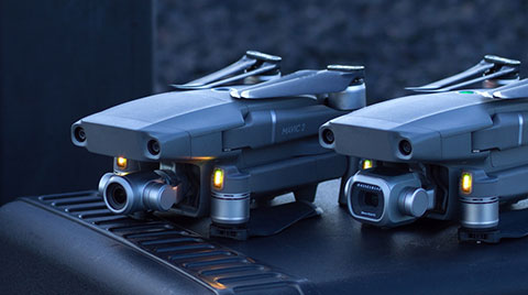
The DJI Mavic 2 Pro drone is now part of the Kespry stockpile measurement solution for mining and aggregates companies. Kespry’s stockpile measurement solution produces data up to 80% more accurate than manual measurement. All of the survey data is stored in a central cloud application, accessible for analysis by the entire team. Large aggregates and mining companies can standardize and capture stockpile data across all their sites in the Kespry platform, while using Kespry 2s or DJI Mavic 2 Pro drones.
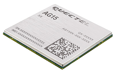
Designed for next-generation automotive applications
Image: Quectel
The automotive-grade C-V2X module AG15 features the Qualcomm 9150 C-V2X chipset paired with Quectel LTE module AG35. It is designed to meet the telematics and vehicle-to-everything (V2X) connectivity requirements of autonomous driving and road safety. It features a built-in multi-constellation high-precision GNSS (GPS/GLONASS/BeiDou/Galileo/QZSS) receiver with additional support from satellite-based augmentation systems (SBAS) and Qualcomm 3D dead-reckoning technology, which improves positioning accuracy and speed while simplifying customer designs. It is designed to allow low-latency, highly reliable and highly dense data exchange between vehicles and their surroundings, enabling effective information sharing among road users to avoid collisions, thus improving automotive safety, automated driving and traffic efficiency.
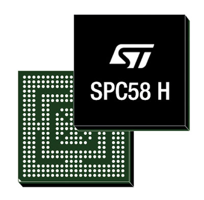
The SPC58 Chorus H microcontroller (MCU) line can run multiple applications concurrently to allow more flexible and cost-effective vehicle electronics architectures. The line is designed for high-end body, networking and security applications such as gateways, body-control modules, battery management and ADAS safety systems. The line has three high-performance processor cores, more than 1.2-MB RAM and powerful on-chip peripherals. The MCU securely delivers updates over the air for vehicle powertrain, body, chassis and infotainment features. With high security and large on-chip code storage, ST’s Chorus automotive microcontroller is a gateway/domain-controller chip capable of handling major OTA updates securely. Two independent Ethernet ports provide high-speed connectivity between multiple Chorus chips throughout the vehicle and enable responsive in-vehicle diagnostics.
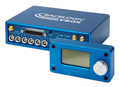
The VBOX 3i RTK is a real-time-kinematic-enabled version of the VBOX 3i dual antenna that can be used in conjunction with an RTK differential base station to obtain ±2-centimeter positional accuracy in real time at 100 Hz. The data logger combines the advantages of a twin antenna GPS setup with GLONASS satellite tracking. It can be used in vehicle tests where positional accuracy and repeatability are of key importance, such as lane departure testing, distance to a fixed object or precise mapping. The VBOX 3i RTK comes with the VBOX manager, a display enabling users to change dynamic modes and filter settings, set up slip angle data and define antenna locations.
The StarLink TrackerWi‑Fi advanced vehicle-tracking device combines u-blox GNSS, 4G and Wi-Fi technology, eliminating the need to equip vehicles with a separate mobile Wi‑Fi hotspot. StartLink is suitable for applications for connected cars, telematics, vehicle diagnostics, fleet management, vehicle security, usage-based insurance, and rental and leasing service companies. With the Wi‑Fi hotspot, users can tap into cellular 4G to transfer telematics data to the fleet manager and send real-time data to the driver’s smart device or infotainment system.
The Notilo Plus team with the iBubble. (Photo: Notilo Plus)
Notilo Plus has launched iBubble, a fully wireless, autonomous and intelligent underwater drone that can be used for search-and-rescue operations, naval or underwater infrastructure maintenance, and subsea patroling. iBubble can accompany divers for up to an hour and down to 197 feet depth, enabling superior underwater imaging. The remotely operated vehicle (ROV) was designed using a patented underwater localization technology, which is mainly based on acoustic signal transmission and image recognition (video tracking). By combining these technologies, iBubble is able to locate precisely its target underwater and shoot stable footage. The iBubble is equipped with an obstacle avoidance system, real-time image recognition, a stabilization system and direct surface control.
Anafi Work is an ultra compact tool for professionals, helping them make informed decisions using the drone’s aerial insights. Anafi Work includes the advanced Anafi drone equipped with an innovative imaging system, a 4K/21MP camera with a 180° vertical orientation, allowing users to capture images of inaccessible areas.The drone operates for 1 hour and 40 minutes with its 4 USB-C smart batteries. It can be transported anywhere in a compact shoulder bag. Professionals can create 3D models of buildings, quickly and easily, using a one-year subscription to Pix4Dmodel.
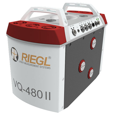
The Riegl VQ-480 II and VQ-580 II are designed for airborne applications at mid-altitudes for use on both manned and unmanned aircraft. The new Mark 2 designs of previous models improve both performance and user-friendliness. Both offer a measurement rate of up to 1,250,000 measurements/second and a 75-degree field of view of suitable for corridor mapping, city modeling and applications in agriculture and forestry. Weighing approximately 10kg, they are ready for integration into helicopters and unmanned UAVs with a higher payload capacity. The VQ-480 II and VQ-580 II are prepared for smooth GNSS/IMU integration, offer interfaces for up to five optional cameras, and are have built-in and removable storage.The VQ-480 II works at a laser wavelength of 1550 nm; the VQ-580 II at the1064 nm wavelength suited to measure on ice and snow.
DroneNode is a portable, compact and inconspicuous counter-drone jamming device that law enforcement can use at large outdoor events without raising public concern (it is not yet authorized for use in the U.S.) It can simultaneously jam 2.4 GHz, 5.8 GHz and GNSS L1 and L2 bands up to one kilometer, causing drones to return to their point of origin or land. It is also effective against swarm attacks. Emergency broadcasts, cellphone communication and other dedicated channels are unaffected.
Skydio R1 users now have the ability to follow cars. New modes include Car Follow, improved Lead Mode, and other improvements throughout the system, which is built on top of the Skydio Autonomy Engine. The engine operates 13 cameras, enabling it to map and understand the world in real time, allowing it to be fully autonomous and independently capture video footage. Its Nvidia Jetsonl AI runs neural networks that trained for the Car Follow feature on datasets of automobile images.
Lidar USA’s Forrest Briggs introduces its new lidar systems for the DJI M200 and M210 drones at Intergeo 2018, which took place Oct. 16-18 in Frankfurt, Germany.
Skycatch has announced an on-premise data processing and GNSS base station, the Skycatch Edge1, manufactured in partnership with DJI and now available worldwide.
Edge1 base station. (Photo: Skycatch)
Tested and optimized for the Skycatch Explore1 and DJI Phantom 4 RTK drones, the self-positioning Edge1 allows commercial drone users the ability to process and receive data without the need for internet or cellular connectivity, the company said.
Field teams can fly their drone, process the data and receive centimeter-level data outputs in 30 minutes or less, directly to a tablet. 2D maps and 3D point clouds are available for viewing and sharing directly from the tablet.
The Edge1 concept began as a companion to the Skycatch Explore 1 drone. Now, a new generation of the Edge1 will support all DJI drones, including the recently released DJI Phantom 4 RTK, and will process any 2D geotagged images.
In addition to a survey-grade GNSS base station, the Edge1 includes built-in WiFi, LTE, reliable sub-5-centimeter accuracy, and delivers high-quality data outputs, the company added. Built around a state-of-the-art compute module, the Edge1 is also capable of running deep learning algorithms to extract more insights from collected data in near real time.
“It’s truly a revolutionary product that we’re excited to make available to the DJI community, and the construction and mining industry at large,” said Christian Sanz, founder & CEO of Skycatch. “With the partnership and support of DJI, the Edge1 will be assembled with precision execution in their world-class manufacturing facility, and will be available faster to the customer.”
“As the commercial drone industry has grown, the amount of data collected by our enterprise users is unprecedented,” said Jan Gasparic, director of strategic partnerships at DJI. “We are glad to work with Skycatch to manufacture the Skycatch Edge1 GNSS base receiver, enabling enterprise customers, especially those in the construction industry, to process data from their DJI drones on-site and in real-time.”
Skycatch is an industrial data collection and analytics company focused on indexing and extracting critical information from the physical world, using a combination of hardware, software and artificial intelligence. Built for enterprise, its turnkey solutions are deployed across global project sites with largest construction, mining and energy companies.
Kespry and DJI are partnering to offer the DJI Mavic 2 Pro drone as part of the Kespry stockpile measurement solution for mining and aggregates companies.
The solution delivers the Kespry autonomous flight and aerial intelligence experience for stockpile measurement using a DJI drone. It enables large aggregates and mining companies to standardize and capture stockpile data across all their sites in the Kespry platform, while continuing to use Kespry 2s drones to support mine and site planning operations, Kespry said.
Integration of data captured from a DJI drone is the next innovation in the development of the Kespry industrial sensor platform.
Kespry provides inventory management and mine planning data to more than 200 mining and aggregates companies. As these customers scale their use of drone data, they are looking to standardize on a single platform to organize and analyze that data across sites, geographies and product divisions — even when those sites are highly distributed, Kespry said.
The addition of the DJI Mavic 2 Pro to the Kespry lineup is designed to enable even more site data to be centralized in the Kespry cloud. It will be available with a new, cost-effective purchase point designed to support using Kespry across more sites.
“Drone data is now the standard approach for measuring stockpiles at mine sites, however, millions of dollars are wasted through reconciling inconsistent data from different platforms and the time involved getting that data ready for analysis,” said George Mathew, CEO and chairman at Kespry. “Our goal with the addition of the Mavic 2 Pro to our solution is to respond to our customers wishing to use the Kespry aerial intelligence platform across all mine sites to standardize how stockpile data is generated — lowering their costs and helping drive the profitability of every site.”
“DJI is excited to have Kespry offering the Mavic 2 Pro as part of its aerial intelligence platform portfolio,” said Jan Gasparic, director of strategic partnerships, DJI. “Pairing the Mavic 2 Pro with Kespry’s industry leading AI, ML, and analytics capabilities will be of enormous benefit to mining companies that are looking to take advantage of drone technology in a portable and powerful package.”
According to the companies, the integration of DJI’s drone and sensors into the Kespry platform is the latest innovation in the delivery of an industrial sensor network, closely following Kespry’s recently announced high-resolution thermal capabilities for industrial inspection.
This expansion in the range of data that can be explored and analyzed in the Kespry platform further enables customers to protect and maximize their assets across industrial sites.
The Kespry platform is now capable of processing and analyzing a wide range of sensor data, enabling the future creation of industry-specific applications, including those under current development with leaders in the energy sector.
“We have sites in North Carolina, Pennsylvania, Ohio and Maryland, so with the Kespry platform and DJI drone, we’ll be able to fly multiple sites at one time,” said Justin Dermont, accounting manager at Russell Standard. “I could be flying in Erie while my partners fly in North Carolina, but still be able to get the data in real time to the Kespry cloud.”
“Having DJI as part of the Kespry system will help with the flexibility and the timeliness of us being able to take inventory at multiple locations, especially when we have to take inventory at the end of production, or month end, to make sure we have accurate readings,” said Craig Schiebel, controller at Russell Standard. “Being able to take inventory simultaneously at multiple locations is huge.”
“We’re growing our business and recently acquired some new sites,” said Kyla Jungclaus, senior accountant at Brannan Companies. “We need all of our inventory to be done in just a couple days, so introducing the DJI drone to have another pilot surveying at some of our other locations will get inventory done even faster. I know that our measurements will be consistent and accurate even if I don’t do them myself, and I can manage them all in a single account in the Kespry cloud.”
Kespry is offering the Mavic 2 Pro as part of its fully-managed, end-to-end annual subscription model. Kespry customers that choose the Mavic 2 Pro for stockpile measurement will benefit from the full Kespry experience, including its acclaimed support, training, customer success team, and drone up-time guarantee.
The Kespry stockpile measurement solution with DJI will be available Q1 2019.
Propeller Aero, a cloud-based drone analytics company, is partnering with DJI to create the Propeller PPK Solution leveraging the DJI Phantom 4 RTK drone.
The solution provides customers in the civil, mining, aggregates and waste management industries with a reliable and fully integrated drone mapping system, helping them collect highly accurate data from any worksite without the challenges of traditional workflows, the companies said.
The DJI Phantom 4 gathers data at a construction site. (Photo: DJI)
According to Propeller Aero, Propeller PPK Solution is a fully integrated software and hardware system that reliably provides photogrammetric model outputs in geodetic, projected or local coordinate systems.
The solution provides accuracy of 1/10 feet (3 cm) from independent checkpoints across small and large survey areas (checkpoints up to 1 km from GCPs). To capture surveys of this accuracy, all that is needed is one AeroPoint on the ground (over a known point if working in local coordinates).
The Propeller PPK Solution has been shown to reduce the time required to complete a drone survey by 70 percent as compared to a traditional workflow using multiple GCPs across a worksite, Propeller Aero said.
“DJI has led the drone market with their reliable and innovative products, and quickly demonstrated the ability for these machines to become useful tools in the heavy civil and natural resource industries,” said Rory San Miguel, CEO of Propeller Aero. “Globally, these industries are seeing real cost savings and efficiencies through cloud-based analytics and using innovative new technologies like PPK drones combined with AeroPoints. Accurate data is paramount to worksite analytics and Propeller has always been obsessed with helping teams achieve this. We introduced the world’s first smart ground control point, AeroPoints, and now we’ve partnered up with DJI to build an end-to-end PPK solution.”
On today’s construction sites, lack of project data costs businesses more than $177 billion annually. To help solve this problem, Propeller developed a tightly integrated PPK workflow across the DJI Phantom 4 RTK drone, an AeroPoint, and Propeller’s cloud processing platform that visualizes real-time site data. Surveyors and contractors can Propeller PPK solution to gather verifiable, trustworthy data to help make data-driven decisions and prevent costly mistakes, the companies added.
“Propeller’s deep expertise in aerial mapping and analytics coupled with DJI’s industry-leading open-platform drone hardware creates a highly accurate turnkey solution,” said Jan Gasparic, director of strategic partnerships at DJI. “We are excited about this partnership because it broadens the use of DJI drones to deliver accurate data at a cost-efficient price point, helping teams better answer questions about site progress and productivity.”
The complete PPK solution will be distributed through channel partners, including Trimble’s SITECH distribution network. Trimble Stratus, a 3D cloud-based visualization platform developed by Propeller, along with AeroPoints, is already integrated with Trimble Connected Site solutions.
“The advent of drones in the construction industry has improved efficiencies, and Trimble Stratus users are already benefiting from the ease-of-use and scalability of drone-based surveys,” said Scott Crozier, general manager, Trimble Civil Engineering and Construction. “With the new Propeller PPK Solution and Trimble Stratus software, we’ve seen first-hand how surveyors and contractors can collect aerial survey data in a fraction of the time it used to take, and get repeatable and reliable results.”
DJI has unveiled its Mavic 2 Enterprise, a portable drone designed to improve everyday work for businesses, governments, educators and other professionals.
According to the company, the Mavic 2 Enterprise features an ultra-compact and foldable design with an array of advanced controls and accessories that extend users’ capabilities during critical operations like firefighting, emergency response, law enforcement and infrastructure inspections.
The drone carries a high-resolution, 12-megapixel camera that’s stabilized by a three-axis gimbal for smooth and stable videos and images. The camera also features a two-time optical and three-time digital zoom capability, the company said.
The Mavic 2 Enterprise can be used for inspections and other everyday tasks. (Photos: DJI)
The Mavic 2 Enterprise comes equipped with a number of accessories, including the M2E Spotlight, M2E Speaker and M2E Beacon. The M2E Spotlight, which has a brightness of 2,400 lumens, is ideal for search-and-rescue operations, as well as inspection applications, the company said. The M2E Speaker allows pilots to play up to 10 custom voice recordings on demand. Finally, the M2E Beacon features a bright flashing strobe that’s visible up to three miles away, DJI added.
According to DJI, the drone also includes a GPS timestamping feature that encodes the time, date, and location of every recorded image, aiding in pilot accountability and ensuring that data captured by the drone can be trusted and used in situations from reviewing critical infrastructure inspections to potential legal proceedings.
It also comes equipped with DJI’s AirSense technology to help improve pilots’ situational awareness and enhance airspace safety. According to DJI, AirSense uses an integrated receiver to automatically alert drone pilots of ADS-B signals from nearby airplanes and helicopters, providing real-time positioning alerts through the DJI Pilot mobile app.
Finally, the Mavic 2 Enterprise features DJI’s latest video and data transmission system, Ocusync 2.0, which helps provide a more stable connection between the drone and its remote controller.
“With the Mavic 2 Enterprise, DJI has created a drone that makes powerful technology accessible to every enterprise and revolutionizes how they do their work,” said DJI President Roger Luo. “DJI’s hardware and software set the standard for aerial innovation around the globe, and Mavic 2 Enterprise is the most compact, powerful, reliable and safe tool to help professionals integrate drones into their operations.”
New risk-based “bow-tie” zones will help protect aircraft using PrecisionHawk’s Low Altitude Traffic and Airspace Safety (LATAS) platform.
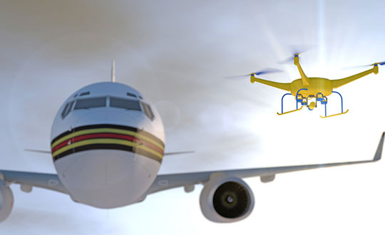
DJI is improving its geofencing technology to refine the airspace limitations for drone flights near airports, providing smarter protection for airplanes in critical areas.
DJI has updated Geospatial Environment Online (GEO) Version 2.0, and will phase it in starting in November when the revised zones will take effect for airspace around airports in the United States. Upgrades in other regions will follow.
Image: DJI
The new system allows GEO to create detailed three-dimensional “bow-tie” safety zones surrounding runway flight paths, and to use complex polygon shapes around other sensitive facilities, rather than simple circles.
The new restrictions better reflect the actual safety risk posed in those areas, while allowing more flights to the side of runways where risk is substantially lower.
Runway exclusion zones. DJI’s new geofencing also incorporates the principles of Section 384 of the recently enacted U.S. Federal Aviation Administration (FAA) Reauthorization Act designating the final approach corridor to active runways at major airports to be “runway exclusion zones” for unauthorized drones. DJI customers should update their DJI GO 4 flight control app and aircraft firmware to ensure these improvements are implemented.
To obtain reliable geospatial information for the enhanced shapes in GEO 2.0, DJI has chosen a new data provider that can provide highly accurate details such as the exact locations of airport runways and facility boundaries.
PrecisionHawk’s LATAS. In North America, DJI will use data from PrecisionHawk Inc., replacing DJI’s previous geospatial data provider AirMap. Under a partnership agreement, PrecisionHawk’s Low Altitude Traffic and Airspace Safety (LATAS) platform will provide DJI customers with critical airspace information that will position them to fly safely in North America.
DJI will be able to refine airspace limitations for drone flights near airports, providing smarter protection for drones in critical areas and clarifying restrictions, PrecisionHawk said.
“PrecisionHawk has a corporate commitment to safely integrating drones into the airspace and enabling complex operations,” said Diana Cooper, senior vice president of policy and strategy at PrecisionHawk. “Through our work under the FAA Pathfinder Program, we have shown how technology can play a critical role in unlocking advanced operations, including beyond visual line of sight flight.”
GEO 2.0 Development. DJI first created No-Fly Zones for its drones in 2013 and introduced the more refined GEO system three years later, adding live updates and new zones for prisons and nuclear power plants, while providing flexible self-unlocking for professionals.
Both systems recognized that the overwhelming majority of drone pilots want to fly safely and responsibly, and want an easy-to-use guide to help them understand the airspace so they can do so.
Artist’s rendering of a no-drone sign near an airport. Image: PixOne/Shutterstock.com
To develop GEO 2.0, DJI collaborated with general aviation pilots through the Aircraft Owners and Pilots Association (AOPA) and with airports through the American Association of Airport Executives (AAAE) to incorporate their expertise and guidance about air traffic and airports into DJI’s new geofencing methods.
DJI geofencing uses GPS and other navigational satellite signals to automatically help prevent drones from flying near sensitive locations such as airports, prisons, nuclear power plants and high-profile events.
In certain locations, a DJI drone cannot take off or fly in a geofenced area without special authorization. Drone pilots with verified DJI accounts can unlock some areas if they have legitimate reasons and necessary approvals, but the most critical areas require special action from DJI to unlock them.
DJI has streamlined the approval process so professional drone pilots with authorization to fly in sensitive locations can receive unlocking codes within 30 minutes.
The GEO System. The GEO system previously geofenced a 5-mile circle around airports, with enhanced restrictions in a smaller circle encompassing the airport area.
GEO 2.0 applies the strongest restrictions to a 1.2 kilometer- (3/4 mile)-wide rectangle around each runway and the flight paths at either end, where airplanes actually ascend and descend. Less strict restrictions apply to an oval area within 6 kilometers (3.7 miles) of each runway.
This bow-tie shape opens more areas on the sides of runways to beneficial drone uses, as well as low-altitude areas more than 3 kilometers (1.9 miles) from the end of a runway, while increasing protection in the locations where traditional aircraft actually fly.
Artist’s concept of a drone approaching a commercial airliner. Image: PixOne/Shutterstock.com
Aviation Parameters. DJI’s new boundary areas around airport runways are based on the International Civil Aviation Organization’s Annex 14 standard for airspace safety near runways and the FAA’s Part 77 parameters for “imaginary surfaces” and air navigation obstructions.
DJI’s categorization of airports is based on traffic volume principles defined in statutes such as U.S. Title 49 section 47102, and the FAA’s criteria developed in 2012 for categorizing general aviation airports.
Using these aviation parameters, DJI has aligned its geofencing safety feature to broader understandings of airspace and airport risk. This chart demonstrates how GEO 2.0 applies those detailed, risk-based airspace boundaries to the airspace around airports that can be considered to involve relative high, medium, and low risk (see graphic).
LATAS. Through its work under the FAA Pathfinder Program, PrecisionHawk has shown how technology such as LATAS can play a critical role in unlocking advanced operations, including beyond visual line of sight flight. LATAS was tested under the Pathfinder Program to facilitate safe beyond visual line of sight operations.
LATAS brings a combined set of geospatial and software tools to the market. In addition to providing improved geospatial data, the LATAS platform features specialized display elements, including telemetry and access to the Harris real-time manned aircraft feed. Using these elements pilots can easily observe the relative altitude and horizontal separation of intruding aircraft and other mission-critical measures.
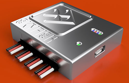
The Skyfish platform is controlled by the tiny SkyNode computer, which integrates with optical, thermal, navigational and lidar devices along with sensors, algorithms and robotics. (Photo: Skyfish)
UAV technology developer Skyfish has introduced a computing platform for commercial drones that fully automates crucial infrastructure inspection and measurement tasks.
The Skyfish platform was unveiled and is being demonstrated at Booth #133 at the Commercial UAV Expo Americas conference being held Oct. 1-3 in Las Vegas.
Skyfish supports DJI and PixHawk flight controllers and other popular drone architectures, as well as 3D modeling software from companies such as Bentley Systems Inc.
Skyfish provides a smarter platform so anyone can fly, inspect and model complex infrastructure with an easy-to-use interface, the company said. The platform also pre-processes the collected infrastructure data and metadata to help create impeccable 3D models.
Available now to selected early-adopter customers, the Skyfish platform comprises:
SkyNode. Application-specific, onboard microcomputer controls the Skyfish system (and any Pixhawk 2.1 or DJI A3-based airframe.)
SkyControl. Flight planning software that facilitates the creation and execution of complex flight plans in a few clicks.
SkyFish Smart Gimbal. Delivers precision angle measurement with encoded motors to capture deep, highly accurate metadata for 2D mapping and 3D modeling.
SkyFish M6 or a DJI Commercial Drone. An expandable and collapsible commercial-grade UAV.
“The Skyfish platform represents a sea change in commercial drone technology for infrastructure inspection, measurement and analysis,” said Mike Barkasi, project manager at Bentley Systems. “For our infrastructure customers that want to enable the benefits of drone sourced data — but need engineering grade accuracy for their 3D modeling — I believe leveraging both the Skyfish and Bentley platforms together is a good answer.”
“As a leader in the unmanned aerial system (UAS) industry since 2013, Vision Aerial’s been waiting for a well-designed, autonomous solution that provides both precision navigation and built-in sensor integration,” said Shane Beams, CEO at Vision Aerial. “Skyfish delivers exactly that.”
A roundup of recent products in the GNSS and inertial positioning industry from the October 2018 issue of GPS World magazine.
OEM
Anti-spoofing
Provides mitigation and reporting
Photo: Regulus
The Pyramid GNSS allows detection, mitigation and reporting of spoofing of the GNSS system, while still providing accurate positioning (jamming protection will be available in a future version). Version 2 of the Pyramid GNSS adds a software-only version, making it available to numerous applications and enabling GNSS to perform seamlessly under spoofing and jamming conditions. The device is designed for any system depending on GNSS navigation or precise timing, including cars, drones, ships, robots, financial institutions and stationary infrastructure, such as power plants and power grids. The Pyramid GNSS connects externally and integrates seamlessly with existing GNSS receivers, adding reliability and protection to the system. It offers full GNSS support including for BeiDou, Galileo and GLONASS.
Swift Navigation has upgraded the firmware of its flagship product — the Piksi Multi GNSS receiver. This marks the sixth major release to Piksi Multi since it was launched in February 2017. The upgrade is available free of charge to Swift customers. The firmware release also enhances Duro, the ruggedized version of the Piksi Multi receiver housed in a military-grade, weatherproof enclosure for long-term outdoor deployments. Firmware Release 2.0 for Piksi Multi and Duro supports two additional major satellite constellations — Chinese BeiDou (B1/B2) which, once completed, will contain 37 satellites, and Europe’s Galileo (E1/E5b), which will eventually consist of 30 satellites. Piksi Multi’s performance will further improve for future satellites. The addition of BeiDou and Galileo creates more robust positioning in a variety of challenging sky-view environments.
The G300D gyro is a three-axis, inertial rate system gyroscope. Measuring 0.67 cubic inches, it features low power and high speed, making it suitable for image stabilization applications. The G300D has message timing under 150 microseconds and output data rates up to 8 kHz with external sync. A micro-electro-mechanical gyroscope, it has an ARW of <0.0028 degrees/sec/√Hz and an option for both 24 and 32-bit LSB for exceptional resolution. Users can configure the G300D using a software development kit or through software protocols to simplify the integration process. The G300D gyro is non-ITAR.
Two new GNSS low-noise amplifier (LNA) front-end modules, the SKY65933-11 and SKY65943-11, integrate Skyworks’ proprietary TC-SAW filters. The modules are designed specifically for internet of things (IoT) applications including smartwatches, action cameras, drones, asset trackers and personal navigation devices. They are designed for wireless module and IoT device manufacturers, providing a turnkey GNSS connectivity solution in a compact form factor. Both solutions offer integrated pre- and post-filter LNA and matching to reduce printed circuit board (PCB) area versus a discrete implementation; single DC supply for design flexibility and simplicity; multi-GNSS compatibility to cover GPS, GLONASS, Galileo, BeiDou and QZSS receiver applications in the 1559–1606 MHz frequency range; extremely low leakage current (1 uA max) benefitting battery-powered IoT devices; and highly manufacturable and low-cost surface-mount technology in a 2.5 x 2.5-millimeter multi-chip module package.
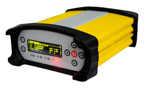
The Net20 Pro provides high-quality data for users interested in the proximity and reliability of a reference station while eliminating real-time kinematic (RTK) corrections service charges. It uses multi-frequency, 555-channel technologies in a rugged casing to deliver accurate and effective positioning data even in harsh environments. It can be configured for correction data reception in client mode to calculate a fixed RTK position and to monitor the antenna position while continuing to work as a GNSS reference server. With NTRIP Caster software, the Net20 Pro provides superior connectivity with an unlimited number of mount points. Users can have permanent transmission of RTK corrections with a local internet connection. Its 32-GB internal and 32-GB external memory is enough for permanent recording even at a 100-Hz high data sampling rate. Its web user interface features upgrade, status and settings management as well as data downloading via smartphone, tablet or other internet-enabled device.
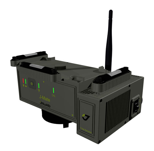
The J-Mate measurement module combines conventional measurement via laser scanning and photographic imagery with the multi-constellation location accuracy of the Triumph-LS receiver. It utilizes precision horizontal and vertical encoders for angular measurement, while the high-definition camera and laser module combine to locate the USB-powered target for accurate measurements. The target rests on top of the receiver and lights up for better visibility to the camera and sensor. The lighting power comes through the USB cord connected to the receiver. Coupled with the onboard data collector screen of the Triumph-LS, operation of the module is done visually with the LS mounted on top of the module or remotely on the J-Pod pole used for GNSS data collection. The module and software is also designed to be an efficient staking application.
The Trimble R10 Model 2 GNSS System is designed to help surveyors work more effectively by enabling reliable, fast and accurate data collection in the field. Enhancements in Model 2 include a custom Trimble survey GNSS ASIC with 672 GNSS channels including GPS, GLONASS, BeiDou, Galileo, QZSS and IRNSS as well as the full range of SBAS. It also will support planned GNSS signals. It has improved reliability against interference and spoofed signals, improved power management by 33 percent, and increased internal memory (6 GB) to store more than 10 years of raw observations. Support for Android and iOS platforms allow field crews to use their own mobile devices. The Trimble R10 Model 2 supports the recently released Trimble TSC7 controller and Trimble Access 2018 field software.
The TerraStar-C PRO correction service provides multi-constellation support, including GPS, GLONASS, Galileo and BeiDou. Combined with NovAtel’s OEM7 positioning technology, TerraStar-C PRO cuts initial convergence times by nearly 60 percent and offers 40 percent better horizontal accuracy than the current TerraStar-C service. In challenging signal conditions, it offers multipath, shading, interference and scintillation. High-rate TerraStar-C PRO corrections provide reconvergence in less than 60 seconds following brief GNSS signal interruptions. Corrections are generated using TerraStar’s proprietary global network of more than 100 GNSS reference stations. The data is delivered worldwide through overlapping geostationary satellites directly to a NovAtel receiver or via cellular IP network.
The C3UBE Command Center enables unmanned beyond-visual-line-of-sight (BVLOS) data collection and near real-time data streaming from almost any point within any critical infrastructure network. The mobile command and distribution center allows for the flight of unmanned aerial systems and is designed to not only allow AviSight to reach the maximum BVLOS distances permitted today, but also to expand its range for UAS operations as limits increase in the national airspace. In addition, it enables near-real-time transmission of data and imagery, which can be disseminated live to anywhere in the world via its proprietary distribution network located at Switch’s Tier 4 data center. It is aimed at the oil, gas, power, transportation and telecommunications sectors.
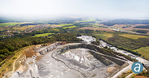
SimActive has updated its Correlator3D end-to-end photogrammetry software to include tools for users to generate precise statistics on mining activities, with improved volumetric calculation. The integrated tools allow users to generate precise statistics on mining activities. The Correlator3D software performs aerial triangulation and produces dense digital surface models, digital terrain models, point clouds, orthomosaics and vectorized 3D features. Applications like mineral extraction monitoring can be done seamlessly within the software. Users can process raw drone data, produce point clouds and DSMs, and perform volumetric calculations in the same Correlator3D workflow.
The improved TruPulse 360 laser features LTI’s TruVector 360° Compass Technology. The rangefinder measures slope distance, inclination and azimuth; instantly calculates horizontal and vertical distances; and calculates 3D missing line values. The enhanced device offers 33 percent increased distance accuracy, 25 percent better target acquisition and a higher azimuth accuracy of 0.5° root mean squared (RMS). Other features include reflectorless technology that enables data capture to any surface type; advanced targeting modes to achieve accurate, repeatable results of the intended target; seven-power superior optics technology that displays all measured and calculated solutions; and smart technology that recognizes adverse measurement conditions and prompts recalibration. Uses include forestry, utilities, construction and GIS mapping.
Synthetic aperture radar imagery from Maxar’s MDA RADARSAT-2 satellite is now available to SecureWatch subscribers. SecureWatch is DigitalGlobe’s powerful, cloud-based geospatial intelligence platform. The service has added the radar imagery to its high-resolution optical imagery, enabling defense and intelligence analysts to deliver actionable insights to decision makers regardless of weather and light conditions. The satellite will refresh hundreds of global sites on a weekly basis using a wide-ultra-fine format (3-meter resolution, 50-kilometer scene width). RADARSAT-2 imagery allows users to observe features and changes that go undetected using other imaging techniques, and provides day and night coverage regardless of weather. SecureWatch users can access timely RADARSAT-2 imagery using current subscription plans. When combined with 30-cm optical imagery, analysts will have a powerful and reliable toolset to make decisions with confidence.
U-blox has introduced a toolset comprising the u-track software and the C030-R410M application board. The toolset is a rapid-prototyping platform that lets product designers test and optimize the position accuracy and power consumption of wireless location tracking applications that use LTE-M and NB-IoT cellular networks, as well as GNSS technology. The toolset targets product engineers working on battery-powered applications such as sport, people and asset trackers. An increasing number of battery-powered consumer and industrial products feature integrated GNSS receivers. These products include virtual reality headsets, smartwatches and devices to track elderly people, containers or parcels. With the ongoing roll-out of low power wide-area cellular networks (LPWAN) such as LTE-M and NB-IoT technologies around the world and the extremely low power consumption they enable, the range of use cases for wireless location trackers is expected to expand further. The u-track software runs from embedded firmware on the new u-blox C030-R410M application board. The board, specifically designed to rapidly prototype applications for the internet of things (IoT), includes an ultra-small, low-power u-blox ZOE-M8B GNSS receiver and a size-optimized SARA-R410M LTE-M/NB-IoT cellular communication module, and u-track includes a PC software application that lets users log, retrieve, and visualize power consumption, accuracy, and other important values, such as the GNSS time to first fix.
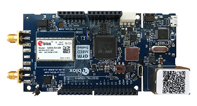
Add-on to AT&T Fleet Complete platform or for separate use
Photo: AT&T
The new GPS Asset Tracker One (AT1) from AT&T and Fleet Complete can track transportation as well as agriculture, food services, pharmaceuticals and emergency services. Users can monitor their assets through the Fleet Complete mobile app. Besides tracking location in near real-time, it also captures humidity, temperature, light exposure and more. AT&T’s nationwide LTE-M network is designed for devices that require low-cost, extended battery life, coverage underground and inside buildings, and carrier-grade security. Two high-capacity Lithium AA batteries power the AT1. They can last up to five years with a once-a-day use.
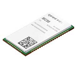
The MC90 is a quad-band GSM/GPRS/GNSS/Wi-Fi module that supports hybrid positioning technologies including GNSS, Cell ID and Wi-Fi aided positioning. It integrates the multi-GNSS system, including GPS, GLONASS, Galileo and QZSS, which makes it suitable for urban areas with high-rise buildings and complex environments. The MC90 also adopts Wi-Fi hotspot positioning technology for blind spots and satellite coverage. It integrates multi-aiding positioning technologies to offer customers with optimized GNSS performance. It also supports EPO technology, which provides predicted Extended Prediction Orbit to speed up TTFF without the need of an extra server. The MC90 features a compact design and lower power consumption, and supports dual SIM single standby function.
TomTom will offer free maps and traffic tiles on its mobile software developer kit (SDK) in both Android and iOS. With global coverage, the Mobile Maps SDKs and its free map tiles will guide developers of mobility and ride-sharing apps. The TomTom Maps APIs (application programming interfaces) also play a role in the internet of things, where traffic data is needed to enable self-driving cars and smart city planning.
MAGNET Inspect is designed for UAV data collection. (Photo: Topcon)
MAGNET Inspect software is designed to facilitate the data-processing workflow for UAV (unmanned aerial vehicle) infrastructure inspection by efficiently managing large UAV data sets to create inspection reports. It allows operators to visually navigate UAV photos, aligning 3D reality meshes with raw georeferenced images in one location and filtering them based on selected criteria including field of view. When combined with Intel Falcon 8+ Drone – Topcon Edition and Topcon ContextCapture, powered by Bentley Systems, the software enables operators to navigate, annotate and create reports with inspection photos, creating a strong end-to-end inspection workflow.
Site Scan Esri Edition is a custom version of the Site Scan iOS app for drone flight planning and data capture that works seamlessly with Esri’s ArcGIS Online and Drone2Map for ArcGIS. The Site Scan Esri Edition app complements Esri’s Drone2Map for ArcGIS software by providing full drone project mission planning and a simple workflow for transferring drone captured data into Esri ArcGIS. Users will be able to connect to ArcGIS Online with an Esri sign-in. The app will allow users to directly use Esri data layers from ArcGIS Online as base and reference data for their drone flight planning mission. Esri customers can use any drone supported by Site Scan, including a variety of DJI drones. Site Scan also supports a custom version of the new Yuneec H520 commercial drone by 3D, which is based on the Dronecode PX4 software and designed to be an open and secure drone option for use on U.S. government projects.
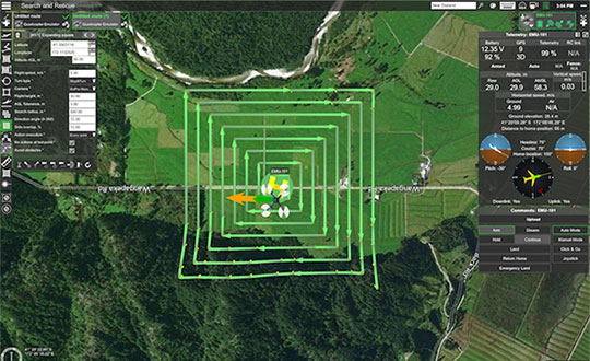
UAS mission-planning software company UgCS has joined with disaster response expert Airborne Response to develop a comprehensive search capability for drones. The search-pattern software, a new feature of the UgCS platform, allows remote pilots to more effectively conduct search-and-rescue operations. Customizable search patterns such as the “expanding square” and “creeping line” can be deployed. Based on the flight altitude input by the operator, the UgCS software will automatically calculate the course heading and track spacing necessary to provide the prescribed coverage area for a search target. UgCS software allows central management of all types and manufacturers of unmanned vehicles, enabling a user to control one or a fleet of drones on a single mission in multi-operator mode and multi-platform environments. Airborne Response will offer the UgCS mission planning software and associated training to public safety and emergency response professionals throughout the U.S.
The Mavic 2 Pro is designed for professionals, aerial photographers and content creators. With a folding design, the Mavic 2 is a powerful platform with new gimbal-stabilized cameras and advanced intelligent features like Hyperlapse and ActiveTrack for easier and more dynamic storytelling. Flight time is 31 minutes. Co-engineered in partnership with Hasselblad, the Mavic 2 Pro houses a 1-inch CMOS sensor with a 10-bit Dlog-M color profile. It can capture 20-megapixel aerial shots with utmost color accuracy using the Hasselblad Natural Color Solution (HNCS) technology, while an adjustable aperture from f/2.8-f/11 provides control across a wide variety of lighting conditions.
FAA also warns about drones interfering with public safety.
The Federal Aviation Administration (FAA) has announced nine new partners to its Low Altitude Authorization and Notification Capability (LAANC) initiative, a collaboration between the FAA and the drone industry that provides near real-time processing of airspace authorizations for Part 107 drone operators nationwide who fly in controlled airspace.
Following the FAA’s successful prototype, the initiative was simultaneously opened to additional air traffic control facilities and to new industry partners. The five-month onboarding process that began in April resulted in nine new LAANC partners — Aeronyde, Airbus, AiRXOS, Altitude Angel, Converge, DJI, KittyHawk, UASidekick and Unifly.
The nine join five companies — AirMap, Harris Corp., Project Wing, Skyward and Thales Group — that have already met the technical and legal requirements to provide LAANC Services.
LAANC uses airspace data, including UAS facility maps, which shows the maximum altitude around airports where the FAA may authorize operations under Part 107 in controlled airspace. The program gives drone operators the ability to interact with industry developed applications and obtain near real-time authorization from the FAA.
The FAA next year will accept applications from parties interested in becoming LAANC service providers from Jan. 7 to Feb. 8 and from July 8 to Aug. 9. This is not a standard government acquisition; there is no Screening Information Request (SIR) or Request for Proposal (RFP) related to this effort.
In a different announcement, the FAA said that drone pilots who interfere with fighting wildfires, law enforcement efforts, or other first responders such as medical flights now are more likely to face serious civil penalties, even for first-time offenses.
Deterring interference with first responders is critical as drone use expands exponentially. Firefighting aircraft trying to contain a wildfire have to suspend flights when a drone enters the area to avoid a possible mid-air collision. A drone flying over a crime scene or accident site can hamper police or medical aircraft operations.
Ultimately, interference by a drone can cost lives.
The FAA has provided guidance for agency personnel who handle possible drone violations to refer all cases involving interference with first responders to the FAA Chief Counsel’s office for possible enforcement action.
In July 2016, Congress authorized the FAA to impose a civil penalty of not more than $20,000 for anyone who operates a drone and deliberately or recklessly interferes with wildfire suppression, law enforcement, or emergency response efforts.
Under FAA guidance, inspectors generally use non-enforcement methods, including education, for correcting unintentional violations that arise from factors such as flawed systems, simple mistakes, or lack of understanding.
However, given the potential for direct and immediate interference with potentially life-saving operations where minutes matter, offenders will immediately be considered for enforcement actions. Enforcement actions can include revocation or suspension of a pilot certificate, and up to a $20,000 civil penalty per violation.
The attack seems to have been mounted by those operating two small six-rotor UAVs similar the DJI Matrice 600 — one was certainly carrying explosives because it was videoed exploding. These drones showed up somewhere near Maduro and disrupted not only the president’s speech, but also broke up the parade with participants running for cover.
One drone seemed to collide with an apartment building, fell to the ground, and then fire broke out in an apartment on the first floor. Firefighters apparently disputed a drone explosion saying that a propane gas tank had exploded inside an apartment, but images show a significant hole blown in the wall below the apartment window.
A number of discrepancies could suggest that the incident was staged, but there were injuries to several in the parade below where the first drone exploded, and the apartment fire was only 400 meters from Maduro’s review stand. The “apartment drone” appeared to behave as if control had been lost, possibly due to anti-drone jamming. Check out pictures, a video and a comprehensive analysis of these events on Bellingcat here.
Zephyr-S launched for flight test. (Photo: Airbus)
Meanwhile, on a more drone-positive note, the Airbus Zephyr S pseudo-satellite, solar-powered UAV achieved a world endurance record flight which was just 3 minutes short of 26 days, eclipsing a previous record of 14 days set by a Zephyr prototype. The ultra-lightweight UAV took off July 11 July and landed Aug. 6. This is likely the longest ever flight by an air-vehicle without refueling (balloons and spacecraft excepted).
The Zephyr S is the first of three such vehicles built by Airbus for the U.K. Joint Forces Command. The Zephyr-S flies around 70,000 feet in the stratosphere, powered solely by sunlight, and is aimed at providing short turn-around, satellite-like communications and observation services for both commercial and military customers. The potential exists to support disaster monitoring of fires, earthquakes, oil spills and the like, and to connect almost everywhere in the world that doesn’t already have established communications.
Following evaluation of the flight test results, further flights are planned from a new base at Wyndham airfield in Western Australia. The aircraft is extremely light and does not have an undercarriage, so it’s hand launched and retrieved under minimal wind conditions.
Joe Lee and paramedics UAV pilot Scott Mcleod confer before a simulated medical rescue scenario. (Image: Kongsberg Geospatial)
Meanwhile, at a deserted airfield near Pembroke, Ontario, Canada, a simulated disaster exercise, led by a Royal Canadian Mounted Police (RCMP) incident commander and supported by personnel from Transport Canada and the National Research Council, was evaluating a new air traffic management system supplied by Kongsberg Geospatial from Ottawa.
Integrating drones with disaster management air traffic is one aspect of the Emergency Operations Airspace Management System (EOAMS), a situational awareness system which provides first responders with situational awareness of the airspace around a disaster scene. The system integrates real-time data from a number of sensors, including 3D airborne radar, ground radar, ADS-B (Automatic Dependent Surveillance — Broadcast) sensors, video and GPS. Real-time information was presented to participants on regular computer displays and through a Microsoft HoloLens “mixed reality” visor.
Drones were flown beyond visual line-of-sight (BVLOS) at up to 2 km away from the airfield while the trial emulated emergency scenarios including a plane crash, a medical emergency, and the protection of a VIP threatened by an approaching, unauthorized drone. Drones were operated by the RCMP and local paramedics.
The EOAMS system displayed ground tracks and the identity of a variety of emergency aircraft, and emergency ground vehicles, and enabled safe flight of UAVs within the same airspace. Non-participating drones in the area of the disaster were also identified as possible threats to police and medical aircraft involved in the recovery efforts.
The RCMP and paramedic pilots flew consumer-model drones including the DJI Mavic to test the system’s capacity to detect small drones. Position outputs from these drones were used to verify the accuracy of the EOAMS-displayed plots. A light aircraft was also used to simulate different airborne assets, including a water bomber.
What was learned in the trials will be useful in further development of future emergency airspace management systems for use by first responders, police services and other government agencies in Canada.
RoboTiCan, an Israeli start-up, has developed a unique way of dealing with unwelcome, unidentified drones that intrude into sensitive airspace. With ground-based radar detecting and tracking an incoming UAV, its large, robust drones use machine vision and artificial intelligence technologies to identify threats and then physically attack them.
This video provides — complete with dramatic accompanying music — an insight into how their “Goshawk” drone engages, attacks and by brute force, disables smaller drones in flight.
At first encounter, the Goshawk octocopter appears to also be disabled by an intentional collision with a small UAV, but subsequent encounters demonstrate how it hones in on, collides with, and disables its target and recovers to attack again.
Compared to bird behavior, especially in the spring when nesting birds use similar tactics to defend their eggs or chicks, it does seem that its mode of operation could be very much like a hawk attacking smaller birds — hence its name.
The Goshawk uses strong, fiber reinforced blades to enhance impact survival, while its smaller drone victims may have plastic props. Overall, it’s large, has multiple blades, seems to use an attack move just before impact, and it recovers well. So control algorithms appear to have been enhanced for collisions and recovery. Its targets seem to immediately lose lift and control before they hurtle towards ground impact.
Not surprisingly, RoboTiCan appears to be positioning its marketing towards military customers, but combining this aggressive take-down capability with a high-quality drone detection/location system might also be a winner for civilian/government drone intrusion defense — Mr. Maduro, take note!
To sum up, we have more bad press for UAVs being used as offensive weapons, interesting progress towards pseudo-satellites as Zephyr-S completes 26 days aloft in the stratosphere, another UTM (UAV Traffic Management) system trial aimed at better air traffic control for disasters, and another way to bring down unwanted drone threats.
This last solution might be a better deterrent for negligent or intentional operators who stray into inadvisable airspace. The potential destruction of the drone might just get some recreational flyers to think twice and perhaps reduce these problems.