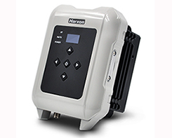
Tag: DJI

  • DJI will unlock geofencing for enterprise drone users

    DJI will unlock geofencing for enterprise drone users

    Streamlined application and 30-minute response improve unlocking process.

    DJI's Matrice 200 drone. (Photo: DJI)
    DJI’s Matrice 200 drone. (Photo: DJI)

    Drone maker DJI is introducing improvements to its geofencing system. Professional drone pilots with authorization to fly in sensitive locations can now use a streamlined application process to receive unlocking codes within 30 minutes.

    DJI’s geofencing system uses GPS and other navigational satellite signals to automatically help prevent drones from flying near sensitive locations such as airports, nuclear power plants and prisons. These improvements are carefully designed to help expand the beneficial uses of drones in sensitive areas that have been restricted in DJI’s geofencing system.

    While those areas will remain restricted to more casual drone pilots, DJI now staffs its global authorization team around the clock in order to process applications and provide unlocking codes quickly.

    Professional drone pilots can apply to unlock restricted zones at www.dji.com/flysafe/custom-unlock. This portal page allows pilots to easily enter information about their aircraft and controller, as well as authorization documents supplied by the controlling authorities in areas where they wish to fly.

    Enterprise users can for the first time include multiple aircraft in a single unlocking request.

    “DJI now processes most requests within 30 minutes, though requests involving unusual circumstances or requiring additional documentation may need additional time,” said Michael Perry, managing director of North America at DJI. “By making it easier for authorized pilots to put drones to work in sensitive areas, DJI is once again showing why professional drone operators choose our aerial platforms for the most important tasks.”

    “DJI first implemented geofencing in 2013, and it is now established as an important tool to help our customers make thoughtful flight decisions, while also addressing legitimate concerns about safety and security by helping prevent unauthorized flights in the most sensitive locations,” said Brendan Schulman, vice president of policy & legal affairs at DJI. “These improvements illustrate DJI’s ongoing commitment as the industry leader to continually improving the safety features we implemented years ago, while enabling beneficial applications for our technology.”

    For more information about how enterprises are using DJI products to work safer, faster and more efficiently, visit enterprise.dji.com.

  • Launchpad: RTK modules, inertial sensors

    Launchpad: RTK modules, inertial sensors

    OEM

    RTK and Heading Module

    Positioning and attitude determination

    Image: Unicore
    Image: Unicore

    The UM442 can simultaneously track GPS, BDS, GLONASS and Galileo. It also supports SBAS and QZSS. It uses Uncore’s new-generation Nebulas II chip and UGypsophila real-time kinematic (RTK) algorithm. Based on high-performance data-sharing technology and the simplified operation system of the Nebulas II chip, the UGypsophila RTK algorithm dramatically optimizes matrix processing, enabling the UM442 to track more satellites and shorten the initialization time to 5 seconds.

    Unicore Communications, www.unicorecomm.com

    Inertial sensors

    Designed for dynamic inclination and positioning

    Image: Lord Sensing
    Image: Lord Sensing

    The MV5-AR inertial sensors are designed for off-highway and military vehicles, marine and mobile robot applications, and the autonomous vehicle market. The rugged, compact sensors use LORD’s fifth-generation high-performance industrial-grade solid-state six-degrees-of-freedom (6-DOF) micro-electromechanical accelerometer and gyro inertial sensor technology. Successfully deployed on ground robots and heavy machinery, applications also include autosteer and terrain compensation; dynamic incline detection (roll, pitch, rotation); vehicle stability and leveling; platform control, alignment and stabilization; operator feedback; and precision navigation. The compact and rugged reinforced housing is fully sealed for immersion and pressure wash. Each sensor is calibrated and temperature compensated.

    LORD Sensing Microstrain, microstrain.com

    BeiDou upgrade

    GNSS simulators ready for 2020

    Spirent's GSS7000 test system. (Image: Spirent)
    Spirent’s GSS7000 test system. (Image: Spirent)

    BeiDou Phase 3 signals are now available on Spirent GNSS RF constellation simulators GSS7000 and GSS9000 — existing users can obtain the software upgrade by contacting Spirent. Phase 3 of the Chinese BeiDou system will extend its coverage from Asia to the entire world, providing receiver developers and integrators with additional GNSS signals to make positioning, navigation and timing systems more accurate, and help to support new applications, such as autonomous vehicles. Customers can test their designs before the system is fully operational in 2020.

    Spirent Communications, www.spirent.com

    High-precision module

    Based on u-blox F9 technology

    Image: u-blox
    Image: u-blox

    The ZED-F9P multi-band GNSS module has integrated multi-band real-time kinematic (RTK) technology for machine control, ground robotic vehicles and high-precision unmanned aerial vehicles applications. It measures 22 x 17 x 2.4 millimeters and uses technology from the u‑blox F9 platform to deliver robust high-precision positioning performance in seconds. The ZED-F9P is a mass-market multi-band receiver that concurrently uses GNSS signals from all four GNSS constellations (GPS, GLONASS, Galileo and BeiDou). Combining GNSS signals from multiple frequency bands (L1/L2/L5) and RTK technology lets the ZED‑F9P achieve centimeter-level accuracy in seconds.

    u-blox, u-blox.com

    Chip-scale atomic clock

    Ready for space

    Image: Microsemi
    Image: Microsemi

    The SA.45s Commercial Space Chip-Scale Atomic Clock (CSAC) is a commercially available radiation-tolerant CSAC suitable for low Earth orbit (LEO) applications. The device provides the accuracy and stability of atomic clock technology while achieving significant breakthroughs in reduced size, weight and power consumption. It provides excellent drift performance and built-in 1 pulse per second (PPS) input for GPS disciplining, making the device well-suited for holdover applications. Commercial and research space applications include satellite timing and frequency control; satellite cross linking; assured position, navigation and timing; and Earth observation.

    Microsemi, microsemi.com


    SURVEY & MAPPING

    Radio modem

    For heavy-duty RTK applications

    Image: Harxon
    Image: Harxon

    The long-range, power-efficient eRadio is designed to support high-precision GNSS real-time kinematic (RTK) applications in surveying and precision agriculture. It is enabled with intelligent serial baud rate identification for different RTK devices. It can automatically identify RTK serial baud rate with a radio data cable and provide a plug-and-play form for easy connection between the eRadio and RTK. With its high transmitting power (5-35 Watts), transmission data can be up to 19200 bps/s over a connection distance of 50–80 kilometers. It can work as either a base or repeater with other Harxon radio modems in challenging environments.

    Harxon, harxon.com

    GNSS receiver

    Wireless communication with any Android or Windows terminal

    Image: SXblue/Geneq
    Image: SXblue/Geneq

    The SXblue Premier GNSS receiver is available in a submetric version (GNSS) or centimetric version (RTK). It is equipped with Pacific Crest Maxwell 6 Trimble technology with BD910 (GNSS version) and BD930 (RTK version) OEM boards, delivering 220 channels to acquire and track GNSS signals from all constellations in view. It makes effective use of GPS, GLONASS, Galileo, BeiDou, QZSS and SBAS signals for precise positioning.

    SXblue, www.sxbluegps.com

    Smart antennas

    With integrated Atlas L-band

    Image: Hemisphere GNSS
    Image: Hemisphere GNSS

    The single-frequency, multi-GNSS Vector V123 and V133 all-in-one smart antennas are multi-GNSS compass systems using GPS, GLONASS, BeiDou, Galileo and QZSS for simultaneous tracking for heading, position, heave, pitch and roll. Both support NMEA 0183 and NMEA 2000. The V123 and V133 thrive in radar/ARPA, AIS, ECDIS, side-scan survey, multi- and single-beam surveys, dredging and general navigation applications.

    Hemisphere GNSS, hemispheregnss.com


    TRANSPORTATION

    Mobile GPS tracker

    For tracking vehicles, assets and people

    Images: Trak4
    Images: Trak4

    The Trak4 provides GPS tracking with cell-trilateration fallback. Ping rates can be selected from every two minutes to once a day, with email and text alerts provided for geozone entry and exit or if the high-capacity rechargable battery is low (the battery runs up to 12 months on a single charge.) The Trak4 is designed for tracking vehicles, assets and inventory; it can also be used to track people such as the elderly. Indoor/outdoor weatherproofing allows “anywhere” mounting.

    Trak-4, trak-4.com

    Multi-GNSS antennas

    For positive train control

    Image: PCTEL
    Image: PCTEL

    PCTEL’s multi-GNSS L1/L2/L5 antennas combine aerospace-level precision with global satellite compatibility in a highly durable package. They enable critical applications including vehicular automation, 5G network timing synchronization and Positive Train Control (PTC) systems. The antennas increase the accuracy of timing and location information by providing simultaneous access to multiple GNSS signals across multiple frequency bands. The antennas support all relevant GPS, GLONASS, BeiDou and Galileo frequencies with excellent multipath mitigation and high out-of-band rejection for greater signal clarity. Their robust AAR and IP67-compliant design makes them suitable for years of use on railways and in other harsh real-world environments.

    PCTEL, pctel.com

    Off-Road GPS

    New range for walking and cycling

    Image: Ordnance Survey
    Image: Ordnance Survey

    Four new GPS handhelds are designed for off-road use, with safety in mind. All four of the OS GPS models have a built-in SIM card with access to the SeeMe subscription-based service and its safety features. With I.C.E (In Case of Emergency), users can send emergency alerts with exact coordinates to family and friends directly from the OS GPS. Live Tracking enables the user to be locatable at all times, sharing location and performance data with up to 20 friends in real time. Aventura, the most advanced navigation device, can be used in all weather conditions.

    Ordnance Survey, ordnancesurvey.co.uk

    Fleet management

    Real-time GPS fleet tracking

    Image: Zubie
    Image: Zubie

    Zubie Fleet Connect provides real-time GPS fleet tracking, driver check-in and performance reports, and vehicle health alerts. The monitoring and reporting service lets managers of fleets from 2 to 5,000 vehicles optimize business on the road. Wi-Fi connection to the cloud delivers important information about the health and performance of the vehicle, enhancing driver safety. Zubie also works with large enterprises to develop custom data flows and access driving data that can be used to analyze driving patterns, spot geographical trends in activity, or improve fleet asset management based on vehicle wear and tear.

    Zubie, zubie.com

    Multi-sensor payload

    Utility inspections with manned helicopters

    Image: Sharper Shape
    Image: Sharper Shape

    The Heliscope 2.0 provides onboard data collection with speed, efficiency and productivity improvements for the utility inspection industry. It provides a solution for operations over greater distances or in harsher environments than drones can accommodate The system integrates multiple sensor systems into a single, lightweight helicopter payload, capable of simultaneously collecting a range of data types required for utility maintenance and vegetation management inspections. Deployment enables optimized inspection and maintenance schedules, offering potential cost savings in those operational activities by as much as 50 percent. The Heliscope 2.0 has flexible mounting configurations and the ability to adapt for mounting on many different helicopter types.

    Sharper Shape, sharpershape.com


    UAV

    Survey system

    Accurate, quick aerial surveys

    Image: Aibot
    Image: Aibot

    Based on DJI’s M600 Pro platform, the Leica Aibot system is designed to rapidly and autonomously enable digitizing of critical infrastructure. It enables users to get a complete data set quickly with a user-friendly interface. Using Leica Infinity for point-cloud, digital surface model and orthophoto generation enables surveyors to process and visualize aerial data. For construction projects, Aibot provides access to critical information to perform volume calculations and monitor site progress. Users can see high-definition imagery and 3D mapping of the site and document progress. The UAV data can be combined with other survey technologies such as GPS for a more complete set of information.

    Leica Geosystems, leica-geosystems.com

    UAV antenna

    GPS L1/L2 + GLONASS G1/G2

    Image: Tallysman
    Image: Tallysman

    Two lightweight, compact antennas are designed for UAVs with a low aerodynamic profile. Antenna model TW1829 is for original equipment manufacturers (OEMs), and model TW8829 is a housed version. Accutenna technology provides high-level rejection of multipath signals, a phase linear response and tight phase-center variations. Pre-filters prevent saturation of the front-end low noise amplifier by strong near frequency and harmonic signals.

    Tallysman, www.tallysman.com

    GNSS Antenna

    Multi-GNSS, multi-frequency four-heliX UAV antenna

    Image: Hemisphere GNSS
    Image: Hemisphere GNSS

    The HA32 high-performance antenna supports GPS, GLONASS, Galileo, BeiDou and Hemisphere’s Atlas L-band correction service. It is designed for UAVs, geographic information systems (GIS), surveying, real-time kinematic (RTK) and other applications requiring high-precision positioning and navigation. The HA32 is built on a proprietary four-helix antenna technology that provides superior filtering and anti-jamming performance with features such as a low noise figure of 2.0 dB (typical) and up to 30-dB gain (typical). Suitable for most outdoor and harsh operating environments, the HA32 antenna is sealed in a durable and ruggedized IP67-rated. The lightweight (40 g, typical), compact form factor (40 x 75 mm) makes it resistant to wind when on UAVs.

    Hemisphere GNSS, hemispheregnss.com

  • UAVs, new sensors and mapping help with volcano eruption response

    A team of five volunteers armed with drones, advanced sensor systems and GIS technologies joined the response effort at Kilauea Volcano Lower East Rift Zone to assist in tracking and predicting the ongoing volcanic eruption.

    Using small unmanned aerial systems (sUAS) together with air-quality sensors, advanced imaging tools and Esri’s spatial analytics and mapping, the team from the Center for Robot-Assisted Search and Rescue (CRASAR) provided real-time aerial views of the eruption.

    The CRASAR team identified a new fissure not visible from the ground, projected the lava flow rate during the night when manned helicopters were not allowed to fly, and provided ongoing data collection from new thermal sensors technology.

    The CRASAR response marks the first known use of sUAS for emergency response to a volcanic eruption and first known use of sUAS for sampling air quality. The CRASAR team provided Hilo Fire Department and the Civil Defense with live streaming of video from the sUAS over the new FirstNet cellular network.

    “This latest CRASAR mission is another example of dedicated volunteers working together with private sector partners to deploy technology to save lives and property when disaster strikes,” said CRASAR Director and disaster robotics expert Robin Murphy. “With support from technology partners like Esri, Hangar Technologies, RemoteGeo and RMUS, we are able to both respond to active disasters but also demonstrate to the first responder community best practices and benefits of engaging robots and other technologies in disaster response.”

    CRASAR supported tactical response operations at the Leilani, Hawaii, eruption event May 14-19, supplementing the University of Hawaii Hilo’s (UHH) sUAS capabilities and allowing UHH sUAS operators to focus on geographical and volcanology.

    During the six-day Leilani deployment, the CRASAR team flew 44 sUAS flights, including 16 at night, using DJI 200, 210, Inspire, and Mavic Pro drones.

    Esri’s Drone2Map for ArcGIS together with Hangar’s Enterprise Platform for 360-degree imaging enabled rapid 360-imaging for situational awareness.

    DJI’s new XT2 thermal sensor provided unprecedented drone-based air-quality monitoring.

    Video and data were shared with local first responders using FirstNet, the first high-speed, nationwide wireless broadband network dedicated to public safety.

    The CRASAR response team included sUAS pilots Justin Adams of Constellation Consulting Group, David Merrick and Laura Hart of Florida State University Center for Disaster Risk Policy, Jon McBride of Rocky Mountain Unmanned Systems, and Robin Murphy of Texas A&M University. Funding was provided in part through research grants from an insurance partner and the National Science Foundation.

    “This eruption is especially impactful because of its location,” said Esri’s Public Safety Lead, Ryan Lanclos. “That makes the CRASAR’s use of drones and mapping technologies, and the near real-time situational awareness it provides of people, homes, businesses and infrastructure during this disaster, a resource first responders will be able to turn to time and again.”

    CRASAR’s deployment to Hawaii marked a number of firsts for technology applied to disaster response. To interact with the same GIS mapping and imaging technologies responders used on the scene at Kilauea Volcano Lower East Rift Zone, visit this page.

  • GNSS receiver, drone developments from AUVSI Xponential 2018

    GNSS receiver, drone developments from AUVSI Xponential 2018

    As the dust from this year’s AUVSI Xponential show, which took place May 1-4 in Denver, begins to settle, we complete the overview we began last month and wrap up our coverage of the show.

    Septentrio

    Septentrio introduced its AsteRx-i V product series of integrated GNSS/inertial receivers, based on the Septentrio m2 GPS/GLONASS/Galileo/BeiDou/QZSS/SBAS receiver and a high-end VectorNav MEMS IMU. Providing:

    • AsteRx-i V receiver & IMU. (Photo: Septentrio)
      AsteRx-i V receiver & IMU. (Photo: Septentrio)

      Reliable, accurate IMU-enhanced GNSS positioning down to the cm level

    • Full attitude — heading pitch and roll
    • Lightweight, low power <50 grams, typically 1.5 W — suitable for UAV applications
    • AIM+ interference monitoring and mitigation system
    • High update rate, low-latency positioning and attitude

    Also introduced at the show was the AsteRx SB, a packaged version of the m2 receiver with multiple interfaces and Bluetooth wireless, targeted at machine control and other sensor fusion applications.


    GSS9000 Simulator. (Image: Spirent)
    GSS9000 Simulator. (Image: Spirent)

    Spirent Federal

    Spirent offered a demo of its “flagship” GSS9000 simulator at the show — with capability to generate all constellations, all frequencies, plus L-band signals. Kalani Needham (director of sales) also mentioned the company’s sim-MNSA program with Rockwell Collins, aimed at providing support for M-code for the GNSS simulation market.


    DJI

    Inspire drone. (Image: DJI)
    Inspire drone. (Image: DJI)

    As usual, the DJI booth was extremely busy — with a demo area almost continuously flying each of the most popular DJI drones. What I learnt from my visit was that 70 percent of sales are recreational, and the balance is commercial. With quadcopters for hobbyists, using replaceable parts, auto-flight systems and data links, DJI was virtually the first drone manufacturer to market, and still one of the most successful. The Phantom now carries gimbal-mounted cameras and is finding lots of applications with business, academics and government agencies, including first adopters like the film and TV industry.

    Phantom 3 drone. (Image: DJI)
    Phantom 3 drone. (Image: DJI)

    DJI drones have weather resistant bodies, strong blades, swap-out easy-charge batteries, and ADS-B, RTK and heading capabilities. Set-up in the field is simple, with an SDK for lab developers, multi-spectral cameras for applications such as crop growth monitoring, real-time data available through the control uplink and infrared/visible slant-range outputs.

    DJI’s approach is to keep ahead of the competition by adding more and more technology over time, and the company clearly has the sales volume to support this strategy.


    CyPhy Works

    PARC tethered drone system. (Photo: Tony Murfin)
    PARC tethered drone system. (Photo: Tony Murfin)

    CyPhy Works makes and promotes tethered drones — enabling very long endurance reconnaissance/forward observation/inspection/communications. The company got into this specific drone niche because it found customers who couldn’t live with short duration battery-restricted drone operations.

    For ground forces, having a real-time video overview from higher altitude is of great benefit; similarly, they’re of great use for disaster recovery efforts, such as in the aftermath of hurricane Harvey in Texas. And if you add a Wi-Fi transducer working through one of two payload ports on its PARC (persistent aerial reconnaissance and communications) platform, you can also reconnect survivors and provide a comms network for first responders.


    Ruggedized Duro receiver. (Image: Swift Navigation)
    Ruggedized Duro receiver. (Image: Swift Navigation)

    Swift Navigation

    Swift is a relatively new GNSS receiver manufacturer, and its Piksi Multi receiver has a lot to do to catch up technically with the products offered by the predominant players in the market. So its approach is to use rock-bottom pricing for almost all of their offerings. Currently, the Piksi has only GPS L1/L2 and GLONASS L1/L2 plus SBAS, but Galileo and BeiDou are promised for later this year.

    The new Swift capability launched at the show is Skylark, a cloud-based, hybrid PPP/RTK network currently testing in around six U.S. areas and planned for national and even worldwide coverage sometime in the future. Skylark is apparently cellular, with a large number of base sites, each equipped with a Swift Duro receiver. With a target subscription price of only $495 per year, this could be a popular GNSS assistance service, provided you use compatible Swift receivers in your application.

    Swift is targeting automotive applications, and has a San Jose trial underway with Voyage at a retirement community — residents call for a self-driving taxi using a cell-phone app, and get transport anywhere in the 4,000-strong community. A similar trial at the Villages in Florida (125,000 residents and 750 miles of roads) is also apparently getting underway.


    Hemisphere GNSS

    Vector 500 Smart Antenna. (Photo: Hemisphere GNSS)
    Vector 500 Smart Antenna. (Photo: Hemisphere GNSS)

    Hemisphere GNSS was also at the show with its line of GNSS receiver solutions for UAVs, Atlas Correction Service and a new V500 Heading/Smart Antenna.

    The Vector V500 is an all-in-one multi- frequency, multi-GNSS smart antenna that provides RTK-level position and precise heading. The latest generation of Hemisphere’s heading antennas now appears with an integrated GNSS receiver and a rugged design sealed for the harshest environments — a design that has evolved over many years. It takes a great deal of sweat and tears to get to a reliable weather-hardened product, and Hemisphere has no doubt incorporated a lot of experience into this latest product.

    Atlas corrections are derived from public JPL data and are supplied worldwide over Inmarsat L-band satellite transmissions.


    Harxon Corporation

    D-Helix antenna. (Photo: Harxon)
    D-Helix antenna. (Photo: Harxon)

    Harxon’s D-Helix antenna got lots of attention at its booth, as did the OEM frequency-hopping transceiver. The D-Helix antenna supports GPS, Galileo, BeiDou and GLONASS, as well as L-band signal reception. With low wind resistance and ruggedized IP67 protection, this antenna appeared to be very popular at the show for UAV applications.

    The frequency-hopping OEM transceiver works over 840-900 MHz and weighs in at only 5 grams. With anti-jamming and wide signal capability, this miniature device is designed for complex data-intensive applications. In full duplex mode, secure data transmissions are possible over long distances with low latency. The popularity for this transceiver at the show might be connected with a recent FAA proposed rule that would require transmission of a drone’s registration ID for remote identification.


    More

    Other neat products and applications the GPS World team came across at the show included:

    • Topcon’s B111 multi-constellation GNSS receiver and the Topcon-distributed Sirius Pro fixed-wing UAV and Intel Falcon 8+ quadcopter;
    • the Rockwell Collins aviation Flight Management System, which is apparently being incorporated into the General Atomics commercial Flight Guardian system;
    • Northrop Grumman’s project, which is tracking polar bears with UAVs in Northern Canada on behalf of the San Diego Zoo;
    • the senseFly eBee series of drones with automated mapping capability and a BVLOS (beyond visual line of sight) trial in Canada with in-flight data — more on this later.


    GPS World will bring you a special UAV supplement later in the year, and we will carry more news and details on selected manufacturers and applications within this exciting and ever-expanding drone industry.

  • New Leica Aibot facilitates accurate, safe aerial surveys

    Leica Geosystems has released the Leica Aibot, its latest unmanned aerial vehicle (UAV) system based on DJI’s aerial platform, the M600 Pro, designed to rapidly and autonomously enable digitizing of critical infrastructure.

    Leica Geosystems’ UAV technology enables users to get a complete data set in less time with a user-friendly and innovative interface, opening new business opportunities while reducing time, costs and effort from with traditional data collection methods.

    A proprietary software suite supports the new UAV workflows. Using Leica Infinity for point cloud, digital surface model and orthophoto generation enables surveyors to process and visualize aerial data, increasing productivity and speeding data delivery. Supporting users to share data to Cylcone and Cloudworx, the integration of the UAV point cloud with terrestrial scan data enables informed decisions, while complete data sets increase project efficiency.

    Use in construction

    Throughout a construction project lifecycle of planning, designing and construction, Aibot provides easy access to critical information to perform volume calculations and monitor site progress. From creating digital terrain models to stripping and bulk earthworks and trenching to finally fine grading, paving and compaction, the solution facilitates actuals comparisons. This provides a more transparent view of site progression monitoring and volume calculations with safer operations, to keep projects on schedule.

    High-definition imagery and 3D mapping enable viewing of site mapping or progress documentation, meaning users identify gaps early with high accuracy, and save time and money at all project stages.

    Automating operations

    The new technology, developed in partnership with UAV manufacturer DJI, allows users to process and analyze millions of data points gathered from above and to visualize the data for actionable information. UAV data can be combined with existing survey technologies, such as TPS, GPS and laser scanning, for a more complete set of information.

  • State, local and tribal governments to test UAVs for FAA

    Ten state, local and tribal governments have been named to conduct flight tests as part of the Federal Aviation Administration’s (FAA’s) Unmanned Aircraft Systems (UAS) Integration Pilot Program.

    “We know our diverse new partners will help us address a broad range of complex drone integration challenges,” said FAA Acting Administrator Dan Elwell. “The fields that could see immediate opportunities from the program include commerce, photography, emergency management, public safety, precision agriculture and infrastructure inspections.”

    The 10 programs are:

    • Choctaw Nation of Oklahoma, Durant, Oklahoma
    • City of San Diego, California
    • Innovation and Entrepreneurship Investment Authority, Herndon, Virginia
    • Kansas Department of Transportation
    • Lee County Mosquito Control District
    • Memphis-Shelby County Airport Authority
    • North Carolina Department of Transportation
    • North Dakota Department of Transportation
    • City of Reno, Nevada
    • University of Alaska-Fairbanks

    Over the next two and a half years, the selectees will collect drone data involving night operations, flights over people and beyond the pilot’s line of sight, package delivery, detect-and-avoid technologies and the reliability and security of data links between pilot and aircraft.

    The data collected from these operations will help the FAA:

    • craft new enabling rules that allow more complex low-altitude operations,
    • identify ways to balance local and national interests related to UAS integration,
    • improve communications with local, state and tribal jurisdictions,
    • address security and privacy risks, and
    • accelerate the approval of operations that currently require special authorizations.

    First announced in October 2017, the White House initiative partners the FAA with local, state and tribal governments, which then partner with private industry to safely explore the further integration of drone operations.

    The program will help tackle the most significant challenges to integrating drones into the national airspace and will reduce risks to public safety and security.

    Brian Wynne, president and CEO of the Association for Unmanned Vehicle Systems International (AUVSI), issued the following statement on the announcement of the participants selected for the FAA’s Unmanned Aircraft Systems (UAS) Integration Pilot Program:

    “The participants selected for the FAA’s UAS Integration Pilot Program represent a commitment by governments at all levels to safely and efficiently integrate UAS into the national airspace. As more and more businesses and public institutions embrace UAS, it is more important than ever to have a process in which states, municipalities and tribal governments can provide input on federal policy without infringing on the U.S. government’s jurisdiction over the airspace.

    “The data the participants will collect on UAS operations will help shape a national UAS policy framework, including for a UAS traffic management system and expanded UAS operations such as flying over people or beyond line of sight,” Wynne said. “We look forward to seeing the results of their work and the contributions these groups will make to keeping our skies safe.”

    According to AUVSI, the potential economic benefit of drones in the nation’s air space, in less than a decade, is estimated at $82 billion and could create 100,000 jobs.

    Drone maker DJI issued a statement saying it looks forward to the advances in drone regulatory procedures that will be enabled by the innovative proposals offered by the 10 state, local and tribal governments.

    “Regulators and governments want to develop safe systems that encourage the beneficial uses of drones while addressing concerns about them, and today’s announcement is a major step forward in this effort,” said Brendan Schulman, DJI vice president of Policy & Legal Affairs. “By connecting state, local and tribal governments with industry partners and federal support, the Integration Pilot Program makes it easier to find ways for American businesses, governments and individuals to put drones to good uses all across the country.”

  • Humanitarians using life-saving drones honored at AUVSI Xponential

    Humanitarians using life-saving drones honored at AUVSI Xponential

    Five organizations that flew drones on critical, life-saving missions are winners of the inaugural XCELLENCE Humanitarian Award by the Association for Unmanned Vehicles Systems International (AUVSI).

    The award, which is sponsored by DJI, was presented at the AUVSI Xponential 2018 conference at the Colorado Convention Center in Denver.

    “We are thrilled to recognize and reward organizations who have utilized drone technology to make great contributions to their communities and the environment, through AUVSI’s inaugural Humanitarian Awards,” said Michael Perry, managing director of North America at DJI.

    “We congratulate the winners and thank all those who have participated for sharing the innovative ways they use drones to support humanitarian and life-saving efforts around the world,” Perry said. “We hope this award will inspire more organizations and drone operators to accomplish great feats and help others in their community.”

    In Rwanda, fresh blood is launched to a hospital using a Zipline drone. (Image: CNN video)

    These first recipients of the AUVSI XCELLENCE Humanitarian Award were recognized for using drones for disaster management, medical assistance and search-and-rescue operations at locations around the world:

    • Aeryon Labs Inc.: Aeryon SkyRanger UAS provides critical aerial intelligence to first responders in Sint Maarten in the wake of Hurricane Irma (Canada).
    • DroneSAR, DroneSAR UAV Search & Rescue (SAR) Solution: Executing autonomous aerial search and delivering live drone data to augment first response efforts (Ireland).
    • Nepal Flying Labs: drone hazard and vulnerability mapping in Nepal (Nepal).
    • ONG DroneSAR Chile: Emergency response team and humanitarian aid through the use of drones (Chile).
    • Zipline International: Zipline’s medical drone delivery operation in Rwanda (Rwanda).

    “As these organizations have shown, unmanned aircraft systems that are typically flown for commercial purposes are also capable of accomplishing vital humanitarian missions,” said Brian Wynne, president and CEO of AUVSI. “With sophisticated on-board cameras and sensors, drones can quickly fly to remote locations or areas that are inaccessible to ground vehicles because of roads blocked by storm debris or flooding.”

    The five organizations will equally divide a $25,000 donation as prizes for their ground-breaking humanitarian and philanthropic efforts.

  • DJI: Drones rescued 65 people in 2017

    At least 65 people have been rescued by drones in the last year, according to a new report issued by DJI, a civilian drones and aerial imaging company.

    The report gathers accounts from news outlets and public safety agencies around the world, and includes 27 separate incidents on five continents.

    The report, “More Lives Saved: A Year Of Drone Rescues Around The World,” is available for download. It highlights how improved drone technology, rapid adoption by first responders, and smart aviation regulations have combined to increase the pace of drone use in critical public safety missions.

    In conjunction with an earlier report released in March 2017, DJI has now counted at least 124 people around the world rescued by drones.

    The new report found drones have

    • dropped buoys to struggling swimmers in Australia and Brazil,
    • spotted unconscious victims in sub-freezing weather in England and America, and
    • found stranded people in fields, rivers and mountains.

    “Drones allow rescuers a way to find missing people, deliver supplies like food and life vests, and cut search and response times from hours to minutes,” said Brendan Schulman, DJI vice president for policy and legal affairs. “When laws and regulations allow public safety agencies to deploy drones easily, rescuers are able to save time and money, protect their personnel, and most importantly, rescue people from peril.”

    More than one person a week was rescued by a drone over the last year on average, the report found, including at least 18 found by thermal imaging cameras that can sense a person’s body heat even in darkness or when hidden by thick brush.

    In one case, police in Lincolnshire, England responded to a car crash on a dark rural road on a cold night but were unable to find the driver. A drone with a thermal imaging camera spotted the driver in a ditch away from the crash scene, and captured the dramatic moments when it guided officers to find him. See video below.

  • UAVs map construction sites, protect NASCAR, even pollinate trees

    UAVs map construction sites, protect NASCAR, even pollinate trees

    As the days tick down towards the coming AUVSI Xponential convention in Denver April 30 to May 3, new UAV/UAS developments and applications continue to appear, indicating that this industry could be moving from startup into the beginning of a growth phase.

    Skycatch and DJI high-precision drones for Komatsu

    The construction industry has always been one of the preeminent areas that require medium- to high-precision surveys. And Komatsu has become one of the world’s leaders in machine automation for the construction site.

    Now Komatsu has committed to the automation of site surveys using drones, which ultimately appears to be packaged as a turnkey service for construction companies.

    Komatsu aims to show up at a site with all the necessary automated construction machinery and a small staff of automation experts. The experts will survey the site using Skycatch drones and manage the construction for the contractor.

    Skycatch drones will survey construction sites with existing RTK networks. (Photo: Skycatch)
    Skycatch drones will survey construction sites with existing RTK networks. (Photo: Skycatch)

    Skycatch, based in San Francisco, California, has teamed with Komatsu, who has apparently invested financially in the company and purchased around 1,000 Explore1 drones manufactured by DJI from Skycatch.

    Explore1 is actually a modified Matrice 100 DJI drone with special additions. A Skycatch onboard computer links GPS real-time kinematic (RTK) high-precision positioning with a gimbal-mounted 20-megapixel high-resolution camera and the flight computer, resulting in centimeter-level geocoded data.

    The big deal is that the system uses existing RTK networks.

    Komatsu has been using Skycatch systems for more than three years. The Explore1 system is a combination of all the lessons learned on ease of use and time to collect usable data. Explore1 is used to digitize construction sites during planning, construction and completion.

    NASCAR drone protection

    It’s unfortunate, but nowadays there always seems to be heightened awareness that events where lots of people gather may present ideal opportunities for possible terrorist attacks. And there has been much made of the possibility that UAVs may be included in the next wave of offensive means for terrorists to inflict civilian casualties on the Western world.

    So it’s comforting to hear that for the recent NASCAR race in Fort Worth, Texas, a number of security organizations decided to take the precaution of installing drone countermeasures for the event.

    DroneGun, part of the DroneShield anti-UAV system. (Photo: DroneShield)
    DroneGun, part of the DroneShield anti-UAV system. (Photo: DroneShield)

    At the Fort Worth race, the Texas State Department of Public Safety, the Denton County Sheriff, the Fort Worth Police Department, the Texas Forest Service and the Texas Rangers used DroneShield anti-drone systems for the protection of the 2018 Monster Energy NASCAR Cup Series at the Texas Motor Speedway on April 8.

    DroneSentinel for drone detection, DroneSentry used for integrated detection and defeat, and DroneGun drone interception were all deployed to determine where drones may be operating and to intercept them if required.

    This appears to have been the first known live operational use of all three products by U.S. law enforcement to provide “peace of mind in the aerial domain,” as expressed by an officer about the event.

    No bees? Just call for a drone

    I’m always frustrated by the fruit tree in my backyard — it absolutely insists on flowering in March when there seems to be more high winds than at any other time of the year, so most of its blossoms are blown to the ground. It’s a mature tree, and you would imagine that it should have learned by now.

    But when it is calm and warm, only a few butterflies and birds seem to show any interest. I hardly ever see any bees buzzing around and doing their pollinating thing, and so fruit is hard to come by later in the year.

    I’ve thought of borrowing my wife’s make-up brush and dabbing my way round the flowers, but the neighbors, or my wife for that matter, might see me and call the cops to get me taken away…

    So I was quite interested when I saw that an outfit called DropCopter, based in Corning, California, is setting about pollination using customized drones. DropCopter basically supplements lost bees by flying over flowering fruit trees and dropping pollen on their blossoms using a drone.

    This UAS start-up has initiated a drone pollination service which uses automated multi-rotor drones to dust almonds, pistachios and cherries, boosting crops by up to 15 percent! It seems that fruit producers can rent bees when it comes to pollination time, but bee-rental costs have apparently soared recently. Growers may have been paying up to $180 for one hive to be relocated among their fruit trees. These costs have been cutting into margins and raising the price of fruit at the store.

    Enter DropCopter to alleviate pollination problems and restore profit margins for the growers.

    DropCopter is using some funding provided by GENIUS NY sponsorship to operate its patent-pending pollination system during nighttime over local New York orchards. Bees don’t like the colder night temperatures, so DropCopter can double the pollination time by operating at night while the bees work the day shift.

    But where the heck does DropCopter find all the pollen necessary to fill its pollen distribution containers on its drones? The mystery of fruit pollination still puzzles me.

    Range of novel UAV applications grows

    So, it’s quite a range of interesting drone applications: automated site survey using drones and a suite of Skycatch processing and data-delivery software; anti-drone protection systems becoming commonplace at larger events; and nature getting a helping hand from pollinating drone systems… Who would have ever thought we’d be seeing these novel, innovative drone solutions?

    But, then again, who would have ever expected in the pre-2000 timeframe all the applications that GNSS alone has managed to open up?

  • Drone-bird to scare away flocks tested at airport

    Drone operational rules have quite a few restrictions, largely aimed at keeping unmanned aircraft away from manned and commercial aircraft operations. The Federal Aviation Administration (FAA) has set a boundary limit for UAV operations to stay a minimum of 5 miles away from any airport. So it’s a little surprising that at least one airport is actually carrying on trials to fly drones within airport property.

    The reason is birds. Most airports are large, open spaces where birds love to land in large numbers to seek food and to rest, so airports and aircraft have to cope with the problem of avoiding bird-strikes in the critical phases of take-off and landing.

    Airports have used remotely compressed air cannons, and manually fired ordinance that “screams” or explodes making various forms of loud noise, or dogs or even hunting falcons of different species. Birds, however, become habituated to cannons and guns, and neither dogs nor hunting falcons can be relied on to actually herd birds away from runways.

    All this is in an effort to drive flocks of birds away from runways and low-altitude aircraft traffic corridors. At high altitude, a bird strike is usually survivable and an aircraft still has sufficient energy to be able to glide in the event of a complete engine-out situation, giving the pilot time to find a landing place. U.S. Air’s Chesley Sullenberger was a great airman to save his passengers and aircraft, but he was also lucky to have the Hudson right there to ditch into. He was some cool dude when he put his Airbus A320 down on the river, once losing both engines at low altitude on take-off after flying through a flock of Canada Geese.

    Enter Robird, a drone that looks — and behaves, in the right operator’s hands — like a female peregrine falcon, with flapping wing propulsion and attack moves emulating the predatory bird. Flown by a pilot and accompanied by an observer whose primary job is to ensure the UAV “bird” stays away from runways, the pair seeks resting flocks of birds that pose risk to aircraft within the boundaries of an operational airport.

    https://youtu.be/-gc8kBmzOOI

    Clear Flight Solutions in Holland has recently undertaken a trial at Edmonton airport in Alberta, Canada, where it obtained special flight clearance to fly within the airport grounds to demonstrate how its mechanical falcon could clear birds away from airport danger zones.

    Of course, drones and aircraft don’t mix either, so flight rules within the drone systems (GPS/autopilot?) apparently include geofenced no-go areas corresponding with runways and approach areas, and there is a shutdown mode in case of loss of signal or other failure — avoiding runway incursion is all important.

    Registration is back on

    Since U.S. Federal Aviation Administration (FAA) regulations requiring registration of small UAVs (sUAV) and model aircraft were struck down last spring by the appeals court, the need to register has been in abeyance. However, Congress has rolled a new requirement back into the recently signed $700 billion National Defense Authorization Act, making registration of any sUAS or recreational model aircraft a legal requirement, subject to fines for lack of compliance.

    The FAA has continued to advocate registration as a means to track wayward operators and to enforce separation of drones from manned aircraft. AUVSI has also continued to support the FAA position. A 2012 law, on the other hand, was said to prevent the FAA from making rules covering “model aircraft,” defined as “unmanned aircraft” flown for recreational purposes.

    The new regulation within the Defense Authorization Act has now apparently clarified and overcome any contradictions — recreational model aircraft and drones all have to be registered.

    DJI claims and counter-claims

    The U.S. Immigration and Customs Enforcement’s (ICE’s) recent claims that manufacturer DJI could be spying for the Chinese Government have been refuted by DJI.

    DJI has responded that allegations are wrong and that ICE should consider withdrawing or correcting unsupportable assertions. But claims persist that the Chinese government may be using information gathered by DJI UAVs to target potential assets for purchase.

    A large wine producer in California used DJI UAS to survey its vineyards and monitor grape production, but soon afterwards a number of Chinese companies apparently purchased vineyards in the same area. So it’s being alleged that the companies appear to somehow have used DJI data.

    DJI UAVs collects reflective images of leaves to calculate the nitrogen levels of plants using a specialized infrared scanner. The scanner enables growers to deduce how much nitrogen to add to the soil to optimize plant growth. Information on the location and stages of crop growth can also be collected. As of May, it’s been reported that DJI’s only customers using this particular scanner were wine producers along California’s Pacific Coast.

    Most UAVs would seem to be capable of collecting location and geographic information data; however, these claims are being leveled at manufacturer DJI. In a website statement, DJI denied any wrongdoing but hinted that some of its data storage may have been compromised.

    This story may be far from over.

    Potential new aircraft control systems?

    I recall climbing around in the fuselage of a Jet Provost training jet back in my apprenticeship years at BAE in the UK — I was wiring in auxiliary systems. But the thing I remember most was the mass of control cables running down the top center of the aircraft and winding their way to control surfaces via pulleys, with in-line tensioners and rubber lined holes to pass through bulkheads. I thought, How reliable could this be? Of course, it’s the way almost every aircraft control system has been constructed since Wilber, Orville and wing-warping. Up until we got fly-by wire and electrical actuators, that is — then mechanical cables became less prevalent, except for reversionary back-up.

    But making surfaces pop up into the airstream around an aircraft is how we’ve been able to take off, maneuver and land aircraft/UAVs — up to now. Elevators, rudders, ailerons, leading and trialling edge flaps, speed brakes — all of them control pitch (up and down), yaw (left to right), roll and manage lift. These mechanical control surfaces sprout out of the wings and horizontal and vertical stabilizers, and provide control for the pilot, autopilot or onboard flight computer.

    Now BAE Systems and Manchester University (MAN U) in the UK have come up with a different way to control a flying vehicle without using moving control surfaces. If the smooth surfaces of a stealth aircraft were to be never disturbed, the stealth radar signature of the vehicle would remain unchanged even during maneuvering — a handy enhancement to have to keep an aircraft as invisible as when it’s “clean” in level flight.

    The BAE/MAN U innovation, incorporated into a new MAGMA drone, uses internal, redirected air from the engine to “blow” the aircraft into a different direction. The small demonstration UAV has apparently completed a successful first flight.

    These innovations could both reduce mechanical complexity and improve the integrity of a stealth signature, by removing conventional control surfaces. Wing circulation control redirects supersonic air from the engine and blows it through the trailing edge of the wing. Thrust vectoring changes the direction of the aircraft’s exhaust.

    When used together, these control the direction of the aircraft by manipulating the air around it. Hydraulic and electrical actuators have been replaced by air redirecting ducts and air blowers, which may simplify build and flight controls without making the air vehicle more visible to radar. Of course, taking additional airflow from the engine means the engine has to be more powerful to provide the additional airflow, so this doesn’t come for free.

    The technologies being developed may enable cheaper, higher performance, next-generation aircraft. Its hoped that R&D will contribute towards technological improvements for advanced military aircraft. These trials are an important step forward in the exploration of adaptable airframes — along with other work to improve the performance of UAVs in collaboration with the University of Arizona and NATO Science and Technology Organization.

    MicroPilot adds sense and avoid

    MicroPilot in Manitoba, Canada, is a leading supplier of autoflight solutions for the UAS industry. The latest MicroPilot autopilots include integrated control datalinks, and they are small, lightweight and interface with a wide range of sensors. MicroPilot has now integrated its UAV autopilot with the FLARM sense and avoid system, adding an essential element for autonomous and beyond-visual-line-of-sight (BVLOS) operations.

    FLARM is a traffic awareness and collision avoidance technology used by light aircraft and UAVs. When integrated with MicroPilot’s autopilot, the system alerts the autopilot of any close-by, suitably equipped aircraft. FLARM outputs the velocity and altitude of these detected targets, and the autopilot then decides how to avoid them.

    FLARM collision avoidance systems, used by manned aircraft for more than a decade, now come with an ADS-B out option that broadcasts the UAV’s position to alert other aircraft to its location. Together, the MicroPilot autopilot and integrated FLARM system offer a unique combination of automated flight control and sense-and-avoid capability for UAS developers.

    Summary

    So bird-hunting, wing-flapping, bird-like UAVs being used to clear airports to prevent collisions between birds and aircraft; you will need to put down your $5 registration fee with the FAA if you want to fly your own UAV because new legislation has replaced that previously struck down in the courts; DJI and the U.S. ICE seem to be on some sort of a collision course; BAE and MAN U appear to be on the verge of a potentially revolutionary system with which to affect flight control of aircraft and a combined system for autoflight and collision avoidance — just a few of the many things happening this month in the UAV industry.

  • Launchpad: New RTK system for surveyors

    Launchpad: New RTK system for surveyors

    SURVEY & MAPPING

    RTK survey system

    Using a smartphone

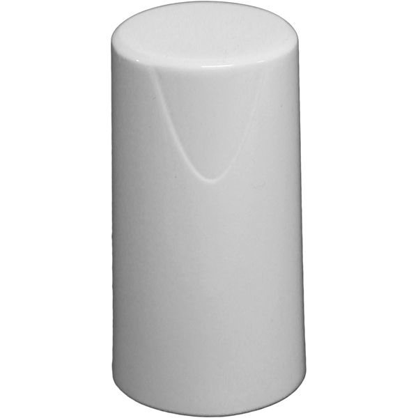
    Tersus David RTK is a real-time kinematic solution for centimeter-level accuracy using a smartphone. By plugging into a smartphone with a USB cable, The Tersus David turns the phone into an RTK rover, geographic information system (GIS) collector and RTK base. It supports GPS L1/L2, BeiDou B1/B2 and GLONASS G1/G2 signals. The rugged design enables it to operate in harsh environments.

    Tersus GNSS, www.tersus-gnss.com

    Mobile mapper

    High speed for corridor mapping

    The Riegl VMX-2HA is a high-speed, high-performance dual-scanner mobile mapping system that provides dense, accurate and feature-rich data at highway speeds. With 2 million measurements and 500 scan lines per second, the turnkey solution is suitable for survey-grade mobile mapping applications. The powerful technology in the Riegl VMX-2HA is comprised of two Riegl VUX-1HA high-accuracy lidar sensors and a high-performance INS/GNSS unit housed in an aerodynamically shaped protective cover. A camera interface for up to nine optional cameras enables the lidar data to be complemented by precisely georeferenced images.

    Riegl, www.riegl.com

    3D laser scanner

    Rapid mapping indoors and out

    The ZEB-REVO RT is the next generation of the ZEB-REVO — GeoSLAM’s lightweight, handheld laser scanner that allows rapid, simple mapping of complex, indoor and multi-level spaces. The ZEB-REVO RT uses Wi-Fi technology to seamlessly connect the scanner to a mobile phone or tablet, allowing for real-time data visualization as the user walks and scans. The simultaneous scanning and processing of 3D data removes the need for post-processing, effectively slashing project survey times in half. The technology is so rapid, users can scan and process a three-story building in 30 minutes.

    GeoSLAM, geoslam.com

    ArcGIS add-on app

    Connects Esri ArcGIS data with Salesforce data

    MapAnything Connector for ArcGIS gives users a map view of Esri ArcGIS Online data inside Salesforce with their organizational data for strategic planning and analysis. The add-on app serves as a bi-directional integration layer between the programs, enabling customers to access their ArcGIS mapping and location intelligence inside the MapAnything Platform. Once connected, the MapAnything user interface helps Salesforce users view and interact with Esri maps and data alongside their existing customer and business data, exposing new opportunities to drive revenue and increase efficiency; improve decision making by aligning two core systems of record, the GIS system and the customer relationship management (CRM); and make it easy for GIS professionals to share insights seamlessly with their counterparts. The application has uses across retail, commercial real estate, telecommunications and economic development.

    MapAnything, mapanything.com


    OEM

    Simulator

    Generates Realistic Test Scenarios for a wide variety of applications

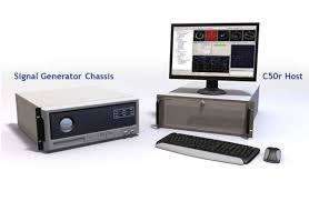
    The SMW200A GNSS simulator can be extended to up to four RF outputs and allows GNSS signals to be simulated simultaneously in multiple frequency bands for multiple antennas. It can internally simulate a complex interference environment in parallel with GNSS signals. To test multi-frequency and multi-antenna systems, users have access to 72 GNSS channels that can be assigned to up to four RF outputs. The SMW200A can generate QZSS and SBAS signals as well as GPS, GLONASS, Galileo and BeiDou signals, enabling users to quickly and easily verify the position accuracy of their receivers under realistic conditions. An internal noise generator can generate complex interference scenarios with multiple interferers.

    Rohde & Schwarz, www.rohde-schwarz.com
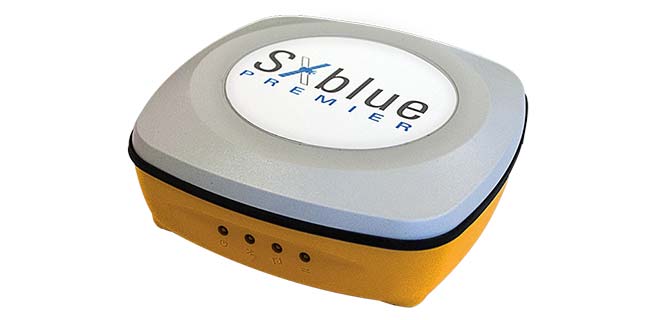
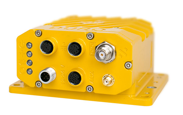
    RTK receiver

    Multi-frequency, four constellations for survey and GIS

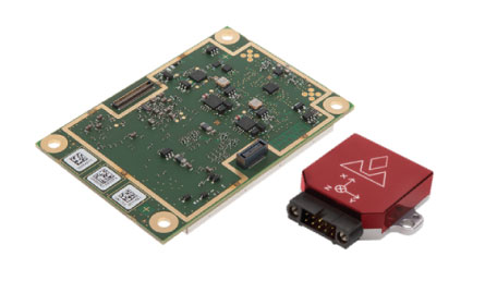
    The Altus NR3 is a multi-frequency, quad-constellation (GPS, GLONASS, BeiDou and Galileo) RTK receiver for survey and GIS applications. It features Septentrio’s AIM+ interference mitigation and monitoring system, allowing continued operation in the presence of both intentional and non-intentional interference. It combines advanced GNSS features with a robust communications suite in a compact, low-power and easy-to-use unit. The Altus NR3 is configurable as either a rover or a base station. It offers one-touch logging and Septentrio’s on-board web interface so users can monitor and configure the unit as well as collect data using any Wi-Fi-capable device.

    Septentrio, www.septentrio.com

    Battlefield navigation

    Protects critical military and security networks

    VersaPNT provides virtually failsafe battlefield navigation, even in GPS-denied environments, to protect critical networks. The new, ground, air or sea vehicle-mounted unit is designed for military environments, with a ruggedized, compact, low-power and lightweight form factor. It provides continuous mission assurance and command, control, communications, computers, intelligence, surveillance and reconnaissance (C4ISR) support, even in hostile environments.

    Spectracom, www.spectracom.com

    Timing server

    Incorporates SAASM for defense

    The SyncServer S650 SAASM server incorporates a Selective Availability Anti-Spoofing Module (SAASM). The SAASM capability provides a highly secure, accurate and flexible time and frequency platform for synchronizing mission-critical electronics systems and instrumentation applications in the defense market. The SAASM received the GPS Directorate security approval to incorporate a military-grade, GPS SAASM receiver module, enabling U.S. armed forces to deploy features of the commercial SyncServer S650 in a military-grade configuration and allowing for a migration path to GPS Military Code (M-code) support.

    Microsemi, www.microsemi.com
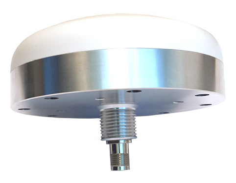
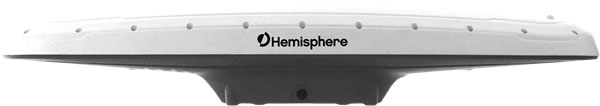
    Antenna

    Superior multi-constellation tracking for uavs, survey vessels

    The multi-constellation D-Helix Antenna is capable of superior tracking of signals from GPS L1/L2 L-Band, GLONASS L1/L2, BDS B1/B2/B3 and Galileo. The quadrifilar helix design of low wind-resistance makes it suitable for UAV positioning and navigation. The increased antenna gain and beamwidth ensure better signal receiving performance at low elevation angles; the low noise design also reduces interference and improves signal quality. The antenna can be used in UAV patrol, UAV plant protection and for unmanned patrol and survey vessels.

    Harxon, en.harxon.com
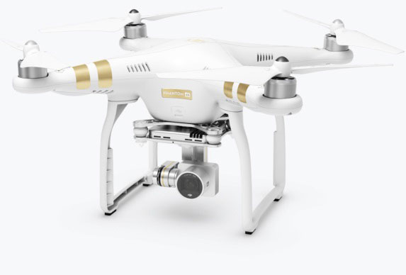
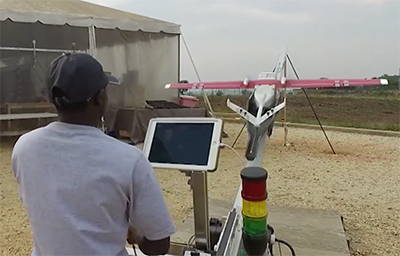

    UAV

    Operations software

    Helps enterprises efficiently manage their drone operations

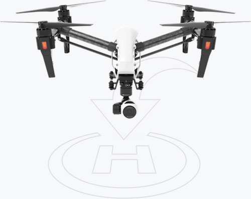
    FlightHub is a new software solution that helps enterprises and drone service providers efficiently manage their drone operations from a single platform. A web-based service, FlightHub enables the secure management of real-time drone operations, flight data, drone fleets and pilot teams to meet the needs of the expanding global commercial drone industry. Users can view their teams’ remote drone operations from one place in real time.FlightHub provides enterprises a clear, centralized view of their company’s drone operations to enable onsite pilots to more effectively collaborate with offsite teams. The Map View and Real-Time View features display telemetry, camera and sensor data for faster, more informed decision making.

    DJI, www.dji.com

    Drone camera

    Addition to M-Series IP network camera line

    The new MR6442AX IP 4MP dome camera is suitable for demanding outdoor installations in challenging lighting conditions, such as schools, parking lots and sports stadiums, as well as city and perimeter surveillance. It features brilliant video quality, a 2.8 to 12 mm Varifocal-Auto iris lens, 100-db high dynamic range (HDR) and built-in Sense up+ low light technology. Intelligent video surveillance (IVS) functionality is a cornerstone of LILIN IP M-aeries cameras. The MR6442AX IVS analytics include advanced motion detection, object counting and tripwire detection, allowing the camera to detect when an object or person has breached an area such as the entrance to a building or parking lot. The MR6442AX is outdoor-ready out-of-the-box with an IP66 rating for rain and dust resistance, suitable for perimeter protection where early detection of an intrusion attempt is critical.

    LILIN Americas, www.lilin.us
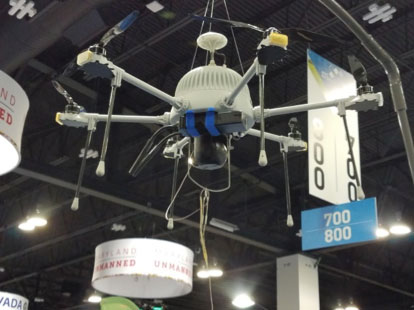
    Quadcopter

    Specifically designed for agriculture

    The Parrot Bluegrass Agricultural Solution includes a powerful quadcopter equipped with a full high-definition front camera and embedded Parrot Sequoia advanced multispectral sensor; flight planning mobile application with Pix4Dcapture; data processing with AIRINOV FIRST+ cloud platform; and a long-range remote control, the Parrot Skycontroller 2. Parrot Bluegrass is easy to set up , fly and repair, with Pix4Dcapture autonomous flight capability. It can automatically cover up to 30 hectares at 70 meters / 230 feet flight altitude per battery (25 minutes per battery).

    Parrot, www.parrot.com
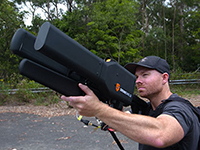
    UAS countermeasure

    Automatically detects, locates, tracks and takes over UAS controls

    The Airfence 5.0 UAS countermeasure platform, updated from Airfence One, provides new and improved directional finding along with detection, tracking and long-distance jamming capabilities. It is designed to protect militaries, airports, prisons and private companies from rogue drones in illegal and potentially life-threatening situations. Airfence 5.0 is certified rugged and offers compact out-of-the box setup and installation. The update incorporates lessons learned from key projects with the FAA, NASA, the U.S. Marine Corps and the European Commission. Airfence 5.0 includes updates focused on increasing the detection rate and level of data packets received, enabling for real-time actionable insights.

    Sensofusion, sensofusion.com


    TRANSPORTATION

    Connected car device

    Plug-in for older vehicles

    The HumX plug-in turns older model autos into smart cars. It equips the cars with features like using GPS for roadside assistance, Wi-Fi hotspot for up to 10 devices, maintenance reminders and auto health diagnostics. HumX uses safety features such as speeding and boundary alerts, vehicle diagnostics, driving history and emergency assistance (with crash detection capabilities). It allows travelers to stay safe with pinpoint roadside assistance, turn-by-turn navigation, live traffic updates and a mechanics hotline for certified, expert advice. HumX is sold with an equipment fee, a one-time activation fee and a monthly subscription.

    Verizon, Hum.com

    Electronic logging for mobile devices

    Enables fleets to improve safety, productivity from a Samsung device

    Omnitracs and Samsung Electronics America are partnering to help the transportation industry address the Federal Motor Carrier Safety Administration (FMCSA) Electronic Logging Device (ELD) Mandate. The solution combines Samsung smartphones, tablets and security solutions with Omnitracs’ XRS fleet management software to improve safety, data security and productivity for U.S.-based fleets. Drivers can use their mobile device to monitor hours of service (HOS) logs to comply with legal requirements during on- and off-duty management of vehicles. Electronic tracking of HOS increases speed and accuracy of reporting, because drivers can track their hours in real time instead of fixed increments, such as in manual entry methods. The solution provides fleets with key driver performance analytics, including fuel usage, drive time, speed, driving behavior, driver vehicle inspection reporting (DVIR) and trip data to improve driver safety, lower costs and increase productivity.

    Omnitracs, www.omnitracs.com; Samsung, www.samsung.com

  • New DJI tech identifies and tracks drones

    AeroScope addresses safety, security and privacy concerns while protecting drone pilots

    DJI has unveiled AeroScope, its new solution to identify and monitor airborne drones with existing technology that can address safety, security and privacy concerns.

    AeroScope uses the existing communications link between a drone and its remote controller to broadcast identification information such as a registration or serial number, as well as basic telemetry, including location, altitude, speed and direction.

    Police, security agencies, aviation authorities and other authorized parties can use an AeroScope receiver to monitor, analyze and act on that information. AeroScope has been installed at two international airports since April, and is continuing to test and evaluate its performance in other operational environments.

    “As drones have become an everyday tool for professional and personal use, authorities want to be sure they can identify who is flying near sensitive locations or in ways that raise serious concerns,” said Brendan Schulman, DJI’s vice president for policy and legal affairs. “DJI AeroScope addresses that need for accountability with technology that is simple, reliable and affordable — and is available for deployment now.”

    DJI demonstrated the system Oct. 12 in Brussels, Belgium, showing how an AeroScope receiver can immediately sense a drone as it powers on, then plot its location on a map while displaying a registration number. That number functions as the equivalent of a drone license plate, and authorities can use it to determine the registered owner of a drone that raises concerns.

    In March 2017, in response to growing calls by governments worldwide for remote identification solutions, DJI released a white paper describing the benefits of such an approach to electronic identification for drones.

    AeroScope works with all current models of DJI drones, which analysts estimate comprise more than two-thirds of the global civilian drone market. Since AeroScope transmits on a DJI drone’s existing communications link, it does not require new on-board equipment or modifications, or require extra steps or costs to be incurred by drone operators. Other drone manufacturers can configure their existing and future drones to transmit identification information in the same way.

    Because AeroScope relies on drones directly broadcasting their information to local receivers, not on transmitting data to an internet-based service, it ensures most drone flights will not be automatically recorded in government databases, protecting the privacy interests of people and businesses that use drones. This approach also avoids substantial costs and complexities that would be involved in creating such databases and connecting drones to network systems.

    This system is consistent with DJI’s problem-solving approach to drone regulation, which aims to strike a reasonable balance between authorities’ need to identify drones that raise concerns and drone pilots’ right to fly without pervasive surveillance.

    DJI has led the industry with safety and security advances such as geofencing and sense-and-avoid technology, and believes the rapid pace of innovation provides the best means to address new policy concerns.

    Drone identification settings will be included in DJI’s initial drone software to allow customers to choose the content of their own drone’s identification broadcast to match local expectations both before and after identification regulations are implemented in different jurisdictions.

    To protect customers’ privacy, the AeroScope system will not automatically transmit any personally identifiable information until regulations or policies in the pilot’s jurisdiction require it.

    “The rapid adoption of drones has created new concerns about safety, security and privacy, but those must be balanced against the incredible benefits that drones have already brought to society,” said Schulman. “Electronic drone identification, thoughtfully implemented, can help solve policy challenges, head off restrictive regulations, and provide accountability without being expensive or intrusive for drone pilots. DJI is proud to develop solutions that can help distribute drone benefits widely while also helping authorities keep the skies safe.”

    For more information about AeroScope, contact [email protected].