Tag: drone

  • USX51 flight controller aids UAV development

    USX51 flight controller aids UAV development

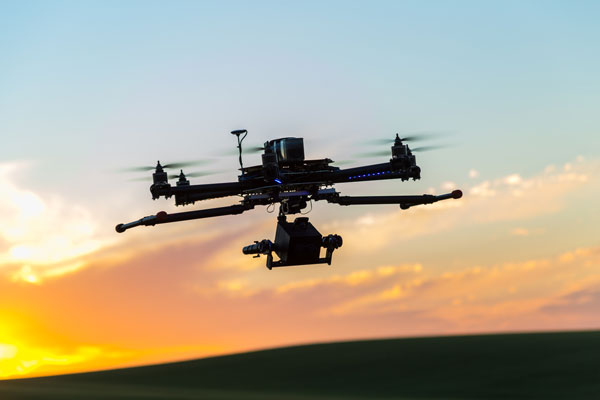
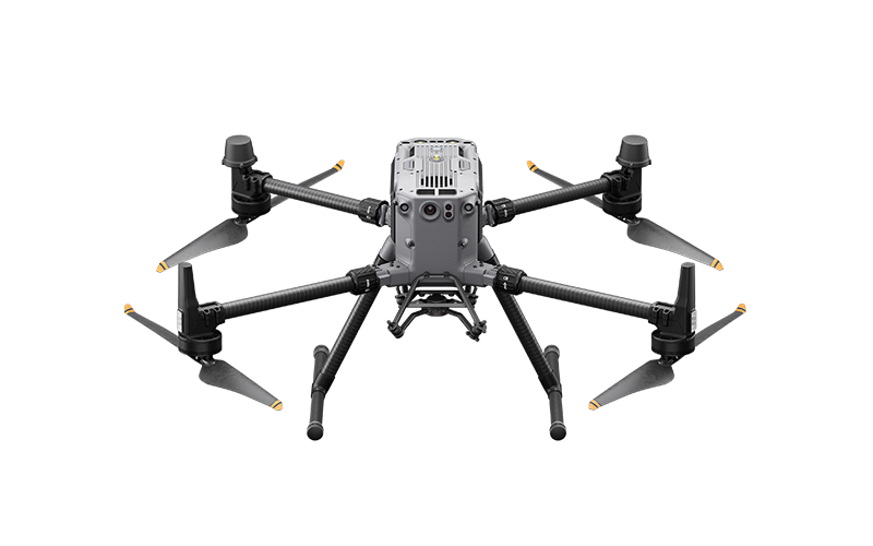
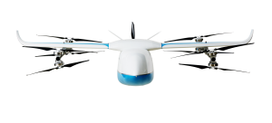
    The USX51 Computing Power Flight Controller by UTMSYS is a system architecture that combines the Pixhawk 6X flight controller with the D Robotics RDK X5 edge-computing module.

    According to the development team, the goal of the USX51 platform is not only to provide hardware, but to simplify complex UAV system integration for developers, research teams, and robotics engineers working on real world deployment scenarios.

    The USX51 system integrates Pixhawk 6X and RDK X5 to support PX4-based UAV development for GNSS-denied, VTOL, and multi-sensor applications.

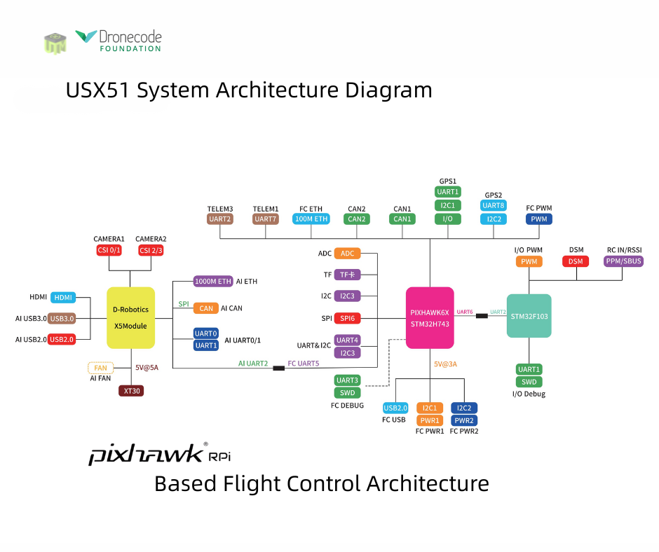
    The system is designed to support PX4-based UAV development while separating real-time flight control tasks from high compute perception workloads. This decoupled architecture helps maintain flight stability while allowing developers to expand into vision based and autonomous applications.

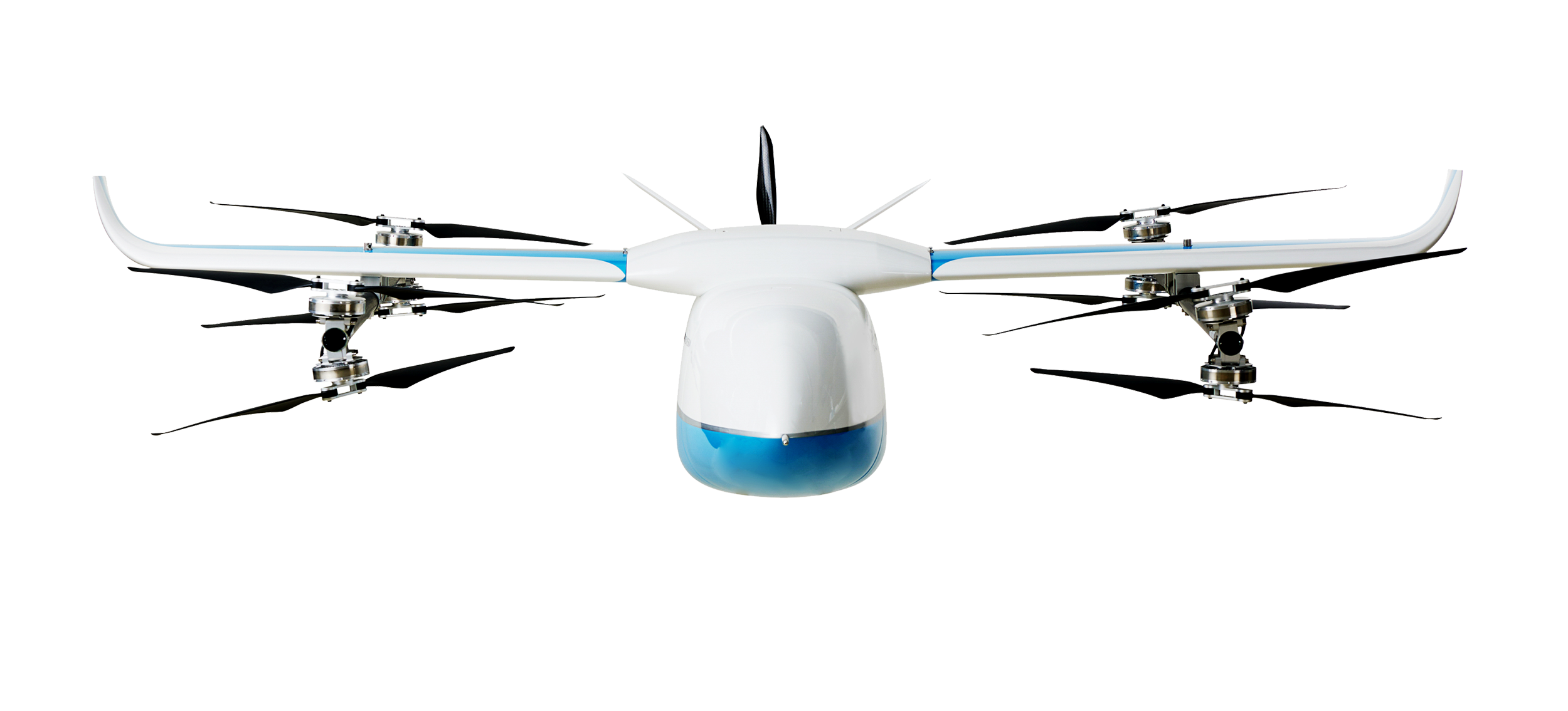
    The USX51 supports development scenarios including:

    • GNSS-denied navigation
    • VTOL mission platforms
    • Multi-sensor integration
    • Visual perception and tracking
    • ROS2-based robotics workflows
    • Research and autonomous UAV development
    Credit: UTMSYS
    Credit: UTMSYS

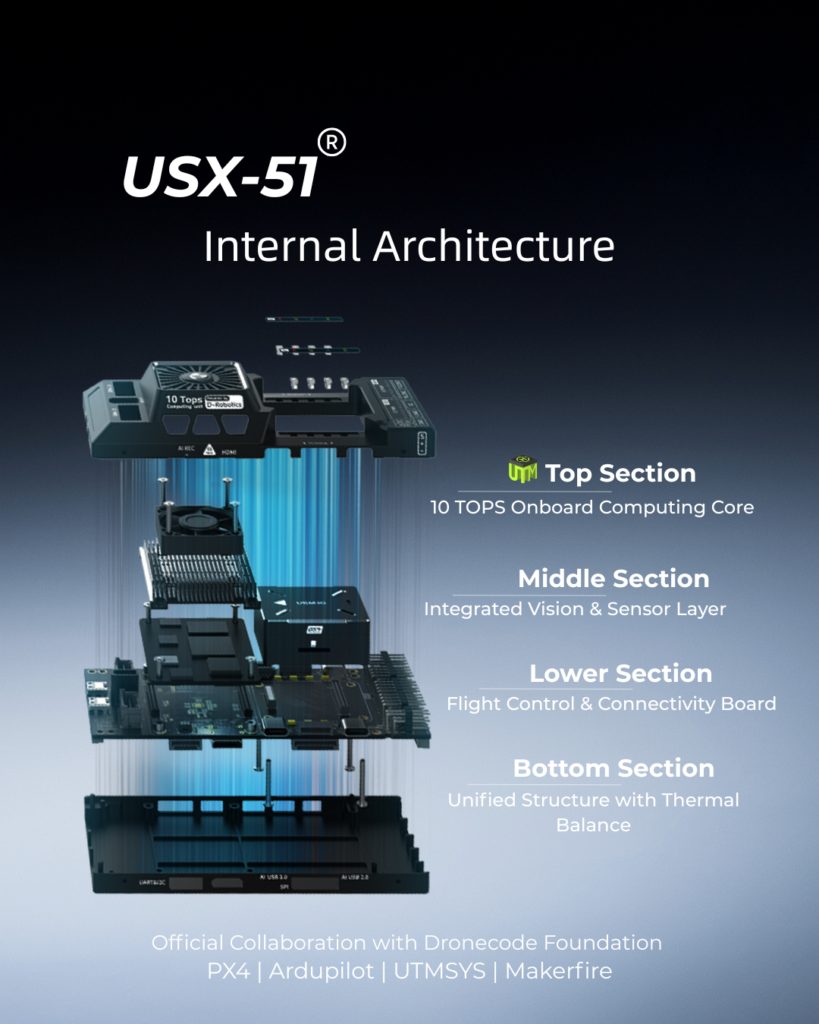
    The Pixhawk 6X handles flight critical control functions, while the RDK X5 module provides onboard computing capability for visual processing, sensor fusion, and autonomous related workloads.

    The system also provides multiple communication interfaces including Ethernet, CAN, UART and I2C, allowing developers to integrate cameras, thermal modules, lidar systems, and additional peripherals into their UAV projects.

    Current ecosystem development around USX51 includes PX4 integration, ROS2 workflows, developer testing programs, and community based project collaboration.

  • AirData UAV joins the Commercial Drone Alliance ahead of Part 108 adoption

    AirData UAV joins the Commercial Drone Alliance ahead of Part 108 adoption

    The U.S. commercial drone industry is at an inflection point. After years of incremental progress, the FAA’s landmark Part 108 Beyond Visual Line of Sight (BVLOS) rule is expected to take effect later this year, unlocking a new era of scaled commercial drone operations across delivery, infrastructure inspection, public safety, perimeter protection and beyond. It’s a pivotal moment for drone operators to get ahead of the most significant regulatory shift the commercial drone industry has seen.

    Today, AirData UAV announced it is joining the Commercial Drone Alliance (CDA), bringing its operational platform into the industry’s broadest coalition for drone policy and progress. As a member of the CDA, AirData will actively contribute to the policies and standards that will define the next chapter of the U.S. drone economy through the CDA.

    Part 108 introduces sweeping new operational requirements across pre-, during and post-flight documentation, personnel roles, risk-categorized operational areas, and mandatory continuous data reporting, and AirData’s platform is already built to meet them.

    “We are at a critical moment for the drone economy,” said Lisa Ellman, Chief Executive Officer of the Commercial Drone Alliance. “As the industry moves toward broader BVLOS operations and frameworks like Part 108, access to scalable, reliable operational data such as that which AirData provides will help to safely unlock the full potential of the drone economy.”

    Credit: AirData UAV

    AirData’s platform delivers the tools operators will need to meet Part 108’s requirements, including: checklists, automated compliance documentation, flight logging across every mission, and fleet-wide analytics that give program managers visibility into operational risk. With more than 61 million flights across 450,000 pilots and 850,000 drones globally, AirData has been building the compliance infrastructure the industry now needs.

    As the industry’s leading policy advocate, the CDA has been central to advancing the regulatory frameworks. The CDA is an independent non-profit organization led by key members of the commercialdrone industry. It works to educate policymakers and the public on the safe integration of drones into the national airspace and to advocate for policies that enable commercial drone operations.

    “We have long served as the intelligence backbone for drone
    operations,” Eran Steiner, CEO and founder of AirData UAV. “We look forward to leveraging our data, insights, and experience to enable scalable, compliant, and mission-critical drone programs, particularly as frameworks like Part 108 unlock the next phase of scaled BVLOS operations in the United States.”

    AirData’s platform gives public safety agencies, enterprise operators, and drone programs of every size the maintenance documentation, pilot currency tracking, asset management, checklist discipline, and operational data history that regulators will expect when Part 108 takes effect.

  • Rohde & Schwarz to highlight UAV-based navigation analyzer at IFIS 2026

    Rohde & Schwarz to highlight UAV-based navigation analyzer at IFIS 2026

    The 23rd International Flight Inspection Symposium (IFIS) will gather experts in San Salvador May 4-8. There, Rohde & Schwarz will demonstrate its test and measurement solutions for ground-based navigation aids. The exhibits address the rising traffic volumes and stricter safety requirements.

    Rohde & Schwarz will take part in the conference’s technical sessions with a presentation on “Challenges for UAV Operations in RF Dense Aerodrome Environments.”

    The aviation sector today faces increasing air traffic density, rapid technological advancements and heightened security concerns, the company explained. Operators need test equipment that delivers laboratory level precision while tolerating the harsh environment of an airport runway or a remote navigation site.

    Among the exhibits at the Rohde & Schwarz booth is the R&S EVSD1000 VHF/UHF Nav/Drone Analyzer, designed to conduct GBAS, ILS and VOR measurements in line with ICAO Doc 8071 and ICAO Annex 10. The receiver delivers laboratory precision, supports an air to ground Wi‑Fi datalink and gapless measurements with improved location accuracy during flight inspections. Customers benefit from a device that can be mounted on a drone, reducing the need for manned flights and lowering operational expenses.

    Rohde & Schwarz gives airlines, airport operators and navigation service providers a reliable way to certify and maintain ground‑based aids under today’s demanding conditions. By combining high measurement accuracy, easy operation and durability, Rohde & Schwarz aims to help the industry keep pace with growth.

  • India approves indigenous high-altitude rescue UAV for IAF

    India approves indigenous high-altitude rescue UAV for IAF

    The Indian government has approved development of an indigenous, runway-independent combat search-and-rescue UAV for the Indian Air Force.

    The drone will be used to rescue pilots and crew, and deliver supplies in extreme terrains, tasks to be accomplished without risking manned aircraft. For instance, snowbound heights are difficult for helicopters to traverse.

    The UAV will be developed under the government’s Make-I category with 70% funding, and will operate up to 16,000 feet in the air. It will carry payloads up to 400 kg and support autonomous missions within a range of 200 km and a 45-minute loiter time.

  • Safe Pro unveils new algorithms for GPS-denied drone operations for U.S. Army

    Safe Pro unveils new algorithms for GPS-denied drone operations for U.S. Army

    The latest generation of Safe Pro’s AI technology will be presented at U.S. Army exercise at Fort Hood, Texas

    Safe Pro Group, a developer of artificial intelligence (AI)-enabled defense and security solutions,  has deployed upgraded AI algorithms to its patented Safe Pro Object Threat Detection (SPOTD) technology for drone operations in GPS-denied environments.

    The newly enhanced SPOTD capabilities will be prominently featured at the upcoming U.S. Army 2026 Concept Focused Warfighter Experiment (CFWE) technology demonstration taking place at Fort Hood, Texas.

    Operating on the Amazon Web Services (AWS) Cloud or at the Edge, SPOTD is Safe Pro’s patented rapid battlefield image analysis platform designed to identify and map small explosive threats such as landmines and ambush drones detected in videos collected from virtually any drone.

    The ability for SPOTD to rapidly detect threats and create 2D/3D models from drones flying in GPS-denied environments was developed after real-world exercises in Ukraine at the request of end users. The integration of these new algorithms further enhances the value of SPOTD as a situational awareness tool for use in a wide array of military reconnaissance and planning operations.

    SPOTD enhancements include:

    • Ability to process any drone video data: Turning video clips into 2D and 3D models with AI-trained explosive threat detections
    • Enhanced operational robustness: Operating capability in GPS and GPS/GNSS denied environments
    • Terrain modeling: Threat and terrain mapping in support of unmanned ground vehicles (UGVs) route planning
    • Rapid mapping-only mode: Mapping for intelligence, surveillance and reconnaissance (ISR) and missions that do not require AI-powered threat detections
    • Accelerated processing: Up to 10x reduction in processing time powered by Safe Pro’s proprietary geospatial AI algorithms.

    Powering the company’s SPOTD technology is Safe Pro’s unique real-world datasets, which include high-resolution drone imagery and GPS-tagged geospatial data encompassing more than 2.2 million drone images analyzed to date, and 41,400+ threats identified across 11,400 hectares (28,000+ acres).

  • Pathfinder provides signal-resilient autonomy in navigation

    Pathfinder provides signal-resilient autonomy in navigation

    Aero Drop Systems (ADS) has developed Pathfinder, a proprietary autonomous navigation framework designed to reduce dependence on GNSS-based positioning. Pathfinder is signal-resilient, capable of maintaining precision even in complete GNSS dead zones and unaffected by deceptive interference.

    At the core of Pathfinder lies an array of sensors and advanced self-regulating logic driven by machine learning. Unlike traditional systems that treat GPS as a singular source of truth, Pathfinder fuses a constant stream of information from multiple internal and external domains and dynamically rebalances itself in real time as it evaluates, cross-verifies, and refines its positional understanding based on an algorithm that classifies the trustworthiness of each data stream.

    The result is a self-correcting navigation intelligence that can anticipate changing conditions, isolate false data, and continue to perform when other systems cannot. This allows Pathfinder to sustain highly accurate navigation during satellite connection or radio frequency outages or when being targeted with jamming or spoofing.

    Designed as a modular framework, Pathfinder can be integrated across a range of fully autonomous platforms operating on land, at sea, or in the air. Its flexible architecture makes it suitable for both commercial logistics and defense applications, where navigation integrity is critical to mission success.

    Currently in the testing phase, Pathfinder is part of ADS’s broader initiative to develop resilient, autonomous logistics technologies capable of performing in contested and complex environments. ADS has confirmed that Pathfinder will serve as the core navigation technology for the platform Aerocrate. Aerocrate is a disposable, autonomous aerial delivery system that enables precise, reliable resupply without requiring recovery operations, staging areas, or active communication with the platform.

  • Turkish kamikaze drone unveiled

    Turkish kamikaze drone unveiled

    A new Turkish-made twin-jet kamikaze drone, showcased at the Ateş Serbest-2025 exercise, features GNSS-independent autonomy, with GNSS/GPS signals, supplemented by odometric data where necessary, reports Defence Turk and Defence Index. With specially designed avionics and onboard visual-odometry algorithms, the drone can navigate and reach its assigned coordinates without dependence on satellite positioning.

    According to information obtained by both news outlets, the KZ-350 drone is being developed with a target range of 350 km. Its cruising speed is 500 km/h, cruising altitude is 3,000 meters. Its takeoff weight is 120 kg and warhead 25 kg. Two domestically produced jet engines power the drone.

    Once a mission profile is uploaded, the KZ-350 is intended to operate in a “fire-and-forget” mode. It autonomously follows its flight plan to the target area and executes its strike without external guidance.

  • TSR unveils tactical drone system with 3-hour flight time

    TSR unveils tactical drone system with 3-hour flight time

    TSR Inc. (Tactical Surveillance Reconnaissance) has launched the AVRIO series autonomous drone systems — cutting-edge European-made unmanned aircraft designed to redefine aerial surveillance, reconnaissance, and precision-strike capabilities.

    The AVRIO family, which includes the Falcox and Nebris platforms, delivers unmatched performance and resilience for defense, security and critical infrastructure missions, according to TSR. The company designed the AVRIO series for a wide range of defense and homeland-security missions, including:

    • Border security and coastal defense
    • Rapid-response reconnaissance and force protection
    • Counter-UAS operations using RF seeker payloads
    • Critical infrastructure protection and disaster-response intelligence.

    “The AVRIO series combines European aerospace engineering with U.S.-based deployment and support, giving governments and security agencies a next-generation toolset for ISR and tactical defense,” said Rick Clarke, CEO of Safe Room Designs/TSR Inc. “This is autonomous aerial defense, reinvented.”

    Specifications of the AVRIO

    • ISR (intelligence, surveillance, reconnaissance). Real-time EO/IR video, day/night operations, target tracking and identification.
    • Quick-launch and versatility. Vertical takeoff and landing, <1-minute preparation, runway-independent operation, and mission abort/return-to-base features.
    • Extended reach. Endurance of up to three hours and a range of up to 30 km, depending on payload and mission configuration.
    • Precision engagement. Options for smart munition payloads with precision super-quick impact fuzes and effective 15 m radius, plus anti-personnel and armor-piercing warheads.
    • Resilient design. Low radar cross section, GNSS-denied operation, MIL-STD-810G-qualified ground control, and operational temperature from –20 °C to +50 °C.
    • Naval and special missions. Capable of surface-mine detection, sweeping operations, and beyond-line-of-sight (BLOS) intelligence gathering.

    TSR is now accepting government and defense-sector inquiries for the AVRIO Falcox and AVRIO Nebris systems. For detailed specifications, demonstrations, or procurement discussions, contact TSR.

  • UAV companies discuss FAA BVLOS policy at White House

    UAV companies discuss FAA BVLOS policy at White House

    Representatives from 18 drone technology companies — including AgEagle Aerial Systems, uAvionix, BRINC, Kelly Hills and Pierce Aerospace — participated in a second high-level, invitation-only policy discussion with the White House, hosted by the Office of Information and Regulatory Affairs (OIRA). This most recent engagement was centered on the proposed FAA Rule Part 108, which will define the regulatory framework for beyond visual line of sight (BVLOS) drone operations across the United States.

    The finalization of FAA Rule Part 108 is expected to replace the current piecemeal waiver-based system, providing a more predictable, scalable, and innovation-friendly regulatory environment.

    Enactment of Part 108 would remove operational barriers, drive capital investment, and unlock next-generation drone technologies that enhance both commercial and public sector applications, explained AgEagle CEO Bill Irby.

    “This follow-up invitation by OIRA reaffirms the strategic importance of expanding BVLOS operations for the domestic drone industry,” Irby said. “Thoughtful and timely rulemaking can accelerate innovation, improve safety and compliance, and strengthen the U.S. position as a global leader in drone technology. Of particular value was the discussion of how streamlined regulation will allow broader deployment of autonomous data solutions and open the door for increased economic activity.”

    The engagement was made possible in part through the leadership and coordination of the Association for Uncrewed Vehicle Systems International (AUVSI) and the Commercial Drone Alliance (CDA), who played key roles in facilitating industry participation and ensuring productive dialogue between the private sector and federal stakeholders.

  • Frontier Precision announces upgraded UAV platform

    Frontier Precision announces upgraded UAV platform

    Photo:
    Image: Frontier Precision

    Frontier Precision has announced the availability of an upgraded flagship UAV platform, the Matrice 350 RTK.

    This UAV platform features a new video transmission system and control experience, an efficient battery system, and more comprehensive safety features. It also offers robust payload and expansion capabilities.

    The Matrice 350 RTK has a 55-minute max flight time and an IP55 rating. It features six-directional sensing and positioning, as well as a night-vision FPV camera, and 400 battery cycles.

    Click here for more product information.

  • A2Z Drone Delivery launches delivery UAV

    A2Z Drone Delivery launches delivery UAV

    Photo:
    Image: A2Z Drone Delivery

    A2Z Drone Delivery, developer of commercial UAV delivery solutions, has released its delivery UAV, the RDSX Pelican. The Pelican leverages a hybrid vertical takeoff and landing (VTOL) airframe with no control surfaces to combine the reliability and flight stability of a multirotor platform, with the extended range of a fixed-wing craft.

    With no ailerons, elevator, or rudder, the Pelican’s durable design eliminates common points of failure and extends operational time between maintenance overhauls. Designed to meet the 55 lb takeoff weight limitation for Federal Aviation Administration Part 107 compliance, the Pelican can carry payloads of 5 kg on missions up to 40 km, roundtrip.

    The Pelican can be optimized for extended range operations or to deliver payloads from altitude with the company’s RDS2 UAV delivery winch.

    Available in multiple configurations, the RDSX Pelican can be customized for an array of missions. The Pelican enables deliveries from altitude where spinning propellers are kept far from people and property, mitigating consumer privacy concerns of low-flying UAVs while abating intrusive rotor noise.

    Alternatively, for missions in which the UAV can safely land at its destination, a simple servo-release mechanism can release payloads and expand the Pelican’s payload capacity.

    Beyond logistics use cases such as residential deliveries, the Pelican is suitable for aerial mapping, UAV inspection, forestry services, search and rescue operations, water sample collection, offshore deliveries, mining, and more.

  • WingXpand’s expandable-wing drone stretches to 7 feet

    WingXpand’s expandable-wing drone stretches to 7 feet

    Photo: WingXpand
    Photo: WingXpand

    WingXpand has debuted a 7-foot expandable-wing drone that fits in a backpack. The drone was first revealed to the special forces community at the Special Operations Forces Industry Conference (SOFIC 2022) held May 16-19 in Tampa, Florida.

    WingXpand is U.S. made with a patented design that takes the small size and simplicity of a quadcopter and combines it with the horsepower of an airplane. WingXpand maximizes capability, efficiency and safety for the military and public safety officials. It can also be used  by farmers, surveyors and inspectors.

    WingXpand expands in less than 2 minutes. Though the full system weighs less than 10 pounds, it flies five times longer and carries ten times more weight than other drones of its size class, according to WingXpand. It can carry high-resolution cameras and other modular payloads such as a real-time pattern analysis system.

    WingXpand can reduce or replace the need for more costly, scarce or dangerous options. More than 10 WingXpand UAS can fit in a public safety vehicle, more than 30 in a pickup, and 250 on a standard airlift pallet.

    The WingXpand team provides end-to-end services, including pilot services, training, data analysis and sustainment.