Tag: drones

  • Klau Geomatics launches MakeItAccurate GNSS correction service

    Klau Geomatics launches MakeItAccurate GNSS correction service

    Photo:

    Klau Geomatics has launched MakeItAccurate, a global GNSS data correction and processing service.

    MakeItAccurate takes data from any GNSS receiver on drone or survey equipment and makes it accurate. Users can now achieve centimeter (cm)-level accuracy without the need for base stations, real-time kinematic (RTK) links, data from Continuously Operating Reference Station (CORS) or other external inputs.

    MakeItAccurate requires only the raw GNSS data from a drone to produce a highly precise trajectory and turn the traditional autonomous 3-5m GPS accuracy to 3-5 cm anywhere in the world.

    In many parts of the United States, Europe, Japan, Australia and New Zealand, absolute accuracy of 2-3 cm XYZ will be achieved. In these areas, the KlauPPK processing engine applies sophisticated hybrid PPK/PPP algorithms, merging global PPP clock and orbit corrections with many distant CORS stations to achieve this high absolute accuracy.

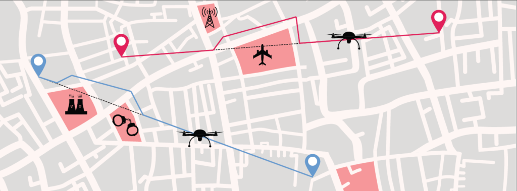
    The service enables enterprise drone operations to achieve high accuracy across their entire global operations with one repeatable workflow.

    Sectors such as insurance, telecommunications and utilities can scale their operations without additional survey expertise and site-specific data constraints. The same process works for multiple operators on thousands of sites enabling consistent, high accuracy every time, the company said.

    MakeItAccurate supports data from all GNSS manufacturers. Native support for DJI M 210v2 RTK or Phantom 4 RTK drones returns precise camera positions with centimeter-level accuracy. Other drones using external PPK GNSS products also can achieve highly accurate kinematic trajectories and camera coordinates.

    A MakeItAccurate application programming interface (API) is available to push raw GNSS data to the processing engine and return highly accurate coordinates, with full reporting on the accuracy achieved for the entire trajectory or each camera event. GNSS hardware manufacturers can offer a custom service to add value to their products. Software developers offering artificial intelligence technology, photogrammetry processing or other outcomes that benefit from high accuracy can use the MakeItAccurate API.

  • Kazakhstan uses drones to patrol capital during COVID-19 lockdown

    Kazakhstan uses drones to patrol capital during COVID-19 lockdown

    Terra Drone group company KazUAV has helped Nur-Sultan police to use drones to patrol and monitor illegal border movement and slow the spread of coronavirus in Kazakhstan

    KazUAV, Kazakhstan drone service provider and a member of Japan-based Terra Drone Corporation, has been working at the frontlines to keep communities safe amid the COVID-19 pandemic outbreak.

    Providing direct support to the operational headquarters set up to prevent the spread of coronavirus in Kazakhstan, KazUAV has been helping the Nur-Sultan Police Department to patrol the borders of the locked-down capital city with drones, ensuring “contactless” surveillance and fast-paced operations.

    Nur-Sultan is the capital city of Kazakhstan.

    The Central Asian nation closed its borders and locked down its main cities, including Nur-Sultan, after confirming the first coronavirus case on March 16. The oil-rich country that borders Russia and China also announced a state of emergency, set to last until April 15, adopting tough measures to combat the pandemic.

    Some of the guidelines put forth by the Kazakh authorities include country-wide travel restrictions, suspension of public gatherings, and implementation of stringent sanitation and anti-epidemic measures.

    A checkpoint on the border of Nur-Sultan. (Photo: TerraDrone)
    A checkpoint on the border of Nur-Sultan. (Photo: Terra Drone)

    All entrances and exits from Nur-Sultan have been completely blocked as part of these measures, mobilizing multiple law enforcement agencies of the Republic of Kazakhstan. Armored vehicles, barriers, and concrete blocks are being used to man the movement from the surrounding villages of Talapker, Karaotkel (Ilyinka), Koyandy, Kosshy and Zhibek-Zholy, on the Nur-Sultan-Petropavlovsk highway.

    An additional post has been set up by the municipal government of the Akmola region in Shubary to ensure there are no cases of non-compliance by the Kazakh population.

    KazUAV has been directly involved in the collection of information, operational monitoring, and coordination of actions of the Police Department and the Coronavirus Spread Prevention Operational Headquarters for all these areas.

    A KazUAV drone takes off to monitor the borders of the Kazakh capital of Nur-Sultan. (Photo: TerraDrone)
    A KazUAV drone takes off to monitor the borders of the Kazakh capital of Nur-Sultan. (Photo: Terra Drone)

    Using drone-mounted cameras with both visible and infrared sensors, the KazUAV team has completed hundreds of flight hours, broadcasting all captured data, as well as the exact coordinates of objects of interest, directly to the operational headquarters command center. This has led to the authorities discovering multiple bypass roads and irregularities in the locked-down area – without which, the quarantine measures could not have proven effective.

    When it comes to remote monitoring of vast areas, unmanned aerial vehicles are one of the best tools available to public safety agencies today. As a leading drone service provider in Kazakhstan, KazUAV not only gave Kazakh first responders access to cutting-edge drone technology, the company also assisted the enforcement agencies with the vast experience of its team of specialists, trained to operate day and night in the toughest of weather conditions.

    The UAV ground control station at the Coronavirus Spread Prevention Operational Headquarters in Nur-Sultan. (Photo: TerraDrone)
    The UAV ground control station at the Coronavirus Spread Prevention Operational Headquarters in Nur-Sultan. (Photo: Terra Drone)

    “As international experience has shown, restrictions introduced to prevent the spread of the coronavirus are the most effective measures to fight it,” said Dmitry Ivanov, development director, KazUAV. “Of course, it’s hard for everyone now; it is a challenging time for each one of us. But the call to stay home is more relevant than ever in the context of drones. We are familiar with carrying out critical tasks like monitoring floods or patrolling important events, but this was an emergency request which needed an immediate response.”

  • ARPAS-UK coordinates COVID-19 drone capability task force

    ARPAS-UK coordinates COVID-19 drone capability task force

    ARPAS-UK logoARPAS-UK — the Association of Remotely Piloted Aircraft Systems UK — is requesting the nation’s drone operators to let them know whether they could help fight the battle against coronavirus.

    “We are aware there are thousands of Commercial Drone Operators out there; we may need your help,” ARPAS-UK said in a statement to the drone industry.

    ARPAS-UK said it is “working hard to push the capabilities of the drone industry and making sure that government departments are reminded of the expertise and capabilities of the drone community in the UK.”

    ARPAS-UK is especially targeting relief for emergency services, as well as delivery of emergency food and medicine to vulnerable people, spraying of disinfectant, and collection of imagery and video to help monitor various situations.

    Current activities that could be expanded include vital inspections necessary to keep infrastructure running or maintain safety, such as monitoring following floods or environmental activity, and monitoring gas levels on sites.

    ARPAS-UK is creating a secure database of the information that will be destroyed when no longer required. To fill out a form for the database, visit this page.


  • Seen & Heard: Spotlight on UAVs

    Seen & Heard: Spotlight on UAVs

    “Seen & Heard” is a monthly feature of GPS World magazine, traveling the world to capture interesting and unusual news stories involving the GNSS/PNT industry. This month, we focus on UAVs.


    Screenshot: Quaternium video
    Screenshot: Quaternium video

    Non-stop flight in Valencia

    On Feb. 3, drone company Quaternium broke its own record for long flight time with a hybrid-fuel electric drone. The Quaternium HYBRiX UAV took off at 08:52 a.m. in Valencia, Spain, and landed at 17:02 p.m., after performing a stationary flight of 8 hours and 10 minutes. The new endurance record for non-stop flight time was accomplished with an experimental version of the company’s HYBRiX 2.1 drone, which carries 25 kilograms of maximum take-off weight.


    Westpac Little Ripper. (Photo: The Ripper Group/SLSA)
    Westpac Little Ripper. (Photo: The Ripper Group/SLSA)

    Dye-dropping drones

    A company is providing drones that can drop sea- marker dye into ocean surf, allowing lifeguards on shore to spot riptides. The drones have been developed by The Ripper Group, reports the Brisbane Times. A fleet of 51 drones is being deployed across 25 beaches on the Gold and Sunshine coasts in Australia, as well as farther north. The drones also could be used to rapidly assess situations such as people swimming or climbing on rocks. Plus, the company has deployed drones to detect sharks and crocodiles.


    Photo: pressdigital/iStock/Getty Images Plus/Getty Images
    Photo: pressdigital/iStock/Getty Images Plus/Getty Images

    Going bananas

    Agricultural diseases cause significant crop losses worldwide. One widespread disease is yellow Sigatoka, which limits banana cultivation. Scientists at Brazil’s Federal University of Ceara have used high-resolution aerial images from an Inspire 1 UAV and machine learning to monitor yellow Sigatoka in banana crops, identifying and classifying disease symptoms such as leaf spots. The system also provides humidity and temperature data that can help assess and manage the disease.


    Rescue from above

    A blind man who spent 33 hours lost in February in the freezing Connecticut woods was rescued thanks to a police drone. Richard Doty, 62, was trapped in the woods near his Enfield home after he became disoriented, Enfield police said on Facebook. Temperatures had dipped as low as 9° F. Officers borrowed a drone and a skilled pilot from police in neighboring Vernon. Within 30 minutes of lift-off, the drone spotted Doty about 100 yards into the woods, hidden from view down an embankment.

  • Draganfly tapped to detect dangerous unexploded landmines

    Draganfly tapped to detect dangerous unexploded landmines

    Photo: Gannet77/E+/Getty Images
    Photo: Gannet77/E+/Getty Images

    Draganfly Inc., a leading North American-based commercial drone company, is partnering with Windfall Geotek to develop drone-based solutions for landmine detection.

    Windfall Geotek is a Quebec-based technology services company and a leader in the use of artificial intelligence (AI) and advanced knowledge-extraction techniques in the mining sector.

    The companies will work to develop an artificial intelligence (AI) driven unmanned aerial systems solution for landmine detection in the defense, humanitarian and other sectors in which the companies have expertise.

    While landmines have been used since World War I, their deployment proliferated from the 1960s onwards. To this day, many unexploded devices are killing and maiming people who step on or trigger the bombs unintentionally.

    About 60 countries and territories are still contaminated with anti-personnel mines, and more than 120,000 people were killed or injured by landmines between 1999-2017, according to research by Landmine Monitor.

    Terms of the agreement include joint research, development and engineering support, drones and equipment o further commercialize an AI driven drone solution for the detection and elimination of landmines, unexploded ordnance and.improvised explosive devices (IEDs).

    In 2018, governments and nonprofits allocated nearly US$700 million in combined international
    and national support for mine action in 2018. The economic impact of landmines is estimated at $100 billion.

    “We have been evaluating drone solutions for nearly a year, and after an exhaustive analysis of the market and providers, it is exciting to select Draganfly as our first drone systems partner for this worthwhile initiative,” said Dinesh Kandanchatha, chairman of Windfall Geotek.

    “Windfall Geotek is the industry leader in AI-based digital exploration for mining. When they approached us on this project, it seemed like a natural fit to partner our engineering and drone capabilities, with their proven software and AI expertise,” sid Cameron Chell, CEO, Draganfly. “The two companies share a mission of saving lives through technology. We expect this partnership to generate new and expanded revenue streams for both companies in the defense sector, public safety and other markets where both companies have expertise.”

  • Drone projects summarized in Europe air traffic management report

    Drone projects summarized in Europe air traffic management report

    Cover: SESAR JC
    Cover: SESAR JC

    Drone technology takes center stage in a new European report on the continent’s air traffic management.

    U-Space: Supporting Safe and Secure Drone Operations in Europe, is a 42-page preliminary summary of SESAR U-space research and innovation results, following 19 demonstrations that took place from 2017 through 2019.

    The research and demonstration projects addressed topics such as drone operations; critical communications; surveillance and tracking; information management; aircraft systems; ground-based technologies; cyber-resilience; and geo-fencing.

    “Drones are disrupting business as usual in air traffic management,” said Florian Guillermet, executive director, SESAR Joint Undertaking. “A simple adaptation of our current air traffic management system is not enough; accommodating these air vehicles in the numbers forecast requires a new approach.”

    The projects map progress on development of the technological capabilities and all services
    required for making U-space a reality, starting with foundation services (U1) before progressing to initial services (U2), advanced services (U3) and finally full services (U4).

    Results of the projects summarized in the brochure will be fully detailed in a comprehensive report, expected to be published in the second half of 2020.

    Photo:
    Chart: SESAR JC

    SESAR 2020

    SESAR 2020 is a European Union innovative program for researching the future of air traffic management in Europe. It builds on its predecessor, SESAR 1, to deliver high-performing operational and technological solutions for uptake by the aviation industry.

    With a budget of 1.6 billion euros between now and 2024, SESAR 2020 will support projects to deliver solutions in these four key areas:

    • airport operations
    • network operations
    • air traffic services
    • technology enablers.

  • European drone-airspace integration project kicks off

    European drone-airspace integration project kicks off

    Photo by: aerogondo/iStock/Getty Images Plus/Getty Images
    Photo: aerogondo/iStock/Getty Images Plus/Getty Images

    GMV has been awarded the SUGUS project (Solution for E-GNSS U Space Service), which aims to speed the adoption of GNSS and Galileo in the unmanned aerial vehicle (UAV) segment and ensure safe airspace access by unmanned aircraft.

    SUGUS is an 18-month, 485,000-euro European Union research and development project. A series of trials will be held to show the benefits of E-GNSS for drone operators as well as its approval by aviation authorities.

    The project will be carried out by a GMV-led consortium including Everis Aerospace, Defense and Security; VVA Brussels; EGNOS service provider ESSP; FADA-CATEC and Unifly.

    The demand for UAV services is steadily increasing, with the potential to generate significant economic growth, as recognized in the 2015 European Union Aviation Strategy. More recently, the 2016 European Drones Outlook Study (by SESAR — Single European Sky ATM Research) estimated that the European drone market will clock up 10 billion euros a year by 2035 and more than 15 billion euros annually by 2050.

    U-Space services

    U-Space is a set of new airspace-management services and procedures designed to ensure airspace access too UAVs while looking out for operational security, the right to privacy and the safety of persons and infrastructure. These services rely on a high level of digitization and function automation, whether onboard the drone itself or part of the ground-based environment.

    Several initiatives are underway in Europe to develop U-Space and work toward the safe and efficient coexistence of manned and unmanned air traffic.

    At the same time, new European legislation on operating unmanned systems is providing a uniform, Europe-wide framework. The new regulation is broken down into three drone operation categories:

    • Open, calling for no AESA clearance or operator declaration
    • Specific, where both clearance and declaration will be necessary
    • Certified, reserved for riskier operations.

    To help integrate drones into the airspace, SUGUS will center on the Open and Specific flight categories.

    SUGUS tasks

    SUGUS will demonstrate the benefits for drone operations of the measures implemented at service-provision level and the new EGNSS API (European GNSS application programming interface) to be implemented in the project.

    These benefits included the mitigation of operating risks, improvement of preparation processes and clearance of the operator’s mission. Such measures as expected to ease future urban aerial mobility operations, such as aero taxis or parcel delivery.

    For the first step in this endeavor, SUGUS will carry out a review of the results of previous EGNSS projects while also pinpointing the needs of drone operators and unmanned traffic service providers in complex operations and built-up areas.

    This analysis will help to define and then implement the new EGNSS-based API.

    SUGUS will also be running several flight trials in complex environments to prove the benefits of the drone-operation measures. The overarching idea is to raise awareness and contribute towards drone standardization and regulation to maximize the chances of the proposed services being implemented as a U Space service.

  • Seen & Heard: Drones and robots fight coronavirus

    Seen & Heard: Drones and robots fight coronavirus

    “Seen & Heard” is a monthly feature of GPS World magazine, traveling the world to capture interesting and unusual news stories involving the GNSS/PNT industry.


    Drone with megaphone. (Screenshot: Xinhuanet video)
    Drone with megaphone. (Screenshot: Xinhuanet video)

    Drones and robots fight Coronavirus

    China’s efforts to contain the coronavirus include drones and robots, according to news reports. Drones are being used to spray disinfectant and enforce instructions to wear face masks. Some reports say drones with thermal imaging are detecting people with fevers from the air. On the streets, hazmat workers are using tank robots to disinfect 50,000 square meters per hour. Other robots are feeding quarantined air passengers at a hotel and disinfecting rooms.


    Jakarta toll road. (Photo: GeorginaCaptures/iStock Editorial/Getty Images Plus)
    Jakarta toll road. (Photo: GeorginaCaptures/iStock Editorial/Getty Images Plus/Getty Images)

    Hungary helps Indonesia with road tolling

    Indonesia and Hungary are in talks to build a multi-lane free flow (MLFF) e-toll system that allows payments without gates while cars are moving. The technology is estimated to cost US$90 million. The GNSS e-toll system is already installed in several eastern European countries, including Hungary. Using GNSS, motorists are charged tolls through sensors installed inside vehicles that identify their locations.


    Photo: Anne Webberi/iStock/Getty Images Plus
    Photo: Anne Webberi/iStock/Getty Images Plus/Getty Images

    Albatross on patrol

    The albatross, which has a wingspan as long as 11 feet, is helping catch illegal fishing vessels. Henri Weimerskirch of the French National Center for Scientific Research has outfitted nearly 200 albatrosses with GPS trackers that detect radar from ships that lack an automatic identification system. This allows the birds to transmit the locations of fishers in the midst of illicit acts. Fishers who trawl without a license, exceed quotas or underreport their hauls imperil fragile ecosystems and cost the global economy up to $30 billion a year.


    A black bear in Shenandoah National Park. (Photo: USNPS/Neal Lewis)
    A black bear in Shenandoah National Park. (Photo: USNPS/Neal Lewis)

    How fare the bears?

    When problem bears are relocated outside the Great Smoky Mountains, 74 percent are never seen again. Do they thrive after being moved at least 40 miles from their home range? Upcoming GPS research may figure out what happens to them. “There is a mindset where everybody thinks we can just go catch a bear and move it somewhere else, and everything is okay. And it’s not,” said wildlife biologist Bill Stiver. The U.S. National Park Service has approved a three-year grant for a GPS research project beginning in 2021 to track bears relocated from the Great Smoky Mountains National Park and Shenandoah National Park in Virginia.

  • US prepares for drone strikes against Middle East targets

    US prepares for drone strikes against Middle East targets

    A Patriot missile launch. (Photo: U.S. Army)
    A Patriot missile launch.
    (Photo: U.S. Army)

    U.S. forces and air-defense missile batteries across the Middle East were placed on high alert Jan. 7 in preparation for possible Iranian drone attacks, reports CNN, including all Patriot batteries and forces in the area.

    U.S. officials told CNN that intelligence mounted about a threat of an imminent attack against U.S. targets in the wake of the U.S. drone strike that killed Iranian general Qasem Soleimani. U.S. intelligence also observed Iran moving military equipment, including drones and ballistic missiles, over the last several days.

    The movement may be an Iranian effort to secure its weapons from a potential U.S. strike, or put them in positions to launch their own attacks.

    Iran has put missiles on its drones that have been used in other attacks, including a significant attack on Saudi oil installations last year (see below).

    Targets of concern are U.S. locations in Iraq, Kuwait, Saudi Arabia, the United Arab Emirates and Jordan.

    2019 Drone Tensions

    Drones forces from both sides targeted assets in 2019. In June, Iran shot down a U.S. military drone that it claimed was an intruding American spy drone entering its territory. The U.S. said the drone was shot down in international airspace over the Strait of Hormuz.

    In July, U.S. Marines jammed and destroyed an Iranian drone in the Strait of Hormuz from aboard the USS Boxer, an amphibious assault ship, because the drone has closed too close, to approximately 1,000 yards. Iran denied losing any of its drones.

    In September, Iran was blamed for an attack on the Saudi oil industry, with drones and cruise missiles assumed launched from an Iranian base in Iran close to the border with Iraq. The Abqaiq oil plant was struck by more than a dozen projectiles.

    Maritime Alert

    On Monday, the U.S. Maritime Administration issued an alert to commercial vessels operating in the Middle East, citing multiple maritime threats and stating “there remains the possibility of Iranian action against U.S. maritime interests in the region.”

    According to the alert, “The U.S. government is continually assessing the maritime security situation in the region to safeguard freedom of navigation, ensure the free flow of commerce, and protect U.S. vessels, personnel, and interests.

    “U.S. Fifth Fleet Naval Cooperation and Guidance for Shipping (NCAGS) has the latest information on the dynamic maritime security threats and operational environment in this region. U.S. commercial vessels are advised to exercise caution and coordinate vessel voyage planning for transits of the Persian Gulf, Strait of Hormuz, Gulf of Oman, North Arabian Sea, Gulf of Aden, and Red Sea with NCAGS and follow NCAGS’s recommendations and guidance whenever possible.”

  • Aceinna drives to CES 2020 with tiny GNSS/INS module

    Aceinna drives to CES 2020 with tiny GNSS/INS module

    Photo: Aceinna
    Photo: Aceinna

    Module designed for developers creating guidance and navigation systems for autonomous vehicles, robots, drones, industrial, construction and agricultural machinery

    Aceinna launched its OpenRTK330L at CES 2020, the massive annual consumer electronics show taking place Jan. 7-10 in Las Vegas. The company is located at Booth 6738, CES North Hall, Automotive Pavilion.

    OpenRTK330L is a low-cost,high-performance triple-band RTK/GNSS receiver with built-in triple redundant inertial sensors. Designed to replace the expensive and bulky precision RTK/INS systems used in today’s autonomous systems, the compact navigation solution meets the challenging performance, reliability and cost requirements of the automotive market along with the needs of robot, drone, construction and agriculture systems, Aceinna said.

    Demonstration Drive

    Aceinna is demonstrating its GNSS/INS-based autonomous vehicle localization technologies on its test vehicle, which drove from Silicon Valley to Las Vegas.

    The company is recording live drive-test data that demonstrates how its precision positioning solutions provide high accuracy and reliability. Precision location capability is critical for all levels of autonomous driving.

    OpenRTK330L includes a triple-band RTK/GNSS receiver coupled with redundant inertial sensor arrays to provide cm-level accuracy, enhanced reliability, and superior performance during GNSS outages.

    The OpenRTK330L integrates a precise 2 Degree/Hour IMU to offer ten to 30 seconds of high accuracy localization during full GNSS denial. This enables autonomous system developers to safely deliver highly accurate localization and position capabilities in their vehicles at prices that meet their budgets.

    Image: Aceinna
    Image: Aceinna

    OpenRTK330L’s embedded Ethernet interface allows easy and direct connection to GNSS correction networks around the world. OpenRTK330L’s CAN bus interface allows simple integration into existing vehicle architectures.

    The multi-band GNSS receiver can monitor all global constellations (GPS, GLONASS, BeiDou, Galileo, QZSS, NAVIC, SBAS) and simultaneously track up to 80 channels. The module has RF and baseband support for the L1, L2 and L5 GPS bands and their international constellation signal equivalents.

    The inertial measurement unit and dead reckoning function contains a total of 9 accelerometer and 9 rate gyro channels based on Aceinna’s unique triple redundant six-axis IMU array. By integrating a triple-redundant IMU array, the OpenRTK330L is able to recognize and utilize only valid sensor data, ensuring high-accuracy protection limits and certifiability under ISO26262 standards.

    Open Navigation Platform

    “The combination of a triple-band GNSS receiver and a high-precision IMU has enabled us to make a remarkably accurate, small, reliable and cost-effective GNSS/INS solution,” said Mike Horton, CTO of Aceinna. “The OpenRTK Precise Positioning Engine optimizes satellite tracking and high RTK fixes rates while integrating seamlessly with Aceinna’s open-source, developer-friendly Open Navigation Platform.”

    The Open Navigation Platform allows custom embedded application development on top of Aceinna’s positioning engine and dead-reckoning algorithms. Autonomous solution developers have full access to all resources on the OpenRTK330L module including the GNSS receiver measurement data, IMU measurement data and all interfaces.

    The OpenRTK330L GNSS receiver supports GPS (L1 C/A, L2C and L5), GLONASS (L1OF, L2OF), BeiDou (B1I, B2I), GALILEO (E1, E5a, E5b, E6) QZSS (L1 C/A), and NAVIC. The IMU sensor array includes a triple-redundant, 3-axis MEMS angular rate sensor, and a triple-redundant, 3-axis MEMS accelerometer.

    Hardware also includes, Ethernet, UART, SPI and CAN interfaces for versatile integration into a host system. Additional specifications include operating temperature range of -40C to +85C, and qualification to standard automotive shock and vibration levels.

    Detailed information and data sheets are available.

  • GE Aviation and Auterion team on commercial drone platform

    GE Aviation and Auterion team on commercial drone platform

    Photo: iStock.com/valio 84sl, via FAA
    Photo: iStock.com/valio 84sl, via FAA

    Team to provide all-in-one hardware and software platform for commercial drones.

    GE Aviation and Auterion are integrating the Auterion Enterprise PX4 operating system on GE Aviation’s Unmanned Aircraft System avionics platform.

    The companies signed a teaming agreement to provide a comprehensive hardware and software solution for drone manufacturers and operators seeking to enable commercial drone operations at scale.

    The hardware and software platform is designed with commercial vehicle original equipment manufacturers (OEMs) and service providers in mind. It is being displayed at Auterion’s booth (#2009) at AUVSI Xponential, taking place this week in Chicago.

    The teaming enables a full-stack solution with airborne autopilot and application computing hardware, flight management, safety management and integration. GE Aviation is providing the avionics hardware, application computing, flight management and integration into airframes. Auterion is providing Enterprise PX4, the operating system that runs on the vehicle, in the cloud and the ground station.

    The core architecture of the hardware and software platform has been implemented with the objective of supporting developers through global open software standards while maintaining an independent and authoritative safety controller.

    The combination of the two supports long-term flexibility and a high level of design assurance to enable commercial drone operations beyond visual line of sight (BVLOS) and within complex airspace and obstacle environments.

    Flight testing of the hardware and software platform took place over the last three weeks at Reno-Stead airport in Reno, Nevada.

    “In demonstrating a seamless integration of ground, cloud and airborne components, we’ve reached another milestone in helping to unlock the value in autonomous and UAS advanced operations,” said Alan Caslavka, president of Avionics Systems for GE Aviation. “Auterion’s open standards leadership and cooperative legacy with the developer community is the foundation to scale a sustainable solution critical for commercial drones.”

    “We are excited about the collaboration with GE Aviation that allows us to offer our operating system on high reliability hardware to meet future regulations,” said Kevin Sartori, Co-Founder of Auterion. “With this collaboration, the combined solution will significantly reduce barriers commercial cargo drones face flying in manned airspace or inspection drones to flying in urban areas.”

  • Thales to lead EU project on drone geofencing

    Thales to lead EU project on drone geofencing

    Principle of geofencing system. (Image: SESAR)
    Principle of geofencing system. (Image: SESAR)

    Thales is leading the SESAR Joint Undertaking to research and develop new services for safe, efficient and secure access to airspace for drones.

    The SESAR Joint Undertaking (SESAR JU) supports the European Commission’s U-space initiative by researching and developing new services for safe, efficient and secure access to airspace for an expected increase in drone use.

    Logo: GeoSafeThe Geosafe project is part of the founding services for the development of drones operation. Thales will manage the project, supported by Aeromapper, AirMap, Atechsys, Airmarine and SPH Engineering.

    The 280 flight tests with 16 different drones will be conducted in France, Germany and Latvia. These tests will explore all possible situations that an automated drone will face in urban and rural areas.

    By securing the flight pattern of drones to avoid determined zones, geofencing solutions are key safety enablers. Geofencing ensures that drones don’t fly in protected perimeters around critical infrastructures, such as power plants or airports.

    The objectives of Geosafe are to establish state-of-the-art geofencing solutions regarding U-space regulation and to propose improvements and recommendations for future geofencing system definition.

    Geosafe will be based on a one-year-long flight-test campaign, assessing a number of commercially available geofencing solutions so that it can propose an improved geofencing system and technological improvements for automated drones.

    Thales designs systems ensuring high security and safety levels for future air mobility. As the leader of the project, Thales will organize all tests and provide recommendations for the European geofencing system.

    “Thales is playing a leading role in shaping the autonomous world,” said Christian Bardot, Thales VP in charge of Helicopter and UAV Avionics Business. “Together with SESAR JU and the Geosafe partners, we will strengthen the foundations of drones’ safe and secure operations, unleashing the potential of this tremendous market.”