Tag: European Space Agency

  • ESA’s Navigation Lab Helps Set Global Time

    The European Space Agency (ESA) is helping to set the world’s time. Ultra-accurate atomic clocks of ESA’s Navigation Laboratory, which will be used to assess performance of the Galileo satnav system, have joined the global effort setting Coordinated Universal Time down to a billionth of a second.

    The replacement for Greenwich Mean Time, Coordinated Universal Time (UTC) is the timing used for Internet, banking, and aviation standards, and other international timescales, maintained by the Paris-based Bureau International de Poids et Mesures (BIPM).

    Participating measurement institutes and observatories around the globe use collections of atomic clocks to estimate a current value for UTC. These clock data are fed through to the BIPM to be carefully weighted and averaged to derive a combined global value. The complexity of this effort is such that it takes around six weeks to arrive at a definitive final figure, ESA said.

    Atomic clocks at ESTEC's Navigation Laboratory. Once Galileo services start, ESA’s Navigation Lab will play an important role independently validating Galileo timing performance. Its atomic clocks, offering precise timings for ESA  missions and experiments, are also contributing to the global setting of Coordinated Universal Time (UTC), the replacement for GMT.
    Atomic clocks at ESTEC’s Navigation Laboratory. Once Galileo services start, ESA’s Navigation Lab will play an important role independently validating Galileo timing performance. Its atomic clocks, offering precise timings for ESA missions and experiments, are also contributing to the global setting of Coordinated Universal Time (UTC), the replacement for GMT.

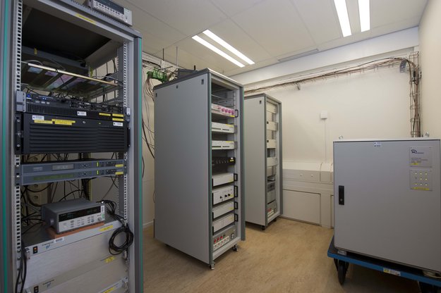
    ESTEC Director Franco Ongaro has signed an agreement with BIPM to mark the international recognition of the ESA timescale and the addition of ESA’s atomic clock data to the UTC calculations. “This is an independent timing capability that ESA’s Navigation Laboratory — based in ESTEC in the Netherlands — built up to support validation of Galileo timing performances, and before it the experimental Galileo GIOVE satellites,” explained Pierre Waller of ESA’s RF Payload Systems division.

    “But it makes sense to apply it more widely, and this BIPM recognition reflects the quality of our data. Our UTC estimate — formally known as UTC (ESTEC) — is also available for projects within ESA: there are many space applications beyond just navigation, such as precision technical experiments or synchronization of telecommunications and deep-space ground stations.

    “Incidentally, it is important to note that our contribution to UTC does not replace the existing input from the Netherlands’ own national timing metrology institute, Van Swinden Laboratories (VSL) in Delft. Instead we are adding to it, for enhanced global accuracy overall.”

    Galileo, like all other satellite navigation systems, is based on the highly precise measurement of time. A receiver on the ground pinpoints its position by calculating how long signals from satellites in orbit take to reach it.

    Matching the receiver and satellite clocks then multiplying the time taken by the speed of light gives the range between the user and the satellite. This allows the receiver to fix its longitude, latitude and time when in contact with four or more satellites. Atomic clocks on each satellite keep time to a matter of nanoseconds — billionths of a second — synchronized by a worldwide ground network.

  • Galileo’s Search and Rescue System Passes First Space Test

    The first switch-on of a Galileo search and rescue package shows it to be working well, according to the European Space Agency. Its activation begins a major expansion of the space-based Cospas–Sarsat network, which brings help to air and sea vessels in distress.

    The second pair of Europe’s Galileo navigation satellites — launched together on October 12 last year — are the first of the constellation to host SAR search and rescue repeaters. These can pick up UHF signals from emergency beacons aboard ships and aircraft or carried by individuals, then pass them on to local authorities for rescue.

    First_Galileo_search_and_rescue_signal_node_full_image
    Galileo search and rescue repeater signal.

    Once the satellites reached their 23,222 km-altitude orbits, a rigorous test campaign began. The turn of the SAR repeater aboard the third Galileo satellite came on January 17.

    “At this stage, our main objective is to check the repeater has not been damaged by launch,” explained ESA’s Galileo SAR engineer Igor Stojkovic. “The first day was a matter of turning the repeater on and checking its temperature and power profiles were as predicted. The following day involved sending a signal to the repeater using the UHF antenna at ESA’s Redu Centre in Belgium, then picking up the reply from our L-band antenna.”

    Redu’s antenna is 20 meters in diameter, so the shape of the relayed signal was captured in great detail, out of all proportion to surrounding noise.

    “We can precisely measure its power, the time the relay took and so on,” added Igor.

    More detailed system testing will follow, to completely prove this new type of SAR payload in orbit.

    Cospas–Sarsat system.
    Cospas–Sarsat system.

    The international system has been in use for more than three decades, saving some 31,000 lives. Cospas is a Russian acronym for “Space System for the Search of Vessels in Distress,” with Cospas standing for “Search and Rescue Satellite-Aided Tracking.” Ground stations — known as Local User Terminals — pinpoint the source of distress calls using signals relayed by participating satellites, then alert local authorities.

    The GPS satellites will also provide a medium-Earth-orbit Sarsat capability and testing is underway. All nine Block IIR satellites carry experimental payloads and all IIF satellites are scheduled to. See “The Distress Alerting Satellite System” for more details.

  • Retired GIOVE-A Helps SSTL Demo High-Altitude GPS Fix

    An experimental GPS receiver, built by Surrey Satellite Technology Limited (SSTL), has successfully achieved a GPS position fix at 23,300 kilometers altitude – the first position fix above the GPS constellation on a civilian satellite. The SGR-GEO receiver is collecting data that could help SSTL to develop a receiver to navigate spacecraft in geostationary orbit (GEO) or even in deep space.

    GPS is routinely used on Low Earth Orbit (LEO) satellites to provide the orbital position and offer a source of time to the satellite. Spacecraft in orbits higher than the 20,000 km of the GPS constellation, however, can only receive a few of the signals that “spill over” from the far side of the Earth, meaning that the signals are much weaker and a position fix cannot always be secured.

    With the support of the European Space Agency (ESA) and the ARTES 4 program, SSTL included the SGR-GEO receiver on the GIOVE-A satellite to prove that a receiver could achieve a position fix from a higher orbit. The SGR-GEO is adapted from SSTL’s SGR range of receivers and incorporates a high-gain antenna and a precise oven-controlled clock. It will demonstrate special algorithms to allow reception of weak signals and an orbit estimator intended to allow a near continuous position fix throughout orbit.

    “The results from the SGR-GEO receiver are really encouraging,” said Martin Unwin, principal GNSS engineer at SSTL. “We’re getting higher signal strengths than anticipated and also acquiring side lobes from the GPS transmit antennas, which improves the availability of the usable signals for navigation. With the success of the SGR-GEO receiver, GPS, in combination with Galileo and GLONASS, could soon be helping navigate spacecraft much further away from Earth.”

    The experimental GPS receiver onboard GIOVE-A has been inactive for six years while the satellite has been used for its primary purpose of transmitting prototype Galileo signals. GIOVE-A’s retirement in June 2012 has allowed the commissioning of the experiment and is now providing valuable data to SSTL and ESA in support of the future use of spaceborne GNSS receivers at GEO altitudes. Engineers at SSTL will continue operations, testing out, tuning and improving the receiver software onboard GIOVE-A to achieve the best possible performance.

  • Navigating the Moon

    The European Space Agency has issued an intriguing Intended Invitation To Tender, “Weak GNSS Signal Navigation on the Moon.” The study will investigate use of weak-signal GPS/GNSS — and of course ESA is interested primarily in the use of Galileo — for real-time position, navigation and timing information to various future lunar assets such as automated landers, rovers, Earth-Moon transportation vehicle, in-situ navigation, and so on.

    Does ESA have a lunar exploration agenda? This I did not know, but with only my own ignorance to thank, I quickly found out that ESA has had a lunar orbiter, SMART-1 (Small Missions for Advanced Research in Technology), since 2004, equipped with an Advanced Moon Imaging Experiment (AMIE) micro-camera and a mission, at least in part, to zero-in on suitable study sites for potential future lunar exploration missions.

    Since the conclusion of that project, ESA now plans to land a spacecraft in 2018 near the Moon’s south pole, a region full of dangerous boulders and high ridges. The aim is to probe the moonscape and test new technology — and now we know this includes GNSS — to prepare for future human landings. “The region may be a prime location for future human explorers because it offers almost continuous sunlight for power and potential access to vital resources such as water-ice.”

    “Although the visibility geometry is not always favorable,” the current ESA Invitation to Tender states, “it would result in 100-500m position accuracy as estimated in a NASA JPL/Ohio University paper. For lunar navigation applications, GPS/Galileo signals could be used if receivers complemented with advanced processing signal and filtering techniques, are capable of acquisition and tracking in the order of 15dBHz signal to noise ratios. Today latest developments show that these values are feasible. The PNT performance figures could also be improved with a GNSS-based system on a lunar relay satellite orbiting the moon as analyzed in [RD3]. The hardware required is equivalent to GPS space-based receivers and a high gain antenna.”

    The invitation to tender, to the tune of 200,000–500,000 euros, closes on April 23.

    GNSS use in space exploration, novel as it seems, has been outlined and partially explored in previously published articles in GPS World.

    In September 2008, Jim Miller and A.J. Oria brought us all up to date on the U.S. National Aeronautics and Space Administration’s (NASA’s) plans to use GPS in the great dark out-there.

    “NASA has engaged with the Department of Defense (DoD) to define the performance parameters to support navigation services in a Space Service Volume (SSV) designated from 3,000 kilometers to GEO altitude to approximately 36,000 kilometers,” they wrote in “NASA’s Vision for Space.”

    “This type of navigation requires specialized software to process the side-lobes of GPS signals coming over the earth’s limb, as well as the increased attenuation and tracking of a very few satellites at a time. Once tracking is initiated. however, one can begin to imagine a future where GPS-in-space may also include syncing GPS positioning and timing with spacecraft and beacons broadcasting other “GPS-like” signals near celestial bodies such as the moon and Mars.

    “Transition from terrestrial-based radar tracking of space vehicles to space-based radiometric data from GPS is well underway at NASA. Simulations demonstrate GPS Navigator receiver applications could be performed almost to the moon. An ongoing effort is developing the TDRSS Augmentation Service for Satellites (TASS) to disseminate differential corrections from the Global Differential GPS (GDGPS) network to users in LEO. The Communication, Navigation, Networking, reConfigurable Testbed (CoNNeCT) on the ISS will use software-defined radios to process GPS/GNSS signals and waveforms.’

    Also, in “GPS Goes Martian: Nav/Com for a Red Planet,” a 2004 article by Susan Skone, Kyle O’Keefe, and Gerard Lachapelle, the authors describe plans for a network of satellites to be placed in orbit around our eerie solar-system sibling for the purpose of GPS-like navigation.

    Finally, way back in 2002, a group of authors proposed “Formation Flight in Space.” Russell Carpenter, Michael Moreau, Jonathan How, Lesse Leitner, Frank Bauer and David Folta described how distributed spacecraft systems are developing new GPS capabilities, on the drawing boards, at least.

    “Scientists have just begun to understand the full potential of space vehicle formation flying. In the last few years, this technology has gone from a space oddity — and a high risk one at that — to a concept fully embraced by earth and space scientists around the world. Prior to the selection of the New Millennium Program Earth Orbiter-1 (EO-1) mission in 1996 (the first autonomous formation flying earth science mission), the National Aeronautics and Space Administration (NASA) had only one or two formation flying concepts under consideration. Now 35 mission sets fill that list.”

    If any young and adventurous engineers out there have been lamenting the dearth of new frontiers for them to explore GNSSively, cry no more.


  • Galileo Launches Accelerated

    Javier Benedicto, the head of the Galileo Project Office for the European Space Agency (ESA), set an aggressive schedule for launching some Galileo satellites as many as four at a time in 2014 and 2015, in an effort to meet a target provision date of Galileo’s initial services in 2014 and full services in 2015. The announcement emerged at the Munich Summit on March 14.

    The hurry-up to carry a further 22 satellites into orbit will get underway with continued dual-satellite launches aboard Russian Soyuz rockets, as was the case for the most recent in-orbit validation (IOV) launch in October, 2011. There will be three Soyuz launches in 2013, for a total of six new satellites boosted into orbit, and two Soyuz launches in 2014, adding four more. Then the burden will shift to European rockets provided by Arianespace, according to a contract signed in February of this year. One Ariane 5 rocket is slated to carry four Galileo satellites aloft in 2014, bringing the projected total of IOV and eventually operational Galileo satellites in space to 16 by the end of 2014.

    Previously, ESA had aired plans to continue with Soyuz-borne IOV launches in 2012, but the schedule announced in Munich did not mention these.

    In 2015, two more Ariane 5 launches will add eight satellites, for a total on orbit of 24, estimated to be sufficient for Galileo full operational capability.

    In subsequent talks with European satellite manufacturers OHB Systems and Astrium, GPS World contributing editor Don Jewell was told that the future launch schedule is “subject to change.”

    ESA has made no official announcement of a detailed launch schedule; inquiries regarding the Benedicto remarks were referred to the February contract statement, cited above.

  • Europe Finds LightSquared Harm to Galileo Signal

    The head of the European Commission’s Directorate General for Enterprise and Industry, the agency that oversees all operations of the Galileo program, has filed an official comment on the Federal Communications Commission’s (FCC) docket regarding the Lightsquared proposal to broadcast a powerful terrestrial signal. Heinz Zourek addresses Julius Genachowski, FCC chair, as follows:

    “I am writing to express our deep concerns about the LightSquared system that is proposed for operation in frequencies immediately below the radionavigation-satellite service (RNSS) allocation at 1559-161OMHz. This band is the core band used by global satellite navigation systems including GPS and you are no doubt aware that Europe is at the advanced planning stage for its own system, Galileo, which will be operational by 2014/15, and that will also use this RNSS allocation.

    The band immediately below 1559MHz, allocated by the Radio Regulations to the mobile-satellite service (MSS), has been used for satellite based transmissions for many years and has proved to be broadly compatible with RNSS systems above 1559MHz. The LightSquared proposal for a terrestrial network deployment in MSS spectrum would completely change the nature of radio transmissions in the band. What are now neighbour MSS transmissions at similar receive power levels to RNSS would in future be many orders of magnitude higher and with the potential to severely disrupt reception of RNSS signals.

    Analysis carried out in Europe, including by our own technical partner the European Space Agency, has shown that transmissions from LightSquared base-stations do indeed have considerable potential to cause harmful interference to Galileo receivers operating in the United States. Interference effects have been determined to occur in the range 100m to almost 1000km, depending on the type of receiver being used. This obviously presents a grave threat to the viability of providing a Galileo service covering US territory – a service which many studies have shown will not only benefit Galileo users, but those of GPS too as the two systems will be interoperable through a common signal design providing significantly improved coverage and accuracy in urban environments. The European Commission is also concerned about potential impacts to safety critical aviation applications. Europe is covered by the EGNOS system, which is equivalent and interoperable with the US WAAS, and so it is vital that EGNOS/WAAS receivers fitted to aircraft entering US airspace do not suffer degradation to the availability and reception of their navigation signals.

    The Galileo system will also contribute to the global COSPAS-SARSAT system through the MEOSAR programme and includes a dedicated space-to-Earth linle in the band 15441545MHz acting as a return channel to distress beacons, in accordance with Article 31 of the Radio Regulations. Intended for the maritime and aviation sector the possibility of disruption to this safety related application within US territory should not be ignored. Whilst recognising that the rules governing worldwide radio usage, enshrined in the ITU Constitution and the Radio Regulations, allow the USA freedom to decide on spectrum matters within its own territory, Article 4 of the Radio Regulations makes it clear that ITU Members States are expected not to cause harmful interference to systems of another country that operate in accordance with the Radio Regulations.

    We are confident that the process put in place by the FCC to deal with internal US concerns about the threat to GPS reception will reach appropriate conclusions and that these will take into account our own concerns about reception of Galileo signals. However, the receivers may not have identical characteristics and therefore we would be grateful that Galileo and EGNOS receivers will also be taken into account within the FCC’s decision making process, thus giving us sufficient assurance that users will be able to receive Galileo and WAAS signals in US territory without risk of harmful interference.

    Yours sincerely,

    Heinz Zourek

  • European Space Agency Says Galileo Launch Site Ready

    ARIANE 5 V200 ATV-2
    Soyuz launch site.


    The ESA announced the Soyuz site at Europe’s Spaceport in French Guiana is now ready for its first launch. ESA yesterday handed over the complex to Arianespace, marking a major step towards this year’s inaugural flight.

    According to the announcement, construction of the Soyuz site began in February 2007, although initial excavation and ground infrastructure work began in 2005 and 2006, respectively. Russian staff arrived in French Guiana in mid-2008 to assemble the launch table, mobile gantry, fuelling systems and test benches. The first two Soyuz launchers arrived from Russia by sea in November 2009 to be assembled in the new preparation and integration building.

    Source: GPS world staff
    Soyuz mobile gantry.

    The French space agency, CNES, as prime contractor for the building work, along with its European and Russian partners, has spent recent months qualifying the site – known as Ensemble de Lancement Soyuz, or ELS for short. The tests covered all the mechanical, fluid and electrical elements, such as the pad’s umbilical arms and fuelling vehicles, and all the buildings, including the launch control centre that will house the combined European and Russianteams.The ‘acceptance review’ this week declared that the site is ready for its first rocket. At the same time CNES handed over the facilities to ESA.

    The last step this week was ESA’s hand-over to Arianespace.

    According to the announcement, the launch site is almost identical to the other Soyuz sites in Kazakhstan and Russia, although adapted to conform to European safety regulations. The most visible difference is the 45 m-tall mobile gantry, which provides a protected environment as payloads are installed on the vertical launcher. Its internal movable work platforms provide access to the Soyuz at various levels.

    The ESA reports that from now on Arianespace is responsible for the Soyuz launch site and will begin the campaign this month to qualify its launch operations. A launch rehearsal will ensure that the Soyuz and the new facilities work together perfectly, while allowing the teams to train under realistic launch conditions. This simulated launch campaign will include the vehicle’s transfer to the launch zone, its erection into the vertical position, its installation on the pad, and the testing of ground and launcher interfaces. These final tests will give the green light for the first Soyuz flight from French Guiana in the third quarter of 2011.

  • EGNOS Performs Well in Flight Trials

    The European Geostationary Navigation Overlay Service (EGNOS) recently passed flight trials in Limoges, France with flying colors, according to the European Space Agency (ESA).

    EGNOS, a venture between the ESA, the European Commission and Eurocontrol, is the first step in Europe’s satellite navigation plans, paving the way for Galileo. EGNOS supplements GPS data, offering more accurate vertical positioning data to pilots, similar to systems already in operation in the United States. The system can provide a precision of better than two meters, according to the ESA.

    In the most recent EGNOS flight trials, a French civil aviation authority test plane was specially equipped to make tests using EGNOS at an airfield in Limoges, France. It made a number of approaches and landings using the new procedures, in each case aligning itself with the runway’s axis and then following a descent path to touchdown.

    Inside the plane, which is normally used for calibration of airport systems in France, the method of analyzing the quality of the EGNOS signals was done by comparing the landing phases guided by satellite with landings using traditional means, such as the plane’s Instrument Landing System (ILS).

    The results of Limoges trials demonstrate again that EGNOS signals allow approaches and landings that meet the safety standards that govern international air traffic, the ESA says.

    One of the main advantages of EGNOS is that it is available everywhere without the need for ground infrastructure and it provides vertical guidance procedures for every runway, the ESA says. Furthermore, the cockpit data display is the same as that of ILS, so there are no familiarization problems for the pilots and no additional training costs.

    Currently in pre-operational service, EGNOS will be certified in 2008 for safety-of-life applications such as air traffic control. It will be comptible and interoperable with similar systems elswhere in the world, according to the ESA.