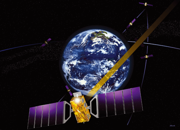
Thales Alenia Space is a joint company between Thales (67%) and Leonardo (33%).
EGNOS enhances the accuracy, reliability and integrity of positioning signals by improving the performance of GNSS. For instance, the EGNOS safety-of-life service is used in aviation for landings, enabling precision approaches at European airports without requiring ground guidance systems. The service has significantly improved operational safety and efficiency for European aviation.
Thales Alenia Space will build on its expertise in engineering, development, testing and maintenance of the existing EGNOS, along with its current development of EGNOS V2, to provide maintenance of the EGNOS V2 system for EUSPA and the European Union satellite navigation community from 2023 to 2026.
Thales Alenia Space will provide operational support and servicing in case of incidents — especially hardware and software troubleshooting and repairs — to deliver optimal 24/7 support for EGNOS. In addition, it will provide the upgraded or modified versions needed to ensure safety-of-life service.
EHang deployed its EH216 eVTOL for flight trials in Europe including the recent Air Mobility Urban-Large Experimental Demonstration. (Photo: EHang)
EHang will deploy its EH216 autonomous aerial vehicle in a European Union-funded project that is assessing how the European Geostationary Navigation Overlay Service (EGNOS) could be used for electric vertical-takeoff-and-landing (eVTOL) aircraft operations.
The fully autonomous, all-electric vehicle will be used for flight trials at Lleida-Alguaire Airport in Spain as part of the Satellite Based Augmentation System Adoption in Multicopter VTOL Aircraft (SAMVA) program.
As part of an initiative of the European Union Agency for the Space Programme (EUSPA), the SAMVA project is tasked with establishing how EGNOS could support planned air mobility services, including eVTOL air taxi flights. It is also intended to prepare for uncrewed vehicles to use the new U-Space concept for managing autonomous or remotely piloted aircraft.
Aeroports de Catalunya will help China-based EHang to establish an operational center at its Lleida-Alguaire facility in the Catalonian region of northeast Spain. The EH216 will use the EGNOS technology to conduct unmanned traffic management (UTM) tasks and to demonstrate how eVTOL aircraft could operate in urban environments, including to and from airports.
EHang is working to achieve Chinese certification for the two-seat EH216, which it intends to deploy with partners and customers for services such as air taxi and sightseeing flights. It also aims to get approval for its aircraft to operate in Europe and has been active in other air mobility partnerships in Europe, where it has provisional customers in places like Norway.
In October, EHang completed its participation in the European Union’s Air Mobility Urban-Large Experimental Demonstration (AMU-LED) with a series of flight tests in Spain. The company — one of 16 consortium members in the AMU-LED program — demonstrated the EH216 at the Rozas Airborne Research Center, which is part of Spain’s National Institute of Aerospace Technology.
“The SAMVA project will unleash EGNOS capabilities aboard EHang’s EH216 AAV to provide precise and integral navigation guidance and support U-Space airspace integration,” said Victoria Jing Xiang, the company’s chief operating officer for Europe and Latin America. “Our participation in this project reflects the meaningful progress we’ve made overseas with our strong technologies as our global footprint expands.”
Galileo Second Generation Batch#1B satellites. (Image: ESA).
Technology multinational GMV has been awarded the NAVGUARD project by the European Commission.
NAVGUARD (Advanced Galileo PRS Resilience for EU Defence) will develop ground and space systems to detect illegal activities on GNSS frequencies and geolocate their sources. It also will build an information-management subsystem together with a user interface to provide a situational awareness picture.
The Galileo Public Regulated Service (PRS) is an encrypted navigation service for governmental authorized users and sensitive applications that require high continuity.
According to the EU Agency for the Space Programme (EUSPA), the PRS signal will ensure better continuity of service to authorized users when access to other navigation services may be degraded (resilience). In cases of malicious interference, PRS increases the likelihood of the continuous availability of the signal-in-space (robustness).
NAVGUARD is among various European Defence Fund (EDF) projects designed to sharpen the competitiveness of the European Union defense industry and strengthen the EU’s strategic autonomy. Besides navigation, the projects contracted to GMV will focus on developing missile defense system capabilities, systems for dismounted soldiers, avionics, command and control and cyber defense.
Collaboration supports emergency services across the European Union
Galileo-supported E112 will result in faster response times and more lives saved. (Image: EUSPA)
Keysight Technologies Inc. is collaborating with DEKRA to ensure that chipset and device vendors can validate E112 caller location (universal European emergency number) functionality in compliance to a new European Union (EU) regulation.
The collaboration leverages GNSS and c (LBS) to verify E112 regulatory test cases used to validate mobile phones sold into the European market. The new regulation supports emergency services across the European Union by reducing response times from rescue services to save more lives.
“Keysight is pleased to expand the company’s collaboration with DEKRA,” said Muthu Kumaran, general manager of Keysight’s Device Validation Solutions business. “With Keysight’s test solutions, DEKRA supports a global ecosystem of smartphone vendors by validating that their products are in compliance to the new regulation, newly created to improve emergency services’ ability to locate individuals in need of assistance from the fire brigade, medical teams or the police.”
Keysight’s network emulation solutions enable DEKRA to validate E112-related test cases regulated by an EU-issued guideline document to assist notified bodies in the assessment of E112 compliance. The new EU regulation (Delegated Regulation (EU) 2019/320) went into effect on March 17, 2022. It mandates that all new mobile phones sold in the EU need to support GNSS technology based on the Galileo constellation, advanced mobile location (AML) protocol and Wi-Fi communications technology. As a result, emergency response call centers can accurately pinpoint the caller’s location.
“DEKRA is founded on the principles of safeguarding human interaction with technology and environment,” said Juan Carlos Mora, vice president, Business Line Connectivity of Service Division, Product Testing at DEKRA. “This is why we are pleased to extend our collaboration with Keysight, which offers DEKRA the regulatory device test solutions needed to quickly and confidently validate E112 caller location functionality per the EU’s latest mandatory requirements.”
Keysight’s device test solutions for regulatory and conformance validation are based on common hardware and software platforms for comprehensive test-case coverage. Keysight’s LBS solutions also support assisted GNSS (A-GNSS) test functionality. This enables users to comprehensively address 5G new radio (NR) conformance requirements mandated by the Global Certification Forum (GCF) and PTCRB, an organization comprised of North American mobile operators.
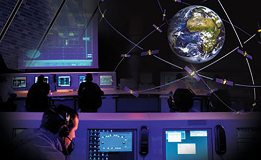
EUSPA’s mission is to link space to user needs. Over the past year, EUSPA has increased access to EU space data and services around the world, launched new Galileo satellites, and put in place additional satellite navigation services.
EUSPA operates Europe’s satellite navigation systems Galileo and EGNOS. It is also the gatekeeper to a secure EU Space Programme, providing end users with the confidence of knowing that the space-derived data they depend on is safe and secure.
The agency plays a central role in the market uptake of the data and services offered by the EU Space Programme components. EUSPA also manages the development of GOVSATCOM hubs, which will provide secure, cost-efficient communication capabilities to security and safety-critical governmental missions, operations and infrastructure.
the entry into service of a new Galileo satellite for additional accuracy to end-users
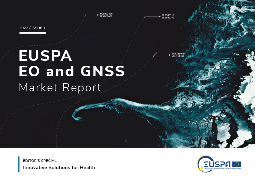
publishing the EO and GNSS Market Report, a comprehensive market intelligence study providing trends for the entrepreneurs and investors.
3.1 billion Galileo-enabled smartphones sold globally since 2016.
“I am more than proud of what EUSPA has achieved in a year. I am also proud to be at the helm of an organization staffed with dedicated professionals, with a service-oriented mindset who work to make EU Space accessible to citizens,’’ said Rodrigo da Costa, EUSPA executive director. “EUSPA remains committed to helping the union and its citizens maximize the socio-economic benefits of space.”
UAV Navigation has confirmed the safety and reliability of its Vector-600 autopilot for civil applications with an independent study. The study was performed as part of the European Union VaNeT project, and conducted by third-party company Anzen Engineering.
An autopilot system in an unmanned aerial vehicle (UAV) is the heart of the flight control system. For the Vector-600, the study included a reliability prediction report (RPR), failure mode effects and criticality analysis (FMECA) and fault tree analysis (FTA).
Reliability Prediction Report. The RPR analyzes probability of failure of every single sensor and component inside a system. It helps define component failure rates and, consequently, a prediction of the time that the VECTOR-600 is expected to operate free of failures under given operating conditions. According to this, the VECTOR-600 has shown a mean time between failures of more than 19,500 hours.
Failure Mode Effects and Criticality Analysis. A FMECA study identifies potential failures of system functions and assesses their effects, so that mitigation actions can be defined. It is a bottom-up analysis considering each single elementary failure mode and assessing its effects.
Fault Tree Analysis. Fault trees are a classic deductive analysis technique useful for both qualitative and quantitative analysis. For the Vector-600, a quantitative FTA provided probability estimates for major hazards, as well as identifying single-point failure modes and guiding further design for hazard reduction. According to the results, Vector-600 showed a probability of loss of mission per flight hour of 1,809E-05 under its operating conditions.
“The FMECA, RPR, and FTA analysis performed by the external and independent company Anzen have proven that our most advanced autopilot, Vector-600, is one of the most reliable GNC [guidance, navigation and control] systems for NATO Class I and II unmanned aircrafts available in the market and enables our clients to execute missions ensuring safety,” UAV Navigation stated in a press release.
The EU regulation framework defines three classes of operations: open, specific and certified. In specific and certified category operations, including most professional UAS flights, operators and aircraft manufacturers need to prove safe operation of their platforms. For this reason, the study of the reliability of the systems involved in the UAV becomes a must to demonstrate the system can operate free of failures under specific operational conditions.
Galileo-supported E112 will result in faster response times and more lives saved. (Image: EUSPA)
As of March 17, all smartphones sold in the European Union must be leveraging Galileo signals in addition to other GNSS for calls to the European 112 (E112) emergency number.
Using Galileo enhances pinpointing locations of 112 calls in Europe, resulting in faster response times and more lives saved, according to the EU Agency for the Space Programme (EUSPA).
The 112 emergency number is operational in nearly all EU Member States, as well as other countries. People in danger can call it 24/7 to reach the fire brigade, medical assistance and the police.
Most calls to the 112 emergency number are placed from mobile phones. These calls already support the sending of location information to emergency services. However, this information was not based on GNSS capabilities until recently.
Three years ago, the Commission Delegated Regulation anticipated measures to take advantage of GNSS and Wi-Fi location capabilities in smartphones placed on the European Union market, starting March 17.
GNSS versus cell-ID
Until now, the 112 caller’s location information was established through identification technology based on the coverage area of a cellular network tower (cell-ID). The average accuracy of this information varies from two to 10 kilometers, which can lead to significant search errors following emergency calls.
By contrast, GNSS location information pinpoints the call within a few meters. This level of accuracy will have a major impact in terms of response times, ultimately allowing for quicker intervention in emergency situations.
Galileo 112 rollout
The ability for 112 to communicate a caller’s location to emergency services automatically is already being rolled out. The protocol — Advanced Mobile Location (AML) — is being deployed across the European Union. When a caller dials 112 from their smartphone, AML uses the phone’s integrated functionalities and data from Galileo to accurately pinpoint the caller’s location and transmit it to a dedicated endpoint, usually a Public Safety Answering Point (PSAP), which makes the caller location available to emergency responders in real time.
According to the European Emergency Number Association (EENA), at least 18 EU Member States have already completed AML deployment, while others are in the process of doing so. This implementation is because of EU initiatives and projects such as the Help 112 project, which was set up to evaluate the merits of handset-based technologies in improving the location of emergency callers.
The 216-page report is designed to help anyone who seeks to make EU space technologies part of their business plan, develop new space downstream applications, and see a tangible return on investment.
More than ever society relies on innovative solutions to deal with the big data paradigm, respond to and mitigate climate change, natural and man-made disasters, curb the spread of diseases and strengthen a global supply chain that underpins our daily lives.
Download report here.
Earth observation and GNSS data is becoming increasingly important to innovative solutions for climate change, disaster and disease response, and global supply chain management. Dozens of applications are emerging or already in use by citizens, businesses, governments, industry, international organizations, NGOs, and researchers around the world.
The report provides analytical information on the dynamic GNSS and EO markets. In 2021, GNSS and EO downstream markets generated more than €200 billion in revenues and are set to reach almost half a trillion over the next decade.
The report also offers in-depth analyses of global trends and developments through illustrated examples and use cases. Using advanced econometric models, it also offers market evolution forecasts of GNSS shipments or EO revenues spanning to 2031.
Green Investments
EUSPA is committed to helping the EU deliver on the Green Deal agenda and the fight against climate change, starting with embedding space data and services into professional activities. According to EUSPA, accelerating Europe’s engagement in space is pivotal to enabling the green transition and reaching climate neutrality by 2050.
The report emphasises how users of EO and GNSS contribute to compliance, monitoring and efficiency of green investments, benefiting companies, regulators and society as a whole. It focuses on concrete examples across the 17 identified market segments.
For instance, Galileo can provide smart power grids with robust timing and synchronization down to a nanosecond, improving their performance. In another example, EU space plays a role in green energy, as Copernicus helps optimize performance of tidal power generators by providing tidal current prediction systems.
Key Report Findings
Global GNSS- and EO-enabled revenues crossed €200 billion in 2021 and are set to reach almost €500 billion over the next decade.
The global installed base of GNSS devices in use will reach more than 10 billion units in 2031.
The market for Earth observation applications is boosted by a large pool of value-added services (85% of global revenue).
The European EO industry is dominated by SMEs and start-ups; from a supply perspective, European companies hold more than 41% of the global EO market.
The downstream space application market accompanied by the EU Space Programme will continue growing and thereby effectively contributing to European policies (such as the European Green Deal and EU’s Digital Decade), as well as global policies (such as the United Nation’s Sustainable Development Goals and the Paris Agreement) in combination with other technologies.
Hamburg-based start-up Beagle Systems has begun building a nationwide network of landing and charging stations for drones.
In Hanstedt (Lüneburger Heide) in the Lower Saxony region of Germany, the first hangar has been set up with an unmanned aerial system (UAS). From there, every surrounding place in Lower Saxony can be reached in a short time.
The drone will be deployed from the Beagle Systems headquarters in Hamburg. Beagle Systems has the corresponding permits for flights beyond visual line of sight (BVLOS).
“The start in Hanstedt is an important step for us,” said Oliver Lichtenstein, one of the three founders of Beagle Systems. “From here we can reach an area of 780,000 hectares in Lower Saxony. As the first provider of drone flights, we are thus on call within a short time at the customer’s site.”
The drone flight can be controlled entirely from Hamburg; on-site personnel deployment is not necessary. This eliminates personnel costs as well as time spent traveling to and from the site. Because of this, Beagle Systems can carry out drone flights at a much lower cost than other providers.
“Our goal is to build a nationwide network of charging stations within the next few years,” said Mitja Wittersheim, COO of Beagle Systems. “An EU-wide expansion is then the next step.” The expansion of the network would allow drone specialists to access a ready-to-go drone from Hamburg for customers at any location within the European Union.
Beagle Systems is a drone-as-a-service provider specializing in long-range flights with unmanned aerial systems. The drones are already in use for the inspection and monitoring of large infrastructure facilities such as power grids.
The company also plans to tap into the multi-billion dollar market of delivery, courier and express services. The Beagle M drone used in Hanstedt was developed in-house. It has a wingspan of 2.50 meters and can transport a load of up to three kilograms.
A new space agency launched in Europe today, taking the place of the European GNSS Agency (GSA) and adding responsibilities to encourage Europe’s space enterprises.
The European Union Agency for the Space Program (EUSPA) marks the start of a new era for European Union space, according to an agency statement. EUSPA will build on the legacy of the GSA, which was established to promote use of Galileo and EGNOS, with additional responsibilities to create even more opportunities from space for European Union citizens and its economy.
An April 27 space regulation established EUSPA. Under the new space regulation, EUSPA’s mandate includes promoting Galileo and EGNOS, but with increased responsibilities, including their service provision and operational security. The agency also will coordinate the user-related aspects of government satellite communication in close collaboration with Member States and other entities.
Including Copernicus
Rodrigo da Costa, executive director, EUSPA (Photo: EUSPA)
EUSPA is also responsible for the development of downstream markets and fostering of innovation based on Galileo, EGNOS, and now also commercial uses of Copernicus (Europe’s Earth observation satellite program), leveraging funding mechanisms such as Fundamental Elements and Horizon Europe.
EUSPA is also responsible for security accreditation of all the components of the EU Space Program. The European Commission may also decide to entrust the agency with other tasks.
“More and more, our economies, our society and our safety depend on space,” said EUSPA Executive Director Rodrigo da Costa, former director of GSA. “Europe has incredible opportunities ahead that cannot be missed. By creating EUSPA, the European Union will further increase the return on investment made by EU citizens in the EU Space Program by strengthening its contribution to the priorities of the union. We will achieve this primarily by leveraging synergies between the various program components — particularly navigation, Earth observation and secure communications — to drive innovation across a broad range of sectors.”
In particular, bringing management of downstream and combined applications based on Galileo, EGNOS and Copernicus under the umbrella of one agency will make it possible to leverage synergies, according to the agency statement. “On their own, these technologies can play a key role supporting a digital and green transformation, but leveraging their synergetic and combined use will facilitate the generation of innovative solutions that bring a higher societal impact,” the statement read.
Focus on security
“The teams of committed professionals we have in place at our sites in Europe — from the EGNOS center in Toulouse to the European GNSS Service Centre in Spain and the Galileo Reference Centre in the Netherlands — will continue to ensure the high quality, robustness and reliability of EUSPA’s service provision,” reads the statement. “This will be backed up Galileo security monitoring centers in France and in Spain, and the industrial teams managed by EUSPA in the Galileo control centers in Germany and Italy, along with facilities around the world.”
In addition, the Security Accreditation Board will continue to initiate and monitor implementation of security requirements to ensure a robust and uniform level of security for the entire EU Space Program.
“The new agency has a core role in the security accreditation of all the components of the EU Space Program,” said Bruno Vermeire, chair of EUSPA’s Security Accreditation Board.
Looking to the future
While EUSPA’s mission has expanded, its core aim remains the same – to link EU investment in space to the needs of users in the European Union and around the world.
“The agency remains committed to its traditional users and will continue to deliver the high level of GNSS services that users have come to rely on,” the agency stated. Copernicus and satellite communications will also benefit from the former GSA’s user-oriented focus and “the experience it has gained in developing markets for Galileo and EGNOS.”
Fucino, Italy, hosts a Galileo Control Centre. (Image: Telespazio/ESA)
Free-to-use maps from more than 40 European countries will be made available through a new online gateway.
Open Maps for Europe will signpost and provide easy access to pan-European open data created using official map, geospatial and land information.
The project, which is co-financed by the Connecting Europe Facility of the European Union, is coordinated by EuroGeographics, the voice of European National Mapping, Cadastral and Land Registration Authorities, in partnership with the National Geographic Institute (NGI) Belgium.
Users will be able to access the data, created by the not-for-profit membership association, through an online interface developed by thinkWhere. The specialist in open source geographic information system (GIS) technologies will deliver the enhanced gateway for discovering, viewing, licensing and downloading the open datasets after winning an open tender.
The open data will include topographic data, a digital elevation model, imagery, a cadastral index map, and a regional gazetteer. The first maps are expected to be available in summer 2021.
“As the official national sources of map, cadastral and land information, our members’ data is fundamental to the everyday lives of people across Europe,”said Angela Baker, program manager, Data Access and Integration, EuroGeographics. “We may not always realise it, but their authoritative information underpins our public services, provides certainty of property ownership and helps to save precious time and potentially save lives when responding to emergencies. In an ever-connected world, it is also increasingly used in a wide range of applications relied upon by both citizens and businesses.”
“The Open Data Directive recognises that the value of data lies in its use and re-use. By providing easy access to free to use harmonised maps for Europe, our members want to boost the development of these innovative services. Their aim is to encourage greater use of their official geospatial data to drive market development and economic growth, and increase competitiveness by reducing costs.
“By working to ensure their data is interoperable, readily available and easily accessible, they are demonstrating a commitment to delivering Open Maps for Europe both now and in the future.”
Alan Moore, Chief Executive, thinkWhere added: “We are delighted to be working with EuroGeographics and its members on the Open Maps for Europe project where the primary aim is to drive up the use of official geospatial and open data.”
“Our mission is to make geographic data highly accessible, easy to use and an essential part of your information architecture. Collaborating with EuroGeographics and its members we will harness the power of our cloud-based geospatial data infrastructure and drive the development of a user-centric portal that makes it easy to find, view, publish and share the rich suite of pan European digital mapping, cadastral and topographic datasets.”
Open Maps for Europe runs until Dec. 31, 2022.
EuroGeographics is an international not-for-profit organization and the membership association for the European National Mapping, Cadastral and Land Registry Authorities. It brings together members from 46 countries, covering the whole of geographical Europe.
“In some specific cases, e.g., for critical infrastructures and applications requiring both continuous availability and fail-safe operations, GNSS cannot be the sole means of positioning and timing information.” European Radionavigation Plan, 2018
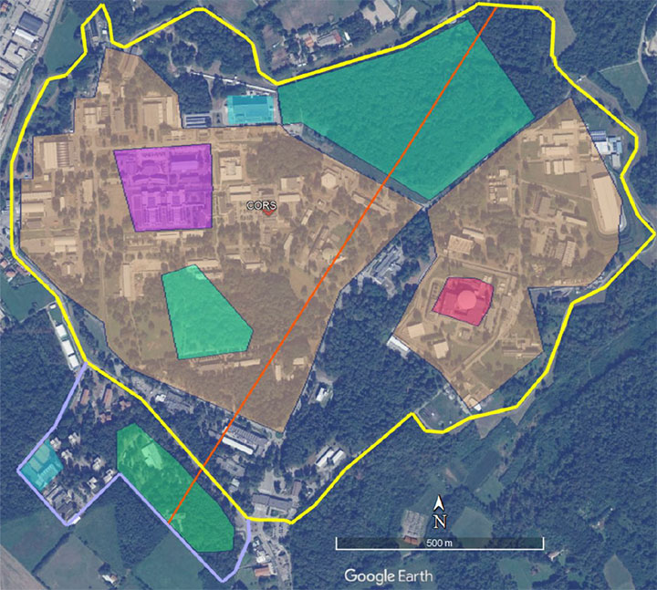
The Joint Research Center in Ispra, Italy, is the preferred demonstration site. (Photo: European Commission)
The European Commission is undertaking a GNSS backup technology demonstration, much like the one completed by the U.S. Department of Transportation earlier this year. Companies from many countries outside the European Union, including the United States, are eligible to participate. Responses are due by Jan. 13, 2021.
A tender issued on Oct. 26 says that the goal is for the commission to better understand available non-GNSS PNT technologies. Also, they are interested in services that can provide positioning and navigation, and/or time.
Completely Independent from GNSS
Since the intent is to provide a backup for GNSS during an outage, all offered technologies must be completely independent. Specifically, they must have “no common points of failure with GNSS.”
Some industry observers have opined that this eliminates any space-based capabilities from consideration. Coronal mass ejections from the sun have long been considered a threat to satellites. Others have wondered if networked-based solutions could be also excluded because of frequent use of GNSS for synchronization, billing and other applications.
Another requirement is that offered technologies be capable of covering the entire EU territory, including inland waters. While this might seem to rule out fiber-based timing systems, advocates say that is not necessarily the case. They contend a fiber network supporting dispersed transmitters would serve both fixed and mobile applications, and reach users for whom connecting to a fiber node is not feasible.
Other requirements listed in the tender for offered technologies include:
Resilience to GNSS jamming, spoofing, and unintentional interference
Technical readiness levels of 5 or more for positioning and navigation, 6 or more for timing
Able to perform for at least a day during a loss of GNSS
Positioning accuracy < 100 m horizontal, or timing accuracy < 1 microsecond relative to UTC
If timing is included, it must be traceable to UTC
The Demonstration
A webinar for potential offerors was held on Nov. 4. Although it was not recorded, the slides shown are available at the RNT Foundation website. One update to the slides is a new email replacing the one of the first slide. All inquiries should be sent to the project leader at [email protected].
Up to seven companies, presumably each demonstrating different technologies, will be accepted into the program.
The preferred demonstration site is the European Commission’s Joint Research Center in Ispra, Italy. Recognizing that transporting equipment and traveling to Italy might be a challenge for many companies, the tender states’ commission personnel are willing to travel to other locations to see systems demonstrated.
The JRC Ispra campus covers 170 hectares with 100 buildings and 36 km of roads. It provides state-of-the-art laboratories, smart city infrastructure (grids, homes, mobility), and varied topography with urban, semi-urban, rural and woodland areas. (Image: EC)
Information on All Technologies Sought
Unlike the European Space Agency’s Navigation Innovation and Support Programme (NAVISP), companies from outside of the EU are invited to respond to the tender and could be selected. This reflects the commission’s desire to include as many technologies and collect as much information as possible.
Limited funding for the demonstration, pandemic travel restrictions, the need for infrastructure to support wide-area signals, and other obstacles may prevent some companies from participating in this effort. The commission’s overall goal, though, is to get information about as many technology options as possible.
So, while not stated in the tender, the commission is eager to hear from technology companies, even if they do not want to be considered as a part of demonstration project. All are invited to contact project leader Ignacio Alcantrailla-Medina. All information is welcome, though most important are a technology’s performance, technical readiness level (TRL), and if it can be deployed in the European Union.
We understand that, as is the case in the United States, solutions delivering timing are of particular interest.
Combining the data from the demonstration project with other information gathered, the commission hopes to be able to identify a way forward with alternative PNT in Europe by the end of 2021.