Tag: fleet management

  • iTRAK WebApp Enables Fleet Management on Smartphones, Tablets

    The iTRAK web app displays vehicle fleet and landmarks.
    The iTRAK WebApp displays vehicle fleet and landmarks.

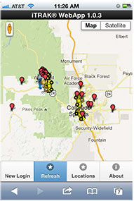
    iTRAK Corporation, provider of GPS-based tracking, mapping, and reporting solutions, has announced the commercial release of its iTRAK WebApp application. The WebApp provides much of the functionality of the iTRAK Fleet Executive software suite in a mobile environment.

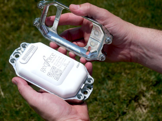
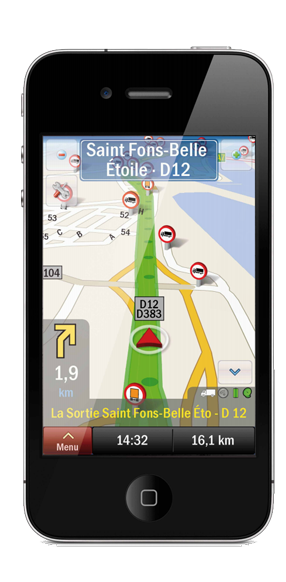
    The new application allows iTRAK customers to view all their tracked devices on a wide variety of smartphones and tablets, such as iPhone and Android phones and iPAD tablets. The assets displayed can be tracked using dedicated, in-vehicle GPS devices or GPS-enabled cell phones. Managers and supervisors who regularly work out of the office can still view the location of the vehicles for which they are responsible, as well as historical location and stop data and user-defined landmarks. The mapping system is integrated with Google global street and satellite maps.

    iTRAK has been offering mobile fleet management solutions since 2007, when iTRAK FleetFinder, a system to display mobile assets on a Blackberry, was released. The iTRAK WebApp is a response to the convergence of multiple applications on mobile devices, and to customer requests for a mobile fleet management system that will support multiple platforms and operating systems.

    The iTRAK WebApp will run on devices that use Apple OS 5.1, 6.0, and 6.1, Android OS 4.0, 4.1, 4.2, and Blackberry 10. Future releases will add geofencing, stored, user-defined map views, and route display. Nine languages are supported: Arabic, Dutch, English, French, German, Italian, Polish, Portuguese and Spanish. There is also an API to the system that allows for third-party integration. Enterprise versions of the cloud services and server software are also available.

    iTRAK Corporation (formerly Data Burst Technologies) was founded in 1995 as a developer of GPS-based wireless tracking and AVL systems. The company’s principal offices and network operations center are located in Woodland Park, Colorado.


  • GPSTrackIt Releases Fleet Productivity Tool for Tablets

    GPSTrackIt has released a fleet management tool called Driver, a website that enables drivers using tablet devices such as iPads and Androids to send and receive messages and plan routes.

    The site provides drivers with two-way communication by chat or forms with dispatchers and fleet managers. It also provides them with route management and timekeeping utilities. Driver compliments GPSTrackIt’s recent releases for smartphones and tablet apps for dispatchers and fleet managers.

    According to Eddie Bermudez, product manager, GPSTrackIt’s vehicle tracking system has been enhanced with Field Service Manager (FSM). “The FSM is the control center for all of the mobile workforce management tools available through the Driver website. Dispatchers and fleet managers use the Field Service Manager to create and send messages. The can build Quick Messages and Quick Responses that drivers can select from a list. They can also create forms with multiple questions, and multiple choice answers that streamline the communications process.”

    Dispatchers enter stops and build routes using the FSM. The routes can be rearranged as new stops are added, saving drivers time and reducing the need for them to call in. The routes are pushed out to the drivers, who can then display them on maps and list out the directions. They can also use a third-party navigation app to render true turn-by-turn directions.

    Soon Driver will provide route optimization. “Driver will look at all the stops and do the arranging for you,” said Bermudez. “It will evaluate the relative distances and calculate the most efficient route.”

    In addition, the FSM also provides a mobile time clock. “This enables drivers to clock in and out using the tablet,” Bermudez said. “That data, as with the chats, stops, and forms, can be reported on using Fleet Manager’s reports. It provides fleet managers with a verification tool for employee timekeeping.”

    One of the other advantages to using a tablet device is that it offers users a wide variety of useful mobile apps.

    “Tablet devices provide our customers with a platform that not only connects them to the Fleet Manager system, but many other productivity tools,” adds John Stull, President and founder of GPSTrackIt. “Drivers can make use of other apps and peripherals to do credit card transactions, scan and transmit contracts, and perform many other important tasks.”

  • GT-1 Tracks Equipment in Remote Locations, Extreme Conditions

    GT-1 Asset Tracker, the world’s most reliable asset tracker combining GPS, RFID, Bluetooth and Satellite technologies into one compact design. Photo: Geoforce
    GT-1 asset tracker combines GPS, RFID, and Bluetooth technologies. Photo: Geoforce

    Geoforce, Inc. is announcing commercial availability of its GT-1 asset tracking device that can track field equipment in locations and conditions previously too challenging for other devices to function effectively. A globally certified GPS device, the GT-1 enables oil and gas service providers to proactively monitor and share data on vehicles and equipment for more cost effective operations, helping to meet ongoing environmental responsibilities, the company said.

    “We have been waiting a long time for a device like this,” said Michael Rolston, operations manager at Permian Equipment Rentals.  “It’s small, it’s incredibly rugged, it will last years without replacement. It’s also surprisingly low cost — given all its features and capabilities.”

    The GT-1 was previously offered in limited release to several major international service and rental companies beginning in the fourth quarter of 2012. To date, thousands have shipped and are actively tracking oilfield assets around the globe.

  • Danaher Acquires Fleet Tracking Company Navman Wireless

    Navman Wireless, a provider of fleet and asset management technology, announced its acquisition by Danaher Corporation, a Fortune 250 science and technology company. Navman Wireless’ technology currently monitors more than 175,000 vehicles and assets owned by over 14,000 organizations worldwide.

    The OnlineAVL2 system, delivered under the Software-as-a-Service (SaaS) model, enables fleet and asset managers to track all vehicle and asset locations in real time as well as control fuel, labor and vehicle/asset operating costs.

    Navman Wireless reports it has had five successive years of revenue and installed base growth during which the company entered new vertical sectors including local services, transportation, construction, cold chain, mining, and oil and gas, and opened new geographic markets including Mexico, Italy, China and Taiwan.

    “Danaher has the resources, global footprint and commitment to support the continued growth of the Navman Wireless platform and business, along with a strong track record of building brands within its highly diversified portfolio,” said TJ Chung of Navman Wireless. “All of these factors will help us continue to enhance our technology platform, expand into new vertical and geographic markets, and bring the benefits of fleet and asset management to vehicles and assets around the world that are not yet taking advantage of the technology.”

    Navman Wireless is Danaher’s first acquisition in the fleet/asset management space, joining Danaher’s portfolio spanning test and measurement, life sciences and diagnostics, dental, environmental and industrial technologies. Financial details of the transaction were not disclosed.

  • GPS Insight Adds Hours of Service to Tracking Platform

    GPS Insight, a GPS fleet tracking solution provider, announced its new GPS Insight Hours of Service Solution as an addition to its award-winning GPS Tracking software intended for fleets that need both electronic driver logs and GPS tracking combined.

    The EOBR-1000 device combines GPS tracking with an Electronic Onboard Recorder and Electronic Driver Logs. The application also integrates electronic Driver Vehicle Inspection Reports (DVIR) in a workflow environment ensuring compliance with inspections and omitting cumbersome paper forms. The HOS Solution is used to significantly reduce HOS violations, eliminate driver paperwork, and reduce log auditing time, the company said.

    GPS Insight is hosting a webinar to introduce the GPS Insight Hours of Service Solution on January 17 at 10 a.m. PST. The webinar will include an update on FMCSA rules, how an HOS solution will benefit fleets that need to be compliant, and a demonstration of the GPS Insight Hours of Service Solution. Register Here.

  • Trimble Acquires Transportation Company ALK Technologies

    iphone-RenaultApp .Credit: ALK Technologies
    ALK Technologies CoPilot Live software enables OEMs to bring own-brand turn-by-turn navigation apps to market.

    Trimble has announced that it has acquired privately-held ALK Technologies Inc. of Princeton, New Jersey. ALK Technologies specializes in routing, mapping, mileage and navigation technologies. ALK Technologies offers proprietary routing and international map-based solutions for transportation, logistics and mobile workforces.

    The addition of ALK is expected to extend and complement Trimble’s Transportation and Logistics product portfolio, including TMW Systems’ transportation management solutions, PeopleNet’s integrated onboard computing and mobile communications systems, and GEOTrac’s fleet management and worker safety solutions for the oil and gas industry. Financial terms were not disclosed.

    ALK software products include CoPilot Live, which offers onboard GPS navigation for professional drivers, and PC*MILER, a truck-specific mileage solution recognized as an industry standard for logistics, manufacturing, government and transportation operations. ALK offers a consistent data platform for operational planning activities, such as mileage and routing and in-cab navigation applications used by fleet drivers. ALK products are sold worldwide and feature extensive international map data. Approximately 64 percent of North American for-hire motor carriers use ALK solutions, including 98 of the top 100 largest for-hire carriers, 47 of the top 50 logistics companies and 77 of the top 100 private fleets.

    “The addition of ALK Technologies expands the portfolio and scope of innovative solutions we can offer transportation providers, logistics companies and shippers,” said David Wangler, president of TMW Systems, a Trimble Company. “The combination of ALK’s routing, mapping, mileage and navigation capabilities with our enterprise transportation management software and the mobile communications solutions under the Trimble Transportation and Logistics umbrella supports our comprehensive and industry-focused technology approach.”

    “This is a significant milestone in ALK’s long history in transportation,” said Barry Glick, president of ALK Technologies, who will continue to lead the organization. “We are excited to join our well-known and respected partner TMW Systems under the global umbrella of Trimble. These organizations share our passion and vision for how location information can transform business and productivity.”

    ALK Technologies business will be reported as part of Trimble’s Mobile Solutions segment.

  • Navman Wireless Debuts Professional Services for Fleet Tracking

    Navman Wireless today announced the availability of two professional services packages designed to expedite, optimize and provide problem resolution for 100+-vehicle implementations of its OnlineAVL2 fleet management platform. Going beyond basic customer support, the new services can reduce rollout and configuration time by up to 80 percent, produce a 50 percent faster return on investment, and help corporate and construction fleet managers derive maximum value from the system by doubling the number of features used.

    “Most fleet tracking vendors say they provide support services, but usually those services are limited to basic phone assistance and coordination of system installation with a third-party vendor. Through our work with customers who track hundreds of on- and/or off-road vehicles, we recognized that large installations need substantially more assistance for timely deployment as well as to take full advantage of system capabilities to reduce costs and streamline operations,” said Nels Erickson, field services manager at Navman Wireless. “We launched our professional services packages specifically to meet these needs.”

    Both the Standard and Turnkey professional services bundles entitle customers to a dedicated project and account team, including a field services engineer serving as a single point of contact and project manager, plus the use of a dedicated phone line staffed with support specialists assigned exclusively to handle larger accounts.

    The Standard package includes installation support, basic OnlineAVL2 configuration, a training website and weekly group training webinars, priority issue escalation, and a yearly account review to evaluate the customer’s use of the system and identify opportunities to realize greater benefits from the deployment.

    The Turnkey package includes all Standard features plus 80 hours of project management time for on-site project planning and user training as well as weekly update calls and advanced OnlineAVL2 configuration for features such as geofences, maintenance module setup, report scheduling, and email and text alerts. This premium package also includes ongoing best practice guidance, regular on-site business reviews, API-based integration into backend systems, and guaranteed 45-day implementation with appropriate advanced notice and asset availability.

    Optional add-on services include custom training and documentation, installation and training at additional depots or terminals, and advanced project management for complex implementations.

  • GPS Tracking Devices Approved for Use on Cargo Airlines

    GTX Corp, which makes customizable, patented two-way GPS solutions, has announced the approval of a custom designed GPS tracking device for use on the cargo airlines AirNet and Cargolux. The custom configured device will be made available as an add-on service to customers of MNX, a provider of expedited transportation and logistics services, to provide a new level of visibility and control for high value and mission critical shipments.

    “We have been working diligently with AirNet and Cargolux to gain the necessary approvals to bring this one-of-a-kind offering to market. We are very pleased to see this day finally come to fruition,” said Patrick Bertagna, GTX Corp cChairman and CEO. “Over the next few weeks we will work closely with the MNX team to formulate a domestic and international deployment strategy to introduce this offering to MNX customers around the world.”

    Designed for customers that ship high value, time or temperature sensitive materials, the technology is well-suited for customers in the life sciences industry. The GPS solution will bring extra security to sensitive shipments, including the transportation of items such as organs, blood, tissue, medications, clinical trial samples and medical devices.

    “The GTX Corp tracking platform gives us the ability to better identify and resolve any unforeseen challenges throughout the entire transport and gives our customers added confidence and peace of mind that their shipment is secure at every step,” said Scott Cannon, MNX CEO. “By providing our clients with real-time tracking of their shipments, MNX will offer an unmatched layer of service, security, temperature integrity and reliability.”

    The GPS device transmits the latitude and longitude, speed, bearing, altitude and temperature of the plane or vehicle carrying the shipment. The device and GTX platform also provide an easy-to-use customer interface with live shipment tracking and geo-fencing capabilities, allowing customers to know exactly when their mission critical shipments depart and arrive in key destinations. The GTX device is small and light weight (comparable to the size of a standard garage door opener), making it easy to insert in even the smallest packages.

    “We realize the capability to track valuable shipments with such detail is especially important to the life sciences industry, especially as this industry continues to expand so rapidly,” said Bertagna.

    AirNet, a leading domestic specialty cargo airline specializing in life sciences transportation, and Cargolux, one of the leading scheduled all-cargo airlines, were among the first airlines to conduct a thorough testing process to certify the GTX device, while MNX and GTX continue collaborating to expand the use of the offering to other partner airlines.

  • Public Transport ITS Market in Europe Expected to Reach €1.5B by 2016

    According to a new research report from the analyst firm Berg Insight, the market value for Intelligent Transport Systems (ITS) deployed in public transport operations in Europe was €0.76 billion in 2011. Growing at a compound annual growth rate of 15 percent, this number is expected to reach €1.5 billion by 2016. Berg Insight is of the opinion that the European market for ITS for public transport is in a growth phase which will last for several years to come.

    In a statement, Berg Insight said the fluctuating economic climate has in most countries had little effect on the market as the public investments which underpin a major part of the ITS initiatives have remained stable throughout the periods of crisis. The vendor landscape for public transport ITS consists of a variety of actors. The companies INIT, Trapeze Group and IVU have emerged as leaders in Europe, having broad product portfolios and large numbers of installed systems in many countries. There are also local players with considerable market shares on regional markets in Europe, including Ineo Systrans and Vix. Another group of vendors are focused on specific parts of complete ITS such as specialized hardware units or software applications.

    ”The public transport ITS market in Europe is favored by several concurrent developments, including UITP’s sought-after doubling of the public transport ridership, the EBSF EU project, and generally higher expectations among travelers,” said Rickard Andersson, telecom analyst, Berg Insight. “Increasingly sophisticated solutions for traffic management and passenger information are available which – if implemented correctly – eventually can put public transport on par with private transportation modes in terms of traveling times and flexibility.” Andersson adds that a noteworthy development is the increasing integration of smartphone-based solutions in public transport ITS, used for various traveler-centric applications as well as business performance overviews for operators, and most recently also as affordable tracking solutions enabling real-time passenger information (RTPI). “Travelers increasingly expect real-time information also from smaller operators with low propensity to invest in ITS,” concluded Andersson.

  • Rand McNally Device Turns GPS Devices into Compliant EOBR Systems

    Rand McNally unveiled its HD 100 device — which provides electronic Hours of Service (HOS) recording, text- and dispatch-integrated messaging plus driver performance monitoring capabilities — at the American Trucking Association Management Conference and Exhibition.

    The HD 100 will be commercially available in April 2013 for use with Android tablets and the Rand McNally IntelliRoute TND 720 truck GPS device. Later in the year, the HD 100 will integrate with other platforms including Android smart phones and iOS tablets and smart phones.

    Designed to work seamlessly with a variety of mobile devices, the HD 100’s Hours of Service recorder qualifies as a compliant electronic driver log. The HD 100 plugs into a truck’s on-board diagnostics port and records the truck’s GPS position along with critical vehicle-specific information such as engine diagnostics and driving behavior. The device — 3 ½ inches by 5 inches — can be installed in less than 10 minutes.

    Drivers interact with the HD 100’s HOS and messaging functions through an application that they download and run on their mobile device or Rand McNally’s IntelliRoute TND 720.

    “With the HD 100, Rand McNally now provides a wide range of options for compliance, communication, and electronic Hours of Service. Our product line offers large fleets and smaller operators unparalleled flexibility with features and pricing options,” said Dave Muscatel, CEO of Rand McNally. “Our goal is to be hardware agnostic in order to provide a cost-effective EOBR (electronic on-board recording) solution for owner operators who already own a smart phone, tablet, or one of our GPS devices and the HD 100 accomplishes this objective. The HD 100 will help fleets and drivers alike with meeting the upcoming EOBR implementation mandated by MAP 21.”

    Just as with the company’s premier enterprise solution, TPC 7600, and the robust cost-effective single-box device, the TND 760, the HD 100 allows data integration with more than 20 third-party dispatch and fuel tax applications via Rand McNally Connect software.

  • LiveViewGPS Vehicle Tracker Supports Verizon CDMA Network

    LiveViewGPS, a GPS tracking company for business, government and individuals, is now shipping its VLS 300VZ GPS vehicle tracker that operates exclusively on Verizon’s CDMA wireless system. The hard-wired unit features a three-wire hookup and can be configured to update vehicle locations at 1-, 2- and 5-minute intervals.

    The VLS 300VZ GPS vehicle tracker is based on LiveViewGPS’ VLS platform, an Internet-based GPS tracking system for small businesses that need powerful monitoring at a lower price, the company said. It includes a fully-featured, real-time, on-demand GPS tracking system with no software and no contracts required.

    Users log on via their web browser or web-enabled mobile device. Once connected, the intuitive, user-friendly interface lets them locate multiple vehicles via a high-resolution satellite map. Users have the option of calling a special phone number instead of using a mobile device. The system automatically texts or emails alerts whenever it detects a vehicle speeding, entering restricted zones, deviating from routes and more. Automated detailed reports include starts/stops, excessive idling, mileage and speeding. State-to-state mileage reporting is also available.

    “The VLS 300VZ GPS vehicle tracker is a low-cost entry device for small fleets, company vehicles and personal vehicles in areas with poor GSM coverage,” said George Karonis, LiveViewGPS CEO, “and it’s even programmed to store and forward information whenever a vehicle loses CDMA coverage, so users never have to worry about data loss.”

  • NVS Technologies Launches Embedded Mini GNSS Receiver


    NVS Technologies AG announces today, from the ION-GNSS 2012 Conference in Nashville, the launch of the NV08C-Mini PCI-E Embedded Mini PCI Express GNSS Receiver.

    The NV08C-Mini PCI-E is a fully integrated GNSS receiver module, optimized for Mini PCI Express (Mini-PCIe) based applications. Its key feature is its full compatibility with GPS, GLONASS, Galileo, QZSS, COMPASS (GNSS), and EGNOS, WAAS, MSAS, and GAGAN (SBAS). It is specifically designed for use in a wide range of mobile computing, in-vehicle and rugged handheld computer equipment, for the security/public safety, telematics/fleet management, and precision GIS/survey, machine control, and agriculture markets. Features include:

    • Embedded mini PCI Express GNSS receiver
    • Very quick and simple integration
    • GPS, GLONASS, Galileo, QZSS, COMPASS, SBAS L1
    • Precise navigation, positioning, and timing
    • 32 GNSS tracking channels / 200K correlators — Ensuring fast TTFF and high signal sensitivity
    • NMEA 0183 / IEC 61162-1, binary (BINR) and RTCM SC-104 v2.3 data protocols
    • Raw Data output — Pseudorange, Carrier phase and Doppler
    • Individual GLONASS group delay calibration — Assuring very high accuracy
    • Receiver Autonomous Integrity Monitoring (RAIM) / Assisted GNSS (A-GNSS) interface
    • 64 KB EEPROM for firmware upgrade and data storage
    • Industrial operating temperature range ‐40 to +85°C

    The NV08C-Mini PCI-E offers high sensitivity, high-performance acquisition and tracking, NMEA and raw data outputs, plus Differential (D-GNSS) and Assisted GNSS (A-GNSS) functions. Tracking satellites from multiple GNSS constellations ensures much higher availability of navigation signals, when compared to single constellation alternatives, and provides increased performance, accuracy, and reliability, NVS Technologies said. It features two RF channels (GPS and GLONASS), three-stage SAW filtration for high noise immunity, and several protocol interfaces and a supply voltage source for an active antenna. This fully featured embedded Mini PCI-e GNSS receiver is the quickest-to-market solution for mobile computing applications, the company said.