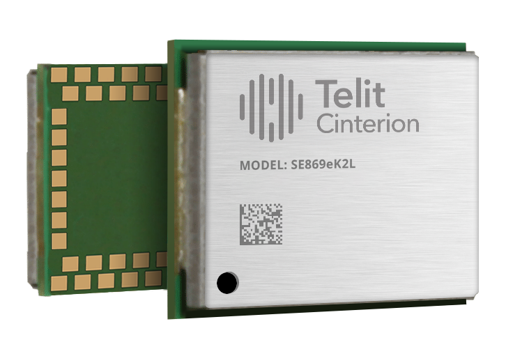
Telit Cinterion has launched the SE869eK2L, a single-frequency L1 GNSS module designed to help device manufacturers upgrade legacy positioning designs with improved performance and cost efficiency, while preserving design continuity.
Built on the Airoha AG3352 platform, the SE869eK2L supports GPS, GLONASS, Galileo, BeiDou and QZSS for reliable multiconstellation positioning. With approximately 1.5-meter accuracy and update rates of up to 10 Hz, it is well-suited for connected devices that require dependable positioning without the cost or complexity of higher-end GNSS architectures.
For OEMs managing product refresh cycles, the SE869eK2L provides a straightforward migration path from Telit Cinterion’s SL869L-V2 and legacy xL869 modules. Its 12.2 x 16 mm footprint maintains pin-to-pin compatibility with the industry-standard form factor, so OEMs can extend existing designs while gaining updated performance and supply flexibility. The footprint includes reserved pins for future use.
The module is designed for a broad range of IoT and industrial use cases, including:
Asset tracking
Fleet management
Smart infrastructure
Cell-tower synchronization
Industrial equipment
Wi-Fi 6E / 7 routers
The SE869eK2L also supports connected devices that require reliable L1 positioning.
Two hardware variants are available: a 3.3 V option and a 1.8 V option, allowing designers to align the module with their system architecture and power requirements.
Dedicated firmware variants provide Windows Location Services compatibility and enable precise timing functionality, delivering synchronization output with ±7 ns jitter.
The module also supports Wi‑Fi navigation mode, enabling compliance with Automated Frequency Coordination (AFC) requirements for Wi‑Fi 6E and Wi‑Fi 7 routers.
Device manufacturers building connected products can pair the SE869eK2L with Telit Cinterion cellular modules — including those without embedded GNSS — simplifying sourcing, integration and support through a single supplier.
Samples of the SE869eK2L are expected to be available soon, with mass production planned for the fourth quarter of 2026.
Telit Cinterion will exhibit at Hardware Pioneers Max, Stand G4, where attendees can learn more about the company’s GNSS, cellular IoT and industrial connectivity portfolio.
Sinclair Technologies has launched its SM 5G Family Tier, featuring the SM714 and SM2601 series antennas. The next-generation, multi-band, multi-port transport antennas are engineered to deliver superior connectivity, reliability and versatility for GNSS, 5G, LTE, Wi-Fi and other mission-critical wireless applications.
The SM714 antenna. (Photo: Sinclair Technologies)
The SM714 is a 4-in-1 low-profile customizable transit antenna that combines 5G/LTE, Wi-Fi and tri-band GNSS coverage in a single compact form. Supporting 617–5925 MHz, it enables seamless operation across all major 5G and LTE bands. The integrated high-gain tri-band GNSS module provides fast, accurate positioning, while the IP67-rated rugged housing ensures long-term durability. With its 2.6-inch ultra-low profile and single-hole mount, the SM714 is suitable for vehicles, fleet systems and connected mobility applications requiring a discreet, high-performance solution.
The SM2601D is a 5-in-1 low-profile customizable antenna purpose-built for transportation, fleet and rail systems. It features five independent ports: one for PTC (219–223 MHz), one for Wi-Fi (2400–6000 MHz), one for GNSS, and two full-band cellular ports (694–2700 MHz) that support diversity and MIMO operation for multi-radio systems. This dual-cell configuration offers greater throughput, flexibility, and redundancy in complex communication environments. Housed in a fire-rated, weather-resistant black radome, the SM2601 ensures exceptional reliability in harsh operating conditions.
Together, the SM 5G family ter delivers high performance and design flexibility for connected mobility, fleet tracking and smart infrastructure — extending Sinclair’s 75-year legacy of engineering excellence and innovation in RF antenna technology.
“The launch of our SM 5G Family marks a bold step in redefining the boundaries of connectivity,” said Martine Cardozo, sales director, Sinclair Technologies. “By blending creativity with cutting-edge innovation, we aim to deliver highly reliable, all-in-one solutions that meet the evolving demands of a market in constant motion.”
Key Benefits
SM714 – Compact 5G / GNSS Transit Antenna
Wideband coverage: 617–5925 MHz across all major 5G/LTE bands
Tri-band GNSS (GPS, Galileo, GLONASS, BeiDou) for fast, precise positioning
Rugged IP67 housing ensures long-term reliability in harsh environments
Ultra-low 2.6 in. profile minimizes installation footprint and risk of damage
Ideal for vehicle rooftops, fleet applications, and mobile IoT systems
SM2601 – Multi-Port Transport Antenna (Spec Sheet)
Five integrated ports: PTC, GNSS, Wi-Fi, and dual broadband 694–2700 MHz channels
Supports MIMO and multi-radio configurations for maximum system flexibility
Fire-rated, weather-resistant radome built for extreme operating conditions
High-gain GNSS with low-noise amplifier enhances accuracy and signal integrity
Optimized for rail, transit, and mission-critical fleet communications
Security company InfiniDome has partnered with one of Israel’s largest vehicle tracking and fleet management companies to simulate a real-world car theft scenario.
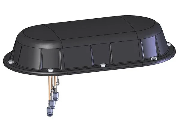
The test recreated a scenario in which criminals deploy in-car GNSS jammers to disable location reporting systems. Two identical tracking units were installed: one protected by OtoSphere-Lighthouse (80×78.5x28mm, 180g), infiniDome’s newest anti-jamming module for commercial use, and one left unprotected.
Credit: InfiniDome
As jamming began inside the vehicle, the unprotected tracker quickly lost GPS signal and failed to transmit location. In contrast, the protected unit maintained full functionality, continuously reporting real-time data throughout the test.
The trial demonstrated the reliability of infiniDome’s technology in commercial environments, the company said. The OtoSphere-LightHouse module was developed to deliver advanced anti-jamming protection for critical applications. As GPS has become essential across industries — from logistics to emergency service — so have the risks.
InfiniDome’s presence at the International Drone Show in Denmark June 18–19, comes at a time when European stakeholders are actively seeking solutions to protect UAVs, maritime, and fleet operations from GNSS disruption — a risk that’s no longer theoretical.
HERE Technologies has launched its Fleet Optimization software package, designed to enhance the efficiency and scalability of fleet management operations.
The Fleet Optimization package aims to meet the needs of the transportation and logistics industry. It offers location-based features using HERE’s artificial intelligence (AI) to tackle the complexities of routing operations for commercial fleets.
The package is a robust set of location-based application programming interfaces (APIs). The key components and features of the HERE Fleet Optimization package include:
HERE Tour Planning uses map content and complex routing scenarios that consider real-time and historical traffic, alongside vehicle and road restrictions, to provide optimal deployments of multi-vehicle commercial fleets.
HERE Routing creates optimized, safe and accurate navigation solutions customized to truck, light commercial vehicle and two-wheeler routing profiles.
HERE Geocoding and Search validates and enhances the accuracy of addresses and optimizes route planning through precise geocoordinates, ensuring fleet movements are based on the most accurate and current data available.
HERE Map Rendering offers up-to-date, detailed map data, in raster and vector formats, with rich attributes used specifically by commercial vehicles — including road restrictions, bridge heights, road topology and topography. This feature offers drivers visualization and cues for reliable commercial vehicle navigation.
A key benefit of the package is the incorporation of variables such as vehicle profiles, driver availability and delivery schedules, to provide instantly optimized tours and more precise estimated time of arrival (ETA).
The package is available for in-house software developers and integrated software vendors. The location-based APIs within the package are accessible directly in a user’s environment, with HERE offering the toolsets, workspaces and APIs for custom development.
The HERE Fleet Optimization package is built to run natively on Amazon Web Services (AWS), HERE Tour Planning and HERE Location Services, including Geocoding, Search, Maps, Navigation, Routing, Fleet Telematics and more.
A roundup of recent products in the GNSS and inertial positioning industry from the May 2023 issue of GPS World magazine.
SURVEYING
Image: Septentrio
Corrections Program Provides documentation for GNSS receivers
The Agnostic Correction Partner Program facilitates the use of Septentrio GNSS receivers with high-accuracy services that provide varying levels of accuracy, coverage and delivery methods. This enables users to select the service that suits specific applications and business models. The program — which includes Polaris from Point One, Skylark from Swift Navigation, and PointPerfect from u-blox — provides documentation for the use of Septentrio receivers with these high-accuracy services. Agnostic corrections are useful in situations where multiple types of GNSS receivers are being used, such as in a large-scale surveying project. Septentrio, septentrio.com
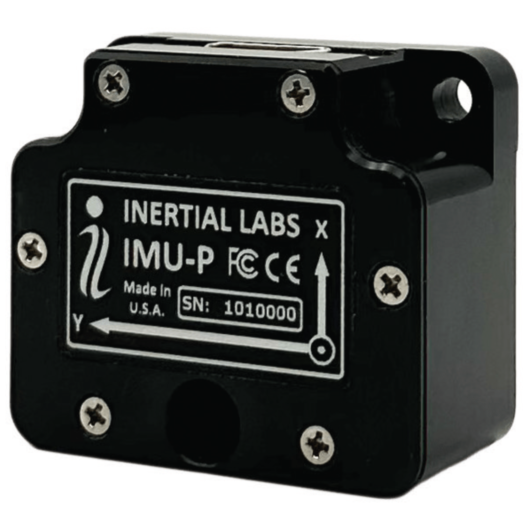
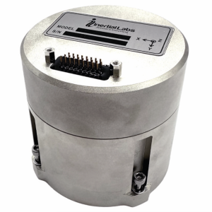
Image: Inertial Labs
Multi-Application IMU A compact, self-contained strapdown, advanced tactical-grade IMU device
The IMU-FI-200C measures linear accelerations and angular rates with its three-axis, tactical-grade, closed loop, fiber-optic gyroscopes and three-axis, high-precision MEMS accelerometers in motionless and high dynamic applications. The IMU-FI-200C is fully calibrated, temperature compensated and aligned to an orthogonal coordinate system. It contains more than 0.5°/hr gyroscopes and less than 2 mg bias repeatability over operational range accelerometers with low noise and high reliability. Continuous built-in test, configurable communications protocols, electromagnetic interference protection, and flexible input power requirements make the IMU-FI-200C suitable for a wide range of integrated system applications. Inertial Labs, inertiallabs.com
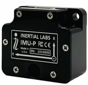
Image: Inertial Labs
MEMS IMU Suitable for applications such as antenna and line of sight stabilization systems, GPS-aided INS and more
The inertial measurement unit-P (IMU-P) is an advanced MEMS sensors-based, compact, self-contained strapdown, industrial- and tactical-grade inertial measurement system and digital tilt sensor that measures linear accelerations, angular rates and pitch-and-roll with three-axis, high-grade MEMS accelerometers and three-axis, tactical-grade MEMS gyroscopes. Angular rates and accelerations are determined with high accuracy for both motionless and dynamic applications. The IMU-P is fully calibrated, temperature compensated, and mathematically aligned to an orthogonal coordinate system. IMU-P demonstrates less than 1 deg/hr gyroscopes and 0.005 mg accelerometers bias inrun stability with low noise and high reliability. The IMU-P models collect data from an external source of GNSS to output full spectrum inertial navigation system data consisting of positions, attitude, velocity and time.
Inertial Labs, inertiallabs.com
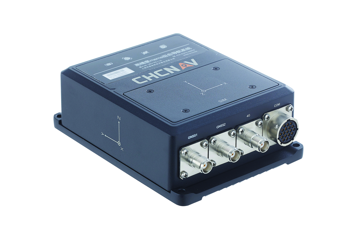
The CGI-610 GNSS/INS sensor is an advanced dual-antenna receiver designed for reliable and accurate navigation and positioning in challenging terrestrial, marine or airborne applications. Designed to meet the needs of 3D positioning and autonomous vehicle guidance applications, it provides high performance in urban canyons and other harsh environments where GNSS signals are lost or degraded. Incorporating GNSS technology and an industrial-grade inertial measurement unit, the sensor delivers accurate hybrid position, attitude and velocity data up to 100 Hz, driven by CHC Navigation algorithms. Its rugged and lightweight package ensures uninterrupted performance and meets high protection standards. CHC Navigation, chcnav.com
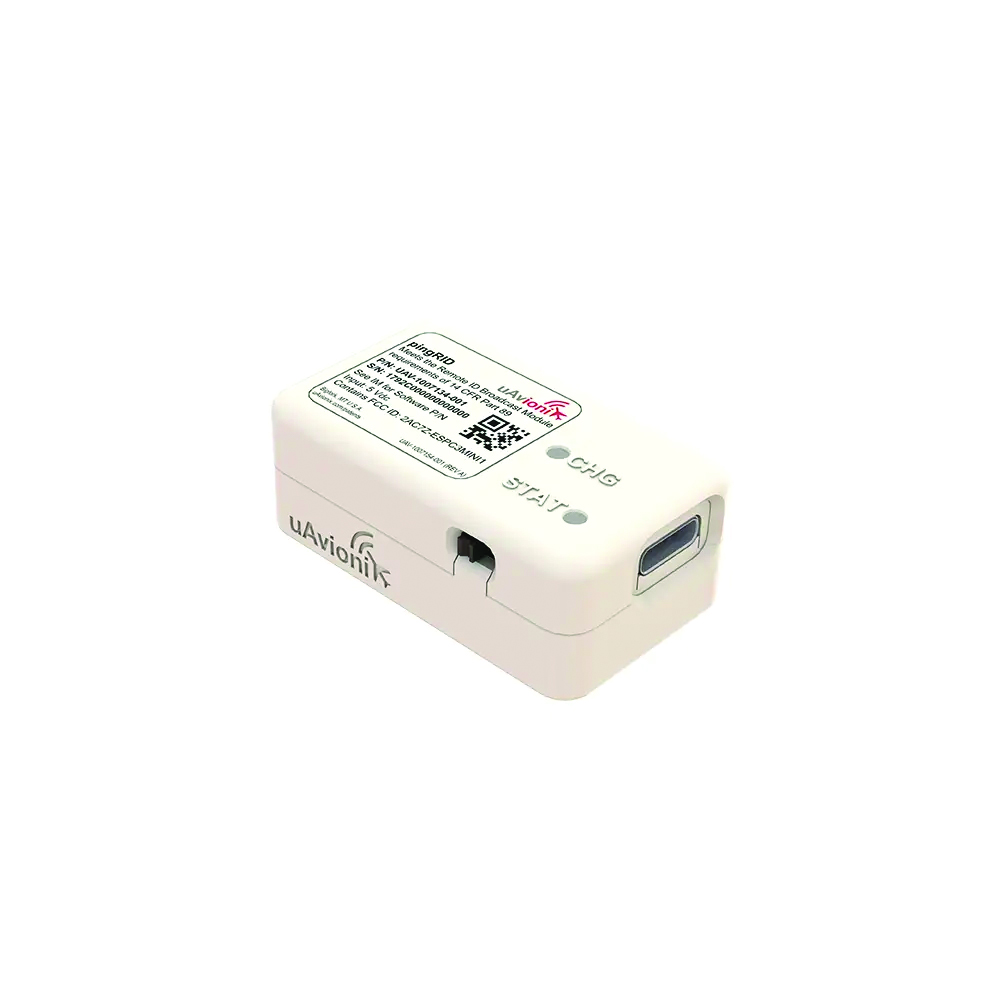
Image: uAvionix
Remote ID Module
Meets FAA standards
The pingRID meets the Part 89 remote ID standards of the Federal Aviation Administration (FAA), which will become effective on Sept. 16, to keep operators safe and compliant throughout a flight. The pingRID comes pre-configured and ready for use out of the box. After assigning the pingRID unique identification number to the aircraft’s registration with the FAA, operators can attach the battery-powered device to their UAV and prepare for flight. A set of LED indicators provides status on the battery charge, device readiness for flight and inflight operations. The compact, lightweight design fits most aircraft without significantly impacting performance. The module also can be quickly recharged via USB-C. The FAA’s final rule on remote ID requires all UAV pilots to meet the operating requirements of Part 89. For most operators, this will require flying a UAV equipped with standard remote ID, a remote ID broadcast module such as the pingRID, or flying at a Federally Recognized Identification Area. uAvionix, uavionix.com
MOBILE
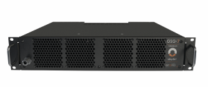
Image: Orolia
GNSS Simulator A positioning, navigation and timing test solution
GSG-7 delivers GNSS signal testing for location-aware applications and systems that require navigation or timing. The GSG-7 GNSS simulator features high-end performance with a 1,000 Hz simulation iteration rate, high dynamics, real-time synchronization, and simulation of all-in-view satellite signals. The GNSS simulator is suitable for development and integration projects that require high performance and an increased number of constellation licenses and satellites in view for a single antenna or trajectory. GSG-7 supports multi-constellation and multi-frequency GNSS simulations. It can be programmed to simulate operations with all current and future GNSS signals. Orolia, safran-navigation-timing.com
Image: Eos Positioning
GNSS Receiver Supports Galileo HAS
The Arrow Gold+ enables users to achieve better than 20 cm accuracy with 95% confidence using Galileo HAS. The Arrow Gold+ is one of the first high-accuracy GNSS receivers that supports Galileo HAS and is designed for the GIS market. Additional signal support for Arrow Gold+ includes: the concurrent use of the BeiDou B3 and GPS L5 signals as well as GLONASS, BeiDou, QZSS and IRNSS signals. Eos Positioning Systems, eos-gnss.com
Image: Pasternack
Mil-Spec GPS/GNSS Antennas Meets military specifications for use in several small form factor and mobile applications
The PEANGPS1006, PEANGPS1007, PEANGPS1008 and PEANGPS1009 mil-spec GNSS antennas are engineerered
for environmental performance according to the MIL-STD-810G standard and include multi-standard GPS L1, Galileo E1 and GLONASS options. They are IP67 rated and available in passive and active versions and provide coverage from 1,597 MHz to 1,607 MHz. The GNSS antennas feature linear polarization for cross-polarized isolation, nominal gain options of -3 dBic and 10 dBic, and SMA mounts. The mil-spec GNSS antennas are available now.
Pasternack, Pasternack.com
TFX62.A. (Image: Taoglas)
Near-Invisible Antennas Supports cellular Wi-Fi and GNSS technologies
The TFX62.A, TFX257.A and TFX125.A offer an alternative to standard opaque antennas, with “peel and stick” mounting capabilities to any nonmetal surface. The TFX62.A, TFX257.A and TFX125.A come with an adhesive and have an enclosed carrier terminated with a FAKRA connector for easy installation. The TFX series antennas leverage a sub-millimeter thick hybrid transparent conductive film that offers designers an invisible antenna solution. They are suitable for mobility, public infrastructure, medical devices, transportation and emerging IoT applications. Use cases for the antennas include electric vehicle chargers and parking meters, smart buildings and transportation vehicles.
Taoglas, taoglas.com
Image: CHC Navigation
3D Grade Control System For motor graders
The TG63 comes with a tightly coupled dual-GNSS positioning system and inertial sensor, and provides reliable 3D positioning and heading to ensure accuracy of the grader blade within ±2 cm. The TG63 is designed to withstand the harsh environment of construction sites and supports multiple applications, including real-time kinematic networked transport of RTCM via internet protocol and ultra-high frequency base stations.
CHC Navigation, chcnav.com
OEM
Image: ComNav Technology
GNSS Modules Now compatible with Galileo HAS
K8 series GNSS modules can use the Galileo High Accuracy Service (HAS) precise-point positioning (PPP). The PVT algorithm upgrade to the K8 series module supports Galileo HAS with an accuracy of 20 cm horizontally and 40 cm vertically. Galileo HAS provides free access to information necessary to estimate accurate positioning using a PPP algorithm in real-time through the Galileo signal E6-B and an internet connection. The improved performance capabilities provide a higher level of accuracy for industries such as UAV, autonomous driving, intelligent transportation, agriculture and more. ComNav Technology, comnavtech.com
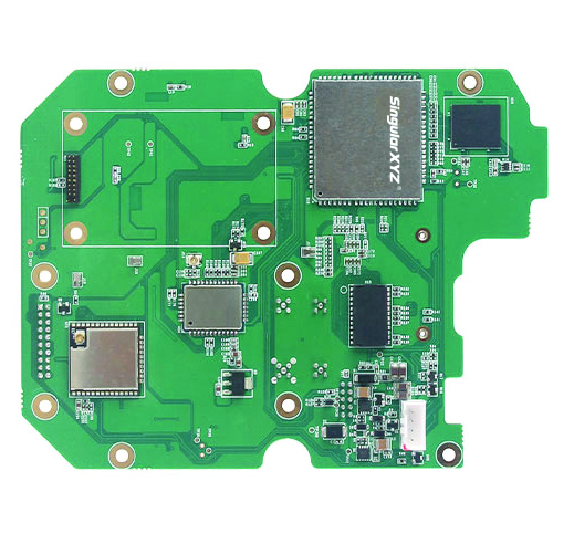
Images: SingularXYZ
Development Kit Designed for GNSS-related development integration
The DK100 development kit is a multi-functional kit with selectable single-antenna and dual-antenna modules, full constellation tracking and centimeter-level positioning. It is a ready-to-use kit designed to simplify integration efforts and increase compatibility with a variety of applications. The DK100 reserves standard adapter board interfaces to connect different GNSS modules and radio modules to meet specific needs. The development kits are coupled with a 4G module, Wi-Fi, Bluetooth, Ethernet modules, large memory and status indicators on a single PCBA. The DK100 comes with a web page for easy configuration. With Ethernet and Wi-Fi access, users can monitor device status and configure working mode and data transmission settings on the web page. The centimeter-level DK100 can be integrated in a range of horizontal and vertical applications, such as CORS construction, precision agriculture, construction machinery, smart navigation, monitoring, robotics, unmanned systems and more. Singular XYZ, singularxyz.com
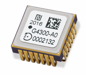
Image: TDK Corporation
Digital MEMS Gyroscope A high stability and vibration-tolerant gyroscope for dynamic applications
The GYPRO4300 features a ±300°/s input measurement range, 200 Hz bandwidth, and 1 ms latency with a closed-loop architecture that enables high linearity and stability. The GYPRO4300 has bias instability of 0.5°/h as a typical value and a maximum value of 2°/h. The GYPRO4300 is suitable for applications such as railways, land vehicles, vertical take-off and landing aircraft and UAVs, marine and subsea systems, borehole drilling and surveying instruments. The GYPRO4300 is available now for sampling and customer evaluations. Evaluations of the sensors also can be made with an Arduino-based evaluation kit that provides built-in testing functionalities such as output reading and recording, recalibration and digital self-tests. TDK Corporation, tdk.com
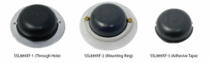
Image: Tallysman Wireless
GNSS Antenna Small, light, and dual-band
The SSL889XF employs Tallysman’s Accutenna technology providing GPS, QZSS L1/L2, GLONASS G1/G2/G3, Galileo E1/E5b, and BeiDou B1/B2b coverage. The SSL889XF antenna is designed for precision dual-frequency positioning where a light weight and a low profile are important. The SSL889XF antenna element is 48 mm in diameter and 20 mm tall and weighs ~50 g. It has a tight average phase center variation of less than 10 mm for all frequencies and overall azimuths and elevation angles. The SSL889XF is available in three versions. Model SSL889XF-1 has an integrated 61 mm ground plane and two mounting holes. Model SSL889XF-2 has a mounting collar, and model SSL889XF-3 is the antenna only and is attached using adhesive tape. All models have a female MCX connector. The SSL889XF antenna also supports Tallysman’s eXtended Filtering (XF) technology. Tallysman Wireless, tallysman.com
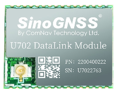
Image: ComNav Technology
Datalink Module Suitable for GNSS-based systems
The U702 datalink module is a RX/TX data link module that supports the LoRa modulation technique. Its compact, surface-mounted design and robust electromagnetic compatibility enable easy integration into GNSS systems such as robotic lawn mowers. With the LoRa modulation technique, the U702 has low power consumption, reception power of 0.025 w, and a working distance up to 1.5 km. It also enhances the ability to protect GNSS systems against various interference — making it possible to have high reception sensitivity, a low error rate, and high reliable data transmission even in harsh environments.
ComNav Technology, comnavtech.com
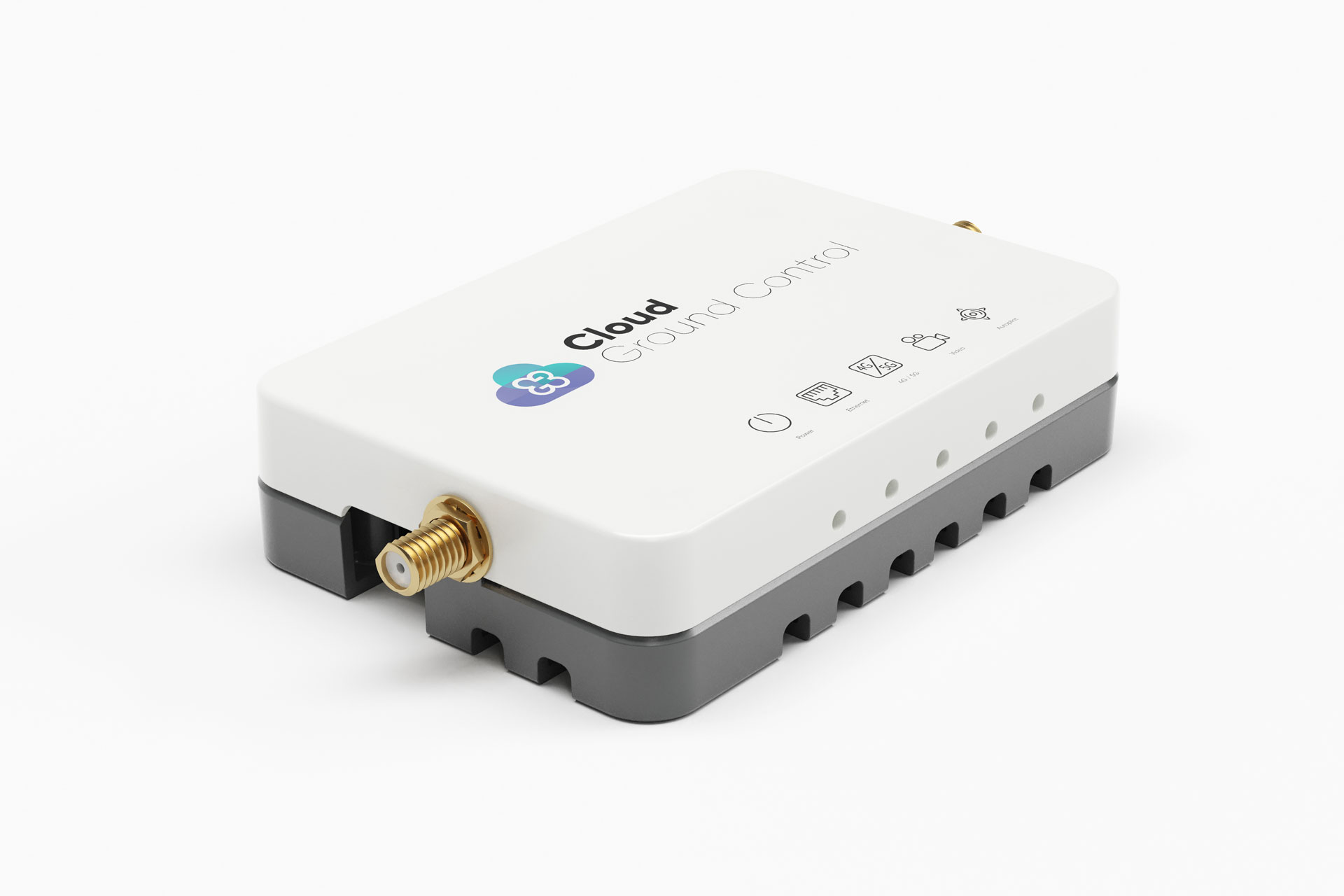
Image: Cloud Ground Control/Advanced Navigation
Fleet management device For air, land and sea vehicles
CGConnect can securely connect UAVs and vehicles into one autonomous fleet across land, sea and air, regardless of manufacturer or model. This provides mission planners and operators with full situational awareness for search and rescue, emergency response and disaster relief. Artificial intelligence (AI) algorithms are running in the cloud, relaying real-time camera feed data to the end user to support missions such as object detection, tracking and thermal imaging. The flexible and customizable open platform is operating on industry standards, which multiplies potential product applications and enables diverse autonomous vehicles and payloads to operate as a coordinated fleet. High-grade security safeguards data and IP from vulnerabilities and security breaches, helping users meet compliance obligations. Additionally, CGConnect supports edge AI to perform intensive object identification and classification directly on the vehicle for dynamic missions. CGConnect is available for pre-order. An OEM option is available. Cloud Ground Control/Advanced Navigation, cloudgroundcontrol.com/advancednavigation.com
Deere & Company has issued a request for proposals (RFP) to secure a satellite communications solution that will further connect its fleet of intelligent machines. The solution will enhance the satellite connectivity that Deere is delivering to its customers.
“We believe satcon will unlock significant opportunities in agriculture by enabling farmers to take advantage of innovative technologies that rely on real-time information and communication,” said Lane Arthur, vice president of Data, Applications and Analytics at John Deere. “For example, autonomous tractors benefit from real-time communication through the John Deere Operations Center, as farmers use the app to start and stop the machine, monitor the job it’s executing, and determine what it should do when it encounters an obstacle.”
During the initial phase, Deere is seeking a strategic partnership with a vendor or set of vendors to connect both new machines and retrofitted machines through satellite service and ruggedized satellite terminals. This is expected to enable Deere’s customers to be more productive and efficient, and increase food and fuel production.
For more information on the request for proposals, contact [email protected].
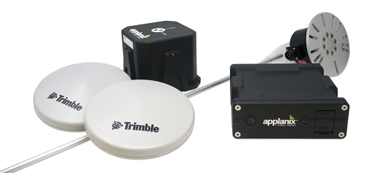
Customizable system provides robust positioning without added site infrastructure for IHI Corp.
Photo: Trimble
Trimble has announced the first deployment of its map-based localization system for land-based autonomous vehicle applications.
IHI Corp., a heavy industry manufacturer based in Japan, will retrofit its existing container and haulage trucks with a customized Applanix POS LV system as part of its broader autonomy capabilities for the transport of goods around industrial facilities.
Map-based localization provides precise positioning and orientation estimation, augmenting GNSS/inertial data, which is critical for safe and efficient autonomous vehicle operations. The ability to provide IHI Corp. a full workflow and real-time data ensures seamless integration into IHI’s truck design.
The custom-built, locally supported system leverages Trimble’s engineering capabilities and technology to provide reliable performance across a variety of challenging environments, the company said. Using this system, IHI Corp. can provide robust positioning for its autonomous fleet without additional site infrastructure, lowering capital expenditure costs and improving scalability.
Tailoring POS LV to work within IHI’s unique specifications and existing autonomous platform, the map-based localization system couples an inertial navigation system (INS) with simultaneous localization and mapping-based (SLAM) capabilities, and works with several types of sensors, including lidar. POS LV provides an accurate base map using post-processed data and localizes vehicle positioning in real time, enabling the reliable and safe autonomous operation of industrial vehicles.
IHI continually enhances its work environments, while also compensating for varying labor scenarios and personnel shortages. This makes the need to automate transportation critical to operations. The complexities of the evolving industrial manufacturing environment require solutions that can be tailored to a customer’s specific application requirements.
By partnering with Trimble, IHI can develop a retrofit system that addresses two major challenges — affordability and reliability — within the autonomous operation of large-scale industrial equipment.
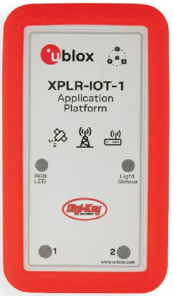
Featuring the full gamut of u-blox technologies and services, the XPLR-IOT-1 enables end-to-end proofs of concepts for IoT products and applications
The u-blox XPLR-IOT-1 IoT explorer kit. (Image: u-blox)
U-blox has announced the u-blox XPLR-IOT-1 IoT explorer kit, an all-in-one package to test, evaluate and validate applications for the internet of things (IoT).
The board hosts an ultra-low-power MAX-M10S positioning module capable of concurrently tracking four GNSS constellations, delivering highly reliable location data wherever GNSS coverage is available.
Integrating all relevant u-blox technologies and services into a capable prototyping platform with a vast selection of sensors and interfaces as well as cloud connectivity, XPLR-IOT-1 makes it easier to explore the potential of IoT applications.
The increasing complexity of IoT devices, which often require satellite-based positioning, Bluetooth low energy, Wi-Fi, and cellular connectivity via, for example, LTE-M is raising the importance of prototyping and validating ideas before bringing them to production. This trend is driving demand for multifunctional application boards like the u-blox XPLR-IOT-1 over evaluation kits (EVKs), intended to comprehensively test a product’s entire feature set.
Prototyping platform
The XPLR-IOT-1 gives users everything they need to prototype low-power IoT use cases such as logistics container trackers, industrial automation, sensor-to-cloud applications, and fleet management solutions. Besides the MAX-M10S positioning module, the board has a u-blox NORA-B106 Bluetooth LE 5.2 radio module that doubles as its main MCU, hosting the application software and controlling the other modules.
Other modules include a u-blox SARA-R510S for LTE-M and NB-IoT cellular connectivity with built-in cloud security, as well as a u-blox NINA-W156 for 2.4 GHz Wi-Fi.
The hardware is complemented by a broad selection of sensors commonly used in IoT applications, including accelerometers and gyroscopes, a magnetometer, and temperature, humidity, pressure and ambient light sensors. A power-on switch, LEDs and user buttons make it easy for users to interact with the device.
The NORA-B106’s powerful Arm Cortex M33 MCU is solely dedicated to running the application software. Clocked at 128 MHz, with 1 MB of embedded flash and 512 kB of RAM, and 8 MB of external flash memory, it offers a solid foundation for development of highly capable solutions.
Integrated antennas for featured technologies, a USB interface and USB charging, a Sparkfun Qwiic I2C connector, and a debug interface contribute to a smooth product development experience, u-blox said.
Native support for u-blox services
The XPLR-IOT-1 offers engineers an easy way to start working with u-blox’s services offering. Included with the kit is a trial of MQTT Anywhere, which delivers ultra-low power by communicating data between the device and the enterprise using the MQTT-SN (MQTT for sensor networks) protocol.
Tracking applications with the most stringent power requirements such as freight container trackers can realize four times longer battery life with u-blox’s positioning in cloud service, CloudLocate, while the CellLocate mobile-network-based location service extends tracking beyond the reach of GNSS signals.
A starting point for commercial end-products
Developers working with XPLR-IOT-1 can use code from u-blox’s ubxlib GitHub repository, a library of software examples for key use cases, to speed up the prototyping of solutions, which can range from wireless sensor networks to indoor and outdoor tracking solutions to industrial or smart building gateways.
Because all hardware design files, software, smartphone app, and online dashboard source code are shared, the XPLR-IOT-1 can also serve as a starting point for commercial end-product design.
“The XPLR-IOT-1 is fully geared towards rapid development, testing, and validation of IoT solutions,” said Pelle Svensson, senior principal, Product Strategy Short Range Radio, u-blox. “Offering a single platform to develop a variety of IoT use cases, the versatile explorer kit reduces the expertise required for hardware, software, and service integration and code development.”
Once launched in June 2022, the XPLR-IOT-1 will initially be sold via Digi-Key.
U.S. Air Force Airmen repair government-operated general-purpose vehicles at Moody Air Force Base, Georgia. (Photo: U.S. Air Force/Airman 1st Class Lauren M. Johnson)
The U.S. Air Force will equip its 21,000 general-purpose vehicles with Geotab fleet-management technology after the company was awarded a sole-source contract.
Geotab received FIPS 140-2 validation for its cryptographic library in February 2019 as well as FedRAMP authorization and ISO 27001 certification for its telematics platform. These compliance certifications and authorizations validate Geotab’s system and organizational processes, enabling the company to offer its fleet-management services to all levels of federal, state and local government agencies.
Geotab’s fleet-management technology for the Air Force is secure and customized. It includes the following features to help the service more effectively manage its vehicles:
automated odometer capturing
engine diagnostics
problem predictive analytics
fuel data
custom reporting
GHG reduction dashboards
fleet right-sizing reporting
Selected for its integration capacity and proven commitment to information security, the sole-source award from the Department of the Air Force yields an Authorization to Operate (ATO) within the Department of Defense (DoD). The authorization will allow other DoD agencies to leverage Geotab services by piggybacking off of this DAF ATO.
Geotab fleet-management products are used by more than 2,000 government agencies and departments at all levels to capture, measure and analyze crucial fleet data with deep granularity. “Winning this sole-source contract from the Department of the Air Force further solidifies Geotab’s ability to collaborate with agencies that operate at the highest levels of national data security and to provide a customized and highly secured telematics solution,” said Dan Zdarko, business development manager, federal government, Geotab.
“It is vitally important that the technology we deploy in our fleets meet the highest standards of data security put forth by the U.S. government,” said Tim Patterson, program management flight chief from the U.S. Air Force’s 441st Vehicle Support Chain Operations Squadron at Langley Air Force Base in Virginia. “Our objective is to enhance fleet-management strategies and reduce the total cost of ownership longer term across the Department of the Air Force.”
Seoul Robotics has introduced the Level 5 Control Tower (LV5 CTRL TWR), a mesh network of sensors and computers on infrastructure that guides vehicles autonomously without requiring that sensors be placed on individual vehicles.
The technology is in the early stage of commercial deployment to automate last-mile fleet logistics at BMW’s manufacturing facility in Munich. The system has the potential to transform operations for a wide range of business applications, from vehicle distribution centers to car rental companies and trucking logistics.
Seoul Robotics is a 3D perception solution company using deep learning artificial intelligence (AI) to power the future of mobility,
By placing sensors equipped with 3D perception software around vehicles — traffic lights, buildings and highway overhangs — the system can fully capture the environment and communicate with other sensors and the 4/5G systems that come standard on vehicles.
The LV5 CTRL TWR collects all the 3D data, and then automates vehicles accordingly using V2X communications.
“Level 5 mobility has been proven to be more challenging to achieve than expected, until now,” said HanBin Lee, CEO of Seoul Robotics. “LV5 CTRL TWR has massive potential to fuel autonomous mobility, and we are thrilled to continue expanding upon the implementation of this technology with BMW and other partners.”
“Ultimately, these systems will be deployed in additional public and commercial settings, powering aspects of our everyday lives, such as autonomously navigated parking and public transit,” Lee said. “With LV5 CTRL TWR, this future is closer and more accessible than ever.”
The collaboration with BMW leverages hundreds of connected lidar and 3D sensors on infrastructure to automate newly manufactured vehicles within factories and vehicle distribution centers without any human involvement. By making this process autonomous, automakers like BMW can increase operational efficiencies and safety within automotive logistics.
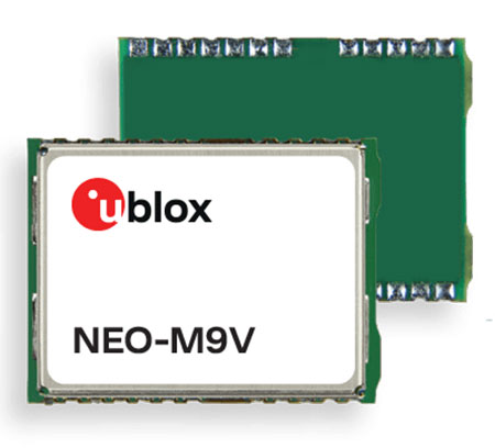
U‑blox has announced the NEO-M9V module, its first GNSS positioning receiver to offer both untethered dead reckoning (UDR) and automotive dead reckoning (ADR).
The NEO-M9V is suitable for fleet management and micro-mobility applications that require reliable meter-level positioning accuracy even in challenging GNSS signal environments such as urban canyons.
Using inertial sensor measurements, UDR offers a smooth navigation experience in dense urban environments by bridging gaps in GNSS signal coverage and mitigating the impact of multipath effects caused by GNSS signals that bounce off buildings. ADR further increases positioning accuracy in demanding environments by including the vehicle speed in the sensor-fusion algorithm.
Offering both UDR and ADR on the same module delivers maximum positioning performance and design flexibility, u-blox said. The NEO-M9V also features dynamic models optimized for both cars and e-scooters.
NEO-M9V is based on the u‑blox M9 GNSS technology platform. Its ability to track up to four GNSS constellations maximizes the number of GNSS satellites within its line of sight at any given moment. Integrated SAW and low-noise amplifier filters offer excellent interference mitigation for a robust solution. Compatibility with the NEO form factor reduces migration efforts for customers upgrading existing designs.
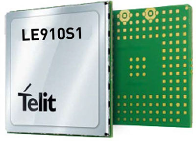
Telit, a global enabler of the internet of things (IoT), has launched the LE910S1-ELG, a new LTE Cat 1 module designed for IoT applications in Latin America (LATAM) that need a combination of performance, affordability, voice support and 2G fallback in a compact form factor.
With an embedded GNSS receiver, the cost-optimized LE910S1-ELG is suitable for tracking applications such as fleet management, stolen-vehicle tracking and recovery, and other mobile IoT applications that need to maintain a reliable connection when moving around in a country, region or multiple regions.
The LE910S1-ELG is the latest member of Telit’s flagship xE910 module family, whose unified form factor and electrical and programming interfaces spanning 2G, 3G and 4G products enables developers to implement a “design once, use anywhere” strategy. The module supports LTE Cat 1 with single-antenna reception, providing downlink speeds of up to 10 Mbps and uplink speeds up to 5 Mbps. Its streamlined configuration, compared to LTE Cat 1 devices with two antennas, helps significantly reduce cost and complexity.
Supporting 2G fallback, the LE910S1-ELG is suitable for applications that require full mobility throughout the LATAM regions, including areas that have not upgraded to 4G yet. It also supports both circuit-switched voice and VoLTE for those applications that require making phone calls, such as healthcare mobile personal emergency response systems (mPERS), connected elevators, alarm systems and more. The power-saving embedded GNSS receiver enables the use of GNSS positioning even when the cellular modem is switched off.
“The LE910S1-ELG is a great option for migrating customers that use legacy 2G and 3G modules in Latin America, especially where nationwide LTE-M and NB-IoT coverage does not yet exist,” said Marco Stracuzzi, head of product marketing, Telit. “Our all-in-one cellular and GNSS module covers all LATAM 4G and 2G bands, as well as mainstream bands used in Europe and Asia, which makes it well-suited particularly for high-performance tracking across intercontinental deployments.”
The LE910S1-ELG is sampling now, and will be commercially available during the first quarter of 2022.