Esri has released ArcPad 10.2. ArcPad is mobile mapping and field data collection software designed for GIS professionals. The new version of ArcPad improves synchronization with the ArcGIS platform and speeds data collection in the field with new automation options.
Esri’s reported its latest release of ArcPad gives users the ability to directly open ArcGIS feature services in ArcPad and synchronize edits with hosted or on-premises GIS. The new capability significantly improves mobile workflows by enabling disconnected editing of published services. In addition, ArcPad gives users the ability to automate edits with a Quick Fields option, which can be customized to autopopulate any field during data collection.
According to the announcement, for users who rely on desktop workflows that revolve around file sharing and distribution, ArcPad 10.2 includes new ArcGIS Online integration. With this option, users can store their ArcPad projects and QuickProject templates as an ArcPad package in their ArcGIS Online accounts for sharing with members of their group. ArcGIS Online subscribers can also browse ArcGIS Online from inside ArcPad with the ability to select and download a project or template, creating an easy, collaborative workflow.
Trimble announced it has entered into an agreement with DigitalGlobe Inc. to license its satellite imagery for offline use in Trimble Outdoors mobile apps, allowing outdoor enthusiasts to view and store imagery on their smartphones and tablets. In addition, DigitalGlobe imagery will be available for high-resolution, large-format custom prints at MyTopo.com, a Trimble company.
“Our customers use Trimble apps in remote areas where network data coverage doesn’t exist. Armed with smartphones loaded with memory, they�re increasingly asking for map content to be stored locally on the handset for off-the-grid use. We’re excited to enable our customers to cache DigitalGlobe’s high-resolution imagery on their smartphones to address these needs,” said Mark Harrington, vice president of Trimble. “In addition, providing our MyTopo customers with the ability to create large format print maps with DigitalGlobe’s high-resolution imagery allows them to have the convenience of a traditional paper map that matches their handset experience in the field. By partnering with DigitalGlobe, Trimble can significantly enhance the quality of satellite photography available in our products.”
According to the announcement, DigitalGlobe will provide imagery down to a 30-centimeter resolution for the continental U.S. and 50-centimeter resolution globally, effective immediately. The 30-centimeter resolution means one pixel on the image equals 30 centimeters on the ground.
“By partnering with Trimble we can showcase how our imagery can be used in new and unique ways for location-based services companies,” said Bert Turner, senior vice president of sales at DigitalGlobe. “Outdoor enthusiasts will now have access to DigitalGlobe’s vast imagery library—the largest and most up to date of its kind—in order to harness the power of mapping and location intelligence even in the most remote locations.”
Mobile Apps with DigitalGlobe Imagery
According to the announcement, outdoors enthusiasts will be able to use DigitalGlobe’s worldwide imagery in five apps:
Trimble Outdoors Navigator (iPhone, Android), designed for in-the-field navigation for hikers, backpackers, mountain bikers, and general outdoor use
Trimble Outdoors MyTopo Maps (iPad, Kindle Fire, Android tablets), designed for outdoor trip planning
Trimble GPS Hunt (iPhone, Android), smartphone app built for hunters
Trimble GPS Fish (iPhone, Android), smartphone app built for anglers
Trimble GPS Maps (iPad), tablet app designed to plan hunting and fishing trips
To save maps on their mobile device, customers need to select the area and zoom levels of the DigitalGlobe imagery using the Offline Maps tool found in the supported apps. The ability to store offline satellite imagery will require an Elite membership ($29.99 per year) to TrimbleOutdoors.com (trimbleoutdoors.com/elite) or GPSHuntFish.com (www.gpshuntfish.com/elite).
Printed Maps with DigitalGlobe Imagery
Customers can order the new Premium Satellite Image prints in five sizes ranging from 18″ x 24″ to 60″ x 96″ on MyTopo.com, which has a simple five-step process to design custom maps. In addition, users can select the map scale down to 1:1K, plus overlay GPS coordinates, navigation grids and exclusive map layers like public land boundaries, hunt units, forest roads, and lake contours. The imagery can be printed on several paper formats, including waterproof and glossy.
High-resolution prints will be available in the U.S. and Canada to start, and expand to worldwide coverage later in 2013.
The U. S. Geological Survey announced that the Federal Geographic Data Committee (FGDC) is seeking public comments on the draft strategic plan for the National Spatial Data Infrastructure (NSDI). The draft NSDI strategic plan has been developed with inputs from a variety of sources, including FGDC member agencies, the National Geospatial Advisory Committee, and geospatial partner organizations. The plan describes a broad national vision for the NSDI, and includes goals and objectives for the Federal government’s role in continued sustainable development of the NSDI. Following the public comment period, a revised draft of the plan will be prepared for final review and adoption by the FGDC Steering Committee. Following completion of the strategic plan, the FGDC will develop more detailed project plans for the goals and objectives in the strategic plan.
Willens Law Office announced the first self-reported Chicago bicycle accident map will collect data about cyclists’ encounters with careless and reckless driving. This interactive map will allow users to report, not only bicycle accidents and doorings, but close calls or near misses as well, all in real time. Additionally, by reporting the type of collision, weather, lighting and surface conditions during the accident or close-to accident, we will be able to have more data about bicycle accidents, when they occur, where they occur, and how to prevent them. The most important improvement over past maps is that close call or near miss data can also be reported and shared among cyclists, and while technically not an accident, this data may be the most valuable as it occurs in the highest frequency and often can help with future design plans and infrastructure updates. As more accidents and near misses get reported, the heat map will provide visual representation to identify the areas with the largest number of incidents, and maps can be created specifically for a particular type of accident. You can access the map here and conduct your own search, if you’re a cyclist please share your most troublesome intersection or address for near misses.
Reported Chicago bicycle accidents over the last 5 years http://www.willenslaw.com/report-your-accident/ Source: Willens Law Offices
According to the announcement, the cyclists of Chicago will be able to use this interactive map to help identify “hot spots.” These are areas of the city that are particularly dangerous for cyclists. The data will bring attention to problem areas and arm cyclists and community organizations with information to advocate for safer roads, which, in turn, will increase roadway modifications and/or targeted enforcement of the law. Extended use of the map will help keep the streets of Chicago safer for everyone – cyclists, motorists and pedestrians alike, helping to plan safer routes for riding. Knowledge is power when it comes to choosing the safest routes while bicycling in the city of Chicago.
Attorney Matthew Willens of Willens Law Offices in Chicago had this to say “An ounce of prevention is worth a pound of cure. My hope is that, with the use of this map, bicycle accidents will decrease as the popularity of informed cycling increases.” Willens Law Offices was recently featured in the Chicago Tribune for the initiative to provide ghost bike racks in memory of deceased bicyclists. The firm plans to donate a ghost bike rack for each cyclist who falls victim to a fatal bicycle-motorist accident in the City of Chicago and contacts the firm. The racks would NOT replace ghost bikes, but would increase the number of public bike racks and would hopefully help maintain the memory of the past cyclist by its permanent nature and utility allowing cyclists to lock up their bikes, as well as a serve as a reminder to be aware of the cyclists on the road.
The British Cartographic Society (BCS) celebrates its 50th anniversary this year. Since 1963, the Society has been supporting individuals and organizations dedicated to exploring and developing the world of maps. Part of its celebration includes a special issue of The Cartographic Journal, which will bring together an interesting range of reflective and forward looking articles covering one simple question: “What does cartography mean to you?”
The Cartographic Journal’s 50 volumes have spanned 115 issues and over 1000 articles in its lifetime. The journal is edited by Kenneth Field, senior cartographer at Esri, Inc., and former principal lecturer in GIS at Kingston University, London. It is an established peer reviewed journal of record and comment containing authoritative articles and international papers on all aspects of cartography, the science and technology of presenting, communicating and analyzing spatial relationships by means of maps and other geographical representations of the Earth’s surface.
“This very special 50th anniversary issue brings together the leading lights in cartography today,” Field said. “Representing academia, commercial mapping, publishing and the so-called neo-cartographers, each contributor has fashioned a personal, reflective piece that will encourage thought and debate as we look to the future. There are some fascinating insights as well as key questions posed that will launch the Journal towards the next 50 years of publication.”
The society will also be hosting a 50th anniversary celebratory conference titled “Today, Tomorrow and Beyond” at the historic Hothorpe Hall, Leicestershire, September 3-6, to reflect on the society’s forward vision for the future of cartography.
The BCS aims to promote the art and science of cartography through publications, events, awards and educational workshops. Members include mapping companies, designers, academics, researchers, map curators, individual cartographers, GIS specialists and ordinary members of the public with an interest in maps.
The Open Source Geospatial Foundation (OSGeo) announced the release of a new stable version of GRASS GIS. This release fixes bugs discovered in 6.4.2 version of the program and adds a number of new features. This release includes over 830 updates to the source code since 6.4.2. As a stable release series, the 6.4 line will enjoy long-term support and incremental enhancements while preserving backwards-compatibility with the entire GRASS 6 line.
According to the announcement, key improvements of this release include some new functionality (assistance for topologically unclean vector data), major speedup for some vector modules, fixes in the vector network modules, fixes for the wxPython based portable graphical interface (attribute table management, wxNVIZ, and Cartographic Composer). A number of new modules have been added for processing LANDSAT and MODIS satellite data, and a new vector statistics module is also introduced. Many new symbols and north arrows are available, and the user will find an improved and easier to use wizard for creating custom project locations with precise map projection and datum support. Community-contributed add-on modules are now more easily and robustly installed from an online archive. Other major developments include enhancements to the Python scripting library and numerous software-compatibility fixes and translation updates. Important is the enhanced portability for MS-Windows (native support, fixes in case of missing system DLLs). And we welcome Romanian as our twenty-fourth language.
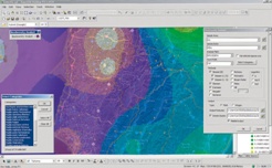
Esri released the new version of ArcGIS, marking a major milestone in the history of the Esri platform. With ArcGIS 10.2, Esri has taken advantage of the significant changes in IT that magnify the power and accessibility of GIS. The new release improves ease of use, real-time data access, and integration with existing infrastructure. It allows people to more easily deploy web GIS—the key component for implementing GIS as a platform. Web GIS helps users organize their work and simplifies geographic information discovery, access, sharing, and collaboration.
More Online Analysis Tools
According to the announcement, ArcGIS 10.2 extends the analytic functionality of GIS to everyone via ArcGIS Online. Advanced analysis tools have been added to ArcGIS Online for investigating geographic relationships, patterns, and trends within data. New tools in ArcGIS Online include overlay layers for combining two or more layers into one single layer; enhanced hot-spot analysis; and data enrichment resources to glean information about the people, places, and businesses in a specific area or drive time.
ArcGIS Online Access
To ensure that ArcGIS for Desktop users have access to ArcGIS Online capabilities, Esri entitles every customer organization that has ArcGIS for Desktop (Basic, Standard, or Advanced) to receive an ArcGIS Online subscription. The number of named users will be equal to the total number of ArcGIS for Desktop licenses current on maintenance. This will enable users to easily get started with ArcGIS Online. It will also give access to all Esri apps—such as Esri Maps for Office, Collector for ArcGIS, and Operations Dashboard for ArcGIS—as well as numerous app templates hosted in ArcGIS Online. Esri will notify ArcGIS for Desktop customers about the details of this new entitlement in the coming weeks.
Portal for ArcGIS
At ArcGIS 10.2, Esri gives people the ability to deploy ArcGIS Online capabilities on-premises for tighter content security and control. Portal for ArcGIS provides a secure front end for ArcGIS for Server, with dozens of easy-to-use apps and full integration with ArcGIS for Desktop. It includes geographic viewers and analysis tools designed for people without any GIS knowledge. Experienced GIS users can connect to Portal for ArcGIS from ArcGIS for Desktop, developer APIs, and other Esri applications. The Portal for ArcGIS extension software is included with ArcGIS for Server Advanced (Enterprise or Workgroup) and is licensed and priced based on the number of named users.
Real-Time Data Access
Esri’s new release of ArcGIS introduces a number of new technologies that enable the real-time collection and sharing of data with GIS. It includes ArcGIS GeoEvent Processor for Server, a new ArcGIS for Server extension that gives users the power to access live data streams. People can analyze and send processed results to other users or into other systems. This capability transforms GIS applications into powerful frontline decision tools, refining data quickly for consumption and enabling fast response in any situation.
Expanded Business Intelligence Support
With business intelligence (BI) being relied on even more in an increasingly competitive marketplace, the new ArcGIS release expands Esri’s support for major BI systems. ArcGIS 10.2 includes new MicroStrategy BI and Microsoft Dynamics Customer Relationship Management tools, allowing users of those platforms to perform location analytics on their business data and focus their marketing. Core BI tools Esri Community Analyst and Esri Business Analyst Online also get productivity-enhancing face-lifts and major customization capability.
For more information on the dozens of other improvements in the latest release of ArcGIS, visit esri.com/whatsnew.
TomTom announced an updated agreement with BlackBerry to provide real-time traffic information for the maps app on BlackBerry 10.
TomTom Traffic provides customers with more precise traffic information, enabling faster journeys, more accurate arrival times, and a smarter navigation experience.
According to the announcement, BlackBerry 10 customers also have the option to anonymously help enhance the coverage and quality of TomTom’s world-class traffic information by sharing traffic data.
“Having accurate and up-to-date traffic information integrated in BlackBerry Maps is an important feature for customers, and TomTom is a recognized leader that provides traffic data to many companies in the market,” said Adrian Gould, VP of Handheld Software Product Management at BlackBerry. “We are pleased to expand our relationship with TomTom in support of BlackBerry 10 customers.”
“By integrating TomTom Traffic, BlackBerry’s smartphone customers will have access to the most accurate traffic information available,” said Charles Cautley, Managing Director of TomTom Automotive & Licensing. “We are proud to be supporting BlackBerry to deliver enhanced location-based services to its subscribers across the globe.”
The U.S. Geological Survey announced that advances in the technology of online map-based data collection platforms have made it possible for citizens of the U.S. to contribute to USGS topographic mapping efforts like never before.
The USGS is currently seeking volunteers to aid in collecting data for The National Map (TNM), which comprises a variety of products and services that provide the Nation with geospatial information to describe the landscape of the United States and its territories. The National Map Corps (TNMCorps) aims to improve this topographic information by updating existing and gathering previously uncollected data via volunteered geographic information (VGI).
Blue dots represent locations where citizen-mapping efforts are currently underway. Green states are currently available for editing with remaining states available around September
The National Map includes hydrographic features such as streams and lakes, elevation contours, geographic names, land cover, and structures. To improve and update The National Map, the USGS is turning to volunteers to map the location of important community buildings – such as police stations, schools, hospitals, post offices, prisons, cemeteries, and fire stations. Adding and verifying the locations of buildings to existing TNM datasets makes significant additions to the USGS’s ability to provide accurate information to the public.
After citizen input is peer-reviewed by fellow volunteers, the valid data are incorporated into The National Map databases. These databases are used to create many products, including US Topo maps – free and downloadable digital topographic maps that are released every three years.
Currently, the USGS is in the process of expanding TNMCorps; 35 new states have been added to the volunteer database and need mapping support from volunteers. These states are: Alabama, Arizona, Arkansas, Alaska, California, Colorado, Connecticut, Delaware, Florida, Georgia, Idaho, Illinois, Louisiana, Maryland, Massachusetts, Michigan, Mississippi, Montana, Nebraska, Nevada, New Hampshire, North Dakota, New Jersey, New Mexico, Ohio, Oregon, Pennsylvania, Rhode Island, South Carolina, South Dakota, Utah, Vermont, Washington, West Virginia and Wyoming.
Web Editor showing downtown Little Rock, AR. Red icons are structures that need to be checked or verified by volunteers. The green icon is an example of a structure that has been verified by a volunteer and which will be added to the National Map after it has gone through peer-review.
Similar to the way Wikipedia or OpenSteetMap allows users to add and edit information on the site, The National Map Corps web editing interface allows users to easily contribute geographic data that will eventually become part of The National Map.
A complete list of the types of buildings the USGS is looking to volunteers to verify throughout the country can be found here.
“Because of a lack of publicly available national authoritative datasets for some municipal buildings and infrastructure throughout the country, we are looking for volunteers who can fill in this information quickly and keep it up to date,” said Volunteer Geographic Information Project Leader Elizabeth McCartney.
In addition to adding previously unmapped community buildings and landmarks to The National Map database, volunteers are encouraged to remove structures that no longer exist, update existing buildings that have changed, and label correctly marked structures as correct.
The current platform used by TNMCorps is a customized version of OpenStreetMap, an online platform that enables users to edit, add, and access geographic data.
“The editor, like OpenStreet Map which has over a billion users worldwide, is meant to be accessible to non-professionals. Users don’t need to be professional scientists in order to contribute. Anyone who wants to volunteer can give it a go. There are a lot of people out there who love maps and are interested in improving information in their communities,” said McCartney.
Volunteer participants are not required to live within the state they review — the mapping technology used for TNMCorps allows anyone to update geographic data from anywhere.
Testing the feasibility of collecting VGI for the The National Map began in a series of pilot projects in January 2011. To test the viability of using volunteers to edit TNM map data, students at Colorado universities were asked to map structures in four topographic quadrangles around the Denver area. The results were impressive, as the structures mapped surpassed the quality standard maintained by the USGS. The success of the pilot projects confirmed that VGI is a viable source of data.
Since its start in Colorado, the program has expanded to 35 states. The National Map Corps hopes to have all 50 states available for mapping by September 2013.
Volunteer Recognition
The USGS has created a social media presence to support this program and reach new volunteers. Using Twitter , with more than 2,080 followers, and the USGS Facebook page, volunteers who contribute to The National Map Corps are awarded badges are recognized based on the number of points edited.
Each badge is represented by a different antique surveying instrument.
Volunteers can earn each successive badge by contributing structures through the editing or peer review process.
OpenGeo announced their plans to support QGIS and the open source community behind it. According to the announcement, QGIS is the most widely available open source GIS tool with a proven track record and an extensive plug-in ecosystem. It is widely regarded to have achieved feature parity with proprietary tools while being more stable, easier to use.
OpenGeo’s flagship product, the OpenGeo Suite, is a complete set of standards-based geospatial software that offers the fastest and easiest way to publish geospatial information on the web. The addition of QGIS incorporates a strong desktop tool into OpenGeo’s solid server offerings. Users of the OpenGeo Suite will now have a complete solution for creating, analyzing, publishing and consuming geospatial data and services without requiring any proprietary software.
Juan Marin, OpenGeo’s CTO, outlined the following areas of development:
Improve integration between QGIS and the OpenGeo Suite
Provide services such as maintenance, technical support, training, etc for QGIS
Enhance existing documentation, tutorials, and examples to make QGIS even easier to learn and use.
Help users collaborate around geospatial data with GeoGit, a scalable distributed versioning system for geospatial information.
Marin noted, “QGIS offers a truly open alternative that lowers barriers to entry and total cost of ownership. It’s also operating system agnostic and has no license fees. We feel it fits perfectly with our mission of extending the availability of geospatial open source software. But we’re not only impressed with the software, we respect the community that has built it and we look forward to supporting them however we can.”
CMTINC.COM announces the release of the Deed Calls Pro software application for the Apple iPad. This app expands on the popular Deed Calls – Area – Perimeter app from the same company. It will let the user easily create a land parcel by entering distances and angles, by importing data in Shapefile or DXF format, or by precise digitization over a background map. It will also create a deed plot from the angle and distance values stored in a text file. For an existing Line or Area Feature on the job map, the app can create a set of deed calls that can be saved into a text file or printed to a PDF file.
According to the announcement, Deed Calls Pro can display the acreage and perimeter of an area as well as label the line segments and corner angles with distance and angle values, respectively. It will let the users easily subdivide a land plot, or combine adjacent land plots into a larger area. Below are a few other highlights of this app:
* Ability to rotate the deed plot to align with the background map.
* Ability to select a coordinate system other than the Lat-Lon-Altitude system.
* Ability to adjust the deed plot using the Compass Rule or the Transit Rule.
* Ability to have multiple Features created on the map.
* Ability to tag the Features with descriptions.
* Ability to attach photos to a Feature to showcase a property.
* Ability to export data in DXF format and send out data files via email.
* Ability to make use of iCloud Storage.
The Deed Calls Pro app is now available at the iTunes App Store.
Supergeotek announced that the SuperGIS Toolkit in the newest version of SuperGIS Desktop 3.1a now supports Biodiversity Analysis functions to assist users in comprehending the relationship between distribution of species and spatial pattern.
According to the announcement, biodiversity Analyst in the newest update of SuperGIS Desktop 3.1a provides Diversity Analysis and Landscape Indices and is capable of assisting users in exploring features of spatial patterns of species distributions, including richness, diversity and evenness. Users who have the licensed SuperGIS Biodiversity analyst are allowed to employ Biodiversity Analysis in SuperGIS Toolkit.