Tag: GNSS corrections

  • Trimble Launches VRS Now Service in Georgia

    Trimble has launched Trimble VRS Now correction service in Georgia. The commercial subscription service provides surveyors, civil engineers, and geospatial professionals in the region with instant access to real-time kinematic (RTK) GNSS corrections without the need for a base station.

    Using both the GPS and GLONASS constellations, the Trimble service delivers centimeter-level RTK corrections customized for each GNSS receiver’s location anywhere in the network via cellular communications. The Trimble VRS Now service supplies accurate, reliable and easy-to-use GNSS positioning for a variety of applications including surveying, urban planning, urban and rural construction, environmental monitoring, resource and territory management, disaster prevention and relief, and scientific research, Trimble said.

    “As we continue to expand our VRS Now network throughout the U.S., we’re excited to offer users in Georgia state-of-the-art VRS correction services powered by the latest Trimble infrastructure technology,” said Lisa Wetherbee, business area director of Trimble’s Positioning Services Division. “Now seamless coverage is available across Georgia, Alabama and Florida providing customers with reliable centimeter-level accuracy and the flexibility to work more freely across a larger tri-state coverage area.”

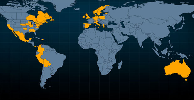
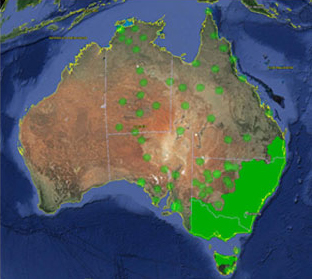
    Service in Georgia is a continuation of Trimble’s focus on providing solutions that enable customers to increase productivity by simplifying access to high-precision positioning around the world. Similar VRS Now services are operating in Illinois, Indiana, Iowa, Nebraska, Colorado, Florida, Alabama, Mississippi, Texas, Oregon, New Mexico and parts of Europe and Australia.

  • Topcon GNSS Network Expands to Latin America

    Topcon GNSS Network Expands to Latin America

    Photo: Topcon GNSS

    Topcon Positioning Group is expanding the TopNETlive GNSS reference station network into Latin America. In conjunction with hosting partners, new service will be provided in Mexico, Peru, the Dominican Republic, Bolivia, Guatemala, Colombia and Panama.

    TopNETlive is designed to deliver high-accuracy GNSS correction data to rovers for surveying, construction, GIS mapping and agricultural applications.

    Partners in the Latin America expansion include TTQ of Monterrey, Geomatic Instruments Corporation, Caribbean Positioning System, Mertind, GYFSA and GeoSystem.

    “The growth of the network into Latin America through these strong partnerships clearly demonstrates the Topcon commitment to grow TopNETlive and provide quality service to more positioning professionals globally,” said Jonathan Ball, senior manager for the Topcon network business. “Our hosting partners provide outstanding support, training and service to their customers and the addition of the TopNETlive reference stations will allow them to expand their operations by offering real-time network correction data.”

    Topcon dealers will host TopNETlive throughout the various regions, which include: TTQ of Monterrey for Mexico, Geomatic Instruments Corporation in the Peruvian market, Caribbean Positioning System in the Dominican Republic area, Mertind Ltda in Bolivia, GYFSA in Guatemala, and Columbia-based GeoSystem will host the network throughout Colombia and Panama.


  • Fugro Offers High-Accuracy Offshore Positioning Service

    Fugro has introduced its high-accuracy G2+ service, designed to benefit offshore operators around the globe who require positioning and measurement accuracy at centimeter level.

    G2+ is an enhancement of Fugro’s G2 service (based on GPS and GLONASS). The service uses highly advanced GNSS augmentation algorithms developed in house. The code and carrier-phase signals transmitted by GPS and GLONASS satellites are monitored globally by Fugro’s worldwide network of reference stations.

    These observations are processed centrally in real-time using the company’s proprietary algorithms to generate precise corrections which are used to augment the standard signals broadcast by GPS and GLONASS satellites.

    Customers receive corrections via seven high-powered communications satellites, providing at least two independent G2+ data sources. The new satellite positioning service will be particularly beneficial when seeking to measure latitude, longitude, elevation and speed with high accuracy in real-time, Fugro said.

    Applications include offshore construction, survey services, vessel monitoring and structural monitoring. The ultra-high accuracy enables the real-time correction of tidal changes — which impact the accuracy of seabed mapping — as well as the real-time monitoring of the motion of floating and fixed structures.

    The 3D accuracies of the system approach those of GNSS RTK (real-time kinematic) systems while avoiding the need for an RTK base station or local transmission link, overcoming the logistical challenges and range limitations associated with coastal RTK systems, Fugro said.

    The launch of G2+ follows the recent launch of Fugro’s G4 satellite correction service, which takes advantage of all four global navigation satellite systems: GPS, GLONASS, BeiDou and Galileo.

  • Trimble VRS Now Service Available in Australia, Oregon

    Trimble VRS Now Service Available in Australia, Oregon

    Trimble VRS Now coverage in Australia. Photo: Trimble
    Trimble VRS Now coverage in Australia. Photo: Trimble

    Trimble, together with its distribution partner Ultimate Positioning Group, announced the availability of Trimble VRS Now correction service in Queensland, New South Wales, South Australia, Tasmania and Victoria.

    Trimble is also now offering the Trimble VRS Now correction service in Oregon’s Willamette Valley.

    The commercial subscription service provides surveyors, civil engineers, geospatial professionals and other industry specialists in these areas with instant access to real-time kinematic (RTK) GNSS corrections without the need for a base station.

    Using both GPS and GLONASS constellations, the Trimble service delivers centimeter-level RTK corrections customized for each GNSS receiver’s location anywhere in the network via cellular communications. The Trimble VRS Now service supplies accurate, reliable and easy-to-use GNSS positioning for a variety of applications including surveying, urban planning, urban and rural construction, environmental monitoring, resource and territory management, disaster prevention and relief and scientific research, Trimble said.

    “The addition of VRS Now to Trimble’s current portfolio of corrections technologies and services in Australia highlights our ability to meet any accuracy, delivery, availability and financial consideration across a variety of applications and markets,” said John Sprivulis, business area director of Trimble’s Positioning Services Division in the Asia Pacific. “Trimble is effectively creating a national positioning infrastructure to meet Australia’s future needs.”

    Trimble VRS Now in Australia is a continuation of Trimble’s focus on providing solutions that enable customers to increase productivity by simplifying access to high-precision accuracy around the world. Similar VRS Now services are operating in parts of the U.S. and Europe.

    In addition, the Australian VRS Now service supports the Trimble Pivot Field Mobile App, which provides up-to-the-minute information on the VRS Now system status for users in the region.

    Because OmniSTAR CORS service in the area is being phased out, existing Australian users will be automatically transitioned to the Trimble VRS Now service, which provides easy access to high accuracy and reliable positioning within the network coverage area.

    Service in Australia and Oregon is a continuation of Trimble’s focus on providing solutions that enable customers to increase productivity by simplifying access to high-precision positioning around the world. Similar VRS Now services are operating in Illinois, Indiana, Iowa, Nebraska, Colorado, Florida, Alabama, Mississippi, Texas, and parts of Europe.