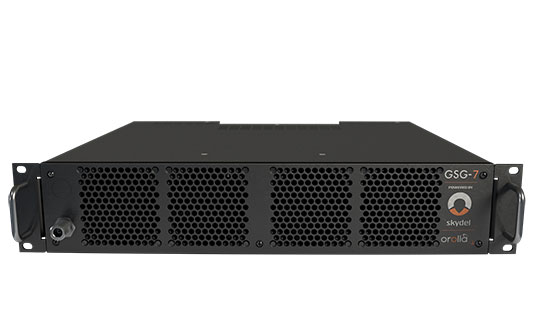
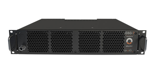
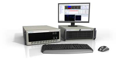
GSG-7 delivers the highest standard of GNSS signal testing in a cost-effective, easy-to-use, turnkey form factor supporting navigation and timing systems
Photo: Orolia
Orolia has released the GSG-7, its latest GNSS signal testing solution.
Orolia made the announcement at the ION GNSS+ conference, taking place this week in Denver.
Offered through the Orolia family of Skydel-based simulators, the GSG-7 features a small form factor, an internal RF combiner, high-end performance with a 1,000-Hz simulation iteration rate, real-time synchronization, hardware-in-the-loop (HIL) integration, powerful automation, and multi-constellation and multi-frequency simulations.
“The GSG-7 is redefining the essential and high capabilities in GNSS simulation with its ease of use, advanced simulation capabilities, reduced size, and competitive price,” said Lisa Perdue, simulation product line director. “Leveraging the powerful Skydel software and commercial-off-the-shelf (COTS) hardware, GSG-7 can accommodate almost any configuration to conduct system testing and simulation. The use of SDRs [software-defined receivers] means that maintenance and customization are not only easier, but more cost-effective than other options on the market.”
Powered by Orolia’s Skydel simulation engine, the GSG-7 can be programmed to simulate operations with all current GNSS signals, as well as future ones. Skydel’s architecture makes the GSG-7 future-proof by allowing new, incoming signals and updates to be implemented through software updates.
The GSG-7 simulator is suitable for development and integration projects that require high performance, all-in-view satellite signals, and an increased number of GNSS constellations.
“Capable of handling complex simulation scenarios, the GSG-7 has a simple, yet powerful application program interface (API) ensuring easy automation and integration into your test environment,” Perdue added. “Users can also benefit from advanced HIL capabilities that include zero-effective latency and built-in performance monitoring tools.”
GSG-7 Webinar
Orolia will host a product webinar on Oct. 6 to discuss the new GSG-7 in great detail. Topics will include:
IFEN GmbH has released a new version of its NCS Nova RF signal simulator, offering a full package of advanced simulation capabilities.
With its now-integrated interference generation capability (AWGN, CW, pulsed and chirp), NCS Nova version 2.8 can generate coherent interference signals with a signal power of up to –30 dBm.
The ability to assign two users to one RF output enables integrated spoofing scenarios with a single RF output (one user is the original simulated user; the other is the target spoofing user). Thus, spoofing is available even with an entry-level single RF Nova.
The key feature of this new release is the new navigation message authentication (NMA) simulation capability, compliant to User ICD 1.0 for the Galileo E1-B OSNMA. Beyond basic authentication-testing capability, specific OSNMA events can be simulated. Testing OSNMA-enabled receivers under these specific events is key to ensuring compliant receiver behavior. The supported events include both a public key renewal and revocation and TESLA keychain renewal and revocation. Also, GPS cross-authentication is fully supported.
Finally, the new release fully supports generation of Galileo E6-C encrypted codes. This enables users to take full advantage of the Galileo third-frequency pilot signal.
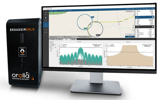
The Solo joins the BroadSim line of Skydel-powered GNSS simulators, which includes models suited for hardware-in-the-loop and multi-element antenna/controlled reception pattern antenna (CRPA) testing.
Live demonstrations of BroadSim Solo are taking place in the JNC Exhibit Hall at Orolia Defense & Security booth No. 117 through Aug. 26. Orolia provides M-code solutions for resilient positioning, navigation and timing.
BroadSim Solo shares the same Skydel simulation engine that runs on a standard BroadSim, BroadSim Anechoic and BroadSim Wavefront. It supports advanced scenario creation features and the benefits provided by a software-defined architecture such as high dynamics, a 1000-Hz iteration update rate and ultra-low latency of 5 ms.
Photo: Orolia
Nearly all civilian GNSS signals can be generated through the Solo’s single RF output (one frequency band at a time), along with jamming or spoofing signals, and GPS AES M-code. AES is an encryption method; rather than using the MNSA encryption, it is possible to use AES for testing purposes only.
BroadSim Solo’s compact form factor is designed to do away with bulk, fitting comfortably at a typical desk or workstation. Plus, the Solo addresses the permanent challenge engineers face with laboratory capacity and availability.
“Creating complex test scenarios can be a tedious process, especially when emulating challenged environments,” said Tim Erbes, director of engineering for Orolia Defense & Security. “Having the ability to create scripts at your desk significantly frees up lab time and space for running these important simulations. Also, scenario creation is no longer limited to one person fixed to one system. Imagine a team of engineers, each with a BroadSim Solo, simultaneously building tests. Having a whole fleet of BroadSim Solos? It’s game-changing.”
BroadSim Solo with the Skydel simulation engine offers an intuitive user interface, a comprehensive API supporting Python, C++ and C#, and automation tools and custom plugins that will speed up development cycles, increase performance and ultimately drive innovation.
“In an effort to enhance the customer experience and expand the reach of advanced GNSS simulators, we wanted to offer an affordable solution with all of the same core features as our most advanced BroadSim systems,” said Tyler Hohman, director of products for Orolia Defense & Security. “This gives our customers the opportunity to place more simulators in the hands of engineers and scientists without sacrificing capabilities. Our hope is that customers will find value in having a simulation ecosystem that is scalable based on their requirements.”
Latest advancement from Skydel uses software-defined advantages to deliver real-time performance
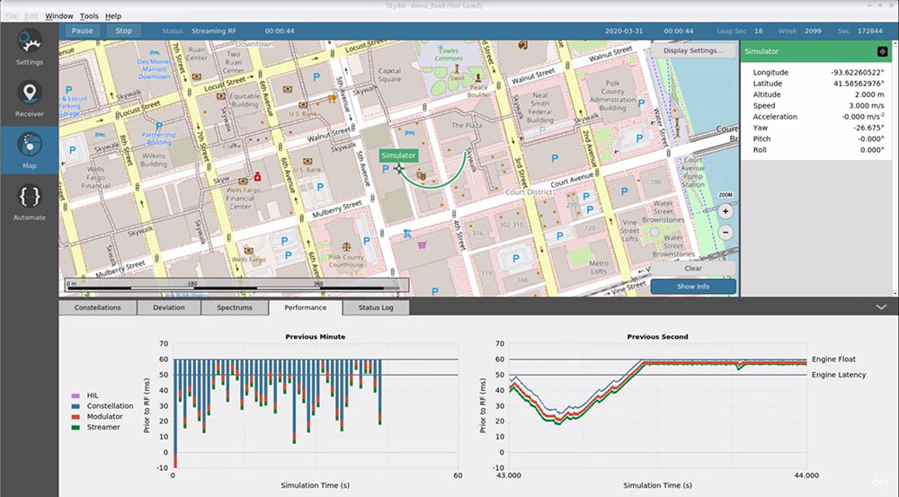
The Skydel Real-Time Performance graphs illustrate the software-defined engine’s low latency during a GNSS simulation. (Screenshot: Orolia)
Orolia has announced the launch of its Real-Time Performance capability, which achieves an ultra-low latency of five milliseconds. The feature will be standard on all Skydel-powered GNSS simulators.
Skydel is a software-defined simulation engine that powers Orolia’s advanced GNSS simulators including its BroadSim (available via Orolia Defense & Security) and GSG product lines.
“Skydel is known by users for its intuitive nature and ability to be quickly redeployed for a variety of projects,” said Tim Erbes, director of engineering for Orolia Defense & Security. “Delivering Real-Time Performance with latency as low as five milliseconds further shows that Orolia is a market leader empowering our customers by exceeding their expectations.”
Skydel’s software-defined architecture is designed to meet the demanding GNSS simulation testing requirements in the automotive, military, space and other high-tech industries. Skydel also supports hardware-in-the-loop simulations without sacrificing ultra-low latency and high-end performance.
The user interface has a sophisticated dashboard showing Real-Time Performance graphs. The tool enables users to grade the simulator’s performance, interpret data, diagnose inefficiencies, and optimize scenarios on the fly. In a video tutorial, Orolia demonstrates how the simulation engine processes data and how easy it is to read the graphs through its visualization and precise indications. As the system reaches its limits, it remains stable and fully operational, preserving the integrity of the simulation.
Erbes said the Real-Time Performance graphs not only instill confidence in the simulator, but also allow for better integration in the testbed.
“For example, instead of just hoping their hardware-in-the-loop configuration is working, users can view the real-time data and see that low latency is being maintained,” he said. “This feature provides enhanced visibility not only into the performance of the simulation, but also into the reliability of the hardware-in-the-loop integration, resulting in a more robust solution. This is critical when generating complex environments with high dynamics, jamming, spoofing, repeating, and alternative PNT sensors.”
The European Commission and the European Space Agency (ESA) have selected Orolia to provide the core GNSS simulation engine for the Galileo Second Generation (G2G) RF Constellation Simulator (G2G RFCS).
While the first launched Galileo satellites are reaching the end of their theoretical operational life, the G2G initiative includes the preparation of a future generation of Galileo global infrastructure, from satellites to ground segments, to maintain current services as well as provide improved performance and Required Navigation Performance (RNP) features to all users.
In this context, Orolia has been selected to participate in the G2G RFCS activity, which will support G2G signals evolution requirements.
The primary objective of the G2G RFCS initiative is to design, develop, manufacture and test an enhanced radio-frequency constellation simulator dedicated to Galileo engineering and experiments. This simulation technology will enable scientists and industries to verify, demonstrate and validate the future G2G configuration.
To meet these requirements, Orolia will provide the core GNSS simulation engine based on its Skydel software technology, within a custom hardware configuration, to simulate all Galileo signals including Open Service (OS) and Public Regulated Service (PRS). Orolia’s GNSS simulators offer the high-end performance level and flexibility required to configure this new testing infrastructure in a software-defined solution.
“With this project, Orolia demonstrates the Skydel platform’s exceptional flexibility to meet critical application requirements and serve as the core engine to design the next generation of GNSS signals,” said Orolia CEO Jean-Yves Courtois. “We are very proud to work with ESA, GMV and Tecnobit to help develop the next generation European Galileo constellation.”
Racelogic, the company behind LabSat, has been named as one of the “10 Ones to Watch” in the 22nd annual The Sunday Times BDO Profit Track 100, which ranks Britain’s top private companies.
The Profit Track 10 Ones to Watch list represents a cross-section of companies that have achieved or predict good profit growth. In addition to profit performance, inclusion is also based on factors such as resilience in the face of the pandemic and strength of the business model.
Graham Mackie, CEO of Racelogic, was delighted to see the hard work of his team recognized by industry experts. “In a challenging year, we are proud of our performance and the way in which every member of the team at RACELOGIC has adapted to new ways of working and serving our customers,” he said.
The Buckingham-based business sells to more than 100 countries and generated 88% of its sales overseas last year. “We have great products that service a global market that provided some resilience to the impact of the pandemic,” Mackie said. “We are continuing to develop cutting-edge technology, which is enabling us to diversify into new sectors including the film and gaming industries.”
The sales growth and addition of new products has resulted in Racelogic expanding its workforce at a time when many are having to reduce staff numbers, Mackie said. “We are currently recruiting for a range of engineering and administrative positions, all of which can be found on our website. It is an exciting time to join Racelogic, and perhaps even more so now that we are officially ‘one to watch’.”
The 10 Profit Track Ones to Watch finalists will be judged by Stuart Lisle, senior tax partner at BDO, and Hamish Stevenson, founder of Fast Track. The winner will be announced at the Profit Track 100 virtual awards event in June.
Among the enhancements, a doubling of the update rate means the GSS9000 series now offers the ability to recreate operations more precisely and realistically, reducing uncertainty in positioning, navigation and timing (PNT) testing.
The latest developments provide the GSS9000 series with the ability to run simulations at a software and hardware update rate of up to 2 kHz, improving accuracy of the simulated trajectory without compromising performance. This is of particular benefit to high-dynamics applications, such as space missions and hypersonic vehicles. The increased update rate also delivers lower latency for hardware-in-the-loop (HIL) testing, further reinforcing the GSS9000’s position as the industry’s most accurate and realistic test instrument.
“Our dedicated hardware and powerful software solutions are built specifically with PNT test in mind — to improve accuracy, increase flexibility and provide high-performing systems to meet customer needs,” said Adam Price, Spirent director of PNT simulation. “These latest enhancements to the GSS9000 continue to raise the bar for highly flexible and scalable solutions that enable our customers to stay ahead of their competition.”
Other enhancements to the GSS9000 Series include:
Extended Scenario Duration. In a simulation environment, where control and repeatability are key for a realistic representation of the mission, reducing the number of user inputs is essential. The new update will extend the available scenario duration to 65 days, using the same initial conditions for the simulation throughout the duration of testing to deliver uninterrupted high-performance simulation for longer.
Enhanced Embedded Interference Capabilities. To provide greater power and flexibility in interference testing, Spirent has improved support for interference testing on wide spectrum signals, increased bandwidth resolution and repetition rates, and added variable bandwidth control on additive white Gaussian noise (AWGN).
“Spirent’s leadership in GNSS testing comes from the combination of our unrivalled heritage and deep understanding of the PNT market, alongside our continuing commitment to improving test capabilities for customers,” said Ricardo Verdeguer Moreno, product line manager for high-end applications. “By working closely with customers, we are able to better understand the challenges they face, and these latest enhancements to the GSS9000 series demonstrate how we are continuing to help customers reduce uncertainty by providing more accurate operations, without impacting system performance.”
The enhancements to the Spirent GSS9000 series will be available to new and existing customers at the beginning of the second quarter of this year. For more information, visit the GSS9000 Series product page. U.S. government and prime contractors should contact Spirent Federal for details.
New Galileo OS SIS ICD V2.0 is now fully supported by IFEN’s NCS Nova GNSS simulator
Photo: IFEN
IFEN GmbH, a manufacturer of GNSS navigation test products and services, announced that its NCS Nova GNSS simulator now fully supports the simulation of Galileo Open Service (OS) signal improvements based on the new Galileo OS SIS ICD V2.0.
The NCS Nova GNSS simulator is a high-end, powerful and easy-to-use satellite navigation testing and R&D device. It is fully capable of multi-constellation and multi-frequency simulations for a wide range of GNSS applications. It provides multiple GNSS frequencies in one box.
A key enhancement to the NCS Nova GNSS simulator is comprehensive support of new Galileo OS signal message improvements on E1B. By enabling real-time simulation of the Galileo OS message improvements, the NCS Nova GNSS Simulator expands the user’s Galileo signal capability.
The NCS Nova GNSS simulator will, in future, also fully support the new Galileo E1B OS-Navigation Message Authentication (OS-NMA) and Galileo E6B High Accuracy Service (HAS) capabilities.
The GNSS simulator enhancements were developed through ESA’s Navigation Innovation and Support Programme (NAIVSP) Element 2, within the project STX2G.
“Through a simple software update, NCS Nova GNSS Simulator customers can automatically generate the new Galileo signal capabilities,” said Günter Heinrichs, head of Client Solutions at IFEN. “Adding Galileo OS signal improvement support to our NCS Nova GNSS simulator comes at the perfect time given the recent release of the Galileo OS SIS ICD V2.0 specification.”
Photo: Philipp Berezhnoy/iStock / Getty Images Plus/Getty Images
According to a new research report, “GNSS Simulators Market by Component Type (Single Channel and Multichannel), GNSS Receiver (GPS, Galileo, GLONASS and BeiDou), Application (Vehicle Assistance Systems, Location-based Services and Mapping), Vertical, and Region — Global Forecast to 2025,” the market is estimated to grow from $106 million in 2020 to $165 million by 2025, at a compound annual growth rate (CAGR) of 9.3% during the forecast period.
Factors such as rapid penetration of consumer internet of things, the contribution of 5G in enabling ubiquitous connectivity and increasing use of wearable devices utilizing location information are expected to drive the adoption of the GNSS simulators hardware, software and services, the MarketsandMarkets report said.
Market segments
The report stressed several key points in regard to the hardware segment, automotive vertical segment and GPS segment.
The GNSS simulators market, by component, is segmented into hardware, software and services. Of these three, the hardware segment is expected to account for a larger market size in the coming years in the GNSS simulators market as it enables signal simulations and plays a key role in the simulation process.
The GNSS simulators market, by vertical, is segmented into military and defense, automotive, consumer electronics, aerospace, marine and other verticals (agriculture, construction, and rail and road). According to the report, the automotive vertical segment is expected to hold a higher CAGR during the forecast period in the GNSS simulators market.
“GNSS offers a cost-effective and accurate way of determining position in real-time,” the report said. “Ride-sharing apps, such as Uber and Lyft, car-sharing, usage-based insurance apps, dynamic toll charging and parking apps all depend on the real-time location of the car. GNSS offers sufficient accuracy for all these apps by providing location coordinates leading to its adoption in the automotive vertical.”
Next, GNSS receivers are segmented into GPS, GLONASS, Galileo, BeiDou and others, with the others comprised of NavIC and QZSS receivers. The satellite tracking service provided by GPS is useful in various commercial and personal applications. The increasing commercial application of GPS vehicle tracking system for taxi companies and cab services is contributing to the rising adoption of GPS location services. It makes the navigation easier by providing relevant details, such as distance and shortest route to the desired location, the report said.
Market size and location
North America is expected to have the largest market size during the forecast period, with the key factor favoring the growth of the GNSS simulators market in North America being the increase in technological advancements coupled with the rise in government support for the adoption of UAVs. The increasing number of players across different regions is also further expected to drive the GNSS simulators market globally, the report said.
In addition, Asia-Pacific is projected to grow at the highest CAGR during the forecast period, as it has witnessed considerable developments and adoption of solutions across the region. According to the report, Asia-Pacific has a large potential for GNSS and space-enabled applications, and it has a wide consumer base due to its booming economies accompanied by an increasing share of local R&D and technology innovations.
Major players
Major vendors in the global GNSS simulators market include Spirent Communications, Rohde & Schwarz, VIAVI Solutions, Hexagon, Keysight Technologies, u-blox, Orolia, Cast Navigation, Accord Software and System, IFEN, Racelogic, Syntony GNSS, Teleorbit, iP-Solutions, Pendulum Instruments, Saluki Technology, Shanghai Huace Navigation Technology, Averna, GMV NSL, Brandywine Communications, Jackson Labs Technologies, Hunan Shuangln Electronic Technology, Work Microwave, Qascom and M3 Systems.
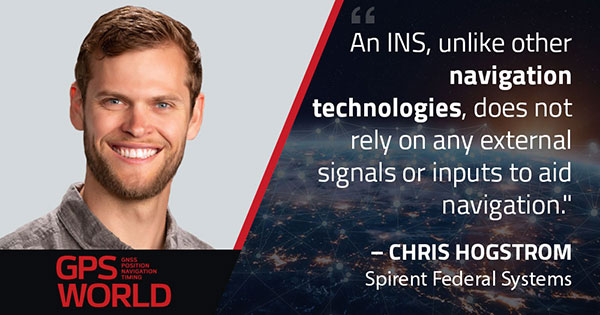
Image: metamorworks/iStock/Getty Images Plus/Getty ImagesChris Hogstrom, Spirent Federal Systems
Inertial navigation systems (INS), like most navigation systems, have evolved through countless iterations and improvements over many years. An INS, unlike other navigation technologies, does not rely on any external signals or inputs to aid navigation. It is, therefore, extremely difficult to spoof, jam or disrupt the system, and solar flares, ground/sky visibility and climate do not affect its ability to aid in navigation — unlike GNSS.
An INS knows where it is going because it knows where it has been. Modern INS use a minimum of three orthogonal accelerometers to measure accelerations in the x, y, z planes and a minimum of three orthogonal gyroscopes to measure the angular accelerations about the x, y, z planes. When the INS is initializing, its current location is fed into the system. After initialization, the INS utilizes the sensor outputs to determine its position relative to its starting point.
The INS made its debut during World War II, where it was used to guide German V2 missiles. At the time, the INS was still rather primitive, using two two-degrees-of-freedom gyroscopes and one integrating accelerometer. It wasn’t until the war’s end that Wernher von Braun and his team developed a stable platform with three single-degree-of-freedom gyroscopes and an integrating accelerometer.
World War II Innovation
Once the war was over, the United States Army acquired many of the lead scientists from the German V2 project and furthered research into INS. The Air Force also had an interest in INS and contracted Northrop Aircraft (now Northrop Grumman) to develop the guidance system aboard the SNARK cruise missile. However, the work under Charles Draper at MIT’s Instrumentation Laboratory spearheaded INS for use in aircraft. Draper was an amateur pilot and quickly saw the benefits that a self-contained system provided over the navigation systems of the day. The developments made by the Instrumentation Laboratory led to the success of the inertial-guided transcontinental flight in 1953.
By the late 1960s, military bombers and aircraft used INS, and by the early 1970s, it was commonplace in commercial aircraft, too. Today, INS technology can be found in aircraft, spacecraft, ships and submarines, as well as smartphones, watches and other wearable tech. It has quickly become an essential enabling technology for autonomous vehicles, and future applications are being studied.
The biggest weakness of INS is that they drift over time. This means that the longer an INS functions, the less accurate it becomes. For this reason, many INS are part of a sensor-fusion system. Incorporating data from many different sensors — such as GPS, a barometer, a compass and INS — a sensor-fusion system combines data through a Kalman filter to determine a more reliable and accurate positioning and navigation solution.
Best of Both Worlds
By combining INS with GPS, you get the benefit of both systems while minimizing their weaknesses. GPS and other GNSS have quickly become the gold standard for accurate positioning, as well as being the only global source of absolute position. Receivers tracking four or more satellites can provide their precise location anywhere on Earth.
However, GPS has significant and well-documented weaknesses. These stem, primarily, from the fact that GPS signals are extremely weak by the time they reach terrestrial users. This means that GPS signals, intentionally or otherwise, are easy to jam, and the broadcast nature of the signals means they are open to a variety of spoofing attacks. Fusion systems using an INS and GPS receiver can rely on GPS when the GPS signal is unobstructed, and switch to the INS solution when GPS is unreliable.
In a world where aircraft are now able to fly themselves and cars are quickly achieving autonomy, our dependence on these sensors is ever-increasing. Autonomous solutions with a navigation sensor suite of multiple sensor types are becoming common. Sensor suites can include other vehicle sensors that aid absolute positioning by sensing parameters such as steering angles, wheel rotations, etc. They are also beginning to incorporate non-GNSS-based RF signals to aid in navigation. Multiple sensors offer increased redundancy, helping achieve the required safety levels and the desired performance boundaries.
High-Mileage Testing
Testing and optimizing these sensor-fusion systems presents a serious challenge, especially in the transportation sector. Testing on a live platform can be hugely expensive and lacks any chance of repeatability. For these reasons, simulation is critical. In addition, representative models must take into account the impact of the environment and the dynamics of the vehicle frame (where sensors are installed) to achieve the requisite realism.
My company, Spirent Federal, has spent the past 20 years building sophisticated and robust test solutions so that sensor-fusion systems can be fully tested and characterized. Thorough testing increases performance and reliability in safety- and mission-critical applications.
Specifically, our GSS7000 and GSS9000 GNSS simulators deliver the precision and fidelity needed for high-performance applications, while our inertial emulation platforms incorporate the key industry models of both inertial measurement units (IMUs) and embedded GPS/inertial (EGIs) for dynamic integrated testing in the lab.
We work closely with major defense contractors, such as Northrop Grumman and Honeywell, to provide robust test solutions as well as alternative RF PNT simulation capabilities.
In addition, hardware-in-the-loop incorporation with ultra-low latency, modeling signal propagation in a 3D environment — and the ability to “shift left” with software-only testing — are what helps to make Spirent Federal the trusted partner in sensor fusion development.
Chris Hogstrom is an engineer with Spirent Federal Systems.
Flight simulators range in price from free to tens of millions of dollars and in purpose from pure entertainment to serious business — such as learning to fly multi-million-dollar aircraft without crashing them in real life and getting anyone killed. Military and commercial pilots spend thousands of hours in simulators learning both routine operations and how to deal with emergency situations. They can become fully proficient through immersive training in these virtual environments. The U.S. Army, Air Force, Navy and Marines all use flight simulators to train pilots to fly in battle, recover in an emergency, and coordinate air support with ground operations. To do this, they use hardware and software developed both by military agencies and by commercial military contractors.
In high-end flight simulators, the trainee steps into a life-size replica of a cockpit, whereas others consist of several monitors that cover the trainee’s field of view, or, at the lowest end, everything is crammed onto a single monitor. All flight simulators, however, are designed to replicate as closely as possible the layout and controls of a real aircraft. (Ironically, the $120 Microsoft Flight Simulator Premium Deluxe Edition lets you fly 35 different planes, while flight simulators that cost tens of millions of dollars are limited to a few models because they have to physically replicate the cockpit layout, which varies from aircraft to aircraft. Some training centers invest in multiple simulators, while others privilege convenience over accuracy and use a single simulator model.)
Most professional flight simulators sit on top of either an electronically-controlled motion base or a hydraulic lift system that rotates the replica cockpit in three dimensions in reaction to both user input and simulated events. This provides trainees with haptic feedback, in other words, feedback they can feel. (Another example of a device that provides haptic feedback is a joystick with force feedback.)
Like when learning to sail offshore or to survive in the wilderness, a large component of any pilot training program is navigation. For flight simulators, this involves detailed aeronautical charts, huge amounts of Earth observation imagery including thousands of airports, and faithful replicas of several cockpit navigation instruments. While aviation programs provide standard training to ensure pilots can handle situations ranging from enemy fighters to bird strikes to engine failure, they may overlook the importance of duplicating actual cockpit instruments rather than relying on facsimile ones.
Simulating GNSS signals
This is where GNSS simulators come into play. They make it possible “to simulate the actual GPS signal required by the cockpit navigation instruments,” according to a case study by Orolia.
This approach, the company points out, offers advantages to both the trainees who use flight simulators and the engineers who develop them. For a trainee, “the advantage is that he is trained using the identical instruments as those in the actual airplane […] providing the same feedback as a real-world experience.” For an engineer developing a flight simulator, GNSS simulators make it possible to “design more effective flight simulation programs without compromising quality.”
Furthermore, “using real navigation instruments may […] reveal unexpected behavior from the instrument, which helps the pilot to be prepared for this possibility. If any conditions involving the plane dynamics are not properly handled by the navigation unit, the pilot can obtain actual feedback from real navigation instruments, which could differ from feedback provided by a facsimile instrument.”
Hardware-in-the-loop (HWIL) techniques enable Orolia to integrate its simulator in a flight simulator to reproduce the GPS/GNSS dynamics for the airplane in real time. “Because the pilot steers the aircraft in real time, the GPS simulator must also simulate GPS signals in real time, forming an HWIL integration,” the company said. “This integration enables the flight simulator to integrate the actual navigation unit to provide a very realistic environment for the trainee.”
Racelogic, another manufacturer of GNSS simulators, is launching a new RealTime LabSat that can connect to Microsoft Flight Simulator, including the new 2020 version. “This will create a live GNSS RF feed that accurately follows the trajectory in the simulator, enabling the testing of any GNSS device as though it were being flown on the aircraft,” said Julian Thomas, the company’s managing director. “To help make this a cost-effective solution, we have recently optimized our SatGen signal simulation software so that a real-time simulation such as this can be carried out on an entry-level PC with a full constellation of simulated satellites.”
The GNSS and flight simulation industries overlap even further. For example, Garmin, which manufactures consumer GPS receivers, makes the avionics used in some professional flight simulators.
Simulator demand on the rise
The utility of simulators is not limited to training human pilots and drivers. The demand for simulation is being sharply increased by the development of autonomous vehicles of every kind — from self-driving cars to unmanned aerial vehicles (UAV), from bathymetric vessels to urban air mobility (UAM) aircraft.
For example, manufacturers of self-driving cars need to simulate driving millions of miles, in all kinds of traffic and weather conditions, to perfect their vehicles’ algorithms. The result of all these simulations is better trained human and robotic pilots and drivers prepared for real situations, superior mission readiness, and maximum safety for both military and civilian operations on land, at sea and in the air.
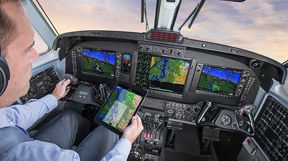
Feature image: In a simulated G1000 NXi integrated flight deck for a King Air 350, a pilot refers to the Garmin Pilot app, used as a supplement during flight. (Photo: Garmin)
Orolia Defense & Security has been granted security approval by SMC Production Corps. for BroadSim MNSA (modernized Navstar security algorithm).
The company delivered its first batch of MNSA M-Code to multiple customers in late August. BroadSim MNSA joins P(Y)-Code and AES M-Code as another GPS encrypted signal that Orolia Defense & Security supports, the company said.
Thought, skill, and patience went into developing this solution,” said Tyler Hohman, director of products at Orolia. “Not only have we taken an innovative approach to ensuring the security of this technology, our implementation was designed with ease of use being top-of-mind — from procurement, to delivery, to installation, to testing — so our customers can spend more time supporting their mission and less time making their simulator work.”
According to Orolia, BroadSim is a proven and trusted solution among government, Department of Defense and military customers with more than 100 systems fielded. BroadSim was recently selected by the U.S. military to support diverse testing of military GPS receivers, the company added.
BroadSim MNSA users receive a step-by-step guide allowing them to effortlessly set-up and generate MNSA in minutes and quickly downgrade the system on a moment’s notice, Orolia said.
The capability is currently available as a software upgrade to current BroadSim users or as a purchase alongside Orolia’s BroadSim hardware platform.
Orolia Defense & Security, which operates as a proxy-regulated company and wholly-owned subsidiary of Orolia, provides resilient PNT solutions to U.S. government agencies, defense organizations and their contractors.