GPS III Space Vehicle 02 (GPS III SV02) is complete, tested and expected to launch in 2019.
As the first Lockheed Martin-built GPS III satellite prepares to ship to the launchpad, the U.S. Air Force has declared that the second GPS III satellite is complete, fully tested and ready to launch.
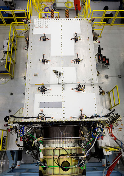
In May 2017, the U.S. Air Force’s second GPS III satellite was fully assembled and entered into Space Vehicle (SV) single line flow when Lockheed Martin technicians successfully integrated its system module, propulsion core and antenna deck. (Photo: Lockheed Martin)
The Air Force’s “Available for Launch” declaration is the final acceptance of Lockheed Martin’s second GPS III Space Vehicle (GPS III SV02), declaring it technically sound and ready to launch.
GPS III SV02 will bring new capabilities to U.S. and allied military forces, and a new civil signal that will improve future connectivity worldwide for commercial and civilian users.
GPS III SV02 now awaits official call up for launch in Lockheed Martin’s GPS III Processing Facility clean room in Denver. In June, the Air Force officially called up its first GPS III satellite for launch.
“The first GPS III satellite, GPS III SV01, was declared ‘Available for Launch’ in September 2017,” said Johnathon Caldwell, Lockheed Martin’s program manager for Navigation Systems. “It is now being prepared for shipment to Cape Canaveral, Florida, for a launch before the end of the year. With two GPS III satellites now ready for launch, and the third GPS III expected to be ready by early next year, we’re building strong momentum. These satellites will soon begin modernizing the current GPS constellation with new capabilities and more advanced technology.”
On July 13, 2017, the U.S. Air Force’s second GPS III space vehicle (GPS III SV 02) successfully completed acoustic testing. (Photo: Lockheed Martin)
GPS III will be the most powerful GPS satellite ever on orbit. It will have three times better accuracy and up to eight times improved anti-jamming capabilities.
GPS III’s new L1C civil signal also will make it the first GPS satellite to be interoperable with other international global navigation satellite systems.
Lockheed Martin is now in full production on 10 GPS III satellites at its GPS III Processing Facility near Denver.
In June, GPS III SV03 completed thermal vacuum testing, strenuous environmental trials simulating operations in the harshest space environments. In May, the antenna deck was added to GPS III SV04, fully integrating it into a complete satellite ready to begin environmental testing.
Right behind GPS III SV04 on the production line, the fifth, sixth and seventh GPS III satellites are in component build-up. The fifth satellite has its navigation payload and is expected to be fully assembled later this summer. To date, more than 90 percent of parts and materials for all 10 satellites under contract have been received.
In April, the company submitted a proposal to the government to build up to 22 additional GPS III Follow On (GPS IIIF) satellites which would bring even further enhanced capabilities to the GPS constellation’s more than four billion users.
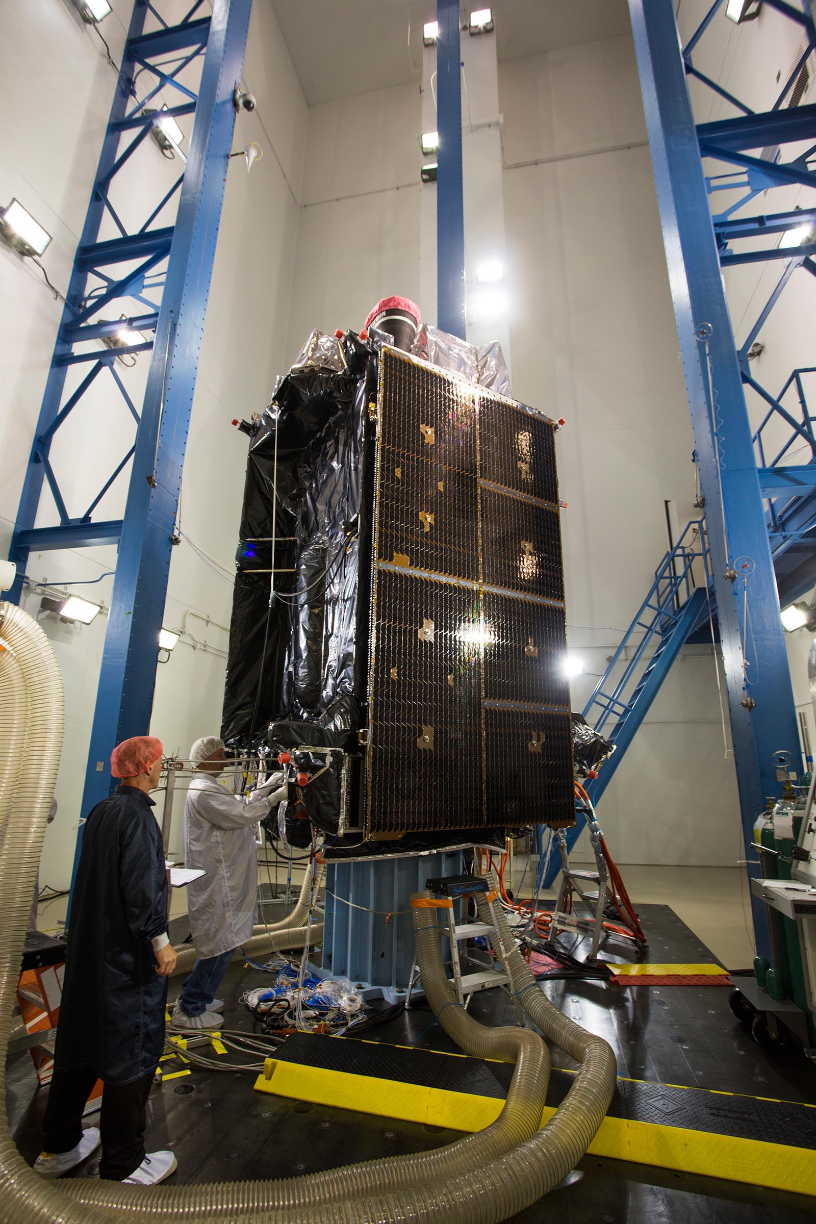
In July 2017, Lockheed Martin tested the deployment of the solar arrays for the U.S. Air Force’s second GPS III space vehicle (GPS III SV02). (Photo: Lockheed Martin)
The decision means Lockheed Martin is all but assured the contract. Lockheed Martin announced on April 17 that it had submitted its proposal.
All three companies received study contracts in 2016 valued at up to $6 million each to demonstrate their ability to build future GPS satellites, in preparation for the planned competition.
This month, we bring you a guest column on the 34th Space Symposium in Colorado Springs, Colorado. Robin Wrinn, a communications professional based in Atlanta, gives her perspective on the premier annual space event, held in April. Among her findings: information on the mission longevity vs. technology innovation debate, GPS IIIF program bids, discussions of time and space, and more.
— Alan Cameron, editor
During recent interviews with Lockheed Martin and Harris Corporation conducted during the 34th Space Symposium (April 16-19) in Colorado Springs, time and space were a frequent focus of discussion, but not in the normal “continuum” kind of way.
Greater mission longevity is one of the key improvements GPS III delivers over those currently in service. Space Vehicles 1-10 have a planned mission life of about 15 years – 25 percent longer than their satellite predecessors. Yet that bragging right begs the question “How long should a satellite ‘live’ up in space with technology innovation occurring almost annually?” After all the last Block IIR-M series satellite was launched in 2009. To put that into perspective, that same year the Canadian company Blackberry (RIM) held 20 percent of the smartphone OS market share and was the second largest OS in the world. Apple had just introduced the iPhone two years earlier.
A partial answer to that question it seems is advanced payload technology. Both Lockheed Martin and Harris Corporation highlighted their advances in payload capabilities that would enable built-in flexibility to adapt satellites in orbit to advances in technology, as well as changes in missions. Lockheed Martin provided the media a tour of their RF (Radio Frequency) Payload Center of Excellence (Payload Center). Meanwhile, Harris Corporation recently announced that is has completed development of the company’s fully digital Mission Data Unit (MDU), which is core to the navigation payload for GPS III 11 +.)
As a reminder, the current Harris payload for SVs 1-10 includes:
Greater than three times reduction in range error,
Up to eight times increase in anti-jamming power,
Added signals – including one (L1C civil signal) compatible with other Global Navigation Satellite Systems (GNSS), like the European Space Agency’s Galileo.
And greater signal integrity.
According to Harris, the new, fully digital navigation payload it has engineered will deliver more powerful signals, PLUS the ability to change and upgrade the satellites incrementally over the mission life.
Meanwhile, Lockheed recently announced a partnership with NEC to introduce artificial intelligence for computer learning in orbit. And the company’s Payload Center subject matter experts touted their significant advances in processers and a move toward the next generation of antennas, arrays and transmitters that would drive more flexibility and capability and resilience into satellites.
Observation: It seems the market pressures of ‘new space’ players is prompting delivery of products that can drive more value for less cost. In this case, delivery of a common payload architecture and electronically steered beams to make satellite antennas become any shape you want. Most likely, beams of a different size on demand is a much better business case than a static one built five years ago.
GPS III 1-10 on track. in full production. GPSIII SV1 awaiting U.S. Air Force “Call Up” for Launch
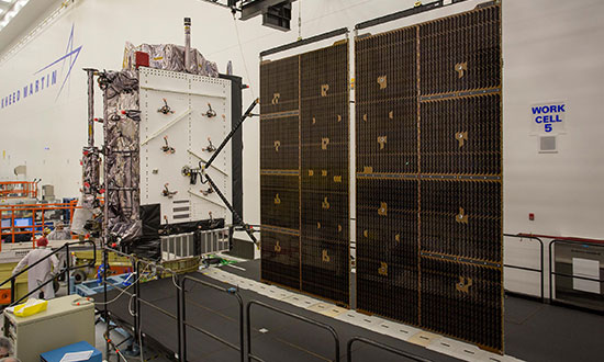
Lockheed Martin’s GPS III SV03 became fully integrated in August 2017. Photo: Lockheed Martin
The day I interviewed Lockheed Martin’s Navigation Systems mission area Program Manager Johnathon Caldwell, the company had submitted its proposal for the U.S. Air Force’s GPS III Follow On (GPS IIIF) program. That same day, April 16, the media was given a tour of Lockheed Martin’s GPS III satellite assembly floor. It was clear from both Lockheed’s press materials and Caldwell that Lockheed Martin believes it is fully recovered from prior production hiccups and is
• “on track” to deliver GPS Space Vehicles (SVs) 1 through 10, and
• deserves to win the bid for GPS IIIF. Now that Boeing has dropped out of the running, it seems they probably have it. (The government has said it will announce the award in March 2019.)
Here is the GPS III SVs 1-10 Update:
SV 01. Declared “Available for Launch” (AFL) by the Air Force on Sept. 28, 2017. Awaiting “Call Up” for launch. A formal date has not been set. “Sometime this year” was the answer Lockheed Martin provided when asked a timeframe.
SV 02. Completed Thermal Vacuum (TVAC) testing, Dec. 2017. Currently in final environmental EMI (electromagnetic)/EMC (electromagnetic compatibility)/PIM (passive intermodulation) testing. AFL expected Summer 2018.
SV 03. Fully integrated, Fall 2017. Currently in TVAC testing, AFL expected. Spring 2019
Interview with Harris Corporation’s Jason Hendrix, PNT Program Director.
GPS World readers are familiar with the differences in the GPS III signals as compared to those transmitted by satellites to date. What are the differences in the GPS III satellite payloads that were instituted to enable those new signals?
The main difference is the power. The Air Force’s requirements called for significantly more anti-jamming capability. All the transmitters are a higher power.
What was the most significant obstacle (or top obstacles, plural) in designing and manufacturing this new payload, to new Air Force specifications? How did you overcome it/them?
Same answer really, the higher power. Keeping in mind, we went from a 7-year mission life requirement to a 15 year. That higher power puts more strain on components and new cyber requirements in software. When you couple all that together we are not just upgrading payload technology. It is really engineering a new set of payload requirements. It’s new generation, advanced.
What are the advantages of a digital payload over the alternative? When you say “Our current GPS payload is 70 percent digital” does that refer to the IIR payload? The offered “fully digital navigation payload with enhanced performance” — is that the GPS III payload? What’s the new 30 percent that has gone digital?
The advantages and the 30 percent difference are the timekeeping system portion. We’re moving from a manual, analog timing to digital to deliver to the Air Force more flexibility. It’s a nice option to have to be able to reprogram in orbit and maybe enhance capabilities desired in the future.
Can you provide any perspectives on how Harris is performing now in delivering payloads for SVs 1-10?
We’re now ahead of schedule. We delivered the 5th payload three weeks early (early March 2018). We are on time for 4 and three more are due this year.
Interview with Lockheed Martin’s Navigation Systems Mission Area Program Manager Johnathon Caldwell
Can you provide some general updates on assembly of GPS 1-10?
Photo: LMCO
Vehicle SV01: It is ready and we’re very excited about that. We defer to the Air Force on questions about launch date. But once they call it up we will install the solar panels and take it to a C-17. Then load it in the back of the plane and fly it down to Florida. We will then take it over to the vehicle processing facility and mate it up with the launch vehicle provider. The GNST – the satellite prototype -has gone to the Cape twice already. So, we have conducted a dry run for shipping SV 01.
Vehicle SV02: It has completed thermal vacuum testing – a major milestone. We’re in the last of the environmental tests. And we’re tracking to have that vehicle declared AFL this summer.
Vehicle SV03. It is fully integrated and is in the T-Vac chamber now. The door is closed and it’s going through tests. (Pump down to vacuum is achieved in approximately three hours and the total testing time is 70 days.)
Vehicle SV04: It is fully integrated on the floor. It is in its baseline electrical tests and will be in environmental tests as soon as 3 comes out of the chambers. It is staged to go in right after – 3.
Vehicle SV05: It is about to go through its integration to the propulsion core. And five has its navigation payload. Integrating it this summer.
Any changes in your production approach having completed SV01 that you are fixing in your production approach to SV02, 03 or 04?
No, the performance on Vehicle 01 was as designed there were no technical or design changes necessitated throughout the rest of the fleet. So, it was a very successful from that perspective – from the standpoint of validating the design and wringing it out, Vehicle 01 served its purpose well.
It had a very good T-Vac. I would say overall when you look at the industry, Vehicles 01 – 02, our vacuum test campaigns are the most rigorous test. Both went through their tests quite well. Some of the best I’ve seen.
We consider thermal vacuum the gold standard for testing any satellite before it goes into operations. It really is putting the craft through the paces. When it goes through the testing, the satellite is on. It is working. It is exposing it to the heat and the cold and the zero pressure while the satellite is functional. The entire thermal vac testing from start to end is a little over 70 days. “Test like you fly.” From the time it launches and deployment sequence we test it like it is real. Minus the shaking, the satellite thinks it is getting launched. Meanwhile, our people are looking at the data and its health. T Vac is a huge milestone for a satellite to go through it and come out without any issues. Which is why we are so pleased about the two.
Have there been any production delays since last year.
No, we’ve been quite stable in our production schedule.
Can you shed some light as to how many Lockheed Martin employees are involved in the production of GPS III?
The way we’re organized, there are engineers that flux in and out of the project depending the stage we’re in. This is production program, so we use the skillsets we need at the time we need them, then those engineers go on to do other work. But this also comes back to some of the commonality we’re trying to achieve across out product lines. That when you have common processes, common parts and common procedures in building spacecraft you gain leverage and major cost savings to have flex in resources.
Can you speak to any issues with subcontractors? Any delays?
No, since last year, the Harris production line has stabilized. We’ve been receiving Harris payloads, and we’ve just received the 5th payload and we’re finishing up integration. Vehicle 6 navigation payload is currently in test. And Vehicle 7 and 8 payload production is going according to schedule. We feel Harris has definitely overcome some of the challenges of the past. And we’ve been seeing stable production deliveries. By the end of this year we should receive 3 more payloads and by the first quarter of next year, the 8th, and they are contracted for 9 and 10.
From a civilian perspective, can you remind us what will be different with GPS III?
Three times better accuracy and up to eight times improved anti-jamming capabilities. And it is a longer life vehicle and healthy constellation of satellites that people can rely on. The new L1C signal is common with other GNSS, like Galileo, so as that becomes incorporated into equipment, it will give you more data points for better service, more accuracy and reliability.
For GPS IIIF requirements, are there capabilities that will require innovation or new technology?
We’ve designed with some of those capabilities in mind. If you just look down the list. The regional military protection is about bringing higher power and boosting the signal where the military needs it most. That’s not a particularly new technology per se, but it is bringing a new capability that the current GPS satellites don’t have.
The Search and Rescue payload, again, I wouldn’t consider it a new capability, it is provided by a partner nation, a Canadian company, but it effects those folks in need.
Digital payload. For 11+, fully digital payload for greater flexibility for the government. It allows the government to expand or enhance capabilities of the mission over time. It enables loading new software to do different things.
GPS III was designed with a modular, flexible architecture. Because Lockheed Martin knew that as time goes by, technology evolves. New technology becomes available and the government’s mission needs are likely to change.
Now that ability to evolve is down to the payload with a fully, 100 percent digital payload.
Lockheed Martin has been working on a lot of the GPSIII F design requirements already (preliminary design review level).
Can you speak to the other “Risk Retired” you mentioned in your slides?
Last fall, we had our first time with the OCX zero ground system. It’s one thing to talk to satellite in the high bay, it’s another thing to talk to it with the entire Air Force control network you plan to use when you’re operating. So, we were excited to get that done and run the entire chain from the vehicle out from the Air Force control network the AFCN network, utilizing the OCX system to command the vehicle. It was a big milestone for us. And previously we demonstrated our compatibility of our signals (with OCX).
Our future satellites in our GPS IIIF proposal share a common design with GPS III so they also will be compatible with OCX because we have proven that compatibility.
Can you speak to the GPS III Ground System Support Contracts Lockheed Martin has received?
The government asked us to help provide some gap fillers for the ground system (rmw note: if OCX isn’t there yet). To take the heritage AEP ground system and provide the ability to fly GPS III satellites using that ground system. So that activity has been going well and the critical design review has been completed and it is on track for delivery to the government next year. And subsequently, we were also put on contract for the M-code new signal to add some capabilities to the legacy ground system to begin to furnish early use of that new GPS III M-code signal to the military. We’ve been working hard on that. We conducted our preliminary design review last fall and just recently completed a critical design review to add that capability.
Lockheed Martin has submitted a competitive and fully compliant proposal for the U.S. Air Force’s GPS III Follow On (GPS IIIF) program, which will add enhanced capabilities to the most advanced GPS satellites ever designed. The GPS IIIF program intends to produce up to 22 next-generation satellites.
The U.S. Air Force’s first 10 GPS III satellites, now in full production at Lockheed Martin, are already the most powerful GPS satellites ever designed. GPS III will have three times better accuracy and up to eight times improved anti-jamming capabilities. Spacecraft life will extend to 15 years, 25 percent longer than the newest GPS satellites on-orbit today. GPS III’s new L1C civil signal also will make it the first GPS satellite to be interoperable with other international global navigation satellite systems, like Galileo.
Lockheed Martin’s proposal for the GPS IIIF program adds further power, resiliency and capabilities to GPS III.
The biggest feature of GPS IIIF will be a regional military protection capability, which will increase anti-jam support in theater to ensure U.S. and allied forces cannot be denied access to GPS in hostile environments.
Lockheed Martin’s GPS IIIF will feature a fully-digital navigation payload. The payload on the first 10 GPS III satellites is already 70 percent digital.
Each GPS IIIF satellite will include a laser retro-reflector array, which allows the positioning of on-orbit satellites to be refined with ground-based, laser precision. The precise positioning of each satellite ultimately enhances the positioning signals they generate.
Additionally, the U.S. government will provide each GPS IIIF with a new search-and-rescue payload. These hosted payloads, spread around the globe on GPS IIIF satellites, will make it easier for first responders to detect and respond to emergency signals.
“When we developed our design for the first 10 GPS III, we used a flexible, modular architecture that would allow for the insertion of modern technologies and new Air Force requirements in a low-risk manner,” said Johnathon Caldwell, program manager for Lockheed Martin’s navigation systems mission area. “In addition, our GPS IIIF solution is based off a design already proven compatible with both the Air Force’s next generation Operational Control System (OCX) and the existing GPS constellation.”
The first 10 GPS III satellites are in full production at Lockheed Martin’s GPS III Processing Facility, a $128 million cleanroom factory designed in a virtual reality environment to drive efficiency and reduce costs in satellite production.
GPS III SV02 completed rigorous Thermal Vacuum (TVAC) testing in December 2017, is in final environmental testing, and is expected to be declared AFL in summer 2018. GPS III SV03 was fully integrated in fall 2017 and recently began TVAC, and SV04 was recently integrated in anticipation of environmental testing later this summer. GPS III SV05 has now received its navigation payload and is in final vehicle build up. Not far behind, GPS III SV06 has begun its initial build with GPS III SV07 also planned to begin production this spring.
To date, more than 90 percent of parts and materials for all 10 satellites have been received, from more than 250 aerospace companies from 29 states, to help ensure GPS III maintains the gold standard in position, navigation and timing.
While it sounded like good news at first, once the real results were plucked from the slurry, they resemble nothing so much as the same old uncertainties.
About the future of GPS III, I mean.
Additional money allocated by Congress to the Department of Defense budget — $80 billion on top of $549 billion for FY18 and $85 billion added to the $562 billion previously set for FY19 — alleviated longstanding worries about sufficient funding for GPS. The satnav system has always been at the mercy of raiding by other military programs, over budget and cash-strapped. At least that pressure will be off, we thought.
But money on paper does not always lead, expeditiously or at all, to boots on the ground or birds in the sky. The funds come with an enthusiasm for reorganizing everything. To streamline it, effectivize it, make it more…businesslike.
In the case of the Space and Missile Defense Command, this means eliminating three top-level decision-making positions, and designating someone other than the secretary of the Air Force as responsible for space budget prioritization.
Congress stopped short of its initial idea, which was to establish a whole new department for military space activities, separate from and equal to the Air Force. But there’s no doubt that the 2018 National Defense Authorization Act strongly rebukes the current way of doing space things in the Pentagon and the Air Force — while proffering more money to do them.
Like many announced initiatives to drain the swamp elsewhere, this one has just drawn in more murky water. It may take four or five years, according to some with Pentagon insight, to figure out new procedures, lines of command and the actual fulcrums of decision-making. In the meantime, matters will — you guessed it — slow down.
All this as the GPS III launch schedule and OCX next-generation ground-control readiness slide rightward, and military GPS user equipment can count on at least a decade to even partially update. Mind you, Increment I of the new M-code cards is not yet complete. Once it is, the three major contractors who have developed them will compete to sell their varying versions to the different branches of the military, the different arms of those branches, and the different weapon systems (716, by GAO’s count) operated by those arms.
The pursuit of increased resilience in space, clearly destined to be a contested domain in the event of large-scale international conflict, may actually inhibit itself in the near term.
As noted below, the previous wielder of this space has relinquished satnav matters to take up, as he says, “some unfinished business with life.” I owe him a great debt. He gave me my start here.
Glen Gibbons Retires
Glen Gibbons announced his retirement from active leadership of Inside GNSS magazine at the end of last year, when he wrote he was “promoting myself to Editor Emeritus.” Gibbons was editor of GPS World from 1989 to 2005, and editor and publisher of Inside GNSS from 2006 through 2017.
In 2003, he received the U.S. Institute of Navigation’s Norman P. Hays Award for inspiration and support contributing to the advancement of navigation. GPS World joins all those around the industry and the international GNSS community in recognizing and thanking him for his many years of coverage of and service to the field of positioning, navigation and timing.
The U.S. Air Force has awarded a GPS III satellite launch contract to SpaceX. This is the third GPS III launch contract awarded; the previous two also were awarded to SpaceX.
SpaceX will receive a $290,594,130 firm-fixed-price contract for launch services to deliver three GPS III missions (1 base and 2 options) to the intended orbit using two Evolved Expendable Launch Vehicles (EELVs).
A SpaceX Falcon 9 rocket lifts off from Space Launch Complex 4E at Vandenberg Air Force Base, California, Jan. 14, 2017. (Photo: SpaceX)
The launch contract provides the government with a total launch solution for the GPS III mission, including launch vehicle production, mission integration, launch operations and spaceflight certification. The launches will take place from Cape Canaveral Air Force Station or Kennedy Space Center, Florida.
The GPS III missions are planned to launch between late 2019 and 2020.
“The three GPS III missions will deliver sustained, reliable GPS capabilities to America’s warfighters, our allies and civil users,” the U.S. Air Force said in a statement. GPS provides positioning, navigation and timing service to civil and military users worldwide.
In a second launch services contract, United Launch Alliance has been awarded a $351,839,510 firm-fixed-price contract for launch services to deliver Air Force Space Command (AFSPC)-8 and AFSPC-12 satellites to the intended orbit.
This is the fourth competition under the current Phase 1A procurement strategy. Both launch service contract awards strike a balance between meeting operational needs and lowering launch costs through reintroducing competition for National Security Space missions, according to Los Angeles Air Force Base, which made the announcement.
“The competitive award of these two EELV launch service contracts directly supports Space and Missile Systems Center’s mission of delivering resilient and affordable space capabilities to our nation while maintaining assured access to space,” said Lt. Gen. John F. Thompson, U.S. Air Force Program Executive Officer for Space and SMC commander.
SpaceX won two previous GPS III launch contracts, one awarded in March 2017 and one in April 2016.
The contract will be awarded to a single bidder, the Air Force Space Command stated in the announcement posted on FedBizOpps.gov. The estimated dollar value of the acquisition is $10 billion including all options.
Phase 2 is planned as a single, predominantly fixed-price incentive-type contract awarded via full and open competition for production of 22 GPS III satellites. Deadline for proposals is April 16. Construction is to begin in fiscal year 2019 (Oct. 1, 2018), with delivery of the first satellite in 2026.
For Phase 1, AFSC awarded in May 2016 three fixed-price contracts to Boeing Network and Space Systems, Northrop Grumman Aerospace Systems and Lockheed Martin Space Systems Company, which is building the first 10 GPS III satellites. According to the Air Force, “Phase 1 has determined that viable, low-risk, high-confidence sources exist to conduct a full and open competition for Phase 2, the production of 22 GPS III SVs starting in the FY19 timeframe.”
The U.S. Air Force plans to release a request for proposal (RFP) for the second phase of GPS III Follow-On satellite production “on or about” Feb. 13, according to a report by Inside Defense.
The RFP was expected in December 2017, but was held up as officials worked to solidify requirements.
The solicitation is expected to result in a contract for up to 22 GPS III Follow-On satellites in the 2019 time frame.
Lockheed Martin is on contract to build the initial 10 GPS III satellites, the first of which is expected to launch this year. Besides Lockheed, Boeing and Northrop Grumman have both expressed interest in competing to produce the next batch of satellites.
It is the best of times, it is the worst of times. GPS modernization, once gasping for breath by the side of the track, is back in the race and pulling ahead. Relentless innovation in user equipment and newly opened software access mean that high-precision positioning may soon be available to owners of mere tablet computers. Spoofing counter-measures are growing in sophistication and availability. GPS continues to drive many sectors of the economy, with a benefit of as much as $65 billion per day to the U.S.
Yet there are a few flies in the modernization ointment. And GPS may soon collide, catastrophically, with that other U.S. military invention from the 1970s that also leaped the fence into the civic domain and life-changed billions of people around the world: the Internet.
Note: After this issue, we are temporarily suspending publication of the GNSS Design & Test e-newsletter. Subscribers who do not already receive the Navigate! Weekly e-newsletter will in 2018 find it in their inbox each Tuesday. Navigate! covers a broad range of GNSS and PNT industry news and all GNSS constellation and signal updates. You may freely unsubscribe if you wish. The final Navigate! newsletter of each month will carry my GNSS Design & Test column — so, I’m not going away!
— AC
Let’s open these boxes one by one.
Modernization. The first satellite GPS III satellite, declared available for launch in September, appears headed for a March 2018 lift-off. Both the GPS III digital navigation payload and the ground-control software programs are recovering momentum following earlier hiccups and delays. The first III satellite has successfully “talked” with the OCX system on the ground. Lockheed Marting is building 10 of the satellites for the Air Force. Harris Corporation delivered the fourth of 10 digital payloads to Lockheed, and said it would ship four more in 2018. Raytheon is the prime contractor for OCX.
The Government Accountability Office (GAO) projected that the current constellation of 31 GPS II satellites will remain operational until 2021, two years longer than previously estimated. This affords some breathing room for the seven GPS III satellites scheduled to be in orbit by then to start replacing the long-lived II generation. No longer need we fear the constellation gap, an alarm sounded by the same GAO back in 2009.
Problems Ahead. But this year’s GAO report also warns that GPS III’s increasing program complexity and upgrades required for new encrypted signals mean that it will take longer for ground infrastructure and user equipment to catch up in capability afforded by the new satellites.
Five programs are now encompassed under the rubric of GPS modernization: the satellites, next-generation ground control (OCX), military user equipment, contingency operations and military code (M-code) early use.
Just because the satellite schedule has regained its footing and is racing forward does not mean that M-code software and installing the receivers needed to acquire it aboard major U.S. weapon systems are keeping up pace with the pack. “Additional development is necessary to make M-code work with over 700 weapon systems that require it,” according to GAO analyst Christina Chaplain. Long message short: the new satellite constellation may be orbiting in the skies years before user equipment and software are in place. “War fighters will have to operate with a mix of older and newer receiver cards.”
Consumer Access to Precision. The January cover story in GPS World magazine will show the results of very promising new tests taking advantage of access to raw GNSS observables now possible thanks to Android. “For those who want high accuracy, but don’t need it full time, high-productivity dedicated professional solutions may not be cost-justified,” writes Stuart Riley along with his co-authors, all from Trimble. “In these cases, a positioning-as-a-service subscription could offer a viable use model. Achieving precision positioning with just a standard mobile device, a correction stream using the mobile device’s data connection and a high-accuracy positioning application produces a very low barrier to achieving high accuracy.”
One of the figures from “Positioning with Android.” Code RTX performance the dataset sampled Nov 20 and corresponding RTK and RTX phase solutions — cell-phone GNSS antenna.
“While we expect that dedicated system approaches employing a custom GNSS chipset and firmware and purpose-built precision applications will continue to be the right solution for industry professionals,” they continue, “it is clear that the ubiquity of consumer mobiles, with increasing compute power, ruggedness and an expanding feature set represents a fertile ground for new development of improved positioning systems that don’t have strict professional requirements.
“A range of new use models and applications will be enabled by consumer mobile phones with technology that improves positioning performance. The goal of the work presented here is to assess what level of performance can be achieved by using proprietary PVT (Position Velocity Time) engine(s) utilizing GNSS measurements from the Android GNSS measurement API.”
Look for the January issue in your mailbox by mid-next month.
Spoofing. This has been the hottest issue, by far, during the past year — maybe two — at technical conferences around the world. Its role has been speculated in some rather notorious seafaring accidents. Its potential to wreck many carefully wrought schemes of transport, finance, safety, security, defense, power supply and more has been resoundingly aired. But help is on the way. Javad Ashjaee in the January magazine’s Expert Opinion column lays out an anti-spoofing strategy that has been installed, as an option, in all OEM boards offered by JAVAD GNSS.
In its most basic form, it amounts to “it is vital that in areas that spoofing danger exists, users employ OEM boards that provide more satellite systems and more signals, rather than using a simple GPS C/A code, for example.”
Heartbreak Dead Ahead. Finally, the January issue contains a lengthy treatise by Brad Parkinson, variously the grandfather, godfather, or just plain father of GPS, on a burgeoning danger that threatens the whole system and the vast economic benefit it provides.
Widespread big data streaming, storage in the cloud, and the much-ballyhooed Internet-of-Things are accelerating the World Wide Web’s breakneck consumption of broadband. More, more, more is needed, and more again tomorrow. We are all complicit, to use a current term, in this.
Every single sliver of radio-frequency band is now worth billions. And this is neither an infinite nor a renewable resource. There’s only so much. No one’s talking about taking away the small radionav portion of the spectrum (yet), but serious, well-funded and well-friended efforts seek to park massive transmitters right next door to it and effectively obliterate the signal, not only of GPS but other GNSS as well.
LightSquared tried this once, in 2010-11, and failed. Now the company is back under a new name, and in the current political climate it has more than a fighting chance of knocking the RF legs out from under the PNT community and all who depend upon it. Which, again, is all of us.
Talk about conflicting priorities.
“I believe the concept of allowing the installation of transmitting towers that, by design, will interfere with normal GPS use at some distance away, opens the door to tacit approval of short-range (or not-so-short-range) GPS jammers,” writes Parkinson.
Well, let’s put all that trouble aside, just for a few more weeks. Enjoy, everyone out there, your winter holidays if you are lucky enough to have some, and we’ll return to business in January.
The first advanced GPS III satellite successfully established remote connectivity and communicated with the next-generation Operational Control System (OCX), further validating the U.S. Air Force’s modernized GPS is ready to launch its first satellite.
On Nov. 2, GPS III Space Vehicle 01 (GPS III SV01), the first of 10 GPS III satellites designed by Lockheed Martin, and OCX, being developed by Raytheon Corporation, successfully completed Factory Mission Readiness Testing (FMRT).
The FMRT validated the command and control interaction between GPS III and the OCX’s Launch and Checkout System (LCS) through a simulated full launch and early orbit mission event sequence.
During this end-to-end system demonstration, command signals were sent from the latest OCX LCS software installed at Lockheed Martin’s Launch and Check Out Capability node in Denver to Schriever Air Force Base in Colorado Springs, Colorado.
From there, the commands were uplinked back to the GPS III SV01 satellite, currently awaiting a call up for launch at Lockheed Martin.
“During FMRT, GPS III SV01 received and successfully processed OCX commands that are routinely sent during launch, transfer orbit maneuvers, deployments and payload initialization,” said Mark Stewart, Lockheed Martin’s vice president for Navigation Systems. “We thoroughly tested the first GPS III satellite just like we are going to fly it in 2018.”
GPS III SV01 and OCX first “talked” to each other during a link check on October 3, 2017.
“This was the first time the launch and checkout system directly interfaced with the GPS III satellite,” said Bill Sullivan, vice president of Raytheon’s GPS OCX program. “We’re making consistent, steady progress, and that’s driving us toward a successful launch next year.”
The demo further verifies the space-to-ground compatibility between GPS III satellites and OCX. During a 2013 Compatibility & Integration test, Lockheed Martin’s GPS III Nonflight Satellite Testbed (GNST) — a full-sized, functional satellite prototype — also connected with and received commands from an earlier version of Raytheon’s OCX LCS software.
On Sept. 22, the Air Force declared GPS III SV01 “available for launch,” with launch expected in 2018. The successful FMRT was the final validation that GPS III SV01 is ready to be shipped to the launch pad.
GPS III will have three times better accuracy and up to eight times improved anti-jamming capabilities. Spacecraft life will extend to 15 years, 25 percent longer than the newest GPS satellites on-orbit today. GPS III’s new L1C civil signal also will make it the first GPS satellite to be interoperable with other international global navigation satellite systems, like Galileo.
OCX will revolutionize GPS command and control and mission management capabilities. It will control all legacy and new signals, provide protection against evolving cyber threats, and reduce operation and sustainment costs through efficient software architecture, automation and performance-based logistics. OCX represents a quantum leap in capabilities over the current system, providing flexibility and adaptability to meet future GPS mission needs.
The GPS III and OCX teams are led by the Global Positioning Systems Directorate at the U.S. Air Force Space and Missile Systems Center. Air Force Space Command’s 2nd Space Operations Squadron (2SOPS), based at Schriever Air Force Base, Colorado, manages and operates the GPS constellation for both civil and military users.
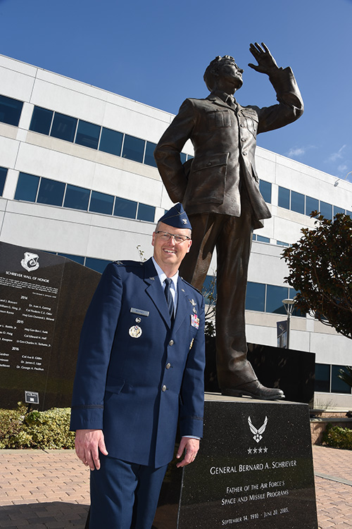
Col. Steve Whitney stands beside a statue of General Schriever at Los Angeles Air Force Base, home of the GPS Directorate. (Photo: U.S. Air Force/Joseph Juarez, Sr.)
By Col. Steven Whitney Director, Global Positioning Systems Directorate
The most discussed theme in the U.S. Air Force space community over the last year has been “resiliency.” But what does that actually mean, and how can the Air Force increase resiliency in space?
The GPS Directorate took these questions to heart and thought long and hard about resiliency in our Positioning, Navigation, and Timing (PNT) service. I am pleased to report that we have made significant progress in the past year in our quest to bring a new generation of PNT technology to reality.
More importantly, our investments in space, ground, and user equipment developments are bringing real, tangible benefits towards providing a more resilient PNT service worldwide. We stand on the cusp of delivering modernized civil and military GPS signals which provide critical pieces to the puzzle.
Farther into the future, the Air Force is already exploring new, emerging technologies and capabilities to even further advance the robustness of the GPS enterprise, with the vision that GPS will always remain the “Gold Standard” for the worldwide PNT community.
Resiliency Begins with Signals
Modernized GPS signals will be the first piece of the puzzle for an overall resilient PNT solution. The community has long anticipated the beginning of the multi-GNSS era.
The GPS Directorate has embraced this future with a new L1C signal, designed cooperatively from the ground up to be interoperable with international satellite navigation systems. The signal design will greatly improve GPS reception in cities and other challenging environments.
Another important GPS signal was introduced with our GPS IIF satellites. The L5 signal is designed specifically to meet the demanding requirements for safety-of-life transportation and other high-performance applications.
This signal is broadcast in a radio-frequency band reserved exclusively for aviation safety services to ensure it has optimal spectrum protection. Together, these two new additions greater improve PNT resilience for civil users around the globe.
“The need to improve cyber security and protection quite honestly cannot wait until delivery of the Next-Generation Operational Control System (OCX). To that end, the Directorate has focused on high payoff updates for the existing operational system.”
Other measures already improve resiliency by leveraging existing signals. For example, the L2C signal, when combined with L1 C/A in a dual-frequency receiver, will enable ionospheric error correction and improve positioning and timing accuracy.
For the military, the directorate has been focused on bring Military Code (M-code) into operations. The M-code signal features advanced anti-jam, anti-spoof, and encryption features that will ensure resilient and dependable PNT solutions for the United States and its allies.
The rollout of an operational M-code capability involves all segments of the GPS enterprise, and while it has been a long time in coming, the GPS Directorate made big strides this year (see “2017 in Review”). I will touch on the progress we are making in each of our development programs.
Resiliency in Space
The GPS space segment is the next step towards a more resilient PNT architecture. Our constellation remains robust and healthy, albeit aging, with 31 operational satellites providing worldwide coverage at the time of this article. The GPS III satellites will bring additional robustness with increased power and accuracy over previous generations of satellites.
We made big strides towards launching the first GPS III satellite in 2018, and just as importantly, production is in full swing on the rest of the ten satellites. I am incredibly proud of the entire government and contractor team that is meticulously acquiring, assembling, and testing these complex machines.
GPS IIIF. Farther into the future, the directorate is preparing for the GPS III follow-on program. The Air Force will be adding important new resiliency capabilities, with added signal flexibility via a reprogrammable, digital payload and increased anti-jam support to theater with a Regional Military Protection capability. Over the coming years as the follow-on GPS III satellites join the constellation, they will revolutionize GNSS with the full complement of operational L1C, L2C, L5 and M-code signals.
Resiliency in Control Segment
As important as the satellites are, the control segment is just as integral to the overall resiliency of the GPS enterprise. The need to improve cyber security and protection quite honestly cannot wait until delivery of the Next-Generation Operational Control System (OCX).
To that end, the directorate has focused on high payoff updates for the existing operational system.
For example, we acquired and deployed software-based GPS monitor station receivers, known as Monitor Station Technology Improvement and Capability (MSTIC) receivers, to replace the aging fleet of existing monitor-station receivers.
The functionality and expandability of the MSTIC receiver design will facilitate adding further capabilities such as M-code signal monitoring, and even civil L1C, L2C, and L5 signal monitoring.
The GPS Directorate also deployed a new cybersecurity monitoring suite to enhance cyber defenses. This new suite is in operation today at the GPS Master Control Station (MCS).
Beyond just improving our cyber protection, the Air Force has also stepped out on several OCX off-ramps to support the launch and operation of the GPS III satellites and mitigate risk of further OCX delays.
The Contingency Operations (COps) program modifies the existing Operational Control System (OCS) to allow the first GPS III satellites to join the operational constellation. The Air Force also initiated a companion program, M-code Early Use (MCEU) to further update OCS to provide limited M-code operations.
Together, these two programs provide critical interim steps towards fielding a more resilient constellation.
The OCX program provides the ultimate cyber protection and assurance needed for the GPS enterprise. After emerging from program recertification this year, the program has focused heavily on improved software system engineering and embracing software industry best practices, such as adopting DevOps and greater software automation.
The program has even leveraged Amazon Web Services’ Gov’t Cloud capability to provide more responsive development and test environments. While the program has a long ways to go, the government and prime contractor, Raytheon, are committed to delivery to ensure a robust and secure ground infrastructure.
User Equipment: Final Piece
The final piece of the resiliency puzzle for military customers is our user equipment segment. The directorate has made big strides in delivering the first set of modernized receiver cards for the Military GPS User Equipment (MGUE) Increment 1 program.
These advanced cards will enable platforms across the U.S. Department of Defense to leverage the new M-code signal, providing a tremendous boost in both anti-jam and anti-spoof capability.
They will also provide the latest in cryptography to ensure secure, robust protection for the United States and its allies.
Down the road, the Department of Defense is evaluating additional capabilities and platforms for the MGUE Increment 2 program.
Currently envisioned to address precision guided munitions, space receivers, and a modernized handheld unit, the Increment 2 program will be laying out an acquisition plan in this coming year to further adoption of M-code signals throughout the military.
A consideration for the future of user equipment will be exploring processing multi-GNSS signals. While no decisions have been made, multi-GNSS could offer opportunities for even additional resiliency.
Final Thoughts
This is an exciting time for the GPS enterprise.
We stand on the cusp of a new generation of capabilities that will usher in a huge increase in PNT resiliency and robustness. I am astounded at the quality of work that is presented at the many GNSS and PNT conferences around the world, and it is both exciting and humbling to see the community continuing to innovate ways to increase accuracy, integrity, availability, continuity, and performance.
Likewise, I am honored to lead the men and women of the GPS Directorate as we strive to deliver on our commitments and find new, innovative ways to provide robust and resilient PNT to the world.
This dedicated team is poised and ready to lead us into the future, and we look forward to working with the entire community to continue delivering the GPS “Gold Standard” in space-based PNT.
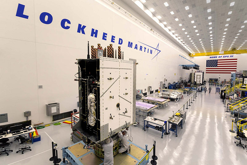
Lockheed Martin’s GPS III clean room in Littleton, Colorado.
By Col. Steven Whitney Director, Global Positioning Systems Directorate
This year saw the GPS enterprise take big strides towards completing major acquisition and development milestones and overcoming significant program challenges.
As we close out the year, the GPS Directorate stands poised to launch the first GPS III satellite in 2018.
The GPS III prime contractor, Lockheed Martin, successfully placed GPS III Space Vehicle (SV) 01 into storage in late February. Following a comprehensive engineering review, SV-01 was determined to be Available For Launch in September.
Road to Launch. The GPS Directorate also kicked off its inaugural Road to Launch campaign this year, and the satellite recently completed a final factory mission readiness test in November. Just as importantly, production is in full swing on the remaining nine satellites with the SV-02 Available For Launch declaration expected early in 2018.
The GPS Directorate was also hard at work preparing the request for proposal (RPF) for a follow-on production contract that will add up to 22 additional GPS III satellites. As the U.S. Department of Defense (DoD) finalizes requirements for the program, we stand ready to release the RFP by the end of the year.
OCX. While the Next Generation Operational Control System (OCX) continued to be a focal point for the DoD, the program has made progress in 2017 following a program restructuring. OCX completed the first integrated live-satellite launch rehearsal with GPS III in August.
A fitting capstone to the year’s achievement was the long awaited delivery in November of the initial version of OCX, known as the Block 0, to support launch and checkout of GPS III satellites. But while these are encouraging signs, there is still a long road to delivery of the full suite of capabilities in 2022.
The Contingency Operations (COps) program remained on track this year for delivery in 2019 to support interim GPS III operations. The program completed two (out of three) major software builds this year. The U.S. Air Force initiated a companion program, M-Code Early Use (MCEU), to enable limited M-code operations. MCEU is on target to complete its Preliminary Design Review in November 2017.
MGUE. Early this year, our Military GPS User Equipment (MGUE) program achieved acquisition Milestone B, allowing it to enter the Engineering and Manufacturing Development phase.
Just as importantly, MGUE successfully completed two major risk-reduction events. First, the U.S. Army successfully demonstrated 81-mm mortar precision-guided munitions integrated with MGUE receiver cards to complete the first ever M-code guide-to-hit tests in March.
The Air Force then demonstrated a prototype MGUE navigation unit integrated into the B-2 bomber in four successful flight tests. These tests are an important step towards anti-jam, anti-spoof GPS capability, ensuring secure, robust protection for the United States and its allies.
So, as we close this year, I am encouraged by our recent successes, but with a clear understanding of the many challenges ahead on the road to GPS modernization. We remain fully committed to meeting our program commitments with transparency.