Tag: GPS III

  • New players trigger new space race, GPS III update

    New players trigger new space race, GPS III update

    Robin Wrinn
    Robin Wrinn

    This month, we bring you a guest column on the 33rd Space Symposium in Colorado Springs, Colorado. Robin Wrinn, a communications professional based in Atlanta, gives her perspective on the premier annual space event, held in early April. Among her findings: new players in space race, new capabilities afforded by 3D printing and virtual reality, and insights into the GPS III program from Lockheed Martin’s VP for navigation systems.

    — Alan Cameron, editor


    Blue Origin spacecraft.
    Blue Origin spacecraft.

    A host of new entrepreneurial and government players entering the space sector created an underlying sense of excitement that a new “space race” has begun. Visitors attending the 33rd annual Space Symposium first encountered the imposing, reusable Blue Origin spacecraft displayed prominently in front of the Broadmoor Hotel Exhibit Hall. It seemed to symbolically punctuate a statement that the space industry landscape is changing — and putting long-experienced government players and government contract monopolies on notice.

    Hosted by the Colorado Springs-based Space Foundation, this year’s Symposium featured more than 180 exhibitors, including 38 new international partners and space, government and defense officials from more than 30 countries. In addition to the United States, other notable space nations attending included China, Germany, South Korea, Japan, high-level members of Russia’s ROSCOSMOS, and for the first time, the European GNSS Agency (GSA).

    Space Recognized as a Security Asset

    A primary theme throughout the speaker lineup was development of missions and programs to shore up national cyber and space security. Japan, for example, had previously banned all military use of space assets, but according to Shuzo Takada, director general of Japan’s National Space Policy Secretariat, the country has established new laws in part due to growing threats from countries such as North Korea.

    Europe also has joined the club of providers of navigation services and has formally acknowledged the need to defend its member countries against cyber threats. In a keynote session, EU Commissioner for Internal Market, Industry, Entrepreneurship and SMEs, Elżbieta Bieńkowska, the first European Commissioner to address the Space Symposium, noted that Galileo, Europe’s GNSS, went live last December. In 2016, six Galileo satellites were launched building on the six the year before. Today, 17 leading chipset companies, representing more than the 95% of global supply, all produce Galileo-compatible products.

    Bieńkowska also outlined a three-point space strategy for Europe that incentivizes innovation, including investment in R& D projects, but also prompts Europe to officially view space as a security asset. “We for the first time recognize that space is a strategic asset and a central element of Europe’s strategic autonomy. Europe must ensure its own security,” she said.

    In his conference remarks, U.S. Congressman Jim Bridenstine welcomed addition of Galileo’s capabilities to the global satellite infrastructure, noting that GPS capabilities make it as important to our way of life as the electrical power grid. (Indeed, GPS actually enables key capabilities of the power grid through its precise timing, although Bridenstine did not mention this aspect.)

    “There are very strategic risks to our satellite systems and we need to make sure the GPS, GLONASS and Galileo signals provide back0up to one another and are supported in bilateral ways. “

    New Private Investment Sparks Change in Costs and Bidding

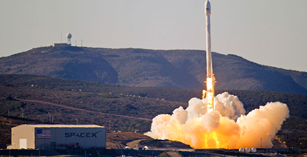
    The growing presence of private investment in the space economy was very notable at this year’s Symposium. Jeff Bezos’ Blue Origin is among several entrepreneurial companies — Elon Musk’s SpaceX (Space Exploration Technologies) and Richard Branson’s Virgin Galactic, to name two others — that are challenging the traditional drivers. These new players are upsetting the standard government agency inclination to prefer longstanding relationships over price. Now the bid price gaps are too big to ignore.

    Case in point: SpaceX has twice now in two years won bids to launch GPS III satellites, with price as a major factor. According to a March 2017 U.S. Department of Defense press release, SpaceX will provide the Falcon 9 launch vehicle production, mission integration and launch operation for support of the GPS III mission. The contract awards break a nearly 10-year monopoly held by United Launch Alliance, a joint venture of Lockheed Martin Space Systems and Boeing Defense, Space & Security.

    Previously, Claire Leon, launch enterprise director for the Air Force Space and Missile Systems Center had been quoted as saying the service views the entrance of competition as a good step that will help the government over time. “You’ll see a lot of innovation between multiple contractors to invest in the rocket systems for the United States,” she said.

    Lockheed Martin Touts Digital Tapestry Savings

    Collaborative Human Immersive Laboratory (CHIL).
    Collaborative Human Immersive Laboratory (CHIL).

    During the Symposium, Lockheed Martin Space Systems invited attending media to tour its expansive Littleton, Colo. campus where it is assembling and testing both the next-generation GPS III satellite constellation and the Orion spacecraft. Lockheed Martin is the prime contractor on the GPS III program and is under contract the U.S. Air Force to build eight position, navigation and timing satellites. The contract includes options for up to four more vehicles. In September 2016, the Air Force announced it had exercised the option for Lockheed Martin to build the ninth and tenth satellites, which will include additional hosted payloads to increase accuracy.

    Throughout the tour, Lockheed Martin’s hosts emphasized the company’s cost and time efficiency innovations. We first saw the Collaborative Human Immersive Laboratory (CHIL), where Lockheed is using virtual reality (VR) technology to plan the design and manufacture of nearly all its aerospace components. In one of the largest VR laboratories of its kind, engineering teams review 3D models of product designs, tooling and facilities. Instead of paper, virtual prototyping enable Lockheed’s engineers to inspect holographs of the engineered designs, as well as become avatars to examine designs in virtual environments in full scale and in an immersive way. The lab also is used to conduct virtual dry runs of systems once products get to the shop floor.

    Collaborative Human Immersive Laboratory (CHIL).
    Collaborative Human Immersive Laboratory (CHIL).

    According to Darin Bolthouse, manager of the CHIL, Lockheed Martin began virtual prototyping in 2010 with an initial focus on the GPS III and the Orion space capsule programs. Now the company uses the CHIL across the enterprise for all programs. It also is looking for ways to shrink the large lab footprint with newer commercially available VR equipment to create more VR pods at other locations and a site-to-site VR environment network with other facilities, including Sunnyvale, Calif., Kennedy Space Center and Johnson Space Center.

    Again, time and cost savings were emphasized with a primary narrative that “inserting virtual modeling and model-based engineering helps from the ground up.” Touted benefits included recouping an initial investment of $5 million per year since its construction in 2010 through cost avoidance in rooting out specific engineering problems in VR that otherwise would have been discovered on the shop floor. A specific example served up was using the CHIL to virtually redesign the top deck of the Orion spacecraft three times to work out human-machine ergonomic issues.

    Parts made with a 3D printer.
    Parts made with a 3D printer.

    In another leg of the tour, Lockheed Martin showcased how it uses 3D printing to make parts for both Orion and military satellites: tubing routings, bottles and attachments. This has reportedly reduced lead time to manufacture a single part from six months to 1.5 months, with assembly time reduced from 12 hours to just three. Another added benefit is accessibility and costs of replacement parts down the road. 3D printing provides the roadmap and means to recreate a part 20 years later even if Lockheed Martin or a sub-contractor should have ceased operation.

    GPS III Vehicle Rundown

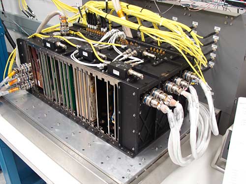
    The highlight of the tour was Lockheed Martin’s top secret clean room, where the next-generation GPS III satellite constellation is being assembled and tested. The expansive space included areas for integrating the parts of each satellite vehicle, as well as environment testing chambers for acoustics and thermal vacuum, which simulate space conditions with extreme temperatures, including the near and far side of Earth solar temperatures. No phones, cameras or recorders were allowed, and even then parts of the satellite vehicles were draped off from visitors’ view.

    3-D printer.
    3D printer.

    Prominent placards gave the GPS III Program Production Status:

    Vehicle 01

    Completed Factory Functional Qualification Testing

    Placed in Storage since February 2017

    Vehicle 02

    Space vehicle integration forecast completion – May 2017

    Environmental testing to begin – May 2017

    Available for launch – 2018

    Vehicle 03

    Navigation Payload forecast delivery – Spring 2017

    Space vehicle integration – Fall 2017

    Begin environmental testing – Early 2018

    Available for launch – 2019

    Vehicle 04

    Navigation Payload forecast delivery – Fall 2017

    Space vehicle integration – Early 018

    Satellite Delays Resolved

    According to Lockheed Martin spokesperson Chip Eschenfelder, who spoke with GPS World during the media tour, previously reported GPS III engineering delays related to the payload have been resolved.

    Lockheed Martin's GPS III clean room in Littleton, Colorado
    Lockheed Martin’s GPS III clean room in Littleton, Colorado

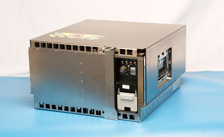
    Lockheed subcontractor Harris Corporation provides the critical mission data unit (MDU) and other components of the navigation payload, including atomic clock timing systems, radiation-hardened computers and powerful transmitters to deliver accurate, robust navigation signals for the GPS III constellation. Last year it was discovered that a ceramic capacitor had not been subjected to all the program’s required qualification tests. Once the issue was discovered, Harris deployed a dedicated team to complete the required tests by December 2016. The issue caused a delay of four months. The part was among the more than 28,000 used in the navigation payloads for the GPS III vehicles. The company announced in February 2016 that it plans to offer a fully digital navigation payload for the GPS III’s space vehicle 11 and beyond.

    According to Harris Corp. spokesperson Ellen Mitchell, the company has so far delivered two full payloads to Lockheed Martin and has delivered some of the hardware for the third space vehicle.

    Another potential GPS III delay presented itself in March 2017 when the U.S. Air Force opened a review of the propulsion systems used for Lockheed Martin’s GPS III and other military satellites, following a problem during an attempt to boost one into orbit. According to Eschenfelder, the review is a standard process and was out of an abundance of caution. Lockheed is“confident that this review will not delay the Air Force’s planned spring 2018 Initial Launch Capability (ILC).”

    Further comments on the GPS III program came in a subsequent conversation I held with Mark Stewart, Lockheed Martin’s vice president for Navigation Systems:

    Q: GPS III has extensive military applications. What differences will it bring to the civil, end-user experience as compared to today’s?

    A: Millions of commercial and civilian users rely on GPS every day. GPS III begins a new era of improved Positioning, Navigation and Timing (PNT) performance for these civilian users in that it will be the first GPS satellite transmitting a new L1C civil signal designed to be compatible and interoperable with other international Global Navigation Satellite Systems (GNSS), like Galileo and QZSS. In the near future, civilian GPS receivers – like those found in smart phones — will be looking for L1C and compatible signals from satellites from multiple GNSS constellations, including GPS III. With more opportunities for GPS receivers to maintain “line-of-sight” L1C connections, civilian users will have much improved connectivity.

    Q: What is the impact of the OCX/ground segment delay? Won’t that impact realizing GPS III’s full capabilities on time?

    A: The first GPS III satellite, GPS III Space Vehicle 1 (GPS III SV01), was placed in storage on Feb. 27 and is now awaiting call up for launch from the Air Force. GPS III SV01 will need the Next Generation OCX Block 0 to launch. We are working closely with the Air Force and Raytheon to demonstrate GPS III SV01 operating on orbit as soon as possible. It is more appropriate for the U.S. Air Force and Raytheon to comment about OCX’s capabilities and what it will bring to the overall GPS III enterprise.

    OCX Block 1 is the baseline program under development to command and control GPS III satellites.  As a temporary gap-filler until OCX Block 1 is available, the Air Force placed Lockheed Martin under contract for “GPS III Contingency Operations” (COps), which will enable the current GPS Operational Control Segment (OCS) to checkout and operate GPS III satellites prior to the delivery of OCX Block 1.  Lockheed Martin’s COps program successful completed a Critical Design Review in November 2016, on schedule for delivery in 2019.

    Q: How do you see the future of GPS in a multi-constellation environment (considering that soon in addition to GPS and the Russian GLONASS, the European Galileo and the Chinese Baidoo will be fully operational)? And what does that mean for the civilian end-user?

    A: Civilian multi-constellation users will significantly benefit from the new L1C signal, designed be compatible and interoperable with the Galileo E1 Open Service (OS) signal. In addition, GPS navigation messages include the GPS/GNSS-time offsets to enable a multi-constellation PNT solution.

    Q: Galileo will be implementing a Commercial Service already in the first generation. Do you think that such a service could be implemented in the future on GPS?

    A: Ultimately the capabilities of future GPS satellites will be determined by the Air Force. That said, Lockheed Martin’s GPS III was specifically designed to be flexible and modular so in the future the satellite could easily incorporate new missions if they are deemed necessary, and new technology as it becomes available.

    Q: What were and are the technology challenges Lockheed Martin faced during the GPS-Ill development?

    A: GPS III is the most powerful GPS satellite ever designed, with three times greater accuracy and up to eight times improved anti-jamming capability. That increased signal power comes from a revolutionary new navigation payload. Early in development our payload provider, Harris Corporation, had some design challenges. Those issues were eventually overcome and fully validated when GPS III SV01 successfully completed its Thermal Vacuum (TVAC) test in December 2015. We are excited to be bringing GPS III’s new capabilities to our warfighters soon.

    Q: How do GPS III satellites compare with Galileo FOC satellite constellation? Achieve parity (Galileo 2 frequency, current GPS 1)? or leapfrogging over Galileo technology?

    A: I cannot speak for Galileo’s capabilities but the U.S. Air Force’s Global Positioning System (GPS) has been the gold standard for PNT for more than 20 years. Lockheed Martin’s GPS experience includes more than 250 collective years of on-orbit operations for the 19 GPS IIR and IIR-M satellites that make up about 60 percent in today’s GPS constellation. With GPS III being the most powerful GPS satellite ever designed and built, I am confident GPS III will maintain that PNT gold standard ranking.

    Q: There were clock anomalies in Galileo. What are you doing to avoid similar issues? Are GPS III clock’s different or the same?

    A: GPS III Rubidium Atomic Frequency Standards (RAFS) have evolved from GPS IIR and IIR-M RAFS, which have collectively and reliably provided more than 250 years of on-orbit service, including significant time beyond their intended design lives. Our GPS III RAFS clocks undergo rigorous environmental qualification and life tests to assure performance over this next generation satellite’s 15-year design life.  In addition, each GPS III SV includes multiple RAFS for redundancy.  GPS III continually monitors the active RAFS to detect and mitigate clock anomalies.  This is just one way that GPS III provides increased signal integrity for GPS users.

    Galileo clocks utilize different suppliers than GPS III clocks. The GPS III clock supplier has produced reliable RAFS clocks for GPS satellites over the past several decades.

    [end of Mark Stewart interview]

    Ground Control

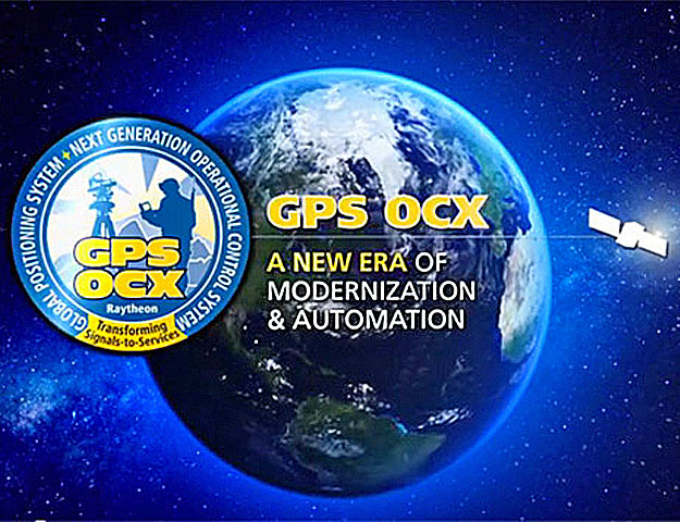
    The GPS III satellite program is heavily dependent on the GPS Next Generation Operational Control System (GPS OCX), which according to  government officials has experienced developmental issues and remains under General Accounting Office (GAO) scrutiny.

    In assessing the implications, it’s important to note that OCX’s development is delivered in blocks, with Block 0 comprising the Launch and Checkout System required to take GPS III satellites into early orbit. Block 1 is built on Block 0  and will deliver the full OCX capability, allowing the Air Force to transition from its current GPS ground controls to the modernized and secure GPS OCX master control station.

    According to the OCX prime contractor, Raytheon, all coding for Block 0 is complete and testing is wrapping up for delivery. Block 1 development is ongoing with the final iteration estimated to be completed in late 2018.

    Findings in a recent GAO report are prompting examination of the reasons for the cost overruns and delays in military development programs. Meanwhile, the Air Force is looking at ways to modify the existing GPS control system to enable the operational use of the GPS III satellites until delivery of the OCX Block 1. Regardless, the Air Force may need to delay the launch of multiple GPS III satellites, according to the GAO.

    Mr. Bezos, Mr. Musk, Mr. Branson … are you out there?

  • SpaceX wins second US Air Force contract to launch GPS III

    SpaceX wins second US Air Force contract to launch GPS III

    A SpaceX Falcon 9 stands ready for launch from Cape Canaveral Air Force Station, Fla. The Air Force awarded a contract for GPS III Launch Services to SpaceX.
    A SpaceX Falcon 9 stands ready for launch from Cape Canaveral Air Force Station, Fla. The Air Force awarded a second contract for GPS III Launch Services to SpaceX.

    SpaceX has won a second contract from the U.S. Air Force for launch services to deliver a GPS III satellite to its intended orbit.

    SpaceX was awarded the $96,500,490 firm-fixed-price contract over the United Launch Alliance. ULA — a joint venture of Lockheed Martin Space Systems and Boeing Defense, Space & Security — did not compete for the first GPS III launch contract. That contract, worth $82.7 million, is expected to orbit a GPS satellite aboard a Falcon 9 rocket in May 2018.

    According to the contract announcement, SpaceX will provide launch vehicle production, mission integration, launch operations, spaceflight worthiness and mission unique activities for a GPS III mission. The contract is being overseen by the Air Force’s Space and Missile Systems Center (SMC), Los Angeles Air Force Base, California.

    Work will be performed at Hawthorne, California; Cape Canaveral Air Force Station, Florida; and McGregor, Texas. It is expected to be complete by April 30, 2019.

    “The competitive award of the GPS III Launch Services contract to SpaceX directly supports SMC’s mission of delivering resilient and affordable space capabilities to our nation,” said Lt. Gen. Samuel Greaves, leader of SMC.

  • Lockheed responds to report on Air Force review of GPS III propulsion

    Lockheed Martin responded to a report by Bloomberg last week that the U.S. Air Force has opened a review of the propulsion systems used for Lockheed Martin’s GPS III and other military satellites, following a problem during an attempt to boost one into orbit.

    A Lockheed spokesperson said the first GPS III satellite passed all of its qualification testing and verification.

    “On Feb. 27, the Air Force declared GPS III Space Vehicle 01 (SV01) ready for storage following the completion of all space vehicle Factory Functional Qualification Testing (FFQT) and successful verification of more than 30,000 pre-storage technical requirements,” responded Chip Eschenfelder, communications lead for Lockheed’s Military Space division.

    “Out of an abundance of caution, the Air Force and Lockheed Martin are thoroughly evaluating the A2100 GPS III Propulsion Subsystem, prior to declaring the satellite Available for Launch (AFL),” Eschenfelder said. “This review is a standard process for our rigorous systems engineering approach to assure mission success.”

    The plan remains to launch the first GPS III satellite by spring of 2018.

    “Lockheed Martin is working closely with the Air Force on resolving any concerns about the mission readiness of SV01’s Propulsion Subsystem,” Eschenfelder said. “We are confident that this review will not delay the Air Force’s planned spring 2018 Initial Launch Capability (ILC).”

    Today, more than 50 Lockheed Martin A2100 bus satellites are operating successfully on orbit.


  • GPS III satellite propulsion under US Air Force review

    The U.S. Air Force has opened a review of the propulsion systems used for Lockheed Martin’s GPS III and other military satellites after a problem during an attempt to boost one into orbit, according to the service, Bloomberg reports.

    The review has delayed the Air Force’s acceptance of Lockheed’s first GPS III satellite, which is 34 months late. The most recent delivery goal had been Feb. 28, and the plan remains to launch it by spring of 2018.

    While there’s no evidence that the propulsion system on the first GPS III satellite has a flaw, the Air Force has decided to keep it in storage at a Lockheed facility out of an abundance of caution, Captain AnnMarie Annicelli, an Air Force spokeswoman, told Bloomberg. It was placed into storage after having successfully completed all planned test and integration activities.

  • CNN explores space warfare, US military’s use of GPS

    shiyan-grabbing-cnn-space-warfare
    Photo: Shiyan

    A spaceborne laser zaps a GPS satellite, disabling it.

    A “kamikaze” satellite hits and destroys other nations’ critical satellites.

    Another satellite moves beside an Intelsat bird — and listens in.

    A new CNN special considers all of these possibilities in an exploration of an arms race in space, showcasing the devastation that would be caused by space warfare and how the U.S. military is preparing.

    War in Space: The Next Battlefield” premiered Nov. 29 on CNN. It provides the general public with an understanding of the critical nature of GPS, ranging from mundane activities such as daily commutes and withdrawing money from a bank, to the reliance on GPS for soldiers and intelligence agencies defending the U.S.

    The documentary explores the belief by many in the military and civilian experts that war in space is inevitable, with particular attention to methods China and Russia might use to interfere with or disable GPS.

    CNN goes inside Lockheed Martin’s facility, where it is building the next-generation GPS III satellite, as well as U.S. Space Command at Peterson Air Force Base, and visits the 2SOPS team at Schriever Air Force Base.

    CNN national security correspondent Jim Sciutto interviews the chain of command for space warfare, including Gen. William L. Shelton and Gen. John Hyten, both former commanders of Air Force Space Command. (Gen. Hyten is now commander of U.S. Strategic Command).

    Also interviewed are Adm. Cecil Haney (Ret.), former commander of U.S. Strategic Command; Lt. Gen. David Buck, commander of the Joint Functional Component Command for Space; and Defensive Duty Officer 1st Lt. Andrew Engle, a newly created position to monitor threats in space.

    If you haven’t seen this documentary, you can still watch it through on demand on cable and via the CNNgo app.

  • Galileo declares: Open for business!

    Galileo declares: Open for business!

    At a Dec. 15 ceremony in Brussels titled “Galileo Goes Live,” two high officials of the European Commission issued the Galileo Initial Services Declaration.

    The declaration means that the Galileo satellites and ground infrastructure are now operationally ready. These signals will be highly accurate but not available all the time, since the constellation is not yet complete and users cannot always count on four satellites being visible at one time at all points on the Earth.

    Galileo Goes Live! ceremony in Brussels: European Commission Vice-President Maroš Šefčovič, responsible for the Energy Union, and Commissioner Elżbieta Bieńkowska, responsible for Internal Market, Industry, Entrepreneurship and SMEs, count down to hit the “Go” button.
    Galileo Goes Live! ceremony in Brussels: European Commission Vice-President Maroš Šefčovič, responsible for the Energy Union, and Commissioner Elżbieta Bieńkowska, responsible for Internal Market, Industry, Entrepreneurship and SMEs, count down to hit the “Go” button. Photo: Galileo

    Simultaneously, the European GNSS Agency (GSA) awarded the Galileo Service Operator (GSOp) contract, with a value of up to 1.5 billion euros, to Spaceopal, a joint venture between Telespazio and the German Space Agency (DLR).

    The Galileo constellation currently consists of 18 satellites in orbit. However, two of these are in an orbit not totally useful for positioning and navigation. Four more, launched in November, may or may not have completed their on-orbit testing (a series of notice advisory to Galileo users or NAGUs has appeared relating to the flag status of each satellite; see details at the end of this story) but have not yet been integrated to the operational constellation. This is expected to take place in spring 2017.

    During the initial phase, the first Galileo signals will be used in combination with other satellite navigation systems, like GPS. In coming years, new satellites will be launched to enlarge the constellation, gradually improving Galileo availability worldwide. The constellation is expected to be complete by 2020 when Galileo will reach full operational capacity (FOC) of 30 satellites: 24 satellites plus six orbital spares, intended to prevent any interruption in service.

    Paul Verhoef, the European Space Agency’s (ESA’s) director of the Galileo Programme and Navigation-related Activities, stated, “Today’s announcement marks the transition from a test system to one that is operational. Still, much work remains to be done. The entire constellation needs to be deployed, the ground infrastructure needs to be completed, and the overall system needs to be tested and verified.

    “In addition, together with the commission we have started work on the second generation, and this is likely to be a long but rewarding adventure.”

    Galileo Initial Services are managed by the GSA. The overall Galileo programme is run by the European Commission, which has handed over responsibility for the deployment of the system and technical support to operational tasks to the ESA.

    Operator Contract. The GSOp contract runs for 10 years and covers operation and maintenance of the Galileo satellite system and its committed performance level: in particular, the operations and control of the system, the logistics and maintenance of the systems, and infrastructure as well as the user support services.

    “With its emphasis on service performance, this contract will shape the future of Galileo. We look forward to building a strong partnership with Spaceopal as Galileo moves towards full operational capability under the responsibility of the GSA from January 2017,” said GSA Executive Director Carlo des Dorides.

    Under GSA management, the contract awarded to Spaceopal specifically includes:

    • Secure operations of Galileo from two mission control centres (GCC), located in Germany and Italy, and the European GNSS Service Centre (GSC) for user support services in Spain;
    • Management of the Galileo Data Distribution Network (GDDN);
    • Integrated logistics support and maintenance for the entire space and ground infrastructure;
    • Monitoring of the system performance;
    • Support for the completion of the Galileo infrastructure and associated launches.

    Spaceopal has served as the contractor for Galileo operations since 2010 under the Galileo Full Operational Capability (FOC) Operations Framework Contract.

    Products and Services. The first Galileo smartphone by Spanish company BQ is now available on the market, and other manufacturers are expected to follow suit. Application developers can now test their ideas on the basis of a real signal.

    With the declaration, Galileo will start to deliver, in conjunction with GPS, the following three types of services free of charge. Their availability will improve as more satellites are launched.

    The Open Service is a free mass-market service for users with enabled chipsets in, for instance, smartphones and car navigation systems. Fully interoperable with GPS, combined coverage will deliver more accurate and reliable positioning for users.

    Public Regulated Service is an encrypted, robust service for government-authorized users such as civil protection, fire brigades and the police.

    Search and Rescue Service is Europe’s contribution to the long-running Cospas–Sarsat international emergency beacon location. The time between someone locating a distress beacon when lost at sea or in the wilderness will be reduced from up to three hours to just 10 minutes, with its location determined to within 5 kilometers, rather than the previous 10 kilometers.

    Advisory Updates. USABINIT NAGUs were issued for 11 satellites: 0101, 0102, 0103, 0203, 0204, 0205, 0206, 0208, 0209, 0210 and 0211.

    USABINIT, or Initially Usable, notifies users that a satellite is set healthy for the first time. 0104 had a power problem and is operating on E1 only. 0201 and 0202 were launched into lower orbits.

    0207 and 0212–0214 are still undergoing commissioning and drifting to their designated orbital slots.


    Ground control upgrade for GPS III approved

    The U.S. Air Force approved Lockheed Martin’s design to upgrade the current GPS satellite ground control system with new capabilities that will enable it to operate more powerful and accurate GPS III satellites.

    The successful Critical Design Review (CDR) for the Contingency Operations (COps) contract, completed on Nov. 17, gives Lockheed Martin a green light to proceed with software development and systems engineering to modify the existing GPS ground control system, called the Architecture Evolution Plan (AEP) Operational Control Segment.

    The AEP is currently maintained by Lockheed Martin and controls the 31 GPS IIR, IIR-M and IIF satellites in orbit today.

    The COps modifications will allow the AEP to support the more powerful, next-generation GPS Block III satellites, enabling them to perform their positioning, navigation and timing mission, once they are launched. COps is envisioned as a temporary gap filler prior to the entire GPS constellation’s transition to operations onto the next generation Operational Control System (OCX) Block 1, currently in development.

    On Oct. 15, under a separate contract, Lockheed Martin completed the Commercial Off-the-Shelf (COTS) Upgrade #2 (CUP2) project — part of a multi-year plan to refresh the AEP’s technology and enhance the system’s ability to protect data and infrastructure from internal and external cyber threats, as well as improve its overall sustainability and operability. CUP2 is now fully operational and managing the current GPS constellation.

    Lockheed Martin also is under contract to develop and build the Air Force’s first 10 GPS III satellites, which will deliver three times better accuracy, provide up to eight times improved anti-jamming capabilities, and extend spacecraft life to 15 years, 25 percent longer than the newest GPS satellites on-orbit today.

    GPS III’s new L1C civil signal will make it the first GPS satellite to be interoperable with other international global navigation satellite systems.


    GPS funded at $847 million for FY 2017

    On Dec. 23, 2016, President Obama signed the National Defense Authorization Act (NDAA) for Fiscal Year 2017. The act includes policy and funding guidance for the GPS program of $847.362 million. This total excludes $13.171 million requested for the GPS IIF program, which requires FY 2017 funding for on-orbit support and contract closeout.

    Procurement of GPS III satellites is budgeted at $34 million, development of GPS III satellites is at almost $142 million and the next-generation ground control system (OCX) is budgeted at $393 million, which comes with certification and congressional briefing requirements. The amount includes funding for the GPS Enterprise Integrator.

    The GPS Enterprise Integrator project includes efforts necessary to accomplish the critical integrating function with the entire GPS user community. The Enterprise Integrator maintains the GPS architecture and system definition, controls and validates interfaces, ensures compatibility of Generation II and III systems, and develops and manages plans for execution and fielding of the GPS enterprise.

    The final defense budget item is $278 million for development of new military GPS user equipment.

    Besides the NDAA, other areas that include funding for GPS and related programs are Transportation (including WAAS), to support designated civil elements of the Air Force GPS program, along with civil GPS augmentations and related activities.

    The Department of Transportation this year requested civil funding for GPS through the Office of the Secretary instead of through the FAA. Also, the request does not include funds for the Nationwide Differential GPS (NDGPS) program in FY 2017.

  • GNSS CEOs see bright future, alternative PNT promises well

    It has been a good year for all global navigation satellite systems (GNSS), as the chief executives of each system testify here. Alternative positioning, navigation and timing (PNT) also thrives. In this roundup of the latest highlights from the past year and forecasts for the future, 2017 augurs very well indeed! Let’s look at the newest alternative-PNT offerings first, followed by forecasts from the chief executive officers (CEOs) of each of the conventional GNSS.

    Alternative PNT grows and expands

    Two new entrants to the positioning, navigation and timing (PNT) marketplace offer key capabilities to fill in the gaps left by GNSS. A new satellite timing and location (STL) service from low-Earth orbit satellites, provided by Satelles and Orolia, gives a strong signal capable of penetrating buildings.

    Satellite Time and Location (STL) Service. Pursuant to a recent announcement of new PNT solutions independent of GPS/GNSS signals, provided via the Iridium constellation, GPS World talked with Jean-Yves Courtois, CEO of Orolia. Orolia has partnered with Satelles to bring new PNT products and services to the global market, with a focus on military, and defense, government and commercial customers worldwide.

    Jean-Yves Courtois, CEO of Orolia

    Jean-Yves Courtois, CEO of Orolia.

    “We are a manufacturer and integrator of timing equipment,” Courtois said. Orolia is the parent company of GPS/GNSS product and service providers Spectracom, McMurdo and Spectratime. “This new STL service is not fully commercialized yet, but it’s operational and it can be tested. Receivers are available and can be integrated into our equipment.

    “The timing signal is very accurate and close enough to GPS for most timing applications, although the positioning accuracy is lower than what GPS users are used to. It is an augmentation for timing primarily, and secondarily for positioning.

    “In terms of timing accuracy, it provides on the order of tenths of microseconds in accuracy, and this covers a lot of timing applications, very familiar to us and to our customers. This is an ideal timing backup or augmentation of GPS. As number 2 worldwide in high-precision timing, we know this market and its applications very well.”

    Correlator beamforming. The Locata Corporation announced a patented correlator beamforming technology to stem multipath mitigation. The new technique’s performance under rigorous testing by the U.S. Air Force Institute of Technology will be detailed in the January 2017 issue. Look for it! Here are a series of snippets as a preview of that lengthy technical article appearing in Richard Langley’s Innovation column.

    “Unlike conventional or traditional beamsteering technology, the new correlator beamforming approach combines RF signals received by any number of individual antenna elements into a single switched-RF signal. This time-multiplexed signal is then downconverted and digitized by a single RF front-end. The correlator beamforming design will should offer cost savings because the resulting data stream is processed using a single correlator channel per beam. This markedly reduces the complexity when compared to the traditional beamsteering methodology.

    “The correlator beamforming technique performs antenna array signal processing to form beams as part of a receiver’s correlation process. The complete explanation of this technology can quickly get complex, even for the seasoned RF engineer. To describe this process more simply, we will assume noiseless signals and no multipath (except as noted), as well as equal noise figures for all front-end processing chains. To further simplify our explanation, modulation on the carrier and switching losses will be ignored.”

    “To evaluate the performance of correlator beamforming as fairly as possible compared to traditional beamsteering and single-element processing, AFIT set up its data collection such that all three approaches could be implemented in a software receiver. Additionally, a seven-element Naval Air Systems Command GPS Antenna System 1 (GAS-1) antenna was used for this experiment. The antenna was mounted on a 51-inch (130-centimeter) diameter rolled-edge ground plane provided to the ANT Center by the MITRE Corporation.”

    “The testing focused on demonstrating an easily modified GNSS receiver to potentially deliver a low-cost solution for mitigating multipath — specifically targeting short delay and carrier multipath. The results presented here show that the multipath rejection performance nearly equals that of a traditional beamsteering GNSS receiver. Applications that can significantly benefit from this technology include stationary GNSS monitoring installations such as those used in satellite-based and ground-based augmentation systems and GNSS receivers for autonomous vehicles and UAVs in high multipath areas such as urban canyons.”

    GPS III ready, steady

    Col. Steve Whitney, Director, U.S. Air Force GPS Directorate
    Col. Steve Whitney, Director, U.S. Air Force GPS Directorate

    “The [GPS III] program is  working to solve several technical challenges as we progress to completion,” Col. Steve Whitney, director of the U.S. Air Force GPS Directorate, wrote in GPS World’s December issue. “SV-01 testing uncovered electro-magnetic interference between a payload component and a hosted payload. Testing also uncovered electron impact issues on the L-band antenna elements. In partnership with Lockheed Martin, the program developed corrective action and design mitigations for both of these issues and is implementing these steps within our production flow for all the SVs.”

    “In the coming year, SV-02, the second GPS III satellite, will also be progressing towards completing production. Currently, all of the SV-02 sub-assemblies have been received by Lockheed Martin and are being integrated into the spacecraft. The next major step in the production flow for SV-02 will be to mate it with its propulsion core.

    “Recently, we completed negotiations with Lockheed Martin to extend the production line with purchases of SV-09 and SV-10. These satellites will be technically equivalent to SV-01 through SV-08. This $395 million purchase of two satellites marks a significant affordability milestone for the procurement of GPS III satellites.

    “Looking ahead, we are analyzing how to acquire satellites beyond SV-10. We are executing a phased strategy which starts first with determining the viability of a GPS III production design existing beyond the current contractor. We awarded an initial phase of contracts to the Boeing Company, Lockheed Martin Space Systems Company, and Northrop Grumman Aerospace Systems in May 2016 to provide a feasibility assessment of the readiness of their satellites designs. In this phase, the contractors will provide a GPS III production design, manufacturing plans and a navigation payload brassboard test report, along with manufacturing/production processes and facilities maturity.”

    Galileo coming on strong

    Director of the Galileo Programme Paul Verhoef of the European Commission wrote in that same issue of the magazine, “The production of the satellites continues to maintain a steady rhythm, with a production line stretching from suppliers across Europe to OHB and SSTL and then to ESA’s ESTEC Test Centre in the Netherlands for acceptance testing, based on a wide range of simulated space tests.”

    Closing out the year on a triumphant note, Galileo declared its Initial Services on December 15.

    Paul Verhoef, director of the Galileo Programme and Navigation-related Activities, European Space Agency.
    Paul Verhoef, director of the Galileo Programme and Navigation-related Activities, European Space Agency.

    “The acceptance of the next satellites to launch is scheduled for this year’s end,” continued Verhoef. “Along with the two more Ariane 5 launches to come — one in the second half of 2017 and another in 2018 — the current plan is to commission further launch services as well as additional satellites in order to have Galileo fully operational by 2020. For these launches, Galileo may be the first customer of the new Ariane-6 launch vehicle.

    “2017 will see the upgrade of various elements of the Galileo Ground Segment to reinforce its robustness, including updated releases to the Galileo Control Segment overseeing the satellites and the Galileo Mission Segment, overseeing the navigation signals. A new release of elements of the Galileo Security Facility, for security monitoring of the system, as well as the secure Public Regulated Service, will be deployed at the two Galileo Security Monitoring Centres.

    “The Galileo Ground Segment will gain a sixth tracking telemetry and control facility, for monitoring the satellite platforms in Papeete, Tahiti, and additional processing chains for increased redundancy will be deployed across the Uplink Stations in Kourou, Reunion and Noumea used to update the navigation message information. Similar redundant chains will be finalized for all 15 current Galileo Sensor Stations, which perform continuous collection of Galileo signals to identify the tiniest clock error or satellite drift.”

    EGNOS. “Along with the progress of Galileo, contracts are planned to cater for the further development of the ESA-designed European Geostationary Navigation Overlay Service, Europe’s first navigation system. EGNOS was certified for safety-of-life aviation use in 2011, and is managed by the European Commission through a contract with operator the European Satellite Services Provider, based in France. ESA will support the technical evolution of EGNOS version 3, intended as multi-constellation in nature, again through the Horizon 2020 framework.”

    GLONASS looks forward to a new signal: CDMA!

    Sergey Karutin, GLONASS Chief Designer, wrote “On the threshold of the first GLONASS-K2 launch, new GLONASS reference documents were published in October 2016, describing the family of code-division multiple-access (CDMA) radionavigation signals. The draft GLONASS Open Service Performance Standard has been developed. The GLONASS User Information Support System continues to evolve.”

    From left: Sergey Karutin, GLONASS designer general; Nicolay Testoedov, director general, SC Information Satellite Systems; and Andrey Tulin, director general, SC Russian Space Systems.
    From left: Sergey Karutin, GLONASS designer general;
    Nicolay Testoedov, director general, SC Information Satellite Systems; and Andrey Tulin, director general, SC Russian Space Systems.

    “The system transmitting CDMA navigation signals is referred to in four interrelated interface control documents containing general information on signals and the detailed description of signal structures and digital message data. The new signals make it possible to include 63 satellites in the constellation, not only in circular medium-Earth orbit but also on geostationary and high-Earth orbits.

    “The transition to the flexible string-type structure of the message data produces 2-second periodicity of integrity information delivery to users. The increased number of digits occupied by the ephemeris and clock parameters contributes to a better orbit and clock broadcast accuracy. The ephemeris broadcast precision improves from 0.4 to 0.001 meters. Time-stamp length in CDMA signal has increased to 30 bits, compared to 12 bits of frequency-division multiple-access signals.”

    BeiDou approaches full regional services

    Li Wang
    Li Wang

    “In 2017, three to four launches of BeiDou satellites will occur,” wrote Li Wang, Director of the International Cooperation Center in China’s Satellite Navigation Office. “BDS will provide basic services to the countries along the Belt and Road region by 2018, and possess global service capability by 2020.”

    “BDS will keep improving its nationwide reference station network and steadily enhance its service performance. The dense reference stations for the nationwide frame network will be constructed by 2018, providing meter and decimeter level real-time location services for users in China, even centimeter level service in some areas.

    “BDS will carry out the design, validation and construction of SBAS in accordance with international civil aviation standards. The first GEO satellite of BDSBAS will be launched in around 2018. The satellite-based augmentation services covering China and surrounding regions will be provided from 2020, to provide CAT-I services to civil aviation users.

    “China will promote construction of a national comprehensive positioning, navigation and timing (PNT) system based on BDS, and strive to establish such a national PNT system with a united benchmark, no-gap coverage, security and effectiveness by 2030, as well as to upgrade capabilities to provide time and space information.”


  • US Air Force approves Lockheed’s ground control upgrade for GPS III

    The U.S. Air Force approved Lockheed Martin’s design to upgrade the current GPS satellite ground control system with new capabilities that will enable it to operate more powerful and accurate GPS III satellites.

    The successful Critical Design Review (CDR) for the Contingency Operations (COps) contract, completed on Nov. 17, gives Lockheed Martin a green light to proceed with software development and systems engineering to modify the existing GPS ground control system, called the Architecture Evolution Plan (AEP) Operational Control Segment.

    SV 01 in testing at Lockheed Martin's Denver facility. (Photo: LMCO)
    SV 01 in testing at Lockheed Martin’s Denver facility. (Photo: LMCO)

    The AEP is currently maintained by Lockheed Martin and controls the 31 GPS IIR, IIR-M and IIF satellites in orbit today.

    The COps modifications will allow the AEP to support the more powerful, next generation GPS Block III satellites, enabling them to perform their positioning, navigation and timing mission, once they are launched. COps is envisioned as a temporary gap filler prior to the entire GPS constellation’s transition to operations onto the next generation Operational Control System (OCX) Block 1, currently in development.

    “The GPS constellation is a valuable asset to our warfighters, our nation and the world. This risk-reduction effort ensures the Air Force has the ability to maintain the constellation at full strength,” said Mark Stewart, vice president of Lockheed Martin’s Navigation Systems mission area. “We are here to support the Air Force and the GPS III program any way we can.”

    The Air Force awarded the $96 million COps services and supplies contract to Lockheed Martin on February 3. The government approved the company’s proposed ground system modification during a Preliminary Design Review on May 11.

    On Oct. 15, under a separate contract, Lockheed Martin completed the Commercial Off-the-Shelf (COTS) Upgrade #2 (CUP2) project — part of a multi-year plan to refresh the AEP’s technology and enhance the system’s ability to protect data and infrastructure from internal and external cyber threats, as well as improve its overall sustainability and operability. CUP2 is now fully operational and managing the current GPS constellation.

    Lockheed Martin has a long history of supporting ground systems, providing operations, sustainment and logistics support for nearly 60 Department of Defense satellites, including GPS, often allowing them to double their on-orbit operational design life.

    Lockheed Martin also is under contract to develop and build the Air Force’s first ten GPS III satellites, which will deliver three times better accuracy, provide up to eight times improved anti-jamming capabilities and extend spacecraft life to 15 years, 25 percent longer than the newest GPS satellites on-orbit today.

    GPS III’s new L1C civil signal also will make it the first GPS satellite to be interoperable with other international global navigation satellite systems.

  • The System: First OCX receiver delivered to Air Force

    The System: First OCX receiver delivered to Air Force

    Photo: Harris
    Photo: Harris

    Harris Corporation delivered the first of 34 modernized receivers to support the GPS Next-Generation Operational Control System (OCX). They will receive the signals sent by the current GPS satellite constellation plus the new signals sent by the next generation GPS III — 13 military and civilian signals in all.

    The receiver was shipped to the prime contractor, Raytheon Company, in Aurora, Colorado, after it passed a critical electromagnetic interference test, the first of many stringent qualification requirements. Though the receivers will be placed throughout the world, this first production unit will be installed in Aurora as OCX software development and integration continues.

    OCX will replace the existing ground control system that receives signals from the 31 operational GPS satellites already orbiting Earth. Only OCX will be able to receive and decrypt all GPS III military and civil signals, however.

    In addition to receivers, Harris has delivered 14 ground encryptors that will help protect the GPS signal. Harris also is providing critical software elements, which provide the fundamental navigation data to the GPS satellites and enable U.S. Air Force operators to better know and monitor the exact position and timing of the GPS constellation.


    Risk Reduction Testing Completed for GPS OCX

    Image: Raytheon
    Image: Raytheon

    Raytheon reached a milestone in development of the GPS Next Generation Operational Control System (OCX), completing a series of Risk Reduction functional checkouts of OCX Block 1 capabilities, with a focus on OCX software.

    This activity integrated iteration 1.5 of the OCX Block 1 Master Control Station with the GPS System Simulator and ran operational scenarios, representing the first end-to-end integration of available Block 1 capabilities.

    The testing included GPS constellation management and sustainment, demonstrating OCX’s abilities for precision navigation and timing capabilities in a fully cyber-hardened environment.

    The test also included running Kalman filters and generating GPS satellite navigation uploads. Future development will add to and expand capability to include both the civil and military modernized signals.

    OCX’s development is delivered in “blocks,” with Block 0 comprising the Launch and Checkout System to take GPS III satellites into early orbit. Block 1 is built on Block 0 and delivers the full OCX capability, which allows the Air Force to transition from its current GPS ground controls to the modernized and secure GPS OCX master control station.

    GPS OCX is being developed by Raytheon under contract to the U.S. Air Force Space and Missile Systems Center.


    M-Code User Equipment Certified

    L-3 Communications announced that its next-generation military code (M-code) GPS user equipment has successfully completed the final step in a government security certification process. L-3’s M-code GPS features advanced user equipment technology, increasing soldiers’ ability to resist enemy jamming and spoofing and performing significantly better in contested environments. The development and certification of this technology was performed under the Air Force Military GPS User Equipment (MGUE) program led by the GPS Directorate.

    Certification review was performed by an independent government review team, with a focus on the security design of the L-3 GPS User Equipment. The goal of these new security standards is to further protect the integrity of the navigation and timing solutions and provide required safeguards for critical information inside GPS User Equipment.

    Work on this project will be done by L-3 Interstate Electronics Corporation (L-3 IEC), which is part of the Precision Engagement and Training sector within L-3’s Electronic Systems business segment.


    The first eight GPS III satellites are under contract and in production at Lockheed Martin’s GPS III Processing Facility outside of Denver.
    The first eight GPS III satellites are under contract and in production at Lockheed Martin’s GPS III Processing Facility outside of Denver.

    GPS III Satellites 9 and 10 Procured, Launches Targeted for 2022

    The U.S. Air Force Space and Missile Systems Center awarded a contract option to Lockheed Martin Space Systems Company to procure two additional GPS III satellites, space vehicles nine and 10 of the next generation. The contract option procures long lead and production hardware.

    “The GPS III SV 9 and 10 satellites are expected to be ready for launch in 2022, thus sustaining the GPS constellation and the global utility the world has come to expect,” said Lt. Gen. Samuel Greaves, the Space and Missile Systems Center’s commander.

    The Lockheed Martin team is finishing up final testing and integration activities on the first GPS III satellite, GPS III SV01, and is preparing to deliver it to the Air Force later this year. The second satellite, GPS III SV02, is poised to have its major functional systems fully integrated into one space vehicle prior to starting its own environmental testing. GPS III SV03 also is beginning to take form in the company’s production clean room as its major subcomponents are being assembled. All eight of the first set of GPS III satellites are in various stages of production at Lockheed Martin’s GPS III Processing Facility outside of Denver.

    The government expects to compete future purchases of GPS III satellites, beginning with GPS III SV 11. This competition will maintain the current technical baseline of GPS III and will add additional hosted payloads to increase system accuracy, search-and-rescue capability, and universal S-band compatibility.


    European GNSS Service Centre Opens

    The European GNSS Agency (GSA) is gearing up to assume its operational role for Galileo in early 2017. This summer, the GSA formally accepted the Loyola de Palacio facility in Madrid, Spain, that houses the European GNSS Service Centre (GSC). This is a significant milestone in the development of the programme and its service provision as Galileo’s “door to the GNSS world.”

    GSA already oversees the operation and service provision for the European Geostationary Navigation Overlay Service (EGNOS), along with managing the security accreditation and general security provision for both programmes.

    The GSC offers 1,100 square metres of space and employs over 40 people. Since 2013, the core team at GSC has been providing limited services and working as a precursor to GSC v1. Its key work includes supporting the lead up to Galileo Initial Services provision, along with operating the GSC Helpdesk, disseminating orbital products to the search-and-rescue community, supporting GNSS-related research and industrial activity, and monitoring user satisfaction.

    Once operational, GSC v1 will be connected to the Galileo core system, enabling the long-anticipated Commercial Service. This service is expected to enter operations by mid-2017.

  • Raytheon, US Air Force complete GPS OCX test milestone

    Raytheon, US Air Force complete GPS OCX test milestone

    Raytheon has reached another milestone in its development of the U.S. Air Force’s Global Positioning System Next Generation Operational Control System, known as GPS OCX. This new system offers significant improvements to the GPS on which the U.S. military and millions of civilians rely, including enhanced availability, accuracy and security.

    OCX’s development is delivered in “blocks,” with Block 0 comprising the Launch and Checkout System to take GPS III satellites into early orbit. Block 1 is built on Block 0 and delivers the full OCX capability, which allows the Air Force to transition from its current GPS ground controls to the modernized and secure GPS OCX master control station.

    Testing demonstrates end-to-end functional checkout, integration of Block 1 capabilities.(Image: Raytheon)
    Testing demonstrates end-to-end functional checkout, integration of Block 1 capabilities.(Image: Raytheon)

    Raytheon recently completed a series of Risk Reduction functional checkouts of OCX Block 1 capabilities, with a focus on OCX software. This latest development activity integrated iteration 1.5 of the OCX Block 1 Master Control Station with the GPS System Simulator and ran operational scenarios, representing the first end-to-end integration of available Block 1 capabilities. The testing included GPS constellation management and sustainment, demonstrating OCX’s abilities for precision navigation and timing capabilities in a fully cyber-hardened environment.

    The test included running Kalman filters and generating GPS satellite navigation uploads. The completion of the Risk Reduction functional checkout informs and benefits future OCX development efforts. Future development will add to the existing capability and expand capability to include both the civil and military modernized signals.

    The U.S. Air Force-led GPS Modernization Program will yield new positioning, navigation and timing capabilities for both the U.S. military and civilian users across the globe. GPS OCX is being developed by Raytheon under contract to the U.S. Air Force Space and Missile Systems Center, which is replacing the current GPS operational control system.

    GPS OCX provides a number of significant modernized capabilities for GPS users, including robust cybersecurity and deployment of jam-resistant, operational military code, or M-code. The OCX Launch and Checkout System provides an early delivery of much of the overall block 1 OCX capability, and will support the GPS III satellite launches.

  • GPS III 9 and 10 procured, targeting 2022 launch

    GPS III 9 and 10 procured, targeting 2022 launch

    The first eight GPS III satellites are under contract and in production at Lockheed Martin’s GPS III Processing Facility outside of Denver.
    The first eight GPS III satellites are under contract and in production at Lockheed Martin’s GPS III Processing Facility outside of Denver.

    The U.S. Air Force Space and Missile Systems Center awarded a contract option to Lockheed Martin Space Systems Company to procure two additional GPS III satellites, space vehicles nine and 10 of the next generation. The contract option procures long lead and production hardware.

    “The GPS III SV 9 and 10 satellites are expected to be ready for launch in 2022, thus sustaining the GPS constellation and the global utility the world has come to expect,” said Lt. Gen. Samuel Greaves, the Space and Missile Systems Center’s commander and Air Force program executive officer for space.

    The Lockheed Martin team is finishing up final testing and integration activities on the first GPS III satellite, GPS III SV01, and is preparing to deliver it to the Air Force later this year. The second satellite, GPS III SV02, is poised to have its major functional systems fully integrated into one space vehicle prior to starting its own environmental testing. GPS III SV03 also is beginning to take form in the company’s production clean room as its major subcomponents are being assembled.   \All eight of the first set of GPS III satellites are in various stages of production at Lockheed Martin’s GPS III Processing Facility outside of Denver.

    190921-f-zz999-108The government expects to compete future purchases of GPS III satellites, beginning with GPS III SV 11. This competition will maintain the current technical baseline of GPS III and will add additional hosted payloads to increase system accuracy, search and rescue capability, and universal S-band compatibility.

  • Harris delivers first OCX receiver

    Harris delivers first OCX receiver

    Photo: Harris
    Photo: Harris

    Harris Corporation delivered the first of 34 modernized receivers to support the GPS Next-Generation Operational Control System (OCX). They will receive the signals sent by the current GPS satellite constellation plus the new signals sent by the next generation GPS III — 13 military and civilian signals in all.

    The receiver was shipped to the prime contractor, Raytheon Company, in Aurora, Colorado, after it passed a critical electromagnetic interference test, the first of many stringent qualification requirements. Though the receivers will be placed throughout the world, this first production unit will be installed in Aurora as OCX software development and integration continues.

    OCX will replace the existing ground control system that receives signals from the 31 operational GPS satellites already orbiting Earth. Only OCX will be able to receive and decrypt all GPS III military and civil signals, however.

    In addition to receivers, Harris has delivered 14 ground encryptors that will help protect the GPS signal. Harris also is providing critical software elements, which provide the fundamental navigation data to the GPS satellites and enable U.S. Air Force operators to better know and monitor the exact position and timing of the GPS constellation.

    Pictured here is the advanced MDU on navigation payloads being delivered for GPS III Space Vehicles 1-10. (Photo: Harris)
    Pictured here is the advanced MDU on navigation payloads being delivered for GPS III Space Vehicles 1-10. (Photo: Harris)