Tag: GPS modernization

  • GPS Block IIF-4 Launch Set for Today

    GPS Block IIF-4 Launch Set for Today

    News courtesy of CANSPACE Listerv.

    Update: The launch window for the liftoff has been adjusted slightly to  21:38-21:56 UTC.

    The United Launch Alliance (ULA) Atlas 5 rocket’s rollout to the pad  took place Tuesday. Weather forecasters have predicted an 80
    percent chance of favorable conditions for launch.

    Updates on the mission and live video coverage of the launch is available.

    Live video will also be available here and on this satellite feed (for those of you still with backyard dishes): SES 2, Transp. 21, C-band, 87° West

    ULA is also posting to Facebook and tweeting to Twitter at twitter.com/ulalaunch; look for the #GPSIIF-4 hashtag.


    The next GPS satellite launch is scheduled for May 15 with the launch window extending from 21:39 to 21:58 UTC. An Atlas 5 rocket will be used to place the satellite, GPS IIF-4, into orbit from Cape Canaveral Air Force Station.

    This is the first time in almost 28 years that an Atlas rocket will be used to launch a GPS satellite. All of the prototype or Block I satellites were orbited with Atlas rockets. Since then, Delta rockets have been used exclusively for GPS launches. The IIF satellites are being launched with a mixture of Atlas and Delta rockets.

    The IIF-4 satellite, also known as SVN66, will operate as PRN27. SVN66/PRN27 will eventually occupy the C-2 slot, replacing SVN33/PRN03, a Block IIA satellite launched in 1996. Reportedly, SVN66/PRN27 will go through an extended period of testing following launch, and is not expected to be set healthy until August. SVN33 will become a reserve or backup satellite.

    Ground Stations: ER = Eastern Range; BOSS = Call sign of New Hampshire   Station, New Boston Air Force Station, New Hampshire; LION = call sign   of Telemetry & Command Station, Royal Air Force Oakhanger, Hampshire,   U.K.; Diego Garcia = Diego Garcia Station (call sign REEF), British   Indian Ocean Territory; Guam = Guam Tracking Station (call sign GUAM),   Dededo, Guam. TDRS: Tracking and Data Relay Satellite MES1: Centaur first main engine start MECO1: Centaur first main engine cutoff MES2: Centaur second main engine start MECO2: Centaur second main engine cutoff At spacecraft separation, the GPS satellite's orbit will be circular   with a height of 11,047 nautical miles or 20,459 kilometers and an   inclination of 55 degrees.
    Ground Stations: ER = Eastern Range; BOSS = Call sign of New Hampshire Station, New Boston Air Force Station, New Hampshire; LION = call sign of Telemetry & Command Station, Royal Air Force Oakhanger, Hampshire, U.K.; Diego Garcia = Diego Garcia Station (call sign REEF), British Indian Ocean Territory; Guam = Guam Tracking Station (call sign GUAM), Dededo, Guam.
    TDRS: Tracking and Data Relay Satellite
    MES1: Centaur first main engine start
    MECO1: Centaur first main engine cutoff
    MES2: Centaur second main engine start
    MECO2: Centaur second main engine cutoff
    At spacecraft separation, the GPS satellite’s orbit will be circular with a height of 11,047 nautical miles or 20,459 kilometers and an inclination of 55 degrees.
    (Courtesy of SpaceFlight Now) This is the 45th Launch Support Squadron crew patch for the GPS 2F-4   mission, which is Boeing's Space Vehicle (SV) #5. Each SV is a named   for a navigation star and its constellation. SV-5 is named Vega, with   constellation Lyra. On the patch, they are the large star and   constellation in the background of space. The United Launch Alliance   Atlas 5 rocket is shown lifting the satellite from the Eastern Launch   Site at Cape Canaveral Air Force Station. The Squadron mascot is a   gator, and a lyra is a Greek harp. SSgt Thomas Hogan drew a   "Toga-Gator" and Lt Ken Stuart did the patch design.
    (Courtesy of SpaceFlight Now) This is the 45th Launch Support Squadron crew patch for the GPS 2F-4 mission, which is Boeing’s Space Vehicle (SV) #5. Each SV is a named for a navigation star and its constellation. SV-5 is named Vega, with constellation Lyra. On the patch, they are the large star and constellation in the background of space. The United Launch Alliance Atlas 5 rocket is shown lifting the satellite from the Eastern Launch Site at Cape Canaveral Air Force Station. The Squadron mascot is a gator, and a lyra is a Greek harp. SSgt Thomas Hogan drew a “Toga-Gator” and Lt Ken Stuart did the patch design.


  • Pacific PNT: GNSS, SBAS Updates

    The status of world GNSS, and augmentation systems in the Pacific region, highlighted the policy session of the Institute of Navigtion Pacific PNT Conference being held this week in Honolulu, Hawaii. Here are a few highlights:

    BeiDou-Logo-150x142BeiDou. Construction of the second phase of BeiDou has been completed; further launches for the third phase – constellation completion – are on hold until tests of the existing 14-satellite constellation are complete, according to Xiancheng Ding, Senior Advisor, China Satellite Navigation Office. As of December 27, 2012, BeiDou achieved full operational capability for most of the Asia-Pacific region. The full constellation is now expected to be completed by 2020.

    Other accomplishments include releasing the BeiDou Interface Control Document and manufacture of BeiDou chips for end-user applications. By the end of June, some manufacturers will release BeiDou chips in China, Ding said.

    Also in December, BeiDou introduced a new logo (at right).

    Yuanxi Yang (China National Administration of GNSS and Applications) presented statistics showing that BeiDou+GPS provides greater accuracy than GPS alone. For instance, the RMS of BeiDou+GPS kinematic positioning by using differential carrier phase is about 20 percent better than that of GPS alone, Yang said.

    By itself, existing BeiDou constellation system accuracy is better than 10 meters, timing better than 20 nanoseconds, and velocity accuracy is better than 0.2 meters/second.

    In all, BeiDou is composed of 14 satellites: five GEO, five IGSO, and four MEO. The full constellation (by 2020)  will consist of 35 satellites: 5 GEO and 30 non-GEO (a mixture of MEO and IGSO satellites).

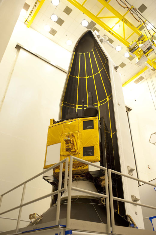
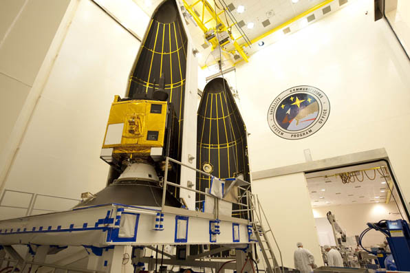
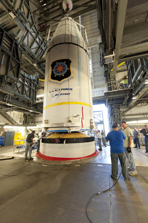
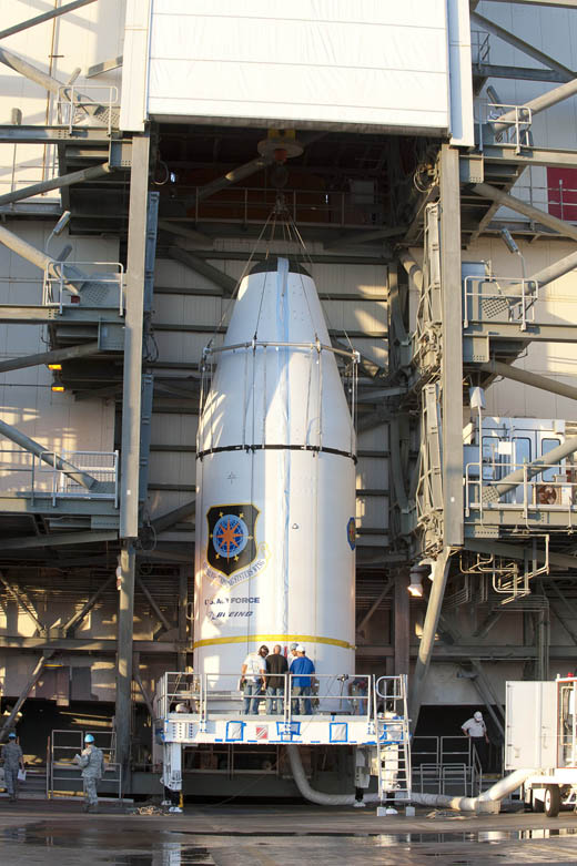
    GPS. Keynote speaker David A. Turner (U.S. Department of State) shared his time with surprise GLONASS speaker Sergey Revnivykh (International Committee on GNSS, ICG). In his GNSS Policy and Program Update, Turner provided the dates by which three new civil signals will be on 24 GPS satellites.

    • The L2C signal is a developmental signal broadcasting from 10 GPS Satellites. It began launching in 2005 with GPS Block IIR(M) satellites, and is expected to be available on 24 satellites around 2018.
    • The L5 signal is a developmental signal broadcasting from three GPS satellites. It began launching in 2010 with Block IIF satellites, and is expected to be available on 24 GPS satellites around 2021.
    • The L1C signal begins launching in 2015 with GPS III; available on 24 GPS satellites around 2026.

    “We have an increasing number of signals, increasing capability, and increasing level of service as we continue to evolve the constellation,” Turner said.

    GLONASS. The next GLONASS satellite will be launched this Friday, April 26, Revnivykh said. This will be a GLONASS-M satellite, number 47. The first launch of a new generation GLONASS K satellite is scheduled for 2015.

    Revnivykh stressed GLONASS’ role as a global utility. “We consider international cooperation is essential for all GNSS, and we consider GLONASS an essential part of the international multi-GNSS system,” he said. He stressed the importance of compatibility and interoperability as key to this policy.

    In 2012, GLONASS performed with an average accuracy better than formally required, he said. GLONASS is in worldwide use, and positioning has improved by a factor of 10, from 35 meters to about 3 meters since the first satellites were launched. Using both GPS + GLONASS provides 1.5 times better high-precision measurements, Revnivykh said.

    The new GLONASS program for 2020 for GLONASS sustainment, development, and use includes GLONASS M, K1, and K2 satellites; the positioning accuracy objective is to go from the current 2.8 meters to 0.6 meters.

    Aviation. Chris Hegarty (MITRE) presented an FAA Navigation Programs Overview on behalf of the scheduled speaker Deborah Lawrence (FAA) who was unable to attend. He noted that United Airlines has begun GBAS operations in Houston.

    In answer to a funding question, he said, “The sequestration is not expected to have a positive effect on schedule, but the presented timeline for APNT is the FAA’s current best estimate. Congress has some tough decisions before them, and I wouldn’t want to speculate on potential schedule impacts. In the words of Yogi Berra, predicting is hard, especially when it involves the future.”

    Korean SBAS. Changdon Kee (Seoul National University) shared plans for a Korean SBAS. In South Korea, LPV availability is 49.4% compared to 90.6% in Japan. “Korea needs its own system,” Kee said.

    Phase 3 of the SBAS development could start by the end of September, depending on funding. It will include open service multifunctional GEO satellites interoperable with other SBASs. A pseudolite demonstration system will be completed in 2014, clearing the way for the beginning of Phase 3.

    In all, the system will include five reference stations, two master stations, two ground uplink stations, and two GEO satellites (the main GEO by 2018 and a backup by 2020).

    The Korean SBAS open service system will provide GPS L1 augmentation, begin operation in 2020, and support aviation, land and maritime users. A test operation system will provide GPS L1 and L5 augmentation. The system is expected to be fully operational by 2021, with service available throughout Asia.

    Michibiki-AlanJapan’s QZSS. Hiroyuki Noda (Office of National Space Policy, Japan) said three more satellites for this augmentation system will be launched by the end of the decade, with the service beginning in 2018. In September 2012, the Japan cabinet made the commitment to accelerate development of the system. The first satellite, launched in 2010 (QZS-1, aka Michibiki) is performing as expected.

    QZSS is expected to improve positioning availability from 90% to 99.8% in Japan. QZSS will not only improve positioning in the Asia-Pacific region, but is expected to improve the capacity to respond to natural disasters, Noda said.

  • Lockheed Martin Team Completes Delta Preliminary Design for Next GPS III Satellite Capabilities

    Lockheed Martin has successfully completed a Delta Preliminary Design Review (dPDR) for the next Global Positioning System (GPS) III satellite vehicles planned under the U.S. Air Force’s GPS III program.

    The GPS III program will replace aging GPS satellites, while improving capability to meet the evolving demands of military, commercial and civilian users. GPS III satellites will deliver three times better accuracy and up to eight times improved anti-jamming signal power while enhancing the spacecraft’s design life and adding a new civil signal designed to be interoperable with international GNSS.

    The Air Force plans to purchase up to 32 GPS III satellites. Lockheed Martin is under contract for production of the first four GPS III satellites, and has received advanced procurement funding for long-lead components for the fifth, sixth, seventh and eighth satellites.  The successful dPDR addresses design modifications, agreed on by the Air Force and the Lockheed Martin-lead industry team, which will provide new capabilities for GPS III Space Vehicle 9 (SV09) and beyond, including the addition of a search and rescue satellite payload and a Laser Retroreflector Array (LRA). An innovative new waveform generator permits the addition of new navigation signals after launch to upgrade the constellation without the need to launch new satellites.

    “We have worked very closely with the Air Force and GPS community to make GPS III the most affordable and lowest risk solution for bringing new capabilities to the GPS constellation,” said John Frye, Lockheed Martin’s GPS III capability and affordability insertion manager. “The design modifications from this dPDR address ways to further reduce Air Force launch costs by $50 million per satellite through dual launch of two GPS III space vehicles on a single booster. This successful dPDR milestone sets the stage to proceed with SV09 design maturation.”

    From the beginning of the program, the Lockheed Martin team has remained focused on affordability for GPS III, the company said, while working to ensure the enhanced satellite system can evolve to continue to meet the world’s global navigation and timing needs for the next 30 years. To help reduce risks and cut costs, the GPS III team developed a GPS Non-Flight Satellite Testbed (GNST), which serves as the program’s ground pathfinder and vehicle demonstrator for the first complete satellite. The entire GPS III development and production sequence uses the GNST to provide space vehicle design level validation; early verification of ground support and test equipment; and early confirmation and rehearsal of transportation operations.

    Lockheed Martin team has met recent milestones and appears to be on track to deliver the first GPS III satellite, for launch availability in 2014.

    In February, the Lockheed Martin team successfully turned on power to the system module of the program’s first spacecraft, designated GPS III Space Vehicle 1 (SV01), demonstrating mechanical integration, validating the satellite’s interfaces, and leading the way for electrical and integrated hardware-software testing.  The satellite will complete its Assembly, Integration and Test (AI&T) in Lockheed Martin’s new GPS Processing Facility (GPF) designed for efficient and affordable satellite production.

    The GPS III team is led by the Global Positioning Systems Directorate at the U.S. Air Force Space and Missile Systems Center. Lockheed Martin is the GPS III prime contractor with teammates ITT Exelis, General Dynamics, Infinity Systems Engineering, Honeywell, ATK and other subcontractors. Air Force Space Command’s 2nd Space Operations Squadron (2SOPS), based at Schriever Air Force Base, Colorado, manages and operates the GPS constellation for both civil and military users.

  • Upcoming GNSS Satellite Launches Scheduled

    News courtesy of CANSPACE Listserv.

    Satellites expected to be launched in support of various Global Navigation Satellite Systems are the following:

    GPS
    May 15: Block IIF-4, SVN66, launch window: 17:39-17:58 UTC
    November: Block IIF-5

    GLONASS
    April 26: Single GLONASS-M or -K satellite from Plesetsk
    June 28: Three GLONASS-M satellites from Baikonur

    Galileo
    October: FOC-1 launch (two satellites)

    Indian Regional Navigation Satellite System (IRNSS)
    June (This is the first launch for an expected constellation of seven satellites, some of which will be geostationary. The constellation will provide continuous regional coverage for positioning, navigation and timing services.)


  • Air Force Awards Lockheed Martin Contracts for Next Set of GPS III Satellites

    The U.S. Air Force has awarded Lockheed Martin two fixed-price contracts totaling $120 million to procure long lead parts for the fifth, sixth, seventh and eighth next-generation GPS III satellites.

    The GPS III program will replace aging GPS satellites while improving capability to meet the evolving demands of military, commercial and civilian users. GPS III satellites will deliver better accuracy and improved anti-jamming power while enhancing the spacecraft’s design life and adding a new civil signal designed to be interoperable with international global navigation satellite systems, Lockheed Martin said.

    Lockheed Martin engineers work on the full-sized prototype of the GPS III satellite in the company’s GPS Processing Facility (GPF) near Denver.
    Lockheed Martin engineers work on the full-sized prototype of the GPS III satellite in the company’s GPS Processing Facility near Denver. In November, the team completed thermal vacuum testing for the Navigation Payload Element of the GPS III Non-Flight Satellite Testbed.

    “The GPS III program was laid out at the very beginning to reduce risk early and facilitate affordable satellite production over the long term,” said Lt. Col. Todd Caldwell, the U.S. Air Force’s GPS III program manager. “This most recent award and our team’s ability to convert the contract structure to fixed price is a sign that we are on track to meet the affordability objectives and commitments we originally set out to achieve.”

    Incorporating lessons learned from previous GPS programs, the Air Force initiated a “back-to-basics” acquisition approach for GPS III. The strategy emphasizes early investments in rigorous systems engineering, industry-leading parts standards, and the development of a full-size GPS III satellite prototype to significantly reduce risk, improve production predictability, increase mission assurance and lower overall program costs. These investments early in the GPS III program are designed to prevent the types of engineering issues discovered on other programs late in the manufacturing process or even on orbit.

    “The Air Force’s back-to-basics acquisition strategy and the progress we have already made on our GPS III prototype gives us high confidence in our ability to perform efficient and affordable fixed-price satellite production going forward,” said Keoki Jackson, vice president of Lockheed Martin’s Navigation Systems mission area. “As our world becomes increasingly dependent on GPS technology, the new GPS III satellites will be a critical element of both our national and economic security, and we are committed to achieving mission success for the billions of military, commercial and civilian users worldwide.”

    Lockheed Martin is currently under contract for production of the first four GPS III satellites, and will now begin advanced procurement of long-lead components for the fifth, sixth, seventh and eighth satellites. The Air Force plans to purchase up to 32 GPS III satellites.

    The GPS III team is led by the Global Positioning Systems Directorate at the U.S. Air Force Space and Missile Systems Center. Lockheed Martin is the GPS III prime contractor with teammates ITT Exelis, General Dynamics, Infinity Systems Engineering, Honeywell, ATK and other subcontractors. Air Force Space Command’s 2nd Space Operations Squadron (2SOPS), based at Schriever Air Force Base, Colo., manages and operates the GPS constellation for both civil and military users.

  • Lockheed Martin Completes GPS III Flight Software Milestone

    The Lockheed Martin team developing the U.S. Air Force’s next generation Global Position System III satellites has completed a key flight software milestone validating the software’s ability to provide reliable and effective command and control for the GPS III satellites planned for launch into orbit.

    The GPS III program will affordably replace aging GPS satellites, while improving capability to meet the evolving demands of military, commercial and civilian users. GPS III satellites will deliver better accuracy and improved anti-jamming power while enhancing the spacecraft’s design life and adding a new civil signal designed to be interoperable with international global navigation satellite systems.

    The milestone, known as Software Item Qualification Testing (SIQT), was completed for the satellite’s spacecraft bus flight software, which is critical to controlling the spacecraft on orbit and monitoring the health and safety of the satellite’s subsystems. SIQT included 131 individual test events and represented the culmination of a rigorous software engineering risk reduction and development phase. The software will next be integrated and tested on the first GPS III satellite, which is on schedule for launch availability in 2014.

    “Completion of this flight software milestone demonstrates our continued positive program momentum and is another step forward in reducing risk up front to facilitate long term affordability,” said Lt. Col. William ‘Todd’ Caldwell, the U.S. Air Force’s GPS III program manager. “In this challenging budget environment, the entire government and industry team is focused on delivering the critical GPS III satellites affordably and efficiently for users worldwide.”

    To further reduce risk, the flight software has already been integrated and tested on the program’s satellite prototype, known as the GPS III Non-Flight Satellite Testbed (GNST).

    “Delivering fully qualified flight software this early in program development demonstrates the rigor of our GPS III software development processes,” said Keoki Jackson, vice president of Lockheed Martin’s Navigation Systems mission area. “Through up-front investments in high-fidelity, flight equivalent hardware and software testbeds, our team successfully executed on schedule to develop and qualify the flight software critical to the success of the GPS III program.”

    Lockheed Martin is on contract to deliver the first four GPS III satellites for launch. The Air Force plans to purchase up to 32 GPS III satellites.

    The GPS III team is led by the Global Positioning Systems Directorate at the U.S. Air Force Space and Missile Systems Center. Lockheed Martin is the GPS III prime contractor with teammates ITT Exelis, General Dynamics, Infinity Systems Engineering, Honeywell, ATK and other subcontractors. Air Force Space Command’s 2nd Space Operations Squadron (2SOPS), based at Schriever Air Force Base, Colorado, manages and operates the GPS constellation for both civil and military users.

  • Exelis Wins Air Force Contract to Research Low-Cost GPS Alternatives

    ITT Exelis has been awarded a $2.15 million contract by the Air Force Research Laboratory (AFRL) to research the development of a small satellite navigation payload to augment the current GPS program. The GPS NAVSAT (Navigation Satellite) program seeks to provide affordable capabilities to aid end-users located in tough-to-reach environments.

    “The development of smaller satellites — in terms of size, weight, power and cost — will yield greater affordability for our customers,” said Mark Pisani, vice president and general manager, Precision Instruments and Positioning, Navigation and Timing Systems, ITT Exelis Geospatial Systems. “A smaller satellite size will allow for improved launch vehicle selection flexibility.”

    The goal of the 18-month initial study is to identify innovative ways to increase affordability and sustainment of the GPS program through payload weight reduction, size and power. The GPS NAVSAT will maintain similar performance capability to the existing GPS system, but will aid GPS end-users in signal-constrained environments, located in urban or mountainous terrain.

    Work on GPS NAVSAT is performed in Clifton and Bloomfield, New Jersey.

    For nearly 40 years, Exelis payloads and payload components have been on board every GPS satellite with more than 500 years of on-orbit life without a single mission-related failure due to Exelis equipment.

  • Launch of GPS Satellite Struggled through Tense Moments

    A new report by Spaceflight Now reveals that the launch October 4 of a GPS satellite experienced tense touch-and-go moments.

    The Delta 4 rocket’s cryogenic upper stage engine experienced a fuel leak that caused a low-thrust condition. Four-and-a-half minutes into the launch, after the first stage had shut down and separated, the trouble began as the RL10B-2 engine on the upper stage extended its nozzle and fired to life.

    When the powerplant was igniting and reached its peak chamber pressure, a leak started above the narrow throat portion of the thrust chamber, setting off a chain of nail-biting events over the next three hours as the vehicle made its climb to the GPS constellation. The Delta 4 made autonomous adjustments, however. The onboard inertial guidance and flight control systems compensated for the lower thrust conditions. Its closed loop guidance system measured the decreased thrust in real time and revised the trajectory and burn durations to ensure the mission succeeded. The GPS IIF-3 satellite was delivered to the correct orbit as planned.

    United Launch Alliance has begun an investigation into the incident.

  • Lockheed Martin Completes Environmental Test on GPS III Pathfinder

    The Lockheed Martin team developing the U.S. Air Force’s next generation Global Positioning System III  satellites has completed thermal vacuum testing for the Navigation Payload Element (NPE) of the GPS III Non-Flight Satellite Testbed (GNST). The milestone is one of several environmental tests verifying the navigation payload’s quality of workmanship and increased performance compared to the current generation of satellites, the company said.

    The GPS III program will affordably replace aging GPS satellites, while improving capability to meet the evolving demands of military, commercial and civilian users. GPS III satellites are expected to deliver better accuracy and improved anti-jamming power while enhancing the spacecraft’s design life and adding a new civil signal designed to be interoperable with international global navigation satellite systems.

    “GPS III satellites have the most advanced navigation payloads ever manufactured.  This milestone is a key indicator that we have a solid design and are on track to provide unprecedented position, navigation, and timing capability for GPS users worldwide,” said Lt. Col. Todd Caldwell, the U.S. Air Force’s GPS III program manager.

    During thermal vacuum testing, the navigation payload’s performance was proven in a vacuum environment at the extreme hot and cold temperatures it will experience on orbit to ensure it will operate as planned once in space. Following the test, the NPE will now be integrated with the GNST for final satellite level testing.

    The GNST is a full-sized prototype of a GPS III satellite used to identify and solve development issues prior to integration and test of the first space vehicle. The approach significantly reduces risk, improves production predictability, increases mission assurance and lowers overall program costs. Following integration and test at Lockheed Martin’s GPS Processing Facility (GPF) near Denver, the GNST will be shipped to Cape Canaveral Air Force Station, Fla., for risk reduction activities at the launch site.

    “The completion of thermal vacuum testing on our first navigation payload is a critical milestone for our program that demonstrates we are on a solid path to meet our commitments,” said Keoki Jackson, vice president of Lockheed Martin’s Navigation Systems mission area. “The Air Force’s early investment in our GPS III pathfinder is now paying off and will enable highly efficient and affordable satellite production going forward.”

    Lockheed Martin is on contract to deliver the first four GPS III satellites for launch. The Air Force plans to purchase up to 32 GPS III satellites.

    The GPS III team is led by the Global Positioning Systems Directorate at the U.S. Air Force Space and Missile Systems Center. Lockheed Martin is the GPS III prime contractor with teammates ITT Exelis, General Dynamics, Infinity Systems Engineering, Honeywell, ATK and other subcontractors. Air Force Space Command’s 2nd Space Operations Squadron (2SOPS), based at Schriever Air Force Base, Colo., manages and operates the GPS constellation for both civil and military users.

  • USAF Awards Four Contracts To Improve GPS Performance

    The U.S. Air Force is investing to improve the Global Positioning System (GPS) used worldwide for military and civilian purposes.

    Between Sept. 28 and Oct. 1, the Air Force announced four new GPS contracts.

    Three were in the $30 million range, including contracts to Rockwell Collins and L-3 Communications to test and engineer new GPS technology, while Raytheon was awarded just under $30 million to develop receiver cards for GPS systems. Honeywell International also received a $14 million contract for engineering services related to GPS.

    Maintained by the Air Force, the GPS is used in everything from civilian car navigation to targeting for military weapon systems. The only competition for the American GPS is the Russian GLONASS system, although the European Union is currently developing its own system, nicknamed Galileo.

    The contracts were announced days before the Oct. 4 launch that put the first new GPS satellite of 2012 into orbit. That satellite, a Boeing-designed GPS IFF, improves on navigational accuracy, provides a more secure military signal and has a longer design life than older satellite models. It should deploy fully in about three months.

  • GPS IIF-3 Satellite Now Transmitting L1, L2 Signals

    Credit: ULA/Atkeison
    A Delta IV rocket lifts-off into the blue skies over Cape Canaveral on Thursday with an advanced GPS satellite. (Credit: ULA/Atkeison).

    Video of launch.

    UPDATE: The SVN65/PRN24 L5 transmitter has now been switched on. L5 is the civilian safety-of-life GPS signal, designed to meet demanding requirements for safety-of-life transportation and other high-performance applications.

    UPDATE: The GPS Block IIF-3 satellite, SVN65, began transmitting L1 and L2 signals as PRN24 on October 8. A number of stations of the International GNSS Service are now tracking the satellite. The satellite is included in broadcast almanacs although it is set unhealthy and will continue to be so until satellite commissioning is completed. The satellite is still drifting towards its designated orbital position of Slot 1 in Plane A.

    Meanwhile, SVN27/PRN27 was decommissioned from active service on October 6 and removed from the broadcast almanacs. However, the L-band
    transmitters of SVN27 remain active, presumably for end-of-life testing.


    UPDATE: According to Boeing, the satellite manufacturer, SVN65 is on orbit and performing as expected. A Boeing press release stated that “Controllers confirmed initial contact with the spacecraft at 11:43 a.m. Eastern time. The satellite’s GPS signals will be turned on and tested within a few days.”

    Incidentally, the launch occurred exactly 55 years to the day after the launch of the world’s first satellite, Sputnik I, on October 4, 1957. It was Doppler tracking of that satellite that gave rise to the Transit navigation system and subsequently, its successor, GPS.


    The launch of the GPS Block IIF-3 satellite took place as scheduled October 4 at 12:10 UTC (8:10 a.m. EDT), aboard a United Launch Alliance Delta IV rocket from Cape Canaveral, Florida. Spacecraft separation was reported at 16:27 UTC.

    The Boeing-built spacecraft is designed to improve network coverage for both civilian and military networks, including a new L5 signal for improved commercial and civil aviation users.

    The satellite, also known as SVN65, will be positioned in orbital slot 1, which is in plane A and will use the PRN24 ranging codes. Slot 1 was recently occupied by a Block IIA satellite, SVN39, operating as PRN09. SVN39 is one of the oldest operating satellites in the GPS fleet, having been launched on 26 June 1993. SVN39 underwent an initital Delta-V on September 27 to move it close to SVN38/PRN08 in slot 3 in plane A, making room for the new Block IIF satellite.

    “Congratulations to the entire team on today’s successful launch of the GPS 2F-3 satellite,” Jim Sponnick, ULA vice president, Mission Operations, said in a post-launch press release.

    “ULA and our mission partners have a rich heritage with the GPS program and we are proud to have served alongside the government and contractor teams over the last two decades to provide important Global Positioning System capabilities for our national defense and for millions of civilian and commercial users around the world.”

    Credit: ULA/Atkeison
    A Delta IV rocket lifts-off with an advanced GPS satellite from Cape Canaveral on Thursday. (Credit: ULA/Atkeison).


    An NANU announcing the launch has been issued:

    NOTICE ADVISORY TO NAVSTAR USERS (NANU) 2012062
    SUBJ: SVN65 (PRN24) LAUNCH JDAY 278
    1.     NANU TYPE: LAUNCH
    NANU NUMBER: 2012062
    NANU DTG: 041222Z OCT 2012
    SVN: 65
    PRN: 24
    LAUNCH JDAY: 278
    LAUNCH TIME ZULU: 1210

    2. GPS SATELLITE SVN65 (PRN24) WAS LAUNCHED ON JDAY 278.
    A USABINIT NANU WILL BE SENT WHEN THE SATELLITE IS SET ACTIVE TO
    SERVICE.

    3. POC: CIVILIAN – NAVCEN AT 703-313-5900, HTTP://WWW.NAVCEN.USCG.GOV
    MILITARY – GPS OPERATIONS CENTER AT HTTPS://gps.afspc.af.mil/
    GPSOC , DSN 560-2541,
    COMM 719-567-2541, [email protected] , HTTP://gps.afspc.af.mil/GPSOC/GPS
    MILITARY ALTERNATE – JOINT SPACE OPERATIONS CENTER, DSN 276-3514.
    COMM 805-606-3514.
    [email protected]

  • GPS IIF Launch Set for Thursday

    Photos from United Launch Alliance
    Photos from United Launch Alliance

    Lift-off is set for 8:10 a.m. EDT (1210 GMT) Thursday for a GPS IIF satellite, reports Spaceflight Now. GPS IIF-3 will replace an aging 19-year-old craft in plane A, slot 1, part of the program to incrementally upgrade the GPS constellation with greater accuracy, better jam-resistance, and a new civilian aviation signal, all of which are features of the Boeing-build Block IIF series.

    The United Launch Alliance Delta 4 rocket and GPS satellite payload will undergo a final technical assessment today and a readiness review Tuesday before entering into countdown operations Wednesday night.

    The 19-minute launch window is timed to deliver the GPS IIF-3 satellite directly into plane A of the navigation network 11,000 miles above Earth.

    The satellite is expected to be checked out and ready for handover to Air Force controllers by mid-November, according to Jan Heide, Boeing’s GPS program director.

    Photos from United Launch Alliance: