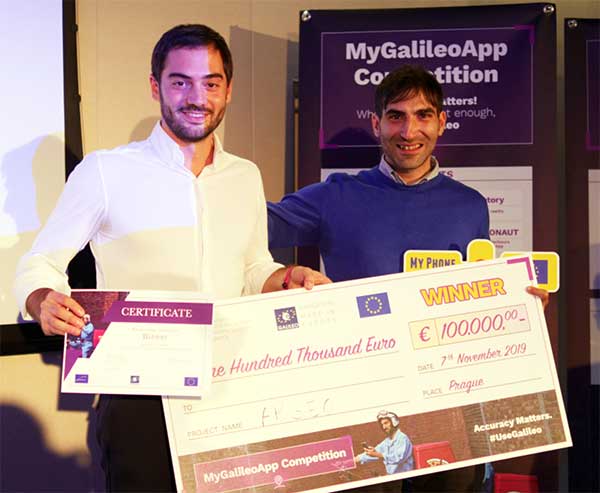
The winners of this year’s MyGalileoApp competition were announced at a ceremony held at the European GNSS Agency (GSA) headquarters in Prague on Nov. 7.
First prize of EUR 100,000 went to ARGEO, a mobile app based on geolocation, augmented reality and blockchain that allows users to discover content such as prizes, coupons and shopping cards geo-located around the streets of a city.
Second prize, worth EUR 50,000, went to the Tractor Navigator app, which provides guidance for farmers driving tractors, enabling them to visualise their position and trajectory in an open field. Finally, the EUR 30,000 third prize went to Ready Park, an app that makes parking easier by pairing drivers leaving a spot with users looking for one.
The 10 finalists from eight countries made their pitches to a panel of jurors throughout the afternoon of Nov. 7, after which the jury reached its decision on the winning apps.
Welcoming the competitors to the finals, GSA Executive Director Carlo des Dorides noted that the 10 finalists had been selected from a total of 150 competing teams, representing more than 35 nationalities.
“The MyGalileoApp competition is the largest app development competition ever organised within the Galileo programme. After reaching 1 billion smartphones equipped with Galileo earlier this year, the next big challenge is to develop applications that will make best use of the Galileo differentiators,” des Dorides said.
Following the pitches was an investors’ panel, with presentations by experts from various institutions, including venture capital firms and accelerators, providing information on how apps can bridge the gap between great ideas and viable business opportunities.
“Private and public investors will have an opportunity today to expand their investment portfolio with the Galileo apps generated by the competition, helping to transform the apps into commercial successes,” des Dorides said, adding that the goal of the MyGalileoApp competition was not just to make beautiful apps, but to create jobs and generate economic growth. For a full agenda of the day’s events, click here.
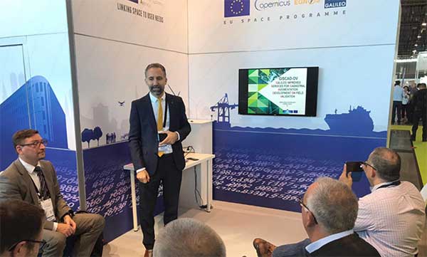
Galileo and EGNOS were the focus of attention at a special workshop at this year’s Intergeo in Stuttgart, which took place in September. Intergeo is the world’s leading conference and trade fair for geodesy, geo-information and land management.
Intergeo provided an opportunity to give an update on the status of the Galileo and EGNOS programs and to present user case studies at a special workshop focusing on the geomatics market.
In his presentation at the conference, Eduard Escalona, Market Development Innovation Officer at the European GNSS Agency (GSA), stressed the key role of GNSS.
“GNSS is a cornerstone in many areas: It is a fundamental element for cadastral surveying, in the construction sector, in mining, land surveying and mapping activities, for all geographic information systems (GIS), for infrastructure monitoring and for marine surveying. For all of you who are working in these and many other areas, Galileo is now helping to provide the GNSS services you need,” he said.
Dual-frequency boosts market
The European GNSS programs, Galileo and EGNOS, continue to move forward in terms of adoption by the professional market and among general users, thanks in no small part to the development of dual-frequency capability.
Traditionally, mobile, location-based applications have been powered by single-frequency GNSS receivers operating under stringent battery-power and footprint constraints. With a dual-frequency chipset, these devices now benefit from better accuracy, ionosphere error cancellation, improved tracking and better multipath resistance.
Galileo is leading the way in the area of dual-frequency signal delivery, now with more dual-frequency operational satellites in orbit than any other GNSS system. Market uptake of Galileo receivers has been impressive; in addition to the geomatics-related areas of particular interest to the Intergeo public, dual-frequency GNSS chipsets are also appearing in the automotive sector, where connected cars and autonomous vehicles present a clear and pressing need for accurate and reliable positioning information.
New services to come
“To date, more than one billion Galileo-enabled devices have been sold,” said Escalona, “but Galileo isn’t standing still, waiting. We are proposing new services to appear in the coming years.”
These include the much-anticipated High-Accuracy Service (HAS) and a new Authentication Service. “The HAS will be a free, globally available service providing an accuracy of 20 cm, with PPP [Precise Point Positioning] corrections,” Escalona said.
Meanwhile, the Authentication Service (OS-NMA) will provide protection against jamming, spoofing and meaconing on the E1B signal and a separate Signal Authentication Service (SAS) will provide an even higher level of protection on the E6 signal.
“EGNOS is currently working with GPS, but of course we are looking forward to augmenting Galileo in the near future,” said Sergio Cabrera Bona, EGNOS Service Adoption Tools Engineer at the European Satellite Services Provider, whose core activities comprise EGNOS operations and service provision.
“GNSS is critical in all of these fields, whether it is mapping and GIS, farming, forestry, thermal pictures, management of natural terrains,” Cabrera said. He listed other areas, including management and inspection of utilities, power networks, water supply, telecoms, drones, inventory, surveying, field campaigns and determination of perimeters in agriculture as areas where GNSS plays a key role.
“It is not possible to mention all of the activities where you need reliable positioning. What you have to know is that with EGNOS augmentations you already have a horizontal accuracy below one metre and a vertical accuracy below two metres, so this is a very good accuracy,” he said.
There is much more that could potentially be done right now, Cabrera explained. “Most of the professional equipment is already EGNOS-enabled, but in practice users do not always configure their equipment correctly to exploit this capability. EGNOS adoption and support is going ahead full speed, but in the GNSS device market, many users still do not know they can use EGNOS. So the education process remains an ongoing effort,” he said.
Cabrera explained that the EGNOS user support website can be an important part of this educational drive on the top of the help desk. “We have very interesting tools and resources available online. For example, we will have a new EGNOS usability map available very soon on the website. With this tool you will be able to easily see the current availability of EGNOS signals in your location, which will be very useful especially in urban environments, for example. We also have many user support services and there is a new mobile app coming, so please visit our website and take advantage of EGNOS. It is there for you.”
Introducing the GSC
Galileo services improvement expert Pedro Gómez Martínez informed participants about the European GNSS Service Centre (GSC), defining both the concept of operations as well as the procedures necessary to provide the services that the GSA offers to Galileo users.
“The European GNSS Service Centre is the single interface between the infrastructure and users of the Galileo open services, commercial service and search and rescue service (SAR),” said Gómez. “So the GSC is a center that provides experts, know-how, evaluation of capability, distribution of information and support for the provision of value-added services provided by the Galileo system.”
The GSC website is a core resource for Galileo users, Gómez said, reporting real-time system status and incident notifications, with a bank of key documents and a full-time help desk. “It is very important for us that this is a two-way interactive service that includes your feedback. We need you to report any incidents that you might experience related to the product, service and data provision. We are very interested in user satisfaction, and we want to know how you respond to improvements. And of course, in general, we are here to promote GNSS in all its forms, in all areas, for all users.”
The GSC launched a new version of its website in the run-up to the InterGEO event. “More than ever we are making it easier for you to engage in dialogue with us and to provide your feedback. This is very important to us with new services coming up in the future,” Gomez said.
Research fundamentals
“One of the very important responsibilities of the GSA is the management of a number of EGNSS research and development programmes,” said Eduard Escalona. “We have Horizon 2020, the European Union’s research Framework Programme. There we have a final call for proposals coming up in November, with a deadline in March 2020. The GSA also is overseeing the Fundamental Elements programme, which is funding research specifically targeted at developing Galileo-enabled chipsets, receivers and related technologies.”
To illustrate Escalona’s point, the presentations featured EU-funded GNSS-related research projects leveraging the accuracy and integrity offered by Galileo. Pere Molina of Geonumerics presented the MapKite project. Funded under Horizon 2020 and now completed, MapKite integrates an unmanned aerial system (UAS) and a mobile mapping aystem (MMS) for simultaneous capture of geo-data from the air and from the ground. Molina showed data from a successful corridor mapping exercise run using the MapKite system.
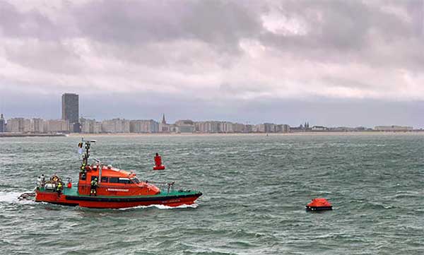
Operation Shark Bait showed how this vital service can quickly trigger a rescue operation and save lives at sea. Despite a grey day and choppy sea conditions, an emergency rescue was initiated in just over three and a half minutes after intrepid “volunteer victim,” Australian broadcaster and explorer Tara Foster, operated her Galileo-enabled SAR beacon from a small life raft buffeted by the waves just offshore from the port of Ostend.
Operation Shark Bait was a specially designed demonstration of the capabilities of the Galileo SAR service that took place around the new state-of-the-art Belgian Maritime Rescue and Coordination Centre (MRCC) in Ostend with an invited audience of VIPs and media. The whole operation was streamed live over YouTube and the Europe By Satellite (EBS) TV service.
The Shark Bait test took just over three and a half minutes to locate the PLB developed under a GSA Horizon 2020 project. (Photo: GSA)
The scenario was simple. Tara was left alone at sea in a small life raft, but with a 406-MHz Cospas-Sarsat personal locator beacon (PLB). On activating the beacon, the stopwatch started. The time to receive the distress signal, compute her position and alert the relevant rescue authorities was recorded. The Belgian fast rescue boat ORKA R6 then dashed out to sea to pick her up.
Subsequently, a NH90 Cayman SAR helicopter from the Belgian 40th squadron was also scrambled to help transfer “injured” Tara to hospital.
Shark Bait was a great success with just 3 minutes 32 seconds elapsing from Tara activating her Galileo-enabled personal locator beacon (PLB) to the moment commanders at MRCC could dispatch the ORKA to her location.
The location, with an initial accuracy of 100 metres, is provided by the Galileo receiver inside the PLB to the Galileo satellites in view. The Galileo satellites then forward this information to the Cospas-Sarsat infrastructure, where the position is validated.
“The PLB used was developed under one of our Horizon 2020 projects and is the first Galileo-enabled beacon on the market,” said Fiammetta Diani, head of market development at the GSA.
Time saver, life saver
The day started at the MRCC in Ostend with a visit to the operations centre, an inspection of the ORKA Fast Rescue Boat and a chance to talk to Tara Foster before she was “castaway” on the waves.
Dries Boodts, deputy nautical director at MRCC, described the role of the center, which has a single focus on safety at sea. “The globe is divided into Search and Rescue Regions (SRRs),” Boodts said. “The MRCC oversees the Belgian maritime region that extends up to 47 miles off the Belgian coast.”
The region includes major shipping lanes and two large offshore wind energy parks. The MRCC deals with around 450 incidents each year involving a range of craft and issues from collisions at sea to war munitions recovery. It can call on an assortment of assets including its own rescue craft, police and navy vessels and the Belgian air force and the MRCC collaborates extensively with authorities in neighbouring countries.
Galileo is Europe’s contribution to upgrading Cospas-Sarsat, the global satellite-based search-and-rescue system. Since its introduction in 1981, Cospas-Sarsat is estimated to have saved 45,000 lives.
The current MEOSAR (Mid-Earth Orbit Search and Rescue) upgrade is based on the EU’s Galileo satellite constellation that carries a dedicated Cospas-Sarsat payload for the 406-MHz distress beacons that give users free access to global system.
The addition of Galileo (and other GNSS satellites) to the system has already enabled a dramatic increase in performance in terms of better accuracy to locate activated distress beacons and vastly improved global coverage.
“With the Galileo system, all parts of the world will be covered at least every 10 minutes — previously this was up to four hours — and guaranteed location accuracy is reduced from 10 to 2 kilometers,” explained Jolanda van Eijndthoven from the European Commission.
As well as the 23 SAR payloads currently provided by Galileo, with more to come, the EU also provides ground infrastructure including MEO Local User Terminals (LUTs) to pick up the signals relayed from the satellites. These LUTs are not just in Europe, and a fourth facility is o be opened soon on La Reunion island to improve coverage across the Indian Ocean.
Return link reassurance
From the end of the year the Galileo system will also provide a Return Link Service (RLS) that will be able to send an acknowledgement to the victim that their distress signal has been received and help is on its way. This new ability to provide reassurance should deliver a valuable psychological lift to victims and further boost survival rates.
“The PLBs developed under our Horizon 2020 projects will be the first ones on the market to have the RLS capability,” said Fiammetta Diani.
Back on dry land, Tara confessed that the simulation had felt very real to her. “The scariest part was the transfer to the helicopter from the rescue boat,” she said. “The winch was like a lift without a floor and very fast! Stepping from the flimsy life raft to the ORKA was also not easy – those waves were high!”
“The operation went just like clockwork,” concluded Paul Flament Head of the Galileo and EGNOS unit at the European Commission’s DG GROW.
The new GSAGNSS Market Report is now available for download. The report provides a comprehensive overview of the GNSS market and the global industry, as well as a focus on EGNSS differentiators and synergies with Copernicus, according to the publisher, the European GNSS Agency (GSA).
Areas covered include:
A general overview of the GNSS market and a global industry overview.
Analysis of macro-trends affecting GNSS, including climate change and the circular economy, big data, artificial intelligence, the silver economy, cyber security and the sharing economy.
A review of the main GNSS market segments in detail, including trends and developments, forecasts for future shipments, revenues and the GNSS installed base, and a look into GNSS user requirements.
GNSS in Space. This year, the report features the “Editor’s Special: GNSS for NewSpace,” a section that introduces GNSS receivers in satellites and their relation to the evolving space sector.
GNSS market monitoring is a key activity of the GSA. Market monitoring supports GNSS stakeholders in their planning and decision-making, and offers a clear tool to understand GNSS trends and evolutions.
Since its launch in 2010, the GSAGNSS Market Report has become the go-to-source for information on the dynamic, global GNSS market segments and applications.
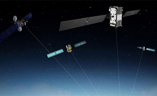
A Eutelsat communications satellite launched Oct. 9 carried a payload for the European GNSS Agency (GSA) called GEO-3. GEO-3 is a geostationary satellite designed to augment GNSS signals.
The EGNOS payload, manufactured by Airbus Defence and Space, will hone the accuracy of satellite navigation signals over Europe for use in aviation, maritime and other industries as part of the European Geostationary Navigation Overlay System (EGNOS).
The Eutelsat-5 West B satellite also hosts a payload that will enable service continuity for television broadcasting in Europe and North Africa.
The GSA signed a contract in March 2017 with Eutelsat Communications for the development, integration and operation of the next-generation GEO-3 EGNOS payload.
EGNOS operational messages are broadcast via navigation payloads on-board two GEO satellites, including an Inmarsat-3F2 satellite that is fast approaching end-of-life. The GEO-3 services replenish the EGNOS SBAS payloads, guaranteeing EGNOS availability and supporting the transition to the dual-frequency multi-constellation-capable EGNOS V3.
Eutelsat will also develop two redundant RF ground stations to uplink the EGNOS message to the payload. It will also host EGNOS’ Navigation Land Earth Stations (NLES) in Rambouillet, France, and Cagliari, Italy, both of which will be co-located and connected to the RF ground stations.
Proton-powered launch
The satellite was carried aloft on a Proton rocket along with a second satellite, the Mission Extension Vehicle-1 for Northrop Grumman subsidiary SpaceLogistics, designed to service satellites. Both spacecraft were built by Northrop Grumman.
The Proton rocket lifted off at 6:18 a.m. Eastern Time from Russia’s Baikonur Cosmodrome in Kazakhstan. Its two passengers separated from the rocket 16 hours later in a supersynchronous transfer orbit.
Eutelsat-5 West B is a replacement for the 17-year-old Eutelsat-5 West A satellite.
The estimated number of Galileo-enabled smartphones in use has reached one billion. This significant milestone has been achieved in the week when the European GNSS Agency (GSA), responsible for operation of the Galileo programme, celebrates its 15th anniversary.
The company BQ pioneered Galileo use in smartphones with its Aquaris X5 Plus in July 2016. Since then, market uptake of Galileo-enabled smartphones has been rapid as other manufacturers were quick to embrace the opportunities that Galileo offers.
Global annual GNSS receiver shipments are forecast to grow from 1.8 billion units in 2019 to 2.7 billion units in 2029.
Currently, 156 Galileo-enabled smartphone models available on the market. The “1 billion users” milestone is based on the number of smartphones using Galileo sold across the world. The actual number of Galileo users around the world is much larger. You can track which devices, including smartphones, are Galileo-enabled on the UseGalileo.eu site.
Today, 95% of companies that produce smartphone chips for satellite navigation make chips that enable Galileo. According to figures in the latest GSA GNSS Market Report, which is to be published soon, global annual GNSS receiver shipments are forecast to grow continuously across the next decade, from 1.8 billion units in 2019 to 2.7 billion units in 2029. Most of these shipments are for receivers costing less than €5, and 90% of receivers in this price segment are used in smartphones and wearables.
The number of Galileo-enabled smartphones in use has soared to 1 billion in just 3 years. (Image: GSA)
“Galileo is now providing high quality timing and navigation services to 1 billion smartphone users globally,” said Elżbieta Bieńkowska, commissioner for Internal Market, Industry, Entrepreneurship and SMEs. “This has been made possible by a truly European effort to build the most accurate navigation system in the world, with the support and dedication of the GSA. I am confident that our space industry will continue to thrive with more work, ideas and investment under the new EU Space Programme.”
“One billion smartphone users is a significant milestone and a major achievement for the Galileo programme and for the GSA,” said GSA Executive Director Carlo des Dorides. “The GSA has worked tirelessly to build bridges with research and industry and create a strong community of service providers who trust Galileo and understand the technological innovation opportunities it brings.
“Chipset and receiver manufacturers in particular have been quick to leverage Galileo’s outstanding performance,” des Dorides said. “These manufacturers believed in Galileo from the beginning, when Galileo was still an idea, and invested in the technology. It is thanks to them and the unique blend of expertise and knowledge of the GSA team that we are now celebrating 1 billion Galileo-enabled smartphones.”
GSA Executive Director Carlo des Dorides kicks off the celebration. (Photo: GSA)
News from the European GNSS Agency
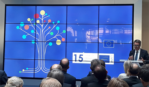
The European GNSS Agency (GSA) hosted a special event on Sept. 10 to mark the 15th anniversary of its creation. The agency was set up as the European GNSS Supervisory Authority in 2004 to oversee the development of the European space programmes EGNOS and Galileo.
GSA Executive Director Carlo des Dorides welcomed special guests to the GSA’s Prague headquarters to celebrate the event, including European Commissioner Elżbieta Bieńkowska, Czech Transport Minister Vladimir Kremlik, French Space Agency (CNES) President and GSA Administrative Board Chair Jean-Yves Le Gall and European Space Agency Director General Jan Woerner, in addition to other EGNOS and Galileo stakeholders.
“Over the last 15 years, the GSA has become one of the key players in building Europe’s independent capacity in satellite navigation,” said Commissioner Bieńkowska, responsible for Internal Market, Industry, Entrepreneurship and SMEs. While participating in the celebrations, the commissioner also presided over another historic milestone for both the Galileo programme and the GSA — the countdown to the 1 billionth Galileo-enabled smartphone sold.
“GSA has been at the heart of the EGNOS and Galileo programmes over the past 15 years.” — Carlo des Dorides.
Linking space to user needs
GSA Executive Director Carlo des Dorides said: “It is an honour and a great pleasure to celebrate this important milestone with representatives from all our stakeholders — the Commission, users, industry and other institutional bodies. Their presence here clearly shows that the GSA is delivering on its mission – linking space to user needs”.
“15 years ago, no one imagined how far the GSA and the EU satellite navigation systems EGNOS and Galileo would go. Now, no one can imagine Europe without Galileo and EGNOS, or Galileo and EGNOS without Europe. The GSA has been at the heart of these two programmes, accelerating progress in service provision, market uptake and guaranteeing operation security over the past 15 years. All that has been accomplished has been made possible thanks to the unique blend of expertise, dedication and commitment of the GSA’s staff,” des Dorides said.
Speaking at the event, GSA Administrative Board Chair Jean-Yves Le Gall said: “Today thanks to the European Union’s impressive investment, the European Space Agency’s technical expertise and the GSA’s outstanding commitment, Galileo is offering the best localization available worldwide. The range of applications is vast. This is structuring our economy and the implementation of the public policies to ensure that European companies are taking full advantage of these fantastic services.”
Czech Transport Minister Vladimir Kremlik noted the importance to the Czech capital of hosting the EU agency. “It has been fifteen years of hard work and continual development. By chance it is also seven years since the seat of GSA has been relocated from Brussels to Prague. I am very proud, that the Czech Republic is the hosting country of the seat of such an important European agency with real global reach,” the minister said.
Looking to the future
Galileo will soon reach its Full Operational Capability, a phase that will require new governance to comply with benchmarked standards for the management of operational satellite services. It was with this in mind that the European Parliament and the Council agreed on a new EU Space Programme Regulation establishing the EU Agency for the Space Programme (EUSPA) as the successor to the GSA.
“In the new governance the Commission will continue to be responsible for managing the overall programme. The GSA, to be renamed the ‘EU Agency for the Space Programme,’ will increasingly support the exploitation and market uptake of EU space activities and play an increased role in ensuring the security of all programme components. The intergovernmental European Space Agency (ESA), given its expertise, will remain a major partner in the technical implementation of the EU space programme,” des Dorides said.
To explore new investment support for the European space-based economy, the EIB and GSA are bringing together their expertise and experience. The common objective is to create high-skill jobs in the EU and improve the day-to-day lives of Europeans by supporting innovative companies and accelerating the development of new applications that use European global navigation satellite systems and earth observation data. These applications could be used to ensure smooth navigation, such as in search-and-rescue operations to save lives, for observing crops, and in precision farming to reduce the need for fertilizers and pesticides.
“Space is the final frontier, and there is a new worldwide ambition in reaching it. The EU’s global competitors and new private actors are investing heavily in the space sector. At the same time, new disruptive technologies and business models are emerging and changing the playing field,” said EIB Vice-President Ambroise Fayolle, who is responsible for innovation. “We need to make sure that Europe stays in the game. That is why we are particularly enthusiastic about this agreement with GSA. It is an important step to develop further support for European space entrepreneurs and businesses to eventually give them and the EU a competitive edge in this new space race.”
“Our expertise in market intelligence for satellite navigation and in supporting new business opportunities — thanks to EGNOS and Galileo — is the basis of our agreement with the EIB,” said Carlo des Dorides, GSA Executive Director. “We are confident that our cooperation will bring the extra added value required by entrepreneurs to transform their application businesses into globally successful companies.”
A changing space sector
The global space economy has been evolving rapidly in recent years. On average it has grown by 6.7% per year over the last 10 years, which is almost twice the 3.5% average yearly growth of the global economy. This growth has been partially driven by the US, China and other countries that have developed new ambitious space missions.
The main driver, however, has been the “New Space” phenomenon: a number of technological and business model innovations that have introduced new products and services and reduced the cost of accessing and using space.
The transformation of the space economy has seen new space companies investing over EUR 14.8 billion since 2000, with a fast accelerating trend: total investment in space companies grew by a factor of 3.5 in 2012–2017 compared with the previous six-year period. Moreover, US-based investors dominate the field accounting for around two thirds of the 400+ worldwide investors in space companies.
Historically, Europe has always been at the forefront of publicly-funded space exploration, investing massively in space infrastructures such as the Copernicus and Galileo satellite programmes. Europe still boasts academic and scientific excellence but risks missing the next wave of space innovation unless it seizes the opportunity to stimulate more private investment in the new space sector.
According to a recent EIB and European Commission study on the future of the European space sector, European space entrepreneurs feel there is a lack of private financing sources, particularly for late-stage investments. They therefore tend to keep an eye on private capital outside the EU, especially in the US.
In this context, European public innovation instruments play an essential role in unlocking private capital for the space sector. 40% of the European companies surveyed seek public funding, which serves as a seal of approval in the market, as a precondition for further private investment.
Ten projects in the MyGalileoApp competition have been named finalists.
Out of a shortlist of 30 semi-finalists, the 10 were judged to be the most exciting in terms of innovation, market potential and technical feasibility.
The 10 projects will now advance to the second development phase, at the end of which they should deliver a fully functioning app.
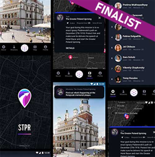
The STPR augmented reality app. (Screenshots: GSA)
Four of the 10 shortlisted projects are in the Augmented Reality and Games innovation area:
uMaze (Finland) — uMaze creates mazes in specific outdoor areas in which users can play.
ARGEO (Italy) — ARGEO allows users to discover content such as prizes, coupons and shopping cards geo-located around the streets of a city.
STPR (Poland, Australia, Ukraine) — The STPR app combines a virtual environment with game-related physical experiences in the real world.
arstory (Germany) — Arstory is a complete augmented reality ecosystem based on four main components: Galileo location, virtual objects in the real world, clustering of objects and a wide array of content options.
Apps in the smart navigation and infotainment innovation area include:
Ready Park (France) — Ready Park makes parking easier by pairing drivers leaving a spot with users looking for one.
Galileonaut (France) —Galileonaut helps sailors navigate inside a port or a marina and provides a link to the harbour master’s office.
Trukatu (Spain) — Trukatu is a mobile C2C platform that connects people who want to rent or lease items with owners who have items to rent.
Two of the shortlisted projects fall in the Fitness, Sport and mHealth category.
PanPan – Possible Assistance Needed (Germany) — PanPan serves as backup safety solution for potentially dangerous activities that may leave users in need of assistance.
LetMeAut (Italy) — LetMeAutmakes everyday tasks easier for people with autism.
One app is in the Mapping, GIS and Agriculture innovation area.
Tractor Navigator (France) — Tractor Navigator provides guidance for farmers driving tractors, enabling them to visualise their current position and trajectory in an open field.
The 10 projects have until Oct. 21 to deliver a finalized version of their app with 100% functionality. During this phase, the teams can receive technical support from the competition’s technical and business advisory team. At the end of the phase, the application should be already available for download on the Google Play and Apple platforms.
“The standard of entry in this year’s competition was very high, which made the judges’ task a difficult one. However, the final 10 projects stood out in terms of their innovative approach and uptake potential and we are looking forward to seeing the final working apps in October,” said Justyna Redelkiewicz Musial, in charge of LBS and IoT market development at the European GNSS Agency (GSA). “We hope that the 20 projects that didn’t make it into the second development phase will continue to develop their apps because, at the finals, they will also have the opportunity to demonstrate the progress that they have made,” she said.
All teams that will successfully complete the second development phase will be invited to the finals in November, where they will present their application to the GSA evaluation board.
The awards will be decided after these presentations, with the first-place winner receiving a EUR 100,000 prize. The runner up and third place winners will receive EUR 50,000 and EUR 30,000 respectively.
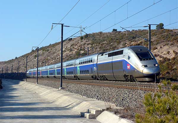
The French national rail company SNCF is adopting Galileo technology to boost customer services, in particular in its high-speed TGV network. TGV is France’s intercity high-speed rail service, and is operated by the SNCF.
With almost 50% of TGV trains already equipped with Galileo receivers, European GNSS is enabling improved customer information and traffic management.
Galileo is a technology building block that can precisely and safely locate trains and contribute to the future evolution of the European Rail Traffic Management System (ERTMS). ERTMS aims to harmonize signaling systems across Europe, and European GNSS can help reduce its costs.
SNCF is already embracing GNSS-based systems, in particular for passenger information, and fleet and traffic management.
“At the beginning of 2019, some 250 high-speed trains were already equipped with Galileo-ready receivers,” said Antoine Barre, head of SNCF train localization projects. “This represents nearly 50% of SNCF’s TGV fleet. Some 320 trains are expected to be Galileo-ready by the end of 2019.”
70 million passengers to benefit
The aim is to deliver Galileo-enabled services along the entire train journey and customer experience. During 2019, more than 70 million passengers will benefit from the improved accuracy and positioning availability delivered to French TGV trains by Galileo.
SNCF aims to equip its entire train fleet with Galileo receivers to assist non-safety relevant train localization. It also plans to further investigate the future contribution of European GNSS within ERTMS.
“Having Galileo on the iconic TGV trains is a major milestone for us, confirming that European GNSS is delivering a clear value added to one of the main EU Railway undertakings,” said Daniel Lopour, GSA market development officer.
“It is also good to see that SNCF is further progressing towards GNSS adoption on the regional fleet on the basis of the GSA position paper delivered earlier to the Community of European Railways (CER), explaining the benefits of Galileo for such applications,” Louper said.
Currently, signaling is enabled by equipment installed along rail tracks that requires regular inspection and maintenance. Accurate and reliable geolocation using GNSS will enable rail networks to reduce the cost related to the infrastructure.
Receivers installed in the train and connected via wireless networks should considerably reduce the costs of operation, maintenance and renewal of the network.
SNCF has identified three main themes of work for future rail technologies: geolocation, telecommunication and the use of satellite images for infrastructure monitoring.
Technology forward
Speaking at the Space for Innovation in Rail event, held in Vienna, Austria, March 18-19, Corinne Talotte described SNCF’s Technology Forward programme. Talotte is director of Innovative Technologies at SNCF. Talotte explain that the SNCF program is looking to build the “Railway for the Future” — a railway that is “autonomous, connected and zero emission.”
This spirit of innovation at SNCF aims to accelerate the implementation of new technologies. “First, this involves keeping an open mind on innovation and learning from other transport sectors,” Talotte said. “And our second important principle is to move to demonstrate innovative technologies as soon as possible in real operational situations to prepare the future deployment of innovations.”
Highly precise geolocation is a key element to enable autonomy in all modes of transport and future mobility systems. For trains, autonomous operation can increase the density of trains operating in the network while at the same time improving safety and reliability of customer services.
Space4Rail: From innovation to implementation
“We need to know accurately the position, velocity and attitude in real time to enable autonomous train systems,” explained Talotte. “We are developing a multi-sensor system for localisation based on GNSS but combined with other inertial sensors.
“This hybrid approach is inspired by the approach already adopted in the aviation sector. SNCF is undertaking a number of demonstrations with several partners, including the ERTMS user group and the Shift2Rail Joint Undertaking.”
Hybrid architecture
At the Space for Innovation in Rail event, Corinne Talotte said that SNCF was working on the remote operation of trains for use cases like shunting yards and the development of fully autonomous train prototypes.
The hybrid architecture makes it possible to take advantage of the benefits offered by both technologies: GNSS corrects the natural drift of the inertial unit, and when GNSS is not available, for example in tunnels or in dense urban environments, the inertial unit can take over to ensure continuity of location data. The inertial unit also protects the system from any possible disturbances in the GNSS signal, such as jamming or spoofing, as well as environmental factors.
The use of autonomous trains with innovative network control systems should enable SNCF to increase throughput on its lines. The objective is to carry more people and more goods, with greater regularity, improved energy efficiency and better economic performance, while ensuring continuing high levels of safety.
SNCF believes that the autonomous train is no longer science fiction, but the immediate future. A first prototype remote-controlled freight train should be tested some time this year, and the first prototypes of freight and passenger trains with autonomous driving capability are predicted beginning in 2023, with gradual implementation.
The European GNSS Agency (GSA) is looking for experts with a high level of expertise in navigation satellite systems to assist it with tasks related to the implementation of the Fundamental Elements funding mechanism.
The GSA is interested in experts with professional experience in specific market segments such as aviation, location-based services, agriculture, surveying, rail, road, maritime, and timing and synchronisation and/or with hi-tech business building skills.
Specifically, the GSA would like to involve business and technical experts with proven experience in one or more of the following areas:
E-GNSS signal processing;
Development (hardware, software/firmware algorithms etc.) of E-GNSS receivers and antennas;
Applications, services and products in the area of E-GNSS;
E-GNSS technologies state of the art boosting, particularly E-GNSS differentiators.
Experts assist in:
Evaluation of proposals, prize applications and tenders
Monitoring of actions, grant agreements, public procurement contracts
Experts also provide opinion and advise on preparation, implementation and evaluation of EU programmes and design of policies.
No deadline, but apply early
To select experts, the European Union Institutions regularly publish calls for expression of interest detailing the selection criteria, the required expertise, the description of the tasks, their duration and the conditions of remuneration.
The call for expression of interest is permanently open, so there is no application deadline. However, early application is encouraged because the first experts should be appointed in the third quarter of 2019. Anyone interested can register here.
Experts who have already registered in the Participant Portal expert database are invited to log-on here to declare their interest in Fundamental Elements assignments and to update their area(s) of expertise.
For more information and to download the call, click here.
Fundamental Elements
Fundamental Elements is an EU R&D funding mechanism supporting the development of EGNSS-enabled chipsets, receivers and antennas. Fundamental Elements projects are part of the overall European GNSS strategy for market uptake, led by the GSA. The objectives of the programme can be summarised as follows:
Facilitate the adoption of EGNSS, building on innovative services and differentiators;
Improve the competitiveness of EU industry ;
Address user needs in priority market segments ;
Maximise benefits to European citizens.
The total budget for projects to be carried out in 2015-2020 is EUR 111.5 million.
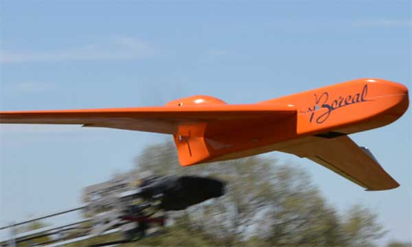
EGNSS improves positioning integrity and accuracy for the Boreal drone. (Photo: GSA)
News from the European GNSS Agency
The Skyopener project, co-financed by the European GNSS Agency (GSA), aims to pave the way toward increased use of remotely piloted aircraft system (RPAS) in civil applications.
The project has tested the benefits of multi-frequency GNSS and EGNOS in RPAS, revealing gains in availability, accuracy and robustness.
There is increasing demand to operate RPAS over long distances because of their potential for a wide range of civil applications. However, regulation regarding RPAS use in civil airspace does not yet allow beyond-visual-line-of-sight (BVLOS) operations, and remotely piloted aircraft are not allowed to fly in non-segregated civil airspace and are not yet widely used for civil and commercial applications.
This is something that Skyopener aims to change.
RPAS for civil applications. The project is developing operational processes that will reduce all categories of risks associated with RPAS and allow an air navigation service provider (ANSP) to manage very-low-level RPAS operations. Thanks to the benefits it offers in terms of improved integrity and positioning accuracy, EGNSS (Galileo and EGNOS) will play a central role in these processes.
Through these operational processes, Skyopener will contribute to the roadmap for the integration of civil RPAS into non-segregated airspace, which will have a huge impact on the service applications that can be offered by these aircraft.
“Systems that enable RPAS to fly safely, in compliance with regulations, will enable market access and significantly reduce the cost of insurance premiums for RPAS operators, making a wide range of RPAS applications more commercially attractive and widely used,” said Marc Pollina, CEO of Skyopener consortium member M3 Systems.
Excellent results. A test conducted by the project into the benefits of multi-frequency GNSS and EGNOS has delivered excellent results. The test found that the use of GPS and Galileo in L1/E1 and L5/E5 multi-frequency combinations provides improved availability, better accuracy and greater robustness against interference, as interference with one frequency band has no effect on the second.
What’s more, EGNOS helps meet increasingly stringent requirements for robust navigation, continuity, accuracy and availability — further complemented by Galileo’s multi-constellation capacity and integration with other sensors such as inertial or vision sensors.
The Boreal drone used in the project is a fixed-wing system that operates over a long range (more than 100 kilometers) in BVLOS, with EGNOS and Galileo enhancing navigation by improving positioning integrity and accuracy. In addition, the RPAS is equipped with a newly developed communication and navigation surveillance (CNS) system that combines use of GNSS, satcom and special security measures.
Essential GNSS. GNSS technologies are essential for RPAS. The primary need is obviously for navigation — the RPAS uses GNSS waypoints to follow the trajectory defined in its mission. However, GNSS also addresses other key needs, such as geofencing to ensure that the RPAS keeps within the mission parameters and surveillance to enable adequate tracking by the operator and civil aviation authority.
GNSS also enables high accuracy and, ultimately, automated landing and the geo-referencing of collected data. These benefits will increase in the future, with the Galileo authentication service reducing the risk of threats, and PPP data correction on E6 providing better geo-referencing.