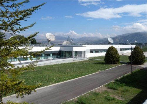
Galileo’s Control Centre in Fucino is used to oversee the satellites’ navigation payloads and services. (Photo: ESA)
Global markets learned something important from the brown-out of Galileo signals over a week’s time in July: Life goes on without a hiccup in the absence of the European GNSS.
Very unfortunately for the backers and boosters of Galileo, this message will reverberate down through the years. If vital affairs proceed unaffected by Galileo’s travails, or triumphs for that matter, who needs it? The response, a shrug. I’m tempted to say a Gallic shrug, were it not that the Gauls, the French, are prime among the system’s boosters and backers.
I’m among that number as well. Galileo and I have known each other all our lives, all our professional lives. When I started on this magazine 19 years ago, the first story I edited was on Galileo’s public-private partnership.
Galileo then was just a collective gleam in several politicians’ and scientists’ eyes. Look how far it has come: 20 satellites flying in various operational or testing states.
The European GNSS Agency was very careful to point out during the crisis that Galileo is in its initial services phase. Its signals are available for use in combination with other GNSS and are not intended to provide a complete solution by themselves. This status is expressly designed to allow for “the detection of technical issues before the system becomes fully operational.”
So, it doesn’t count. Because, the game hasn’t really started yet. Right?
Not quite.
Because this episode occurred, it will be remembered. Because it lasted so long, it will be factored. Because the official announcements about it were so obscurantist, the system may find it more difficult to regain trust.
Of course a full, careful, in-depth investigation must take place before officially announcing what caused the debacle. But more than was said could surely have been said, during the crisis. A full week now, as of this writing, after the week-long outage concluded, we still have no indication as to which piece of ground equipment or software failed and why there wasn’t a smooth transition from the Italian to the German control station.
Redundancy was built into the system to preclude exactly such failures as this. Why didn’t redundancy work?
Transparency is a rhyming word that goes well with redundancy.
Trust — corporate confidence — is fundamental to installation in multi-GNSS chips, boards, modules, all manner of devices. Four systems compete for spots at a table that may comfortably fit only three. Even three could be a stretch.
GLONASS suffered a much shorter (11-hour) timing glitch in 2014, and has yet to climb back into the public-confidence ring.
Here’s a very public lesson in transparency: When the GPS satellite SVN49 failed rather spectacularly in 2009, the GPS Directorate was very forthcoming, almost embarrassingly so, about what happened and why. GPS never lost a step in the public’s and the industry’s eyes.
The Galileo signal outage, ongoing since Thursday, July 11, has been attributed to a problem with the system’s ground infrastructure, according to an announcement by the European GNSS Agency (GSA). “Experts are working to restore the situation as soon as possible,” states the GSA. “An Anomaly Review Board has been immediately set up to analyze the exact root cause and to implement recovery actions.”
No update has appeared at this time as to when service will resume.
[Photo: Galileo’s Ground Mission Segment in the Fucino Control Centre in Italy oversees Galileo navigation services and satellite payload operations. Photo: Telespazio.]
The announcement points out that Galileo is currently in its initial services phase, wherein its signals are available for use in combination with other GNSS and do not provide a complete solution in and of themselves. This status is expressly designed to allow for “the detection of technical issues before the system becomes fully operational,” according to the GSA.
Indeed, experiments undertaken with Galileo-capable smartphones found that these devices excluded Galileo participation in their position solution. This is likely true of commercial receivers as well, which employ sophisticated signal checks as well as following system notice advisories, which have been issued in this case.
“For each constellation, there is a defined maximum age of ephemeris that is considered valid,” explained Sandy Kennedy, vice president, innovation at NovAtel. “Once an ephemeris is too old, our receiver will deem it invalid. Measurements made to satellites without a valid ephemeris are not allowed to contribute to the PVT solution. We noticed the missing Galileo ephemeris within 3 hours of the broadcast stopping. It wasn’t the NAGU that alerted us to the problem.”
The company posted a bulletin to its website on Friday afternoon, July 12, stating: “During this time [without ephemeris], NovAtel receivers will continue to track Galileo signals, but without a valid ephemeris, the signals are not included in the position solution. . . . Once the Galileo service returns to normal and transmits ephemeris information, NovAtel receivers will revert to normal operation.”
The experiments mentioned above were conducted by the Navigation Signal Analysis and Simulation (NavSAS) Group at Fondazione LINKS (formerly the Istituto Superiore Mario Boella) and the Politecnico di Torino. In their account they state that, using a software receiver that tracked the Galileo signals in space (SISs), “the position solution computed using both the GPS and Galileo constellation is affected by errors on the order of 500 meters or even more.”
In a detailed technical analysis, the NavSAS Group found three other curious and unexpected aspects of the situation, all explored and illustrated at the Group’s posting.
A European Union project has designed and prototyped the ESCAPE GNSS Engine (EGE), a positioning module intended to enable autonomous or semi-autonomous driving functions.
Automated vehicles are on the way, and the European GNSS Agency (GSA) sees satellite navigation as a core technology that will help to ensure their safe operation. At the recent Mobile World Congress in Barcelona, the GSA shared its space with the ESCAPE project, an EU-funded initiative that has developed a unique positioning module for autonomous or semi-autonomous driving.
Autonomous vehicles will feature both sensor-based and connection-based solutions for a variety of vehicle services. Ultimately, the GSA sees a “converged solution” as the best alternative, combining the strengths of both approaches. By integrating sensor data and connectivity-based information, operators can reduce the need for the most expensive sensors and at the same time save money on infrastructure.
The Fundamental Elements-funded ESCAPE project has designed and prototyped the ESCAPE GNSS Engine. It is a unique positioning module that combines precision GNSS and 4G connectivity, for the highly accurate and reliable positioning capabilities required to make automated driving a reality.
The ESCAPE GNSS Engine. (Photo: GSA)
“This is an onboard unit for autonomous vehicles,” said Jessica Garcia Soriano, R&D engineer of the Advanced Communications Business Unit at Ficosa. “It is equipped with a very good GNSS receiver made by STMicroelectronics. This was actually the first dual-frequency GNSS receiver made for the automotive market.”
Dual-frequency is of course a real differentiator for Galileo, as the world’s leading provider of dual-frequency GNSS signals. This means added precision and robustness and it helps enormously with multi-phase errors and other urban canyon issues in city-driving scenarios.
“We also have a very good positioning solution provided by GMV, another Spanish company. They are experts in these kinds of solutions. The outputs from this solution are very accurate. So we have GNSS of course, including Galileo, and apart from this you have a modem inside, a 4G modem that gets GNSS corrections from the internet, so this helps to provide better positioning. And apart from this you have inside the same module an inertial measurement unit [IMU]. This is a sensor, a device that senses acceleration and has a gyroscope, so this information also helps in providing good positioning.”
The ESCAPE unit also provides for the integration of other data from the vehicle. “That means vehicle odometry, for instance, you can have camera information, or information from maps that are stored in the vehicle, among others” Garcia said.
The market is ready
“One of our important goals is to provide a low-cost system,” Garcia said. “There are other very good positioning systems that are being developed that can be based on some very advanced technologies, such as LiDAR for instance, but this is very expensive. So our target is to develop and build a prototype of a system that could be installed in all vehicles, for the whole market. And so we are combining GNSS, 4G, IMU and all of these other data sources from the vehicle in an intelligent way, in an affordable way.”
Indeed, one of the things that make ESCAPE unique is the way it brings together high-end GNSS processing capabilities with an industrialisation process that targets high volumes and comparatively limited cost and size. It also encompasses hardware and software safety procedures required for certification for the automotive market.
Garcia explained, “At Ficosa, we are a top-tier global provider devoted to the research, development, manufacturing of vision, safety, connectivity and efficiency systems for the automotive sector. We provide solutions directly to vehicle manufacturers. Based on our expertise and thanks to the work we have done on this project, we understand very well that GNSS is a central focus for a lot of applications. From the moment we started working on this project, at Ficosa we realised that this is a new and very important market. Right now we are working on a positioning system for autonomous driving based on this unit. This is part of our roadmap at the moment. This is a positioning system that we are ready to offer to the customer.”
The unit is ready now, but we have yet to see autonomous cars in large numbers on the road. Is this a problem for the ESCAPE system? Garcia answered, “From the very first moment that you have an autonomous car in the street, you will need high-accuracy positioning, because these vehicles will need this positioning to maintain themselves safely on the road. But we don’t have to wait for autonomous cars. The vehicles on the road today can already benefit from this technology.”
Garcia pointed to Europe’s eCall system, where a call centre automatically receives location information from vehicles in distress, thanks to on-board GNSS. “You already have this emergency call technology in the vehicles,” Garcia said, “and it provides a location, so the better the location is, the easier it is to locate the people in an emergency situation. No, we don’t have to wait.”
Location and more
One thing everyone seems to agree on is that autonomous vehicles will soon be appearing on European road networks, and most driving-related decisions will be based, one way or another, on the location of the vehicle and of other vehicles and objects in its vicinity. So vehicle location and positioning will be a critical component for the effective transportation of people and goods by self-driving road vehicles. That positioning will be enabled mainly by GNSS technologies, including Europe’s Galileo, which is expected to offer significant benefits in terms of accuracy and authentication compared to the other satellite-based navigation systems.
GNSS-based location will have to be complemented by other technologies in order to get to the integrity level needed in all driving situations, but the GSA also believes the combination of dual-frequency GNSS and 4G/5G connectivity can do more than just navigation, enabling as well a diverse range of in-vehicle location-based services (LBS), much like what we see emerging in smartphones. The EU-funded ESCAPE project, with its innovative GNSS engine, represents an important step forward in the pursuit of accurate, reliable and affordable positioning and connectivity for the emerging autonomous and connected cars markets.
Following a waiver by the U.S. Federal Communications Commission (FCC) of its rules in November 2018, in which it allowed devices in the United States to access signals transmitted by the Galileo Global Navigation System, leading U.S. manufacturers are preparing to roll-out Galileo on U.S. territory.
At a meeting on Nov. 15 last year, the US FCC granted in part a request from the European Commission for a waiver of the FCC rules so that devices in the United States may access specific signals transmitted by Galileo.
This decision means that consumers and industry in the U.S. are now able to access certain satellite signals from the Galileo system, which can be used in combination with the U.S. Global Positioning System (GPS). The improved availability, reliability, and resiliency offered by incorporating Galileo capability into devices is something that U.S. chip manufacturers are eager to pass on to their customers.
“This is an important market development opportunity for manufacturers in the U.S. The FCC ruling means that industry can now benefit from the use of Galileo signals. The added accuracy and robustness offered by multi-constellation and multi-frequency capability will be a key differentiator on the market,” said Carlo des Dorides, Executive Director of the European GNSS Agency (GSA).
“We are glad to see FCC supporting Broadcom’s dual frequency GNSS vision, for which the GPS and Galileo combination is key,” said Vijay Nagarajan, VP Marketing Wireless Connectivity and Communication Division at Broadcom. “We enabled the world’s first dual frequency GNSS phone in 2018 with the simple goal of providing accurate location to the consumer even amidst the skyscrapers in a busy downtown. We are certain that consumers will benefit from this FCC ruling that will further drive the adoption of dual frequency GNSS.”
“As a leader in developing cellular technology — today, as the world launches 5G and dating back to Qualcomm’s legacy in 4G, 3G and 2G — including work to incorporate robust navigation solutions for smartphones, Qualcomm Technologies integrated Galileo across its chipset portfolio because we understand the importance and benefits of accurate, reliable, and rapid position location for consumers,” said Dean Brenner, senior vice president of Spectrum Strategy and Tech Policy, Qualcomm Incorporated. “We’re excited about the FCC allowing access to Galileo signals in the U.S. for commercial Location Based Services because it is a big step forward in improving the user experience, particularly in dense urban environments.”
Activating Galileo in the U.S.
Both Broadcom and Qualcomm Technologies, Inc. already have dual-frequency solutions that support Galileo E1/E5a signals: the world’s first dual frequency GNSS smartphone, the Xiaomi Mi-8, was fitted with a Broadcom BCM47755 chip and, in December, Qualcomm Technologies launched the newest generation in its 8 Mobile Platform Series, the dual-frequency Qualcomm Snapdragon 855 Mobile Platform.
“Approximately 100 smartphone models are already fitted with chipsets from these two manufacturers. Following the FCC ruling, we are expecting to see a significant increase in Galileo users coming from the U.S.,” said Justyna Redelkiewicz Musial, in charge of LBS and IoT market development at the GSA.
Better positioning and navigation
The FCC ruling permits access to two Galileo signals — the E1 signal that is transmitted in the 1559-1591 MHz portion of the 1559-1610 MHz Radio-navigation-Satellite Service (RNSS) frequency band and the E5 signal that is transmitted in the 1164-1219 MHz portion of the 1164-1215 MHz and 1215-1240 MHz RNSS bands.
Access to multi-constellation and multi-frequency capability means that users in the U.S. will be able to benefit from a better positioning and navigation experience particularly in urban environments where the unique shape of the E5/L5 signal makes it easier to distinguish real signals from the ones reflected by buildings, reducing the multipath effect. The simultaneous use of E5/L5 frequencies also mitigates other sources of error, such as ionospheric distortions, and makes the signal more robust against interference and jamming.
Responsibility for in-depth troubleshooting and problem resolution of the GSC Ground Infrastructure has been transferred from a European GNSS Agency (GSA)-held European GNSS Service Centre (GSC) infrastructure contract to Spaceopal and its core team member DLR GfR, responsible in the Galileo Service Operator (GSOp) industrial organization also for L2/L3 maintenance activity. This contract extends for 10 years.
The transfer occurred after Spaceopal successfully passed the Maintenance Handover Review (MHOR) for the Level 2 and 3 Maintenance of the GSC in Torrejón de Ardoz, outside Madrid, Spain.
“Taking over this responsibility will allow us to react much quicker to anomalies in a more flexible way, directly improving operations and the service that the European GNSS Agency (GSA) provides to the Galileo end users,” said Christian Hessmann, Engineering Manager at Spaceopal.
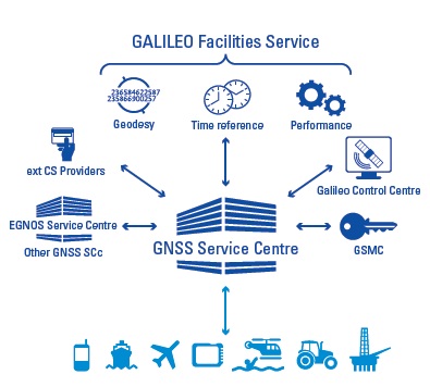
The GSC services can be accessed by Galileo users via the GSC web portal.
Spaceopal is a joint venture between DLR Gesellschaft für Raumfahrtanwendungen (GfR) mbH, a full subsidiary of the German Aerospace Center (Deutsches Zentrum für Luft- und Raumfahrt; DLR), and the Italian firm Telespazio S.p.A. Both parties contribute their respective Galileo Control Centers in Oberpfaffenhofen and Fucino.
Since July 2017, Spaceopal GmbH has operated the Galileo satellite fleet under the GSOp contract and will thus ensure the provision of the Galileo services to the worldwide community.
The GSC provides the single interface between the Galileo system and the users of the Galileo Open Service (OS), and the Galileo Commercial Service (CS) for the provision of specific services beyond the Galileo Signal-In-Space (SIS) transmitted by the operational satellites. The GSC acts as an active means to engage in “in”- and “out” bound activities and is conceived as a centre of expertise, knowledge sharing, custom performance assessment, information dissemination and support to the provision of value-added services enabled by the Galileo OS and CS core services.
The GSC is located in a fully secured environment in Madrid, Spain, within the National Institute of Aerospace Technologies (INTA) facilities at Torrejón de Ardoz, overseen by the Spanish Ministry of Defence.
The European GNSS Agency (GSA) is organizing a public consultation on the Integrity & Reliability of Digital Maps for Connected and Automated Driving, in connection with the recently published Commission Communication on Connected and Automated Mobility.
This communication addresses the need to investigate the integrity and reliability of digital maps in order to facilitate the deployment of fully automated and connected vehicles.
Image: GSA
Digital maps are an essential building block to ensure a safe driving experience for highly automated driving and autonomous vehicles. Purpose-built maps will be produced that will be much more reliable and accurate than those used for traditional applications.
These digital maps will be enriched with information from public databases and sensor data from connected vehicles. Traffic information, such as speed limits or the real-time dynamics of traffic flow, will help the vehicle’s navigation system to anticipate upcoming road conditions and take decisions beyond what is enabled by the vehicle’s on-board sensors.
Key role for GNSS
Satellite navigation (GNSS), and in particular Galileo, plays a key role in providing precise and secure positioning in vehicle navigation technologies for driverless mobility. Moreover, GNSS is the primary sensor for building digital maps to provide very accurate positioning together with other sensors, such as LiDAR, for example.
Dynamic data pose specific problems, particularly given their real-time nature: they must be generated, validated and made available to the user equipment without delay. This makes their integrity validation more challenging, and their transmission can be subject to errors or disruptions affecting the overall reliability.
Addressing the issue
Currently, it is the navigation and map provider’s responsibility to ensure the integrity of its products and the reliability of the information provided by third-party suppliers. However, until now the maps have been mainly used to support navigation, giving information to the driver, rather than to support safety-related functions.
Some industry standards exist or are being developed for data exchange and map content, but there are currently no specific standards or certification procedures to assess map data quality characteristics, such as reliability, integrity, and traceability. This public consultation is a starting point in addressing this issue.
Have your say
The public consultation can be accessed here. It will be open until Jan. 27.
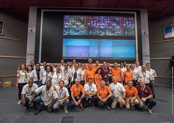
Countdown team at Kourou, Guiana control center for July’s four-satellite launch. (Photo: ESA/CNES/Arianespace, P. Baudon)
By Javier Benedicto Head, Galileo Programme department, European Space Agency
Since the declaration of initial services in December 2016, the European Space Agency (ESA) and the European GNSS Agency (GSA) have expanded Galileo’s system capabilities and service robustness with significant improvements of the ground segment and the last batch of four satellites launched by Ariane 5 in July. Once these satellites reach their final position and complete their in-orbit commissioning before the end of 2018, all 24 nominal slots of the Galileo constellation will be occupied.
Up to 22 satellites are planned to be commissioned in early 2019 and, eventually, the two FOC satellites injected in elliptical orbit should join the operational constellation after on-board software upgrade to provide for automatic health status flagging to users. This should lead to a total of 24 operational Galileo satellites supporting global PNT for users worldwide.
New Infrastructure Contracts
To further expand the system capabilities by 2020 and beyond, and reach Full Operational Capability (FOC), ESA has awarded new large industrial contracts in the context of the Exploitation Phase.
A contract to build and test another twelve Galileo satellites (so-called Batch-3) was awarded in 2017 to a consortium led by prime contractor OHB GmbH in Germany, with Surrey Satellite Technology Ltd in the UK as payload prime. These new satellites are based on the already qualified design of the previous Galileo FOC satellites. Production is advancing well, with first launch planned by late 2020.
With the Galileo constellation now expanded to 26 navigation satellites and plans to deploy additional Batch 3 satellites, the ground control infrastructure is undergoing a corresponding upgrades. In July, ESA awarded a new contract for the Galileo Ground Control Segment to GMV Aerospace and Defence, Spain. This contract includes upgrading the system architecture to manage a constellation of up to 41 Galileo satellites, updating obsolescent elements in the current system, improving operability linked to the provision of services and additional telemetry, tracking, and command capabilities to improve system robustness.
In October, Thales Alenia Space in France received a contract to upgrade the Galileo Ground Mission Segment and the Galileo Security Monitoring Centres (GSMC). This work includes upgrading Galileo’s system architecture to provide more accurate navigation products for broadcast by Galileo satellites, updating obsolescent elements in the current system and improving operability linked to the provision of services and enhanced robustness.
It will also include the construction of additional navigation message uplink and sensor stations. This contract will also augment the capabilities for implementation of the Public Regulated Service (PRS), the single most accurate and secure class of Galileo signals. Encrypted PRS signals will be made available only to authorized governmental users through approved national authorities. GSMCs in France and Spain will ensure the security monitoring functions for Galileo operational assets and manage PRS access and operations.
Growing Service Portfolio
The European Commission, GSA and ESA have jointly defined a broad range of service improvements and system capability enhancements to be deployed in 2019–2020, leading to FOC.
The newly qualified system infrastructure will support the broadcast of authentication information as part of the Open Service Navigation Message in E1; experimentation will start by end of 2019, leading to the possibility to offer trusted PNT to Galileo users.
Galileo will also be the first GNSS constellation to provide a Search and Rescue return link capability: as of 2019 the system will allow broadcast of acknowledgement of receipt message to users in distress with a very low latency, contributing to saving lives.
ESA has also started preparing the necessary modifications to the Navigation Signal Generation on-board the satellites to offer further capabilities to users after 2020. The signal-in-space will be enhanced with additional data transmitted in the I/NAV message, offering faster acquisition and more robust Galileo positioning on E1 and an encrypted navigation signal on E6 supporting authentication at signal level.
The new Galileo High Accuracy Service, soon entering the experimental phase, will consist in the delivery of un-encrypted high accuracy correction data in E6, enabling users to achieve sub-meter level positioning.
The usage of Galileo Open Service for aviation applications using horizontal advanced receiver-autonomous integrity monitoring techniques is being carefully assessed through measurements and review of the system design, including feared-events characterisation.
Longer Term Evolution
Galileo Second Generation has been the subject of technology pre-developments in the areas of platform and payload critical equipment, system techniques and processing algorithms, as well as system and segment Phase B studies over the past few years. We are now approaching the start of the implementation phase.
The European Commission, in close consultation with EU member states, has defined a decision roadmap aiming at very important future budget and programme implementation decisions in the course of 2019. In this context, ESA has launched a competitive procurement procedure for the first batch of so-called “Transition Satellites” with a broad range of enhanced and some new capabilities being considered. This includes improvements in the signal domain for faster acquisition and lower receiver power consumption, on-board clock technology, inter-satellite links, electrical propulsion, flexible payloads and power allocation by means of on-board digital technology and in-orbit re-configurability.
Transition satellites and related ground segment development contracts will begin by the end of 2019, aiming at in-orbit validation of second-generation capabilities from 2025 onwards.
EGNOS Evolution for Aviation
The adoption of Europe’s SBAS EGNOS by aviation is growing faster and faster. EGNOS will continue to evolve in the coming years. In particular, for 2019 and 2020, the evolutions under implementation focus on the obsolescence management of the hardware of some critical components, improvement of the system performances thanks to addition of new stations and system algorithms.
All these evolutions are planned to be qualified in 2021-2022, to continue to offer an excellent level of performance to Aviation Users until the operational take-over by the second generation of EGNOS V3,planned in 2025.
The European Performance-Based Navigation Implementing Regulation plans a growth from the current 35% to 66% in 2020 and 100% in 2024 of all European airports instrumental runways end-equipped with SBAS localizer performance with vertical guidance procedure.
On the aircraft manufacturer side, Airbus confirmed that it will continue equipping its aircraft; following the A350 family already equipped, both A320 and A330 families will be equipped for entry into service in summer 2020.
NAVISP
ESA’s Navigation Innovation and Support Programme (NAVISP), launched in 2017, will continue to boost member states’ industrial competitiveness and innovation in the upstream and downstream navigation sector, investigate the integration of satellite navigation with non-space technologies and complementary positioning and communication techniques, and study novel receiver-based techniques to counteract vulnerabilities and improve the robustness and reliability of GNSS.
Conclusion
The EU-built GNSS infrastructure systems EGNOS and Galileo are operational and serving users in Europe and worldwide. EC, GSA, ESA and European industries are committed to improvement plans over the next 2–3 years, with emphasis on endurance, resilience and robustness of the systems’ infrastructure, and delivering enhanced services.
For the longer term, the real challenge is to modernize the systems with new spaceborne and ground technologies, increase operational robustness and automation, and provide for additional system capabilities, while retaining a large degree of flexibility and in-orbit re-configurability to meet the long-term challenges and evolution of satellite-based navigation and timing.
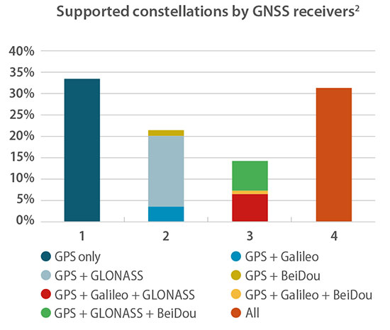
One remark in particular caught my eye as I read the press release précis of the European GNSS Agency’s 2018 GNSS User Technology Report. In point, “Today only around 30 percent of receivers use GPS only.”
“What?!?” methought. Incredulously, I downloaded the 92-page document, so easily done at www.gsa.europa.eu, and scrutinized it closely. Surely the GPS-only installed base out there is wider, vaster and deeper (it’s certainly older!) than could have been overtaken already by the wave of multi-constellation devices.
Yes, they are clearly the future. But is the past already gone? That golden age when GPS was all that anyone lived, positioned and navigated by — vanished into the mist?
Only earlier this very year was I upgraded from an iPhone 3 to an 8, with Galileo onboard for the first time. “Hip, but by the skin of my teeth,” I breathed.
Chart: GSA report
In the fine print on page 20 of the report lay clarification for my consternation. “For the analysis, each device is weighted equally, regardless of whether it is a chipset or receiver and no matter what its sales volume is. The results should therefore be interpreted as the split of constellation support in manufacturers’ offerings, rather than what is in use by end users.”
Of the roughly 500 chipsets and modules tallied by the GSA, 30 percent of those models are GPS-only. That’s a number of quite a different color. See the chart for fuller information.
Better minds than this can take a stab at how many devices in the hands end users on this day are still GPS-only. I’d put it above 50 percent.
The writing’s on the wall for the GPS-only artifact, but a good many of those veterans are still out there, working hard in the marketplace. Their reign as the majority may be limited, especially with the rising global tide of multi-constellation smartphones, but let’s honor them one last time before consigning them to the museum.
The GSA’s report, by the way, is a remarkably good and valuable read. No one can know it all, but this slim volume packs a remarkable and essential density of key facts, trends, issues, markets and more.
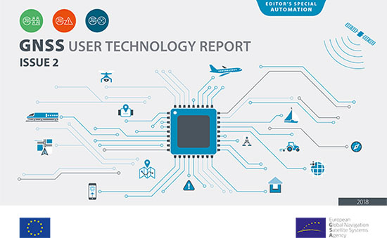
The second edition of the European GNSS Agency’s (GSA) GNSS User Technology Report has been published and is now available for free download, providing an exhaustive review of the latest GNSS trends and developments.
Since its launch in 2016, the GNSS User Technology Report has become the go-to-source for information on the dynamic, global GNSS technology industry.
The GNSS User Technology Report, a sister publication to the GSA’s GNSS Market Report, is published every two years and takes an in-depth look at the latest state-of-the-art GNSS receiver technology, along with providing expert analysis on the trends that will shape the global GNSS landscape in the coming years.
Three key segments
European GNSS Agency
Like the inaugural report in 2016, the second issue focuses on three key macro segments: mass market solutions; transport safety- and liability-critical solutions; and high precision, timing and asset management solutions.
The report opens with an overview of the latest developments and trends in GNSS, with a focus on the multi-constellation and multi-frequency that are driving new trends in the sector.
“With the GNSS User Technology Report, our aim is to provide everybody in the GNSS value chain with a comprehensive overview of the current landscape in the industry and to identify new trends so that stakeholders know in which direction the industry is moving,” GSA Executive Director Carlo des Dorides said.
“The most important new trend identified in this issue is the rapid adoption of multiple frequencies, including for consumer devices, as evidenced by the market introduction of the first dual-frequency smartphone in May 2018,” des Dorides said.
Editor’s special section: Automation
The final section in this year’s report — the “Editor’s special” section — is dedicated to automation and to the increasingly important role GNSS plays in a number of partially — or fully automated tasks and functions. The most publicised examples of these are found in the transport domain — driverless cars, autonomous vessels and drones but, as the report notes, GNSS-based automation applications go well beyond transport.
The analysis of GNSS user technology trends in the report is supported by testimonials from key suppliers of receiver technology, including: Broadcom, Javad, Kongsberg, Leica, Maxim Integrated, Meinberg, NovAtel, Orolia-Spectracom, Qualcomm, Septentrio, STMicroelectronics, Thales, Trimble and u-blox.
In addition, the report includes highlights from around 20 ongoing research projects from the Horizon 2020 and Fundamental Elements programmes, aiming at the development of GNSS receiver technology.
The full GNSS User Technology Report 2018 is available for download here.
GNSS User Technology Report 2018 Highlights
All global and regional GNSS constellations are developing, modernising and innovating, with more than 100 GNSS satellites now available over our heads.
The vast majority of current receivers are multi-constellation, and the most popular way to provide multi-constellation support is to cover all available constellations. Today only around 30% of receivers use GPS only.
In the mass market domain, we are seeing a divide between chipsets optimised for entry-level internet of things (IoT) products, where energy per fix is the primary driver, and high end, where the industry is innovating to propose enhanced positioning performance.
The need for accuracy in the mass market is initiating new solutions, including ones based on Android GNSS raw measurements or, more significantly, using multi-frequency signals.
The frequencies supported across all application areas range from single L1/E1 to 4 frequencies in the professional segment. The dual frequency solution showing the most growth is L1/E1 and L5/E5, however the legacy L1/E1 and L2 are still being used.
Growing interest has been observed in PPP and RTK services proposed by private industry and public system operators, leading to new PPP/RTK concepts aiming to address a wide customer base beyond high precision.
The need to ensure both safety and security of PNT solutions is being highlighted by all solution providers, particularly in systems where humans are out of the control loop, such as in autonomous vessels, cars or drones.
Precision agriculture depends on the precise positioning of augmented GNSS. In Europe, this augmentation is provided by the European Geostationary Navigation Overlay Service (EGNOS).
Although EGNOS is widely available in Europe, coverage is lacking in remote and rural areas.
To help fill the needs of farms in these areas, the Horizon 2020 AUDITOR project, funded by the European GNSS Agency (GSA), is developing a ground-based GNSS augmentation system that will deliver high-performance and cost-efficient services and applications for the agriculture industry.
“The purpose of this project is to develop an improved GNSS ground-based augmentation system using modern and proven algorithms in highly configurable, cost-effect receivers,” said Project Coordinator Esther Lopez. “As a result, AUDITOR will enable cost-effective precision agriculture services for farmers, especially those with small and mid-sized farms in areas where EGNOS availability is limited.”
The AUDITOR system is based on a radio frequency (RF) dual-band multi-constellation GNSS front-end and an embedded digital processing platform. The front-end receiver acquires the GNSS signals and embeds all analog and digital hardware required to convert the RF signal to digital samples.
The digital processing platform then converts and customizes the signals for the AUDITOR systems. The system serves as the basis for providing higher level services for the end user via cloud-based web and mobile applications.
Autonomous Future. With AUDITOR applications, farmers will be able to accurately measure spatial variability in soils and crops. Yield maps will allow farmers to precisely apply fertilizer, water and pesticides, reducing production costs and environmental impact.
AUDITOR’s high-accuracy positioning will also enable the use of autonomous mobile robotic units for identifying weeds, pests and diseases, GSA said.
“Producing precise maps of the soil and crops, as well as the spatially varying application of fertilizer that these maps enable, is completely dependent on the availability of an augmented GNSS signal,” Lopez said. “Thanks to AUDITOR, even areas in Eastern and Southern Europe that once were unable to get the required precise GNSS signal can reap the benefits of precision agriculture.”
With the ever-increasing requirement for augmented yield and profitability and energy and cost savings, the future of farming is precision agriculture. By focusing on providing the augmentation needed to enable existing precision agriculture applications in Europe alone, Lopez is confident that AUDITOR will be well-positioned to compete on the market.
An increasingly bitter political and economic argument between the United Kingdom (U.K.) and the European Union (EU) has alternately stalled and unfrozen progress on Galileo.
Why does this matter from a defense and security viewpoint? Because it’s all about access to Galileo’s Public Regulated Service (PRS), the military-grade service and signal — in addition to billions of pounds and euros.
The byzantine maneuvering on both sides may have further implications, in the form of a much-expanded role for the current European GNSS Agency (GSA), with a corresponding reduction in funding scope for the European Space Agency (ESA).
ESA is not directly affected by the Brexit brouhaha, but indirectly, the impacts mount and extend. ESA is technically independent of the EU, but acts as the union’s procurement body for space programs. It is run by the 22 member states on the ESA council — which crucially includes the U.K., as well as non-EU members Norway and Switzerland. Thus, the Brits, while exiting the union in March 2019, will continue to play a voting role in the space agency.
In an second-round gambit, the U.K. had threatened to use its veto on the ESA council to delay procurement of future Galileo satellites. This was seen as an attempt to bring the EU into negotiations over U.K. access to the highly encrypted Galileo PRS.
A navigation and timing signal restricted to use by authorized government agencies, armed forces, police, emergency and other security services, the PRS is designed to be robust to jamming and spoofing and available even in times of crisis.
Under EU rules, only EU member states can access or work on the PRS. Similar to GPS M-code, PRS could be said to be the prime motivating factor for the origins of the European GNSS: the desire, some would say the compelling requirement, to have a military-grade signal under one’s own control.
The U.K. says it will encounter “significant gaps” in a wide range of areas including prisoner transfers, asset recovery, sharing of financial intelligence, victim compensation and access to criminal records for child protection vetting, should it be shut out from the PRS. This doesn’t begin to reveal the real reason: the ability to conduct military, security and defense operations confidently undertaken with a secure and enrypted GNSS signal.
The European Commission maintains that the U.K. will have to “apply” to use the PRS, like any other non-EU country, tacitly as a “foreign entity.” PRS is for EU member states only.
U.K. companies such as CGI U.K. have developed much of the programming and coding of the PRS signal. Current EU rules bar all U.K. companies from bidding on new contracts unless they transfer their work to EU countries before Brexit. The EU wants CGI U.K. to hand its encryption security intellectual property to the Franco-Italian firm Thales Alenia Espace.
This would poke Britain’s defense ministry where it hurts most: access to the key source codes, and a measure of security in military, defense and police operations. The U.K. government also wishes to retain the encryption expertise and personnel, rather than see them outsourced.
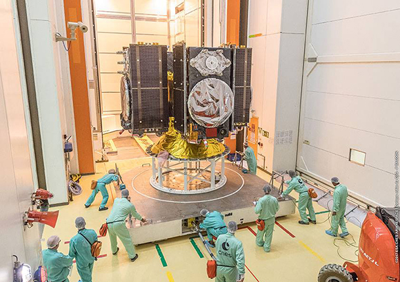
Four Galileo satellites placed in the payload container prior to December 2017 launch, which brought the total Galileo constellation to 22. (Image courtesy of ESA)
Whither GSA?
In a separate but closely related debate within the EU, a strategic repositioning is proposed for the GSA: renaming and remaking it into the EU Agency for the Space Programme. This would not only greatly enlarge its sphere of activity and authority, it could create two sparring space agencies in Europe, one wholly under the control of the EU and one with the maverick U.K. on its ruling council.
A draft EU document states ESA’s decision-making procedures “cannot lead to a call into question of the decisions of the [European] Commission or the European Space Agency within the framework of the actions and space programmes of the union.”
ESA is naturally bitterly opposed to its parent organization creating a rival. It has long struggled — behind closed doors — with its semi-independent, semi-subservient role to the EU, which after all holds the ultimate purse strings.
Some in Europe see indications that the GSA rebadging could lead to a gradual transfer of space funding from ESA to the newly rechristened agency if EU discontent rises. “A creep in power” was the term used by one official.
The EU has long expressed concerns over ESA’s governance of the funds handed to it by the EU for space projects. The long stall in Galileo getting up a full head of steam, a period that could be said to have extended from 2002 to 2008 or thereabouts, was seen by some atop the EU as evidence of ESA over-extension: technically expert but fiscally untrained or unqualified.
Opening Salvos
In what now appears to be a dead issue, the U.K. had first demanded reimbursement for the €1 billion it contributed to Galileo. The EU rejected that out of hand, saying it would not negotiate “under threat.”
In a follow-up, the U.K. claimed that while it wished to continue participating in Galileo, it could well start up its own GNSS if it did not receive adequate access to Galileo PRS. The EU stuck to its guns, so to speak: “Third countries [and their companies] cannot participate in the development of security-sensitive matters.”
The U.K. has also bruited blocking Galileo from use of ground tracking stations in British overseas territories, such as the Falklands.
A U.K. minister stated: “The U.K. genuinely wants to remain a major player in the project, with privileged ongoing access from outside the EU, and views its capabilities and contribution to date as giving it the right to that ticket.”
A European spokesperson countered: “For the EU, the decision to leave inevitably entails relegation to a different role and status in the project, and, let’s be candid, offers scope for EU-located firms to take contractual business away from U.K. ones.”
The European GNSS Agency (GSA) has issued a request for information (RFI) in preparation for the procurement of EGNOS geostationary navigation payload services.
The EGNOS space segment is provided by commercial satellite operators on the basis of service contracts. The GEO-1, GEO-2 and GEO-3 service contracts now cover the EGNOS space segment needs, and the GEO-1 and GEO-2 services will be the first of these to end, GSA reported. The GEO-1 and GEO-2 services will be replaced by new contracts, GEO-4 and GEO-5.
GSA is planning how it will replace the services delivered by the GEO-1 and GEO-2 satellites, and it’s issuing the RFI to collect information about opportunities to embark navigation payloads on board GEO satellites launched in a suitable time frame.
According to GSA, the results of the RFI will also be used to determine the best approach for the procurement of the payload services, which may be either procured at the same time or separately. It will help GSA define the tender specifications and decide on the most appropriate time to launch invitations to tender.
In addition, GSA aims to obtain information from owners of geostationary satellites that will be available for operational service from 2021 to 2027 and able to embark a navigation payload. The agency is specifically seeking information on future satellite plans and the possibility to embark SBAS payloads in due time to ensure an operational start date from 2021 to 2027.
The RFI will also request information service availability and long-term payload reliability; the process for EGNOS payload procurement, in-orbit testing and commissioning; information on the locations of the potential hosting sites for the EGNOS radio frequency uplink stations; and, finally, information on contractual arrangements, the payment scheme, and cost estimates, GSA added.
Answers to the RFI should be sent electronically to [email protected] by Aug. 31.