Tag: high-precision

  • Swift, Carnegie Robotics partner on GNSS for robotics, autonomous driving

    Swift, Carnegie Robotics partner on GNSS for robotics, autonomous driving

    Swift Navigation is teaming up with Carnegie Robotics LLC to develop a line of navigation products for autonomous vehicles, outdoor robotics and machine control. The first navigation product will be announced May 8 at the AUVSI XPONENTIAL event in Dallas, Texas.

    Swift Navigation is a San Francisco-based startup building centimeter-accurate GPS technology for autonomous vehicles, and Carnegie Robotics LLC (CRL), the industry leader in reliable robotic components and systems.

    Swift Navigation solutions use real-time kinematics (RTK) technology, providing location solutions that are 100 times more accurate than traditional GPS. In 2016, Swift shipped the Piksi Multi, a multi-band, multi-constellation high-precision GNSS receiver, suitable for autonomous vehicles.

    The Piksi Multi.
    The Piksi Multi.

    The Piksi Multi offers advanced precision GNSS capabilities for the mass market. The robotics market, through this partnership with Carnegie Robotics, stands to benefit from Piksi Multi’s improved localization and control, the companies said.

    Carnegie Robotics supplies rugged, reliable robotic systems for real-world work. The team at Carnegie Robotics has decades of experience successfully transitioning state-of-the-art technologies from early design into commercial use in precision agriculture, machine control, autonomous vehicles and industrial and military robots. This process requires both a deep knowledge of robotics and best-in-class engineering, but it cannot succeed without also addressing the business case, the needs of the end-user, reliability, maintenance, safety, certifications and the dozens of other essential factors necessary for a product to succeed in the real world.

    “Swift’s technology is perfectly suited for the world of robotics, and we couldn’t do better than working with the renowned industry leaders at Carnegie Robotics,” said Timothy Harris, CEO of Swift Navigation. “From their robotics technology expertise to their inertial intellectual property, Carnegie is an ideal partner for Swift. We are looking forward to developing an exciting line of products and making more joint announcements in the near future.”

    “Thanks to its focus on high-accuracy and low-cost, Swift Navigation has established itself as a leader and innovator in the world of high-precision GNSS,” said Steve DiAntonio, CEO of Carnegie Robotics. “Swift is an ideal partner to work with us on rapid development of robots and autonomous systems. We’re designing our joint line of products specifically for outdoor robots and autonomous vehicles with the appropriate physical, electrical and software interfaces to enable rapid deployment of precision GNSS and other mission-critical sensors.”

    More information about the partnership and the unveiling of this duo’s first joint product will take place at AUVSI XPONENTIAL. Visit the joint Swift Navigation and Carnegie Robotics booth #506 at the Kay Bailey Hutchison Convention Center.

  • European Geosciences seeks abstracts for high-precision GNSS session

    The General Assembly of the European Geosciences Union will be held April 23-28 in Vienna, Austria.

    One session in particular focuses on high-precision GNSS, and abstracts are being sought.

    G1.4 – High-precision GNSS: methods, open problems and geoscience applications

    This session is an activity of IAG SC4.4. “Multi-constellation GNSS” and IAG-ICCT JSG 0.10 “High-rate GNSS”

    Session G1.4 description: In the past two decades high-precision GPS has been applied to support numerous applications in Geosciences. Currently, there are two fully operational Global Navigation Satellite Systems (GNSS), and two more are in the implementation stage. The new Galileo and BDS systems already provide usable signals, and both, GPS and GLONASS, are currently undergoing a significant modernization, which adds more capacity, more signals, better accuracy and interoperability, etc. Meanwhile, the huge technology development provided GNSS equipment (in some cases even at low-cost) able to collect measurements at much higher rates, up to 100 Hz, hence opening new possibilities. Therefore, on one side, the new developments in GNSS stimulate a broad range of new applications for solid and fluid Earth investigations, both in post-processing and in real-time; on the other side, this results in new problems and challenges in data processing which boost GNSS research. Algorithmic advancements are needed to address the opportunities and challenges in enhancing the accuracy, availability, interoperability and integrity of high-precision GNSS applications.

    This session is a forum to discuss new developments in high-precision GNSS algorithms and applications in geosciences; in this respect, contributions from other branches in geosciences (geodynamics, seismology, tsunamis, ionosphere, troposphere, etc.) are very welcome.

    We encourage, but not limit, submissions related to:

    • Modeling and strategies in high-precision GNSS,
    • Multi-GNSS benefit for Geosciences,
    • Multi-GNSS processing and product standards,
    • Inter-system and inter-frequency biases and calibrations,
    • New or improved GNSS products for high-precision applications (orbits, clocks, UPDs, etc.),
    • Precise Point Positioning (PPP, PPP-RTK),
    • High-rate GNSS,
    • GNSS and other sensors (accelerometers, INS, ecc.) integration for high-rate applications,
    • Ambiguity resolution and validation,
    • CORS services for Geosciences (GBAS, Network-RTK, etc.),
    • Precise Positioning of EOS platforms,
    • Precise Positioning for natural hazards prevention,
    • Monitoring crustal deformation and the seismic cycle of active faults,
    • GNSS and early-warning systems,
    • GNSS reflectometry,
    • High-precision applications for Geosciences,
    • and more.

    Papers are welcome on all aspects of these issues. Deadline for receipt of abstracts is Jan. 11.

  • NovAtel positioning on display at CES autonomy exhibit

    NovAtel Inc. is showcasing its high precision positioning technology as part of AutonomouStuff’s “Roadmap to Autonomy” exhibit at the 2017 Consumer Electronics Show (CES), Jan. 3-8 in Las Vegas. The exhibit is located at the MGM Grand in the Skyline Terrace Suite.

    ces-roadmapAutonomouStuff provides research and development platforms for the safe and reliable testing of automation technologies.

    It uses NovAtel’s exceptionally robust SPAN GNSS + Inertial (INS) technology to provide the highly precise, continuous 3D positioning necessary to evaluate robotic and autonomous solutions for autonomous applications.

    NovAtel’s SPAN technology combines a high-performance Global Navigation Satellite System (GNSS) receiver with an Inertial Measurement Unit (IMU) to deliver deeply-coupled centimeter-level positioning. SPAN provides robustness against short GNSS outages, using IMU updates to bridge the positioning solution. SPAN also provides high data rate position, velocity and attitude (pitch, roll, heading) updates to capture the full real-time motion profile of a vehicle. Widely deployed in the automotive R&D space, SPAN supports applications ranging from autonomous navigation to V2X systems, where it is utilized to provide a source of vehicle ground truth.

    As a committed technology partner, NovAtel has worked closely with AutonomouStuff to optimize SPAN for AutonomouStuff’s vehicle perception kits. As a result of these efforts, AutonomouStuff is able to offer three different levels of positioning performance — “good, better, best” — based on the grade of IMU selected.

    “We are always excited to work with the team at NovAtel and cannot wait to show off their ‘good, better, best’ SPAN GNSS options for autonomy in our suite at CES,” said AutonomouStuff CEO Bobby Hambrick. “Their solutions are a significant piece of autonomous research and development. With three kit options, there is something for everybody. We’ve done the work for you, allowing you to choose which kit is best for you based on your accuracy needs and price range.”

    The collaboration with AutonomouStuff is reflective of NovAtel’s commitment to the development of fully autonomous vehicles for a wide range of industries. In May 2016, NovAtel announced the formation of a new Safety Critical Systems (SCS) Group, tasked with developing functionally safe GNSS positioning products that will meet the exceptional performance and safety requirements of autonomous vehicles.

    “Our team made significant progress in 2016 towards product definition, GNSS integrity for automotive applications, and corporate TS 16949 compliance,” said Jonathan Auld, Director of the SCS Group at NovAtel. “As the world leader in high precision GNSS technology for more than 20 years, NovAtel is leveraging its extensive experience developing safety critical systems for the aviation industry to meet the future safety thresholds required for driverless cars.”

    AutonomouStuff and NovAtel representatives will be available in the MGM Grand Skyline Suite during the CES to answer customer questions. To set up a meeting with the NovAtel SCS team at CES 2017, attendees can contact Allan MacAulay, Business Development Manager, SCS ([email protected]).

  • Expert Opinions: Projection of 2017 PNT developments

    Q: What significant new developments in positioning, navigation or timing can we anticipate in 2017?

    Dan Conway, Executive VP, Guidance & Stabilization, KVH Industries
    Dan Conway, Executive VP, Guidance & Stabilization, KVH Industries

    A: With increasing focus on robust and resilient positioning, navigation and timing (PNT), the industry must respond with improved access to accurate and trusted position and timing, particularly for the warfighter. For military vehicles, this translates to a requirement for improved navigation systems that will provide commanders and onboard vehicle electronic systems with resilient PNT in contested environments. Secure and more robust navigation systems must now, more than ever, assure position and timing regardless of access to satellites.


    Jeff Martin, VP of Business Development & Sales, Spirent Federal
    Jeff Martin, VP of Business Development & Sales, Spirent Federal

    A: Global navigation satellite systems have continually evolved, and 2017 should be no exception. With the scheduled launch of GPS III satellites, the world will see two new signals: M-code from a directional antenna and L1C (new civil signal). The European Galileo system may become operational. Russia is not expected to launch the new GLONASS K-2 satellites in 2017, but it’s not far off. Developers, integrators and users will have lots of options in 2017!


    Mark Sampson, Product Manager, RaceLogic
    Mark Sampson, Product Manager, RaceLogic

    A: With approximately 65 percent of mass-market receiver chipsets already capable of multi-constellation tracking — and with this figure set to rise significantly in the near future — the demand for cost-effective but highly capable consumer goods with GNSS capabilities is clearly growing at an exponential rate. The forthcoming civilian signals offer huge opportunity to many sectors, but also present a challenge in the test and validation of new products, which will require highly capable and flexible simulation equipment.


    Fergus Noble, Co-Founder and CTO, Swift Navigation
    Fergus Noble, Co-Founder and CTO, Swift Navigation

    A: Next year will bring huge strides in autonomous navigation. Multi-band high-precision GNSS will be a key enabler for robotics applications. Customers are demanding navigation solutions that are accurate, fast, robust and affordable. Multi-band enables convergence times measured in seconds, not minutes. Rapid time to first fix and reacquiring fix quickly after passing under obstructions will be essential for autonomous driving applications. Low-cost L1/L2 RTK GNSS will help bring these autonomous robotic applications to life.

  • Tallysman Introduces VeraPhase 6000 High-Precision GNSS Antenna

    Tallysman Introduces VeraPhase 6000 High-Precision GNSS Antenna

    Tallysman's VeraPhase 6000 high-precision GNSS antenna.
    Tallysman’s VeraPhase 6000 high-precision GNSS antenna.

    Tallysman, a manufacturer of high-performance GNSS antennas, announces the commercial availability of the VeraPhase 6000 antenna series, a family of antennas that provides the lowest axial ratios (horizon to horizon, through all azimuths) across all GNSS frequencies (70 percent), a tight PCV (± 1mm through all frequencies, azimuths, and elevations), and a consistent PCO through all frequencies.

    The performance of the VeraPhase rivals that of choke ring antennas, but is much lighter, smaller and more economical, Tallysman said. The antenna family is designed for use in survey, precision RTK and reference antenna applications.

    The VeraPhase 6000 also provides an available PCB within the base of the antenna for integration of a custom system board such as a dual-band or RTK GNSS receivers or other applications.

    The VP6000 family provides high receive RHCP gain over the full GNSS spectrum:

    • low GNSS band (1164 MHz to 1300 MHz)
    • L-band correction services (1525 MHz to 1559 MHz)
    • high GNSS band (1559 MHz to 1610 MHz).

    Each model features a robust, high IP3, pre-filtered LNA to minimize desensing from high-level out-of-band signals, including 700 MHz LTE, and that yet still provides a noise figure of less than 2.5 dB. Non-pre-filtered versions are also available with a noise figure of less than 1.5 dB.

    The VP6000 antenna family is available in three formats:

    • A survey-grade all-band antenna that provides 35-dB LNA gain and is available with a robust rubber bumper for field use.
    • An all-band base station antenna is available with 35-dB LNA gain or with an internal 15-dB pre-filtered pre-amp for OEM applications.
    • An all-band reference antenna that features a 50-dB gain LNA, a conical radome to shed snow ice and birds, and is available with a robust monument mount for sub-millimeter precision.

    Each antenna has a well defined phase centre offset relative to the antenna reference plane.

    The base housing of the VP6000 is IP67-compliant and weighs less than 700 grams. The antenna is 167 millimeters wide at the top, 110 millimeters wide at the base and 110 millimeters in height. Each model has a 5/8-inch x 11 TPI thread for mounting and is available with either a TNC or an N-type connector.

    A white paper is available on Tallysman’s website.

    Tallysman’s booth at INTERGEO is in Hall E8, Booth 038. Follow GPS World on Twitter for the latest news from INTERGEO.

  • High-Precision Receiver Design: More than Accuracy

    Anticipating New, Different Application and User Needs

    Users in emerging applications may have different requirements from traditional high-precision users. New users increasingly look to the technology not solely for position, but to navigate them through the environment, often autonomously or semi-autonomously. Tracking all of the new multi-GNSS signals, and then using the large number of inputs in the positioning engine, drives the amount of processing power and memory required onboard the receiver. These in turn drive the cost, size and power consumption of the receiver in exactly the opposite direction from the expectations of customers.

    By Jason Hamilton

    In considering the future of high-precision satellite navigation, we need to consider what users of the technology are trying to accomplish, and which growing and emerging applications will drive adoption of GNSS technology in the future. These applications will drive growth in our industry if we can correctly anticipate their future needs.

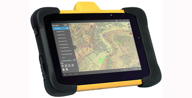
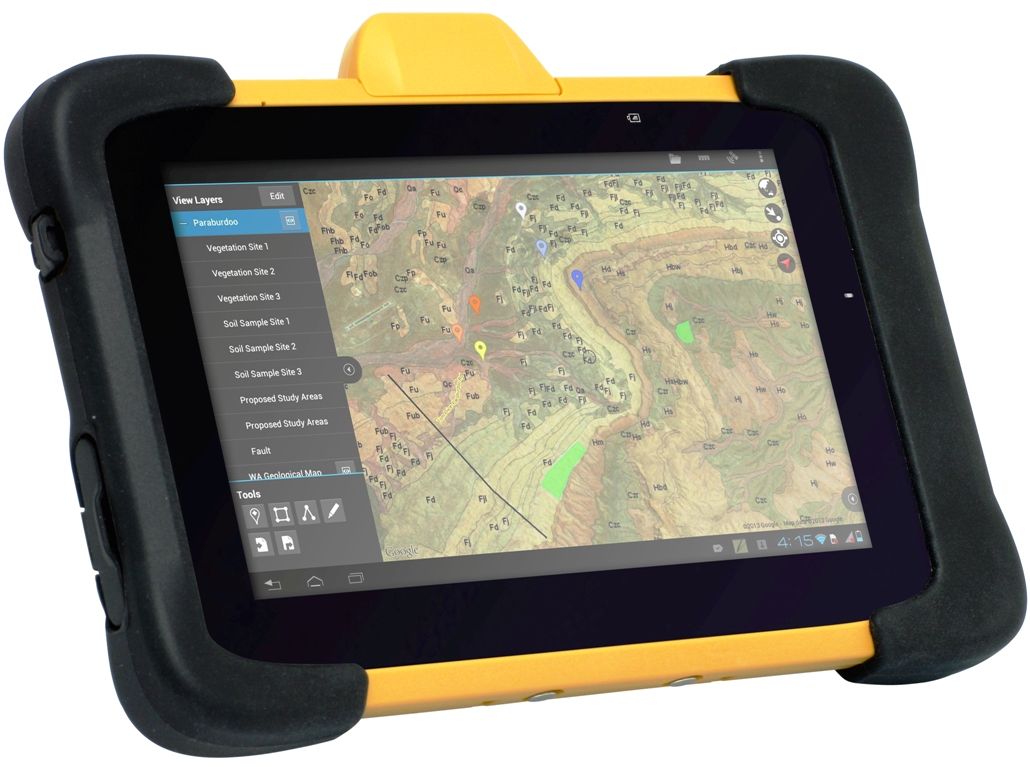
    Traditional applications of high-precision GNSS are well understood, but what these customers have demanded from GNSS can be at odds with what users in emerging applications require. Survey and mapping users were early adopters of high-precision GNSS and remain large user segments. Surveying with GNSS requires the very best accuracy that GNSS can achieve. Every centimetre of accuracy matters. Power and size are important product attributes to survey manufacturers. Mapping customers increasingly are asking for not just position, but orientation of a camera or other sensors.

    Once accuracy challenges were well in hand, the topic of availability came into play. It was no longer good enough to have an accurate position in open-sky situations. Applications demanded continuous positions that were accurate in more and more corner cases and challenging environments.

    In addition to using GNSS to measure location in an environment, new applications are increasingly looking to the technology to navigate them through the environment — often autonomously, or semi-autonomously. For these users, whether operating on a farm, in a mine, on the ground, or in the air, position accuracy is only part of the requirement. Solution accuracy of course matters, but other receiver attributes such as real-time quality control and solution integrity monitoring, are equally or more important.

    Multi-constellation, multi-frequency GNSS provides tremendous opportunity and also presents significant challenges for receiver manufacturers. Constellation and frequency support has previously been a differentiator among high-precision GNSS providers, and among product generations. The relative stability of the satellite constellation definition means that the signals broadcast from space will be relatively predictable for some time into the future, and as such, GNSS products are increasingly supporting “all in view,” the ability to track everything that is broadcast.

    The benefits of more satellites, more frequencies (and resulting frequency combinations) and modern signal structures have been well publicized. As new and modernized GNSS constellations come on line, they will deliver more robust positioning in increasingly challenging environments such as urban centers, open-pit mines and under tree cover. We will be able to account for atmospheric effects more accurately, which will help during times of high ionospheric activity and extend the length of RTK baselines. Users have a great deal to look forward to from their next-generation receivers.

    All of these improvements necessitate pretty dramatic changes in receiver design. Tracking four global constellations and numerous regional SBAS systems increases the complexity of tracking and positioning firmware and algorithms. Tracking multiple frequencies and signal types on each of these constellations drives the receiver channel count up substantially. The days of the 12-channel receiver are gone. Channels, typically implemented within the manufacturers’ custom chips, drive application-specific integrated circuit (ASIC) complexity, which drives cost, power consumption and physical size. Some of this can be mitigated through the use of smaller process geometries, embedded processors and peripherals, and RF chip integration; however, there are down-stream effects to all of these signals as well.

    Challenges

    Once your receiver has enough ASIC channels to track all-in-view, you need to do something with all that data. The receiver’s tracking sub-system generates code (pseudorange), carrier-phase and Doppler measurements for every signal on each satellite. With four global and multiple regional constellations and up to four frequencies on each satellite, that amounts to a great deal of data. These measurements are what we turn into position, through a range of different positioning algorithms from code positioning to real-time kinematic (RTK) to precise point positioning (PPP). Tracking all of these signals, and then using the large number of inputs in the positioning engine, drives the amount of processing power and memory required onboard the receiver. These in turn drive the cost, size and power consumption of the receiver in exactly the opposite direction from the expectations of customers.

    Bandwidth. Communications bandwidth is also a future challenge. Positioning methods, such as RTK, that transmit base-station observations for each GNSS signal to field rover receivers, will require much more bandwidth in the all-in-view future. PPP, which provides a state-space correction of the underlying GNSS error sources, is a promising alternative to RTK that scales better with more satellites than RTK and provides performance that is good enough for many applications.

    Utilizing the multiple frequencies available from modern constellations also presents challenges to receiver designers. RF designers are faced with the opposing challenges of making GNSS receivers and antennas smaller, lighter and lower cost, while also supporting more GNSS broadcast frequencies and mitigating against increasing amounts of interference in the L-band RF spectrum from non-GNSS uses. Robust RF design makes the difference between a system that works most of the time, and a system that works reliably all of the time.

    Expectations

    If we now come back to the expectations of end users, the challenges are clear. Most customers actually don’t care about all-in-view tracking, how many satellites are tracked, or about what the receiver is up to behind the scenes. Users will judge their GNSS receiver on whether or not they are receiving a position that meets the requirements of their application. Are they meeting their targets for accuracy, availability, latency, data rate, and does the receiver fit from a size, power consumption, regulatory and cost perspective? After a certain level, more observations do not make the solution more accurate or more robust. Manufacturers need to carefully manage the tradeoffs in their systems on behalf of users to produce the best quality position possible, while still meeting the customer expectations on all the other receiver attributes.

    Sensor Fusion. Demands of new applications drive GNSS providers to consider more than just position. Most vehicle control applications require orientation information as well as highly accurate position. Multiple-antenna GNSS heading systems are becoming smaller than ever. Inertial measurement device technology is also evolving quickly. Miniature micro-electro-mechanical systems (MEMS) inertial sensors can now deliver performance that only a few years ago was exclusive to large, heavy, bulky systems. The integration of GNSS and inertial technologies has been well adopted in highly demanding applications like aerial and ground mapping. As the size, weight and cost of the technology continues to shrink, sensor fusion in many forms will become the standard for all machine control and autonomous vehicle applications.

    Safety. This is a key consideration for system designers working on remotely or optionally piloted and autonomous systems. Position and orientation accuracy is important, but so, too, is assuring that the solution is right and can be trusted. The accuracy of the solution needs to be characterized in real time so that control systems can react as necessary to protect users on and around the vehicle. Often in these applications, accuracy can be traded off against the robustness and reliability of the solution. This presents new ways of thinking for firmware and algorithm developers who have focused for so long on solution accuracy.

    Support. Lastly, let’s not forget having reliable supply of high-quality product, and expert customer service to back it up. As high-precision GNSS attracts new users in a range of new industries, they are less often geodesists or geomatics engineers. The products absolutely need to be easy to use correctly, backed up by complete and accurate product documentation and supported by world-class application engineers.


    Jason Hamilton is vice president of marketing at NovAtel Inc. Since joining the company, he has held a number of research, development and product management roles. Jason holds a Bachelor of Science degree in geomatics engineering from the University of Calgary and an MBA from Royal Roads University.

  • More, More, More. Accuracy, Accuracy, Accuracy.

    More, More, More. Accuracy, Accuracy, Accuracy.

    Reliable, consistent positioning accuracy has always driven new product development in the survey and mapping sector of the GPS/GNSS market. It’s remarkable how quickly the provided accuracy in successive new survey products over the years has increased the required accuracy from users and customers in the field, and consequently the desired accuracy in a feedback loop to the product developers.

    In other words, the degree of required accuracy has risen steadily over the three and a half decades since GPS was born. “Accuracy is addictive.” Somebody said that in the second decade of GPS development, that is, sometime in the 1990s. This statement continues to hold true, as true for this industry as Moore’s Law does for computer technology as a whole.

    Moore’s Law states that overall processing power for computers will double every two years; as a corollary or an extension, the size of said computers gets cut in half every two years, and the cost (sometimes) also comes down by 50 percent. Moore’s Law in action in the GPS/GNSS industry has driven the product developments that we have consistently seen for many years.

    We have seen the gradual tightening of accuracy requirements across all sectors of the positioning, navigation and timing (PNT) community with each passing year and with each new State of the Industry Report. This is the first time we have seen it cross the 1-centimeter line. Not in capability; sub-centimeter capability has been available for some time. But now that level of performance is the minimum acceptable “good enough” for more respondents in the survey and high-precision sector than any lesser degree of accuracy; in fact, greater than all other ranges combined.

    To put this into measurable, statistical form, GPS World has just released its fourth annual “State of the GNSS Industry Report.” In the years that we have conducted the survey, the accuracy required for the majority of survey applications has steadily come down. No surprises here.

    In 2013, those who said that the majority of this market sector needed accuracy of better than a centimeter amounted to only 8 percent of total respondents.

    In 2014, this group rose dramatically to 35 percent, while close to a majority, or 47 percent, held that a range of 1 to 5 centimeters was “good enough.”

    Now, in this year of 2015, the majority has shifted clearly to the side of 1 centimeter or better as the new standard of required precision; 51.25 percent held this view. From 8 percent to more than half in just two years — that’s some change!

    How accurate is good enough for the majority of this sector?
    How accurate is good enough for the majority of this sector?

    Fewer people believe that a survey done completely on a computer and driven by remote-sensor data will occur in less than five years. Counter to last year’s expectations, most now think it will take longer than five years to come about.

    How soon will a survey be performed entirely from a computer, using high-resolution satellite and/or UAV-collected data, without any instrumented field work?
    How soon will a survey be performed entirely from a computer, using high-resolution satellite and/or UAV-collected data, without any instrumented field work?

    Those who are addicted to 1-centimeter accuracy form the new majority. Their preferences and their behaviors will rule the positioning world, not just in survey, but across all sectors supplied by GNSS and increasingly by a broad range of PNT technologies: defense, transportation, UAVs, machine control, precision agriculture, and much more. These other sectors will presumably answer likewise — “1 centimeter accuracy, that’s what I need!” in coming years, following the trail blazed by the you high-precision surveying pioneers.

    We have crossed the Rubicon. Unlike other obsessive behaviors, there is no going back in our case. This path is a one-way road to to the promised land of always-on, always-true, near-perfect provision of positioning.

    How much effort are you devoting to mitigation of GNSS jamming or spoofing?
    How much effort are you devoting to mitigation of GNSS jamming or spoofing?


    Graphics: GPS World staff

  • Septentrio Completes Acquisition of Altus Positioning

    Septentrio Satellite Navigation has completed the acquisition and integration of Altus Positioning Systems. Septentrio said the acquisition strengthens the company’s focus on highly accurate and reliable GPS/GNSS positioning equipment, and the integrated company will continue to focus on developing emerging markets across the globe and increase advancements in the field of GIS.

    “At the heart of this fusion are our customers,” said  Antoon de Proft, CEO and president of Septentrio, “They will benefit from this unique opportunity, which combines the knowledge and experience of Septentrio in GNSS positioning with experience of Altus-PS in survey, mapping and GIS; and from an expanded offering of products and services under one group.”

    Septentrio Satellite Navigation and Altus-PS started working together in 2007. The collaboration between the two companies resulted in a series of successful products such as the APS-NR2, APS-3, APS-U and APS-GeoPod, surveying and GIS products that provide essential accurate and reliable results and ease of operation, Septentrio said in a statement. The smart antenna products will form a product line in the Septentrio product portfolio.

    The acquisition brings key capabilities and synergies in other areas such as testing, manufacturing and delivery, which will now be based from Septentrio’s corporate headquarters outside the Belgian city of Leuven.

    Neil Vancans
    Neil Vancans

    Neil Vancans, formerly president of Altus-PS, now becomes vice president of Septentrio Americas. “The fusion of our two companies is a logical step in our evolving business relationship and professional collaboration,” Vancans said. “We look forward to leveraging the strengths of both our organizations to grow the market for Septentrio products across a wide range of market sectors and build the same level of success for Septentrio products in the American market that we have enjoyed elsewhere in the world.”

    Septentrio designs, manufactures and sells high-precision multi-frequency, multi-constellation GPS/GNSS equipment used in demanding applications in a variety of industries such as marine, construction, agriculture, survey and mapping, GIS and UAVs. Septentrio receivers are available as OEM boards, housed receivers and smart antennas.

  • DT Research Rolls out Mapping and GIS Tablets

    The DT391GS tablet.
    The DT391GS tablet.

    DT Research Inc. has launched a new line of rugged tablets with the GNSS modules for surveying and mapping applications. The DT391GS, DT395GS and DT307GS rugged tablets feature integrated high-accuracy GNSS receiver modules with built-in antenna for seamless data capture, the company said.

    Built to travel and provide reliable operations in the real world, the tablets are designed for field work in mapping, geographic information systems (GIS), and accurate synchronization, tracking and networking.

    The DT391GS combines a 9-inch sunlight-readable, capacitive touch display with an energy-efficient Intel dual-core processor in a compact, durable package. With the high-accuracy GNSS module options (Hemisphere or Trimble), the foldable antenna, and Windows or Android operating system. The DT391GS also offers protection in demanding environments with IP65 and MIL-STD-810G ratings for dust and water, and shock and vibration resistance.

    The DT395GS tablet.
    The DT395GS tablet.

    The DT395GS offers a 9-inch sunlight-readable capacitive touch screen, an energy efficient Intel dual-core processor, and a choice of Windows or Android operating systems. The GNSS positioning module has u-blox GNSS module. The IP65 rating, and military-standard MILSTD-810G and MIL-STD-461F ratings, as well as wide temperature range, make the DT395GS reliable even in harsh, mission-critical environments.

    The DT307GS GNSS tablet features a brilliant 7-inch capacitive touch screen and a quad-core, energy efficient processor with a built-in, high-accuracy u-blox GNSS module. The size and weight of the DT307GS make this tablet portable for long-term handling in the field, DT Research said.

    The DT307GS tablet
    The DT307GS tablet

    All of the DT Research Rugged GS Tablets offer hot-swappable batteries for continuous operation, enabling real-time project efficiency between staff in the field and in the office. With wireless support for Bluetooth, 802.11, WCDMA and HSPA+ connectivity and optional GSM networking, the tablets keep staff connected from any location.

    The DT391GS and DT395GS have Trusted Processing Module (TPM) encryption for security support, and a choice of Microsoft Windows Embedded Standard 7 or 7 Professional, or Android operating system making these tablets flexible to integrate with existing applications.

    An optional 5-megapixel camera offers another data capture tool to record visual information, and an optional 3G cellular data module provides data connectivity for navigation and real-time data transfer, DT Research said.

    The DT391GS, DT395GS, and DT307GS are available now, form more information, contact DT Research at [email protected].

  • DT Research Rolls out High-Accuracy GNSS Tablets

    DT Research Rolls out High-Accuracy GNSS Tablets

    The DT391GS tablet.
    The DT391GS tablet.

    DT Research Inc. has launched a new line of rugged tablets with the GNSS modules for surveying and mapping applications. The DT391GS, DT395GS and DT307GS rugged tablets feature integrated high-accuracy GNSS receiver modules with built-in antenna for seamless data capture, the company said.

    Built to travel and provide reliable operations in the real world, the tablets are designed for field work in mapping, geographic information systems (GIS), and accurate synchronization, tracking and networking.

    The DT391GS combines a 9-inch sunlight-readable, capacitive touch display with an energy-efficient Intel dual-core processor in a compact, durable package. With the high-accuracy GNSS module options (Hemisphere or Trimble), the foldable antenna, and Windows or Android operating system. The DT391GS also offers protection in demanding environments with IP65 and MIL-STD-810G ratings for dust and water, and shock and vibration resistance.

    The DT395GS tablet.
    The DT395GS tablet.

    The DT395GS offers a 9-inch sunlight-readable capacitive touch screen, an energy efficient Intel dual-core processor, and a choice of Windows or Android operating systems. The GNSS positioning module has u-blox GNSS module. The IP65 rating, and military-standard MILSTD-810G and MIL-STD-461F ratings, as well as wide temperature range, make the DT395GS reliable even in harsh, mission-critical environments.

    The DT307GS GNSS tablet features a brilliant 7-inch capacitive touch screen and a quad-core, energy efficient processor with a built-in, high-accuracy u-blox GNSS module. The size and weight of the DT307GS make this tablet portable for long-term handling in the field, DT Research said.

    The DT307GS tablet
    The DT307GS tablet

    All of the DT Research Rugged GS Tablets offer hot-swappable batteries for continuous operation, enabling real-time project efficiency between staff in the field and in the office. With wireless support for Bluetooth, 802.11, WCDMA and HSPA+ connectivity and optional GSM networking, the tablets keep staff connected from any location.

    The DT391GS and DT395GS have Trusted Processing Module (TPM) encryption for security support, and a choice of Microsoft Windows Embedded Standard 7 or 7 Professional, or Android operating system making these tablets flexible to integrate with existing applications.

    An optional 5-megapixel camera offers another data capture tool to record visual information, and an optional 3G cellular data module provides data connectivity for navigation and real-time data transfer, DT Research said.

    The DT391GS, DT395GS, and DT307GS are available now, form more information, contact DT Research at [email protected].

  • Which Industry Will Be the Largest Consumer of RTK Technology?

    Which Industry Will Be the Largest Consumer of RTK Technology?

    In September, I attended the Institute of Navigation (ION) GNSS+ conference in Tampa, Florida.

    Downtown Tampa, FL Location of the 2014 ION GNSS+ Photo: GPS World
    Downtown Tampa, location of the 2014 ION GNSS+. Photo: GPS World

    The ION GNSS+ conference is a gathering where many of the GNSS scientists from around the world come to share their successes, trials and tribulations. It gives one a view into the future of where GNSS positioning might go. Granted, most of the ideas and concepts presented won’t ever be introduced in a commercial product, but it’s great to see that engineers are pushing the technology envelope to see how much they can squeeze from receivers.

    As I was perusing the ION GNSS+ conference agenda, I was looking for presentations and other subject matter relevant to RTK GNSS technology. (Yes, I’ve been obsessed with low-cost RTK receivers this past year, if you haven’t been following).

    I’d like to tell you about two presentations I attended. The first was sort of unexpected, and the second was every bit of what I hoped it would be.

    The first was a presentation by SubCarrier Systems Corp (SCSC), a small consultancy focused on ITS (Intelligent Transportation Systems) technology. It just so happens, according to David Kelley of SCSC, that RTK receivers and RTK networks will play a critical role in the future of ITS and, as a result, help drive down the cost of RTK technology.

    How is RTK relevant to ITS?

    In ITS, I’ve been told there are three levels of accuracy that drive particular ITS applications. The accuracy terms are expressed in transportation terms:

    • Which Road?, Which Lane? and Where in the Lane?

    Translated into GPS accuracy terms:

    • Which Road? = Autonomous GPS — 5-meter accuracy
    • Which Lane? = WAAS (or SBAS)-corrected GPS — 1-meter accuracy
    • Where in the Lane? = RTK — 2-cm accuracy

    "Safety Applications are Enabled by increased accuracy in the rovers"

    Mr. Kelley further presented that transportation applications of RTK technology will drive mass-market adoption (commoditization) of RTK technology and into the millions of units sold.

    The Automotive Sector: Extending State Networks to Support Vehic

    Lastly, he discussed the strain that such massive deployment of RTK technology in transportation might place on existing RTK networks run by state agencies.

    The Automotive Sector: Extending State Networks to Support Vehic

    To view the entire presentation from Mr. Kelley, you can click here.


    The second RTK-centric presentation I attended at the conference was a moderated discussion panel entitled “High-Precision GNSS — What Will It Look Like in 2020?”

    If you’ve followed my articles over the past couple of years, you have to know I was looking forward to attending this discussion panel with great anticipation.

    Discussion Panel Members: High Precision GNSS - What will it Look Like in 2020?  Photo: GPS World
    Discussion Panel Members:
    High Precision GNSS – What will it Look Like in 2020? Photo: GPS World

    The discussion panel members were (from right to left):

    • Gian Gherardo Calini – European GNSS Agency
    • Ivan Di Federico, Chief Strategy Office and EVP, Topcon Positioning
    • Bernhard Richter, GNSS Business Director,  Leica Geosystems, Switzerland
    • Elmar H. Lenz, General Manager – Geospatial GNSS, Geospatial Division, Trimble Navigation Ltd.
    • Jan Van Hees, Director of Business Development, Altus Positioning Systems
    • Shaowei Han, Co-founder and CEO/President, Wuhan Navigation and LBS, Inc., China

    The discussion began with a short presentation by Gavin Schrock, who, among other things, administers the Washington State Reference Network, a state-wide RTK network, to frame the discussion.

    Next, each panel member commented on the presentation and provided some of their own thoughts. The thoughts by the mainstream manufacturers were largely what you’d expect, since they do not look forward to the day that RTK technology becomes a commodity.

    I’ll cut to the chase and just say that the gentleman from China, Dr. Han, stunned the audience with his claim that RTK GNSS chips will eventually be sold for $20 each. OK, to be fair, he also said RTK GNSS modules (an RTK GNSS chip on a circuit board with supporting components) will sell for $100. At first, these numbers seemed somewhat shocking to the audience, and one might dismiss it as being a speculative pipe-dream to disrupt the current RTK receiver competitive landscape. But then, when questioned, he dropped the reality bomb with a sort of puzzling look at the audience, being a little surprised why they didn’t understand. He said, and I’m paraphrasing, that $100 for an RTK module in 2020 doesn’t seem to be a stretch at all if you consider that RTK GNSS modules in China are selling for only $400 today. BOOM! He dropped the hammer. I admit, the $400 number even surprised me a bit. I thought it was more like $800.

    The reason for the low price is the number of RTK GNSS receivers sold in China is more than 100,000 per year now, and growing. That’s more than the rest of the world combined. What’s driving the demand for RTK GNSS receivers? You guessed it — transportation. While the mainstream RTK GNSS manufacturers are still talking about RTK GNSS technology for niche markets like surveying, engineering, GIS, construction, and agriculture, Dr. Han was talking about RTK GNSS technology being used by everyday consumers for everyday activities. He’s talking about the commoditization of RTK GNSS, and he’s right. The only question that remains is how soon it will arrive.

    Thanks, and see you next month.

    Following me on Twitter at https://twitter.com/GPSGIS_Eric


  • Out in Front: How Much Farther?

    For some years now, we have been talking about GNSS interoperability. The concept has received so much careful attention at conferences, in R&D laboratories, in international working group forums, and behind closed high-level government and military doors, that one might understandably conclude that we have talked interoperability into existence.

    Not quite. Not nearly. Not by the farthest, if measuring into the next decade constitutes far, reach of our actual, real-world grasp.

    “If you can imagine it, you can achieve it.” William Arthur Ward, a professional inspirer of the 20th century, said that.

    For nearly as many years now, we have been talking about GPS and GNSS backup. Similarly, the concept has undergone careful examination and much repeated (’til blue in the face) urging and warning and alarum-
    sounding and planning and conjecturing and running through the halls of Congress. One might understandably conclude that we have conjured backup for critical infrastructure into actual, tangible, effective existence.

    Again, not quite.

    “Everybody talks about GPS backup, but nobody does anything about it.” Mark Twain said that.

    April’s GLONASS downfall prompted distinguished industry leaders to again take up cudgels for multi-GNSS and for redundant PNT. They deserve and require our support, on all fronts, whether in the public arena, the lab, or the marketplace. But neither concept yet exists, truly and pervasively, that is to say effectively for all users.

    When will reliable, robust, consistent and continuous positioning, navigation, and timing become a reality?  Should we rely on whatever technology we currently possess until the perfect system comes available, or should we continuously upgrade at each iterative step along the way?

    We take up this topic in our June 5 webinar, “How Much Farther to the Promised Land? Purchase Decisions in the Evolving Landscape of GPS, Multi-GNSS, and Alternative PNT.”

    Four speakers will present:

    • a high-precision GNSS manufacturer,
    • a mass-market GNSS manufacturer,
    • an alternative PNT provider,
    • a design and manufacturing firm,

    followed by questions from you, our audience. Come for a glimpse into the future, and estimations of its distance and time of travel from current location.

    Among the key insights: technology changes too fast to wait until the next generation of a product to add new capabilities, when doing so risks loss of competitive edge or, worse, risks introducing a new product already obsolete. A mid-lifecycle component change can deliver both greater performance and cost savings. For details on this prior to June 5, visit the White Paper section of our website.