Tag: high-precision

  • Why the Price of Precision Receivers Will Drop

    Why the Price of Precision Receivers Will Drop

    Eric Gakstatter
    Eric Gakstatter

    For quite some time, I’ve been writing in GPS World magazine and speaking at conferences about the declining prices of high-precision GNSS receivers and how the cost of high-precision data (especially vertical) is going to decline substantially. For my colleagues in Asia, Africa, Europe, and South America, you’ve already seen this. Dual-frequency, multi-constellation GNSS receiver prices in those areas are significantly lower than in the United States and Canada.

    Previously, I’ve presented to you that I think dual-frequency (L1/L5), dual-constellation (GPS/Galileo) GNSS receivers will be  inexpensive in the future. My reasoning, simply, is that L5 is an open signal (legacy L2 is not) and supported by both GPS and Galileo. Furthermore, both GPS and Galileo use a CDMA radio technology, so designing a GPS/Galileo receiver is a heck of a lot easier than a GPS/GLONASS receiver. Therefore, unlike today’s GNSS receiver competitive landscape of only a dozen or so manufacturers of high-precision GNSS receivers, there will be dozensssss (emphasis on s) and maybe hundreds of high-precision GNSS receiver manufacturers, based on oodles of L1/L5 GNSS chipsets that are sure to come.

    Will all GNSS chipset designers decide to expend the extra energy it takes to optimize their chipset for RTK FIX or Float solution? No, but certainly there will be “boutique” GNSS chip designers that will specialize in high-precision designs. It likely won’t be the companies selling a $3 GNSS chip to Apple or Samsung  today. Those companies rely on selling tens (or hundreds) of millions of GNSS chips per year. I’m talking about companies that can survive on selling hundreds of thousands of high-precision GNSS chipsets for $50-100 each.

    However, Galileo is still at least two years from a minimal usable constellation and the GPS operator, the U.S. Air Force, is in no hurry to launch GPS satellites with new capabilities (for example, L5) — so low-cost, high-precision GNSS chipsets are still a couple of years away. If this is the case, then why are high-precision GNSS receiver prices declining in some areas today?

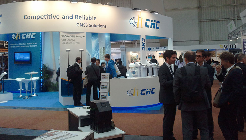
    As I mentioned before, our colleagues in Asia, Africa, Europe, and South America are already seeing lower-cost high-precision GNSS receivers. There are brands offered in those geographic regions that aren’t known (or are very little known) in the U.S. and Canada. Brands like Stonex, FOIF, BHCNav, CHCNav, and others market themselves outside of the U.S. and Canadian markets, but not much in the United States or Canada. The increased competition in those foreign markets has driven high-precision GNSS prices down.

    Intergeo2012_eric1
    The CHC booth at Intergeo 2012.

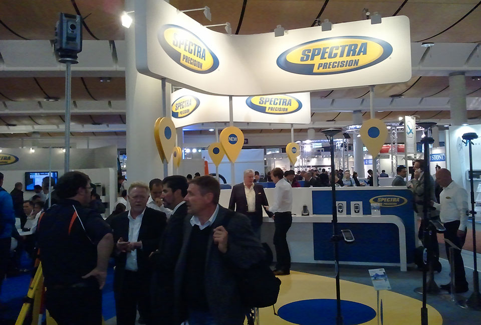
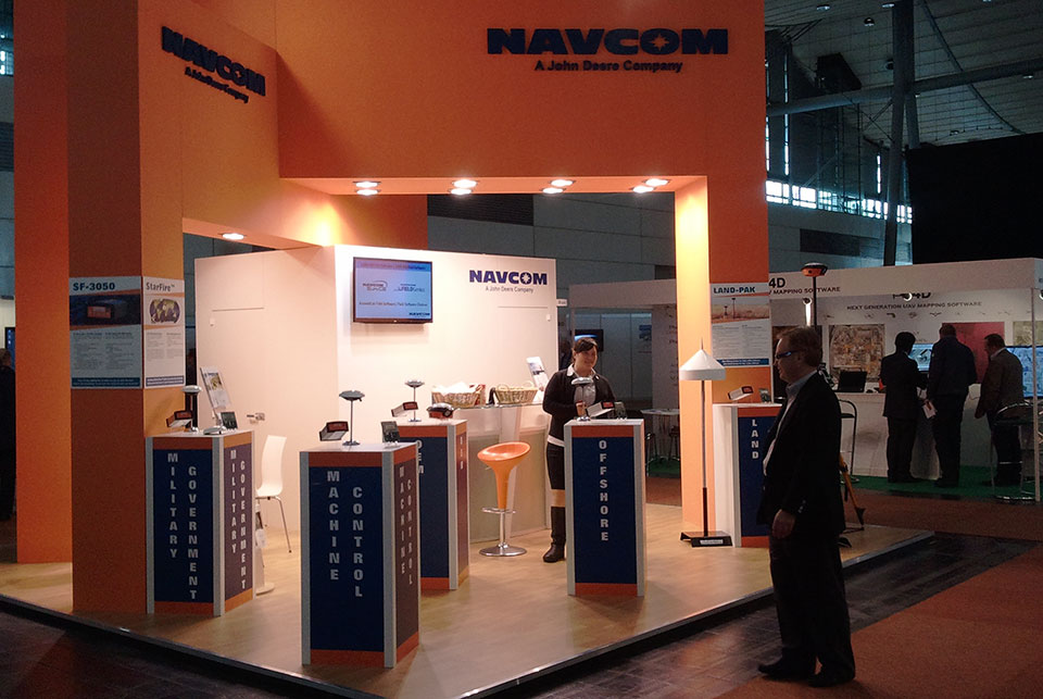
    The reason high-precision GNSS prices are still high in the U.S. and Canadian markets are because it’s still primarily a Trimble, Leica, Topcon game. Yes, there are other brands like Ashtech/Spectra-Precision, SXBlue, Javad, Sokkia, Hemisphere, Altus, and Navcom, that may offer entry-level entry points, but the Big Three still dominate the U.S. and Canadian markets, partly because of their broader product lines and mostly because they have the best network of dealers. Differing from the others in this mix is Navcom, a subsidiary of John Deere & Co. Navcom’s GNSS technology is distributed by Deere & Co, and is focused almost exclusively on the agriculture market.

    In the United States and Canada, high-precision GNSS receiver users are still willing to pay a premium for leading brand-name products and their dealer networks. You might think that there’s a lot of price pressure from the other brands. There is some, but some of the other brands are owned by the big boys. Trimble owns Spectra-Precision and Ashtech. Topcon owns Sokkia.

    Intergeo2012_eric3
    Spectra Precision (here at Intergeo 2012) is owned by Trimble.

    For there to be serious price movement in the United States and Canada as there has been in other areas of the world requires more competition. I think we’re going to start to see more of that.

    I know you don’t want to hear this, but the competition for high-precision GNSS receivers is coming from China — and it’s serious competition. Chinese GNSS receiver manufacturers are already well-established in Africa, Europe, and Asia (of course). Their high-precision GNSS gear is coming soon to a place near you.

    CHCX91
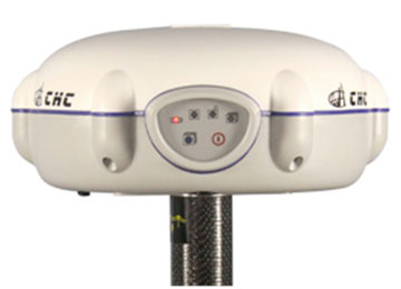
What exactly is a Chinese-made GNSS receiver? Mostly, they are receivers made using the guts (GNSS receiver boards) from mainstream GNSS receiver designers like Trimble, Topcon, NovAtel, and Hemisphere. The Chinese companies buy these receiver boards and design their own cases, battery packs, and other supporting systems around the GNSS receiver board. The finished products, like the CHCNav X91, look much like what you see from Trimble/Topcon/Leica today, and it sports a Trimble or Novatel GNSS receiver inside, for fraction of the price you’ll pay for the equivalent Trimble GNSS receiver.

    Of course, you wouldn’t benefit from Trimble (or whomever) dealer network support, and you would be risking that the manufacturer has designed a reliable system around the GNSS receiver board. What happens if the receiver needs service? Where’s the nearest support center? Who do you call? These are all very valid questions that any prudent businessperson would ask themself before making a significant equipment purchase.

    Some of the Chinese manufacturers rely on low price to attract your attention and then offer minimal customer support. Others, like CHCNav, are addressing this by setting up regional centers around the globe for support and repair. Can they produce high-quality GNSS products that will meet the expectations of U.S. and Canadian buyers? The reputation of Chinese manufactured products in the surveying market is not very good. Will they have the staying power to hang on for a few years, long enough to gain the confidence of U.S. and Canadian users?

    In their favor is their home market. China is the largest consumer of high-precision GNSS receivers in the world. In fact, it’s been said that more high-precision receivers are sold in China than in the rest of the world combined. Even if that’s not an accurate statement, it’s not incorrect by very much. That tells you something about the size of the Chinese market for high-precision receivers. With a market that size, I think it’s safe to say that Chinese receiver manufacturers are gaining a lot of experience in designing and manufacturing GNSS receivers, and one can assume that the next-generation receiver design is better than the previous one.

    While they haven’t quite ventured into offering their own GNSS receiver designs (still buying GNSS receiver “guts” from established manufacturers), last week one Chinese manufacturer took a step closer to doing so. On January 31, Hemisphere GPS announced that Beijing UniStrong Science & Technology Co Ltd. is acquiring Hemisphere’s core GPS design/manufacturing business. Hemisphere has chosen to divest itself of all non-agriculture related businesses and rename the company AgJunction, the same name as a software company it acquired recently. Of course, GNSS technology is highly related to agriculture, and there’s no doubt that AgJunction will continue to use GNSS technology, but clearly the AgJunction management team doesn’t think it’s an important enough technology to have to own it.

    UniStrong is no stranger to the GPS/GNSS business and is no small fry. It’s been in business since the mid-1990s and boasts more than 1,000 employees, offering a wide variety of high-precision GPS/GNSS receiver solutions from handheld GIS receivers to full-blown RTK GNSS receivers. With this acquisition (US $15 million), it becomes the first Chinese-owned GNSS receiver design/manufacturing group in North America.

    Thanks, and see you next time.
    Follow me on Twitter.

    Intergeo2012_eric2
    Navcom, a subsidiary of John Deere, focuses on the ag market.
  • How GLONASS, Galileo, and Compass Will Affect High-Precision Users

    Join GPS World’s Survey and GIS Editor Eric Gakstatter March 15 for the webinar, “Everything Else but GPS: How GLONASS, Galileo, and Compass Will Affect High-Precision Users.” The webinar will be held at 10 a.m. Pacific (1 p.m. ET/6 pm. GMT); registration is free.

    “In a rapidly changing world — which is the world of GPS and GNSS — those who invest significant amounts of their operating capital in hardware must plan carefully for the future,” said Gakstatter, who serves as moderator of the webinar. “Will your survey receiver remain relevant and up to date long enough for you to recoup your investment? How could taking advantage of newly operational constellations improve your efficiency and competitiveness? GLONASS is operational now. Compass has put forward a very aggressive schedule for regional and then global operations. Galileo is moving steadily forward.”

    Gakstatter closely follows all these systems, and can relate their capabilities — current and future — directly to surveyors’ needs. His guest speakers will add to the insight. This webinar is required listening for anyone planning to stay on survey’s leading edge.

  • LightSquared: 1, High-Precision GPS: 0

    At stake is the high-precision GPS industry as we know it. If LightSquared’s current proposal is approved by the FCC, it will render tens of thousands, and possibly hundreds of thousands of GPS receivers obsolete starting as early as next year. The FCC is accepting public comments until July 30 and replies to those comments until August 15. After the public comment period is closed, the FCC can render a decision at any time. Last weekend, I spoke alongside LightSquared and the Coalition to Save Our GPS in a two-hour panel discussion at the Esri Survey Summit in San Diego. Here’s my report.


    Last weekend, I attended the Esri Survey Summit in San Diego. This year was different in that it was combined with the ACSM (American Congress on Surveying and Mapping) annual conference. Part of the conference Plenary on Saturday were 30-minute presentations by LightSquared and the Coalition to Save Our GPS. The following morning (Sunday), there was a two-hour discussion panel on the LightSquared/GPS interference issue, in which I participated.

    At stake is the high-precision GPS industry as we know it. If LightSquared’s current proposal is approved by the FCC, it will render tens of thousands, and possibly hundreds of thousands of GPS receivers obsolete starting as early as next year. The FCC is accepting public comments until July 30 (see also instructions at the bottom of this column) and replies to those comments until August 15, 2011. After the public comment period is closed, the FCC can render a decision at any time.

    The FCC is clearly biased on the LightSquared/GPS issue favoring LightSquared. There’s a lot of pressure to push the U.S. National Broadband Plan, which includes improving Americans’ accessibility to high-speed wireless connectivity to the Internet. After only 2 ½ weeks on the job, FCC Wireless Telecommunications Bureau Chief Rick Kaplan stated earlier this month that “We need to make sure we aren’t locking out valuable spectrum because of inefficient transmission,” obviously referring to the LightSquared/GPS interference issue.

    The LightSquared propaganda machine has been effective in bending the ear of technically-challenged policymakers into believing GPS receivers are using LightSquared’s spectrum without permission, and that GPS receiver designers have known this issue was coming since as early as 1995. Both statements, of course, are not true as I’ve written before, as has GPS World editor Alan Cameron (see LightSquared, FCC Rebuttals Distort Record), and as published on the Coalition to Save Our GPS website.

    Last weekend’s Survey Summit was perhaps the best opportunity to date for land surveyors and other high-precision GPS users to speak out and let LightSquared and our policymakers know how crucial high-precision GPS/GNSS receivers are to their operations. The discussion content was very good and our industry clearly made its points, but it was all for naught.

    Esri got LightSquared Executive Vice President Jeffrey Carlisle to fly in from Washington D.C. to speak at the plenary and then participate in the discussion panel along with myself, moderator John Matonich (NSPS), Dr. Javad Ashjaee (JAVAD GNSS), Dr. Joe Paiva (consultant), Curt Sumner (ACSM), and Peter Large (Coalition to Save Our GPS). However, it was a lost opportunity. Only fifty or so people attended the discussion panel, and I’m sure Mr. Carlisle flew back to Washington D.C. to report that the high-precision GPS users just rolled over, and they are not nearly the roadblock that might have been anticipated.

    LightSquared: 1, High-Precision GPS Users: 0

    A few key points from the discussion panel I think are worth noting:

    It’s a joke, but LightSquared is probably going to win the argument that the “GPS industry knew this was coming.” It is going to win not because it is correct, but because Jeff Carlisle was an FCC employee for several years and knows which buttons to push at the FCC, where to find documents that are publicly available — but not reasonably accessible to the general public, in my opinion — and how to misrepresent them.

    Who is the “GPS industry” that LightSquared and the FCC refer to?

    When LightSquared and the FCC refer to the “GPS industry,” they certainly are not referring to the GPS user community (you and I), which is expected to bear a huge financial burden (you and I will need to buy new GPS equipment) if the LightSquared proposal is approved.

    In nearly all of its documents, LightSquared refers to discussions and agreements with the U.S. GPS Industry Council (USGIC). I have a problem with this, and so should you. The USGIC is a sort of chamber of commerce for GPS manufacturers. If you perform a Google search for the U.S. GPS Industry Council, you won’t find a website, you won’t find a listing of council members, nor will you find much other information about it.

    The USGIC, in other words, does not maintain a high public profile.  To be fair, it is an industry council, not a user council.

    To be further fair, the Industry Council did negotiate an agreement several years ago with a former version of LightSquared (under different ownership then) and with the FCC, along certain business terms and technical parameters. That agreement did not harm GPS users in any way; in fact, it contained some inherent protections for GPS users. The current version of LightSquared has completely changed both its business plan and those technical parameters — turned them on their heads, as a matter of fact — but blithely continues to claim that this was all worked out and agreed to previously.

    Nevertheless, how has it come about that the USGIC was the negotiator with LightSquared and its predecessors for you and I regarding your GPS equipment when you’ve never met a USGIC representative, and never had a chance to provide comments before negotiations with LightSquared and its predecessors on such a critical issue?

    When I made a statement about this during our discussion panel, Jeff Carlisle called me a “fear-monger,” if I recall correctly, and he referred to my assertion that the USGIC is a chamber of commerce as “ridiculous.” I think he needs a little education.

    The analogy I used was that when Walmart wants to build a store in your town, it does not negotiate with the Chamber of Commerce, because the Chamber of Commerce does not represent the citizens. Walmart negotiates with the City Planning Department and City Planning Commission, which is comprised of citizens of the community, who are directly impacted and must bear the consequence of the development.

    The reason LightSquared is in this controversial and expensive predicament today is because it chose the incorrect organization to negotiate with.  Perhaps on purpose, so it could maintain later that it had negotiated with someone.

    This is not virgin territory. There is a clear precedent on this subject. Do you remember back in 2008 when the U.S. Air Force (GPS stewards) wanted to discontinue supporting the semicodeless technique that is used by virtually every civilian dual frequency GPS receiver in existence? It was the first time in GPS history that an action would render several hundred thousand high-precision GPS receivers obsolete, a scale which is very similar to the effect that the LightSquared system would have on high-precision GPS receivers today.

    Do you recall an industry coalition being formed to fight it? Do you recall an industry outcry? Do you recall a technical working group being formed to test the effects on receivers if semicodeless was not supported?

    The answer is no.

    Why is that
    ?

    The answer is very simple. The U.S. Air Force, to its credit, did a fantastic job of communicating with the GPS user community along with the Department of Commerce. It issued public statements describing the impact the action would have on GPS receivers. It held a public comment period. The following statement from its website succinctly summarizes its approach:

    “The Office of Space Commercialization worked hard to raise awareness of the size and significance of the high-end GPS user community, which was poorly understood within the government. The Office collected industry information to quantify the installed base of codeless/semi-codeless GPS equipment, estimate its economic value, and determine an acceptable time frame for its replacement. The Office also issued a request for public comments to receive broad stakeholder feedback.”

    In other words, it did its homework. At the end of the day, the U.S. Air Force set a date of December 31, 2020 to discontinue supporting the semicodeless technique. It correctly determined that 12 years is about the correct amount of time that would allow a smooth transition with a manageable financial impact to the GPS user community. Users would naturally upgrade their equipment during that period.

    Imagine if the U.S. Air Force had set a period of one year to transition away from using the semicodeless technique. That action would have destroyed the high-precision GPS user community, and the continued adoption of high-precision GPS technology would have been set back for years. Fortunately, it did its homework.

    LightSquared, on the other hand, either didn’t do its homework or intentionally kept quiet in order to fly under the radar and push its initiative through before the GPS user community (and others) knew what was happening.

    During the discussion panel, I wanted to (and I think I did) make three points very clear:

    1. The high-precision GPS user community did not know this was coming, period.
    2. There was a precedent already set that clearly illustrated how to successfully communicate to the high-precision GPS user community when an action is proposed that would effectively render hundreds of thousands of high-precision GPS receivers obsolete.
    3. The high-precision GPS user community should not bear any cost related to LightSquared implementing its system.

    That said, I’m not saying “no” to LightSquared.

    I get the 4G wireless broadband argument that LightSquared and the U.S. National Broadband Plan make. I want high-speed internet on my smartphone too. I want my phone to work in elevators and elevator-like environments that LightSquared promises. I think this might be a boost to the economy.

    While I’m not saying “no” to LightSquared, I’m saying “no” to LightSquared’s proposal at this moment. There are still waaaaay too many unknown issues to be understood and resolved.

    A few of them are:

    • Even using the lower frequency spectrum in its new proposal (1526-1536MHz), at least tens (maybe hundreds) of thousands of your high-precision receivers will need to be replaced. Who will bear that cost?
    • More testing is needed to understand exactly what the effect of using only the lower frequency spectrum will have on all types of GPS receivers. That was not LightSquared’s original roll-out plan and therefore wasn’t tested extensively to determine its affect on GPS receivers.
    • The idea of using the upper frequency (1545-1555MHz) for high-powered terrestrial broadcast needs to be permanently abandoned.
    • The effect on GLONASS L1, Galileo L1, Compass L1, and GPS L1C need to be extensively tested to understand the effect on GNSS receivers of today and of the future. Galileo L1, Compass L1 and GPS L1C all use wider bandwidth than today’s GPS L1 C/A, which makes them even more susceptible to interference from LightSquared’s system.
    • A serious effort needs to be made to understand the effect of LightSquared’s mobile devices on GPS/GNSS receivers. LightSquared’s mobile devices will operate in the 1626.5-1660.5MHz frequency spectrum, above the GPS L1 spectrum and GLONASS L1 (~1597-1605MHz). It’s been reported that Inmarsat devices (using LightSquared’s 1626.5-1660.5MHz mobile device spectrum) do not fare well around Iridium phones (1616-1626.5MHz), which is very close to GLONASS L1.

    We have to be very careful and test these scenarios because once the plug is pulled, you can’t suck the water back out of the drain. There’s no turning back. Also, the FCC doesn’t have a solid history of making good decisions in the wireless arena. In the words of noted wireless industry guru Andrew Seybold (BlackBerry, HP, AT&T, Motorola):

    “The history of wireless is littered with examples where the FCC acted on a request by a vendor, approved the deployment of a system, and later learned that the new system created interference to other services.”

    In fact, Mr. Seybold writes that LightSquared shouldn’t be permitted to move forward at all. On July 6, 2011, he published the following:

    “Okay, I admit it. I don’t believe LightSquared should be permitted to use what was supposed to be satellite spectrum for a terrestrial broadband network. Not only that, I don’t believe LightSquared has a sound business plan. Building more than 40,000 cell sites, maintaining them, and reselling the bandwidth to others who want to sell it to its customers, does not pencil out in my book. The margins will be too slim, especially given the fact that prices for both voice and broadband services keep falling in the United States so margins will continue to be squeezed. But apart from a faulty business plan, the main reason I am opposed to LightSquared’s plan to build this network is that if there is the slightest chance it will interfere with GPS receivers, it simply should not be permitted to be built.”


    To file comments with the FCC: Comments may be filed electronically using the Internet by accessing the ECFS: http://fjallfoss.fcc.gov/ecfs2/. Filers should follow the instructions provided on the website for submitting comments. In completing the transmittal screen, ECFS filers should include their full name, U.S. Postal Service mailing address, and IB Docket No. 11-109.


    Thanks, and see you next time.
    Follow me on Twitter at http://twitter.com/GPSGIS_Eric


  • Webinar Brief – A Closer Look at L5: The Future of High-Precision GNSS

    Yesterday I conducted a webinar titled “A Closer Look at L5: The Future of High-Precision GNSS.” Preparing for it was quite interesting, so I thought I’d share some of the slides I produced (and had produced) for the webinar. I think you’ll find them interesting.

    The webinar was focused on discussing the value of the new L5 civilan frequency for GPS/GNSS receivers. An interesting challenge in preparing for the webinar was my attempt at estimating what a satellite constellation of satellites (GPS and others) broadcasting at least L1 and L5 would look like four or five years from now. The point of it was to illustrate that a useful constellation of satellites broadcasting L1 and L5 (as well as L2C) is potentially only four to five years away.

    In that timeframe, there are potentially 30 satellites that would be healthy and broadcasting navigation signals on the L1 and L5 frequencies that we can use. How is that possible?

    Both GPS and Europe’s Galileo support the new L5 civil frequency (as well as L1). The U.S. has already launched one of the new GPS model IIF satellites. The IIF is currently healthy and broadcasting three civil frequencies; L1 C/A, L2C and L5. There are 11 more of the IIF satellites being built. It’s estimated that all 11 will have been launched into their orbits by ~2015. On the other hand, the first 18 Galileo satellites have been contracted to be built, and it’s estimated that the 18 will be launched into their orbits by ~2015. The Galileo satellites are designed to support L1 and L5 (as well as others). That’s a total of 30 satellites broadcasting L1 and L5.

    In an ideal world and in the best interest of the civilian user community, the Americans and Europeans would coordinate orbits planes/slots of the 30 satellites so they would be in an optimal configuration (steady # of visible satellites, reasonable PDOP) for the user community. But, I seriously doubt that’s going to happen.

    So, the next best thing is to attempt to estimate what an “uncoordinated” constellation of 30 GPS/Galileo satellites would look like in 2015 (assuming the launch schedules hold). Fortunately, our friends at the Galileo Supervisory Authority (GSA) have already mapped out the orbit plane/slot data for the 18 satellites. Without that data, none of these projections would have been possible.

    GPS was a little tougher to estimate. The U.S. Air Force doesn’t have (or at least they don’t share) a long-range plan for where the next 11 IIF satellites are going to be inserted in the GPS constellation. They look out one satellite at a time. That’s understandable because the health of the GPS constellation changes over time. However, the U.S. Air Force does present a “watch list” of the weaker satellites in the constellation so we have some idea of where the new ones are going to be placed.

    Once we compiled the information from the Galileo folks and our projections on where the next 11 IIF GPS satellites will be inserted, we were able to come up with some interesting plots I’d like to share with you.

    All of the following satellite visibility plots are based on my location in Portland, Oregon, USA, and with a 15º elevation mask. Using a 15º elevation mask is pretty conservative so the plots are pretty conservative if you’re working in an open-sky environment like in agriculture.

    The first plot is of the 12 GPS IIF satellites only. You can see there’s an average of about three IIF satellites in view between 6 a.m. and 8 p.m. Thanks to Analytical Graphics, Inc. for help generate the following plots.


    The next plot is of the 18 Galileo satellites. You can see there’s an average of 4-5 Galileo satellites in view between 6 a.m. and 8 p.m.


    The next plot is of both the 12 GPS IIF satellites and the 18 Galileo satellites. You can see there’s an average of 8 GPS IIF and Galileo satellites in view between 6 a.m. and 8 p.m.


    Finally, the last plot is of the 12 GPS IIF satellites, 18 Galileo satellites, and the 19 remaining legacy GPS satellites (broadcasting L1 and L2). You can see there’s an average of 12 GPS IIF, Galileo, and legacy GPS satellites in view between 6 a.m. and 8 p.m.


    For a different perspective, here are 3D orbit plots of the 18 Galileo satellites and the 12 GPS IIF satellites.

    3D orbit plot of 18 Galileo satellites


    3D orbit plot of 12 GPS IIF satellites

    There are several more plots similar to these in my webinar for different locations around the world including London, Rio de Janeiro, New Dehli, Perth, and Bangkok. In the webinar presentation, I also provide more details about the benefits of L5. You can view a recording of the webinar by registering here. After registering, you’ll receive an e-mail with instructions on how to view the webinar.

    Thanks, and see you next time.

    Follow me on Twitter at http://twitter.com/GPSGIS_Eric

  • What’s Going to Happen When High-Accuracy GPS is Cheap?

    Last week, as you may have heard given the multiple launch delays, the United Launch Alliance (a Lockheed and Boeing joint venture), under contract with the U.S. Air Force, successfully rocketed a new GPS satellite into orbit.

    The GPS satellite launched into orbit last week wasn’t just any other GPS satellite. It was the first of a new generation of GPS satellites that are going to change the way surveying, engineering and construction data is collected and processed in the future. Its new features are going to profoundly transform surveying, engineering and construction. I’m not exaggerating.

    Before you stop reading because you think you’ve read this already in my other newsletter, Geospatial Solutions Weekly released earlier this week, hang in there because although some of it is the same, I’ve added some surveying-specific comments.

    First of all, it’s important to understand that this is going to happen. It’s not a matter of if, but rather when. What I mean is the price of high-accuracy GPS is going to be very inexpensive, both horizontal and vertical, and it’s going to dramatically affect your business.

    Here’s why.

    The new L5 signal will eventually (when it’s being broadcast from enough satellites – more on that later) significantly transform GPS receivers in two ways:

    1. It will result in high-accuracy GPS receivers being much cheaper and smaller.
    2. It will make collecting high-accuracy GPS data much more convenient for the average person.

    Let’s examine in more detail.

    Why will high-accuracy GPS receivers be cheaper and smaller?

    Today’s GPS dual-frequency receivers (L1/L2) can achieve a high level of accuracy (1 cm) in a short period of time, as little as a few seconds. But, they are expensive. An entry-level GPS dual-frequency receiver is a few thousand U.S. dollars. The primary reason is because there is a limited number of companies that design GPS dual-frequency receivers for surveying, maybe a dozen or so. Why is there a limited number of manufacturers? The answer is because the original L2 was not an open signal. In the 1980s, some very smart engineers figured out how to utilize L2 (designed for military use only) in commercial receivers. When they developed those techniques, the companies were smart enough to patent them. There are so many patents in place that it makes it very difficult for a new designer to enter the traditional GPS dual-frequency market, whether it’s surveying, machine control, GIS, or whatever.

    Unlike the original L2, L5 is an open signal. Its specification is published for anyone to use. No license fee. No receiver tax. Nothing.

    Without any patent blocks, any company in the world is free to develop a GPS dual-frequency (L1/L5) receiver that would be just as accurate, and arguably more accurate, than today’s L1/L2 GPS dual-frequency receivers.

    Looking back on the history of electronics, within and outside the GPS industry, we know that increased competition usually results in lower prices to the consumer and improved product quality.

    Take, for example, GPS L1 receiver chips used in personal navigation devices and mobile phones. Those chips are available today for less than $3 each. Fifteen years ago, much less powerful GPS L1 receivers were $200 each and 10 times larger.

    Mark my words: you will see a similar trend with high accuracy GPS dual-frequency receivers. GPS dual-frequency receivers will be sold at prices you can’t imagine today, allowing surveyors, engineers, contractors, GIS folks, biologists, ecologists, etc. (and an educated general public) to collect high-accuracy data (horizontal and vertical) very inexpensively.

    The only thing holding this trend back is the availability of L5. It needs to be broadcast by  about 24 GPS satellites. That’s going to happen somewhere between 2018 and 2020. Of course, GPS designers will be working on their receivers long before that.

    Why will collecting high-accuracy GPS data be much more convenient for the average person?

    First of all, the cost of high-accuracy GPS dual-frequency receivers will plummet significantly due to the open L5 signal. This will spur a fantastic amount of innovation and competition among a large number of receiver designers, especially in the consumer electronics market. Surveyors, engineer, contractors, GIS folks, etc. will benefit greatly from the consumer electronics industry because the high volumes in the consumer market will further spur innovation and cost reduction.

    Oddly enough, at that time, the most expensive part of a high-accuracy GPS receiver may be the antenna. The consumer electronics market won’t accept the type of high-accuracy GPS antenna we need (too big/bulky), so the limited number of antennas means you’ll pay a higher price, maybe a $100, maybe $200.

    If you have a minute, you might want to browse this article by Dr. Frank van Diggelen. Essentially, he says that consumer GPS receivers in your mobile phone, PND, etc. can be as accurate as a GPS receivers built for high-accuracy surveying. The reason they aren’t, he says, is due largely to the inferior antenna being used in mobile phones, PNDs, etc. Now, I’m not saying I buy everything he’s writing, but he’s a lot smarter than I am with regards to GPS, and I do have enough experience to know that antennas can make a big difference in receiver performance.

    What you’ll see, eventually, is GPS dual-frequency (L1/L5) receiver technology in consumer electronics, which means high-accuracy positioning at consumer prices. Take it a step further and one can make the statement that high-accuracy positioning will be in the hands of the consumer. A knowledgeable consumer will be able to take a  low-cost, high-accuracy GPS dual-frequency receiver and collect (or have others collect) an amazing amount of valuable data (think high-accuracy vertical) that would otherwise be too expensive to collect using today’s technology.

    That is where we are headed, guaranteed.

    Wildcards

    Other GNSS

    The time-frame estimation I made above (2018-2020) for a full (24-satellite) constellation of GPS satellites broadcasting L5 is based solely on the activities of the U.S. government. Keep in mind that the U.S. government can’t exceed the 2020 deadline because December 31, 2020, is when the U.S. Air Force says it will stop supporting legacy GPS L1/L2 dual-frequency receivers. So, the end of 2020 is the worst-case scenario.

    Of course, the U.S. isn’t the only country working on GNSS. Europe’s Galileo system also utilizes L1 and L5. It’s possible that in the 2014 timeframe, the U.S. could have a dozen GPS satellites broadcasting L1/L5 and Galileo could have a dozen Galileo satellites broadcasting L1/L5. Because the U.S. and Europe have been working so closely together to ensure GPS and Galileo work together seamlessly, having 12 Galileo satellites broadcasting L1/L5 is the same as GPS broadcasting L1/L5.

    China is also working on a GNSS called Compass/BeiDou. Although China is very tight-lipped with its intentions, it’s possible China could launch some satellites in orbit that may contribute to an L1/L5 solution, but China is a serious wildcard.

    L2C

    Some of you may be wondering why I haven’t included GPS L2C in the discussion. L2C is an open GPS signal much like L5. There are currently seven GPS satellites broadcasting L2
    C. Not including Galileo, there will be 24 GPS satellites broadcasting L2C before there are 24 GPS satellites broadcasting L5. In fact, some designers may decide to develop L1/L2C receivers. However, Galileo isn’t supporting L2 so while there will probably be triple-frequency receivers (L1/L2C/L5), my guess is that the standard will be L1/L5, because the third frequency isn’t going to buy you much.

    Conclusion

    No other conclusion can be drawn but that in the future, as soon as 2014 and as late as 2020, high-accuracy GPS receivers (cm-level in both horizontal and vertical) will be in the hands of anyone with a few hundred dollars to spend. This will be consumers as well as surveyors, engineers, contractors, GIS folks, and many other folks who see value in spatial data. They will have easy access to a fantastic new tool that will allow them to collect high-accuracy, horizontal and vertical data, at a very low cost and very conveniently. I keep referring to vertical accuracy because accurate vertical data is much more expensive to acquire with the technology that exists today, GPS and otherwise. Not so in the future. When one really thinks about the value of accurate low-cost vertical data, the numbers of applications are mind-boggling and will certainly send all disciplines that use spatial data in a new direction.

    Perhaps no discipline will be more affected by this technology advancement than surveying. If you’re retiring in five years, you can probably get away with not thinking about this. But, if you’ve got more than that left in your career, you really need to consider what direction you want to go.

    The bad news is that you have to change. Change is stressful, especially at mid-career, but you don’t have a choice if you want to enjoy a career in surveying. Technology is transforming surveying. You know it because you’ve been feeling the squeeze. You’ve seen that engineers and contractors have acquired technology tools to bring some activities in-house. Machine control is an obvious one. In just a few years, you likely won’t be doing the same sorts of tasks you’re doing today. There will be much more emphasis on data management and data analysis than on data collection (less field time, more office time). Of course, there will still be a need for people in the field, but that’s not where the professional wage is going to be earned. Those in the field will only have jobs, not careers. The well-paying careers will be in the office (either home office or business office or mobile office).

    The good news is that there’s more opportunity than ever before. I can’t count the number of times I’ve had people from different organizations (public and private) ask me if I knew someone who could help solve their geospatial problem. Sometimes, it’s a problem combining data sets. Sometimes, it’s a problem interpreting the data they have as well as finding or collecting new data. Guess what? They aren’t looking in the telephone book (yellow pages) to find someone to help solve their problem. In fact, in some cases they don’t even care if you live in the same country as they do. True, you may have to travel to their office, but they don’t care as long as you solve their problems. I realize this may be a strange concept to many of you, but the Internet has made the world a lot smaller than it used to be. Your clients don’t have to be located within 200 miles of your office. You can have clients in different counties, states, provinces, and even countries! When you start letting go of the idea that your clients need to be geographically close to you, suddenly your business prospects start to look bright. When you limit your ten-person company to clients located within 100 miles in rural Alabama in this economy, you’re going to starve. When you release that limit and start thinking and acting regionally, statewide, nationwide, or worldwide, all of the sudden there’s a lot more opportunity to keep your employees working.

    One important note

    In order to take advantage of the opportunities I mentioned above, you have to expand your knowledgebase. There’s no choice. It’s either that or you’re bagging groceries at Walmart. Technology is changing and its forcing changes in your business, so you must adapt to those changes. Recently, I wrote about a technical session at the ACSM/GITA conference I attended called the Surveying Body of Knowledge (SBoK). Although I may have some differences with some of the SBoK committee member’s intentions, the concept is right. SBoK does a good job of defining the different disciplines in which surveyors can diversify. Briefly, the five areas are:

    1. Positioning (field data collection)
    2. Imaging (photogrammetry/remote sensing/3D scanners/LiDAR/)
    3. GIS (mapping/cartography)
    4. Law (boundary/real property/business law)
    5. Land development (construction/planning/development)

    The idea is that if one discipline is weak, such as positioning, in the current economy, then you could shift your business in another direction where you are qualified, such as GIS or imaging. You certainly don’t need to be qualified in all five disciplines, but having three or four in your pocket gives you a lot of flexibility when the economy is as weak as it is now.


    Thanks, and see you next time.

    Free Webinar on June 24th

    On June 24 (was originally scheduled for June 22), I will be conducting a free 60-minute webinar on “GIS Mapping for Forestry, Agriculture, and Other Natural Resource Professionals.” I will discuss GIS mapping software tools/concepts/techniques as well as GIS mapping hardware such as GPS receivers, digital cameras, and laser rangefinders. Although focused on natural resources, it will be relevant for all people interested in GIS mapping, which could be utility companies, municipalities, transportation organizations, etc.  Sign up now by clicking here and submit questions in advance.

    Follow me on Twitter at

    https://twitter.com/GPSGIS_Eric