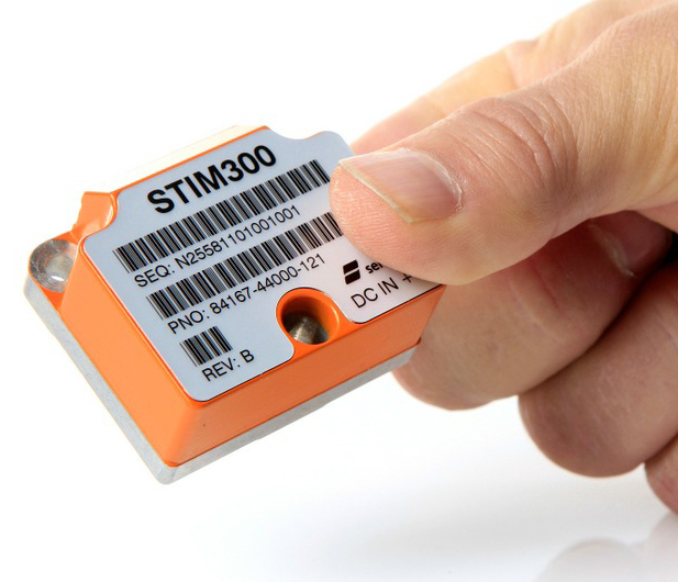
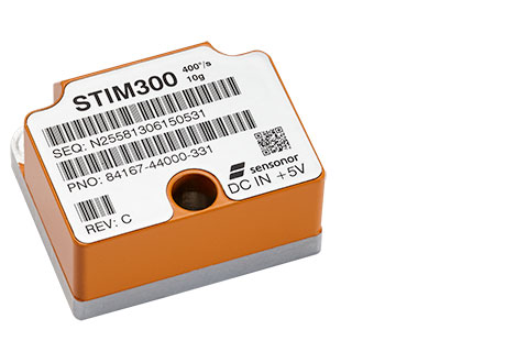
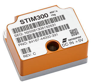
The STIM300 is a small, tactical-grade, low-weight, high-performance non-GPS aided IMU. It contains three highly accurate MEMS gyros, three high-stability accelerometers and three inclinometers. The IMU is factory calibrated and compensated over its temperature operating range.
The STIM series is designed for use below and on the ocean, on land, in the air, and in orbit and space. The STIM300 IMU is well suited for stabilization, guidance and navigation applications in the industrial, aerospace and defense markets. It is a crucial building block for inertial navigation systems in UAVs, AUVs, AGVs, UGVs and ROVs, Sensonor said.
The STIM300 is also used for camera turret stabilization and for use in various handheld devices that require a small IMU to secure operations during GPS outage.
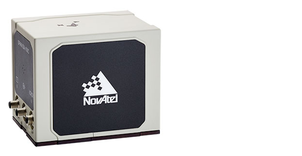
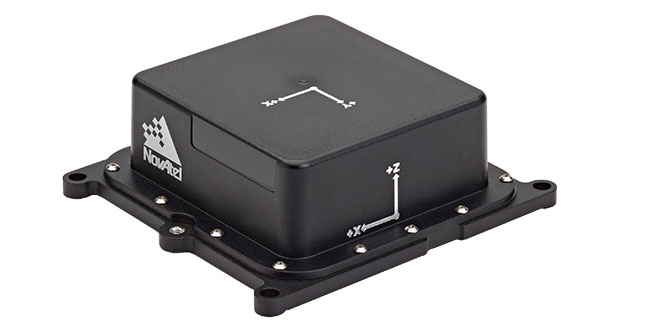
NovAtel Inc. has added the IMU-ISA-100C as an inertial measurement unit (IMU) option to its SPAN GNSS+INS line of positioning products. The IMU-ISA-100C is a high-performance, near navigation-grade IMU designed for platform stabilization, general-purpose navigation, photogrammetry, remote sensing, and ground mobile-mapping applications.
Commercially exportable, the IMU-ISA-100C integrates easily with a NovAtel SPAN capable receiver to provide a tightly coupled 3D navigation solution, NovAtel said. Offering customers continuous position, velocity and attitude (roll, pitch and azimuth) measurements, a SPAN system is stable and available even through periods when satellite signals are blocked or unavailable.
With the IMU-ISA-100C, customers will receive near navigation-grade performance, at an affordable price point. The product also features a new enclosure designed to maximize versatility for a range of applications.
“The compelling aspect of this product is its value — it is a high-end SPAN solution, delivering extremely precise positioning, at an attainable price point,” said Siamak Akhlaghi, NovAtel’s product manager, SPAN. “And without the export constraints, it can be shipped internationally in a timely fashion.”
The MTi-G-700 by Xsens is a GPS-aided, IMU-enhanced GPS/INS that offers high-quality orientation and position. It makes use of sensory measurements from magnetometer, barometer, and a high-sensitivity GPS-L1 receiver to provide navigation estimates of position, velocity, and orientation at high data rates under high-dynamic conditions.
The Xsens estimation engine (XEE) sensor-fusion framework enables the motion tracker to take advantage of different aiding sensor measurements and optimally fuse them to get robust tracking estimates. The MTi-G-700 has a u-blox 6 internal 50-channel L1C/A code receiver with 2-meter horizontal accuracy and 5-meter vertical accuracy; SBAS; a 4-Hz update rate; 27-second cold start-up time; and -161 dBM tracking sensitivity.
The MTi is being used by customers for many maritime and oceanographic applications that require 3D orientation, 3D position, 3D velocity, and 3D dynamic data, such as a monitoring system in a barge master vessel where the MTi monitors the movement of a wave-compensated crane.
Three weeks ago, GPS World / Geospatial Solutions held a webinar highlighting new technologies for imagery and data capture. The webinar had four presenters: Paul Smith of CycloMedia, Ted Ralston with Soft Power Solutions, Peter VanAmburgh from IIF Data, and John Ciampa CEO of Alta. You can view a YouTube video of the session. Because webinar time is limited, we couldn’t cover the technologies in detail, so I’m covering some of the technologies one column at a time.
In February, I devoted my column to CycloMedia, so you may want to review that material if you want more detail. This month I want to delve into the Alta balloon system that was presented by John Ciampa, the CEO of Alta. John was the original patent holder of Pictometry, the revolutionary high resolution geo-referenced metric oblique imagery system. He and Steve Schultz took the concept from theory to a practical functioning system that has been an industry standard for over 10 years.
John continues his research, dividing his time between the Rochester Institute of Technology (RIT) and Florida International University (FIU) while also working with the National Science Foundation (NSF). Although Pictometry was very successful, he also understood the limitations and cost of a manned aircraft as a capture system, especially for disaster response. Pictometry was a very capable system, but John felt that what was needed was a system that had a “lighter footprint” figuratively and literally. John took his knowledge and experience, and combined it with the latest developments in micro-miniaturized technology, to develop a system that was elegant in its simplicity and usefulness.
The Platform
Simply put, the Alta balloon is a steerable oblique geo-referenced camera system attached to a weather balloon. By using a balloon, John solved several problems associated with manned aircraft — cost, image quality, and accessibility. A balloon is cheaper than an aircraft, doesn’t require a licensed pilot, is more easily deployable, and can “fly” at lower altitudes.
Even a small aircraft is expensive, and requires a trained pilot and complex support logistics. A small used aircraft can run $50,000 to several hundred thousand dollars. Additionally, most high-end aerial imagery systems generally require expensive FAA-approved modifications of the airframe. This adds cost, and limits the aircraft that can be used. Equipped with Pictometry cameras and electronics, a total aircraft capture system can easily cost $300,000 and up.
A significant factor during disaster response events is transportability and support. Past experience has shown that it can be very difficult to transport and operate even small aircraft in disaster regions, especially if the damage is widespread. Fuel and ground support in disaster sites can also be a serious limitation. By comparison, a balloon system can be carried in a suitcase, shipped quickly, and set up in less than an hour. Since the cost is in the range of several thousand dollars, multiple systems are practical and can be deployed in numerous remote locations. Equally impressive is that operators can be trained in less than an hour.
But don’t get the impression that Alta is as simple as strapping a digital camera to a balloon. Achieving the image quality, accuracy and dynamic performance of the Alta system requires a very sophisticated package, including the balloon, controls, communications and sensors. The balloon system is actually two balloons, one within the other, an outer balloon and inner lift gas balloon. The outer balloon provides some external protection while presenting a consistent profile. The inner balloon provides the lift and is filled with either hydrogen or helium.
The altitude is remotely controlled by venting lift gas to descend or by dumping water ballast to ascend. An onboard computer and sensors can also maintain altitude autonomously. When the balloon is brought down, a tethered weight drops to several feet under the balloon. The weight contacts the ground first and “anchors” the balloon and payload for retrieval. This keeps the balloon and payload off the ground, and also makes it easier to spot.
There are several modes of operation that are determined by the operator prior to launch:
“Path Mode”: The balloon is released, ascending to the programmed altitude, then drifting with the wind currents before descending back to the ground.
“Patch Mode – single tether”: Used to launch and retrieve the balloon. The balloon ascends to altitude, and its position is downwind based on the strength of the wind acting on both the balloon and tether.
Patch mode with single tether.
“Patch Mode – multiple tethers”: Very precisely controls the location of the balloon over a limited area. This is very similar to the overhead cameras used in televised football games but in reverse, since the balloon wants to fly up.
Patch mode with multiple tethers.
The system can also be equipped with a parachute for emergency landings, a solar trickle charger for extended missions, and even a quadcopter that can steer the balloon to specific target areas. The lift capability of the balloon permits significantly longer duration flights than a quadcopter alone. A detailed operator’s manual is available for review at the Alta website — look for the Operators Manual.
The Payload
The modular payload is complex, but also lightweight and compact thanks to the latest developments in miniaturization. It consists of a precision GPS unit, inertial measurement/navigation unit (IMU), an onboard computer, environmental sensors, Wi-Fi communications, and an aimable high-resolution camera on a stabilized gimbal. The camera can be RGB, night vision or even multi-spectral. The imagery is downloaded as captured and delivered almost real-time.
Modular payload.
The Output
Because the balloon floats at low altitudes, image resolution is an impressive “game changer.” Here is just one example comparing a 4-inch pixel Pictometry/Bing image taken from 3,000 feet to a 1-centimeter pixel Alta image of the same location taken from several hundred feet.
Bing (left) and Alta images of stadium seats, compared.
Similar to Pictometry, the system uses GPS and IMUs to very accurately determine the camera location and attitude. That information, linked via algorithms to the captured imagery, results in imagery that is geo-referenced, measurable and available with full metadata, including the time of capture. I can’t over emphasize how important this is. Having instant access to imagery is nice, but having that imagery already geo-referenced means that the imagery can be quickly and easily imported into a GIS and overlaid with legacy GIS data for instant analytics.
The system has been used for many mundane applications such a real estate, agriculture, construction/engineering and event planning. More critical applications include crime-scene monitoring, surveillance and disaster response. Recently, in response to a South Florida Mall shooting, police launched an Alta balloon to view the crime-scene location. The imagery was instantly and continuously sent to police station computers and mobile devices of responders en route to the mall for pre-planning of their response. Viewing rooftops and walkways for victims and perpetrators, a near real-time operational picture was provided to police before putting themselves and others in harm’s way.
Actual image from an Alta balloon used in SWAT team maneuvers.
Dolphin Mall Sweetwater Florida, May 14, 2014, 6:05 a.m.
The Potential
I’m especially excited about the potential lifesaving use of Alta balloons. On numerous occasions I was involved in emergency response actions, and the dominant overarching need was high-quality imagery that could be combined with legacy data and imagery as close to real-time as possible. This system answers that need, and at a low cost. I could envision several Alta systems in every county nationwide ready to deploy on a moment’s notice. I believe that these units would be especially valuable for disaster response in second- and third-world countries. Dozens of Alta systems and trained operators could be delivered on short notice to major disaster sites, providing almost real-time common operational pictures for first responders. The added advantage is the very light need for logistics and support.
Military applications could be equally important. The silence of balloons coupled with a small visibility profile, including almost total invisibility at night, makes them ideal for reconnaissance and surveillance. The relatively low cost of the platforms also permits them to be expendable. In a tethered mode, the persistent “eye in the sky” could serve as a deterrent, or at a minimum make hostile activity more complicated for the perpetrators as they try to hide activities from the balloon. The “light” logistics and fast operator learning curve are just added benefits.
A key question raised during the webinar was FAA control. John indicated that the FAA does not consider the Alta balloons in a tethered mode subject to their control, and is currently reviewing it in a drift mode. John further amplified that the very low altitude of operation and dual control of descent should also exempt the drifter from FAA involvement. Alta could provide a significant advantage where UAS operations are restricted or not practical.
In a recent book, “Smaller Faster Lighter Denser Cheaper” by Robert Bryce, reviewed in the Wall Street Journal, the author argues that a similar dynamic, making less do more, drives virtually every technological change that has created the modern world, from cars and airplanes to advanced medicine, strategic metals and the iCloud. Alta balloons are certainly a good example.
I was an early proponent of Pictometry because, unlike abstract GIS data and ortho imagery, the metric oblique imagery was easily understood by non-GIS users. I saw many examples where it saved lives because police and firefighters were able to form and exploit a common operational picture quickly. Alta has me equally excited because it brings that same capability to users with a much simpler system that delivers almost real-time imagery at a cost anyone can afford. This technology is going to help a lot of people.
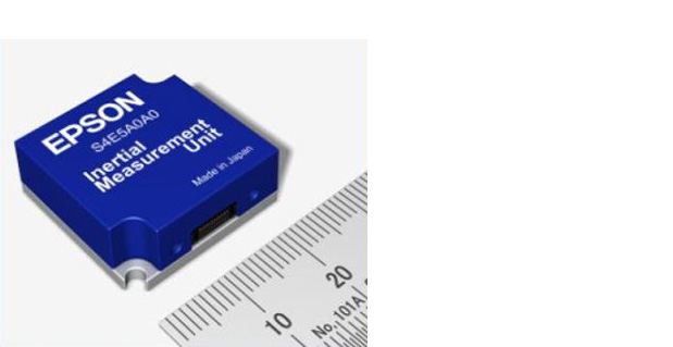
Epson Electronics America has announced a strategic partnership with Geodetics Incorporated of San Diego, California, for production of a new variant of its Geo-iNAV product.
According to the announcement, Geo-iNAV is a fully-integrated GPS-aided inertial navigation system that provides real-time, high-precision positioning and navigation for manned and unmanned air, sea and ground vehicles. It combines GPS and proprietary sensor fusion technologies to achieve centimeter-level real-time positioning and navigation for dynamic platforms. Geodetics will offer Geo-iNAV integrated with Epson’s new G362 and G352 IMU modules. The G362 and G352 are the world’s highest performance IMUs on the market in their size, weight and power class, the company said.
“Geodetics has the high-precision navigation expertise necessary to integrate IMU and GPS technologies, producing Inertial Navigation Systems (INS) that meet the performance requirements of very demanding applications,” said David Gaber, EEA’s IMU product line manager. “The combined solution, called Geo-iNAV Tactical, is a cost-effective, tactical-grade INS in a compact package with no EAR or ITAR export control restrictions.”
Geodetics President and CEO Lydia Bock added, “Epson has established a new benchmark for MEMS IMU performance, enabling Geodetics’ products to reach new applications and customers by delivering high performance for a significantly lower cost than competing devices.”
Epson says that with recent advances in unmanned vehicle technologies, the GNSS ecosystem has expanded to support mission-critical applications, which require more accurate navigation. Geo-iNAV Tactical delivers this capability with features to support reliable and precise navigation with a low SWaP (size, weight and power) profile for autonomous vehicles and payloads on manned vehicles. Geo-iNAV Tactical is offered in several configurations designed to meet a wide range of requirements and is available in commercial as well as SAASM configurations.
As GPS vulnerabilities to intentional jamming and unintentional interference become key factors for high-reliability navigation, inertial aiding to coast through outages becomes an important consideration for OEM integrators. Micro-electro-mechnical systems (MEMS) have been seen as offering the most promising, economical way forward for cost-effective, compact inertial and gyro solutions for almost every application going.
However, in the past, MEMS gyro and accelerometer components from which inertial and gyro systems are built have not provided performance anywhere near as good as laser gyros (ring laser gyros, or RLG) used in the majority of high-performance inertial systems. Now, as new MEMS inertial systems have begun to hit the market in recent months, the envelope appears to be opening up on achieving pretty high performance.
Gladiator Technologies, based in Snoqualmie near Seattle, Washington, is one of several companies currently supplying MEMS-based inertial/gyro systems for a wide range of applications. I came across Gladiator at the Association for Unmanned Vehicle Systems International (AUVSI) convention in Washington, D.C., last August and decided to take a closer look at them as a typical supplier of new, compact, cost-effective MEMS navigation devices, which are becoming essential compliments to GNSS.
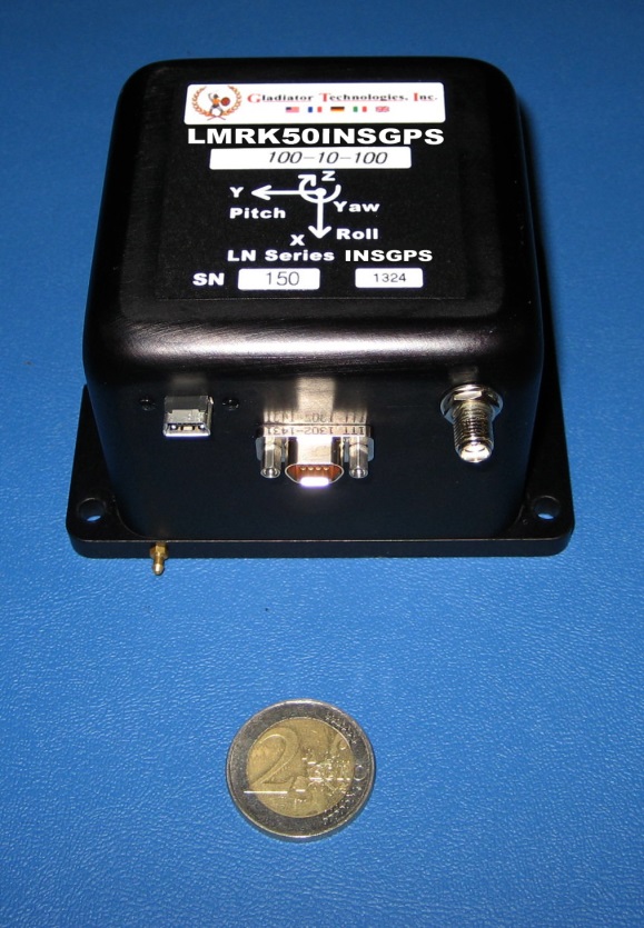
Gladiator has been around since 2005 and has continued to innovate each year, growing its product line and gradually improving performance. Right or wrong, as an “inertial layman” I’ve always used drift rates (bias) to assess inertial accuracy, and this is apparently directly related to the noise floor of the sensor device. Now Gladiator has released its latest Landmark 50 INS/GPS with low noise MEMS gyros and accelerometers and it claims 1 degree/hour drift rate in-run — as good as an 8-cm path length ring-laser gyro — something of an achievement for a MEMS-based device. (That’s a 2 Euro coin used in the photo for size reference.)
Landmark 50 INS/GPS, shown with a 2 Euro coin.
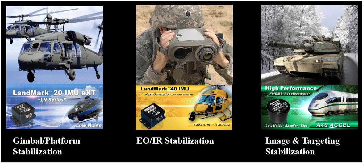
The product line goes all the way from automotive gyros up to the latest high-performance GPS/INS, and includes basic angular rate sensors and accelerometer packages. Applications include automotive testing, agricultural motion sensing, motorsport racing, instrumentation (including robotics and flight testing), rail, marine and energy motion detection, military land-vehicle and marine platform stabilization and navigation, electro-optical/infra-red targeting and stabilization, launcher and missile stabilization/navigation, and unmanned vehicles.
Gladiator integrates u-blox GPS receivers in its GPS/INS systems because of good environmental and test performance and good accuracy and navigation update rates. It’s possible in the future that airborne-qualified GPS or higher performance DGPS will find their way into new inertial variants, but for now Gladiator is very satisfied with u-blox receivers.
Applications may use a single/dual axis gyro or inertial measurement unit (IMU) where angular attitude outputs are required, such as image, attitude or weapons stabilization, or even packaged accelerometers.
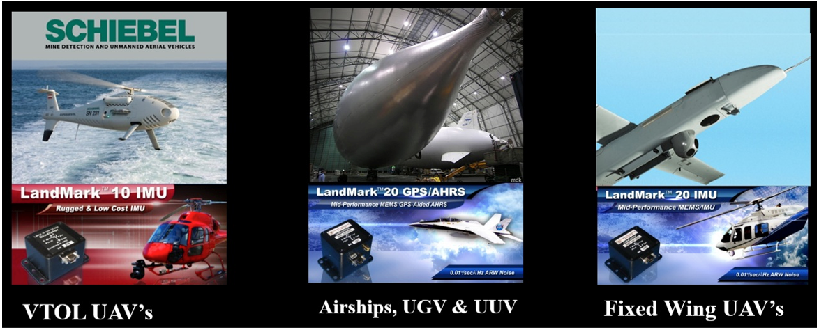
And, of course, unmanned aerial vehicles (UAVs) are one of the target markets for these MEMS products — Gladiator has already had a lot of success in this segment. Its equipment is used on a number of unmanned vehicles, including fixed-wing and vertical take-off and landing (VTOL) vehicles, as well as ground and underwater unmanned vehicles. These applications range from primary navigation/backup navigation to primary flight control/backup flight control, and include a large number of stabilization applications including electro-optical/infrared, LIDAR (light detection and ranging) and platform stabilization. Gladiator supplies these UAV applications with various inertial sensors (gyros) and inertial systems, including IMUs, vertical gyros (VGs), attitude heading reference systems (AHRS) and GPS-aided inertial systems. Customers in this market segment include Schiebel, U.S. Army, U.S. Naval Research Laboratory, ST Aerospace, and others.
Gladiator is closely monitoring progress towards UAVs gaining certified access to civil aerospace, and the prospect of expanding civilian applications and markets that that will bring. The company feels that its skills are in and around inertial sensor technology and products, and its efforts towards civil qualification should focus on these elements. Therefore, Gladiator is are looking for a partner who would take on GNSS civil qualification for civil airborne GNSS/INS applications.
Gladiator is still a small outfit with around 30 people, with most of its engineering done in-house by a team of nine engineering staff supported by some external consultants. Senior management has more than 100 years’ experience in this field, and Rand Hulsing, the chief scientist, holds 68 patents in MEMS inertial sensors. New patents are currently pending on inertial-grade gyro and accelerometer designs. People on staff have gained significant experience working for companies such as Allied Signal, Sundstrand, Honeywell, L3, Systron Donner and Hughes.
I pressed Mark Chamberlain, Gladiator CEO, for details of which (bought out) OEM MEMS devices his company integrates into its systems, and I was quite surprised by his response — Gladiator designs its own high-performance MEMS gyros and accelerometers and uses a fabless model to produce them. Clearly, it is having great success with this approach as its product performance has improved to almost within reach of existing technology high-performance inertial systems. Some of Gladiator’s lower end systems do still use OEM MEMS sensors. Their manufacturing facility in Washington focuses on product assembly and test, including calibration and environmental test.
The systems Gladiator supplies are non-ITAR — which is short for saying that they can be exported to most friendly countries, and are not subject to special/restricted U.S. State-Department trade regulations.
Gladiator does around $10 million/year currently, and anticipate its growth to continue. It has a number of sales representatives in North America, South America, Europe, Asia and Australia, so it is well known around the world, with more than 200 customers in 30 countries. I asked Mark about the possibility of an Initial Public Offering (IPO), but he is currently quite happy with the existing private ownership for the time being. The Gladiator board includes investor-directors from France and Germany, and the external directors also have impressive experience, so presumably board guidance has also helped Gladiator get where it is today.
So, we have almost-inertial high-performance products with integrated GPS, attitude-only products and accelerometer packages for almost any application you could imagine, and are quietly inching towards 1 deg/hour total within the next few years — MEMS devices really have come a long way in the last few years.
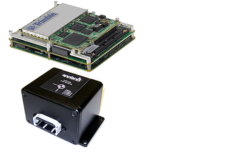
Applanix, a mobile mapping and positioning company, has introduced new versions of its positioning and orientation systems for airborne and land-based mapping — the POS AV 610 and POS LV 610. Delivering the same industry-leading performance as previous versions of POS AV and LV, the new systems use next-generation commercial inertial technologies that are offered globally.
Applanix POS AV and LV products integrate precision GNSS with advanced inertial technology (accelerometers and gyroscopes) to provide uninterrupted measurements of the position, roll, pitch and true heading of moving vehicles. Geospatial projects using POS can be completed more efficiently, effectively and economically. The POS AV 610 and POS LV 610 offer new advantages to customers:
Global availability: commercial technology.
Smaller and lighter: achieved by integrating a new state-of-the-art FOG (Fiber Optic Gyro) based Inertial Measurement Unit (IMU).
Exceptional performance with Applanix SmartCalTM software: SmartCal is a new compensation technology designed to achieve unrivalled performance from IMUs manufactured specifically for mobile mapping applications.
Cost efficiency: exceptional accuracy, even in demanding conditions, at unprecedented price points.
POS LV 610 and AV 610 are also available to systems integrators in the form of an OEM board set called the Trimble AP60. The Trimble AP is a series of embedded GNSS-Inertial OEM boards that provide both continuous mobile positioning in poor signal environments and high-accuracy direct georeferencing of imaging sensors. The AP series is ideal for a variety of commercial mobile positioning and orientation applications including airborne and terrestrial mapping and guidance for unmanned vehicles.
“The latest versions of POS LV and POS AV take Applanix’ state-of-the-art positioning technologies worldwide for land and air applications,” said Steve Woolven, President of Applanix. “Wherever mobile mappers operate, the new POS technology provides users with accurate, reliable and robust position and orientation solutions.”
POS AV 610, POS LV 610 and Trimble AP60 are available now through the Applanix sales network.
NovAtel has added Sensonor’s commercially exportable OEM-IMU-STIM300 to its SPAN GNSS + INS line of positioning products. The OEM-IMU-STIM300 is a Micro Electromechanical System (MEMS) Inertial Measurement Unit (IMU) that integrates with NovAtel’s OEM6 receiver technology to provide a powerful 3D continuous position, velocity and attitude solution, the company said.
The distinguishing characteristic of the OEM-IMU-STIM300 is its small form factor with tactical-grade performance capabilities. “As an OEM supplier, our customers come to us with a wide range of application demands. The addition of the OEM-IMU-STIM300 to our SPAN portfolio enables us to provide a cost-effective solution for weight and space constrained environments without having to compromise performance in any way,” said Jason Hamilton, NovAtel director of marketing.
NovAtel’s proprietary MEMS Interface Card (MIC) integrates the OEM-IMU-STIM300 with NovAtel’s OEM6 receiver products for full SPAN navigation capabilities. The product will be available as an integrated single-enclosure SPAN solution (SPAN-IGM-S1), enclosed standalone IMU (IMU-IGM-S1) for use with external SPAN-enabled receivers, and as an OEM component (OEM-IMU-STIM300).
OEM-IMU-STIM300 is available for delivery in September, followed by SPAN-IGM-S1 and IMU-IGM-S1 in November 2013.
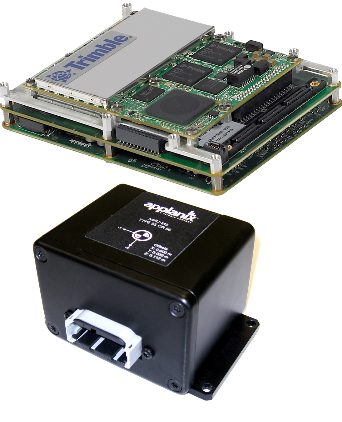
Trimble introduced today the Trimble AP15, the latest member of the AP series of OEM GNSS-Inertial board sets. The introduction was made at the AUVSI 2013 Conference and Exhibition, being held in Washington, D.C.
The AP15 uses a custom Micro Electromechanical Machined (MEMS) based Inertial Measurement Unit (IMU). It is the first product to take advantage of Applanix’ proprietary calibration process — Applanix SmartCal, a new software compensation technology that allows Trimble to achieve exceptional performance from IMUs manufactured specifically for mobile mapping applications.
The AP15 combines high-precision GNSS positioning with Applanix IN-Fusion GNSS-Inertial integration technology, all running on a powerful, dedicated Inertial Engine (IE) board. AP products provide the performance and functionality of Applanix’ POS systems in an embedded form-factor that is specifically designed for third-party manufacturers and systems integrators, Trimble said. The AP Series is designed for a variety of commercial mobile positioning and orientation applications including airborne, terrestrial and marine mapping and guidance for unmanned vehicles.
Combined with a wheel-mounted Distance Measurement Instrument (DMI), the AP15 provides a full 6-degrees-of-freedom navigation solution for land vehicles that is capable of providing robust position and orientation information regardless of obstructions to GNSS-only positioning such as multipath or complete signal loss. Applanix IN-Fusion technology produces uninterrupted position, roll, pitch and true heading measurements of moving platforms by combining IMU data with raw GNSS observables and DMI velocity.
GNSS functionality is provided by a Trimble GNSS module, a dual-antenna, 440 channel, multi-frequency survey-grade GNSS receiver that supports a wide range of satellite signals, including GPS L1/L2/L2C/L5 and GLONASS L1/L2 signals. The module also supports Satellite-Based Augmentation Service (SBAS) corrections, including the U.S. Wide Area Augmentation System (WAAS), European Geostationary Overlay Service (EGNOS), Japan’s Multi-functional Satellite Augmentation System (MSAS) and the OmniStar VBS, HP and XP/G2 corrections.
“Trimble is a leading provider of technology for positioning and orientation solutions and the introduction of the AP15 module continue this tradition,” said Kevin Andrews, product manager. “The AP15 has been designed as a more compact, lighter unit which can deliver excellent performance at lower cost.”
The Trimble AP15 is expected to be available in October of 2013 through Applanix’ sales channel.
The U.S. Military relies on GPS to aid air, land and sea navigation. Like the GPS units in many automobiles today, a simple receiver and some processing power is all that is needed for accurate navigation. But, what if the GPS satellites suddenly became unavailable due to malfunction, enemy action or simple interference, such as driving into a tunnel? Unavailability of GPS would be inconvenient for drivers on the road, but could be disastrous for military missions. DARPA is working to protect against such a scenario, and an emerging solution is much smaller than the navigation instruments in today’s defense systems.
DARPA researchers at the University of Michigan report that they have made significant progress with a timing and inertial measurement unit (TIMU) that contains everything needed to aid navigation when GPS is temporarily unavailable. The single-chip TIMU prototype contains a six-axis IMU (three gyroscopes and three accelerometers) and integrates a highly-accurate master clock into a single miniature system, smaller than the size of a penny. This chip integrates devices (clocks, gyroscopes and accelerometers), materials and designs from DARPA’s Micro-Technology for Positioning, Navigation and Timing (Micro-PNT) program.
Three pieces of information are needed to navigate between known points A and B with precision: orientation, acceleration and time. This new chip integrates tiny devices that can measure all three simultaneously. The design is accomplished through new fabrication processes in high-quality materials for multi-layered, packaged inertial sensors and a timing unit, in a tiny 10-millimeter-square package. Each of the six microfabricated layers of the TIMU is only 50 microns thick, approximately the thickness of a human hair. Each layer has a different function, akin to floors in a building.
“Both the structural layer of the sensors and the integrated package are made of silica,” said Andrei Shkel, DARPA program manager. “The hardness and the high-performance material properties of silica make it the material of choice for integrating all of these devices into a miniature package. The resulting TIMU is small enough and should be robust enough for applications (when GPS is unavailable or limited for a short period of time) such as personnel tracking, handheld navigation, small diameter munitions and small airborne platforms.”
The goal of the Micro-Technology for Positioning, Navigation and Timing (Micro-PNT) program is to develop technology for self-contained, chip-scale inertial navigation and precision guidance. Other recent breakthroughs from Micro-PNT include new microfabrication methods and materials for inertial sensors.
NovAtel Inc. has announced a new SPAN-IGM series of Micro Electromechanical Systems (MEMS) inertial sensor products, including the IMU-IGM-A1 MEMS enclosure and the SPAN-IGM-A1 GNSS/INS enclosure.
The IMU-IGM-A1 is a small, rugged enclosure that houses a MEMS inertial sensor. The IMU-IGM-A1 can be configured from the factory as an integrated GNSS + Inertial Navigation System (INS) or as a standalone IMU sensor for pairing with a customer’s existing NovAtel SPAN enabled OEM6 receiver. Featuring regulated 10-30 VDC input and a dedicated wheel sensor input to enhance GNSS outage bridging capabilities, the IMU-IGM-A1 delivers a 200 hertz navigation solution and raw measurement output.
“The IMU-IGM-A1 is the smallest, lightest IMU enclosure in our SPAN GNSS/INS product portfolio,” said Jason Hamilton, director of marketing for NovAtel. “It provides NovAtel customers with the ability to leverage our powerful SPAN technology in new applications that are size and weight constrained but still require highly precise position, velocity, roll, pitch, and heading.”
The SPAN-IGM-A1 combines NovAtel’s OEM615 GNSS receiver card with a MEMS inertial sensor in a single enclosure. By integrating the MEMS IMU with NovAtel’s tightly coupled OEM6 GNSS/INS SPAN engine, advanced positioning options such as AdVance RTK, ALIGN heading technology and RAIM are available to maximize performance.
Shipments of the new IMU-IGM-A1 enclosure and the SPAN-IGM-A1 GNSS/INS integrated enclosure commence early Q2 2013.