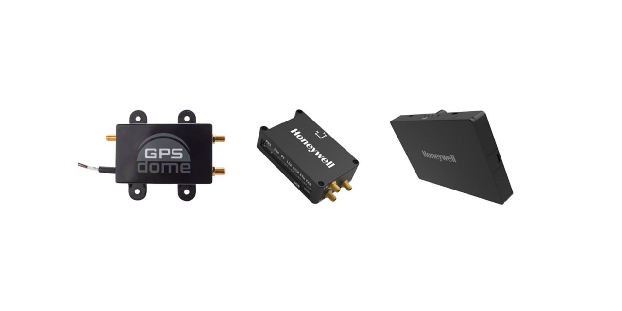
Honeywell has launched two new resilient navigation systems: the Honeywell Compact Inertial Navigation System and Honeywell Radar Velocity System. These systems, jointly with GPSdome, an anti-jamming system developed by Honeywell’s partner InfiniDome, are designed for commercial and military customers needing reliable navigation solutions that are small and light and have a low power consumption.
The systems will provide multiple layers of protection that allow continued operations even in GNSS-challenged or denied environments.
Honeywell’s philosophy of resilient navigation revolves around multiple layers of resiliency achieved by a combination of GNSS anti-jamming, inertial navigation and alternative navigation systems.
The GPSdome is a small add-on device that provides the first layer of protection against GNSS jamming attempts, ensuring continuity of operation during low-power jamming conditions and the ability to achieve the crucial first GPS lock even in GPS-challenged environments. The device is compatible with any off-the-shelf GNSS receiver and antenna. Honeywell signed a collaboration agreement with infiniDome in August to jointly develop and deliver GPS signal protection systems.
The new Honeywell Compact Inertial Navigation System is about the size of a deck of cards and uses tactical-grade inertial sensors to provide accurate position information to commercial and military customers. This second layer of resiliency provides the ability to navigate during shorter GNSS outages. This is especially useful in urban canyons where GNSS availability is intermittent or in strong jamming environments where anti-jamming systems are not enough.
The TopAXYZ inertial navigation unit by Thales. (Image: Thales)
Thales and CS Group partner to offer navies a cybersecure, jam-resistant navigation system inspired by civil aviation
Thales and CS Group have partnered to offer a complete navigation system for navy surface ships. At the heart of the system is the Thales TopAxyz inertial navigation unit, which is integrated with CS Group’s real-time computer to combine high-level performance and resilience in an electronic warfare environment. The system provides high-precision pointing, gyrocompass, location and navigation functionality for all types of naval platforms, from surface combatants and submarines to autonomous vehicles.
The TopAxyz inertial navigation unit has delivered outstanding performance in the rigorous conditions of civil aviation, clocking more than 20 million hours of operation. The naval version of the unit was integrated on a French Navy vessel in less than a day by CS Group, and has already proven its operational value for maritime navigation in a sea trial.
“After proving their value on board aircraft, space launchers and French Army land vehicles, Thales inertial navigation systems are now available for naval platforms,” said Tristan Grivel, vice president business development and sales for Thales’s flight avionics business.
“CS Group has supplied real-time navigation computers, military-grade GPS receivers and other solutions to the French Navy and Naval Group for many years, explained Gilles Rigal, director of CS GROUP’s naval systems business line. “This partnership with Thales allows us to offer an innovative, robust and resilient maritime inertial navigation system for surface ships,” Rigal said.
Countering electronic warfare
In today’s constantly changing naval environment, crews need to contend with the threat of cyberattacks, electronic warfare activity and the high risk of jamming and spoofing of GPS-based radionavigation solutions. Accurate navigation data, real-time data distribution and resistance to external threats are crucial for every mission conducted by a naval vessel today.
Thales and CS Group have worked together for more than 20 years to address these issues. Drawing on their combined expertise across all the key navigation system technologies, the two companies are now proposing a new approach to maritime navigation based on more trustworthy and reliable navigation data.
The TopAxyz inertial unit uses accurate, reliable navigation information that is independent of sea state and vessel location, combined with a function that detects attempts to spoof GPS signals. The navigation data calculated by TopAxyz is distributed in real time by the NDDS (Navigation Data Distribution System) developed by CS Group’s onboard computer.
The computer uses the latest technological advances in cybersecurity, guaranteeing the best level of resilience to attacks. Its architecture offers three key advantages: safer navigation, reduced costs and integration risks, ease of use and simplified maintenance of the system. No calibration is required during the service life of the system, reducing the total cost of ownership.
The new maritime navigation system are now available, and are being manufactured at the companies’ production and integration facilities in Châtellerault and Aix-en-Provence in France.
Alternative. Complementary. Backup. Co-primary. These are some of the terms used to refer to sources of positioning, navigation and timing (PNT) data other than GNSS satellites.
The four current GNSS constellations — supplemented by two regional ones and by public and private augmentation systems — have firmly established themselves as the primary source of PNT data by virtue of their accuracy, reliability, global coverage and ubiquitous use. Yet, this widespread dependency on them — especially on GPS — coupled with their well-known vulnerabilities to jamming, spoofing, other RF interference, multipath, solar flares and space debris (see page 10) — make the development of alternative sources of PNT data imperative. In fact, the U.S. Congress has repeatedly mandated it.
Typically, when talking about alternative PNT, we are referring to sources of PNT data that either were not originally developed for navigation purposes — such as television broadcast towers used as “beacons of opportunity” — or that use a higher broadcast power or a different frequency band than GNSS. They include legacy systems and new versions of legacy systems, such as eLoran.
“The only replacement for a GNSS is another GNSS.”
Other non-GNSS sources of PNT data have a wide range of benefits, limitations and costs, including infrastructure requirements. Most provide only the P and the N, or only the T, in PNT. Inertial systems, for example, once initialized can provide positioning and navigation, but need to be periodically re-initialized to compensate for their drift. Therefore, while excellent for maintaining the navigation solution during short GNSS outages and very helpful in identifying false GNSS measurements due to multipath, they are no replacement for GNSS. Cameras, radar and lidar, while often excellent sources of relative positioning, cannot provide absolute positioning.
It is even harder to replace GNSS when it comes to timing. Already enormously important in synchronizing the Internet, financial transactions and broadcasting, this service is essential to the development of complex new systems, such as integrating autonomous and legacy vehicles into digital traffic networks.
As in other human enterprises, the key to resiliency in PNT is diversity: a mix of systems based on sufficiently distinct technological foundations so that a threat to one does not imperil the other ones. Additionally, having a variety of available sources of PNT data will enable users to choose the ones most suited to their platforms.
However, we need to distinguish between technologies that can assist GNSS, such as inertial, and those that could substitute GNSS. I agree with Chuck Schue’s definition of the latter (see cover story, page 28): “an alternative PNT solution is one that is readily available; provides an easy and seamless transition to/from the primary or other alternatives; allows continuity of operation at a possibly degraded, yet usable, level of accuracy, availability, integrity or continuity; and is dissimilar enough from the primary solution to withstand the effects that might be affecting it.”
Ultimately, Schue pointed out to me, “the only replacement for a GNSS is another GNSS.” So, let us stop referring to systems that are not true substitutes for GNSS as “alternative PNT.” Complementary is a more appropriate adjective.
The inauguration of the Navigation Technologies Center took place in March. (Photo: IAI)
The new center will focus on developing and producing navigation systems for the battlefield, and plans to implement a co-developed, non-GPS accurate navigation technology
A Navigation Technology Center dedicated to developing and producing non-GPS navigation systems has been launched by Israel’s Ministry of Defense (IMOD) and Israel Aerospace Industries (IAI).
In the new center, IAI will develop and manufacture highly accurate inertial sensors for production of next-generation navigation systems, and will significantly increase their performance and capabilities. The sensors will be implemented in operational systems within Israel’s defense systems, enabling Israel to continue to address challenges of the modern battlefield.
The technology to be developed at the center is based on years of research and collaboration between the Directorate of Defense Research & Development (DDR&D) and IAI.
The center was established at the Tamam Division of IAI’s Systems Missiles and Space Group, which specializes in electro-optics and navigation. IAI has served as the inertial navigation system (INS) house of the State of Israel since 1964. Tamman is based in Yahud, a suburb of Tel Aviv.
“In launching the new compound, DDR&D demonstrates our position at the forefront of technology and its contribution to Israel’s technological independence,” said Brig. Gen. Yaniv Rotem, chief of research and development at DDR&D. “The extensive know-how and experience accumulated at DDR&D and Tamam, our partners, allowed us to challenge ourselves with this new endeavor and accomplish something impressive. The follow-up program is just as challenging, and we plan to work diligently until we prove the new capability in the various applications and in collaboration with IDF units.”
“Our partnership with IMOD DDR&D dates back many years,” said Avi Elisha, Tamam general manager. “We work together to achieve the ongoing enhancement of the innovative navigation systems for Israel. The new center we launched will allow highly accurate navigation capabilities with IAI’s unique technologies. Only a handful of countries have this technology, which is a game-changer in the field of inertial navigation.”
Inertial Labs is offering a new industrial-grade inertial measurement unit (IMU) for aerospace and defense applications, among others.
The Kernel-100 is a compact, self-contained strapdown IMU that measures linear acceleration and angular rates with three-axis MEMS accelerometers and three-axis MEMS gyroscopes.
The Kernel-100 is fully calibrated, temperature compensated, mathematically aligned to an orthogonal coordinate system. It contains up to 2 deg/hr bias in-run stability gyroscopes and 10 μg bias in-run stability accelerometers with extremely low noise and high repeatability.
The Kernel-100 is a fully integrated inertial solution that includes the newest MEMS sensor technologies. With seamless integration, the Kernel-100 inertial system is a cost-effective high performance yet compact and low-power IMU, the company said. The Kernel-100 is easy to integrate in a wide range of higher order systems while consuming very little space and power.
With continuous built-in test (BIT), configurable communications protocols, electromagnetic interference protection, and flexible input power requirements, the Kernel-100 is built to be used in a wide variety of environments and integrated system applications.
Built for air, marine and land environments, the Kernel-100 can be integrated into motion reference units, attitude and heading reference systems, and GPS-aided inertial navigation systems. As a result, the Kernel-100 is suitable for a wide variety of applications such as autonomous vehicles, antenna and line-of-sight stabilizations systems, and buoy or boat motion monitoring.
Inertial Labs provides innovative solutions to commerce, industry and government for defense and aerospace.
Emcore Corporation, a provider of advanced mixed-signal optics products that provide the foundation for defense systems, has acquired Systron Donner Inertial, Inc. (SDI) from Resilience Capital Partners for approximately $25.8 million. Consideration will be in the form of $22.8 million in cash plus 810,698 shares of Emcore common stock.
Highlights of the transaction are as follows:
Expected to increase the navigation systems products to over one third of Emcore’s total revenue; making the aerospace and defense market Emcore’s largest revenue source.
Expands Emcore’s navigation systems product portfolio and accelerates growth through the contribution of substantial additional revenue, which in the unaudited books and records of SDI, totaled approximately $28 million for the 12 months ended March 31, 2019.
Adds additional Raytheon, Lockheed Martin and Boeing 777X programs to Emcore’s existing navigation systems portfolio.
Expected to create material operating synergies in manufacturing, sales and engineering.
Expected to be non-GAAP EPS accretive by the end of calendar 2019
Emcore intends to add SDI’s business to its current navigation product line and support these products from facilities in Concord, California. Through the transaction, Emcore has acquired all of the outstanding assets and liabilities of SDI, including SDI’s 100,000 square foot production facility in Concord.
“This acquisition delivers immediate scale to our growing navigation systems product line and positions Emcore as one of the largest independent inertial navigation providers in the industry,” said Jeff Rittichier, president and CEO of Emcore. “Merging Emcore’s existing navigation systems product line with SDI’s strong brand, technology and backlog, and program wins, instantly creates a stable, growing, and technically advanced business well-positioned to disrupt market norms.
“SDI provides Emcore with a scalable, chip-based platform for higher volume gyro applications, while delivering superior performance compared to its competitors. Combining this business into Emcore will allow us to provide customers with a full product suite that serves a broad range of requirements across both the tactical and navigation grade segments of the market,” concluded Rittichier.
Emcore also announced the appointment of Bruce Grooms to its board of directors. Grooms has extensive senior management and executive experience in both the private sector and the U.S. Navy. From 2015 until June 1, 2019, Grooms served as Raytheon’s vice president of U.S. Business Development, Navy and Marine Corps Programs, where he was responsible for identifying and pursuing U.S. Navy and Marine Corps business growth opportunities for Raytheon and was one of its primary contacts with Navy customers, pursuing opportunities in the evolving cyber area, undersea growth and next-generation strike weapons.
Unicore Communications has launched CLAP-B, a multi-GNSS/MEMS integrated inertial navigation board, which integrates a miniaturized high-performance inertial measurement unit (IMU) on a compact high performance GNSS board.
The high-accuracy GNSS positioning coupled with a high-precision gyro and accelerometer provides stable, continuous three-dimensional position, velocity and attitude, as well as original acceleration and angular velocity measurements, even in GNSS-denied environments, the company said.
CLAP (Concurrent Localization & Attitude Pilot) technology is a high-precision multi-sensor fusion positioning and orientation technology developed by Unicore.
The CLAP- B, along with all the UM and UB family of receivers, are on display at BDStar booth C12.0C.022 for the duration of Intergeo 2018 starting Oct. 16 in Frankfurt, Germany.
Key features of the CLAP-B include:
Compact size: 46 × 71 × 17.1 mm
5-ns RMS PPS output
0.1 degree (1σ) pitch and roll
WINS optimized technology (wheel INS) for vehicles, wheeled robotics
With the features of compact size, light weight, low power consumption, and easy for integration and mass production, CLAP-B is suitable for applications such as autonomous driving, smart surveying, unmanned aerial vehicles and various attitude stabilization platforms. Customer samples will be available by the first quarter of 2019.
Polynesian Exploration Inc. has introduced its PolyNav 2000P, a high-accuracy navigation solution for emerging applications such as autonomous driving and UAVs.
According to the company, PolyNav 2000P is designed to fully utilize the advantages of both GNSS and inertial navigation systems to provide centimeter-level position and velocity accuracy with dual-frequency real-time kinematic technology, with simultaneously accurate attitude information (roll, pitch and heading).
Polynesian Exploration demonstrated the PolyNav 2000P at ION GNSS+, which was held Sept. 24-28 in Miami.
The PolyNav 2000P system is ultra-stable in terms of short-time satellite signal outages and capable of providing highly accurate heading information no matter whether the system is static or moving, the company said. It is also packaged with a rugged and waterproof enclosure for applications in severe environment conditions.
Options are available to meet various customer requirements, which include, but are not limited to, up to 100-Hz position, velocity, attitude outputs, and meters to centimeter-level position accuracy. They can also be operational in all weather conditions and will be available globally.
The company is able to integrate special sensors such as lidar and cameras for each unique application as requested by customers.
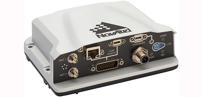
The PwrPak7D-E1 is a robust, high-precision receiver that has multi-frequency, dual-antenna inputs and provides GNSS multi-constellation heading and position data. These capabilities make the PwrPak7D-E1 suitable for ground vehicle, marine or aircraft-based systems. NovAtel’s Synchronous Position, Attitude and Navigation (SPAN) technology brings together GNSS positioning and inertial navigation to provide an exceptional 3D navigation solution that is stable and continuously available. The PwrPak7D-E1 has a powerful OEM7 GNSS engine, integrated Epson G320N micro electromechanical (MEMS) inertial measurement unit (IMU), built-in Wi-Fi and 16 GB of internal storage.
A: The availability and quality of GPS in the application is critical. Industrial-grade MEMS IMUs can provide survey-grade performance when high-quality GPS is continuously available, but even tactical-grade MEMS cannot provide more than a couple of minutes of GPS-denied navigation. The level of integration between the two technologies is also important. Even comparing two systems using the same sensors, the performance is highly dependent on the ability of the system designer to leverage their respective strengths.
A: Successful integration of inertial sensors with GNSS requires understanding both the goals and environment of the application. Consider the required accuracy of attitude and position, severity of GNSS obstructions, expected dynamics and environmental conditions. Tradeoffs in size, power and cost narrow the choices, but achieving the desired performance is more nuanced. Data sheets for IMUs can also be notoriously difficult to compare. My advice is to focus on the goals and listen to the experts.
A: There is a clear need for reliable consumer-grade GNSS/INS in GNSS-degraded environments. In this case, two key aspects are: removal of measurement outliers, mostly caused by multipath; and adequate modeling of inertial errors. The first aspect is efficiently addressed via residual monitoring, especially with GNSS carrier phase. A 15-state INS error model is generally sufficient. Yet, modeling parameters and contribution of other terms such as axis misalignment must be evaluated using test data.
Renesas will use NovAtel’s high-performance SPAN tightly coupled GNSS and inertial navigation system (INS) technologies with GNSS correction services for live autonomous vehicles and advanced driver assistance systems (ADAS) demonstrations throughout CES.
SPAN GNSS+INS products provide position, orientation and time solutions that are critical for autonomous applications.
NovAtel’s assured positioning technology not only delivers solutions based on signals from satellite constellations but also uses vehicle behavior modelling, inertial sensor integration and GNSS correction signals to improve accuracy and significantly reduce interruptions in availability.
Image: NovAtel
Renesas relies on NovAtel products to provide high integrity and accurate positioning for autonomous driving, ADAS, connected car feature demonstrations and automotive solutions that will be showcased at CES 2018.
With the commitment to ensure autonomous vehicles have assured positioning solution, a team of engineers formed the Safety Critical Systems Group at NovAtel to meet the exceptional performance and safety requirements of autonomous vehicles at the necessary production volumes and price point required.
Since its formation, the group has made many positive partnerships in the automotive industry.
NovAtel and Renesas are currently collaborating on implementing NovAtel’s high-performance GNSS+INS positioning solution with the Renesas R-Car H3 system-on-chip (SoC). The R-Car H3 is compliant with the ISO 26262 functional safety standard for automotive applications, which aligns with NovAtel’s automotive strategy.
NovAtel has a long history providing industry leading high-precision GNSS solutions that are high quality and reliable. As an ISO 9001 certified company, NovAtel is also developing an extensive product line of receivers, antennas, correction signals, positioning algorithms, sensor fusion solutions and systems that fulfill specific safety requirements of the automotive industry such as ISO 26262.
Sonardyne Inc. has supplied acoustically aided inertial navigation technology to McDermott International for its Lay Vessel 108 (LV 108). McDermott is an offshore engineering, procurement, construction and installation company.
The Ranger 2 Pro DP-INS system, the highest specification available from Sonardyne, is being used to support touchdown monitoring surveys of submarine cables, umbilicals and pipelines and as an independent position reference for the LV 108’s Kongsberg dynamic positioning (DP) system.
McDermott’s Lay Vessel 108. Photo: McDermott
McDermott’s LV 108 entered service in 2015 and is on contract in the Ichthys field, Western Australia. Designed as a fast-transit, dynamically positioned (DP 2) vessel for subsea constructions support across a wide variety of water depths, the LV 108 has 21,528 square feet of deck space and can accommodate a crew of 129.
Dynamically positioned construction and installation vessels such as the LV 108, conventionally rely on ultra-short baseline (USBL) acoustics and the GNSS as their primary sources of position reference data.
However, a vessel’s station-keeping capability can be compromised in the event the USBL is affected by thruster aeration and noise and the GNSS signal is simultaneously interrupted. The latter is particularly common around equatorial regions and during periods of high solar radiation.
Sonardyne’s Ranger 2 Pro DP-INS system addresses this operational vulnerability. It aids vessel positioning by exploiting the long-term accuracy of Sonardyne’s Wideband 2 acoustic signal technology with high-integrity, high-update-rate inertial measurements. The resulting navigation output has the ability to ride-through short-term acoustic disruptions and is completely independent from GNSS.
In addition to the system’s deep-water positioning performance and safety benefits, DP-INS has been proven to deliver valuable time and cost savings for vessel owners. It does not need a full seabed array of transponders to be installed and calibrated before subsea operations can commence. For most subsea tasks, positioning specifications can be met with only one or two transponders deployed on the seabed.
Additionally, as the system needs only occasional aiding from the acoustics, transponder battery life is substantially increased and the need to task a remotely operated underwater vehicle (ROV) to deploy and recover transponders for servicing is reduced.
The equipment supplied to McDermott for the LV 108 included Sonardyne’s INS sensor co-located with the company’s sixth-generation (6G) HPT acoustic transceiver. This hardware was installed on one of the vessel’s two Kongsberg through-hull deployment machines and interfaced directly with the vessel’s DP system, also supplied by Kongsberg.