The GEO-FOG 3D inertial navigation system (INS) uses sensor fusion to deliver reliable, high-accuracy navigation and control to a wide variety of unmanned, autonomous and manned aerial, ground, marine and subsurface marine applications and platforms. Other applications include navigation and control, positioning and imaging, georeferencing, land surveying, robotics, underground navigation, stabilization and orientation.
Designed for demanding navigation and control applications, the GEO-FOG 3D has performance monitoring and instability protections to ensure stable and reliable data. Using an innovative artificial intelligence algorithm, its intelligent high-performance filter is capable of extracting significantly more information from the 1750 IMU core processor than a typical Kalman filter.
The GEO-FOG 3D is built upon the high-performance fiber-optic gyro (FOG)-based 1750 inertial measurement unit (IMU). It contains three DSP-1750 fiber optic gyros integrated with three very low noise micro-electro-mechanical systems (MEMS) accelerometers as well as a pressure sensor, a three-axis magnetometer, and a triple-frequency GNSS receiver.
The triple frequency receiver provides 8 millimeters of positioning accuracy and supports all GNSS systems. It also offers data rates up to 1000 Hz; data can be output over a high-speed RS-422 interface or optional RS-232 interface. The rugged GEO-FOG 3D INS is protected from reverse polarity, overvoltage, surges, static and short circuits on all external surfaces.
Key Features
Core processor: KVH 1750 IMU
6 degrees of freedom (DoF) IMU consisting of integrated FOGs and accelerometers
Triple-frequency Trimble GNSS receiver
Sensor fusion algorithm delivers accurate, reliable data for navigation, orientation, and control
Integrated with images and dense distance measurements from a range camera using active illumination, inertial navigation produces real-time results on a tablet computer. Experiments demonstrate that the system provides good positioning and mapping performance in a range of indoor environments, including darkness and smoke.
Soldier with prototype system mounted on tactical vest.
Positioning and mapping abilities for indoor environments can speed search and rescue, keep firefighters from getting lost, and help a commander track soldiers searching a building. Accurate results from these environments increase personnel safety in unknown, dangerous environments and can also facilitate remote control of unmanned ground vehicles (UGVs).
A new iteration in the Chameleon family of positioning systems that we have developed, the Tiger Chameleon, combines an inertial measurement unit (IMU) with an active camera that measures distances using modulated laser light. This type of camera provides dense and accurate distance measurements, and has the added advantage of working well in darkness.
The main goal of the Chameleon systems is to provide soldiers and first responders with position information and approximate overview maps, preferably without affecting their operating procedure. The Tiger Chameleon does not require any infrastructure, such as visual markers or radio beacons. Positioning and mapping results are computed in real time based on data from the IMU and the active camera, and wirelessly transmitted to a visualization interface running on a tablet computer or smartphone.
Sensors and Hardware
In initial experiments, the Tiger Chameleon’s components are enclosed in a wooden box which can be mounted on a soldier’s tactical vest. FIGURE 1gives a schematic overview.
FIGURE 1. Schematic overview of how the components are connected.
Image Sensor. The image sensor includes two cameras: one high-resolution visual camera and one lower-resolution depth sensor. The latter uses a modulated near-infrared (NIR) light source and a special type of sensor to measure distance. Essentially, each pixel is divided into two halves, one of which integrates incoming light when the light source is turned on, while the other integrates light when it is turned off. If the light hitting a pixel has bounced off an object located close to the sensor, almost all light will be integrated by the first half of the pixel. If the object is moved further away, it will take longer for the light to return, and hence more light will be integrated by the second half of the pixel.
In addition to measuring the depth of the scene, the NIR camera provides an intensity image where the value of each pixel is determined by the total amount of light hitting the two pixel halves. The intensity image is similar to an ordinary visual image. Unlike an image from a passive camera, however, it is largely independent of ambient light, since it mostly measures reflected light from the illuminator. Hence, both the intensity and the depth images are available even in completely dark or obscured environments. Coming from the same sensor, the intensity and depth images are perfectly registered to each other. Images are produced at 30 Hz.
The high-resolution visual camera is not used by this prototype.
Inertial Sensor. The IMU provides calibrated measurements of acceleration and angular velocity at 400 Hz. The sensor itself does not perform any inertial navigation or attitude estimation. Since we fuse the inertial data with image-based features for navigation, however, the basic acceleration and angular velocity measurements are more useful in our application than pre-filtered position or orientation estimates. The sensor measures acceleration up to 5 g, and angular velocity up to 1,000 degrees/ second, since relatively high-dynamic motion is common in the intended application. The IMU also contains a magnetometer and a barometer, but these are not used since air pressure and magnetic fields are not always reliable for navigation indoors.
Algorithms
The positioning algorithm is based on EKF-SLAM, simultaneous localization and mapping (SLAM) implemented as an extended Kalman filter (EKF). The EKF fuses data from the IMU (three-dimensional accelerations and angular velocities) with image data, according to the uncertainties of the different types of data. It tracks the system state, composed of the position, velocity and orientation of the system, the IMU biases (slowly varying offsets in the acceleration and angular velocity measurements), and the positions of a number of landmarks in the images.
The landmarks are points observed in the images, which are used for navigation. These are chosen to be points which are recognizable, well-defined and stationary. This essentially means that it should be easy to recognize a landmark when it appears in a new image, and that the image coordinates of a landmark should be stable in both the horizontal and vertical directions. Thus, corner points are good candidates for landmarks, while line structures in an image are not. The world coordinates of a landmark should not change over time.
Theoretically, it would be possible to navigate using only IMU data. The system orientation would then be obtained by integrating the angular velocities, while the acceleration (after removing the effect of gravity) would be integrated to obtain the velocity, and double-integrated to obtain the position. Due to the high bias variability and noise of micro-electro-mechanical systems (MEMS) IMUs — the only type sufficiently small, lightweight and inexpensive for use by soldiers or firefighters — this only works for a few seconds before the accumulated error grows to an unacceptable level.
In theory, it would also be possible to navigate using only landmarks extracted from the image sequence. This, however, is also problematic in practice. If the system moves too rapidly, successive images may not share any landmarks at all. Additionally, no landmarks are found in featureless environments. This causes image-only navigation to fail in many realistic scenarios.
By fusing the inertial data with landmark observations, we alleviate most of these problems. While the IMU provides good short-term performance, the image data provides long- term stability. Hence, the IMU can overcome short periods with few or no landmarks, while the image data limits the error growth of the system (assuming that the periods without landmarks are not too long).
FIGURE 2. Overview of the algorithm.
Algorithm Flow. In the data fusion FIGURE 2, potential landmarks are found in an intensity image from the NIR camera, by identifying points that can be well localized. The potential landmarks are found by using an interest-point detector. The visual appearance of a point is represented using the SIFT descriptor. The distance to each potential landmark is determined by using the depth image. Potential landmarks are matched to landmarks that are already tracked by the system, based on a combination of their visual appearance and their coordinates (the spatial distance between the observed points and the predicted image coordinates of the tracked points, and the difference between the predicted and the observed distance to the points).
IMU data is used to predict where tracked points should appear. Pure inertial navigation is relatively accurate in the time interval between successive frames (approximately 30 images per second are processed). Observed points, which match tracked points, are used to update the estimated state (position, velocity and so on). Tracking is started for observed points, which do not match any tracked points unless a predetermined number (30 in the current implementation) of points are already tracked. Points that are tracked but not observed in a number of consecutive image pairs are removed from the point tracker.
Each depth image corresponds to a local point cloud, where points lie on the surfaces of objects in the scene observed by the camera. The intensity of each point can be obtained from the corresponding intensity image. Since the position and orientation of the system are estimated by the SLAM algorithm, these local point clouds can be transformed into a common coordinate system, thereby creating a large point cloud representing the entire environment along the trajectory of the system. This point cloud can either be used as a three dimensional model, or projected onto a horizontal plane for an overview map.
Implementation
To accurately predict where tracked landmarks will appear in a new image, it is important to synchronize the image stream and the inertial data. While the IMU handles this well (it can either trigger, or timestamp the trigger pulse from, a camera), synchronization is potentially difficult when working with consumer hardware such as the the one selected for this prototype. However, while the camera cannot be triggered externally, it does perform internal synchronization between the NIR and the visual cameras, which both run at 30 Hz. (It is unknown to us which camera triggers the other, or if there is a third piece of hardware which triggers both cameras.) Using an oscilloscope, we found that a pulse train at 30 Hz can be accessed at a solder point inside the camera.
This 30 Hz signal is active whenever the camera is powered. It is therefore not possible to synchronize the camera to the IMU using only this signal, since it only indicates that an arbitrary image was acquired at the time of each pulse. To synchronize the sensors, we need to know exactly when each specific image was acquired. Thus, a synchronization pulse, which is only transmitted when image acquisition is enabled, is needed. In addition to the 30-Hz pulse train, a signal that is high only when the cameras are active can also be found inside the camera. We perform a logical AND to combine these signals into the desired synchronization pulse.
We obtain the timestamp of each image from the IMU by connecting the combined synchronization signal to its synchronization input. There is a small delay between the first pulse in the combined signal and the time when the first image is acquired. This was measured by recording inertial data and images while first keeping the system stationary, and then rotating it quickly. Manual inspection of the image sequence and the angular velocities reveals that the delay is approximately 8 intra-frame intervals (0.267 s).
Software. The recording and analysis software are written in C++, and run in real time under Linux. It makes heavy use of multi-threading in order to optimize the computational performance of the algorithms.
The software is divided into two subsystems: one that communicates with the sensors, and one that performs the image analysis and SLAM computations. These subsystems communicate using the Robot Operating System (ROS). There is also a subsystem (or “node” in ROS terminology) for playing back previously recorded data. The playback node publishes the same type of messages as the sensor node, and these nodes can therefore be used interchangeably.
FIGURE 3. Overview of the analysis node. Blue boxes represent threads, while red boxes are queues. Purple boxes are other software components, and the orange and the red/green boxes represent the sensors. Orange, red and green lines represent data from the respective sensors. Black lines represent data based on more than one sensor.
FIGURE 3 shows how data flows through the analysis node. Queues buffer data between the different threads. Incoming images from the recording or playback node are initially put in the image queues for feature extraction. After feature extraction (where the depth image is used to determine the distance to each observed landmark), the resulting image features are stored in the potential landmarks queue. The features are then processed by the EKF-SLAM thread, which also reads from the IMU data queue. The resulting pose estimates (positions and orientations) are sent to the communication module, where they are transmitted to the visualization device. In parallel with this, images are also processed by the rectification and mapping threads, where they are paired with poses from the SLAM algorithm to create map data. The map data is also sent to the communication module. A number of efficient libraries exist for low-level image processing, and also for the linear algebra computations needed by the EKF. The following libraries are used:
VLFeat for finding landmarks and extracting SIFT features
OpenCV for image rectification
Armadillo for high-level math operations
ROS for communication between the subsystems
A modified version of IAI Kinect2 for ROS communication with the sensor
A slightly modified version of Libfreenect for low-level communication with the sensor.
Evaluation
The prototype has been evaluated in a number of experiments, in cooperation with soldiers and first responders. Three experiments are reported here. All were performed during soldier or smoke-diver training. Mapping results in the figures are presented along with estimated soldier and smoke-diver trajectories (bluegreen lines) from the positioning system. The results are evaluated based on the mapping, since the ground truth trajectories are unknown. Positioning is still evaluated implicitly, as inaccurate positioning would cause poor mapping performance such as double or skewed walls, since the mapping is based on estimated camera positions and orientations.
Searching for Biological Hazards. Collection of evidence at a crime scene is commonly performed using a camera, taking numerous pictures of the scene from different positions at different angles and distances. To keep track of all images and where they were captured is cumbersome work, which can easily be automated by integrating the camera with a positioning system.
Several variations of this experiment were performed, all in cooperation with soldiers from the Swedish Armed Forces National CBRN Defence Centre. The main task was to document different areas in the building, to be able to handle any encountered dangerous biological objects in a safe way, and to preserve evidence for later use. If a dangerous object is found, the mapping result from the system could be used to plan how the object should be taken care of and what exit path the soldiers could use to minimize the time being exposed to a dangerous environment.
FIGURE 4. Map estimated by the prototype positioning and mapping system while two soldiers searched for biological hazards. The trajectory is also shown. The grid spacing is two meters.
The photo above an image from the NIR sensor in the prototype system, captured in the building while two soldiers searched for biological hazards. A map estimated by the prototype system appears in FIGURE 4.
For evaluation of the mapping performance, a part of this building was also measured using a highly accurate scanning laser system. FIGURE 5 shows the point clouds from both the Tiger Chameleon (black) and the scanning laser (white). Locally (within a room), the errors are less than 5 centimeters. Over larger distances, heading drift causes larger errors, which are visible as slightly misaligned walls. In this case, there are no significant errors. (The structures that are only visible in the laser scanner data are parts of the ceiling and its supporting beams, which were never observed by the positioning system.)
FIGURE 5. Map produced by the Tiger Chameleon (black) overlaid on reference data (white).
Searching a Building. A group of eight soldiers searched and cleared a part of a building. This required them to move more quickly than in the first experiment, since the building could not be assumed to be safe. Additionally, one or several soldiers often appears in the field of view of the positioning system. We requested the soldier carrying the system to avoid walking too close behind another soldier, to avoid covering the entire field of view. Apart from this, the soldiers were asked to act as they normally would during the exercise.
FIGURE 6 Map estimated while eight soldiers cleared a building.
Positioning and mapping results are shown in FIGURE 6. The map is slightly distorted due to errors in the estimated heading, but still good enough to understand the building layout. The distortion is visible as double walls in the top part of the figure. We believe that most of the errors were caused by the system not being entirely stationary during the sensor initialization at the start of the experiment. No reference map is available for this location. We also performed experiments where the soldiers fired their weapons near the positioning system. This affects the IMU, severely degrading the measurements of acceleration and angular velocity. Hence, the positioning system was not able to present correct position or mapping estimates in these cases.
Smoke-Diver Searching a Building. The smoke-diver experiments indicated how the positioning system performs when used in a smoke-filled environment. During the experiments, the system was exposed to different levels of smoke.
FIGURE 7. Map estimated while a smoke-diver searched a (partly) smoke-filled building. The trajectory is also shown.
Positioning and mapping results from the experiment are shown in FIGURE 7, while FIGURE 8shows the result from the Tiger Chameleon (black) overlaid on reference data from the laser scanner (white). The estimated map is in good agreement with the reference map data, although a heading error affects some walls (bottom right).
All smoke densities affect the image quality from the NIR sensor, since the active illumination is reflected by the smoke particles. In light smoke, the main effect is that the smoke appears as spurious points in the point clouds, eventually ending up in the map, while positioning performance is not significantly affected. Most spurious points were removed by adding the constraint that points very close to the camera are not added to the map, although smoke still causes more interior points to be visible in Figure 7 than in the other maps. The effect on the positioning system increases with the smoke density. In thick smoke, most illumination is reflected, effectively rendering positioning impossible using this type of image sensor.
Discussion
FIGURE 8. Maps from the experiment in smoke. The map produced by the Tiger Chameleon (black) is overlaid on reference data (white).
The current positioning algorithm works well, but over longer experiments its position estimate slowly drifts away from the true position. This is caused by both the inertial sensors and the landmark-based positioning updating the current position estimate only relative to recent estimates. Since landmarks are discarded after not being observed for a short time, no loop closures ever occur. Saving landmarks could solve this in specific scenarios, where landmarks are re-observed after long times, but doing so would increase the computational complexity considerably. Additionally, for landmark-based loop closure to work well, the landmarks would need to be reobserved from approximately the same position, further limiting the scenarios where this could be expected to work well. Ongoing work aims instead at closing loops by recognizing the scene geometry, as represented by the point-cloud models.
When using active illumination, the mapping performance does not depend on texture on walls and other surfaces. This is an advantage compared to passive stereo cameras. Further, active illumination enables positioning and mapping in darkness.
Comparison to Other Systems. The prototype system was not constructed with the purpose of creating high accuracy models of small, detailed environments. Rather, the purpose was to enable soldiers to create approximate maps of entire buildings with minimal impact on their operating procedure. Detailed reconstruction is handled better by other systems, but these have the disadvantage of requiring the user to survey the environment systematically, adapting his or her work methods to the sensor.
SWaP-C and Hardware. Size, weight, power and cost (SWaP-C) are constant issues for soldier equipment. Ideally, the equipment should be disposable: cheap enough to throw away after being used just once, or fit into some type of disposable container.
Since this is a prototype system built for research and demonstration purposes, components with convenient electrical and programming interfaces have been selected. Therefore, the system is considerably larger than a final end-user product would be. In such a product, sensors and computation hardware with similar performance, but considerable smaller size, lower weight and lower power consumption, would be selected instead. Such components are commercially available.
Outdoor/Indoor Use. Though this positioning system is primarily designed for indoor use, seamless transition between indoor and outdoor environments is desired. Ongoing work aims at integrating a GPS receiver to achieve this. Adding GPS would also enable positioning in a georeferenced coordinate system; currently, all results are presented in a local coordinate system defined by the start position and orientation. This requires an algorithm for making robust decisions regarding when GPS measurements should be considered reliable.
Visualization Interface. The visualization interface currently runs on a tablet computer, and is therefore most useful to a commander or group leader who remotely tracks the soldier or firefighter. By adapting the interface to the smaller screen of a smartphone, it would be possible to also give the user access to position and map information.
An important advantage of automatic mapping, according to several users, is the ability to detect hidden spaces in buildings. In certain types of operations, the ability to document a building before leaving it is also considered valuable.
Real-Time Implementation. An interesting aspect of performing all computations in real time is that it effectively precludes tuning of algorithm parameters to individual data sets. When analyzing data offline, this is far too common, and typically overestimates the performance of the system or algorithms. All experiments reported in this article have been performed without any such parameter tuning.
Autonomous or Remote-Controlled Platforms. The system can also be used on an unmanned ground or
aerial vehicle (UGV or UAV). This could be suitable for searching buildings too dangerous to enter. The system would continuously distribute its position and mapping estimates while traveling through the building. This could provide soldiers and rescue teams with a preview of the unknown environment and a possibility to plan their operations in a safer way. Many robotics projects use ROS, which makes integration of the Tiger Chameleon relatively straightforward.
Firing of Weapons. During some experiments, we discovered that the measures of acceleration and angular velocity are affected by close-range gunfire. Relatively long segments of measurements are affected, which makes interpolation of missing values difficult. During these periods, it may be possible to disregard the inertial measurements, resorting to only image-based positioning.
Summary
This prototype system for indoor positioning and mapping, based on inertial navigation and distance measurements using active illumination, does not require any infrastructure or prior knowledge about the environment. The system has been designed for experiments and demonstration purposes, and has been shown to provide good performance in real time in a variety of different indoor environments when carried by potential end users.
Manufacturers
The Tiger Chameleon consists of a Microsoft Kinect v2, an Xsens MTi-10 IMU and a small computer with a mobile Intel i7 CPU.
Acknowledgments
The authors thank the soldiers from South Scania Regiment (P7), Sweden, who participated in the initial tests with the prototype. We also thank the smoke divers from Södertörn Fire Prevention Association, Sweden, for carrying the prototype in smoke-filled environments. Also, we really appreciated the feedback from the Swedish Armed Forces National CBRN Defence Centre during the prototype development. Finally, we acknowledge Hannes Ovrén at Linköping University, Sweden, for improving the Libfreenect library.
The material in this article is based on a technical paper presented at ION/IEEE PLANS 2016.
All-in-one time-and-frequency master time and clock server
Spectracom’s VelaSync time server and grandmaster clock.
When the VelaSync time server platform was introduced in 2014, it met the needs of financial trading networks’ move to 10 gigabit-per-second networking. Now available with 40-GbE network interfaces, it offers high-performance synchronization for time-sensitive networks. Matching network speeds between timing and data on a single low-latency high-throughput network enhances synchronization accuracy and eliminates queuing delays and hidden time errors caused by slower connections. The availability of a network timing appliance with 40-GbE interfaces benefits any deployment of critical network infrastructure at high data rates.
The TW3970 / TW3965 antennas have superior cross polarization rejection to enhance multi path signal rejection, tight phase center variation and an excellent axial ratio. The TW3970 is a pole mount or through-hole mount antenna; the TW3965 is an embeddable form. Bothemploy Tallysman’s Accutenna technology and are capable of receiving GPS L1/L2/L5, GLONASS G1/G2/G5, BeiDou B1/B2, Galileo E1/E5a+b plus L-band correction services (1164 MHz to 1254 MHz + 1525MHz to 1606 MHz). The antennas are designed for precision agriculture, autonomous vehicles and other precision applications. The ability of the antennas to access L-band correction services extends its utility to a wider range of applications.
The Tactical Series of inertial navigation systems (INS) is a next-generation family for high performance. Built on a common tactical-grade proprietary micro-electro-mechanical (MEMS) inertial sensing core, the Tactical Series includes the VN-110 inertial measurement unit and attitude heading reference system (IMU/AHRS), the VN-210 GPS-aided INS (GPS/INS), and the VN-310 dual-antenna GPS/INS. The Tactical Series offers the same functionality and features as the Industrial Series for integrators of SWaP-C (size, weight, power and cost) constrained manned and unmanned systems. The Tactical Series takes advantage of the latest developments in solid-state MEMS technology to incorporate a three-axis gyro with <1°/hour in-run bias stability, leading to an attitude accuracy of 1 to 2 milliradian. In addition to the improved IMU core, the Tactical Series enclosure is designed to DO-160G airborne standards and rated IP68 for deployment in harsh and extreme environments.
Plug n’ fly control system for UAV, UAS, USV and UGV systems
Veronte Autopilot is a miniaturized fail-safe avionics system with an embedded suite of sensors and processors for advanced control of unmanned systems. The OEM version weighs 90 grams, and the version with an aluminum enclosure weighs 200 grams. Both versions include a datalink radio. The control system is fully configurable — payload, platform layout, control phases, control channels and the user interface layout can be user defined, making it cost effective for a wide range of professional applications. The embedded GPS module offers RTK-like positioning with centimeter precision. It meets DO-178C / ED-12, DO-254 and DO-160G aircract regulations.
Critical coverage for autonomous driving development
TomTom’s HD (high-definition) Map and RoadDNA are highly accurate digital map products helping automated vehicles precisely locate themselves on the road and plan maneuvers, even when traveling at high speeds. These technologies are being rolled out in strategic geographies and are the subject of key partnerships with other automotive suppliers. TomTom now offers more than 122,000 kilometers of HD Map coverage globally, including Interstates in Connecticut, Delaware, District of Columbia, Georgia, Idaho, Kansas, Louisiana, New Hampshire, New Mexico, North Carolina, Ohio, Pennsylvania, Rhode Island, South Dakota, Tennessee, Texas, and Vermont; Interstates and highways in California, Michigan and Nevada; and the Autobahn network in Germany.
Applications range from infrastructure to infotainment
Smart Antennas by Laird Technologies combine antenna elements and radio receivers in the same robust package. Compared to traditional architectures, the Smart Antenna provides signifcant performance improvement and system-wide cost savings. Custom solutions are available, including 4G LTE cellular, GNSS, Wi-Fi and Bluetooth, as well as the emerging dedicated short-range communications (DSRC) technology with a 1,000-meter range for V2X. Applications include navigation systems, vehicle-to-vehicle communication,vehicle to infrastructure communication and infotainment. Operating temperature range is –40 C to 85° C.
The CEESCOPE-USV is a waterproof one-box echo sounder, GNSS and broadband radio telemetry package that can be installed on practically any remotely operated unmanned surface vehicle (USV). The self-contained unit requires no interface with the USV, eliminating challenges of instrument data integration on the vehicle. Using real-time broadband radio telemetry, detailed 20-Hz dual-frequency soundings, up to 20-Hz RTK GNSS and a 3200-sample-per-ping digital echogram are available to the USV operator on shore via the CEE-LINK radio base station. Data from the CEESCOPE-USV telemetry link allows the operator to steer the USV along the survey line like in any manned boat survey. The CEESCOPE-USV offers users a range to their vehicle of more than 1,000 meters.
The new ALS80-UP airborne sensor enables even more flexible data acquisition with extended range measurement capability. It takes advantage of the dual-output optical system pioneered in the ALS70 and enhanced in the originl ALS80. The AL80-UP has higher Multiple Pulse in Air (MPiA) operation settings, enabling data collection in extreme terrains with minimal variation in swath width due to terrain elevation variations. The ALS80-UP works perfectly in a wide variety of scenarios, including wide-area mapping, detail mapping from high-flying heights and detail mapping over mountainous terrain. With its expanded maximum range, the system has demonstrated good results at up to 6,000 meters above terrain and with terrain relief of up to 2,300 meters.
The Settop Repeater allows rover-RTK network users in areas of low or no GSM coverage to receive differential corrections via radio. It can connect to any external radio model on the market for precision agriculture systems or machine control. Repeater field application versatility is managed by an intuitive software controlled using a touchscreen. It can also be used for land surveying and marine work. It reduces the need for an RTK base station and offers flexible field configuration.
Expanded toolsets and capabilities for speed and accuracy
FieldGenius 8 software takes advantage of the high-power processors, high-definition displays and larger memory in modern Windows Mobile powered data collectors and Windows 7 powered tablets. It provides tight control through expanded toolsets. Features include easy GNSS local transformation with the ability to export and import localization files; enhanced DXF support; advanced point averaging, which allows users to take multiple GNSS measurements and calculate an averaged position; support for integrated inertial sensors; native unicode support;and simplified GIS mapping. FieldGenius 8 also has improved road alignments, an onboard basic measurement mode, dynamic screen rotation and expanded ASCII export options. Supported coordinate systems, geoids, instruments and data collectors have been expanded, making it easier to integrate into existing survey operations.
The FLIR Vue Pro R adds radiometric functionality to the Vue Pro camera, giving drone operators the ability to save pictures for post-flight image analysis and accurately measure the temperatures of individual image pixels. Calibrated radiometric imaging allows it to capture the temperature data of every pixel in an image. When saved in Radiometric JPEG format, still images can be imported into FLIR Tools software for detailed analysis and reporting. FLIR Tools, a free download on FLIR.com, lets drone operators adjust settings including object emissivity, background temperature, target distance, relative humidity and thermal sensitivity, as well as assigning various color palettes for each image. The Vue Pro R records digital thermal video, along with radiometric thermal still images, to an on-board micro-SD card. For applications such as electrical inspection, infrastructure assessment and precision mapping, the onboard recording allows operators to capture high-quality thermal data for post processing and analysis.
Reconnaissance for disaster relief, time sensitive situations
The Digital Mapping Reconnaissance Toolkit (DMRT) creates up-to-date orthomosaic maps and 3D models. Users can fly a drone to survey the landscape for real-time solutions, and geotag reference points in impacted areas without a time lag. Seeing what the drone sees, pilots can create search patterns and map with situational awareness. Modular aerial and land-based solutions are available.
iXBlue, a navigation and positioning company, is providing 70 Marins M7 to equip 35 Royal Navy major surface ships and submarines as part of the Navigation Compass Programme.
The decisions to equip both the Queen Elizabeth-Class Aircraft Carriers and the fourth Astute-Class nuclear-power submarine with iXBlue’s Marins inertial navigation system (INS) were the first steps made by the UK Ministry of Defense toward the adoption of iXBlue fiber-optic gyroscope technology.
The ministry awarded a five-year contract awarded to Lockheed Martin UK, iXBlue’s strategic partner, for iXBlue’s inertial technology.
The 70 Marins M7 INS will replace the obsolete gyro systems on board the Royal Navy ships which include Type 23 Frigates, Hunt and Sandown Class mine countermeasure vessels and submarines. They will be integrated by Lockheed Martin UK within the compass system installed on board.
“We conducted a detailed assessment of all available possible partners along with their proposed technologies,” said Robert Kramer, vice president of Lockheed Martin UK – Integrated Systems. “By precisely understanding the Royal Navy expectations and assessing their views on the industry leading suppliers, it clearly appeared that iXBlue’s solutions best fitted the needs in terms of performance, capability and cost.”
The Marins family of military-grade FOG INS (M3, M5 and M7 models) are the latest additions to iXBlue range of naval products. They offer performances and reliability that meet the requirements of the demanding navies. Marins M7 model offers a drift of less than 1 nautical mile in 72 hours of surface GNSS-denied or submarine-dived navigation.
“We are very grateful to the Royal Navy for such a decision that demonstrates through a fair and open competition iXBlue’s INS excellence in terms of performance, reliability, lifecycle costs and versatility. This success relies on iXBlue core values: innovation, excellence and a strong commitment to the user,” said Olivier Cervantes, iXBlue vice president for sales and marketing.
Such a milestone contract opens up bright prospects for iXBlue in the field of military inertial solutions, Cervantes said.
The Defense Advanced Research Projects Agency (DARPA) has awarded HRL Laboratories $4.3 million to develop vibration- and shock-tolerant inertial sensor technology that enables future system accuracy needs without utilizing GPS.
While GPS provides sub-meter accuracy in optimal conditions, the signal is often lost or degraded due to natural interference or malicious jamming.
HRL Laboratories, based in Malibu, California, is a corporate research-and-development laboratory owned by The Boeing Company and General Motors specializing in research into sensors and materials, information and systems sciences, applied electromagnetics and microelectronics.
“The ATLAS project will deliver a comprehensive approach to breaking performance and cost, size, weight and power barriers in inertial sensor technology that prevent robust, GPS-independent, military positioning, navigation, and guidance,” said Logan Sorenson, principal investigator and research staff member in HRL’s Sensors and Materials Laboratory.
ATLAS will combine intimate locking of a micro-electro-mechanical systems (MEMS) Coriolis Vibratory Gyroscope (CVG) sensor with an atomically-stable frequency reference in order to exploit the intrinsic accuracy of the atomic hyperfine transition frequency.
“The engineering challenge lies in developing a system architecture to transfer the stability from the atomic reference to the CVG sensor without introducing unintended noise,” Sorenson said. “We are very excited to explore this novel approach to addressing long-standing precision navigation need faced by the U.S. military.”
SBG Systems has released the Apogee-M and the Apogee-U, two inertial sensors, to complete the Apogee product line.
The Apogee-M is a motion reference unit (MRU), and the Apogee-U is an inertial navigation system (INS). Both are made of titanium with a depth rating of 200 meters.
Apogee Series is an accurate INS based on robust micro-electro-mechanical systems (MEMS) technology. One year after the successful release of Apogee surface sensors (IP68 enclosure), SBG Systems completes the product line with the two inertial sensors, which have titanium subsea enclosures (200-meter depth rating).
Accuracy. Apogee integrates the latest generation of MEMS sensors to reach a high degree of precision — 0.008 degrees in roll and pitch in real-time — while delivering a robust and accurate heading from the continuous fusion of GNSS and IMU data. Made of titanium, Apogee-M and Apogee-U are designed to mount close to the sonar head for hydrographic tasks from shallow to deep water.
Heave computation. The Apogee provides a real-time heave accurate to 5 centimeters, which automatically detects the wave frequency and constantly adjusts to it. When wave frequency is erratic or in case of long period swell, the delayed heave feature can save the day by allowing survey in rough conditions. This algorithm allows a more extensive calculation, resulting in a heave accurate to 2 cm displayed in real-time with a short delay.
Connects to survey-grade GNSS receivers. Apogee sensors can be paired with any type of survey-grade GNSS receiver or with the one offered by SBG Systems. The SplitBox GNSS integrates the latest tri-frequency GNSS receiver to offer several positioning features such as RTK, Marinestar, OmniSTAR, Veripos and TerraStar corrections.
Configuration is acomplished throughout the intuitive, embedded web interface where all parameters can be quickly displayed and adjusted. The new 3D View helps the user check the mechanical installation, especially sensor and antennas position, alignments and lever arms. The user can then connect the Apogee to the main hydrographic software such as Hypack, QINSy or Teledyne PDS2000, thanks to available drivers.
The MEMS technology is renowned for being highly robust and low-maintenance, while the subsea enclosure is made in titanium. SBG SYSTEMS continuously make its systems evolve with new firmware upgrades that are available during the whole life of the product without extra cost.
Bordelon Marine, providers of vessel services to operators in the Gulf of Mexico and around the world, has selected acoustically aided inertial navigation technology from Sonardyne Inc., Houston, for its new ultra-light intervention vessel (ULIV) Brandon Bordelon.
The dual Ranger 2 Pro DP-INS systems, the highest specification available, will be used to track remotely operated underwater vehicles (ROVs)during inspection, repair and maintenance activities and provide an independent position reference for the vessel’s Marine Technologies Class 2 dynamic positioning system.
Specialized vessels such as the Brandon Bordelon conventionally rely on GNSS and ultra-short baseline (USBL) acoustics as their primary sources of dynamic positioning reference data.
However, a vessel’s station-keeping capability can be compromised in the event that the USBL is affected by thruster aeration or noise and the GNSS signal is simultaneously interrupted. The latter is particularly common around equatorial regions and during periods of high solar radiation.
Sonardyne’s Ranger 2 Pro DP-INS system addresses this operational vulnerability. It aids vessel positioning by exploiting the long term accuracy of Sonardyne’s Wideband 2 acoustic signal technology with high integrity, high update rate inertial measurements. The resulting navigation output has the ability to ride-through short-term acoustic disruptions and is completely independent from GNSS.
The Brandon Bordelon was delivered at the end of 2015 and is under a 60-day contract with Tidewater Subsea. Designed to support complex inspection, repair and maintenance operations, the vessel features a high-capacity deep-water crane, infrastructure for two work-class ROVs and a large, reconfigurable back-deck area.
In addition to the system’s deep water positioning performance and safety benefits, DP-INS has been proven to deliver valuable time and cost savings for vessel owners. It does not need a full seabed array of transponders to be installed and calibrated before subsea operations can commence.
For most subsea tasks, positioning specifications can be met with only one or two transponders deployed on the seabed. Additionally, as the system needs only occasional aiding from the acoustics, transponder battery life is substantially increased and the need to task an ROV to deploy and recover transponders for servicing is reduced.
The equipment supplied to Bordelon Marine included Sonardyne’s ship-mounted inertial navigation sensor and two HPT 7000 acoustic transceivers. The HPTs have been installed on the Brandon Bordelon through-hull deployment poles and are optimised for tracking and dynamic positioning in ultra-deep water.
Wes Bordelon, President/CEO Bordelon Marine said, “Equipping the Brandon Bordelon with Sonardyne’s Ranger 2 DP-INS, reflects our commitment to providing high-tech, high-spec equipment on our fit-for-purpose Stingray vessels and ensuring our fleet is safe, efficient and cost-effective.
“Ranger 2 DP-INS is a mature, field proven technology that addresses operators’ need for a robust, independent DP reference that provides an update rate and accuracy on par with GNSS,” said Ralph Gall, Technical Sales Manager at Sonardyne in Houston. He added, “The Brandon Bordelon joins a significant fleet of vessels which depend upon our acoustically-aided inertial technology for safer and more efficient dynamic positioning operations.”
KVH’s new GEO-FOG 3D inertial navigation system (INS) continuously provides extremely accurate measurements that keep applications operating in challenging conditions. (Image: KVH)
KVH Industries has introduced the GEO-FOG 3D inertial navigation system (INS). The new product offers roll, pitch and heading accuracies of .05 degrees for demanding applications in unmanned, autonomous and manned aerial, ground, marine and subsurface platforms, such as subsea remotely operated vehicles or mining systems.
The GEO-FOG 3D is based on the company’s high-performance fiber optic gyro (FOG) technology combined with centimeter-level precision RTK GNSS receivers and advanced sensor fusion algorithms. The result is a solution that continuously provides fast, ultra-accurate position, velocity and attitude measurements that keep applications operating no matter how challenging the conditions, according to KVH Industries.
The core inertial sensor for the new system is KVH’s 1750 IMU, an inertial measurement unit incorporating three axes of KVH’s DSP-1750 FOG — a high-performance fiber optic gyro — with three axes of advanced accelerometer technology. The 1750 IMU is then fully integrated with a GNSS receiver and a three-axis magnetometer, a barometric pressure sensor and a triple frequency RTK GNSS receiver to deliver reliable, real-time, centimeter-level positioning and orientation measurements.
The system’s sensor fusion algorithms automatically switch from loosely to tightly coupled filtering for improved performance under poor GNSS signal conditions. The system also offers high-speed update rates and rapid north-seeking gyrocompass capabilities for high-accuracy heading in environments when magnetometers and GNSS-aided heading cannot be used.
The GEO-FOG 3D Dual inertial navigation system (INS) is designed for applications that require heading at system startup or in low dynamic conditions. (Image: KVH)
KVH has also introduced a variant, the GEO-FOG 3D Dual, an INS and attitude and heading reference system (AHRS). This product features two GNSS antennas on a fixed RTK baseline that offers the same reliability and performance levels as the GEO-FOG 3D, with increased heading, pitch, and roll accuracy for static and dynamic applications where single antenna systems can be problematic. The GEO-FOG 3D Dual is a superior choice for applications that require heading at system startup or in low dynamic conditions.
“KVH’s GEO-FOG 3D and GEO-FOG 3D Dual provide exceptional accuracy and outstanding performance in a single, small package (less than 1.6 pounds), at price points never previously achieved in the industry,” said Jay Napoli, KVH’s FOG/OEM vice president. “And, because KVH controls the entire design and production process, from creating its own optical fiber to packaging its FOGs together with other sensors for advanced applications, these new products — and all of our open-loop FOGs, IMUs and INSs — offer outstanding accuracy and excellent durability at a lower cost than competing systems.”
Reliable, high-accuracy navigation and control are essential to unmanned, autonomous and manned platforms that must operate in conditions that include magnetic interference and the absence of reliable satellite navigation data. The integrated FOG, GNSS and sensor fusion technologies allow the GEO-FOG 3D and GEO-FOG 3D Dual to achieve performance levels that are beyond typical INS- or MEMS-based solutions.
Both the GEO-FOG 3D and GEO-FOG 3D Dual are designed to support current and future satellite navigation systems including GPS, GLONASS, Galileo and BeiDou. Both systems offer data rates up to 1000 Hz, and the ability to output data over a high-speed RS-422 interface or RS-232 interface, which ensures the systems can be easily and readily integrated in a wide range of platforms.
Northrop Grumman has been selected by the New Zealand Ministry of Defence to provide navigation suite upgrades to the two Royal New Zealand Navy’s ANZAC Class Frigates.
The suites will replace existing MK49 inertial navigation units with fourth-generation MK39s.
The new units feature an embedded data distribution system, reduced weight and size, and autoselect features that ensure the highest quality data is made available to the ship.
Data distribution capabilities include secure network communications capable of transmitting time-corrected data with low senescence to significantly improve the warfighter’s ability to react to potential threats and increase safety at sea.
There I was, well above Angels 40, sound asleep wearing a positive pressure oxygen mask and helmet with the droning of multiple jet engines in the background for company. Then, I was abruptly awoken by an aircrew member urgently calling my name.
On waking I noticed that it was colder and darker than I remembered when I had nodded off. The only light was that strange ambient light you only experience at high altitudes, and there was zero radio chatter in my helmet headset.
When I reached the cockpit, I noticed the ambient light again because the radar screens were blank, as were all the electronic screens for our multiple sensors, and then it dawned on me. There had been some kind of an electrical failure. I glanced at the navigation displays to determine our position, and to my dismay, discovered they were all blank and lifeless as well. This should not have been, as all navigation and emergency avionics instruments had extensive battery backups.
Then I looked closer and noticed that not only were the screens blank, but the inertial power switches were in the standby position. All kinds of thoughts raced through my mind as the pilot-in-command, easily 20 years my senior (we will call him Bill for brevity) explained that after the fifth and last over-water air refueling things were progressing nominally — until they weren’t. Suddenly, amber and yellow caution lights appeared, followed quickly by red warning lights, all of which warned of imminent power failures of the jet-engine-driven generators. The special mission aircraft we were flying had enormous generators on all engines, so large they precluded thrust reversers on any of the engines. The aircraft needed all that power to function as a mission aircraft, but fortunately needed no electrical power to remain airborne.
We completed the “total loss of electrical power” checklist, and for the time being all was well. The copilot calculated the aircraft could fly for another 10+ hours with IFR reserves using the fuel on board, and from our high altitude could “glide” with engines at idle for a couple hundred miles. So, no worries right?, as one of our Australian exchange pilots liked to say. Of course, there were several worries, the main one being no one knew exactly where we were. Like Daniel Boone we were not officially lost, just a bit bewildered.
Airborne Class
Another aircrew instructor and I were onboard this particular aircraft enroute to what must remain an undisclosed location down under, to teach a class and develop a curriculum on overwater navigation for crews flying reconnaissance aircraft. My apologies for the brevity, but that is all I am allowed to say about the aircraft and our mission to this day.
The aircraft had every bell and whistle you can imagine and then some, but it was essentially an electric aircraft as far as mission and navigation were concerned, and at the moment we were fresh out of that commodity. My instructor colleague and I were about to give out first impromptu overwater navigation class at altitude. We were not yet in extremis, but if we did not do everything exactly right, it might be everyone’s last overwater navigation class.
Back to Basics by Necessity
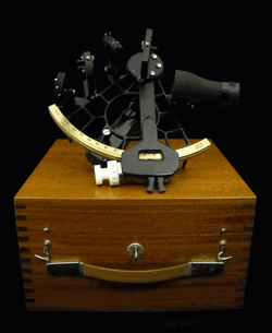
I had one of my flight bags with basic navigation gear with me on the flight deck and not stowed in the cargo hold, which was not accessible in flight. In that bag I had protractors, rulers, various conversion tables including the critical Aeronautical Almanac and Sight Reduction Tables for Air Navigation, plus an antique but serviceable sextant. The sextant needed to be treated with kid gloves, which is why I had the bag with me rather than stowed in the baggage compartment.
Sextant courtesy of Landfall navigation.
My colleague and I suggested that as an augmented crew, we run through the emergency checklist for total loss of electrical power once again. Then we reviewed the Dash One (aircraft bible) on electrical failures and recommended actions plus all the flight crew actions 30 minutes prior to the power failure. We checked circuit breakers throughout the aircraft including in the mission compartment, the avionics and the mission equipment bays. We found nothing amiss except a plethora of red warning lights that told us nothing new; we were literally in the dark.
The good news was that aerodynamically the aircraft was performing perfectly. Considerable experience with the persnickety nature of emergencies and aircraft electrical systems precluded making any drastic changes. The autopilot was off and the aircrew was hand-flying the aircraft that, when perfectly trimmed, actually required very little effort. That was good, since under even the best scenario we were “feet wet” — over water for at least another seven hours.
Just before the massive electrical failure, the navigator calculated the aircraft was passing the “go-no-go equidistant” point of flight, which on long overwater flights means the aircraft, under nominal conditions and considering the prevailing wind and drift, could proceed to the landing destination but no longer had fuel or endurance to return to a suitable airport nearest the original “feet wet” departure point. In other words, we only had enough fuel to continue to our destination and could not turn around and return to another suitable airport to land. Plus, deviating from our scheduled route and flight plan without being able to notify the flight-following stations meant that if we ditched, no one would be looking for us in the right location. Additionally, politically the number of foreign airports where we could land our type of reconnaissance aircraft were few and far between. We elected to proceed to our original destination.
This was not a democratic process or decision, as the pilot-in-command always has the last say. He is ultimately responsible for the aircraft and crew. But we were all in the same predicament, so after we had each voiced our opinions, the aircraft commander made the correct decision to proceed and to change the aircraft configuration as minimally as possible. This meant we would not try to bring the generators back online until we were over land and within gliding distance of a suitable airport, which by our best guess was seven hours distant.
The aircraft had a RAT, or ram air turbine, for just such emergencies, except that it was not for this emergency. RATs are typically used for short durations, generating power to make emergency radio calls. Once deployed, a RAT could not reliably be re-stowed, and there was no record of anyone having deployed a RAT for more than seven hours. Plus, it would probably affect the handling of the aircraft. No one knew exactly how nor how much drag it would produce, and how it would affect our endurance or emergency glide capabilities. Best to leave the RAT stowed for now. If the engine generators and bus did not come back online once we were over or near land, then we would consider deploying it and making emergency radio contact. While being out of radio contact was not unusual for our type of aircraft, the FAA and its equivalent at our destination would probably be the agencies initially concerned. As a last resort, our parachutes all had survival radios that could be utilized for communications on guard channel — presuming someone was monitoring guard and heard our call.
Older Is Not Necessarily Better
We were straight and level on a heading for our destination, determined from the original flight plan and from weather and atmospheric data more than 48 hours old. We needed real-time or as close to zero age of data as we could manage, and it would have to be generated internally.
The aircrew was a senior crew, but rarely flew over water out of sight of land or out of range of electronic navigation aids. The aircrew was, to put it politely, on average nearly twice the age of my colleague and I, who were qualified overwater aircrew instructors. The aircraft commander was still ultimately in charge, but his comment or charge to us was, “OK guys, you’re the experts, now what?”
Status Quo
As far as arriving at our destination, if the engines continued to run and we continued on this course, without encountering or having to deviate blindly around significant weather, we would eventually make land fall feet dry. We would then hopefully extend the RAT, make radio contact, and explain our predicament to ground control or the country’s Air Defense fighters scrambled to intercept us for violating their Air Defense Identification Zone (ADIZ) without the proper radio calls. This is where the handheld radios in our parachutes would come in handy, explaining on guard channel to the fighter/interceptor pilots that we were allies and good guys and just experiencing a communications failure. All of which would be embarrassing and potentially fraught with dangerous consequences, but which could be avoided if the power miraculously came back on or if we followed the emergency “communication out” ADIZ penetration procedures for that particular country.
These emergency procedures, while almost global in nature, were well known in theory but rarely, if ever, practiced by flight crews. They consisted of: flying within a prescribed 10-mile wide corridor, arriving at the ADIZ penetration point on course and on time, and then flying a specific triangular pattern for three consecutive iterations, while listening on guard, if possible, and then proceeding to our original destination as planned, possibly still “comm out,” flying a communications out, VFR (visual) approach and landing as planned. Such an arrival might create a minor stir, but we would be seen as obeying the international flight rules and hopefully no one would be chastised or court-martialed.
Do We Have a What?
To accurately fly the ADIZ penetration procedures, we needed to know where we were, how fast we were flying (our groundspeed), and what factors were affecting our flight planned heading. Since it was still daylight, our best bet was to use “back to basics” navigation techniques to determine our groundspeed, and then as the stars appeared, we could better determine our position and refine our heading.
The crew regarded me with some skepticism as they realized I intended to use an old-fashioned sextant to determine the speed and heading and then navigate a multi-hundred-million-dollar modern reconnaissance aircraft. An aircraft with multiple Doppler receivers, inertial navigators, pinpoint radars, satellite communications, racks for a GPS receiver that had yet to be installed and an avionics suite that was second to none at the time. I proposed we navigate for seven hours with an obviously antique handheld brass sextant that I pulled carefully out of a velvet pouch stowed in my flight bag. And I would have done just that, if I had not realized that this aircraft also had a sextant port when the flight engineer mumbled something about a dusty old sextant case being strapped down in the avionics bay.
Within minutes, the old sextant case was opened to reveal a pristine sextant still wrapped in depot preservatives. It may have literally never been used since it was put on the aircraft, probably as a safety afterthought. Certainly no one on the crew had ever used one on this aircraft, and the senior navigator had not used one since navigator school at Mather Air Force Base in California. Since there was no electrical power, we were not sure the sextant would work or if the displays would be readable. After checking it over, we pushed it through the sextant port and were rewarded with a good pressure seal. We found a spare D-cell battery to power the sextant in emergency mode, hooked up that cable and were in business. General Curtis LeMay would have been proud.
Non-Traditional Navigation Sensors
For those of you not familiar with celestial navigation, or using a sextant with the accompanying Air Almanac Star Reduction Tables (remember, the Sun is a star) basically it goes something like this:
“Celestial navigation is the ancient art and science of position fixing that enables a navigator to navigate without relying on dead reckoning, to determine their position. Celestial navigation uses ‘sights,’ which are angular measurements taken between a celestial body and the visible or artificial horizon. The sun is most commonly used, but navigators also use the moon, a planet or one of 57 other navigational stars whose coordinates are tabulated in the Nautical and Air Almanac.
“Celestial navigation sights locate one’s position on or above the Earth. At a given time, any celestial body is located directly over one point on the Earth’s surface. The latitude and longitude of that point is known as the celestial body’s geographic position (GP) or sub-point, which can be determined from tables in the Air Almanac.
“The measured angle between the celestial body and the visible or artificial horizon is directly related to the distance between the celestial body’s GP or sub-point and the observer’s position. After some computational sight reductions, this measurement is used to plot a line of position (LOP) on a navigational chart, the observer’s position being somewhere on that line. Most navigators use sights of three to five stars and plot the resulting LOP(s) to minimize the chance for error.”
To begin the process, we needed to know time as exactly as possible, the date where we were located, our altitude and, if possible, an approximation of our location and direction of flight. All that information is provide by crewmember timepieces and basic navigation instruments that don’t rely on electrical power. You enter the tables and complete the pre-computation worksheet with the derived data, which you dial manually into the collimators of the sextant. Then with our bubble sextant representing the horizon, you place the Sun in the middle of the bubble and collimate on it for two minutes, read the resulting number off the sextant, convert it to a distance from the celestial bodies’ known sub-point, and that is your LOP. Since we were traveling in a southwesterly direction, the Sun provided a speed or velocity LOP. It would not determine our location with any certainty, but would provide a reliable estimation of our speed over the Earth.
We knew our basic air speed from the onboard instruments that were still working, but we needed to know our ground speed, which is affected by head, tail or cross winds. Two such Sun sightings over a period of 10 minutes multiplied by 6 gave us our ground speed, and when compared to our airspeed told us that we had a 40-knot tailwind, likely due to a forecast large low-pressure system behind us. Consequently, we would be drifting to the left, which would cause us to steer right a few degrees of our intended course, since the planned tail wind was only 20 knots, not 40. Now we knew our groundspeed and refined our ETA (estimated time of arrival) at the ADIZ penetration point. We conducted Sun shots and calculations every 30 minutes until the Sun set and the stars were visible. Shooting and plotting multiple stars for positions is just a bit more complicated and time consuming, but because it results in an actual position, rather than a speed line, it is much more valuable.
We had additional sources of data as well, which surprised the senior crew — whom we were essentially instructing in the basics of emergency overwater navigation. We plotted the best dead-reckoning line of position based on the flight plan and last known position. Then we plotted several more lines of position based on temperature, ground speed and pressure readings. This is a technique rarely used by navigators today, but one that helps you double-check your assumptions and flight planning data. In the Northern Hemisphere, a low pressure system behind you when heading southwesterly will nominally result in a tailwind and drift to the left of your course, based on the old mnemonic high up right and low down left, just as longitude and latitude mathematical values are based on the mnemonic East is least (minus) and West is best (plus). Similarly, if the temperature is rising over time, then you are most likely drifting to the right. If it decreases, you are likely drifting to the left. Lows are typically cooler than highs. If the barometric pressure is rising, then you are drifting right, and if it lowers, then you are drifting left. These are not all hard and fast rules — you can be on the backside of a major weather system and experience all these phenomenon — but if you are not being tossed about in the middle of a major thunderstorm, these mnemonics can save your life.
Normally a navigator will take one sextant shot per hour while averaging wind, pressure and temperature data over the same time. Given our dire circumstances, we calculated pre-comps and shot planets and stars continuously, on the average of three sights per hour, and took temperature and pressure readings every 10 minutes for the next 7 hours. Arriving at the ADIZ penetration point, we flew our three triangular patterns and were shortly thereafter intercepted by a Canberra aircraft that was conveniently in the area (it turns out our hosts had been expecting us and determined from the radio silence that something was amiss). The Canberra pilot informed us on guard channel (those wonderful parachute radios proved a godsend) that he would lead us to our destination. Thankfully, the weather was VFR (visual flight rules). We followed him down on a visual approach to our destination, and when he broke off in the pattern, we landed uneventfully.
We attempted to bring the engine generators online 30 minutes before the predicted ADIZ point without success. However, in the process the battery connections were re-energized and the inertial devices woke up. Because an airborne initialization required more than an hour’s time, we used them as a groundspeed reference only. Frankly, all the warning messages and flashing lights in the otherwise dark cockpit were almost more of a distraction than help.
Debrief
During the mission debrief, the maintenance crews informed us that a faulty sensor and a computer glitch had caused the power problems. Our generators were fine, but the faulty sensor and computer software had combined to shut down all generators.
Lessons Learned
Looking back on this flight many years later, in retrospect I believe we made all the right decisions. We continued to our destination and did not attempt to fix a major problem over water as long as the basic airframe and engines were doing their job. We followed our flight plan, and if we had ditched, we would have hopefully been found along our route of planned flight.
We made use of the instruments and crew-member capabilities on hand. We used a navigation method vetted over literally hundreds of years with the most modern versions of that equipment available. The crew learned how to use basic data almost always available on any aircraft, powered or not, to lay down not one but multiple lines of position.
Today, if the same scenario came about, the basic decisions would be the same, except that crew members would merely pull out their pocket GPS navigation devices, probably mostly iPhones, and using a power-saving battery plan, navigate their way to their destination. The difference is that the data — weather, groundspeed, altitude, heading and ETA, even to various waypoints — would be instantly available, and it would be accurate to within feet and nanoseconds, not miles and minutes. They might even have been able to call ahead.
Inertial Inertia
Contrary to what some in the Defense Department have been saying, the inertial devices onboard would have been just as ineffective if this scenario was repeated today. The critical and operational limiting caveats that most laymen and even some military users miss about individual inertial devices is that they are intrinsically dumb devices that experience drift and bias phenomena that are not always predictable. Inertial units do not know when or where they are until they are told. Even after they are told, if the inertial units lose power without a battery backup, they need to be told time and time again when and where they are. GPS performs this function very well, and together the two systems are almost the perfect navigation combination.
Without an internal clock and coordinate system (chip-scale atomic clocks [CSAC] will work only after they are initialized and told what time it is, a function more often than not performed by GPS today and in the foreseeable future), an inertial device will not show you where you are on a map display or in any discernible or chartable coordinates. An inertial device, while it is superbly equipped to measure movement in every axis, is basically a three-dimensional device. Inertial units detect up from down, left from right, and acceleration or de-acceleration, but they do not detect changes in time or know their starting, way or endpoints in discernible coordinates without being told. So, yes, Mr. Secretary, it would be great to have an inertial that would run for a thousand years, but first you need the miniaturized atomic reference systems, power systems and coordinate determination systems that will run that long as well.
In other words, we need an inertial system that is a system of systems, which today are ideally comprised of CSAC and GPS devices with a laser gyro. In the not too distant future, a cold atom interferometer MEMS (microelectromechanical system) inertial with CSAC and GPS all backed up by eLORAN is probable. That, however, is a story for another time.
Until next time, wax nostalgic — dig out your old sextant and take a sighting. Until then, happy navigating, and remember that GPS is brought to you courtesy of the United States Air Force.
SBG Systems joins YellowScan to present a lightweight lidar with inertial and GPS for UAVs. The new product will be presented at the INTERGEO trade show in Stuttgart, held Sept. 15-17.
The YellowScan lidar is designed for fixed or rotary-wing UAVs, with an embedded Ellipse-E, a miniature inertial navigation system from SBG Systems, which helps obtaining a clear and accurate point cloud.
The UAV market is continuously growing, especially for professional applications like 3D surveying. Developed for such applications, YellowScan’s R&D team has worked closely with researchers and professionals in industries such as construction, surveying, mining and natural resources to create a comprehensive, high-performance and easy-to-use LiDAR.
Ellipse-E. The ready-to-use YellowScan is operational at up to 75 meters and delivers a highly dense point cloud accurate to 10/15 centimeter. The solution includes a lidar with a ±50 degree angle that measures 40,000 points per second, an Ellipse-E inertial navigation system coupled with a centimeter-level RTK GPS, an on-board computer, and an integrated battery.
The Ellipse-E miniature inertial navigation system by SBG Systems.
Once mounted on the drone, the user pushes the yellow button and YellowScan is ready to survey. LED lights give useful information on YellowScan state, for instance if the GPS is receiving RTK corrections or not. The user can launch the UAV and begin the survey. Once the task accomplished, a USB stick is used for downloading the data. An office software visualizes the point cloud in a few clicks, before opening it in an industry specific software like Terrasolid, AutoCAD or ESRI.
The YellowScan research and development team was searching for a high-performance, light and ITAR-free inertial navigation system for motion compensation and data georeferencing. They tested the Ellipse-E, the new miniature inertial navigation systems from SBG. Weighting 12 grams as an OEM version, it provides roll-and-pitch data accurate to 0.2 degree. The heading is accurate to 0.5° with only one antenna. Indeed, the heading computation relies on GPS and accelerometers data. This method is used when GPS positioning is widely available and punctuated by frequent accelerations, such as turns. The R&D team found the test results satisfying, and a point cloud highly clean. “We are very satisfied with this little Ellipse-E. It perfectly matches our technical needs, and we even gained 5 percent on the total weight of the YellowScan,” said Tristan Allouis, CTO at YellowScan.
Ellipse-E Coupled with External GPS Receiver. The Ellipse-E inertial navigation system is able to connect to any survey-grade GPS receiver and to fuse in real-time GPS position with inertial information. Ellipse-E maintains a reliable position even if GPS masks occur. In this application, the Ellipse-E is coupled with the AsterX-m OEM card from Septentrio, a receiver that uses GPS and GLONASS constellations and works with all types of RTK reference stations.
At INTERGEO, YellowScan will be in booth # F8.014, and SBG Systems will present the Ellipse-E at booth # G4.079.
Geodetics Inc. has teamed up with Silicon Valley’s Velodyne Lidar. Velodyne and Geodetics will work on a variety of initiatives to enhance each others technologies and products with the goal of offering a small-size integrated inertial navigation and LiDAR-based mobile mapping payload for UAVs and other autonomous platforms.
Payloads will include Velodyne’s HDL-64E, HDL-32E and VLP-16 real-time LiDAR systems combined with Geodetics’ Geo-iNAV inertial navigation systems.
Geodetics and Velodyne are exhibiting this week at AUVSI’s Unmanned Systems Show in Atlanta, being held May 4-7 (booth 1500J and booth 2838 respectively). See our show coverage page for more information.
Velodyne’s LiDAR sensors are the highest performance LiDAR systems on the market in their size, weight and power class. Geo-iNAV is a fully-integrated GPS-aided inertial navigation system that provides real-time, high-precision positioning and navigation for manned and unmanned air, sea and ground vehicles. It combines GPS and proprietary sensor fusion technologies to achieve centimeter-level real-time positioning and navigation for dynamic platforms.
“We’re delighted to work with Geodetics to ease the integration process for our customers,” said David Oroshnik, Technical Sales Engineer, Velodyne LiDAR. “Our decision to support Geodetics is based upon the growing demand for cost-effective, small-sized, fully-integrated mobile mapping payloads that deliver performance traditionally associated with higher-end systems.”
“Velodyne’s LiDAR systems enable Geodetics’ products to reach new markets and customers by delivering high performance in a smaller package and for a lower cost than competing devices,” said Lydia Bock, Geodetics president and CEO.
With recent advances in unmanned vehicle technologies, the GNSS ecosystem has expanded to support such mission-critical applications as mobile mapping. These applications increasingly require more accurate navigation to accomplish their mission. The Geo-iNAV family of inertial navigation products delivers this capability with features that support reliable and precise navigation with a low SWaP (size, weight and power) profile for autonomous vehicles and payloads on manned vehicles.
Geo-iNAV is offered in several configurations designed to meet a wide range of requirements. It is available in commercial as well as SAASM configurations, meeting a wide range of inertial navigation application requirements.
 The GEO-FOG 3D inertial navigation system (INS) uses sensor fusion to deliver reliable, high-accuracy navigation and control to a wide variety of unmanned, autonomous and manned aerial, ground, marine and subsurface marine applications and platforms. Other applications include navigation and control, positioning and imaging, georeferencing, land surveying, robotics, underground navigation, stabilization and orientation.