Tag: INTERGEO

  • Interaerial Solutions returns to Intergeo as independent UAS event

    LogoIntergeo 2014 in Berlin hosted a flight zone event for unmanned aircraft systems (UAS) business applications, which led to the 2015 debut in Stuttgart, Germany, of Interaerial Solutions as an integrated topic platform. For the first time, Interaerial Solutions will run as a free-standing UAS platform Oct. 11–13 during Intergeo 2016 in Hamburg.

    “Interaerial Solutions Expo. Forum. Flight Zone for UAS.” hosted by Hinte GmbH, now has a dedicated website, www.interaerial-solutions.com, and will serve as a showcase for manufacturers, UAS users and operators, accessories, software and end-to-end solutions.

    The repositioning of Interaerial Solutions is the result of its organizers recognizing the rapid development of the UAS market and the high rate of innovation in this new technology. UAS manufacturing and the development of related solutions currently form the most dynamic growth generator in geo-based data capture, processing and the development of applications, Intergeo said in a news release.

    “A new chapter in aviation history is unfolding, as UAS takes over the civilian market and unlocks huge potential for developing innovative applications in countless directions,” Christoph Hinte, CEO of Hinte, said in the news release. “We will be scripting the storyline at Interaerial Solutions. We are already the biggest platform in this field in the German-speaking world.”

    Uwe Nortmann, managing director of UAV Dach e.V., Interaerial Solutions’ partner organization, already considers the Interaerial Solutions marketplace to be the leading trade fair for unmanned aircraft systems. “For me, the event’s main appeal lies in the way it reveals how a range of sectors can benefit from the fledgling technological developments surrounding UAS,” he said. “By replacing manned flights, UAS heralds vast potential savings in costs. The future lies in unmanned aircraft systems, and Interaerial Solutions is the platform to show this.”

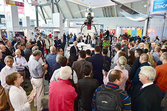
    About 80 exhibitors and approximately 3,200 visitors attended the event as part of Intergeo 2015. A third of those visitors placed an order at the trade fair or immediately afterwards, Intergeo said, and two-thirds of visitors at Interaerial Solutions rated Intergeo 2015 as either “important” or “very important” for investment decisions.

    The event will maintain the same format this year as last year with an exhibition area, expert forum and outdoor flight zone. Exhibitors of the 2016 event include:

    • Suppliers of hardware for UAS.
    • UAS manufacturers.
    • Hardware manufacturers for remote sensing.
    • Manufacturers of UAS accessories.
    • Suppliers of evaluation software/photogrammetry.
    • Suppliers of UAS services.
    • Technology and services for data utilisation.
    • Education and training.
    • Service providers and dealers.
    • Insurersand consultants.
    • Publishers and associations.
    • Authorities.

    “Interaerial Solutions already gave professional UAS manufacturers like us the chance last year to present our products to a large, enthusiastic trade audience,” said Daniel Schmitt, manager of RotorKonzept Multikoptermanufaktur. “At the same time, visitors to the trade fair were able to gain a comprehensive overview of the market. Interaerial Solutions is the most important exhibition platform of the year for RotorKonzept. We will definitely be on board again in Hamburg.”

  • RIEGL Launches BathyCopter UAV with Lidar

    RIEGL Launches BathyCopter UAV with Lidar

    CEO Johannes Riegl unveils the new RIEGL BathyCopter at the Riegl INTERGEO booth in Stuttgart.
    CEO Johannes Riegl unveils the new RIEGL BathyCopter at the Riegl INTERGEO booth in Stuttgart.

    Following RIEGL‘s debut of the RiCOPTER at INTERGEO 2014, a fully integrated UAV-based lidar surveying solution, the company used INTERGEO 2015 in September to launch its new BathyCopter.

    The BathyCopter is a small-UAV-based surveying system capable of measuring through the water surface. It’s suitable for generating profiles of rivers or water reservoirs. The platform design integrates a topo-bathymetric green laser depth-meter, an IMU/GNSS unit with antenna, a control unit and a digital camera. Applications include generation of river profiles, survey of reservoirs and canals, landscaping, support of construction projects, and surveys for planning and carrying out hydraulic engineering work.

    Laser Scanner. RIEGL also offers the VQ-480-U laser scanner for UAVs, which provides high-speed data acquisition using a narrow infrared laser beam and a fast line scanning mechanism.

    High-accuracy laser ranging is based on RIEGL’s echo digitization and online waveform processing, which provides measurement results even under adverse atmospheric conditions, the company said.

  • The Business — October 2015

    The Business section from the October 2015 GPS World. Download the PDF.

    Includes:

    • INTERGEO’s Massive Marketplace
    • Antenova GNSS Antenna Integration
    • What Mattered Most at CTIA Super Mobility Week
    • UAV, Survey Markets Key for Maxtena Growth
    • Broadcom’s New Chip for Internet of Things
    • Autonomous Vehicles, Drones Next Big Thing for u-blox
    • PCTEST Expands Antenna Testing Capabilities with Rohde & Schwarz
    • Spirent Robust Framework Evaluates Threats to GNSS


  • Spectra Precision Introduces New and Enhanced Survey Solutions

    Spectra Precision introduced at INTERGEO this week new and enhanced products in its portfolio of survey solutions. With the new additions, survey and construction professionals have more positioning instrument choices to meet their job requirements, the company said.

    Spectra Precision made the announcement at INTERGEO 2015, the world’s largest conference on geodesy, geoinformatics and land management.

    The new and enhanced products include:

    Spectra Precision FOCUS 35 RX – A new range of motorized total stations providing high-speed, accuracy and precision in measurement. The FOCUS 35 RX robotic instrument moves the power of the observer from the instrument to the range pole, improving efficiency. The speed of observation and precise positioning of the FOCUS 35 RX Robotic Total Station is provided by patented StepDrive motion technology, which controls the horizontal and vertical motion of the motors, eliminating the need for traditional motion locks. The FOCUS 35 RX includes a tracking sensor that uses LockNGo FastTrack tracking technology, enabling the instrument to constantly lock onto the prism.

    The FOCUS 35 RX is available in 2”, 3” or 5” accuracies, features market leading extended operating time with its dual battery system and is controlled externally by Spectra Precision Ranger, Nomad, or T41 data collectors running Spectra Precision Survey Pro or Spectra Precision Layout Pro field software on the Ranger or Nomad.

    “The streamlined design, extremely light weight, very quick turning speed and exceptional battery life enhance the overall value-proposition of the FOCUS 35 RX and make this instrument a very compelling choice for a wide range of survey and construction applications,” said Olivier Casabianca, Spectra Precision Business Area Director. “With the introduction of the FOCUS 35 RX, Spectra Precision continues to expand and improve its portfolio with powerful solutions using new technologies.”

    Spectra Precision Nomad 1050 Data Collector — The Nomad 900 has been updated with new features and capabilities. The Nomad 1050 has more RAM, more Flash and more speed. The base processor is now 1 GHz compared to 806 MHz on Nomad 900 and the Nomad 1050 has 512-MB RAM and 8GB flash storage. The other major enhancement is a new 3.75-G dual-mode GSM and CDMA WWAN modem to provide fast and versatile connectivity for Spectra Precision customers. Also, the new WWAN module uses an internal antenna eliminating the need for an external antenna.

    Spectra Precision Survey Pro 5.7 Field Software — Constant improvement and enhancement continues with Survey Pro. Survey Pro version 5.7 contains significant changes to enable more productive field data collection. Included in this update are new map displays that enable viewing and managing most of the map features that are located on the main map display. The GNSS and robotic staking screens can also display a map view to include background maps along with the standard dynamic guidance control option. The GNSS offsets routine has been updated and now includes a distance-distance option. For those customers who wish to use GNSS and robotic simultaneously, there are now enhanced options for configuration and switching between modes.

    Spectra Precision Survey Office v3.60 Software — Spectra Precision Survey Office now includes enhanced functionality; support for the Spectra Precision FOCUS DL-15 Digital Level and the import of leveling data from any DiNi level; least squares and 5 and 7 parameter Helmert transformations with reports; Geoid 12B support and grouping by country in the Coordinate System Manager; Point Cloud support plus many more additional enhancements.

    Spectra Precision MobileMapper Field GIS Application for Android Devices — A new version of the popular MobileMapper Field GIS application now running on Android devices. This new software is dedicated to GIS data collection and focuses on simplicity to maximize the number of field personnel contributing to the geospatial business. Primarily for MobileMapper 300 users, the application will be the key component of Spectra Precision’s Bring Your Own Device (BYOD) solution. This makes it possible to pair Android tablets and/or smart phones with the MobileMapper 300 GNSS receiver to collect GIS data with survey-grade accuracy.

    “With the introduction of these new and enhanced products into the Spectra Precision portfolio, survey and construction professionals have a wider range of economical choices to get the job done,” said Olivier Casabianca. “These new Spectra Precision optical products complement the ground-breaking line of Spectra Precision solutions, enabling Spectra Precision to offer a complete range of survey products.”

  • Trimble Launches R2 Receiver with GIS Workflow Integration

    Trimble-R2-GNSS-Receiver-with-Tablet-WTrimble debuted its new R2 GNSS receiver at INTERGEO 2015, held this week in Stuttgart, Germany.

    The R2 GNSS receiver is a receiver that works with Trimble handheld devices and iOS, Android or Window mobile handhelds, smartphones and tablets using Bluetooth or USB connectivity. When paired with a mobile device, the receiver adds professional-grade GNSS capabilities for better accuracy. The rugged Trimble R2 provides GIS and survey professionals the flexibility to choose the mobile device, workflows and accuracy they need based on applications.

    Trimble R2 GNSS Receiver for Mobile Devices

    The Trimble R2 GNSS receiver is compact and portable, weighing 2.4 pounds. With one button operation and field swappable battery, the receiver can be pole or vehicle mounted or carried on a backpack. The R2 is a multi-constellation receiver that supports GPS, GLONASS, Galileo, BeiDou and QZSS satellite signals as well as SBAS.

    With a variety of standard and optional correction capabilities, the Trimble R2 can achieve sub-meter to centimeter positioning for a broad range of accuracy requirements. The receiver is an option for the Bring Your Own Device (BYOD) strategy.

    “Today’s geospatial professionals require flexible solutions which allow for configuration to meet their specific job requirements,” said Ron Bisio, general manager of Trimble’s Surveying and Geospatial Division. “The Trimble R2’s versatility to support GIS and survey workflows as well as BYOD deployment enables geospatial professionals to collect data using the mobile device, workflow and accuracy they choose.”

    Workflows – GIS and Survey Field Software

    Designed for both GIS field data collection and survey workflows, the Trimble R2 receiver integrates with Trimble TerraFlex mapping and GIS field software and Trimble Access survey field software.

    TerraFlex software is a scalable cloud-based solution for geospatial data collection. By pairing the R2 with a smart device or Trimble handheld running TerraFlex, the solution addresses a wide variety of field requirements, including attribute-rich GIS data collection on consumer and professional devices.

    Trimble Access software supports the workflows of everyday surveying tasks such as topographic and control surveys and specialized surveying tasks such as roads, monitoring, tunnels and mines. By pairing the receiver with a Trimble handheld running Trimble Access or TerraFlex field software, the Trimble R2 is a versatile solution that supports the full range of geospatial data collection workflows for both GIS and survey applications.

    Flexible Accuracy

    It us capable of receiving a broad range of corrections from traditional RTK, VRS networks and SBAS to Trimble RTX correction services via cellular/IP connections or satellite (L-band), the Trimble R2 provides high-accuracy data worldwide.

    The R2 GNSS receiver can leverage the entire portfolio of subscription-based Trimble RTX correction services to accommodate a wide range of applications and accuracy requirements. This includes CenterPoint RTX (less than 4 centimeters), RangePoint RTX (less than 50 centimeters), and ViewPoint RTX (less than 1 meter) correction services.

  • First Day at INTERGEO: UAVs and RTK GNSS Receivers

    Every fall thousands of geospatial professionals are drawn to Germany, like bees are to honey, for the largest geospatial exhibition on Earth. This year in Stuttgart, more than 17,000 attendees from 92 countries are flooding the halls of the Stuttgart Exhibition grounds located adjacent to the Stuttgart International Airport. Attendees are being treated to a vast array of geospatial technology treats from 500+ exhibitors representing 30 countries.

    Unmanned Aerial Vehicles

    I recall a few short years ago, there were only a handful of UAV vendors at the entire exhibition. Now, there is hardly an aisle that does not contain a quad-copter, fixed-wing aircraft or a UAV-related accessory. The growth of UAVs into the geospatial market growth has been the most explosive geospatial technology introduced in the past 25 years, the span of time that I’ve been involved in the geospatial industry. It’s over the top — there is so much hype surrounding UAV technology that there might be more sellers than buyers. It’s become so crazy that there are vendors presenting UAVs that haven’t even been built yet! It reminds me of the days that Atari would announce a new game system nine months before it was ready to ship.

    In the UAV space, I wonder which companies are actually making money. My guess is very few. A few of the big players like DJI, Parrot (owns senseFly) and 3D Robotics are doing well, plus a few others. But it’s an unhealthy buyer/seller ratio. Something’s going to give.

    The sensefly eXom UAV in flight.
    The sensefly eXom UAV in flight.

    Today’s winners in the UAV market are companies like Pix4D, Agisoft and others who make mission planning and image-processing software for UAV-collected data. They are smart in that they aren’t competing against the hundreds of other UAV airframes on the market; they work with data from most of them. Following is a 3D example of what the Agisoft software can create given a bunch of images shot with a $1,500 DJI Phantom at 200-foot elevation.

    3DModel-W

    The resolution is very good, and you’re able compute material volume such as the piles of aggregate on the west side of the river.

    Inexpensive RTK

    NVM_L1RTK-WIn the past, I’ve written a lot about inexpensive RTK GNSS receivers. At the InfoAg Conference a couple of months ago, Swift Navigation announced it is testing its $500 RTK receivers. At INTERGEO, CHCNav introduced L1 RTK GNSS in a mobile phone (check our website for a video on that). It’s not capable of centimeter accuracy yet, but quickly heading in that direction. NVS Tech is also pushing sub-$500 L1 RTK GNSS modules.

    It’s interesting because L1 RTK is nothing new. That technology was first introduced almost 10 years ago, and wasn’t accepted very well. Now, the UAV phenomena is breathing new life into L1 RTK receiver technology because it’s driving the requirement for low-cost, high-precision GNSS receivers. L1 RTK GNSS are finally getting the love they were looking for nearly 10 years ago.

    In case you weren’t able to make it to INTERGEO this year, Joelle, Michelle and I are shooting a bunch of short (~2-minute) videos at various exhibition booths while we are here. We hope to give you a flavor of the geospatial technology being offered this year in Stuttgart.

    See you next time.

    Following me on Twitter at https://twitter.com/GPSGIS_Eric

  • Trimble Launches R2 GNSS Receiver at Intergeo

    Photo: TrimbleTrimble debuted its new R2 GNSS receiver at Intergeo 2015, held this week in Stuttgart, Germany.

    The R2 GNSS receiver is a receiver that works with Trimble handheld devices and iOS, Android or Window mobile handhelds, smartphones and tablets using Bluetooth or USB connectivity. When paired with a mobile device, the receiver adds professional-grade GNSS capabilities for better accuracy. The rugged Trimble R2 provides GIS and survey professionals the flexibility to choose the mobile device, workflows and accuracy they need based on applications.

    Trimble R2 GNSS Receiver for Mobile Devices

    The Trimble R2 GNSS receiver is compact and portable, weighing 2.4 pounds. With one-button operation and a field swappable battery, the receiver can be pole or vehicle mounted or carried on a backpack. The R2 is a multi-constellation receiver that supports GPS, GLONASS, Galileo, BeiDou and QZSS satellite signals, as well as SBAS.

    With a variety of standard and optional correction capabilities, the Trimble R2 can achieve sub-meter to centimeter positioning for a broad range of accuracy requirements. The receiver is an option for the Bring Your Own Device (BYOD) strategy.

    “Today’s geospatial professionals require flexible solutions which allow for configuration to meet their specific job requirements,” said Ron Bisio, general manager of Trimble’s Surveying and Geospatial Division. “The Trimble R2’s versatility to support GIS and survey workflows as well as BYOD deployment enables geospatial professionals to collect data using the mobile device, workflow and accuracy they choose.”

    Workflows – GIS and Survey Field Software

    Designed for both GIS field data collection and survey workflows, the Trimble R2 receiver integrates with Trimble TerraFlex mapping and GIS field software and Trimble Access survey field software.

    TerraFlex software is a scalable cloud-based solution for geospatial data collection. By pairing the R2 with a smart device or Trimble handheld running TerraFlex, the solution addresses a wide variety of field requirements, including attribute-rich GIS data collection on consumer and professional devices.

    Trimble Access software supports the workflows of everyday surveying tasks such as topographic and control surveys and specialized surveying tasks such as roads, monitoring, tunnels and mines. By pairing the receiver with a Trimble handheld running Trimble Access or TerraFlex field software, the Trimble R2 is a versatile solution that supports the full range of geospatial data collection workflows for both GIS and survey applications.

    Flexible Accuracy

    The receiver is capable of receiving a broad range of corrections from traditional RTK, VRS networks and SBAS to Trimble RTX correction services via cellular/IP connections or satellite (L-band), the Trimble R2 provides high-accuracy data worldwide.

    The R2 GNSS receiver can leverage the entire portfolio of subscription-based Trimble RTX correction services to accommodate a wide range of applications and accuracy requirements. This includes CenterPoint RTX (less than 4 centimeters), RangePoint RTX (less than 50 centimeters), and ViewPoint RTX (less than 1 meter) correction services.

  • NavCom Showcases StarFire Network at INTERGEO

    NavCom’s Luke Wilson talks about the company’s StarFire network and GNSS receivers at INTERGEO 2015, held Sept. 15–17 in Stuttgart, Germany. To learn more about the StarFire network visit http://bit.ly/1iNejWy.

  • Carlson SurvCE 5.0 Improvements on Display at INTERGEO

    Advanced control for multiple rod heights and prism offsets.
    Advanced control for multiple rod heights and prism offsets.

    Carlson Software experts will be demonstrating the newest abilities of the 5.0 version of SurvCE, its data-collection software, at INTERGEO, being held in Stuttgart, Germany, Sept. 15-17. Carlson will have two stands: indoors at  C8.017 (Hall 8) and outdoors at FG.004.

    SurvCE v. 5.0 software is scheduled to be officially released and available for download following extensive testing and after final enhancements are completed in October. Those buying a new license of SurvCE 4.0 software between now and the release of SurvCE 5.0 will receive an automatic upgrade to 5.0.

    SurvCE 5.0 focuses on speed and power.  A new memory allocator empowers users to do more, faster, opening large drawing and coordinate files with ease.

    Mission Planning user-defined list for obstruction masking.
    Mission Planning user-defined list for obstruction masking.

    Other top new improvements include the following:

    • Enhanced GNSS tilt sensor (IMU) for confirmation of level and the taking of measurements with tilted GPS/GNSS poles (works with selected GNSS such as Stonex and CHC in addition to Carlson);
    • All-new GNSS Mission Planning, which will include GLONASS mission planning;
    • Newly designed two-step stakeout procedure now intuitively and accurately guides the user to his point, delivering easy to follow navigation that shifts to proximity information as he gets close to target;
    • And map-picked, cursor-displayed stakeout and one-pick measurement options.

    CarlsonSurvCE2015Box3DFeaturing hundreds of additions and improvements, Carlson SurvCE 5.0 continues to support the widest range of popular and new release RTK GPS and conventional/robotic total stations of any other data collection software on the market.

    “SurvCE 5.0 is incorporating new emerging technologies like IMU support, while still providing its renowned friendly user environment,” says Jesus Latova, SurvCE product director. “Simplicity and safety are our main focus in developing these new features, together with continuing the extensive instrument support capacity of SurvCE.”

    Carlson SurvCE is both powerful and easy to use, providing users with the options to collect data as they prefer. SurvCE 5.0 will be available in nearly two dozen languages. These include: English, Chinese, Croatian, Czech, Dutch, Finnish, French, German, Greek, Hungarian, Italian, Korean, Polish, Portuguese, Romanian, Russian, Serbian, Spanish, Swediish, Tagalog, and Turkish.

    Hardware from Carlson SoftwareAlso visit the Carlson outside stand (F.004, outside Hall 8) at Intergeo to see and sample its hardware options, produced to work specifically with its popular software. These will include the rugged, fast, and popular Surveyor2 data collector, the BRx5 GNSS receiver, and other equipment recommended by Carlson.

    For more information about SurvCE 5.0 and additional Carlson Software offerings, call 606-564-5028 (U.S.) or +31 36 750 1781 in the Netherlands and ask for your local Carlson representative.

  • Septentrio Launches AsteRx-U and AsteRx-U Marine

    AsteRxU_left_orientation-W

    Septentrio this week is launching two successors to its APS-U: The AsteRx-U and the AsteRx-U Marine multi-constellation dual-antenna receivers. The AsteRx-U will be presented to the public for the first time at two trade shows this week. ION GNSS+ takes place Sept.14-18 in Tampa, Fla., and INTERGEO 2015 will be held in Stuttgart, Germany, Sept. 14-18.

    The AsteRx-U and the AsteRx-U Marine incorporate the latest GNSS tracking and positioning algorithms and interference mitigation. Machine-control users in the agricultural and construction industries, as well as users in marine and mining industries, benefit from a complete system with integrated UHF radio, Wi-Fi, USB, Bluetooth and cellular connectivity and a spectrum analyzer, Septentrio said. All configurations can be done via the on-board web interface.

    The AsteRx-U and AsteRx-U Marine feature a full range of positioning techniques and algorithms to ensure that users have the highest accuracy and reliability. The spectrum analyzer enables users to visualize the RF spectrum. Based on its extensive experience with real-life interference sources and their mitigation, Septentrio has developed interference mitigation technology that automatically counteracts various kinds of ambient intentional and unintentional RF interference.

    The AsteRx-U family of receivers is built around Septentrio’s latest ASIC, GReCo4, which was introduced in 2014. It incorporates built-in jamming detection and countermeasures, multi-path rejection, fast acquisition and other advanced features. Both receivers have more than 500 hardware channels to track all available constellations (GPS, GLONASS, Galileo, Beidou, IRNSS and QZSS) and feature many algorithms: LOCK+ technology to maintain tracking during heavy vibration machine use and IONO+ technology to assure the accuracy of the position even in regions of elevated ionospheric activity.

    The AsteRx-U has decimeter- and centimeter-level RTK positioning including TerraStar. The AsteRx-U Marine also supports Veripos PPP augmentation services. It includes extra anti-jamming technology to counter Iridium and INMARSAT-uplink interference, as well as an extra antenna connector for a dedicated L-band antenna to optimize L-band reception at high latitudes.

    Straightforward to set up and integrate with existing systems, the AsteRx-U and AsteRx-U Marine use any device with a web browser to facilitate usability and configuration for the user.

    “We want to make it easy for our customers to use high-accuracy positioning in their work,” said Jan Leyssens, Septentrio product manager. “Using the integrated communication functionality in the compact and portable AsteRx-U, users won’t have to worry about adding their own modems or UHF radios to get access to corrections.”

    Leyssens continued, “The receiver web interface is available wirelessly on any mobile device. It was designed together with several of our key customers, resulting in an interface that is not only easy to use by field operators, but also provides many useful troubleshooting tools, such as the spectrum analyzer, to solve problems in the field and minimize downtime.”

    Septentrio will be at Booth 318 at ION GNSS+, and at Hall: 4, Booth: D4.014, at INTERGEO.

  • Hemisphere GNSS’ Atlas Makes Trade Show Debut at INTERGEO

    Hemisphere GNSS’ Atlas Makes Trade Show Debut at INTERGEO

    Hemisphere GNSS will be showcasing its new Atlas GNSS global correction service at the INTERGEO 2015 Conference and Trade Fair Fair in Stuttgart, Germany, held Sept. 15-17. Hemisphere GNSS will exhibit at Booth E6.093.

    The Atlas correction service offers innovative and accessible correction service options, providing performance in demanding applications and environments, Hemisphere said. Available through various subscription and bundle options, Atlas is a flexible correction service with correction data delivered via L-band satellites or over the Internet at accuracy levels ranging from meter-level to sub decimeter-level.

    ATLAS-Launch-1-howworks-W

    The Atlas platform offers endless possibilities through hardware, software, and branding integration into various products and customized solutions, the company said. Several new Hemisphere products with Atlas support targeted for specific applications will be on display at INTERGEO, including Hemisphere’s latest AtlasLink GNSS smart antenna. Other Atlas capable products, including R330, V320 and VS330 will also be showcased.

    Photo: AtlasLinkAtlasLink, the multi-GNSS, multi-frequency smart antenna, is preconfigured to receive corrections from the new Atlas platform. The bundled AtlasLink solution provides users worldwide with the easiest way to utilize Atlas corrections — either directly from AtlasLink, or on their existing receivers via innovative new technologies built into AtlasLink.

    “AtlasLink is a game changer” declared Chuck Joseph, Hemisphere GNSS CEO and president. “On its own it is a fantastic smart antenna with industry-leading RTK, connectivity and management capabilities. Further, when you add in the ability to deliver Atlas GNSS corrections to equipment you already own, from any vendor, you have a real powerhouse that will allow you to get much more from your existing GNSS equipment.”

    Live demonstrations of Atlas GNSS global correction service and AtlasLink GNSS smart antenna will be given daily. Contact Hemisphere GNSS to schedule a time or visit booth E6.093 during the show.

  • Live updates from Intergeo 2015

    intergeo15_pano_WGPS World staff is reporting from Intergeo Sept. 15–17. The massive trade show, held this year in Stuttgart, Germany, is considered the world’s leading conference trade fair for geodesy, geoinformation and land management. With more than 16,000 visitors from 80 countries, it is one of the key platforms for industry dialogue.

    Editorial staff members attending include GPS World Survey/GIS Editor Eric Gakstatter and Senior Digital Editor Joelle Harms. Both are accepting meeting invitations for companies interested in discussing their products and services. Contact [email protected] for more information.

    BLOG

    First Day at INTERGEO: UAVs and RTK GNSS Receivers, by Eric Gakstatter (9/15)

    NEWS

    Nikon-Trimble Introduces Updated Nikon Total Stations (9/15)

    Spectra Precision Introduces New and Enhanced Survey Solutions (9/15)

    Trimble Launches R2 GNSS Receiver at INTERGEO (9/15)

    Applanix Offers Entry-Level Georeferencing Solution for Airborne Mapping (9/15)

    senseFly eXom Drone Capable of Millimeter Accuracy (9/15)

    Topcon Releases Three New GLS Laser Scanners (9/15)

    Carlson SurvCE 5.0 Improvements on Display at INTERGEO (9/14)

    Septentrio Launches AsteRx-U and AsteRx-U Marine (9/14)

    Hemisphere GNSS’ Atlas Makes Trade Show Debut at INTERGEO (9/14)

    Tallysman Introduces VeraPhase 6000 High-Precision GNSS Antenna (9/10)

    Mobile Surveying Solutions from Teledyne Optech Shown at INTERGEO 2015 (9/9)

    SBG, Viametris Present 3D Indoor Scanning System at INTERGEO (9/8)

    YellowScan Lidar for UAVs Aided by Ellipse-E Inertial Navigation System (9/4)

    INTERGEO 2015: Stuttgart Moves Toward Smart City (9/3)

    JAVAD GNSS to Showcase New Technology at INTERGEO (9/1)

    Tallysman Introduces Wideband Embedded GNSS Antennas (9/1)

    Tallysman Launches Higher Gain Dual-Frequency Antenna (8/19)

    Satel Joins with Antenna Maker Welotec at INTERGEO (8/12)

    INTERGEO in Stuttgart Looks to Mapping’s Future (8/4)

    VIDEO PLAYLIST

    PHOTOS

    SOCIAL MEDIA