Tag: internet of things

  • Verizon’s RTK precise location service launches in 100+ US markets

    Verizon’s RTK precise location service launches in 100+ US markets

    Hyper Precise Location (HPL), a real-time kinematics (RTK) service, is now available via Verizon ThingSpace to customers and application developers in more than 100 U.S. markets. When paired with Verizon’s 5G Edge capabilities, HPL provides precise positioning data for emerging cellular-vehicle-to-everything (C-V2X) technology, which is necessary for certain safety applications.

    Verizon recently teamed with automakers to demonstrate vehicle-pedestrian safety scenarios made possible through HPL, 5G Edge and C-V2X.

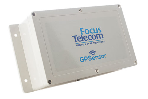
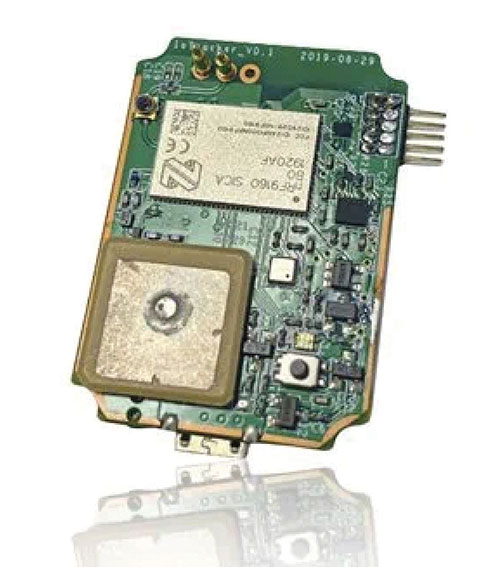
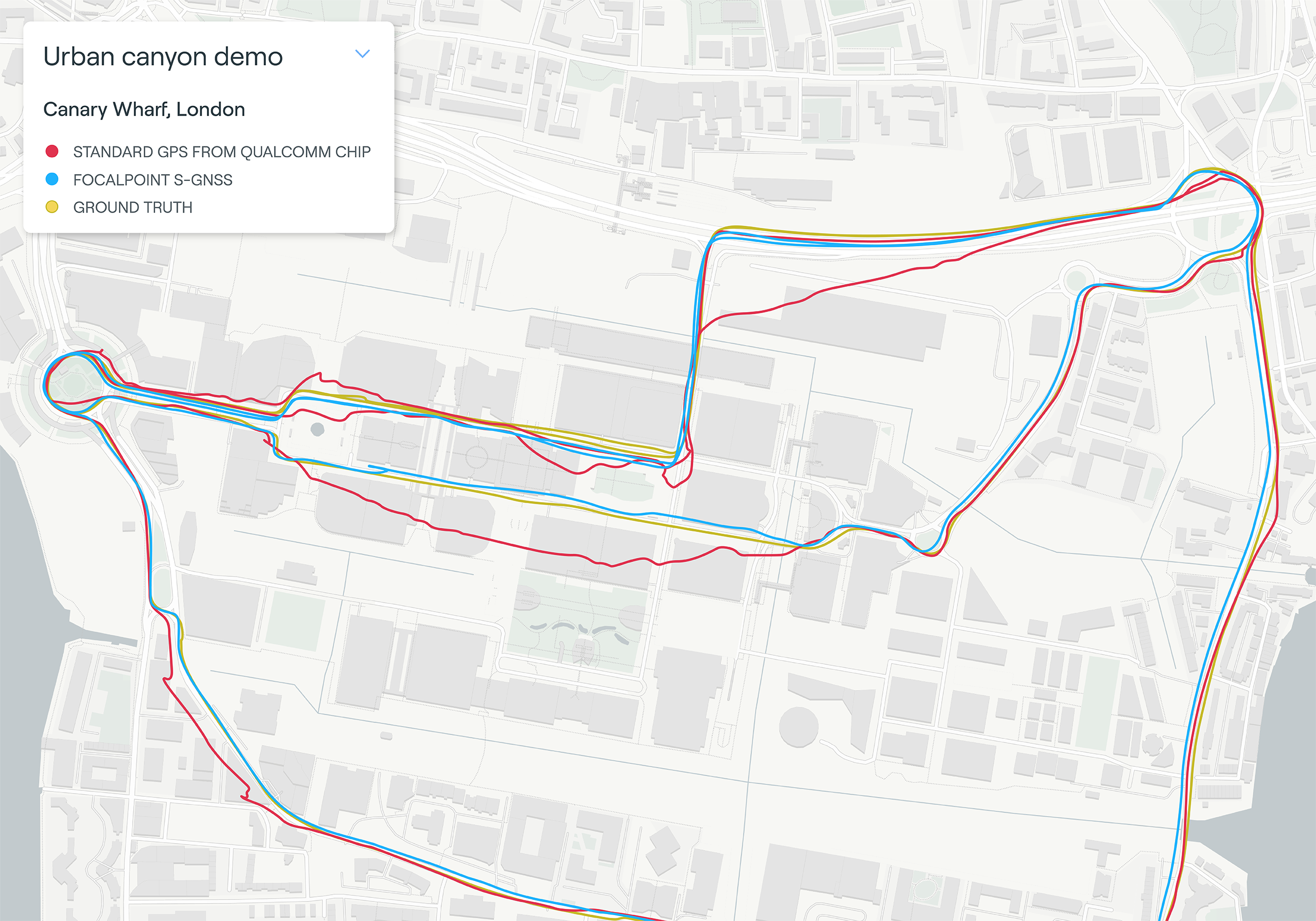
    HPL is software as a service (SaaS) that provides a stream of real-time GNSS correction data to device receivers, enabling location accuracy within 1-2 centimeters, for users on 5G and 4G networks. This can enable high-scale, low-cost, centimeter-level location capabilities for industries such as automotive, HD mapping, robotics, construction, and smart agriculture (AgriTech). Designed and deployed in a privacy-protective manner, HPL does not store or share user location data.

    HPL embraces open delivery standards including RTCM for its data streams, with others to be added on a rolling basis. IoT devices using HPL can be accessed and managed through a user API and the ThingSpace IoT management platform. Support resources on ThingSpace will detail API integration, coverage availability, and more.

    “Hyper Precise Location stands to boost or enable next-gen technologies across industries, from intelligent-driving to drone delivery to highly automated operations within construction, agriculture, and much more,” said TJ Fox, SVP of Industrial IoT and automotive for Verizon Business. “HPL’s fast expanding coverage area, API friendliness, privacy protection, and use of open-delivery standards make it ideal for developers and customers demanding precision and flexibility.”

    In August, Verizon announced it is also developing HPL next-gen road safety and highly advanced driving solutions through partnerships with location and mapping expert HERE Technologies (HERE) and Renovo, the automotive software company. HPL can also support other emerging technologies that depend on high-level location accuracy, such as delivery drones, and advanced IoT applications, such as infrastructure monitoring, critical asset tracking, and high value shipping.


    Feature image: loveguli/E+/Getty Images

  • InfiniDome provides GPS monitoring and Protection Solution to Israel Railways

    InfiniDome provides GPS monitoring and Protection Solution to Israel Railways

    A train arrives at Tel Aviv University Station on the Israeli Railway in Tel Aviv. (Photo: svarshik/iStock Editorial/Getty Images Plus/Getty Images)
    A train arrives at Tel Aviv University Station on the Israeli Railway in Tel Aviv. (Photo: svarshik/iStock Editorial/Getty Images Plus/Getty Images)

    InfiniDome Ltd., a GPS security company, is joining with with Israeli partner Focus Telecom, in a new country-wide project with Israel Railways. The project involves deployment by Focus Telecom of GPS repeaters at more than 30 railway stations across Israel, providing accurate, location-based service indoors at all locations for a new Israel Railways ticketing app.

    A critical component of the project is a monitoring service that detects and provides alerts of any GPS disruption or interference in real time, as they are identified. This is facilitated by infiniDome’s IoT GPSensors and its cloud-based GPS monitoring service, infiniCloud.

    “Incorporating infiniDome’s proven resilient PNT capability to monitor and protect such a critical GPS service is a necessary enhancement for government designated critical infrastructures,” said Ehud Sharar, Focus Telecom CEO.

    Photo: Focus Telecom
    Photo: Focus Telecom

    InfiniDome’s monitoring technology for critical assets detects and alerts operators of threats and disruptions of the essential GPS signals. These threats can originate from both malicious or natural causes.

    “GPSensor IoT technology combined with our infiniCloud GPS security cloud assures real-time alerts about jamming attacks. All GPS signal data and its assured integrity are available as real time data so Israel Railways can react immediately and reduce downtime of the network,” said Omer Sharar, infiniDome CEO.

    Israel Railways is the cornerstone of Israeli critical infrastructure. In 2018, Israel National Railway carried 68 million passengers. This same infiniDome GPS monitoring and protection technology is now available to defend critical infrastructure assets worldwide.

  • IoTeX Pebble Tracker offers security features

    IoTeX Pebble Tracker offers security features

    Photo: Nordic Semiconductor
    Photo: Nordic Semiconductor

    IoTeX has selected Nordic Semiconductor’s nRF9160 low-power System-in-Package (SiP) with integrated LTE-M/NB-IoT modem and GPS receiver to provide the cellular internet of things (IoT) connectivity for its Pebble Tracker.

    The Pebble Tracker provides trusted location, environment and motion-tracking data for global asset tracking and industrial supply chain applications.

    Critical features strengthen security from hacking and data corruption, meeting the demand of applications that require strong data security and integrity protection throughout the supply chain, the company said.

    There are two versions of Pebble Tracker. The first targets blockchain and IoT developers, while a second commercial version is designed for the asset tracking and industrial supply chain markets.

    The product combines an environmental sensor, a motion sensor (gyroscope and accelerometer) and an ambient light sensor. It enables cellular network connectivity and integrated GPS support in a global version supporting precise, long-range tracking of asset data using established cellular infrastructure.

    The nRF9160 syncs with the IoTeX blockchain, enabling large-scale, decentralized asset-tracking applications. It sends environmental and GPS data securely across global cellular networks to blockchain-based backend services and applications. There, the data is used to determine whether smart contracts have been satisfactorily fulfilled. For example, the trusted tracker data can reveal if, when, and where an asset has been mishandled.

  • Telit offers first L1+L5 module under collaboration with Sony

    Telit offers first L1+L5 module under collaboration with Sony

    Photo: Telit
    Photo: Telit

    Telit has launched the SE868SY-D multi-frequency, high-precision GNSS receiver module for applications that require high accuracy, fast updates, multi-constellation support and multipath resistance.

    At 11 x 11 mm, the SE868SY-D accommodates ultra-compact devices and IoT trackers.

    Available now, the high-precision SE868SY-D module is Telit’s first multi-frequency, multi-constellation GNSS receiver module, featuring an ultra-sensitive -167 dBm (tracking) RF front end. By using both the L1 and L5 bands, the SE868SY-D supplies a significantly higher location accuracy than single-frequency devices — even in high-multipath environments such as urban canyons, Telit said.

    This sub-1-meter precision is a major reason ABI Research expects more than 1 billion multi-frequency GNSS devices to ship annually by 2023.

    The SE868SY-D is the first product from a new strategic collaboration between Sony and Telit, and features Sony’s next-generation CXD5610 GNSS receiver large-scale integrated circuit (LSI).

    The Telit SE868SY-D is designed for battery-powered applications such as IoT trackers and wearables. With less than 45 mW in L1+L5 tracking mode, the module has low power consumption, despite using both L1 and L5 bands.

    For high-dynamic applications, the SE868SY-D a high update rate of up to 25 Hz. Its high-accuracy, one-pulse-per-second signal also makes the module suitable for timing applications.

    “With the new SE868SY-D, Telit is uniquely prepared to meet the burgeoning global demand for multi-frequency, multi-constellation GNSS receivers for IoT trackers, wearables and more,” said Eric Lagorce, Telit business development director. “The SE868SY-D also perfectly complements Telit’s two decades of GNSS expertise and its broad portfolio, and highlights the potential of our strategic collaboration with Sony.”

    The Telit SE868SY-D provides pin-to-pin compatibility for applications based on Telit’s legacy GPS module JF2 and GNSS module SE868V3.

  • Vodafone tests remote centimeter-level tracking tech

    Vodafone tests remote centimeter-level tracking tech

    New tech can track vehicles, drones and cargo remotely within centimeters — key to safe adoption of autonomous vehicles, flying objects and machinery

    Vodafone logoVodafone has successfully used new precision positioning technology to remotely track a vehicle to within 10 centimeters of its location, an improvement of more than three meters compared to its current system.

    Vodafone is working in partnership with Sapcorda, using Vodafone’s global internet of things (IoT) platform, which has  118 million connections worldwide.

    Vodafone expects the technology to enable applications that warn autonomous trucks of obstacles, tell first responders the position of critical medical drones, and give operators the precisely location of important cargo.

    Pinpoint accuracy is critical to the acceptance and mass adoption of autonomous vehicles on the road and in factories, airports, dockyards and any site where machines are in motion. A matter of centimeters can be crucial to ensuring the safety of passengers on a driverless bus, or knowing the precise location of a medical drone. a

    The tracking technology will also allow an autonomous truck to mind other road users, including cyclists, whose e-bikes can automatically transmit their position and intended direction of travel.

    “We might not be able to locate a needle in a haystack yet, but we are getting close,” said Vodafone Business Platforms and Solutions Director Justin Shields. “What we can do now is take new digital services like this one, integrate it with our global IoT platform and fast networks, and offer it securely at scale to many millions of customers.

    “Our in-building 5G and IoT services already allow manufacturing plants, research laboratories and factories to carry out critical, and often hazardous, precision work with robots. Now we are applying the same levels of accuracy to the outdoor world.”

    Vodafone is redefining its network and technology on a Telco as a Service (TaaS) model. It makes key network capabilities available through common APIs in a cloud platform to deliver new software, video and data applications at scale, in addition to gigabit-capable connectivity.

    Vodafone said the TaaS model will benefit large enterprises, improving their ability to  locate critical assets, precisely align machines such as driverless trains at platforms, and let farmers, airports, and fleet operators know the exact whereabouts of their autonomous vehicles.

    Vodafone IoT-enabled vehicles, machinery and devices — when linked with Sapcorda’s comprehensive network of GNSS receivers and augmentation technology — improves location accuracy by correcting for things like the curvature of the earth, atmospheric delays and clock differences of global positioning satellites. This offers corporations hyper-precise positioning that they can use to ensure a safe environment for their employees, their customers, the public and their machines.

    Combined with video and onboard diagnostics, the technology will also allow vehicle operators to carry out accurate location-sensitive remote inspections and even pause machines such as grass cutters on public footpaths when they encounter people.

    PPP-RTK method. Vodafone is adopting the precise point positioning – real-time kinematics (PPP-RTK) method with ground-level GNSS stations to achieve the best error correction. GNSS signals are processed and GNSS corrections are sent out to enhance the position accuracy of the vehicles receiving them.

    Vodafone is able to equip any number of vehicles with an in-built IoT SIM, and deliver the positioning data at speed using its gigabit-capable networks.

    Vodafone recently put this to the test by tracking in real-time the exact lane that vehicles were traveling in during a combined journey of more than 100 kilometers in varying weather conditions.

    Sapcorda provided the data feed, which enabled the GNSS signal to be corrected, to deliver the critical-level of positional accuracy. A precise positioning service complements the existing asset tracking and fleet telematics solutions already provided by Vodafone Business for enterprise customers across 54 countries.

  • SkyTraq offers multi-band GNSS receiver with 1-cm position accuracy

    SkyTraq offers multi-band GNSS receiver with 1-cm position accuracy

    Photo: SkyTraq
    Photo: SkyTraq

    SkyTraq is offering a 12 x 16 millimeter multi-band real-time kinematic (RTK) receiver for centimeter-level accuracy positioning applications. The PX1122R works with all the four GNSS, using GPS L1/L2C, Galileo E1/E5b, GLONASS L1/L2 and Beidou B1I/B2I signals concurrently to maximize positioning availability even in difficult urban environments.

    A single-chip system-on-chip, the PX1122R is designed to deliver reliable, centimeter-level accuracy positioning for autonomous unmanned ground or aerial vehicles, the internet of things, and traditional land surveying and precision farming applications.

    The PX1122R has an RTK initialization time under 10 seconds and a maximum update rate of 10 Hz. Its update rate provides in-time positioning with a fast response time and improved guidance for fast-moving applications, the company said.

    Moving-base RTK for GNSS precise heading is also supported. By using two PX1122R and two antennas with 1-meter separation, highly accurate 1-sigma heading accuracy of 0.13 degree can be obtained; such heading accuracy is immune to magnetic interference and unaffected by the receiver’s speed.

    The PX1122R can serve as a key component to provide precise position and heading information for autonomous applications. PX1122R sample, data sheet and evaluation boards are available now.

    Founded in 2005, SkyTraq Technology Inc. develops high-performance chipset and module solutions for the consumer market. Its initial product is L1-GPS-centric, and now its products cover L1, L2, L5, L6 band GPS/GLONASS /Beidou/Galileo/QZSS/NavIC/SBAS applications.

  • ADVA launches edge and access clocks for 5G network timing

    ADVA launches edge and access clocks for 5G network timing

    Photo: ADVA
    Photo: ADVA

    ADVA has launched a set of edge and access network synchronization devices with enhanced capabilities for next-generation applications such as 5G. These latest Oscilloquartz solutions address key challenges for a wide range of industries by bringing new levels of timing accuracy and resilience to edge networks.

    The OSA 5412 and 5422 offer precise phase, frequency and time-of-day synchronization and can be used for time-as-a-service applications. Communication service providers, enterprises, broadcast networks and power utilities can deploy synchronization technology at the edge that features multi-band for nanosecond accuracy.

    The OSA 5412 and 5422 utilize in-service sync probing and assurance as well as innovative GNSS assurance capabilities. The products also provide support for eight field-upgradeable 10Gbit/s ports, ensuring the scale and efficiency needed for next-generation smart grids, industrial IoT applications and 5G connectivity.

    The OSA 5412 is a highly flexible access network synchronization solution that offers compact and cost-effective timing distribution and assurance. The OSA 5422 is engineered for the most extreme conditions. It meets stringent frequency and phase synchronization requirements, delivers the best holdover performance of any edge device on the market, and supports multiple legacy interfaces such BITS and IRIG.

    Both solutions address new ITU-T specifications, including for class A and B PRTCs, ePRTCs with strict holdover requirements, and the newly improved class C and D boundary clocks. They also feature onboard multi-band, multi-constellation GNSS receivers that overcome ionospheric delay variation far more cost-efficiently than rival solutions using high-end rubidium oscillators.

    The OSA 5412 and 5422 support multiple PTP profiles, NTP and SyncE with a high number of 1/10GbE ports. Both devices are engineered with optional OLED display and with hot-swappable modules and power supplies to be easily upgraded in the field.

    “Our latest solutions build on the great success we’ve had with our access synchronization product line. Now operators can harness the power of multi-band GNSS receivers to deliver highly accurate, UTC-traceable timing at the network edge. That enables the availability and precision that will be essential for tomorrow’s services,” said Nir Laufer, senior director, product line management, Oscilloquartz, ADVA.

    “By extending the feature set of our edge technology, we’re empowering CSPs to smoothly transition to the reliability and accuracy required for 5G and, at the same time, enabling our unique innovation to be used across a wide range of verticals,” Laufer said. “With support for 10Gbit/s and 1Gbit/s interfaces as well as hardware timestamping, our access timing products are the ultimate in future-proof, space-efficient synchronization.”

    “Access grandmaster clocks need to meet stricter demands for accuracy and reliability than ever before, and many industries have their own specific set of stringent timing requirements. That’s why we’ve evolved our portfolio of edge and access network synchronization solutions for the specific challenges of the 5G era,” said Gil Biran, general manager, Oscilloquartz, ADVA.

    “Our OSA 5412 and 5422 answer the most urgent timing needs of mission-critical infrastructure in multiple verticals,” Biran said. “They provide nanosecond precision, an abundance of fan-out interface options and operational simplicity thanks to the management and monitoring capabilities of our Ensemble Controller with Sync Director. Operators of broadcast, healthcare, financial networks and more now have a straightforward and affordable path from legacy to next-generation timing.”

    More information on the OSA 5412 and 5422 is available in these slides.

  • Swift Navigation offers IoT GNSS module with Quectel, STMicroelectronics components

    Swift Navigation offers IoT GNSS module with Quectel, STMicroelectronics components

    Photo: Swift Navigation
    Photo: Swift Navigation

    Swift Navigation‘s new Precision GNSS Module (PGM) is now available. The PGM module is designed to offer fast evaluation and a quick path to production for those requiring a precise positioning solution.

    The PGM is available in a simple-to-use, industry-standard mPCIe (mini peripheral component interconnect express) format and is designed specifically for Swift’s Starling positioning engine running on a host application processor to deliver real-time precision navigation.

    The PGM utilizes STMicroelectronics’ TeseoV chipset in Quectel’s multi-constellation, dual-band LG69T-AP receiver to create an affordable, easy-to-use solution for customers building industrial, last-mile and internet of things (IoT) platforms, Swift Navigation said.

    The LG69T family of products, based on the ST TeseoV, is an designed for demanding precision applications that require centimeter accuracies. The LG69T-AP — supporting L1/L5 bands — has an integrated ST inertial measurement unit and processor to support dead reckoning for signal-compromised areas such as urban canyons, parking lots and underground structures.

    According to Swift Navigation, this proven solution is ready for fast and easy integration and deployment — using industry-standard protocols — to reduce customer engineering investment and enable quick time to market.

    This solution operates with the highest accuracy when used with Swift’s Skylark cloud-based, wide-area precise positioning service. Skylark delivers accuracy down to 10 cm. The solution supports standard RTCM OSR (Observation Space Representation) and SSR (State Space Representation) correction formats.

    Skylark is available for integration into wide-area, high-precision positioning applications across the continental United States and Europe and is available in Japan, South Korea and Australia, with plans underway to expand globally. Skylark is an ever-expanding service and is scalable to service millions of users.

    “We are excited to be offering the PGM utilizing the Quectel LG69T-AP receiver,” said Dave Huntingford, staff product manager at Swift Navigation. “The ability to provide a cost-effective, easily integrated solution, complete with corrections, opens up a host of opportunities for IoT, last-mile and industrial customers to benefit from precise positioning.”

    “Quectel is delighted to be working with Swift Navigation to provide the market with an easy-to-use precision GNSS solution,” said Mark Murray, vice president of sales for GNSS and automotive at Quectel Wireless Solutions. “The LG69T-AP, together with Swift’s Starling positioning engine and Skylark corrections, is perfect for supporting applications and markets where <10-cm accuracy is required.”

    This product is available today with full production by the first quarter of 2021;  an evaluation kit is available. Contact Swift Navigation or Quectel.

  • U-blox signs deal with UK start-up for cutting-edge GNSS technology

    U-blox signs deal with UK start-up for cutting-edge GNSS technology

    Map plot from live tests in London show the route of a vehicle driven through Canary Wharf. It shows the difference between the position provided by a standard smartphone GNSS chip (red line) and the same data run through Focal Point Positioning's Supercorrelation software (blue line). (image: u-blox)
    Map plot from live tests in London show the route of a vehicle driven through Canary Wharf. It shows the difference between the position provided by a standard smartphone GNSS chip (red line) and the same data run through Focal Point Positioning’s Supercorrelation software (blue line). (Image: u-blox)

    U-blox has signed a deal with the award-winning U.K.-based technology company Focal Point Positioning to integrate technology that will improve the accuracy and reliability of GNSS devices. Focal Point’s Supercorrelation technology enhances positioning performance and security for applications such as smart cities, location-secure internet of things (IoT) and health and fitness wearables.

    The patented Supercorrelation technology solves a critical weakness in GNSS caused by multipath interference. Multipath interference occurs when satellite signals bounce off buildings and landmarks, causing GNSS receivers to provide degraded positioning outputs.

    The result for users is that the blue dot on their phone or device may be in the wrong place, moving in the wrong direction, or may have a large error ellipse. For autonomous vehicles it could lead to positioning errors that place the vehicle in the wrong lane or worse.

    FocalPoint’s Supercorrelation technology uses software to detect and reject reflected signals, resulting in an improvement in the performance of GNSS devices without the need for additional hardware or applications. Supercorrelation also helps with the detection and rejection of GNSS spoofing signals — an increasing concern for autonomous vehicles, ships, and aviation.

    “We are tremendously excited to be working alongside a market leader such as u-blox, our mission is to improve every positioning system on the planet and we have taken a giant step forward in that vision with this deal,” said Focal Point Positioning CEO Ramsey Faragher. “Positioning systems are so critical to our world, and we look forward to seeing the next generation of products and services that will be enabled by this higher level of accuracy, reliability and security.”

    u-blox CEO Thomas Seiler commented, “The addition of Supercorrelation technology into our latest GNSS platforms is part of our continuing focus on low power consumption, higher accuracy and security for automotive, industrial, and wearable GNSS applications.”

  • Swift Navigation’s SSR service now available across 2 continents

    Swift Navigation’s SSR service now available across 2 continents

    Image: Swift Navigation
    Image: Swift Navigation

    Swift Navigation has launched its production-grade SSR (state space representation) service across Swift’s coverage areas.

    Swift is a San Francisco-based tech firm offering GNSS and precise positioning technology for mass-market applications in autonomous vehicles, mobile and internet of things (IoT).

    SSR is a bandwidth-efficient format to deliver GNSS corrections to mass-market applications, such as for automotive and mobile customers. It is offered through Swift’s Skylark precise positioning service.

    As a new option for corrections delivery available as part of Swift’s precise positioning service, SSR delivers seamless and homogeneous accuracy throughout a coverage area. To date, Skylark delivered corrections in OSR (observation state representation) format for compatibility with legacy equipment but with the introduction of SSR, the power of Swift’s cloud error modeling is now available in its native format.

    SSR provides users with fine-grained information about GNSS error sources. SSR divides the coverage region into a series of “tiles” which can be broadcast to all users within that tile, enhancing scalability and minimizing bandwidth while maintaining the utmost security and privacy.

    With the capacity to reach millions of connected devices in markets such as mobile and automotive, it is critical to provide both a scalable and secure solution. Swift’s Skylark can deliver bulk corrections data to enterprise customers’ backend for distribution, putting the customer in control of their own users’ privacy and security.

    Swift’s enterprise-reference architecture code equips customers with the SSR Tile Distribution Server software that provides a seamless integration path to incorporate SSR corrections into their own cloud or on-premise solution.

    Swift’s SSR solution is also based on the open standard from 3GPP. The significance of utilizing the SSR positioning standard from the 3GPP standards body is that it meets the interoperability requirements demanded by mass-market mobile and automotive applications.

    “The team at Swift is excited to bring its production-grade, standards-based SSR service to market,” shares Fergus Noble, CTO at Swift Navigation. “The ability to deploy SSR to users in a scalable way, while maintaining privacy, makes it possible for automotive, cellular and IoT mass-market customers to integrate precise positioning into their service offering.”

    Skylark is available for integration into wide-area, high-precision positioning applications across the continental United States and Europe and is available in the countries of Japan, South Korea and Australia, with plans to expand globally. Skylark is an ever-expanding service and is scalable to service millions of users. All eligible Skylark subscribers begin with a free trial or pilot program.

  • GNSS + Wi-Fi evaluation kit offered for IoT by Semtech, Actility

    GNSS + Wi-Fi evaluation kit offered for IoT by Semtech, Actility

    Photo: Actility
    Photo: Actility

    Actility and Semtech are offering the LR1110 LoRa Edge Evaluation Kit with a tracking device based on Semtech’s LR1110 chipset and Actility’s LoRaWAN network management expertise.

    The solution delivers ultra-low power meter-accurate positioning both indoors and outdoors.

    The kit allows solution providers and integrators to quickly evaluate this new technology and to experience how it reduces the cost and complexity of building a solution for locating and monitoring internet-0f-things (IoT) assets.

    The LR1110 chipset, integrated to LoRa Edge, uses assisted GNSS (AGNSS) and Wi-Fi AP scanning, alongside standard LoRaWAN communications. It is bundled with Actility’s LoRaWAN network server (the ThingPark platform) and with the Tago.io application server.

    ThingPark Enterprise delivers the data to Tago.io through a predefined interface. Tago.ai provides a mechanism for customers to route received location data to an actionable dashboard with the map location history, the data traffic history and other data.

    The chipset has already been adapted by multiple companies such as Abeeway for its newest geolocation module.

    Low-power geolocation

    Semtech’s LR1110 is the first product in its new LoRa Edge platform — a highly versatile, low power, software-defined LoRa-based platform designed to enable a wide portfolio of applications for indoor and outdoor asset management.

    Modular and configurable, the LR1110 can transition between outdoor and indoor activity automatically, using GPS satellite tracking for outdoor applications and Wi-Fi passive scanning for tracking indoor assets. It replaces the need to build different trackers for indoor or outdoor use or trackers that combine multiple location methods with a single chipset, reducing complexity and cost.

    It contains the ultra-low power capabilities of a LoRa transceiver. This means that it can communicate over LoRaWAN and it can be used to acquire position coordinates either through GNSS or Wi-Fi signals. Instead of changing the batteries on asset trackers every three to six months with conventional Wi-Fi technology, LoRa Edge delivers low power consumption allowing battery lifetimes up to three years.

    A crypto engine allows LoRaWAN keys to be stored inside the device for secure joining and communication. Modules can be securely activated from Semtech’s LoRa Cloud Device Activation Service.

  • YIC offers low-power GPS/GNSS module for internet of things

    YIC offers low-power GPS/GNSS module for internet of things

    YIC logoYuechung International Corp. (YIC) is offering a GPS/GNSS module for internet of things (IoT) applications.

    YIC is a manufacturing and design company for quartz crystals, crystal oscillators, GPS/GNSS modules, GPS/GNSS receivers and RF antennas. It provides low-power solutions to solve product problems that require frequent charging.

    YIC’s new product — the Ultra Low Power GPS/GNSS Module (Model YIC71009EBGG and YIC71513PGMGG) — is designed as an IoT product solution, targeted to improve the operating times of IoT applications such as trackers, wearables and portable devices.

    According to its press release, YIC “is dedicated to providing the best solution for GPS devices and sees a tremendous opportunity in the GNSS market to solve power consumption problems.” The recent industry trend of multi-frequency GPS, low-power consumption, and dead reckoning will be advantageous to YIC in terms of high-grade products entering the global market.

    Models YIC71009EBGG and YIC71513PGMGG provide:

    • Ultra-low power consumption – 6mA (Typical).
    • Multi-constellation – GPS/QZSS + GLONASS.
    • Small size

    About YIC

    Founded in 1994 and headquartered in New Taipei City, Taiwan, YIC is a professional partner in frequency control, GPS/GNSS modules, receivers and RF antennas, advanced low power GPS, and small size solutions.