Tag: internet of things

  • FCC approves Ligado broadband network, DOD and GPS industry react

    FCC approves Ligado broadband network, DOD and GPS industry react

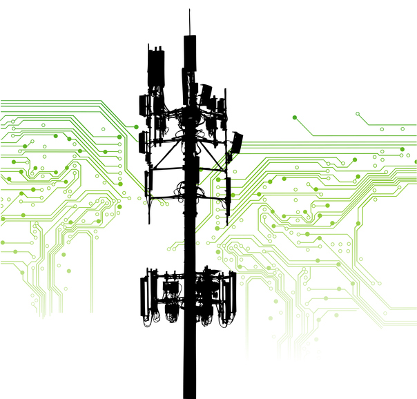
    The five-member Federal Communications Commission (FCC) voted unanimously to approve an order to allow Ligado Networks to deploy a low-power nationwide 5G network.

    The approval comes despite objections from the U.S. Defense Department (DOD), other federal agencies and major U.S. airlines, all of whom are concerned about near-band interference with GPS.

    The FCC said the approval order included stringent conditions aimed at ensuring GPS would not experience harmful interference.

    “After many years of consideration, it is time for the FCC to make a decision and bring this proceeding to a close,” said FCC Chairman Ajit Pai in an April 16 news release. “We have compiled an extensive record, which confirms that it is in the public interest to grant Ligado’s application while imposing stringent conditions to prevent harmful interference.”

    Ligado is seeking to repurpose a swath of L-band spectrum for a 5G network focused mainly on connecting smart devices and other internet-of-things services. According to the FCC, the order will “promote more efficient and effective use of our nation’s spectrum resources and ensure that adjacent band operations, including the Global Positioning System (GPS), are protected from harmful interference.”

    In response, members of both the Senate and House Armed Services Committees and other defense advocates are considering legislative action to overturn the order.

    Defense & Transportation departments object

    Photo: gorodenkoff/iStock / Getty Images Plus/Getty Images
    Photo: gorodenkoff/iStock / Getty Images Plus/Getty Images

    Two areas that rely heavily on the integrity of GPS signals include defense and transportation. The DOD issued a joint statement with the Department of Transportation (DOT) criticizing the FCC ruling.

    “Americans rely on our Global Positioning System (GPS) each day for many things: to locate citizens in need of emergency assistance through our E-911 system, to secure our financial system, to order and receive shipments, to travel by car for work and leisure, to facilitate commercial trucking and construction work, and even to make a simple cellphone call. Our departments rely on GPS each day for all those reasons as well to coordinate tactical national security operations, launch spacecraft, track threats, and facilitate travel by air and sea. The proposed Ligado decision by the Federal Communications Commission will put all these uses of GPS at risk.”

    House Armed Services Committee Chairman Adam Smith (D-Wash.) released a letter he sent to Defense Secretary Mark Esper and FCC Chairman Ajit Pai raising concerns about Ligado’s 5G network.

    “While the United States must be a leader in the implementation of 5G networks, our creation of these networks must not hamper our military’s operational capacity in any way. China’s aggressive, global promotion of its 5G companies presents a considerable security challenge that must be addressed. However, Ligado’s proposal, which seeks a portion of spectrum adjacent to that used for Global Positioning Systems, poses an even larger security risk.

    “The Department of Defense has been clear and direct: providing this license to Ligado would cause unacceptable operational impacts and adversely affect the military’s use of GPS. The military’s seamless use of GPS is vital to our national security. Our service members rely on GPS satellites for critical precision timing and navigation, and thousands of weapons systems are embedded with GPS signals.

    “While I strongly support development of the world’s most robust, safe and secure network, using L-band spectrum in such close proximity to critical GPS, as Ligado’s proposal requires, carries an unacceptable risk that far outweighs the possibility of a 5G network.”

    ‘Risk of crippling’ GPS

    Defense Secretary Mark Esper said via Twitter on Friday that the “Ligado proposal would needlessly imperil GPS-dependent national security capabilities. The Department continues to support domestic 5G options, but not at the risk of crippling our GPS networks. Nearly a dozen other federal agencies have joined us in opposing this proposal.”

    In to the FCC news release, Pai stated:

    “Although I appreciate the concerns that have been raised by certain Executive Branch agencies, it is the Commission’s duty to make an independent determination based on sound engineering. And based on the painstaking technical analysis done by our expert staff, I am convinced that the conditions outlined in this draft order would permit Ligado to move forward without causing harmful interference. For example, the draft order would authorize downlink operations at a power level that represents a greater than 99% reduction from what Ligado proposed in its 2015 application.”

    Image: A-Digit/DigitalVision Vectors/Getty Images
    Image: A-Digit/DigitalVision Vectors/Getty Images

    The release also provided this background about the Ligado proposal, and the “conditions” under which the FCC decided to approve it.

    In recent years, Ligado has amended its application to significantly reduce the power levels of its base stations from 32 dBW to 9.8 dBW (a reduction of 99.3%). Ligado has also committed to providing a significant (23 megahertz) guard-band using its own licensed spectrum to further separate its terrestrial base station transmissions from neighboring operations in the Radionavigation-Satellite Service allocation. As such, Ligado is now only seeking terrestrial use of the 1526-1536 MHz, 1627.5-1637.5 MHz, and 1646.5-1656.5 MHz bands. The Order is conditioned to reflect these technical requirements. It also requires Ligado to protect adjacent band incumbents by reporting its base station locations and technical operating parameters to potentially affected government and industry stakeholders prior to commencing operations, continuously monitoring the transmit power of its base station sites, and complying with procedures and actions for responding to credible reports of interference, including rapid shutdown of operations where warranted.

    However, The decision “appears to ignore the well-documented views of the expert agencies charged with preserving the integrity of GPS, specifically on the critical issue of what constitutes harmful interference to users of Global Navigation Satellite Systems (GNSS),” said J. David Grossman, executive director of the GPS Innovation Alliance (GPSIA). He continued,

    Headshot: J. David Grossman
    J. David Grossman

    “GPSIA has consistently advocated for adoption of the 1-dB Standard as the only reliable mechanism that provides the predictability and certainty to ensure the continuation of the GPS success story, with the support of the Department of Defense, the Department of Transportation and numerous other federal agencies. The 1-dB Standard for radiofrequency-based services is critical for GNSS. The FCC’s press release refers to conditions placed on Ligado’s application to prevent harmful interference, and GPSIA and its members intend to carefully review the details of today’s order while continuing to vigorously advocate for promoting, protecting and enhancing GPS.”

    Ligado Networks President and CEO Doug Smith issued this statement in reaction to the approval.

    “Ligado thanks the Commissioners for moving promptly to approve the order regarding our applications. We greatly appreciate their unanimous support as well as the expert engineering analysis determining that a terrestrial network can be deployed in the L-band to advance our country’s economic and security interests while fully protecting GPS. Our spectrum can be very instrumental in the transition to 5G, and we look forward to utilizing satellite and terrestrial services to deploy customized private networks and deliver innovative, next-generation IoT solutions for the industrial sector.”

    Positive reactions to the decision

    On April 20, the FCC released a compilation of responses to the decision, all of them in support.

    Attorney General Bill Barr: “I applaud FCC Chairman Pai’s proposal to make available L-band spectrum, to be used together with C-band spectrum, for deployment of advanced wireless services, including 5G. As I said in my speech at the Center for Strategic and International Studies, swift FCC action on spectrum is imperative to allow for the deployment of 5G. This is essential if we are to keep our economic and technological leadership and avoid forfeiting it to Communist China.” (Statement, 4/16/2020)

    Secretary of State Mike Pompeo: “I commend Federal Communications Commission (FCC) Chairman Pai’s draft order that would release the L-Band spectrum. Quick action on this order, in conjunction with the allocation of a portion of the C-Band for 5G, is vital to our national security and will help ensure that the United States is the global leader in advanced technologies such as AI, the Internet of Things, edge computing, and the next generation of telemedicine. Accelerating the deployment of 5G is essential to our country’s growth, and global economic security.” (Statement, 4/16/2020)

    Sen. Ron Johnson (WI): “In a time when connectivity is and will continue to be more important than ever, it’s great to see @AjitPaiFCC move forward with freeing up critical spectrum resources for #5G.” (Tweet, 4/16/2020)

    Sen. Mark Warner (VA): “As the U.S. works to lead the world in 5G innovation and promote wider high-speed internet coverage, it’s all the more important to put our valuable mid-band spectrum to use. I urge the @FCC to follow the Chairman’s lead and approve Virginia-based @LigadoInsights’s application.” (Tweet, 4/16/2020)

    Rep. Billy Long (MO): “I applaud @AjitPaiFCC and the @FCC for taking action to unlock vital L-band spectrum that has been held hostage by bureaucratic slow-walking for far too long. Jobs and 5G is a win-win for the country.” (Tweet, 4/16/2020)

    Rep. Doris Matsui (CA): “I called on the @FCC to move forward with new, innovative uses of L-band spectrum to advance 5G. Glad to see the Commission take action on this front today to encourage efficient use of our spectrum.” (Tweet, 4/16/2020)

    Former Rep. Bob Barr (GA): “Federal Communications Commission Chairman Ajit Pai’s decision to circulate a draft FCC Order would at long last move forward the process of opening up a segment of mid-band satellite spectrum for commercial use in 5G technology deserves praise. … If adopted by the five-member Commission headed by Pai, the draft Order would tangibly signal to the country and the world that the United States is committed to seize the leadership in deployment of 5G technology, a role China openly covets.” (Statement, 4/16/2020)

    American Action Forum: “More good news from the FCC! 5G is incredibly important and this is yet another example of actions that will enable innovation in 5G and support the growing number of connected devices.” (Tweet, 4/16/2020)

    American Enterprise Institute Visiting Scholar Mark Jamison:  “@FCC approval of Ligado petition should accelerate 5G, bring diversity to marketplace, and increase efficient spectrum use. … Good leadership and bipartisan effort!”  (Tweet, 4/20/20)

    American Enterprise Institute Visiting Scholar Roslyn Layton: “Kudos @AjitPaiFCC for unlocking more vital mid-band spectrum for #5G. Record of 10 years shows @LigadoNetworks took many steps with agencies and firms to address potential issues with GPS. We must move quickly on 5G!” (Tweet, 4/16/2020)

    Citizens Against Government Waste: “The FCC has the engineering expertise to determine the best use of this spectrum and whether alternative uses would cause undue interference. The adoption of the Chairman’s draft order will promote 5G and IoT development, while providing the necessary safeguards for services using adjacent bands, including GPS positioning. … The L-band would not be used at all for the foreseeable future unless the FCC takes action. Freeing up the spectrum requested by Ligado will not only expand the use of 5G, it will also help to prevent other countries, particularly China, from getting ahead of the U.S. in 5G deployment.” (Blog, 4/17/2020)

    Competitive Carriers Association: “[We] commend Chairman Pai for circulating a draft order to approve Ligado’s applications, which will make much-needed mid-band spectrum, specifically L-band spectrum, available for terrestrial use. This long-awaited, positive progress comes at a critical time for all Americans, particularly those in rural areas, who are relying on mobile connections and services more than ever before. Mid-band spectrum provides real opportunities for deploying next-generation technologies, and competitive carriers are eager to access this valuable resource to expand and enhance their networks.” (Statement, 4/16/20)

    Competitive Enterprise Institute: “Access to spectrum is crucial for our modern economy, connecting everything from radios, to cellphones, to satellites. But for too long, turf-wars between federal regulatory agencies have left spectrum bands largely unavailable for valuable commercial applications. Today’s FCC decision wrests spectrum away from bureaucratic waste and delivers it into the hands of people who will aide our economic recovery and resiliency in the aftermath of the COVID-19 pandemic.” (Statement, 4/16/2020)

    CTIA—The Wireless Association: “We’re pleased to see that the FCC has managed to cut through the red tape to make a decision on Ligado. This multi-year process reveals the challenges at play in our nation’s spectrum policy and the need for stronger support for new commercial wireless services. We need to all learn lessons from this process and ensure that decisions on key spectrum bands like lower 3 GHz occur in a more expedited and collaborative manner.” (Statement, 4/16/2020)

    FreedomWorks: “Freeing up broadband spectrum will make America a global technological leader and will lead to innovations and developments that will improve quality of life across the country. Chairman Pai and the FCC should be applauded for their work resolving these matters[.]” (Blog, 4/15/2020)

    Free State Foundation: “Chairman @AjitPaiFCC has made a commendable decision to act on @LigadoNetworks’ proposal to put L-band spectrum into use for next-gen wireless services. This move takes seriously the @FCC’s responsibility and the urgent need for more commercial spectrum.” (Tweet, 4/16/2020)

    Georgetown Law Institute for Technology Law & Policy Distinguished Fellow Gigi Sohn: “This decision was a long time coming, but it’s the right one. … Kudos to @AjitPaiFCC for having the fortitude to move this forward.” (Tweet, 4/16/2020)

    Information Technology & Innovation Foundation: “Great to see @FCC taking steps to finally approve @LigadoNetworks waiver for terrestrial use of their spectrum. This will be a boon to industrial IoT connectivity, bringing more productivity, safety, and resiliency for users of the network.” (Tweet, 4/16/2020)

    International Center for Law & Economics: “Promoting deployment of 5G & next-gen IoT devices means finding new ways for incumbents to responsibly operate in ever-closer proximity. The @FCC’s Ligado order does that. Credit to @AjitPaiFCC for finding a way fwd that promotes innovation while limiting the risk of interference.” (Tweet, 4/16/2020)

    Lincoln Network: “Access to spectrum is an essential feature in any working 5G plan. Frankly, one key barrier in opening up this vital resource is government’s stronghold on ‘beachfront’ spectrum whether they own it or not. … This proceeding has been in regulatory limbo for several years due in large part to government stakeholders’ speculative interference claims regarding GPS-applications. … The FCC’s draft order in this proceeding provides enough protection for incumbents in adjacent bands, adds more competition into the 5G-IoT space, and allows consumers to have more access to broadband. Everybody wins.” (Blog, 4/16/2020)

    Mercatus Center Senior Fellow Brent Skorup: “Too often new tech is stalled by FCC regulation and incumbents. Chairman Pai pledged to breathe new life into Sec. 7. It’s great to see Chairman Pai and the FCC act on that pledge, liberalize spectrum, and expedite the deployment of new wireless services.” (Tweet, 4/16/2020)

    National Security Institute: “Big move by @FCC Chairman @AjitPaiFCC today to support US 5G availability. This is a key nat sec issue w/ threat posed by China + econ benefits of broad 5G deployment in US.” (Tweet, 4/16/2020)

    New America Foundation’s Open Technology Institute: “Kudos to @AjitPaiFCC @FCC for again standing up to Fed agencies trying to hoard spectrum they are not using – or, in this case, which is licensed to @LigadoNetworks! A big plus for #5G wireless ecosystem if it’s built out.” (Tweet, 4/16/2020)

    R Street Institute: “If you can change your business model to be more productive and profitable, without hurting anyone else, then regulations shouldn’t stand in your way. Well done, @FCC!” (Tweet, 4/16/2020)

    Progressive Policy Institute: “We applaud the FCC’s ongoing efforts to accelerate the deployment of 5G. Repurposing this commercial spectrum for a mobile broadband network is another step in the right direction.” (Tweet, 4/16/2020)

    Public Knowledge: “The Chairman’s proposed Order reveals how the FCC has worked to both protect incumbent GPS users while allowing for pro-competitive commercial licensing of spectrum. … Congress has entrusted the FCC to strike the proper balance between the needs of incumbents and the potential benefits to new entrants or new users, and here, the FCC gets it right. In approving Ligado’s license, the FCC has taken an important step forward in its role as the sole arbiter of spectrum disputes and, in this instance, has correctly sided on behalf of the public interest to help deliver the potential of 5G to more Americans.” (Statement, 4/16/2020)

    Technology Policy Institute: “Allowing the Ligado spectrum to lie fallow would represent a waste of valuable resources that could provide substantial benefits for consumers in the form of new Internet of Things and other uses. … Failure to approve the Ligado license modifications would have the opposite effect, transferring a large block of spectrum from the commercial sector back to the government. The Commission’s action today will avoid that outcome.” (Statement, 4/16/2020)

    Wireless Infrastructure Association: “WIA applauds Chairman Pai for circulating a draft order to approve Ligado’s plans to deploy a nationwide network that would primarily support 5G and IoT services. After years of diligence, study, and discussion, today’s action is further evidence that the FCC bases its decisions on science and engineering. Freeing up more spectrum, especially mid-band spectrum, is vital to 5G deployment. Ligado’s proposal offers an enormous opportunity for infrastructure investment, deployment, and connectivity for Americans across the country right when we need it most.” (Statement, 4/16/2020)

  • Quectel offers 5G sub-6GHz module for mass deployment

    Quectel offers 5G sub-6GHz module for mass deployment

    Photo: Quectel
    Photo: Quectel

    Quectel Wireless Solutions‘ RG500Q-EA 5G NR module has achieved commercial readiness and is now available to support global customers with mass deployment.

    The module features the Qualcomm Snapdragon X55 5G modem. It is designed for a variety of industrial and consumer internet of things (IoT) applications, including business routers, home gateways, customer premises equipment (CPE), MiFi, industrial IoT (IIoT), industrial laptops, PDAs, video surveillance, digital signage, 4K/8K live streaming and many other bandwidth-intensive use cases.

    The Quectel RG500Q-EA supports major sub-6GHz frequency bands as well as worldwide LTE-A and WCDMA network coverage, allowing customers to deploy their IoT solutions flexibly in Asia-Pacific, Europe and the Middle East.

    Quectel RG500Q is a series of 5G Sub-6GHz modules optimized specially for IoT and M2M applications. Adopting the 3GPP Rel. 15 technology, it supports both 5G NSA and SA modes.

    The RG500Q is provided in two variants: RG500Q-EA and RG500Q-NA. The module supports Qualcomm IZat location technology Gen9C Lite (GPS, GLONASS, BeiDou/Compass, Galileo and QZSS). The integrated GNSS receiver greatly simplifies product design and provides quicker, more accurate and more dependable positioning capability.

  • PCCW Global and UniStrong to link GNSS tech with telecoms, airports

    PCCW Global and UniStrong to link GNSS tech with telecoms, airports

    PCCW and Unistrong will collaborate on developing GNSS technologies and services for the telecommunications and aviation industries.

    PCCW Global is the international operating division of HKT, a Hong Kong telecommunications service provider. Beijing UniStrong Science and Technology Corporation Limited is a navigation and positioning company.

    The collaboration intends to link satellite positioning to 5G mobile networks to provide positioning data accurate to within centimeters. The link will unlock new services for telecommunications providers rolling out new networks to support the internet of things (IoT), smart cities and the aviation industry.

    UniStrong’s experience in developing high-precision products, solutions and services will enable PCCW Global to integrate new services with 5G mobile infrastructure, providing high-precision positioning (HPP) accurate down to centimeter levels.

    This integration of precision positioning expertise and technologies has the potential to revolutionize industries such as commercial drone operations, autonomous vehicles and transportation, logistics, construction, agriculture and others.

    New Airport Technology

    The integration of technologies will also enable the provision of smart aviation solutions for airport authorities. Based on high-precision positioning and navigation technology, new airports will be able to leverage smart civil construction works that will facilitate safer and more efficient airport operations.

    These aviation technologies will also be able to integrate with a wide variety of IoT sensors, edge-computing capabilities, machine vision and other artificial intelligence (AI) technologies to create intelligent surveillance platforms capable of managing and enhancing many aspects of airport safety and efficiency.

    The installed base of GNSS devices in use globally is forecast to increase from 6.4 billion in 2019 to 9.6 billion in 2029, with Asia-Pacific continuing to account for more than half of the global GNSS market.

    In terms of global annual GNSS receiver shipments, the market is forecast to grow from 1.8 billion units in 2019 to 2.8 billion units in 2029, according to the 2019 GNSS Market Report by the European Global Navigation Satellite Systems Agency (GSA).

    “As a global ICT service provider with extensive high speed fiber networks and cloud services coverage worldwide, we are delighted to cooperate with UniStrong with the aim to offer unique, game-changing solutions in Satellite High Precision Positioning (SHPP) and Continuous Operating Reference Station (CORS) solutions ideally suited to the new era of 5G, IoT and smart cities,” said Benney Cheng, head of Strategic Project and Development, PCCW Global.

    “The cooperation between UniStrong and PCCW Global will further promote the development of professional solutions and applications that are oriented towards global users’ needs,” said Jun Shen, corporate vice president and chief scientist of UniStrong. “Based on GNSS technologies, and deeply integrated with communication technologies, Big Data, Industry 4.0, IoT, artificial intelligence and other technologies, these solutions will empower and influence more industries and countries, and promote BDS/GNSS global applications and international services worldwide.”

    Photo: Bill Oxford / iStock / Getty Images Plus / Getty Images
    Photo: Bill Oxford / iStock / Getty Images Plus / Getty Images
  • Garmin to use SiTime’s MEMS for timing

    Garmin to use SiTime’s MEMS for timing

    Logo: SiTime

    Garmin International Inc., a unit of Garmin Ltd., has chosen SiTime’s micro-electromechanical system (MEMS) timing solutions for several of Garmin’s automotive, aviation, marine, fitness and outdoor products.

    “Garmin makes products that are engineered on the inside for life on the outside,” said Patrick Desbois, Garmin executive vice president of operations. “Our innovation focuses on developing technologies that enable our customers to enrich their experiences as they pursue their passions. SiTime’s MEMS timing solutions help extend battery life across several of our product lines.”

    SiTime timing solutions are the heartbeat of customers’ electronic systems. With the deployment of 5G, internet of things (IoT) and automotive electronics in challenging outdoor environments, manufacturers will need timing solutions that enable environmental robustness and solve difficult challenges, such as power, size, and reliability. With the proliferation of electronic devices, the timing market is expected to grow to $10.1 billion by 2024.

    “Garmin creates products for active people,” said Piyush Sevalia, executive vice president of marketing at SiTime. “Precise time is at the heart of every GPS receiver and impacts the speed of signal acquisition as well as position accuracy.

    “Garmin’s outdoor products encounter many environmental stresses such as shock, vibration, rapid temperature changes and extreme temperatures. SiTime’s MEMS timing solutions are engineered to provide the highest level of robustness to such stressors and provide a powerful value-add to Garmin’s high-performing, robust and reliable products.”

  • Telstra partners with TEOCO on UAV strategy

    Telstra partners with TEOCO on UAV strategy

    Telstra logoAnalytics provider Teoco has been selected by Telstra — a mobile network in Australia — to assist with the development of its UAV strategy.

    Telstra will use Teoco’s AirborneRF solution to assess the readiness of its radio access network for future UAV applications, including communications, navigation, surveillance, safety and identity.

    Teoco is a provider of analytics, assurance and optimization solutions to more than 300 communication service providers (CSPs) and OEMs worldwide.

    Already deployed by several tier-one operators globally, AirborneRF ensures effective, mission-critical connectivity to enable effective traffic management and control for UAVs in the lower airspace. Telstra will use the solution to develop a platform for enabling a multitude of mission-critical services, vital in supporting successful UAV operations.

    The platform provides a link between cellular networks and aviation systems, such as air traffic management (ATM), unmanned traffic management (UTM) and flight information management systems (FIMS).

    TEOCO’s AirborneRF solution will play an important role in assisting Telstra enable a safe, equitable, secure and reliable urban air space platform. This has become all the more important to Telstra following Uber’s decision in 2019 to use Melbourne as one of three pilot cities to test out its “flying taxis” — the pilot is expected to begin this year, with commercial operations planned for 2023.

    Telecommunications companies can provide needed UAV services via their mobile networks. For the internet of things (IOT), they can provide drone registration, activation and identification. For 5G, they can provide super low-latency remote command and control and high-resolution video carriage.

    “We have been running a number of drone-related technology assessments with various industry customers, within law enforcement, humanitarian aid, post disaster, first responders and city councils, over the past 12 months,” said Thomas Neubauer, vice president of Business Development, TEOCO.

    “Commercial UAVs present a huge opportunity for [[telecommunications]] operators, but only if supporting mobile networks deliver the required connectivity to keep them airborne,” Neubauer said. “Mobile networks were not designed to meet the needs of the aviation industry, so tight focus is needed to guarantee the quality of service needed to safeguard the additional revenue that connected skies promise. Our Airborne RF solution offers this guarantee to a growing number of major operators around the world.”

  • U-blox SARA-R4 cellular modules integrates GNSS technology

    U-blox SARA-R4 cellular modules integrates GNSS technology

    Photo: u-blox
    Photo: u-blox

    U-blox, a global provider of leading positioning and wireless communication technologies, has extended its SARA-R4 family of LTE-M / NB-IoT and EGPRS cellular modules to include variants with the hardware and software features necessary to enable end-to-end security features and services for internet of things (IoT) data, devices and ecosystems.

    “The new SARA-R422 product series offers superior security protection, industrial output power to grant best coverage even in weak signal conditions, and everywhere location using state-of-the-art u-blox GNSS technology,” said Rado Sustersic, senior product manager, Product Center Cellular at u‑blox. “These represent valuable functionalities tailored specifically to the LPWA IoT market.”

    M8 GNSS. The SARA-R422M8S is pre-integrated with the u-blox M8 GNSS (global navigation satellite system) receiver and a separate GNSS antenna interface. This provides highly reliable, accurate positioning data simultaneously with LTE communications.

    The module also supports hybrid positioning strategies, in which positioning data provided by satellite constellations is enhanced with data from the u-blox CellLocate service, ensuring that location data is always available everywhere.

    The SARA-R4 series is designed for a wide range of mission-critical IoT solutions such as connected healthcare, industrial monitoring, point of sale and vending terminals, tracking and telematics devices, as well as smart lighting solutions and building automation.

    Security. Security features include a unique and immutable root of trust (RoT) for each device, as well as access to a scalable pre-shared key (PSK) management system. This provides the foundation for a trusted set of advanced security functionalities to enable data encryption and decryption, both on‑device as well as from‑device‑to‑cloud.

    The choice of PSK-based security, rather than the more complex and computationally intensive public key infrastructure (PKI) approach, strikes the right balance between implementation costs and level of security protection for many IoT applications.

    Robustness. All SARA-R422 modules provide 23-dBm output power, allowing the end device to properly operate in all network conditions. This means no issues at cell edges, no coverage issues in weak signal conditions, and, even more importantly, no unwanted re-transmission that shortens battery life by increasing transmit time and overall system power consumption.

    The series is designed for long working lifetimes in the field, through the inclusion of support for LWM2M, a lightweight machine-to-machine communications protocol ideal for IoT applications with the possibility of updating the firmware of modules already in the field over the air via the uFOTA (Firmware Over The Air) client/server firmware service provided by u-blox.

    The u-blox SARA-R4 series will be presented at Embedded World in Nuremberg, Germany, Feb. 25-27, at Hall 3/Stand 3-139.

  • Semtech releases LoRa Edge for IoT asset tracking

    Semtech releases LoRa Edge for IoT asset tracking

    Image: Semtech
    Image: Semtech

    Semtech Corporation, supplier of high-performance analog and mixed-signal semiconductors and advanced algorithms, has launched LoRa Edge, a versatile and low-power software defined LoRa-based platform.

    Semtech said LoRa Edge will enable a wide portfolio of applications for indoor and outdoor asset management, targeting industrial, building, home, agriculture, transportation and logistics markets.

    The first product from this portfolio is a geolocation solution for development of internet of things (IoT) devices for asset management applications. It features low-power Wi-Fi and GNSS sniffing capabilities combined with LoRa Cloud geolocation and device management services to significantly reduce the cost and complexity of locating and monitoring IoT assets.

    “Semtech continually delivers internet of things (IoT) solutions that simplify and accelerate the development of LPWAN applications,” said Pedro Pachuca, director of IoT Wireless in Semtech’s Wireless and Sensing Products Group. “LoRa Edge and LoRa Cloud geolocation services enable customers to develop ultra-low power applications for a variety of industries and will expand the mass adoption of LoRa in the IoT ecosystem.”

    Over the next decade, 500 billion devices are expected to connect to the internet (according to Cisco), as organizations continue to shift towards a more IoT-focused business strategy, and the majority of those IoT devices require some form of localization capability either at point of install or through the assets life.

    The LoRa Edge geolocation platform will enable solution providers to leverage the unique localization capabilities of LoRa as well as GNSS and Wi-Fi scanning capabilities from a single chip solution, allowing customers to choose the best localization tool for the application task they are addressing.

    By removing the need for incremental GNSS and Wi-Fi components, LoRa Edge reduces the bill of material (BOM) costs of devices and significantly reduces design and procurement complexity, Semtech said.

    The first LoRa Edge chipset targeted with geolocation (LR1110) is available today; more products from this portfolio will be released in the first half of this year.

    Product Features

    Multi-Purpose Radio Front-End

    • 150 – 2700 MHz continuous frequency synthesizer range
    • GPS/BeiDou scanning
    • Wi-Fi passive scanning

    Low-Power LoRa/(G)FSK RF Transceiver

    • Worldwide frequency bands support in the range 150 – 960 MHz
    • High power PA path +22 dBm
    • High efficiency PA path +15 dBm
    • Fully compatible with the LoRaWAN standard

    Cryptographic Engine

    • Hardware support for AES-128 encryption/decryption based algorithms
    • Handling device parameters such as DevEUI and JoinEUI
    • Protects confidential information such as encryption keys
    • Stores NwkKey, AppKey, as defined in the LoRaWAN standard
  • Quectel collaborates with Microsoft and Qualcomm on IoT solutions

    Quectel collaborates with Microsoft and Qualcomm on IoT solutions

    Photo: Quectel
    Photo: Quectel

    Quectel Wireless Solutions is collaborating with Microsoft and Qualcomm Technologies to integrate its new LPWA module BG95 with Microsoft’s Azure Device SDK.

    The integration will provide direct and secure connections to Azure IoT Hub and provide full support for Azure device management capabilities.

    Targeting global markets, the BG95 module is a cost-optimized, highly-integrated variant supporting integrated GNSS, Cat M1, Cat NB2 and EGPRS (also called EDGE). The module complies with 3GPP Release 14 and delivers improved capabilities in power consumption, data rates and hardware-based security.

    The BG95 cellular module is based on the Qualcomm 9205 LTE modem, to be integrated with Microsoft’s Azure Device software development kit (SDK). As a result, customers can connect their BG95 devices to the Microsoft Azure cloud where they can build, manage and deploy internet of things (IoT) solutions at scale, significantly accelerating time to market.

    By integrating RAM/flash, an ARM Cortex A7 processor supporting ThreadX, the BG95 is engineered to reduce power consumption significantly in idle mode.

    By doing this, the BG95 has the potential to support decade-plus battery life, which is critical for IoT devices serving long life spans, such as asset trackers, smart meters, smart city sensors, home security and wearable trackers.

    Additionally, Azure IoT is built for security. It simplifies the complexity of IoT security solutions with built-in protection at each stage of deployment (including cloud services and devices) and minimizes security weaknesses wherever they exist. Leveraging Azure IoT security features, Quectel BG95 will offer IoT devices end-to-end security capability in order to prevent potential risks.

    “We’re excited for the Azure edge device ecosystem to continue to grow. Our partnership with Quectel and Qualcomm Technologies will deliver what our customers need — bringing together ultra-low power cellular modules and Azure to drive their digital transformation,” said Roanne Sones, corporate vice president at Microsoft.

    “The BG95 module is the first Qualcomm 9205 platform to support IoT Plug and Play, accelerating LPWAN solution deployments like smart meters and asset trackers that connect seamlessly to our IoT Central offering,” Sones said.

    “With its cutting-edge performance and power-saving capabilities, the Qualcomm 9205 LTE Modem is the gold standard for multimode IoT modules looking to offer NB-IoT, Cat-M1, GPRS, and GNSS connectivity,” said Jeffery Torrance, vice president, business development, Qualcomm Technologies, Inc. “We are proud to continue our long-standing collaboration with Quectel to jointly drive the IoT forward.”

    “We are happy that the BG95-M3 has been verified on Microsoft Azure IoT Plug and Play. This validates our ability to jumpstart customers’ IoT projects with pre-tested modules and operating system combinations. Leveraging our close relationship with Microsoft and Qualcomm Technologies, we will jointly provide more integral ‘Device-Cloud’ solutions to customers,” said Doron Zhang, Chief Operation Officer, Quectel. “As one of the first wave Azure IoT PnP partners, Quectel has worked with Microsoft on LTE Mobile Broadband (MBB) modules, which have been widely adopted by top laptop OEMs. In the future, we will extend the partnership to more fields, such as Artificial Intelligence (AI) and Intelligent Edge, in order to help the Microsoft partner ecosystem connect their devices even more intelligently.”

  • Testbed enables infrastructure for autonomy, smart cities

    Testbed enables infrastructure for autonomy, smart cities

    Rooftop view of the central parts of Aarhus with the harbor area and the sea in the background. (Photo: DTU Space)
    Rooftop view of the central parts of Aarhus with the harbor area and the sea in the background. (Photo: DTU Space)

    A testbed in an active urban center can show real-world effects on GNSS as an aid for developing autonomous systems for green mobility, smart-city applications or transportation, to name a few.

    Sited in Denmark, the 600-square-kilometer Testbed in Aarhus for Precision Positioning and Autonomous Systems (TAPAS) covers both a densely populated city center and suburbs, a large industrial harbor and parts of Aarhus Bay. Aarhus is the second largest city in Denmark with a population of 350,000 people.

    The GNSS antenna at TAPAS station TA01. (Photo: DTU Space)
    The GNSS antenna at TAPAS station TA01. (Photo: DTU Space)

    Based on RTK methodology, TAPAS is a sound ground-based testbed to support, test and validate technological developments with a need for fast, efficient, flexible and reliable precision positioning. It is designed as a geodetic innovation platform, with both physical and virtual networks providing positioning to the centimeter (cm) level.

    Autonomous systems within transportation, agriculture and environmental monitoring constitute a large growth area for businesses and governments. Automated vehicles, drones and vessels are linked closely to geodetic infrastructure and communications networks such as 5G. TAPAS provides developers in these fields with opportunities to observe GNSS in urban canyons and under canopies, as well as challenges for coastal marine applications. The testbed is available for third-party research projects, and testing of ideas, initiatives and concrete prototypes.

    TAPAS is fully funded and owned by the Danish Agency for Data Supply and Efficiency (SDFE), the Danish agency for geodesy and geographical data. TAPAS is developed by the National Space Institute at the Technical University of Denmark (DTU Space), and is supported by the city of Aarhus. The TAPAS testbed was established partly because of Denmark’s National Space Strategy, which points to the new technological development within positioning, as well as possibilities for use of Galileo, the European GNSS, to the benefit of as many citizens as possible.

    In this article, we review the TAPAS testbed, including design and installation of the GNSS reference stations and the data-processing center, as well as initial performance testing carried out by DTU Space.

    Network of GNSS Reference Stations

    The network of TAPAS stations in and around the city of Aarhus in Denmark. (Map: DTU Space)
    The network of TAPAS stations in and around the city of Aarhus in Denmark. (Map: DTU Space)

    The basic component of TAPAS is high-accuracy carrier-phase-based GNSS positioning using the network RTK methodology, which can provide real-time position accuracies for the end user down to the cm level.Essentially, TAPAS is based on a network of 11 GNSS reference stations as well as data communication infrastructure, a central processing facility with a data server, processing software and data storage.

    TAPAS was designed to provide real-time position uncertainties for objects in motion within 1 cm in three dimensions (1 cubic cm), for end users with modern GNSS equipment. A dense network of GNSS reference stations was originally designed with stations 5 km apart in the city center and up to 10 km apart in the suburbs.

    Because suitable locations had to be found, in the final network distances range from 4.1 km to 22.3 km, with the longest distances across the water to station TA04 (see the network plot in the graphic above).
    Stations TA01, TA03, TA05, TA06 and TA08 are in the city center. Stations TA02 and TA04 are across Aarhus Bay, ensuring coverage for marine applications and contributing to more robust positioning near the sea and in the harbor area around station TA01.

    TAPAS Stations

    The TAPAS GNSS reference stations are equipped with the newest generation of GNSS receivers and antennas capable of tracking all available signals from the GPS, GLONASS, Galileo and BeiDou systems. The stations also have an antenna splitter, power supply, fuse box, programmable logic controller (PLC) for monitoring and control, trustgate, modem and uninterruptible power supply with battery pack (Figure 1). All units were integrated in the cabinets and tested in the lab before installation The stations are modular and flexible for future iterations and updates.

    The receivers can be accessed remotely via a VPN line to a web interface for monitoring, changing settings or firmware updates. All TAPAS stations transmit data to servers at DTU Space where the data is used for estimation of RTK corrections. Also, data is transmitted to servers at the SDFE for storage and backup (Figure 1).

    Figure 1. Design schematics of the TAPAS stations. (Image: DTU Space)
    Figure 1. Design schematics of the TAPAS stations. (Image: DTU Space)

    After installation in the fall of 2018, GNSS data quality was verified for each station by estimating preliminary positions and analyzing data quality. Also, signal strength as given by the carrier to noise ratio (C/N0) of the received signals was analyzed and plotted with 24 hours of data from each of the stations (Figure 2).

    "Figure

    Network Real-Time Kinematic (RTK)

    Data from the TAPAS stations streams in real time to the Central Processing Facility (CPF) operated at a dedicated server at DTU Space in Lyngby, North of Copenhagen. The GNSS observations are processed using the GNSMART 2 software from Geo++, where corrections for network RTK positioning are estimated. The corrections are estimates for errors affecting the GNSS positioning, such as inaccuracies in satellite positions and clock drift parameters as well as ionospheric and tropospheric effects. The dense network of reference stations in TAPAS will assure that corrections for the atmospheric effects will be of very high quality.

    For estimation of the RTK corrections, standard software settings are used. All corrections are estimated by a state space representation (SSR) technique, where error sources are modeled individually. This means TAPAS can deliver both RTK corrections and corrections for precise point positioning (PPP).

    TAPAS corrections are generated in the RTCM format and output using the NTRIP protocol. Registered users can access the corrections through the internet via an NTRIP caster. On the user side, the TAPAS corrections are applied in the positioning process of a GNSS receiver. To make full use of the TAPAS data, user equipment should be capable of tracking carrier-phase-based GNSS data and applying the TAPAS correction data supplied in the RTCM version 3.x format.

    An example of a use of TAPAS is provided in the photo in Figure 9 below where the authors of this article tested the position accuracy of TAPAS for a typical land surveying task, using a Septentrio Altus APS3G receiver with an allegro2 controller unit for RTK positioning. The user’s GNSS equipment can, however, be many other different types and makes of GNSS antennas and receivers, and the equipment can be installed on many different platforms for instance in vehicles, on drones, in robots etc.

    Geodetic Basis

    When determining positions with uncertainties at the 1-cm level, it is important to be aware of the geodetic reference frame used for the positioning. In this case, coordinates for the TAPAS stations have been estimated by DTU Space, using Bernese GNSS software, in the national Danish reference frame which is a realization of the European Terrestrial Reference System (ETRS).

    When applying corrections from the TAPAS caster in the positioning calculations at the user side, positions will be obtained within the same reference frame (coordinate system). In this case, where the national geodetic reference frame is used, this means that the user will obtain positions compliant with maps, charts and other types of geodata geo-referenced in the same coordinate system.

    For 3D positioning, the Danish geoid model must be applied on the user side to obtain heights relative to mean sea level in the national Danish Vertical Reference (DVR90).

    It is possible to configure the setup of the central processing facility using another reference frame for TAPAS given that precise coordinates for the TAPAS stations can be provided in the given reference frame. Future work with TAPAS can involve the use of dynamic geodetic reference frames and transmission of coordinate transformation parameters to the users.

    Performance Testing

    After the stations were installed, DTU Space conducted performance testing, including testing data communication between the TAPAS stations and the TAPAS server, analyses of data completeness from the TAPAS stations, and field tests carried out after the network RTK processing had become sufficiently stable.

    Performance test in static mode. In February 2019, a static mode test took place in a park-like area within the three innermost stations. Two different high-accuracy survey-grade RTK-receivers were used for the field test. RTK positions were estimated at 1 Hz for 30 minutes. For each minute, an average position was calculated based on the 60 observations, and for each of the minute-bins the standard deviation with respect to the reference position was computed.

    Test location indicated with purple circle in the network plot. (Image: DTU Space)
    Test location indicated with purple circle in the network plot. (Image: DTU Space)
    Altus APS3G unit mounted at the test location. (Photo: DTU Space)
    Altus APS3G unit mounted at the test location. (Photo: DTU Space)

    The results are shown in the plots below, where standard deviations are provided for each epoch (i.e., for each bin of 60 seconds).

    Standard deviation in meter for each 60 second with GNSS receiver Altus NR3 (left) and Altus APS3G (right). Results provided in meter. (Images: DTU Space)
    Standard deviation in meter for each 60 second with GNSS receiver Altus NR3 (left) and Altus APS3G (right). Results provided in meter. (Images: DTU Space)

    In the plots, results are provided for the vertical (red), the horizontal (blue) and the 3D position (green). Results of using the two different receivers are comparable, and focusing on the 3D solutions the largest standard deviation is 1.6 cm which is for the fourth epoch with receiver APS3G. Most of the 3D results shown in the plots are better than 1 cm.

    The same test was carried out using a dual-frequency non-survey-grade receiver developed for machine control and autonomous vehicle applications. This receiver was connected to the same antenna mounted on a tripod. Results of using this receiver in static mode are shown in the plot below. In this case, the 3D results are all better than 3.1 cm, and many of the 3D results are better than 1 cm in this open test area.

    Standard deviation for each 60 second with GNSS receiver u-blox F9P dual frequency (DF). Results provided in meter. (Image: DTU Space)
    Standard deviation for each 60 second with GNSS receiver u-blox F9P dual frequency (DF). Results provided in meter. (Image: DTU Space)

    Performance test in kinematic mode. In the same area used for the static test, a kinematic test was carried out with the same three receivers.

    The test was performed using a camera dolly and by placing approximately 10 m of rail on the ground. The camera dolly was pulled back and forth along the rail, a setup that provided a stable trajectory for testing positioning performance while the GNSS antennas were moved slowly and smoothly. A rigid bench, where the GNSS antennas could be mounted, was constructed and installed on the dolly. The three GNSS receivers with antennas were mounted on the bench, and the dolly was pulled back and forth along the tracks 10 times.

    Kinematic Test: Camera dolly with GNSS equipment pulled along tracks. (Photo: DTU Space)
    Kinematic Test: Camera dolly with GNSS equipment pulled along tracks. (Photo: DTU Space)

    For each 1-meter section of track, the standard deviation of the differences with respect to the reference trajectory of the 10 repetitions was calculated. Results for the two survey-grade receivers are shown in the plots in Figure 3. All of the 3D standard deviations are better than 1 cm for both survey-grade receivers.

    Figure 3. Kinematic test results are provided for the vertical (red), horizontal (blue) and 3D (green) positions. (Image: DTU Space)
    Figure 3. Kinematic test results are provided for the vertical (red), horizontal (blue) and 3D (green) positions. (Image: DTU Space)

    The non-survey-grade dual-frequency receiver also was mounted on the test bench, and the results of using this receiver are shown in the plot below. With this receiver, the 3D results are below 2.1 cm for all sections of the trajectory, except for the first meter, a deviation that may have been caused by issues with initialization of the test.

    Binned standard deviation of 10 repetitions with GNSS receiver u-blox F9P dual frequency (DF). Results provided in meter. (Image: DTU Space)
    Binned standard deviation of 10 repetitions with GNSS receiver u-blox F9P dual frequency (DF). Results provided in meter. (Image: DTU Space)

    These tests show that it is possible when using TAPAS to obtain position solutions at the cm-level in open areas in both static and kinematic mode.

    Performance test in dynamic mode. In November 2019, DTU Space carried out a performance test of TAPAS in dynamic mode, using a car with roof-mounted GNSS equipment. The car was driven within the TAPAS coverage area, passing through urban canyons, open streets and the harbor area. During the test, the car drove in normal Aarhus traffic, at speeds varying from zero at traffic lights up to 60 km/h on the wider roads leading into the city center.

    Four different receivers were strapped in the car and connected to either a small patch antenna or a survey-grade antenna mounted on the roof. A survey-grade receiver was mounted on the roof.

    Three different GNSS antennas mounted on the roof of the car used for dynamic testing. (Photo: DTU Space)
    Three different GNSS antennas mounted on the roof of the car used for dynamic testing. (Photo: DTU Space)

    Data from the receiver was converted to KML files, which can be used with Google Earth to illustrate the quality of the positioning obtained during the drives through the city. The plot in Figure 4 shows the quality of the position solution. The best quality is obtained when the ambiguities are fixed, such as an RTK fixed solution at the cm level (green). The second-best quality is with ambiguities estimated to float values, such as an RTK float solution at the dm level (purple). Orange shows differential position solutions at the meter level when corrections for the carrier-phase data have not been obtained. Finally, a few positions were stand-alone GNSS solutions when no aiding from TAPAS was applied in the roving GNSS receiver (blue).

    Figure 4. Quality of RTK positions obtained during one drive through the City of Aarhus. (Map data: Google, TerraMetrics)Photo:
    Figure 4. Quality of RTK positions obtained during one drive through the City of Aarhus. (Map data: Google, TerraMetrics)Photo:

    The plot clearly shows, as expected, that the quality of the positions determined by the survey-grade receiver in the car is good most of the time. But it suffers in areas with narrow streets aligned with buildings or trees.

    These results do not tell the actual uncertainty of the position solutions. But GNSS carrier-phase data collected with one of the receivers in the car during the drive will be post processed to serve as a reference trajectory. Upcoming analyses of the data will then reveal the uncertainty of the positions determined in real time as compared to the post-processed reference trajectory.

    Test Conclusion. After the field tests, we conclude that the TAPAS testbed is able to provide correction data that makes it possible to perform GNSS-based positioning in real time in both static and dynamic mode with position uncertainties at the cm-level. Further, as we analyze the test data thoroughly, TAPAS will be able to set a tone for new research. For instance, the plot in Figure 4 provides a foundation for testing assistance procedures to gain better coverage in the most densely built areas. In this way, TAPAS will aid research into feasible infrastructure for the technologies of tomorrow, such as autonomous driving.

    Outlook and Future Work

    Because TAPAS is not commercial, it is possible, upon agreement with the SDFE, to make changes to the system to adapt to specific testing or development needs. Examples are removing data from some stations in the estimation of RTK correction data, installing an extra receiver in one or more stations using the antenna splitters, or making changes to the settings in data processing on the TAPAS server for shorter time intervals.

    At DTU Space, plans for the testbed include further development of software for ionosphere and integrity monitoring. The station receivers can estimate total electron content (TEC) along the GNSS signal path in Earth’s atmosphere, as well as indices for ionospheric scintillation. DTU Space is researching using this output for an ionosphere monitoring service and to develop it into an integrity monitoring service for GNSS users.

    Upcoming additions to the RTCM data format will support more advanced modeling of the effects of the ionosphere and troposphere, and this will allow for full benefit of the TAPAS SSR network corrections. Research on such models to be applied on the server side, as well as on the user side, will be carried out by DTU Space and tested with TAPAS as a contribution towards the integration, or hybridising, of PPP and RTK. This is also referred to as PPP-RTK positioning which is expected to be especially useful for mass market applications such as autonomous driving. When implemented in TAPAS, such solution may effectively increase the number of simultaneous users as well as use-cases for TAPAS.

    TAPAS provides many opportunities for testing precision or high-accuracy applications, such as autonomous vehicles, vessels, drones and robots; location-based services requiring high accuracy on various digital platforms; and solutions for a more digitized and intelligent city environment through smart-city and green mobility initiatives.

    TAPAS is prepared for the implementation of the coming 5G technologies, and station intercommunication capabilities enable testing of internet of things (IoT) technologies where precision positioning is part of the development. The testbed also provides an excellent environment for validation of new services such as the Galileo High Accuracy Service (HAS). Another area in which TAPAS can play an important role is verification and validation of future 5G-based positioning services.

    For more on TAPAS, visit www.tapasweb.dk/english.

    Acknowledgments

    The TAPAS testbed was developed with close cooperation between DTU Space and SDFE. SDFE contributors include Kristian Keller, Casper Jepsen, Henrik Olsen, Martin Skjold Grøntved, Brigitte Rosenkranz, Maria Rask Mylius and Søren Fauerholm Christensen. DTU Space contributers include Ole Bjerregaard Hansen, Finn Bo Madsen, Lars Stenseng, Daniel Haugård Olesen, Stefan Emil Steffensen, Thor Heine Snedker, Per Knudsen and Niels Andersen.

    Manufacturers

    The GNSS receivers at the TAPAS stations are Septentrio PolaRx5S, and the antennas are Leica AR20. For field testing, a Septentrio Altus NR3 receiver, a Septentrio Altus APS3G receiver and a u-blox ZED F9P dual-frequency receiver were used. The TAPAS station cabinets were assembled and mounted by Nordtec-Optomatic A/S. The TAPAS testbed software solution is based on the GNSMART 2 software package from Geo++ GmbH. Data analyses and processing has been carried out using the Septentrio SBF Analyser and SBF Converter, the RTKlib and the Bernese GNSS software.


    Anna B. O. Jensen is senior advisor and team lead of the GNSS group at DTU Space in Denmark. She is also a part-time professor at KTH Royal Institute of Technology in Sweden.

    Per Lundahl Thomsen is a chief consultant at DTU Space. He has many years of experience with management of space technology projects and is project manager for the TAPAS testbed.

    Søren Skaarup Larsen is a Ph.D. student at DTU Space. Along with his GNSS studies, he runs the RTK-part of the TAPAS testbed.

  • Big acquisition: Qorvo to acquire location company Decawave

    Big acquisition: Qorvo to acquire location company Decawave

    logos-Decawave

    Qorvo, a provider of RF solutions, is acquiring Decawave, as well as Custom MMIC. Financial details have not been disclosed.

    “This acquisition is by far the biggest in the indoor location industry,” according to Bruce Krulwich, founder of Grizzly Analytics. “While the price is not disclosed, I and others have estimated it at $400-500 million.”

    “Apple is using their own UWB chips in upcoming iPhones, but their own chips are too big and use too much power to be used in smartwatches or other small devices,” Krulwich said. “Decawave’s chips will enable Qurvo to sell compatible UWB chips to a much wider range of markets.Apple’s use of UWB in iPhones is the tipping point for UWB. With Apple’s stamp of approval, UWB will be incorporated into a wide range of location-aware electronics, including robots, drones, wearables, smartwatches and more.”

    “The biggest implications for this acquisition are not only in the RTLS market, but also in the areas of internet of things, wearables and location-aware electronics,” Krulwich said. “UWB is being used in next-generation products like drones by Intel, robots by iRobot, and autonomous vehicle movement by Segway.”

    Bob Bruggeworth, president and chief executive officer of Qorvo, said in a third-quarter financial release that the company was “looking forward to welcoming two industry-leading teams, Decawave and Custom MMIC, to the Qorvo family, expanding our technology portfolio and product offerings.”

    Decawave is an Irish fabless semiconductor company specializing in precise location and connectivity applications. The acquisition will advance market penetration of IR-UWB and enable broad global adoption of the technology.

    Decawave was founded in Dublin in 2007 by current CEO Ciaran Connell and CTO Michael McLaughlin. The co-founders had a vision that the new IR-UWB technology, based on a nascent IEEE standard, could deliver ultra-accurate location in a way that would revolutionize people’s lives like GPS did in the 1990s.

    Twelve years later, IR-UWB is on the verge of becoming the next essential component technology, like GPS, Wi-Fi and Bluetooth before it. Already shipping in millions of smartphones and cars, and across more than 40 other verticals, IR-UWB is enabling accurate indoor location services, secure communications, context aware user interfaces and advanced analytics.

    “We are thrilled to announce the acquisition of Decawave by Qorvo,” said co-founder and CEO Ciaran Connell. “We have created an incredibly unique technology, but we understand that to embrace the opportunity in front of us, we will need greater resources to execute at scale, accelerate our innovation and product launches and to continue to support our growing customer base with the same level of service.

    “Joining forces with Qorvo’s leading expertise in RF technology, their experience in serving very high-volume markets like Mobile but also the thousands of customers in Industrial and Enterprise, is, for Decawave, a perfect combination to scale and further accelerate the adoption of IR-UWB.”

    Eric Creviston, President of Qorvo Mobile Products, said, “We’re very pleased to welcome the Decawave team, which we believe will enhance Qorvo’s product and technology leadership while expanding new opportunities in mobile, automotive and IoT. We look forward to building on the groundbreaking work that Decawave has done and helping to drive new applications and businesses using their unique UWB capability.”

    Decawave co-founder Michael McLaughlin added, “From proving a new technology, to building new markets and to today joining a Tier 1 semiconductor company, the past 12 years have been a challenging and fantastic journey.

    “None of this would have been possible without the dedication and passion of Decawave employees as well as the constant support from our lead investor Atlantic Bridge, Act Venture Capital, Summit Bridge, Enterprise Ireland and our business angels. To all others who accompanied us on this journey we also say a sincere and profound thank you and we look forward to the next chapter for IR-UWB.”

    In the coming months and years Decawave and Qorvo will:

    • Continue to contribute to the IEEE, Car Connectivity Consortium, FiRa and UWB alliance to define next-generation PHYs and protocols, ensuring interoperability across applications and fueling IR-UWB adoption,
    • Accelerate the roadmap of ICs and modules, leveraging their respective R&D strengths and product portfolio to bring even more IR-UWB solutions to the market,
    • Pursue existing partnerships and investments in enablement to offer flexible and easy to integrate IR-UWB solutions to our customers.


  • Precision farming market to reach $12 billion by 2025

    Precision farming market to reach $12 billion by 2025

    Photo: USDA
    Photo: USDA

    The precision farming market is set to grow from its current market value of more than $4 billion to more than $12 billion by 2025, as reported in the latest study by Global Market Insights, Inc.

    The market growth is attributed to the rising adoption of smart agricultural practices to increase productivity. The use of Big Data along with information and communication technologies will provide farmers with more accurate insights into the existing crop conditions.

    Another factor contributing to the precision farming market growth is the popularity of drones and IoT for greater production capabilities and analytics. The IoT plays a substantial role in increasing productivity and providing insights about the recent trends of crops. The technology provides an interconnected and multidimensional view of farming activities and offers actionable insights about the environment.

    The government agencies worldwide are making efforts to spur innovations in the agriculture sector. For instance, in 2017, the Dutch government invested USD 1.5 million in the agriculture sector to allow the use of satellite technology to collect crop data for precision farming.

    In the component market, the hardware segment is expected to hold a major market share of over 70% in 2025 due to the rising usage of several hardware devices such as drones, sensors, GPS systems, and smartphones for capturing aerial data. In precision farming, these devices enable farmers and researchers to monitor and optimize their crops and assist in conserving resources such as soil and water in a better manner.

    In the precision farming services market, the managed services segment is expected to exhibit a growth rate of over 27% from 2019 to 2025. The market growth is attributed to the rising applications of IoT and cloud computing in precision farming solutions.

    The agriculture decision support systems are being increasingly hosted on cloud platforms to take advantage of the IoT through internet-connected devices. For enabling improved security and availability, the demand for managed services has to increase to efficiently handle the complexity of running hardware and maintaining different types of middleware.

    Geomapping technologies are expected to hold a share of over 20% of the precision farming market in 2025. The technology proves to be immensely beneficial in agriculture as it offers a cost-effective alternative for localized and wide-scale monitoring of the crop output.

    With the evolution of the technology, 3D geo-mapping techniques have emerged in the market that are particularly useful for the timely detection of existing inefficiencies in the fields, allowing farmers to take immediate corrective measures.

    The irrigation management application segment is projected to grow at a CAGR of over 15% between 2019 and 2025. Using precision farming technologies, the site-specific management of irrigation activities can significantly improve the overall water management.

    Farmers can monitor and control their irrigation pivots from any location using precision irrigation solutions. These solutions enable accurate and uniform water delivery to crops throughout their lifecycle.

    The Asia Pacific precision farming market will witness a growth rate of over 20% during the forecast period. The factors augmenting the market growth are increasing the awareness about the precision farming technologies and several initiatives taken by the government to improve sustainable agriculture.

    For instance, in June 2017, the state government of Haryana in India adopted climate-smart agricultural practices to transform the agricultural systems. This also enabled the regulatory bodies to achieve three objectives such as adapting to climate changes, achieving agricultural productivity, and reducing greenhouse gas emissions.

    The rising adoption of drones and UAVs for capturing crop-related data is also leading to precision farming market growth. For example, in March 2019, the Agriculture Ministry of Japan promoted the use of drones in the agriculture sector. This will help in increasing productivity and improving crop health by closely monitoring the crop condition.

    The companies in the precision farming market are entering into strategic partnerships and acquiring companies to gain more market share. For instance, in September 2018, Topcon Agriculture entered into a licensing agreement with Raven Industries. Under the agreement, Topcon Agriculture’s Slingshot Application Programming Interface (API) was used in Raven’s software platforms.

    The software-to-software interface help users to share data between software systems. Some companies are concentrating on new product developments to enhance the capabilities of their existing offerings and to expand their product line up.

  • Research Roundup: Soft information for IoT positioning

    Soft information for IoT positioning

    The billions of interconnected devices and sensors embedded in other devices, vehicles and even humans that collectively constitute the much-heralded internet of things (IoT) collect and share data used in myriad applications. This requires them to know their location, which is a challenge in GPS-denied environments, such as most indoor locations, tunnels and urban canyons.

    A new approach helps networks of smart devices cooperate to find and communicate their positions in such environments. This “localization of things” could be helpful in applications ranging from autonomous vehicles to asset tracking, from supply-chain monitoring to smart cities and real-time mapping.

    Traditional network localization methods estimate a single value for each geospatial variable, such as the distance between two nodes. Therefore, accuracy drops sharply in environments where multipath, a limited view of the sky, and other problems severely degrade GNSS and wireless signals. A paper by researchers at four institutions outlines a system to capture location information even in these challenging environments by fusing positional data of various kinds as well as digital maps.

    The new method fuses data from various sensing measurements — such as radio, optical and inertial signals — and analyzes features of each signal — including its power, angle of arrival, and time of flight. It uses machine-learning techniques to weigh this “soft information” — the researchers call it that because their method does not favor any single “hard” number — to create a probability distribution of distances, angles and other metrics.

    It also exploits contextual information from digital maps, dynamic models and node profiles to verify what is possible. For example, two nodes could not be 20 meters apart if they are both in an area with a maximum dimension of 10 meters.

    To reduce the complexity and size of the data that it must collect to function, the new method identifies the most and least useful aspects of the received waveforms for the purpose at hand on the basis of a “principal component analysis.”

    In simulations of challenging scenarios, full of reflections and echoes, the new system’s performance significantly surpassed that of traditional ones and consistently approached the theoretical limit for localization accuracy, while the accuracy of traditional systems dropped dramatically.

    Citation:Soft Information for Localization-of-Things” by A. Conti, S. Mazuelas, S. Bartoletti, W. Lindsey and M. Win, Sept. 9, 2019, Proceedings of the IEEE.


    Algorithm helps civil aircraft fight spoofing

    Evolution in civil aviation foresees a greater role for GNSS in onboard navigation systems as opposed to traditional terrestrial navigation aids. This will require improvements in managing the threat posed by RF interference.

    Fortunately, the availability of more GNSS constellations and two carrier frequencies now enables GNSS equipment used aboard civil aircraft to not only detect and monitor spoofing, but also determine from which direction it is coming.

    A recent paper details a procedure to do this. It consists of a detection module that employs an algorithm to identify which signals tracked by the receiver are counterfeit, if any, followed by a direction-finding module that implements an efficient direction-of-arrival (DOA) estimator. The procedure requires three GNSS antennas and the same number of receivers, time-synchronized with a common clock, plus a signal processor that implements the detection and DOA estimation algorithms. The paper presents the design of the chain of algorithms and their preliminary tests in a laboratory setup, with the simulation of several spoofing attacks, assumed realistic in a civil aviation scenario.

    Citation:  “An Algorithm for Finding the Direction of Arrival of Counterfeit GNSS Signals on a Civil Aircraft” by G. Falco, M. Nicola, E. Falletti and M. Pini, presented on Sept. 20, 2019, at the ION GNSS+ conference in Miami, Florida.


    Joint Galileo/GPS Project on the ISS

    The European Space Agency (ESA) and NASA conducted a joint Galileo/GPS space receiver experiment aboard the International Space Station (ISS). The objectives of the project were to demonstrate the robustness of a combined Galileo/GPS waveform uploaded to NASA hardware already operating in the challenging space environment — the SCaN (Space Communications and Navigation) software defined radio (SDR) testbed (FPGA) — on-board the ISS.

    The activities included the analysis of the Galileo/GPS signal and on-board position/velocity/time (PVT) performance, processing of the Galileo/GPS raw data (code and carrier phase) for precise orbit determination, and validation of the added value of a space-borne dual GNSS receiver compared to a single-system GNSS receiver operating under the same conditions. A recent paper provides a general overview of the experiment (called GARISS) and describes its design, test, validation, and operations. It also presents the various analyses conducted in the context of this project and the results obtained, with a focus on the (Precise) Orbit Determination results.

    Citation: “The joint ESA/NASA Galileo/GPS Receiver onboard the ISS – The GARISS Project” by W. Enderle, E. Schönemann, F. Gini, M. Otten, P. Giordano, J. Miller, S. Sands, D. Chelmins, O. Pozzobon, presented on September 20, 2019, at the ION GNSS+ conference in Miami, FL.