Iridium Communications, a satellite network operator, will acquire Satelles for $115 million. Satelles is a provider of secure satellite-based time and location services that complement and protect GPS and other GNSS-reliant systems.
While Satelles primarily focuses on providing its satellite time and location (STL) services for digital infrastructure companies, there are potential applications for aviation, the company said. Satelles offers smaller form factor devices that can be integrated with data processing and storage servers to provide critical positioning, navigation and timing (PNT) data.
According to Iridium, the STL service uses the stronger broadcast paging channels of the Iridium satellite constellation to deliver precise timing information. This aims to provide global, secure time and location signals that are more powerful than GNSS constellations, the company continued. The service is resilient to regional GNSS outages, works inside buildings and is being used to secure digital infrastructure for financial markets, governments and major corporations.
The company is now working to reduce the size and cost barriers to improve integration with autonomous systems, consumer devices, vehicles and traditional markets such as aviation, maritime and land mobile. STL can help mitigate GNSS jamming and spoofing, with dedicated STL receivers incorporated into aircraft avionics.
“The most immediate application would be in aviation/Federal Aviation Administration (FAA) ground infrastructure to support PNT resilience in their networks,” Iridium CEO Matt Desch told AIN. “[In the] longer term, there would be an opportunity for avionics providers to build STL into their avionics to protect the integrity of the GPS signals their boxes use and provide a way to tell if GPS signals were compromised or spoofed. We don’t think we’ll be an alternative to GPS or other GNSS applications—only a backup to constantly check signal integrity.”
A long-standing investor in Satelles, Iridium had an ownership stake of 20% from three previous investments in the company. Iridium expects to complete the acquisition in the next few weeks.
An exclusive interview with Dr. Michael O’Connor, CEO, Satelles. For more exclusive interviews from this cover story, click here.
How many Iridium satellites carry your system?
Mike O’Connor
Iridium has 66 active satellites. There are also several spares on orbit. The satellites were all launched between 2016 and 2018, so they are all relatively new. They cover the entire globe, 24 hours a day, seven days a week, so they have universal coverage.
How will your constellation grow?
Today, our Satellite Time and Location (STL) service is offered only over the Iridium satellites. There’s nothing else that we’re discussing publicly. It could expand over time to other satellites. The signal and the capability are flexible. In terms of how Iridium could change, that’s more for Iridium to discuss than us.
Who makes chipsets that can use your system? And how does that work?
We work with partners. For example, with Adtran (through their Oscilloquartz product line), Jackson Labs (now VIAVI Solutions), Orolia (now Safran Trusted 4D). Companies like that provide the solutions that are favored by critical infrastructure providers today. We provide them either reference designs or effectively referenced designs. They ultimately integrate our STL capability into their solutions. We help them to do that. They can use our reference designs or create their own custom designs based on our reference designs. So, that’s the model that we use.
Is the STL receiver on top of a traditional GNSS receiver and passing certain data to it?
STL is used in two ways. In some cases, users are trying to do positioning or timing in an environment where GNSS signals will not reach, such as indoors, or are otherwise unavailable. In those cases, it wouldn’t be overlaid with GNSS, it would just be a standalone solution.
In many other cases, the goal is having a solution that is resilient to an outage, interference, jamming, spoofing, those sorts of things. In that case, the receiver card that might be provided by one of our partner companies would have both GNSS and STL capabilities and would take the best of both worlds. If GPS is jammed or there’s interference, then the STL signal alone would be sufficient to do PNT. However, whenever both signals are available and can be authenticated, then it would use both and leverage the benefits of having two systems.
Does the location calculation take place in a GNSS chip or separately in the STL?
The chain to take measurements of the STL satellite signals is different. It’s not a single chip that’s measuring both satellites, it’s ultimately two chips that are making those measurements. Then how the position calculation and the integration of those signals is done is left to our partners. In some cases, it is proprietary to the partners that are doing that integration work. It can be integrated loosely or tightly.
When it’s just the STL chip, is that usually for timing purposes, or both timing and location?
Generally, an STL-only solution is best suited for timing. It’ll do timing at about 100 ns, depending on what kind of oscillator is being used and the exact configuration of the product.
What positional accuracies can you achieve?
Generally, in the 10 m to 20 m range, depending on the product configuration.
Most of the correction services refer to variables that are not relevant to your system.
That’s right. There are other techniques, such as integrating with other sensors, that can improve the accuracy. The primary uses for STL today are in delivering timing in environments where GNSS is not able to do so today, such as for national critical infrastructure. That’s been our commercial focus as a company.
Who currently uses the STL receivers? Which markets are you targeting first?
Most of our users are in the data center space. Stock exchanges around the world are also using our service as a source of resiliency, and now wireless infrastructure. So, think 5G infrastructure. As 5G networks are rolling out, they need about five to ten times more nodes to cover a geographic area than 4G networks. GNSS has been used for years to time 4G networks, but most 5G network sites — such as femtocells and picocells — are indoors or in places where GNSS is challenged. We deliver that timing service indoors, outdoors, everywhere. So, those are the three commercial markets where we have the highest adoption rates.
You still have plenty of room for expansion in that market before you must start thinking about expanding into other areas.
Yes, there’s plenty of room for expansion into those markets, so I wouldn’t say that they’re fully saturated. We are also looking into other opportunities. We’ve seen interest in the energy area. I think the industry is a little bit slower moving, but the need is ubiquitous, right? We all recognize that a black swan event in our society would really represent a bad day and we want to avoid that.
There are several companies across the industry that are trying to solve that important problem. Everyone involved in critical infrastructure that requires a timing reference — which is anything that is associated with a network activity — should have an alternative or augmentation to GNSS as a timing source. It’s great that we’re seeing tailwinds from the U.S. Government, from the European Union, and from others to try to encourage that adoption. However, there’s still a long way to go before we really feel that that’s been sufficiently covered.
What, if any, have been the major developments in the past year or so?
One of the most interesting things that has happened over the last year and a half has to do with our capability regarding STL. We’ve been demonstrating more publicly, and with more independent authorities, the capabilities, resiliency, and operational characteristics of our service.
For example, the JRC study.
It started with the U.S. Department of Transportation (DOT) a couple years ago, but there’s also been some work done by the Department of Homeland Security and with the National Institute of Standards and Technology (NIST). We’ve been working directly with NIST to do some validations, as well as with UK and European organizations. They have subjected STL to rigorous third-party, hands-off technology evaluations. They confirmed the timing accuracy specifications to UTC and validated the operational characteristics of STL, such as the resilience in the absence of GNSS, the ability to receive the signal indoors, and having global availability.
We’re delighted to see the third-party operational evaluation of things that we’ve known all along but are now being evaluated and confirmed by these government sources. Beyond that, of course, there are always going to be technology advancements, both with our company and with other companies.
The real focus of industry right now is on adoption. All the providers of these capabilities ultimately need adoption in industry to remain active and viable. These are good people trying to do the right thing to protect our society. There are many great technology solutions out there to do it. Hopefully, many of these solutions are adopted in the near term. That’s what our focus has been. Our focus has not been on squeezing an extra five nanoseconds out of performance, although, of course, we’re always doing that. I think the important focus of industry should be driving adoption. There are solutions available today, including ours, that are ready to go and are being proven operationally in use.
Can you say more about the study by the European Commission’s Joint Research Centre (JRC)?
If you look at the summary, all these technologies that were demonstrated worked. Both the DOT report and the JRC report effectively summarize that there are multiple technologies out there today that are ready to go.
“The new LightSquared business plan and the new FCC rules significantly expand the terrestrial transmission increasing the potential for interference to GPS receivers,” the U.S. departments of Defense and Transportation (DOD and DOT) wrote to the Federal Communications Commission in 2011 after the FCC granted the company permission to offer broadband via its satellite and base station networks to a wide variety of mobile broadband partners. The move — heralded by supporters as hastening the advent of 4G services across the country, especially in underserved communities — sent shockwaves across the GNSS/PNT community, which opposed the plan forcefully for the threat it posed to GPS.
Reborn in December 2015 as Ligado Networks, the company obtained the FCC’s unanimous approval in April 2020 for the use of spectrum near the L-bands used by GPS for its 5G network. It is scheduled to launch its first deployment at the end of September.
Nearly all the federal government, including DOD and DOT, as well as most manufacturers of GNSS receivers, are very strongly opposed. On September 9, the National Academies of Science, Engineering and Medicine’s Committee to Review FCC Order 20-48 will release its independent evaluation of the issue, as mandated by the 2021 National Defense Authorization Act.
The study, begun in May 2021, considered three issues:
1. Which of two prevailing proposed approaches for evaluating harmful interference is most effective to mitigate the risk of harm.
2. The potential for harmful interference from Ligado to mobile satellite services — such as Iridium.
3. The feasibility and practicality of the remedies proposed by the FCC.
I am very pleased to announce that Prof. Penina “Penny” Axelrad has joined GPS World’s Editorial Advisory Board.
Penny is a University of Colorado (CU) Distinguished Professor in the Ann and HJ Smead Department of Aerospace Engineering Sciences. She received her B.S. and M.S. degrees in Aeronautical and Astronautical Engineering from MIT and her Ph.D. in Aeronautics and Astronautics from Stanford University. She has been a member of the faculty at CU since 1992, serving as primary advisor for 25 Ph.D. graduates and many M.S. and undergraduate research students.
Penny has been active in research on GPS and PNT technology and applications for aircraft, spacecraft and remote sensing, as well as estimation of satellite orbits and attitude, since 1985, co-authoring more than 60 journal papers and 130 conference papers. She has served as principal investigator or co-investigator on grants and contracts totaling $17 million. She is a Fellow of the Institute of Navigation and the American Institute of Aeronautics and Astronautics, and a member of the National Academy of Engineering. Since 2013 she has served as a member of the National Space-Based Positioning, Navigation and Timing (PNT) Advisory Board.
I overlapped with Penny at MIT in the mid-1980s. Now, nearly 40 years later, I look forward to her contributions to this magazine.
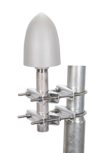
The GP-L1-32-T-MNT GPS timing antenna with mount included, RHCP polarized, 1.571 to 1.61 GHz. (Photo: RadioWaves)
RadioWaves, an Infinite Electronics brand and a manufacturer of high-quality microwave antennas and accessories, has released a new series of GPS/GNSS timing antennas that cover L1 and L5 GPS bands.
The new series of GPS/GNSS timing antennas provide axial ratio and higher accuracy for the reception of satellite timing signals and reference frequencies for enhanced phase synchronization in precision network deployments.
The high gain, low noise figure of 2 dB and high out-of-band rejection provided by these antennas allows for the use of longer and cost-effective cables for easy and flexible installs. They also feature a VSWR less than 1.8:1 and are compatible with several existing mounting brackets. In addition, thee fully ruggedized, weather-sealed antennas are IP67 compliant for use in outdoor and marine environments.
The antennas come equipped with built-in surge protection and support a wide range of GNSS including GPS, GLONASS, BeiDou and Galileo, as well as Iridium. Increased position accuracy in densely populated urban areas, flexible installation, and improved system security make RadioWaves’ latest antenna offering a valuable system component, the company said.
Models include
GP-L1-L5-40-N, an L1+L5 GPS timing antenna, 1.166 to 1.218 GHz and 1.559 to 1.606 GHz
GP-L1-32-T, a L1 GPS timing antenna, RHCP polarized, 1.574 to 1.61 GHz
GP-L1-32-T-MNT, an L1 GPS timing antenna with mount included, RHCP Polarized, 1.571 to 1.61 GHz.
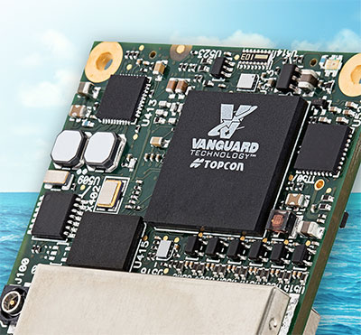
Topcon OEM GNSS components will be used by DDK Positioning to deliver its MAX services to Oceaneering International’s clients. These clients, primarily in the marine energy sector, can achieve accuracy to less than 5 centimeters with this new service.
Founded in 2016, DDK Positioning has combined technical ingenuity with the Iridium satellite network to create a robust, resilient and completely independent GNSS-augmenting positioning solution.
Oceaneering recently conducted an extensive review of how it delivers positioning services to its clients and evaluated the significant advances made in communications infrastructure and services over recent years.
“Our extensive research of receivers in the market, and the performance of Topcon, made the decision for our route going forward,” said Kevin Gaffney, CEO of DDK Positioning. “Topcon’s experience, their extensive support network and leadership will allow us to effectively support multiple clients, in addition to Oceaneering. We see this as a long-term partnership. Both companies worked tirelessly to bring this together.”
“With Topcon Positioning System’s extensive history in precise positioning, providing high performance and quality GNSS boards, antennas and receivers to the OEM industry for over 20 years, the company is well-positioned to supply DDK Positioning with the hardware needed to support their clients globally,” said Ian Stilgoe, vice president of Topcon emerging business. “Working closely with DDK Positioning and Iridium was key to meet the requirements of Oceaneering and the maritime market. Topcon is pleased to be part of this effort to bring the latest positioning technology to this market segment.”
Oceaneering International Inc. and DDK Positioning Limited have entered into an agreement for the provision of GNSS augmentation service and all associated software and hardware supporting Oceaneering’s C-Nav Positioning Solutions group offerings.
Oceaneering provides engineered services and products primarily to the offshore energy industry. C-Nav uses precise point positioning corrections with worldwide accuracy of better than 5 cm horizontally and 15 cm vertically.
DDK Positioning’s services are delivered through the Iridium satellite communications network coupled with hardware developed by partner Topcon. This pairing will enhance the ability of Oceaneering’s customers to precisely position their assets globally. The unified solution offers several benefits to Oceaneering’s positioning customers, such as two-way communication enabling machine control and feedback, and redundancy to cover potential signal losses.
From launch, DDK Positioning will provide its MAX service to Oceaneering clients, which can achieve accuracy to less than 10 cm (2 sigma). The MAX service uses GPS, Galileo, and GLONASS constellations with further systems to be added within a year.
“Significant advances have been made in communications infrastructure and satellite positioning technology over the last several years,” said Eric Smith, director of Survey Services at Oceaneering. “With this agreement, Oceaneering will be able to offer enhanced positioning technology allowing us to build on our strong industry track record while continuing to serve the positioning needs of our clients now and into the future.”
“We are absolutely delighted to have signed an agreement with Oceaneering to provide our precise and reliable GNSS positioning solution to Oceaneering’s customers in the maritime energy industry,” said Kevin Gaffney, CEO at DDK Positioning. “This agreement demonstrates the need for an alternative GNSS augmentation service that increases the reach of services from pole to pole, with the added benefit of Iridium’s resilience and reliability.”
DDK Positioning solutions use the Iridium satellite constellation to deliver 5-cm GNSS accuracy to industrial users of the internet of things (IoT).
Iridium Communications Inc. has made a strategic investment in DDK Positioning, an Aberdeen, Scotland-based provider of enhanced GNSS accuracy solutions.
DDK uses the Iridium network to provide global precision-positioning services that can augment GNSS constellations, including GPS and Galileo, to significantly enhance their accuracy for critical industrial applications.
DDK is developing similar services for other GNSS constellations, such as GLONASS and Beidou. Terms of the investment are not being disclosed.
Standard positioning accuracy through a system like GPS is typically within 10 meters; however, by using the Iridium network, DDK’s enhanced GPS accuracy service brings incredibly precise positioning of 5 cm or less. This advanced level of accuracy is suitable for autonomous vehicles such as UAVs, precision agriculture applications, offshore infrastructure projects such as wind-farm construction, automotive applications like driverless cars, as well as a host of construction, mining, surveying and IoT use cases.
Historically, there have been limited geostationary satellite provider options for this type of service, but they suffer from line-of-sight blockage issues and coverage limitations in and around Arctic and Antarctic regions.
“We are delighted to have embarked on this journey with such a strong and well-respected company as Iridium,” said Kevin Gaffney, CEO of DDK Positioning. “This partnership is a perfect fit for DDK Positioning. With Iridium’s satellite communications network and our GNSS solution, we are in a position to deliver a truly unique service which is robust, resilient and secure. The investment made by Iridium will also allow us to grow the company even further whilst expanding our service offering globally.”
According to a report published by the European GNSS Agency, augmentation services like those offered by DDK will account for $76.5 billion (€65 billion) in global GNSS market revenue by 2029, while the global GNSS downstream market, including services delivered and hardware devices, is estimated to reach $382 billion (€325 billion).
“We are impressed with the team that DDK has put together and see great potential for this technology and how it takes advantage of the Iridium network,” said Iridium CEO Matt Desch. “DDK’s enhanced positioning is a unique capability that adds a high-value solution on top of our existing portfolio of custom network services. Solutions from Iridium and DDK partners that are focused on precision agriculture, autonomous systems, maritime and infrastructure projects can now experience incredibly precise GNSS accuracy from anywhere on the planet.”
DDK Positioning’s precise GNSS positioning solution provides an accuracy of less than 5 cm
NSSLGlobal has entered a strategic alliance with DDK Positioning, to incorporate enhanced GNSS positioning navigation and timing solutions into NSSLGlobal’s maritime portfolio.
NSSLGlobal will now provide, install and service DDK’s GNSS precise point positioning (PPP) solution which enhances the ability of NSSLGlobal’s customers to precisely locate and track their assets.
DDK’s independent GNSS technology is provided exclusively through Iridium’s global satellite constellation, and creates a robust, resilient and completely independent GNSS solution that has an enhanced accuracy of less than 5 cm, compared to the standard GPS accuracy of 10 m.
“This partnership is a fantastic fit for DDK Positioning,” said Kevin Gaffney, DDK Positioning CEO. “We are now in a place to provide our clients with our precise positioning solutions globally and we are delighted to formalize our working relationship with NSSLGlobal with the signing of this new strategic alliance.
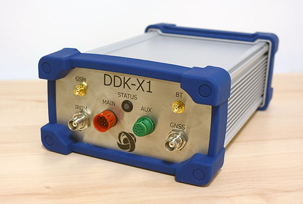
Photo: DDK Positioning
“To continue the journey with such a strong and well-respected company such as NSSLGlobal, and with their reach in the market, makes great sense and we are looking forward to the journey that we will have together.”
“DDK Positioning is leading the field in advanced GNSS positioning,” said Paul Rutherford, service director, NSSLGlobal. “We’re pleased to partner with such an innovative company and to be able to add this technology offering on top of the already extensive navigation and communication portfolio we offer our customers. The system will provide greater location accuracy, along with the ability to help detect and mitigate spoofing.”
Tallysman Wireless is offering two new VeroStar marine antennas to its line of GNSS products. The VSP6037L-MAR supports the full GNSS spectrum and the VSP6337L-MAR supports GPS/QZSS-L1/L2/L5, GLONASS-G1/G2/G3, Galileo-E1/E5a/E5b, BeiDou-B1/B2/B2a, and NavIC-L5 signals. Both antennas support L-band correction signals.
Marine vessels often host both Iridium (1616–1626.5 MHz) and Inmarsat (uplink: 1626.5–1660.5 MHz) satellite communication antennas that transmit and receive signals. The VSP6037L-MAR and VSP6337L-MAR VeroStar marine antennas strongly attenuate interference from both signal sources, providing 75 dB to 85 dB of attenuation over Iridium and 85 dB to 95 dB over Inmarsat uplink, enabling clean GNSS signal reception and precise positioning.
Every VeroStar antenna features a robust pre-filter and a high-IP3 LNA architecture, minimizing de-sensing from high-level out-of-band signals, including 700 MHz LTE, while still providing a noise figure of only 1.8 dB.
VeroStar antennas provide the best-in-class low elevation angle tracking of the full GNSS spectrum and L-band correction signals. The wideband spherical antenna element enables VeroStar antennas to deliver ±2 mm phase centre variation (PCV), making them suitable for high-precision marine, positioning and machine control applications.
The VeroStar marine antennas are housed in a rugged and compact enclosure that supports 1-inch pipe thread or 5/8-inch-11 TPI mounting and provides a TNC antenna connector. The antennas have also obtained the stringent IEC 60945 and IEC 61108 marine certifications, making them suitable for challenging marine environments.
Effective Sept. 1, Tallysman Wireless Inc. was acquired by Calian Group Ltd. to expand Calian’s reach in the satcom industry to markets requiring smaller antennas used in end-user devices that need a different range of fidelities, according to Patrick Thera, president, Advanced Technologies, Calian.
Calian is a publicly owned Canadian company listed on the Toronto Stock exchange. Its solutions include satellite gateways and infrastructure for RF communications, telemetry, tracking and control systems, space science and earth observation. Calian also provides leading-edge communication products for terrestrial and satellite networks.
Based in Ontario, Canada, Tallysman designs, manufactures and sells a wide range of GNSS, Iridium and Globalstar antennas and related products into a market with a broad range of vertical applications that include precision reference systems, survey, timing, precision agriculture, unmanned and autonomous vehicles, marine and more. The company also produces cloud-based wireless tracking systems over two-way radio systems and 4G category M cellular systems, for applications ranging from school buses to municipal public works.
The company is widely recognized as a technology leader and is the supplier of high-precision antennas to precision GNNS systems providers. Under the Calian umbrella, Tallysman will continue to operate as it has been, with no changes in product availability, fulfilment, support, management or engineering services.
Tallysman will also continue to invest in research and development, and bring new and innovative GNSS products to the market, the company said.
The definitive agreement is valued at up $24.5 million. Amount paid on closing is $15.7 million (net of cash received) and contains two earnout periods of $4M and $4.8M based on the achievement of a certain level of EBITDA performance over the next 30 months. Tallysman’s results will be consolidated and reported with Calian’s Advance Technology segment.
“This important acquisition supports both customer diversification and service line innovation, two key pillars within our four-pillar growth strategy,” stated Kevin Ford, Calian president and CEO. “The Tallysman acquisition demonstrates Calian continued our focus on innovation and growth. The wide range of products and applications Tallysman brings to Calian expands our product line and entry into new markets. We are excited with the opportunity to support innovation in exciting growth industries such as autonomous vehicles, precision agriculture and wearables. We could not be more pleased to welcome Tallysman to the Calian team.”
Sampford Advisors acted as exclusive M&A advisor to Tallysman.
“We are extremely pleased to join the Calian team,” said Gyles Panther, Tallysman president and CTO states. “We look forward to continuing, profitable growth of our core GNSS businesses with products that we sell to a broad customer base. As a member of the Calian family, we also look forward to leveraging additional resources, new technologies and markets deriving from Calian’s deep expertise in satellite communications.”
“Calian welcomes Tallysman to our team,” Thera said. “The Tallysman product line and services add a complementary component to our ground-based satellite communications business. GNSS is one of the fastest growing markets for satellite ground systems and we are excited to join forces with a leader in this field.”
The U.S. Department of Homeland Security “did exactly what was required by Congress” in issuing its report in June on positioning, navigation and timing (PNT), according to a letter sent by numerous PNT companies to the DHS.
The July 17 letter to Chad F. Wolf, acting secretary of Homeland Security, refutes a previous letter from Congressional representatives that the report contained numerous errors and failed to address many of the things Congress had required.
“We believe that some key claims made in the members’ letter of June 9 are either exaggerated, irrelevant to the report’s Congressional tasking, or simply wrong,” states the July 17 letter, which is signed by senior executives of Satelles, Orolia, Iridium, Navsys, Jackson Labs, Seven Solutions and Qulsar.
The group takes on the claims of the representatives point by point, finding them exaggerated, irrelevant or incorrect.
For instance, the letter critical of the DHS report states:
“The report focuses on the needs of ‘industry’ largely ignoring the needs and impacts on public services (including first responders), government operations, and individual citizens.”
In response, the industry representatives state:
“The focus of the report, as directed by the NDAA, is on the requirements of the owners and operators of national critical infrastructure. This includes “public services, government operations,” and its beneficiaries, “individual citizens.” To the extent that the report focuses on incentivizing the industry, it is in order for it to be able to meet these requirements.
“While the report only highlights PNT use cases from a subset of the 16 critical infrastructure sectors, their pragmatic recommendations address a range of requirements across all sectors. With respect to PNT needs for backing up GPS, DHS acknowledges the differences between and commonalities among the sectors and offers exceptional guidance for leveraging the capabilities of diverse forms of commercially available alternative PNT rather than endorsing a single, anti-competitive, government-imposed solution.”
Jackson Labs Technologies (JTL) has launched the PNT-6220 Assured Reference — a product combining low-Earth-orbit (LEO) signals, GNSS, terrestrial, wireline and atomic clock services in one small solution, specifically designed for critical infrastructure applications.
The PNT-6220 reference seamlessly combines concurrent L1, L2, L3 and L5 GNSS reception with a custom JLT-designed LEO-based Satellite Time and Location (STL) timing receiver. It also includes terrestrial receivers and PTP/IEEE-1588 edge grandmaster (EGM) and PTP/IEEE-1588-slave capability.
The PNT-6220 provides assured PNT for critical infrastructure applications such as those described in the directives of Presidential Executive Order 13905.
It can serve as a timing reference for 5G equipment, an ePRTC-capable reference, or a high-performance disciplined reference that supports PTP/IEEE-1588, STL, RF distribution and multi-frequency GNSS capability.
The PNT-6220 will be able to select the most optimal UTC reference input automatically and auto-switchover among its numerous reference inputs if one or more of them are jammed or spoofed, as well as average several references for additional stability and accuracy.
If all external references are jammed, the unit can provide UTC timing from its internal holdover oscillator with options that have less than 100-ns drift over 24 hours. The unit is also capable of outputting a GPS RF distribution signal driven by the internal flywheel oscillator, which allows glue-less retrofitting of any GPS-based legacy user equipment to the state-of-the-art reference sources the PNT-6220 can receive by simply plugging into the legacy equipment GPS antenna input.
Available Options
Numerous options are available for the half-width 19-inch-wide rack-mount box.