Tag: Iridium

  • Iridium to acquire Aireon to lead aviation safety

    Iridium to acquire Aireon to lead aviation safety

    Iridium Communications Inc., a provider of global voice, data and positioning, navigation and timing (PNT) satellite services, has entered into a definitive agreement to acquire Aireon LLC.

    Aireon is operator of the space-based Automatic Dependent Surveillance-Broadcast (ADS-B) air traffic surveillance system. The acquisition of Aireon is a defining step in Iridium’s strategy to provide the foundational architecture for global aviation safety, bringing space-based surveillance, safety communications, PNT and operational data together on a single network.

    “Aireon has always been part of Iridium’s aviation safety strategy. We founded it in partnership with the world’s leading Air Navigation Service Providers (ANSPs), because we believed space-based aviation safety was a generational opportunity,” said Matt Desch, CEO, Iridium. “The aviation industry is now entering an era of growing air traffic, denser airspace, autonomous aircraft, and greater expectations for safety and resiliency. Bringing Aireon fully inside Iridium better positions us to build what’s needed to support the future of aviation, including more innovations like the future introduction of space-based VHF communications.”

    Platform for Aviation Safety
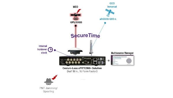
    The acquisition unites Aireon’s surveillance and data services, including GPS jamming and spoofing detection, with Iridium’s global satcom network and PNT services that help keep GPS-dependent systems working in contested environments. This combination creates one company providing four critical aviation industry capabilities: knowing where every aircraft is, communicating with the pilots flying them, providing the navigation and timing integrity those aircraft rely on, and translating that information into operational insights that make airspace safer and more efficient. No other satellite operator delivers this combination of capabilities on a global scale.

    The Aireon system, which is certified by theEuropean Union Aviation Safety Agency (EASA), flies as a payload on the Iridium satellite constellation and tracks an average of 190,000 flights per day. Commercial aircraft broadcast information such as an aircraft’s identity, location, altitude, speed, and heading. Aireon’s space-based ADS-B payload captures this information in real time, with 100% global coverage. ANSPs covering more than 50% of the global airspace rely on Aireon data to create safer and more efficient airspace.

    The world’s leading ANSPs and investors in Aireon, including NAV CANADA and NATS (United Kingdom), AirNav Ireland, ENAV(Italy), and Naviair (Denmark), each played a vital role in launching the Aireon service, proving its reliability, and establishing it as a critical part of the global air traffic control infrastructure. NAV CANADA and NATS, which together manage the most heavily trafficked oceanic airspace in the world — the North Atlantic Tracks between Europe and North America, were the first to go live with the service. In connection with the acquisition, both ANSPs will sign extended data services agreements through 2035 and beyond, with provisions for continued cooperative development of space-based VHF communications and other new capabilities.

    “Aireon and Iridium have been partners since day one, and that partnership is the reason we have been able to build the world’s only space-based air traffic surveillance system and a fast-growing aviation data services business alongside it,” said Don Thoma, CEO of Aireon. “Becoming part of Iridium is a natural next step for our team, our customers, and our roadmap, particularly as our data products expand into new areas like turbulence detection and aviation data analytics. Together, we are building the foundation for the future of global aviation.”

    “NAV CANADA is proud of our foundational role in establishing Aireon’s world-first technology,” said Mark Cooper, President and CEO, NAV CANADA. “This sale sharpens our focus on our core expertise: keeping Canada’s skies safe. As a fellow founding partner, Iridium is the ideal owner to guide Aireon’s continued commercial growth. We wish the entire team continued success and look forward to our ongoing relationship as a customer.”

    “We have been proud to be a part of Aireon’s successes, most notably making real-time aircraft surveillance over the Atlantic a reality for the first time in history, enabling even safer operations across the North Atlantic,” said Martin Rolfe, CEO, NATS. “As a shareholder for the past eight years, it is now the right time for us to divest. We are confident Aireon is well positioned for the future and wish the team every success in the next stage of its development.”

    The Next Transition: Space-Based VHF
    Space-based VHF communications represent a major opportunity in air traffic management, extending pilot-to-controller VHF services into oceanic and remote airspace where ground infrastructure cannot reach, without the need for additional aircraft equipment. The model is similar to how aircraft already carry ADS-B transceivers, which enables Aireon to deliver space-based ADS-B surveillance without requiring fleet retrofits.

    Aireon’s Growing Data Services Business
    Beyond surveillance for ANSPs, Aireon operates a fast-expanding aviation data services business that sells real-time and historical aviation data to airlines, airports, OEMs, governments, and aerospace operators. Product lines already available or launching this year include turbulence detection, GPS jamming and spoofing detection, and safety and efficiency analytics. Additional applications are also in development to support the rapidly evolving airspace environment.

    Aireon’s data business is one of its highest-growth areas today and is expected to be a meaningful contributor to the combined company’s aviation growth.

    Terms of the Transaction
    Iridium is an existing owner of Aireon and will acquire the remaining 61% of equity interests of Aireon in the transaction for a purchase price of approximately $366.7 million from the other owners, NAV CANADA, AirNav Ireland, ENAV, NATS and Naviair. The purchase price will be paid 50% at closing and 50% on the one-year anniversary. Iridium will also assume Aireon’s outstanding debt, expected to be approximately $155 million at closing.

    The acquisition of Aireon is accretive to Iridium’s growth outlook; over the past three years, Aireon’s total revenue has grown at a compound annual growth rate (CAGR) of 10%. Iridium expects the acquisition will result in at least an additional consolidated $100 million of service revenue and $30 million of OEBITDA on an annualized basis.

    Iridium expects to pay the purchase price with current liquidity, including borrowings under its revolving credit facility, and future cash from operations. After closing the transaction, Iridium expects net leverage to increase to approximately 4.0 times OEBITDA during Q3 2026, with net leverage planned to return to the current levels over the subsequent twelve months. Iridium’s long-term net leverage guide of 2.0 times OEBITDA by the end of the decade remains unchanged and assumes no change in its paused share buyback program.

    Aireon will continue business-as-usual operations in the near term, with no planned changes to business strategy. The transaction is targeted to close in early July.

    Evercore served as financial advisor and Cooley and Milbank served as legal counsel to Iridium. PJT Partners served as financial advisor and Hogan Lovells served as legal counsel to Aireon.

  • Launchpad: Mapping applications, new IOT platform and more

    Launchpad: Mapping applications, new IOT platform and more

    A roundup of recent products in the GNSS and inertial positioning industry from the March-April 2026 issue of GPS World magazine.

    Surveying & Mapping

    Mapping Application: High-precision GNSS for IOS and Android smartphones

    Digital Mapping Group

    Image: Fastxy
    Image: Fastxy

    FastXY can transform standard mobile devices into professional-grade data collection tools for geospatial information systems (GIS) and architecture, engineering and construction (AEC) professionals. FastXY offers professionals the ability to collect point, line and polygon data, and delivers advanced capabilities including 3D basemaps, construction staking, topographic surveying, on-the-fly datum transformations and survey-grade elevations. A built-in Bluetooth data parser allows users to configure the app to collect data from virtually any instrument supporting BLE Bluetooth or RS-232 — including echosounders, radiation sensors, laser rangefinders, barcode scanners and more — and marry that data instantly with precise GNSS coordinates. Available in free and premium versions.

    Handheld scanner: Designed for BIM, indoor scanning and reality capture

    CHC Navigation

    Credit: CHC Navigation
    Credit: CHC Navigation

    The RS7 handheld SLAM (simultaneous localization and mapping) scanning solution was built for BIM documentation, indoor surveying, renovation planning and complex spatial analysis. It is designed to help professionals capture high-density 3D data efficiently and convert it into practical deliverables through CHCNAV’s software and cloud ecosystem. The RS7 integrates a next-generation lidar scanner capable of measuring up to 1.15 million points per second. Its wide field of view (360° x 189°) supports comprehensive coverage of floors, walls and ceilings, helping reduce the need for repeated passes and complex capture maneuvers in tight or cluttered spaces. The scanner also includes a high-precision inertial measurement unit with bias stability better than 0.5°/h. By combining lidar and inertial data, the system is designed to maintain stable motion estimation and consistent point-cloud quality in environments that challenge many mobile workflows, including long corridors, repetitive structures, and feature-limited interiors.

    Mobile scanner: All-in-one system offers SLAM, LIDAR, RTK and 360 degree imagery

    Emesent

    Credit: Emesent
    Credit: Emesent

    The GX1 is an integrated, highly accurate all-in-one mobile scanning system combining simultaneous localization and mapping (SLAM), lidar, real-time kinematic (RTK) georeferencing, cameras and software. It supports a seamless workflow, from capture to deliverable, and can reduce the time required to survey a site by up to 95%. The independently validated global accuracy of 5 mm to 10 mm
    delivers the precision needed for topographic and road surveying, scan to building information models, construction progress tracking, and more. These capabilities are supported by integrated RTK georeferencing with real-time quality monitoring, four 20MP cameras for 360° panoramic imagery, and a proven SLAM algorithm. The GX1 has four deployment modes — backpack, survey pole, vehicle mount and supported handheld.

    Quad-band GNSS rover: With support for Galileo high accuracy service

    SparkFun Electronics

    Image: SparkFun
    Image: SparkFun

    The SparkPNT TX2 quad-band GNSS rover combines an IP67-rated aluminum enclosure with support for Galileo’s High Accuracy Service (HAS) and standard RTK correction workflows. The receiver is built around the Quectel LG290P quad-band GNSS engine and supports multi-constellation tracking. Galileo HAS support provides sub-20 cm accuracy globally without subscription-based correction services, while RTK workflows via NTRIP or u-blox PointPerfect can achieve centimeter-level positioning. Battery life is rated at 50-plus hours, positioning the TX2 for multi-day field campaigns without recharging. The unit connects to iOS and Android devices via Bluetooth and WiFi, with compatibility reported for common GIS and data-collection applications. A notable design choice is the open-source firmware, which gives users visibility into how positioning data is processed and allows for customization and third-party integration. SparkFun has positioned this as an alternative to closed GNSS ecosystems where firmware and processing pipelines are not user-accessible.

    Mobile

    GNSS platform: Provides ultra-low power GNSS for all environments

    u-blox

    Image: u-blox
    Image: u-blox

    The u-blox F11 platform provides L1/L5 dual-band standardprecision GNSS to improve positioning accuracy while reducing power consumption to as low as 7 mW in typical configurations. It combines ultra-low power operation with intelligent signal management to meet the evolving demands of tracking, wearables, telematics and mobility applications — including micromobility solutions and drones. The platform enables device manufacturers to achieve longer battery life, faster and more reliable position fixes, and greater design flexibility. Its situationally aware GNSS architecture, with integrated geofencing and indoor detections, dynamically balance accuracy and power consumption. By selectively using dual band L1/L5 operation only when it helps maintain positioning performance, the platform reduces energy use while providing resilience and maintaining confidence in location data.

    IOT platform: Combines GNSS, SBD and LTE-M

    Iridium Communications

    Image: Iridium
    Image: Iridium

    The Iridium 9604 is a compact, threein-one internet of things (IoT) module that integrates Iridium short burst data satellite service, LTE-M cellular connectivity, and GNSS positioning into a single platform. The Iridium 9604 seeks to make dual-mode IoT connectivity viable for price-sensitive, high-volume deployments. Built on the u blox SARA-R5 platform, the module comes in a compact 16 mm x 26 mm x 2.4 mm form factor, suitable for dual-mode IoT deployments across industrial, infrastructure and mobility applications.

    L1+L5 GNSS modules: For trackers and high-precision IOT

    Telit Cinterion

    Image: Telit Cinterion
    Image: Telit Cinterion

    Two dual-band positioning modules built on Airoha’s AG3335 chipset series are available: the ultracompact SE873K5-D and the high-end SE869eK5-DRK. Both support space- and power-constrained IOT devices and use cases that require continuous, ultraprecise positioning. The modules provide a scalable path to adopt dual-band L1 + L5 GNSS.

    Timing

    Cesium-less clock: An alternative to cesium-accuracy holdover clocks

    Viavi Solutions

    Credit: Viavi
    Credit: Viavi

    The patent-pending Cesium-less ePRTC360+ holdover solution is designed to safeguard atrisk infrastructure against the increased threat of GNSS timing disruptions. It is the only alternative to Cesium clocks to meet ITU-T G.8272.1 standards. It can protect critical power grids; transportation, aviation and public safety systems; 5G mobile networks; and AI data centers. It meets the international ITU-T G.8272.1 standard and has been successfully tested across a range of livesky defense and commercial jamming/spoofing environments. It has been integrated into VIAVI’s SecurePNT 6200 product series and can maintain 100 ns accuracy during GNSS-denied threats through the resilient altGNSS GEO-L service with no time limit.

    Transportation

    MEMS IMU module: For vehicles, ships and drones

    Micro-Magic

    Credit: Micro-Magic
    Credit: Micro-Magic

    The U4930 series is a reliable and cost-effective six-axis microelectromechanical system (MEMS) and inertial measurement unit (IMU) module for navigation, control and measurement of vehicles, ships and drones. Applications include vehicle/ship
    attitude measurement, UAV attitude reference and trajectory control, mobile mapping, track inspection and underwater highprecision navigation. The U4930 series integrates high-performance MEMS gyroscopes and accelerometers within an independent structure. The three-axis MEMS gyroscopes sense the angular motion of the carrier, and the three-axis MEMS accelerometers sense the linear acceleration of the carrier. The system internally performs compensation for zero bias, scale factor, non-orthogonal error and acceleration-related terms across all temperature parameters, maintaining high measurement accuracy over a long period of time. The module supports custom communication protocols and provides synchronization for GPS/GNSS time data and pulse per second (PPS) signals.

    Underground navigation: For navigating mines and unmapped environments

    Advanced Navigation

    Image: Advanced Navigation
    Image: Advanced Navigation

    Chimera Land is a 3D laser velocity sensor (LVS) designed to solve the primary challenge for underground mining: maintaining precise vehicle positioning in deep,
    dark and unmapped environments where GPS cannot reach. When fused with an Advanced Navigation inertial navigation system (INS), Chimera Land allows underground vehicles to maintain stable navigation over extended distances and time. Instead of needing to query an external beacon or satellite for its location, the sensor uses specialized lasers to measure a vehicle’s ground-relative 3D velocity with high accuracy. By feeding this precise data into the vehicle’s INS, the sensor eliminates the drift that typically comes with standalone INS. Using AdNav Intelligence, the result is a resilient, high-performance, infrastructure-light positioning solution that excels in the highdust, zero-light conditions typical of underground mines.

    Simulators

    GNSS test tool: Provides real-world testing with signals from the field

    Spirent Communications

    Image: Spirent
    Image: Spirent

    The SimXTRACT GNSS test tool bridges the gap between field and laboratory. It enables signals captured in field environments to be comprehensively decomposed into individual, discrete signals and applied to lab simulation for realism at every stage of the development test cycle. Developers usually rely on either RF record-and-playback or lab simulation for testing and validation of PNT systems and devices. SimXTRACT takes real signals captured in field environments and performs complex signal decomposition, breaking down each received signal into discrete line-of-sight and multipath ray paths, along with metadata such as Doppler offset, code error, power level and angle of arrival. This decomposed environment is then automatically converted into fully controllable simulation scenarios for Spirent GNSS simulators.

    Autonomous

    Inertial measurement unit: For unmanned air, land and sea

    Honeywell Aerospace

    Image: Honeywell
    Image: Honeywell

    Honeywell launched the HGuide i700, an inertial measurement unit (IMU) that delivers high-accuracy performance for unmanned air, land and sea vehicles. By pairing near navigation-grade capability with a nolicense-required (NLR) classification, the HGuide i700 provides integrators worldwide with a new option for critical sensing and navigation. The HGuide i700 uses high reliability sensors and electronic architecture found in Honeywell’s HG3900 inertial measurement unit (IMU). Compact and low power, the HGuide i700 delivers near-navigationgrade accuracy and reliability while being optimized to support longer range navigation in GNSS-denied environments. The HGuide i700 offers strong GNSS-denied performance for by limiting maximum acceleration and spin rates in a license-free package. The latest in Honeywell’s HGuide suite of no-license inertial solutions, the HGuide i700 allows customers to streamline development cycles, simplify system architecture and transition to field deployment quickly. The HGuide i700’s rugged design, compact size and low-power profile make it suitable for diverse commercial, industrial and defense applications, including autonomous vehicles, mapping and surveying.

    Anti-jam antenna system: Provides multi-constellation, multi-frequency GNSS signal protection

    Hexagon | NovAtel

    Image: Hexagon
    Image: Hexagon

    The GAJT-AE3 protects all major GNSS constellations from jamming with full multiconstellation, multi-frequency coverage, ensuring reliable PNT in demanding airborne environments. Its antenna electronics mitigate interference by creating up to seven nulls per band in the direction of jammers, providing significant anti-jam protection even in dynamic multi-jammer scenarios. The output is a protected radio frequency signal, free from jamming and suitable for input to modern and legacy GNSS receivers. The GAJT-AE3 protects and supports all GNSS frequencies, including L-band corrections and Iridium PNT.

    OEM

    GNSS board: All-band multifrequency reception and HAS-ready

    Syslogic

    Credit: Syslogic
    Credit: Syslogic

    Syslogic’s new all-band GNSS expansion board for rugged embedded computers is powered by the u-blox X20 receiver. It supports all major GNSS constellations and frequencies, including L1, L2, L5, L6 and L-band, and enables the use of the Galileo High Accuracy Service (HAS). It provides centimeter-level positioning, opening up new applications across industries such as autonomous field management, operation of construction machinery in remote areas, or navigation of automated guided vehicles and autonomous mobile robots. The GNSS board is designed for worldwide use. The integrated u-blox receiver supports modern correction techniques such as RTK, PPP-RTK and PPP. For the first time, it has been fully optimized for PointPerfect Global, u-blox’s proprietary high-precision GNSS correction service, delivering centimeter-level positioning anywhere in the world. This is particularly useful in remote areas without cellular coverage.

    GNSS L1/L5 breakout: For meter-level positioning in embedded applications

    SparkFun Electronics

    Photo: SparkFun
    Photo: SparkFun

    The SparkFun GNSS L1/L5 Breakout – NEO-F10N (SMA) is a compact GNSS module designed for meter-level positioning accuracy in embedded applications. It uses dual-frequency L1 and L5 bands, with the L5 signal offering improved performance in urban environments due to reduced RF interference within the protected ARNS spectrum.


    The board supports concurrent reception of GPS, Galileo and BeiDou, and uses u blox dual-band multipath mitigation to enhance accuracy in challenging conditions. It features a single UART interface, with an onboard CH340 USB-to-serial converter for easy connection to a computer, and standard pin headers for integration with external systems.

    The module includes an SMA connector for secure antenna attachment and is configurable using u-blox u-center software.

  • KYOCERA AVX launches LDS cap antenna for Iridium satellite IoT applications

    KYOCERA AVX launches LDS cap antenna for Iridium satellite IoT applications

    KYOCERA AVX has launched an LDS cap antenna and evaluation board optimized for Iridium satellite IoT applications and designated as Iridium Qualified Antenna products for Iridium Certus 9704 modules.

    The antenna was developed to provide Iridium with an embedded antenna optimized for low-Earth-orbit (LEO) satellites used to provide seamless connectivity and data exchange for IoT devices anywhere in the world. The new LDS cap antenna developed for Iridium outperforms the ceramic patch antennas traditionally used in these applications.

    Manufactured using laser direct structuring (LDS) technology — an efficient process for creating complex, compact, lightweight, wide-bandwidth, and high-gain 3D antenna designs on myriad substrates — the new LDS cap antenna is smaller and lighter than ceramic patch antennas and exhibits excellent right-hand circular polarization (RHCP) and superior gain from zenith to horizon, which maximizes satellite visibility and reliability and is especially beneficial for improving the connectivity of LEO satellites at low elevation angles. It also exhibits wider bandwidth and higher radiation efficiency than patch antennas.

    The new KYOCERA AVX LDS cap antenna developed for Iridium supports GNSS (1,559–1,610MHz) and Iridium (1,616–1626.5MHz) frequencies with ~2dBi peak gain and 60% efficiency, and delivers reliable performance in challenging environments, including over metal. It’s rated for 4W power handling, 50Ω feed point impedance, and operating temperatures extending from -40° to +85°C. It’s also proven to withstand exposure to high temperatures, high humidity, and salt spray, compliant with the latest RoHS and REACH directives, and packaged and shipped on tape and reel for automated assembly with reflow soldering.

    The on-board antenna has a small, lightweight form factor with a unique design that measures 35.7 mm in diameter and 17.98 mm high, weighs 6.85g, facilitates easy SMT assembly, and allows device manufacturers to locate components on its underside, saving space on the main PCB board.

    The new antenna is expressly designed for satellite connectivity, targeted for satellite IoT applications, and well-suited for applications including telematics, asset tracking, remote monitoring, smart farming and smart city applications. Earlier this year, it was shortlisted for Electronic Specifier’s Electronics Excellence Awards in the passive product category.

  • UAV Navigation-Grupo Oesía integrates Iridium terminal into flight control system

    UAV Navigation-Grupo Oesía integrates Iridium terminal into flight control system

    UAV Navigation-Grupo Oesía, a developer of flight control systems for UAVs, has completed integration and validation of ATMOSPHERE’s Iridium terminal into its VECTOR family of flight control computers. The integration was tested in flight conditions.

    ATMOSPHERE’s Iridium terminal has been integrated into UAV Navigation-Grupo Oesía’s flight control system via RS-232 serial communication. The integration enables command and control beyond visual line of sight.

    During flight tests, the communication link remained stable, with telemetry performance comparable to traditional radio systems.

    The guidance, navigation and control system allows autonomous operation without requiring a control station link during flight. The integration supports two-way communication for mission updates and re-tasking. UAV Navigation-Grupo Oesía said the integration expands options for beyond visual line of sight operations.

    The integration is part of the company’s effort to enhance operational capabilities for its clients. The system’s interoperability has been expanded to work with additional communication infrastructures and mission profiles. Iridium’s global coverage and low-latency service enable operators to maintain control of platforms in remote areas, over oceans or in environments where radio links may be unavailable.

    The development applies to defense, security and industrial applications where beyond visual line of sight (BVLOS) operations require reliable communication. UAV Navigation-Grupo Oesía provides autonomous flight solutions.

  • Mayflower receives US patents for signals of opportunity anti-jamming tech

    Mayflower receives US patents for signals of opportunity anti-jamming tech

    Mayflower Communications Company, a Massachusetts-based leader in advanced anti-jam system solutions for military and commercial markets, has been granted two U.S. patents — US 11,262,457 and US 12,235,365 — that significantly advance its GNSS anti-jam capabilities.

    The patents expand Mayflower’s proprietary technology into signals of opportunity (SoOP), enabling interference suppression across both Iridium and GNSS frequency bands.

    GPS remains a cornerstone of positioning, navigation and timing (PNT) for both military and commercial platforms. However, its vulnerability to intentional and unintentional jamming and spoofing has underscored the need for more resilient PNT solutions. Signals of opportunity — non-navigational RF signals not originally intended for PNT — can serve as valuable backups when GPS signals are degraded or denied. But like GPS, these signals are also susceptible to interference and require protection to be viable contributors to a resilient PNT framework.

    Mayflower’s newly patented technology provides simultaneous protection of GPS and Iridium satellite signals within a compact, low size, weight and power (SWaP) footprint — critical for modern platforms operating in GPS-contested environments.

    “The issuance of these seminal patents by the U.S. Patent and Trademark Office affirms Mayflower’s continued leadership in resilient PNT technologies for both military and commercial markets,” said Triveni Upadhyay, president of Mayflower. “Our innovative approach to filtering interference across multiple satellite communication systems — including Iridium — demonstrates our ability to meet the growing demand for GPS-alternative solutions. Leveraging signals of opportunity without significantly increasing SWaP is a key milestone in delivering more robust, operationally viable PNT systems. We’re excited to bring this technology to our partners across sectors.”

  • NAL Research, SGM Technology and Tschudi to launch maritime navigation and tracking solutions

    NAL Research, SGM Technology and Tschudi to launch maritime navigation and tracking solutions

    NAL Research, SGM Technology AS and Tschudi Shipping Company have formed a strategic collaboration to develop a new line of navigation and tracking products designed for the commercial shipping industry, using Iridium’s low-Earth orbit (LEO) satellite network.

    This joint effort comes amid a rising need for reliable asset tracking and secure navigation tools in high-risk maritime regions, where threats to GNSS signals — such as jamming, spoofing and other forms of interference — are increasing on a global scale. Maritime authorities in some areas have reported a 350% increase in vessels affected by such disruptions in the past six months, according to NorthStandard. The technological interference has caused real-world consequences, including shipping collisions, operational delays, financial setbacks for global trade, and safety risks for crews at sea.

    “As a fifth-generation shipping company, we’ve witnessed the evolution of maritime navigation, but never before have we faced technological threats such as GPS jamming and spoofing,” said Felix Tschudi, chairman of Tschudi Group. “These disruptions pose a serious risk to vessel safety, crew welfare, and the reliability of global trade routes. The industry must act collectively to address these vulnerabilities to protect maritime personnel and assets.”

    The partnership’s initial focus is on integrating NAL Research’s decades-long expertise in assured positioning, navigation, and timing (APNT), tracking, and connectivity with the Iridium PNT service. This service provides a resilient, fully authenticated L-band signal engineered to withstand spoofing and jamming. The venture is also drawing upon SGM’s more than 15 years of experience in maritime technology and Tschudi Shipping Company’s international operations, bolstered by 140 years in commercial shipping and logistics. Together, their aim is to deliver high-reliability navigation solutions for environments where GNSS signals are compromised. Trials of the new solution are now underway.

    “Protection against GPS vulnerabilities is no longer a nice-to-have, but a necessity to ensure operational success and asset safety,” said NAL Research President Robert Bills. “Through this collaborative effort, we are aiming to achieve complete global situational awareness and increase safety at sea for our commercial maritime customers, even in the most remote and challenging situations.”

    “In today’s maritime landscape, the threat of GPS jamming and spoofing is no longer theoretical — it’s a growing reality. Ensuring navigational safety is critical, not just for protecting cargo and vessels, but for safeguarding the lives of seafarers who rely on precise and trustworthy systems every day,” said Steffen Grefsgård, CEO of SGM Technology AS.

  • NAL Research, VectorNav collaborate on solution for GNSS/GPS-denied environments

    NAL Research, VectorNav collaborate on solution for GNSS/GPS-denied environments

    NAL Research and VectorNav Technologies — two U.S.-based leaders in assured position, navigation, and timing (APNT) solutions — are joining forces to develop and produce Iridium STL (satellite time and location)-aided inertial navigation systems (INS) designed to meet the increasing demand for resilient PNT in GNSS-denied environments.

    Both companies will be exhibiting and discussing the collaboration during the SOF Week Exposition in Tampa, Florida, May 5–8, NAL Research (#3005) and VectorNav (#1941).

    Operators of uncrewed systems, in particular, can benefit from implementing an INS solution that leverages NAL’s Iridium STL-enabled APNT receivers to maintain critical operations in areas where GPS/GNSS signals are denied or degraded.

    For such applications, VectorNav is leveraging its VN-210E GNSS-aided INS, which combines a tactical-grade IMU with an L1/L2 GNSS receiver in a miniature, board-mount package. Designed for maximum modularity, the VN-210E hosts VectorNav’s tightly coupled INS and includes four serial ports that enable simultaneous integration with multiple external PNT-aiding sources, such as NAL Research’s ALTM Gen2 Mini Iridium STL receiver. When paired, the system provides a high-rate and continuous position, velocity and attitude solution — even in dynamic applications and in GNSS-denied environments.

    “This complete offering delivered through our high velocity collaboration with VectorNav will deliver dynamic innovation to the emerging APNT market,” said NAL Research President Robert Bills. “Our partnership streamlines our customers’ implementation of alternative APNT sources. We look forward to helping government and enterprise users achieve operational success by enabling the ability to rapidly implement highly accurate and reliable navigation solutions.”

    NAL Research and VectorNav will continue to focus on co-developing product solutions that combine VectorNav’s industrial and tactical-grade INS with NAL Research’s Iridium STL receivers. Future offerings will focus on reducing SWaP-C (size,  weight, power and cost), increasing environmental resilience, and supporting MIL-STD compliance for defense and aerospace applications.

    “The demand for robust APNT solutions, manufactured at scale and capable of supporting dynamic autonomous systems, is growing rapidly — particularly in the critical maritime domain,” said Jakub Maslikowski, VP of business development for VectorNav. “This collaboration with NAL Research will help to realize the emerging LEO satellite PNT capability and strengthen the U.S. and allied nations’ resilience when operating in contested environments.”

  • Iridium focuses on timing and critical infrastructure

    Iridium focuses on timing and critical infrastructure

    Mike O'Connor
    Mike O’Connor

    Satelles, which developed the Satellite Time and Location (STL) system, recently became part of Iridium, which already owned a large share of the company. I spoke with Michael O’Connor, previously Satelles’ CEO, who is now Executive Vice President of Iridium’s PNT Division.

    Besides the ownership change, has anything changed in your organization?

    What was the Satelles business is now part of the broader Iridium company. We’ve been partnered very closely with Iridium since the genesis of Satelles more than a decade ago. It really made strategic sense to become a part of Iridium. The industry is clearly at an inflection point. We don’t have to look too far to understand that the mainstream is catching on to the things that you have been writing about for years. Now, people are realizing what’s actually happening. Various users — especially those near conflict areas — are starting to truly experience jamming and spoofing events. The world is starting to recognize that there’s a need for solutions. The U.S. Department of Transportation has just come out with a complementary PNT plan. They put out a request for a quotation recently to engage the industry.

    Companies like ours, and others in the industry who have been developing solutions to this problem for many years, will finally start to see traction with customers. We just signed an agreement with L3 Harris to roll out GNSS augmentation or complementary PNT for the Federal Aviation Administration (FAA) to networks. Not just industry, but also the U.S. government is now taking steps to implement the resilience that’s needed to protect critical infrastructure. So, the timing is good.

    Does being now fully part of Iridium give you any additional access to the company’s satellite network?

    We will be rolling out, over time, some additional capabilities and expanded service areas. We will be announcing ways in which, by integrating the companies, we can expand more quickly into new geographic areas, providing additional signal coverage in areas where Satelles had not previously been able to do so. As Satelles, we were very focused on timing and national critical infrastructure. Iridium’s business lines align with some of the directions in which Satelles was already intending to grow in any case — such as maritime, internet of things (IoT) and possibly even someday aviation. There are areas where we will be able to expand our reach much more quickly than we ever would have been able to do as a standalone company.

    STL makes indoor positioning possible because the signal is much stronger due to Iridium’s satellites’ much lower orbit than that of GPS satellites, correct?

    Exactly right. It’s really about the signal power. Part of it is being closer to Earth, part of it is that we are on a channel that was dedicated to paging, back when people had pagers on their belts and was designed with a higher power signal than the Iridium satellites’ two-way voice and data channels. Additionally, we’ve designed the signal itself to also have some coding gain. So, all those things ultimately increase the receive sensitivity of a receiver by about 30 dB, which makes the signal 1,000 times stronger.

    In the mix of complementary PNT options and systems, what are your system’s strengths?

    There is no single silver bullet solution to complementary PNT. We can offer our solution, but different applications have different needs, for sure. What Iridium offers with the Iridium STL service is a system that’s available today to protect critical infrastructure — we’ve been delivering this to customers, we have thousands of users; it’s available globally — we effectively have a global license, a global capability, a global satellite constellation. We also have the distinct advantage of a high-power signal that can reach places where GNSS cannot. So, we focus on applications for which we can offer some unique value. A lot of that is based on the underlying Iridium satellite network. A long time ago, Iridium secured global rights for the L-band spectrum. Besides being in LEO, the network has inter-satellite links that enable it to cover the whole world from a finite, manageable set of ground monitoring sites.

    Because of all these aspects of its network, Iridium can offer something unique in the industry. Other solutions have different advantages and disadvantages. There is a breadth of solutions across the industry. All these entities are trying to solve the same important problem. Different users of PNT and different users who have a need for complementary PNT will see the advantages and disadvantages of different solutions out there. So, we like that there’s a thriving ecosystem of solution providers.

    Iridium Communications will provide its Satellite Time and Location (STL) service to more than three dozen L3Harris-operated communications network backbone nodes and a similar number of Federal Aviation Administration (FAA) facilities throughout the United States. (Image: Iridium)
    Iridium Communications will provide its Satellite Time and Location (STL) service to more than three dozen L3Harris-operated communications network backbone nodes and a similar number of Federal Aviation Administration (FAA) facilities throughout the United States. (Image: Iridium)

    Regarding markets, end users and user applications, what’s your focus?

    Our focus today is very much around timing and national critical infrastructure. We are in that market today, but it is one where we also see the greatest growth. We already have several partners who are selling products into those markets — including Adtran Oscilloquartz, VIAVI and Safran — and products available today. That market is just starting to recognize the need for complementary PNT and accelerate its adoption.

    Our primary focus today is making those customers successful with our solutions. Looking at new market opportunities, we are exploring the next products and markets we will pursue, but it is likely to be in an area that overlaps with those in which Iridium already has great partners and customers to which we can provide additional value. Maritime is a good example. Aviation may be a longer sales cycle. It would be speculating as to what that next big market will be because right now we are very focused on that initial market.

    As far as timing for critical infrastructure — cell phone towers, electrical distribution, data centers, etc. — are your boxes replacing the previous ones or sitting next to them?

    They can do either. The products that our partners offer include GNSS plus STL, so it can replace the GNSS-only solution in those systems. A lot depends on the customer and the application, of course. Our partner would provide a solution that includes GNSS plus STL; it typically would replace a GNSS-only solution and provide resilience by having a complementary PNT capability.

    The solutions we’re providing to the FAA are not on-aircraft solutions. They are ground infrastructure solutions that keep the integrity of the ground networks, which are of course Safety of Life critical to the operation of our national airspace. We are providing the timing solution for the FAA within that data center infrastructure.

  • PNT without GNSS: Exclusive interviews

    PNT without GNSS: Exclusive interviews

    Photo: Safran Federal Systems
    Photo: Safran Federal Systems

    GNSS — delivering up to millimeter accuracy from 20,200 km in space with a received signal of one tenth of one millionth of one billionth of a Watt — is, in Arthur C. Clarke’s famous definition, “indistinguishable from magic.” Yet, in addition to the inherent errors in the transmission, propagation, and reception of their signals, GNSS are increasingly challenged by jamming and spoofing attacks, especially in and near conflict zones.

    For that reason, as any regular reader of this magazine knows, combating jamming and spoofing and building resilience in positioning, navigation, and timing (PNT) systems has been a constant theme of many of our articles and industry news items for years.

    The U.S. National Space-Based Positioning, Navigation and Timing Advisory Board has been focusing on how to “protect, toughen and augment” GPS, with the third word referring both to enhancements to GPS and to the “provision and use of alternate sources of PNT that complement, back up, or replace (partly or entirely) use of GPS.”(*)

    For this cover story, I discussed complementary sources of PNT with executives from four companies that design, produce, and/or operate them. They cover a wide range of complementary PNT technologies. Read the exclusive interviews below: 

    • Iridium owns and operates a constellation of satellites in low-Earth orbit (LEO) and has global rights for L-band spectrum. This enables it to operate the Satellite Time and Location (STL) system developed by Satelles before it recently became part of Iridium. STL protects critical infrastructure by providing a timing signal that is independent of GNSS constellations and 1,000 times stronger than the GPS signal.
    • Spirent Communications latest simulation system brings together GNSS and a wide range of other PNT systems. It simulates L-band, S-band, alternative navigation signals, signals of opportunity and emulated inertial outputs. It focuses particularly on the new and emerging LEO constellations, including Xona Space Systems’ PULSAR signals, and enables users to inject new signals via I/Q data files.
    • SpacePNT has developed an FPGA-based hardware/software/firmware spaceborne GNSS receiver technology specifically targeting the fast-growing New Space satellite market. The company’s innovations include a precise orbit determination algorithm that can process signals from the Galileo High Accuracy Service and from geostationary orbit (GEO) satellites.
    • VIAVI Solutions has developed a system that aggregates signals of opportunity, as well as Iridium LEO and Inmarsat GEO sources; weighs and cross-verifies them; then converts the output to the legacy GPS L1 signal and feeds it to a GPS receiver. It can also aggregate a stand-alone cesium clock.

    (*) From Dr. John Betz’s presentation on “Augmenting GPS for Critical Infrastructure” at the April 24, 2024, meeting of the PNT Advisory Board.

  • American Aerospace granted FAA waiver for BVLOS operation

    American Aerospace granted FAA waiver for BVLOS operation

    Photo: American Aerospace Technologies (AATI)
    Photo: American Aerospace Technologies (AATI)

    American Aerospace, an Iridium partner, has received a waiver from the Federal Aviation Administration (FAA) to conduct UAV surveillance of critical infrastructure in California’s San Joaquin Valley for Chevron, an oil and gas company.

    Enabled by Iridium’s global L-Band satellite connectivity, AATI’s AiRanger UAV will conduct remote aerial surveillance of the energy company’s pipeline and production facilities. Iridium’s network offers beyond visual line of sight (BVLOS) connectivity, including remote command and control (C2) and detect and avoid (DAA) capabilities. The UAV will send information via Iridium satellites to conduct routine inspections.

    Iridium partner Blue Sky Network customized and integrated its SkyLink 7100 voice, data and BVLOS terminal on the UAVs. The SkyLink 7100 offers continuous tracking and C2 capabilities for aviation and UAV operations.

    The AiRanger is the first UAV to comply with industry standards for the DAA system and meet FAA BVLOS operation requirements. This achievement aims to pave the way for broader use of BVLOS UAVs to enhance situational awareness, reduce inspection costs and maximize value.

  • Iridium partners with L3 Harris for FAA infrastructure protection

    Iridium partners with L3 Harris for FAA infrastructure protection

    Iridium STL is being deployed by L3Harris to protect critical FAA data center infrastructure. (Photo: Iridium)
    Iridium STL is being deployed by L3Harris to protect critical FAA data center infrastructure. (Photo: Iridium)

    Iridium Communications has entered a five-year agreement with L3 Harris. Under the agreement, Iridium will provide its satellite time and location (STL) service to more than three dozen L3Harris-operated communications network backbone nodes and a similar number of Federal Aviation Administration (FAA) facilities throughout the United States.

    L3Harris, responsible for operating a private network for the FAA, provides voice, data and video communications for the National Airspace System operations and mission support functions. Given the critical nature of timing synchronization within the L3Harris communications network, particularly for supporting various critical infrastructure applications, the Iridium STL service plays a pivotal role in the overall network timing architecture by eliminating dependencies on GPS as the primary timing source.

    The solution for L3Harris includes compact devices provided by Adtran’s Oscilloquartz division, which are designed to receive Iridium STL signals. These devices seamlessly integrate into the network and meet nationwide network timing synchronization requirements.

    In April 2024, Iridium acquired Satelles, a secure satellite-based time and location service provider.

  • SparkFun launches Iridium antenna

    SparkFun launches Iridium antenna

    Image: SparkFun Electronics
    Image: SparkFun Electronics

    SparkFun Electronics has released the 2J7426MPz by 2J antenna, a high-performance magnetic mount antenna designed to communicate with the Iridium satellite communication system. It is manufactured with high-quality polycarbonate (PC) and acrylic-styrene-acrylate terpolymer (ASA), a thermoplastic combination that offers strong resistance to UV, moisture, and heat and enhances mechanical properties.

    The antenna housing is waterproof to IP69 standards and designed to operate in extremely harsh environments, including those with frequent exposure to water, dust and debris. It has a recommended operational and storage temperature of -40°C to +85°C. The magnetic mount allows for easy installation and removal between vehicles or assets, and it is easily converted to an adhesive type for greater flexibility.

    It is delivered with a standard SMA-male connector and a standard 300 cm long coaxial LL100 cable. Iridium has certified the 2J7426MPz antenna for commercial use in connection with the Iridium communications system.