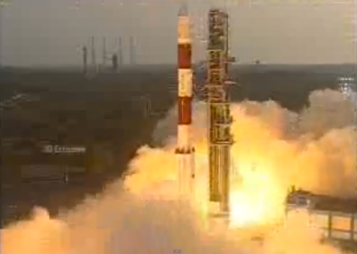
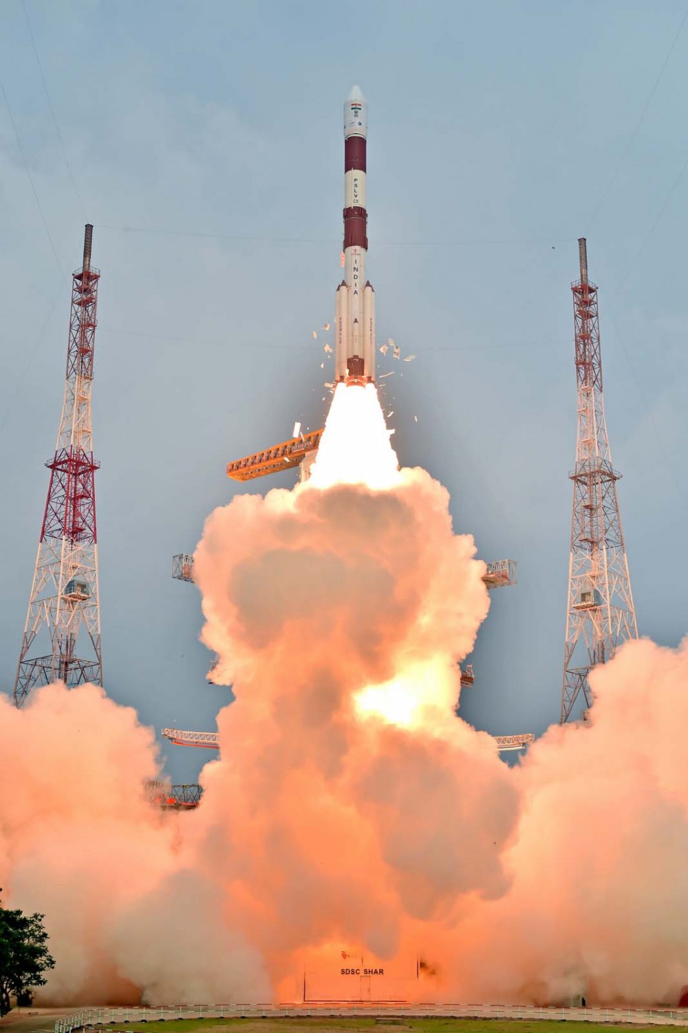
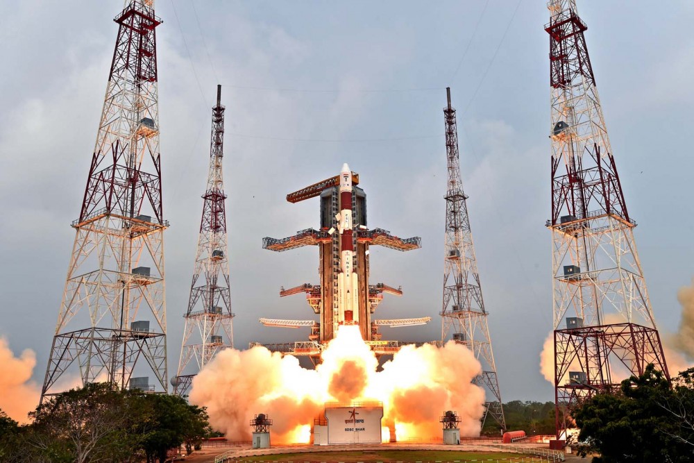
The Aug. 31 launch of a new Indian Regional Navigation Satellite System (IRNSS) satellite failed when the protective fairing did not separate.
Indian Space Research Organisation (ISRO) chairman AS Kiran Kumar confirmed that the mission to launch India’s eighth navigation satellite, IRNSS-1H, from the second launch pad at the spaceport of Satish Dhawan Space Centre, Sriharikota, was unsuccessful.
The 1425-kg satellite was expected to expand the existing seven satellites of the NavIC constellation. The launch vehicle PSLV-C39 lifted the satellite on Aug. 31 using the XL variant, of PSLV equipped with six strap-ons, each carrying 12 tons of propellant.
The three phases of the launch went smoothly, but unfortunately, the heat shield which was supposed to be separated in the fourth stage could not be detached.
IRNSS-1H was planned as a replacement satellite for IRNSS-1A.
Three atomic clocks onboard a single satellite of the NAVIC Indian regional navigation satellite system have failed.
Indian Space Research Organization (ISRO) Chairman A.S. Kiran Kumar told The Hindu newspaper that the agency is trying to restart the clocks. Kumar said the affected satellite, IRNSS-1A, is otherwise healthy, and the rest of the constellation is performing its core function of providing accurate position, navigation and time.
Last week, the European Space Agency discussed clock failures on board Galileo satellites. Rubidium atomic clocks onboard both constellations were manufactured by Spectratime of Switzerland, but the cause of the failures has not been identified and could involve factors other than clock design.
IRNSS-1A is equipped with one primary and two back-up clocks. At this time, it “will give a coarse value. It will not be used for computation. Messages from it will still be used,” Kumar said. “There are some anomalies in the atomic clock system on board. We are trying to restart it. Right now we are working out a mechanism for operating it.”
The ISRO is readying one of the two back-up navigation satellites — IRNSS-1H — to replace it in space in the second half of this year. IRNSS-1A was launched in July 2013 and has an expected lifespan of 10 years.
The Indian Regional Navigation Satellite System (IRNSS) constellation was completed April 28, 2016. It was then renamed NAVIC — Navigation Indian Constellation, by India’s Prime Minister Narendra Modi.
With seven satellites in orbit, the constellation’s primary focus is to provide information in the Indian region and 1,500 kilometers around the mainland.
The Indian Space Research Organisation (ISRO) is finalizing plans to have two spare satellites for its navigation fleet built by private industry in the next two years, reports The Hindu. The seven-satellite NAVIC (Navigation Indian Constellation) — formerly known as IRNSS — is now complete.
The Indian government will “handhold” industry for the first satellite, scheduled to be built by March 2017. The second satellite will be built entirely by industry, said M. Annadurai, director of ISRO Satellite Centre. Both 1,400-kilogram spare satellites will be kept ready on the ground.
The space agency issued “expressions of interest” in June, reports The Hindu, and ISRO is discussing details of risk, price and profit-sharing with prospective partners.
On March 4, Raytheon successfully passed the first formal qualification test milestone for the U.S. Air Force’s GPS Next Generation Operational Control System (GPS OCX). The new system offers significant improvements to the GPS on which the U.S. military and millions of civilians rely, including enhanced availability, accuracy and security.
The event was the Configuration Item Qualification Test (CIQT) milestone for the Launch and Checkout System (LCS). The system provides launch and early orbit checkout capabilities for the modernized GPS III satellites and implements 77 percent of the cybersecurity capabilities for the overall OCX program. The testing was successfully conducted in a representative operational environment with a government-provided GPS III satellite simulator.
The LCS CIQT Run-for-Record was completed more than one month ahead of the plan established in mid-2015, clearing the way for LCS to proceed toward the Factory Qualification Test, the next major qualification event. The FQT test will be at the integrated system level and will take place this summer.
GPS OCX is being developed by Raytheon under contract to the U.S. Air Force Space and Missile Systems Center, which is replacing the current GPS operational control system. The OCX Launch and Checkout System provides an early delivery of a large subset of the overall OCX capability, and will support the GPS III satellite launches.
Congressmen Seek Delay to NDGPS Closings
Four U.S. congressman sent a letter to the Department of Transportation, asking the DoT to delay shutting down Nationwide Differential GPS (NDGPS) sites, a proposal that was posted in the Federal Register.
The congressmen are asking for a delay until the “administration has decided upon and implemented a resilient national positioning, navigation and timing (PNT) architecture.”
“We do not dispute,” they wrote, “the administration’s determination that NDGPS is sufficiently like the Wide Area Augmentation system (WAAS) in its phenomenology and services such that it provides only an incremental benefit to the nation’s PNT architecture. However, some or all of the 62 NDGPS sites (and associated equipment) proposed for elimination could play an important role in achieving the PNT architecture America needs.
“Ceasing transmissions, decommissioning, and disposing of them before we are assured they are not useful to future systems is against our national interest and would not be the best use of government assets and funds.”
Signers were John Garamendi of California, Peter DeFazio of Oregon, Frank Lobiondo of New Jersey, and Walter B. Jones of North Carolina. Read the full text of the letter.
IRNSS Completing
At press time, India was expected to put into orbit its seventh and final navigation satellite on April 28, thus completing the Indian Regional Navigation Satellite System (IRNSS).
IRNSS-1G is expected to launch aboard a Polar Satellite Launch Vehicle (PSLV) rocket from India’s spaceport at Sriharikota in Andhra Pradesh.
IRNSS is designed to provide accurate position information service to users across the country and region, up to an area of 1,500 kilometers.
Jamming on the Borderline
South Korea issued a warning in late March after detecting satellite signal disruptions that appeared to be coming from North Korea. The capital city of Seoul appeared to be the target.
Officials said North Korea discharged a large amount of radio waves to jam GPS signals in the region.
“We’ve detected signs that North Korea has been sending radio waves to the capital area since a month ago to disrupt GPS signals,” a senior government official said, speaking on condition of anonymity. “North Korea had been sending test waves since last month, but today, they discharged the largest amount.”
The disruptions could cause mobile phones to malfunction and affect planes and ships that rely on GPS for navigation. No damage has so far been reported in the military or among civilians, officials said.
Since 2010, GPS disruptions have occurred three times in South Korea, and all have been blamed on the North.
Southern Counter. On April 7, the U.S. State Department confirmed the jamming in a public communique, stating the the jamming was causing signal disruptions to airplanes, ships, and buoys in the area “surrounding Gyeonggi and Gangwon provinces out to about 100 nautical miles.” On April 8, the South Korean government said it would “beef up its system to protect GPS signals” but did not explain how.
South Korea is developing an eLoran system, which would be far more difficult to jam than GPS.
A Long March-3A carrier rocket carrying the 22nd BeiDou satellite lifts off March 30.
22 BeiDou
China launched the 22nd BeiDou satellite into orbit on March 29. BeiDou-22 (or BeiDou-2 I6) was launched at 20:11 UTC (4:11 local time) by a Long March-3A rocket from the Xichang Satellite Launch Center.
China launched the 21st BeiDou satellite on Feb. 1, the second in a series of BeiDou launches scheduled for 2016. The BeiDou constellation is planned to be completed in 2020.
The new satellite, the sixth BeiDou-2 IGSO, will be used to replenish the current operating regional system.
The satellite, after entering its designed work orbit and finishing in-orbit testing, will join others already in orbit and improve the stability of the system, preparing for BDS to offer global coverage.
After landing in French Guiana, the 13th and 14th Galileo satellites, still within their canisters, were unloaded to be taken by road to the Guiana Space Centre. (Photo: ESA)
Next Pair Prepped for Galileo
The latest pair of navigation satellites has reached Europe’s Spaceport in French Guiana, according to the European Space Agency (ESA). This starts a new Galileo launch campaign that will culminate in a May 24 launch of the 13th and 14th satellites in the constellation.
A second launch is planned for this fall, with four satellites carried aloft on a customized Ariane 5 for the first time, bringing the count to 18 Galileo satellites in orbit by the end of the year.
The pair of satellites left ESA’s technical centre in Noordwijk, the Netherlands, on April 4, cocooned within protective air-conditioned containers. They were then driven to Luxembourg Airport, where they were loaded aboard a Boeing 747 cargo jet for a dawn takeoff the following morning.
The satellites touched down at Cayenne — Félix Eboué Airport in French Guiana at 11:15 a.m. local time on Tuesday. Still within their canisters, they were driven to the Guiana Space Centre and unboxed that evening within the cleanroom environment of the centre’s S1A payload preparation building. A fit check is scheduled next, to ensure the satellites can be attached to the dispenser.
ESNC 2016
The largest international competition for the commercial use of satellite navigation once again seeks outstanding ideas and business models, with prizes worth a total of €1 million in more than 25 categories.
The deadline for submissions to the European Satellite Navigation Competition (ESNC) is June 30. The official website provides all relevant information on prizes, partners, and terms of participation. The ESNC is geared toward individuals and teams from companies, research facilities and universities around the world.
India is expected to launch into orbit its seventh and final navigation satellite on April 28, thus completing the Indian Regional Navigation Satellite System (IRNSS).
IRNSS-1G is expected to launch aboard a Polar Satellite Launch Vehicle (PSLV) rocket from India’s spaceport at Sriharikota in Andhra Pradesh at 12:50 local time.
To date, India has launched six regional navigational satellites (IRNSS-1A, 1B, 1C, ID, 1E and 1F) as part of a constellation of seven satellites to provide accurate position information service to users across the country and the region, extending up to an area of 1,500 kilometers.
The full system comprises nine satellites — seven in orbit and two on the ground as stand-by.
The IRNSS will provide two types of services — standard positioning service and restricted service. The former is provided to all users and the latter is an encrypted service for authorized users.
Meanwhile, the Indian Space Research Organization (ISRO) is in the process of developing the front-end radio frequency chips for the satellite navigation system. The initial version is expected to be ready this year, ISRO chairman told the New Indian Express.
The next-generation GPS ground-control system, known as OCX.
The White House budget request for the Next Generation Operational Control System (OCX) comes to $393.3 million for fiscal year (FY) 2017.
The updated OCX budget appears as the Air Force officially acknowledges a two-year delay in the program, which could slide as late as 2023 for implementation.
The total cost for OCX now amounts to $4.81 billion.
In a cautionary move meant to span a suddenly yawning gap in ground control capabilities, the GPS Directorate awarded a $96 million contract modification to Lockheed Martin Space Systems to provide GPS III Contingency Operations services (COps).
By the end of 2019, Lockheed will “modify the current GPS control segment to operate all GPS III satellites that are launched prior to the transition” to OCX, as well as GPS III satellite vehicle simulation modules, a GPS simulator and updates to the GPS Positional Training Emulator.
Late delivery of OCX Block 1 “puts GPS constellation sustainment at risk since the current control segment cannot operate GPS III satellites,” according to a Pentagon statement.
The Air Force will “re-phase the GPS III space vehicle procurement profile,” delaying procurement of the 11th and all following GPS IIIs to FY18.
User Equipment. In contrast, the Pentagon substantially increased its request for developing user equipment to $278.2 million for FY17.
The added funds for Military GPS User Equipment (MGUE) seek to speed platform integration of M-code capability for munitions, warfighters, armored vehicles, planes and all military platforms: a stronger signal and data authentication capability.
OCX must navigate latest acquisition reforms
Acquisition reform mandated by Congress for the U.S. military, and known as Better Buying Power 3.0 guidance and initiatives, poses a tough new challenge for the Pentagon, not least for the Air Force and GPS.
This comes in the face of an impending (some say already underway) cyberwar targeting core infrastructure, much of it controlled or metered to some extent by GPS.
Under-Secretary of Defense for Acquisition, Technology and Logistics Frank Kendall stated in 2014 that the United States is “under attack in the cyber world” and “we’ve got to do a better job protecting our things.”
The cyber realm changes and innovates much faster than the material weaponry realm to which the acquisition cycle is obsolescently tied. Currently, funding, developing and fielding a new capability is a multi-year cycle.
At the heart of this storm is OCX, a new ground control system for GPS that is meant to be cyber-hardened.
“The dynamic nature of the cyber threat, the catastrophic implications to attacks on our GPS-related infrastructure, and the relatively slow acquisition cycle demands the Air Force follow through with added funding to OCX,” wrote Robert Newton, a retired Air Force acquisition officer, in Defense News.
“Consideration of scrapping such an important program may sound politically correct, but would be disastrous and place us years behind an already escalating threat,” Newton said.
In the longer term, Newton wrote, both the Pentagon and Congress must develop new methods and closer cooperation to quickly anticipate and counter threats before they fully materialize.
GPS OCX will be a key test of the government’s and the military’s joint sability to function.
LightSquared testing: The sequel
The U.S. Department of Transportation (DoT) announced in March that testing for the Adjacent Band Compatibility (ABC) Assessment will start in April. Conducted at the U.S. Army Research Laboratory, White Sands Missile Range, the tests seek to determine power limits for spectrum bands near the GPS L1 signal.
Later tests will focus on potential interference with the L5 signal and frequencies of other satellite navigation constellations.
In 2012, after tests at that time demonstrated that the proposed LightSquared network of ground-based transmitters would interfere with GPS, the Federal Communications Commission (FCC) denied LightSquared’s petition while authorizing further tests — never conducted until now.
Testing will take place across a 200-megahertz band spanning 1575.42 MHz, GPS L1. An interference tolerance mask is defined as the point at which the interference test signal power level causes a one-decibel degradation in the signal-to-noise ratio.
GPS and GNSS receivers designed for aviation (noncertified), cellular, general location/navigation, precision, timing, network-, and space-based application will be run through the high-powered gauntlet.
“The Department requests voluntary participation in this study by any interested GPS/GNSS device manufacturers or other parties whose products incorporate GPS/GNSS devices.” the DOT said.
Ligado, the renamed LightSquared company from 2012, came to separate legal settlements with GPS companies Garmin, Trimble and John Deere in 2015; the terms have not been disclosed.
“Use of a defined change in the noise floor (1 dB),” wrote a Deere attorney to the FCC, “provides a readily identifiable and predictable metric that all interested parties can take into account now and in the future.”
Lift-off of IRNSS-1F.(Photo: ISRO)
IRNSS nears completion
The sixth satellite in the Indian Regional Navigation Satellite System (IRNSS) launched on March 10, and all subsequent orbital steps proceeded according to plan. IRNSS-1F was injected to an elliptical orbit very close to its intended final orbit.
The Indian Space Research Organization’s (ISRO’s) Master Control Facility (MCF) at Hassan, Karnataka, took over the control of the satellite. Maneuvers will position the satellite in geostationary orbit at 32.5 degrees East longitude.
IRNSS-1F is the sixth of the seven satellites constituting the space segment of the Indian regional system. All five previosly launched satellites are functioning satisfactorily from their designated orbital positions.
A complete constellation of seven is planned for the second half of this year.
The first IRNSS position fix announced by ISRO, providing longitude, latitude and altitude, took place in April 2015. Since then, position fixes using stand-alone IRNSS receivers have obtained accuracies of better than 15 meters for a minimum of 18 hours in a day over India.
The regional SBAS broadcasts navigation signals in the L5 and S-band frequencies, and computes user position solutions for a restricted service and a standard positioning service.
GLONASS special K
A new-generation Russian GLONASS-K satellite began regular broadcasts on Feb. 15.
The K model line transmits five navigation signals in the GLONASS L1, L2, and L3 bands and carries a COSPAS-SARSAT payload for international search and rescue.
K satellites will gradually replace the GLONASS-M generation, bringing with them new CDMA civil signals compatible with GPS and Galileo.
Eleven new K satellites will take to space starting in 2018, using European and Chinese components as well as those being developed under an accelerated Russian import substitution program.
The countdown for the launch of of a rocket carrying Indian Regional Navigation Satellite Sytem-IRNSS-1F began at 9:30 a.m. local time at the Sriharikota rocket port in Andhra Pradesh, reports the New Indian Express.
The Polar Satellite Launch Vehicle (PSLV) is expected to blast off around 4 p.m. on Thursday, March 10, following a 54-hour 30-minute countdown.
“Like the countdowns for the flight of many other earlier rockets, the countdown is progressing smoothly,” a senior official of the Indian Space Research Organisation (ISRO) told the newspaper.
IRNSS-1F will be India’s sixth navigation satellite. It has a design life of 12 years and carries two payloads. The navigation payload will be operating in L5-band and S-band; the ranging payload consists of a C-band transponder (automatic receivers and transmitters of radio signals), which facilitates accurate determination of the range of the satellite.
A highly accurate Rubidium atomic clock is part of the navigation payload of the satellite. IRNSS-1F also carries Corner Cube Retro Reflectors for laser ranging.
To date India has launched five regional navigational satellites (IRNSS-1A, 1B, 1C, ID and 1E) as part of a constellation of seven satellites to provide accurate position information service to users across the country and the region, extending up to an area of 1,500 km.
The entire IRNSS constellation of seven satellites is planned to be completed in this year. The seventh satellite, IRNSS-1G, is expected to be launched in the second half of 2016. The full system comprises nine satellites — seven in orbit and two on the ground as standby.
The first satellite IRNSS-1A was launched in July 2013, the second IRNSS-1B in April 2014, the third In October 2014, the fourth in March 2015, and the fifth in January of this year.
According to ISRO, with the operationalisation of five IRNSS satellites, the proof of concept of an independent regional navigation satellite system over India has been demonstrated for the targeted position accuracy of better than 20 meters, 24 hours a day.
The GPS Directorate at the Space and Missile Systems Center (SMC) continues to look for someone to build 22 GPS III satellites in the near future.
SMC issued a request for proposals on Jan. 8, with rather complicated terms. The first eight GPS III satellites are already under contract, and two have been built, but delivery and launch schedules have dragged. The Air Force incorporated several other payload requirements for the satellites, beyond those of new GPS signals themselves.
This is the Air Force’s third effort to find a builder.
The RFP is for “11+ Phase 1 Production Readiness Feasibility Assessment. “ It covers GPS III space vehicles 11 and beyond. The process, if followed as the Air Force envisions, will award up to three relatively small fixed-price contracts.
According to an Air Force press release, “The scope of this effort includes the current GPS III SV01–08 technical baseline with the addition of redesigned Nuclear Detonation Detection System (NDS), Search and Rescue/GPS (SAR/GPS), and Laser Retroreflector Array (LRA) payloads, Unified S-Band (USB) compliance, Regional Military Protection capability No changes are allowed to the GPS Next Generation Operational Control System (OCX) or Military GPS User Equipment (MGUE) interfaces.”
The first Air Force effort to recompete the contract for future GPS III satellites came in 2014. A 2015 initiative lowered the bar as far as requirements, but also lowered the award very dramatically, from $200 million each for two companies to $6 million each for three companies.
The 2016 announcement appears to replicate the terms of the 2015 campaign. There has been no official explanation as to why the terms changed between 2014 and 2015, and why they did not between 2015 and 2016.
Rick Ambrose, executive vice president of Lockheed Martin Space Systems, tweeted on Jan. 13 that the satellite had successfully completed its thermal vacuum test (TVAC).
Lockheed Martin Space Systems is the prime contractor on the GPS III program to build a total of eight GPS IIIs. The contract includes options for up to four more satellites, and the Air Force has told Congress it expects to execute options for at least two of those satellites.
The first GPS III satellite is expected to launch in 2017.
Coast Guard Issues Jamming Alert
The U.S. Coast Guard issued a safety alert on Jan. 16, warning mariners of the potential detrimental impact to navigation caused by GPS interference or jamming. The warning emphasizes the importance of understanding how vessel equipment could be impacted by the loss of a GPS signal.
The Coast Guard states that this past summer, multiple outbound vessels from a non-U.S. port suddenly lost GPS signal reception. The net effect was various alarms and a loss of GPS input to the ship’s surface search radar, gyro units and ECDIS, resulting in no GPS data for position fixing, radar over ground speed inputs, gyro speed input and loss of collision avoidance capabilities on the radar display.
Fortunately, the vessels were able to safely continue theirvoyage using radar in heads up display, magnetic compass and terrestrial navigation. Approximately six nautical miles later, the vessels’ GPS units resumed operation. Although the vessels had back-up systems to allow a safe transit, the consequences could have been severe, warns the Coast Guard.
IRNSS Launches Fifth Satellite
The fifth satellite in India’s Regional Navigation Satellite System rode into orbit Jan. 20, joining a growing fleet of spacecraft to provide positioning services to users across South Asia.
“With this satellite in place, within our country we will be able to get, 24 x 7, a good positional accuracy,” said A.S. Kiran Kumar, chairman of the Indian Space Research Organisation (ISRO).”
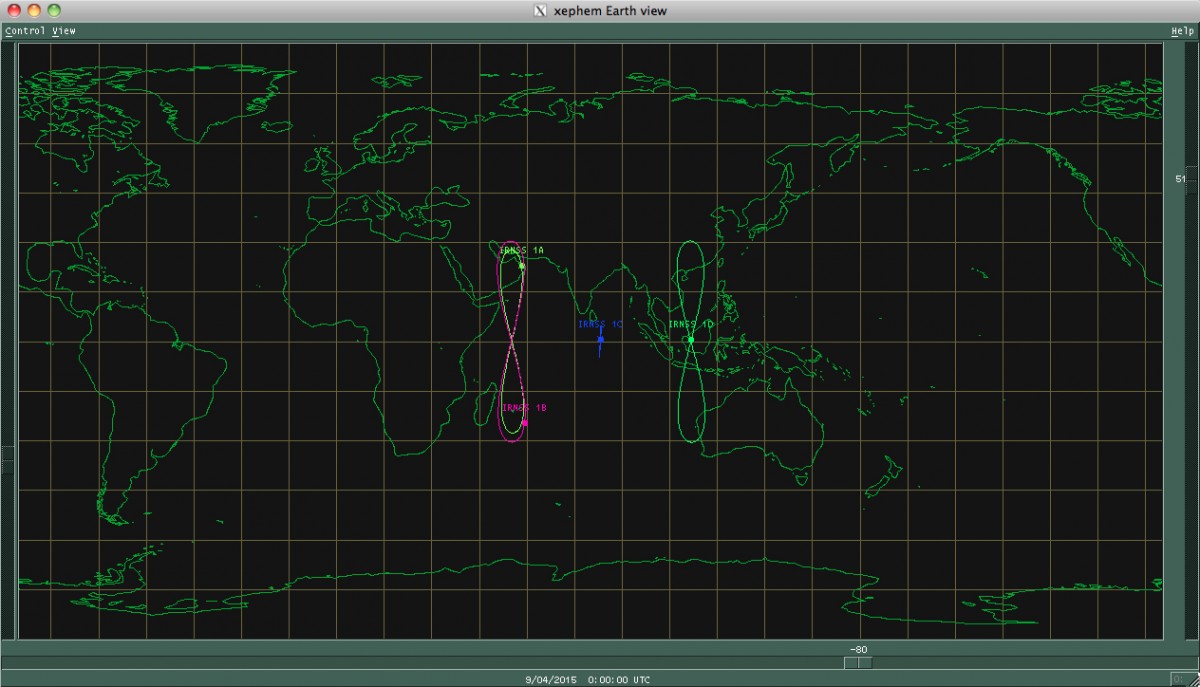
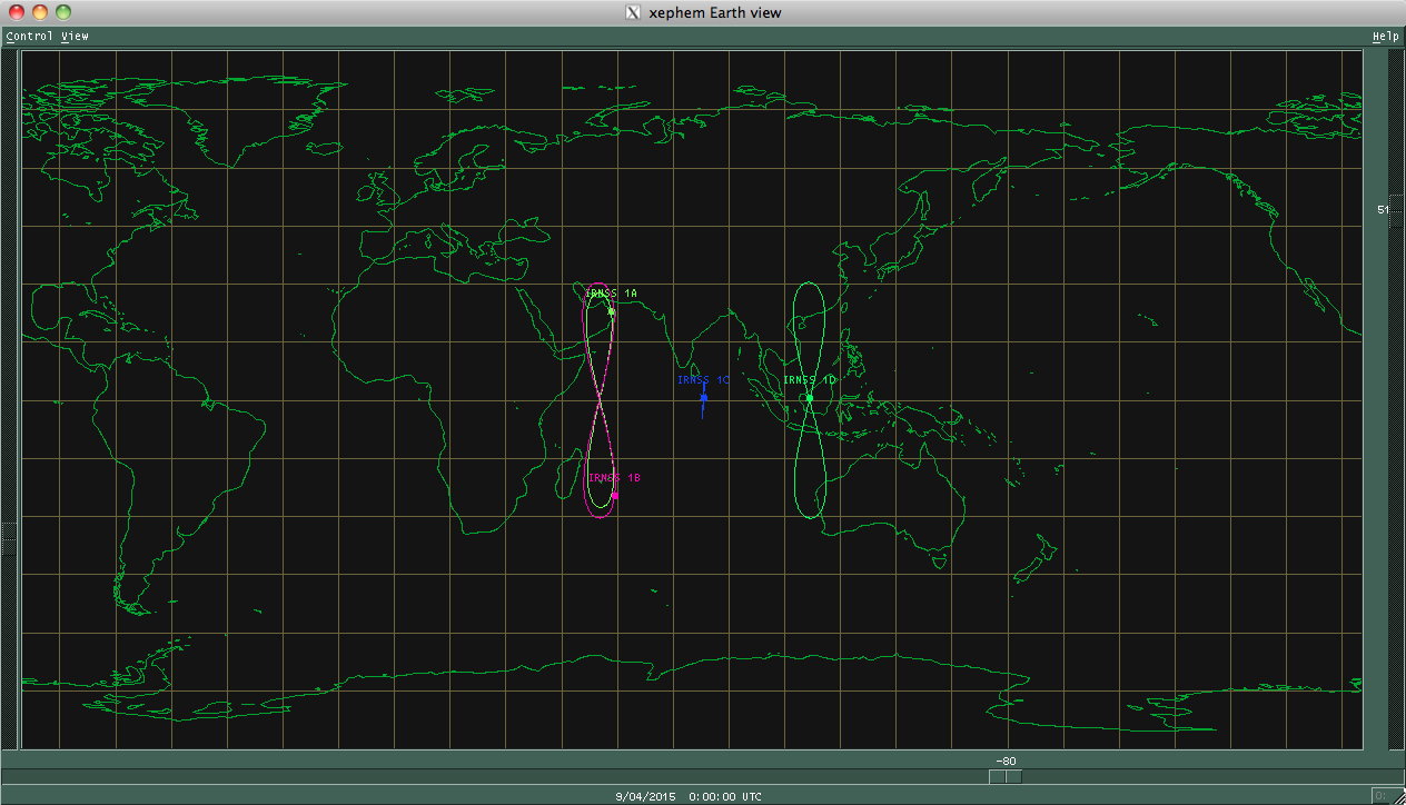
IRNSS 1E will raise its orbit to an altitude of nearly 36,000 kilometers (22,300 miles) over the next few weeks, entering an orbit centered on 111.75 degrees east longitude and oscillating up to 28.1 degrees north and south of the Equator.
Two more IRNSS spacecraft are due for launch bythe end of March to complete the constellation.
The seven satellites — four in inclined geosynchronous orbits like the one intended for IRNSS 1E, and three in equatorial geostationary orbit — will give India an independent navigation system with coverage over Indian territory and regions extending up to 1,500 kilometers (932 miles) from its borders.
India started launching its navigation satellites in 2013. Each spacecraft is designed to operate for 12 years.
IRNSS-1E heads for orbit on Jan. 20. (Photo: IRNSS)
The fifth satellite in the Indian Regional Navigation Satellite System (IRNSS) constellation lifted off on time Jan. 20 from Satish Dhawan Space Center on Sriharikota Island, on India’s east coast.
As in the previous four launches of IRNSS satellites, the navigation satellite rode aboard a Polar Satellite Launch Vehicle (PSLV). This is the 33rd launch for the PSLV.
After the PSLV-C31 lift-off at 0401 GMT Wednesday (11:01 p.m. EST Tuesday) with the ignition of the first stage, the subsequent important flight events — strap-on ignitions and separations, first stage separation, second stage ignition, heat-shield separation, second stage separation, third stage ignition and separation, fourth stage ignition and satellite injection — all took place as planned.
After a flight of about 18 minutes 43 seconds, IRNSS-1E Satellite was injected to an elliptical orbit of 282.4 km X 20,655.3 km inclined at an angle of 19.21 degree to the equator (very close to the intended orbit) and successfully separated from the PSLV fourth stage.
After injection, the solar panels of IRNSS-1E were deployed automatically. ISRO’s Master Control Facility (at Hassan, Karnataka) took over the control of the satellite. In the coming days, four orbit manoeuvres will be conducted from Master Control Facility to position the satellite in the geosynchronous orbit at 111.75 deg East longitude with 28.1 deg inclination.
IRNSS-1E is the fifth of the seven satellites constituting the space segment of the Indian Regional Navigation Satellite System. IRNSS-1A, 1B, 1C and ID, the first four satellites of the constellation, were successfully launched by PSLV on July 02, 2013, April 04, 2014, October 16, 2014 and March 28, 2015, respectively. All the four satellites are functioning satisfactorily from their designated orbital positions.
IRNSS-1E, the fifth satellite in India’s regional constellation, lifted off Jan. 20. (Photo: IRNSS)
IRNSS is an independent regional navigation satellite system designed to provide position information in the Indian region and 1500 km around the Indian mainland. IRNSS would provide two types of services, namely, Standard Positioning Services (SPS) — provided to all users — and Restricted Services (RS), provided to authorized users.
A number of ground stations responsible for the generation and transmission of navigation parameters, such as satellite ranging and monitoring, have been established in 18 locations across the country. In the coming months, the remaining two satellites of this constellation, namely, IRNSS-1F and IG, are scheduled to be launched by PSLV, thereby completing the entire IRNSS constellation.
All seven satellites of Indian Regional Navigation Satellite System (IRNSS) are expected to be in orbit by March 2016, reports New Delhi Television, citing Indian Space Research Organisation (ISRO) Chairman Kiran Kumar.
“We expect by March 2016 all the seven constellation of IRNSS to be in orbit,” Kumar said.
Four IRNSS satellites are now in orbit, with three remaining to complete the system. The next IRNSS satellite, 1E, is scheduled for launch in November, and 1F is set for launch in December.
Also, the GSAT-15 satellite, which has a GAGAN payload, will be launched on Nov. 10.
Kumar made his comments after inaugurating GNSS User Meet 2015 at the ISRO Satellite Centre (ISAC) in Bengaluru, India. The event was jointly organized by ISRO and Airports Authority of India (AAI).
Planet Earth gained five new navigation satellites in late March, for four satellite systems.
GPS. The U.S. Air Force’s ninth GPS Block IIF satellite (GPS IIF-9) launched on March 25 from Cape Canaveral, Fla. The IIF-9 rode aboard a Delta IV rocket, the workhorse of the GPS fleet for successful launches. The satellite was declared operational on April 21.
“Many thought the Delta IV and GPS days were long gone, but the recent questions concerning reliable and proven launch vehicles have brought them back online, so to speak,” said GPS World Defense Editor Don Jewell. “The 20-year milestone for GPS space vehicles on orbit that occurred on April 27 translates to approximately 500 orbital years just for the IIR and IIF constellations alone. The IIAs may account for that many orbital hours as well.
“This is by far the most successful launch record ever put together by any nation or government. No other space-faring nation even comes close. The U.S. Air Force and all the players should be proud of all these records and more, plus we have one more GPS asset on orbit, providing GPS signals to the world and all they enable, courtesy of the USAF.”
Galileo. Two days later, March 27, a duo of Galileo satellites was successfully launched from Europe’s Spaceport in French Guiana. The seventh and eighth Galileo satellites rode aboard a Soyuz ST-B rocket. Both are in their planned orbits.
IRNSS. The next day, March 28, the fourth satellite (IRNSS-1D) ofthe IRNSS satellite navigation constellation was launched onboard PSLV-C27, and reached its orbital slot April 9. The Polar Satellite Launch Vehicle blasted off from the Satish Dhawan Space Center on India’s east coast, in the 28th consecutive successful PSLV mission.
BeiDou. On March 30, China launched the first of a new generation of navigation satellites, BeiDou-3 M1, for its BeiDou constellation. BeiDou-3 M1 is the first of 17 next-generation Beidou navigation satellites. It will have a new navigation signal system with inter-satellite links and other tests to verify the satellite navigation system. The new series of satellites is expected to mark an advancement in the completion of Beidou Phase III several years ahead of schedule, by as soon as 2017 rather than 2020.
GLONASS. Not making the March launch cut, GLONASS kept its hat in the orbit ring, so to speak, by issuing some far-sighted predictions. Nicholas Testoyedov, CEO of Information Satellite Systems Reshetnev, said that the first GLONASS-K2 spacecraft will be launched into orbit in 2018. “New code division (CDMA) signals will be emitted, so it will provide more accurate positioning for users.”
The GLONASS budget for 2015 will be cut by more than 5 billion rubles, a drop of more than 10 percent. GLONASS is also suffering through an embezzlement scandal, related to construction of a new ground control center.
Galileo’s worldwide ground segment as of March 2013.
Galileo Ground Upgrade
On April 9, the European Space Agency announced completion of a full-scale hardware and software migration to version V2.0 of its global Ground Mission Segment providing all Galileo navigation messages. The Ground Mission Segment was turned off Jan. 26, allowing the migration to take place over the month of February. March was taken up with detailed checking by operations and system, concluding in a final check on March 31 to validate the successful migration.
“The upgrade has provided better overall performance and availability, along with improved robustness, security and operability,” explained Martin Hollreiser, overseeing mission segment development for ESA, with Thales Alenia Space France as prime contractor. “An overall 25 percent performance improvement is confirmed.
“Three new sensor stations, Kiruna, Ascension and Azores — used to monitor the satellite navigation signals — were added to the operations chain, as well as a new uplink station in Papeete, to uplink corrections incorporated in the navigation message to the satellites for broadcast to the users.”
The Ground Mission Segment at its core is determining the exact satellite orbits and synchronizing all the satellite and terrestrial elements of that clock: the relevant control center is linked to a global network of ground stations (sensor and uplink stations). The Galileo signals currently undergo technical testing, with early services for the public projected for 2016. “A further update is foreseen for the end of this year,” Hollreiser added, although this will occur with no interruption of services.
GPS Glitch Dates from 2011
On April 15, the U.S. Air Force GPS Directorate said data analysis shows that a technical error affecting some GPS IIF satellites first appeared in 2011. The error affects the way the ground control system builds and uploads messages transmitted by the satellites, but does not affect the accuracy of GPS signals. It involves the ground-based software used to index messages. “A GPS message indexing issue was recently identified that affects a limited number of active GPS IIF satellites, but does not degrade the accuracy of the GPS signal received by users around the globe. The result is an occasional broadcast not in accordance with U.S. technical specifications. ”
The fourth satellite in the Indian Regional Navigation Satellite System, launched on March 28, has arrived at its designated orbital slot.
Based on data supplied by the U.S. Joint Space Operations Center, IRNSS-1D is in an inclined geosynchronous orbit with an inclination of 30.5 degrees and a nodal longitude of 111.7 degrees east, within the allowed limits of the assigned longitude of 111.5 degrees east.