Tag: IRNSS

  • The System: Celebrating 20 Years of GPS

    The System: Celebrating 20 Years of GPS

    April marks the 20th anniversary of GPS FOC. U.S. Air Force Space Command declared Full Operational Capability (FOC) for the GPS constellation April 27, 1995, signifying the system met all requirements with 24 operational Block II/IIA satellites in their assigned orbital slots and providing both the military Precise Positioning Service (PPS) performance standard and the civil Standard Positioning Service (SPS) performance standard.

    FOC was formally announced on July 17, 1995.

    GPS IIF-9 Launch on March 25
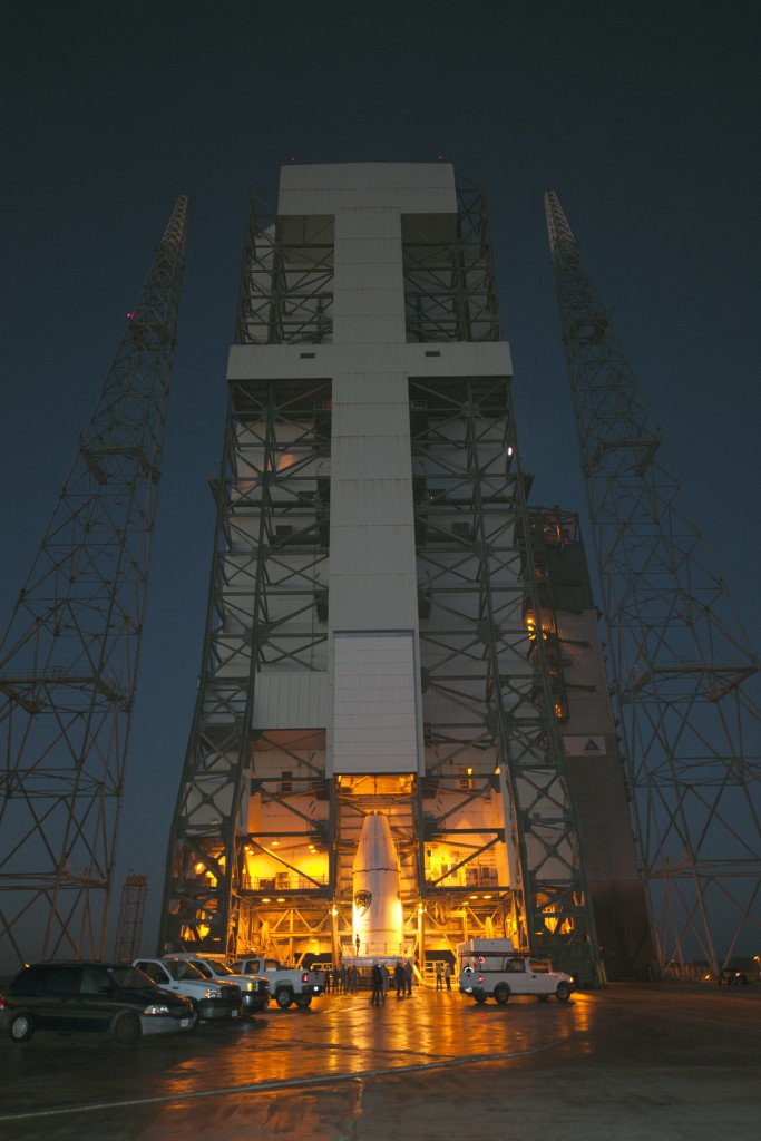
    GPSIIF-launch-ULA-8As this magazine went to press on March 19, the U.S. Air Force’s ninth GPS Block IIF satellite (GPS IIF-9) was being readied for a March 25 launch [since successfully launched]. The satellite was encapsulated in the Delta IV rocket’s 4-meter-diameter nose cone at a processing facility, and moved to the launch pad at Space Launch Complex 37 for mating to its booster inside the mobile service tower.

    Launch is scheduled for March 25 at 2:36 p.m. U.S. Eastern time from Space Launch Complex 37 at Cape Canaveral Air Force Station, Fla. GPS IIF-9 marks the 29th Delta IV launch and the 57th operational GPS satellite to launch on a ULA or heritage launch vehicle.

    CNAV Performance Compares Favorably to Legacy Signals

    A March 5 announcement concerning the new L2C and L5 GPS civil signals states: “CNAV Message Types 10, 11, 30 and 33 are currently transmitted on seven GPS IIR-M (L2C) and eight GPS IIF satellites (L2C and L5). A Modernized Navigation (MODNAV) Tool integrated with the GPS ground control software (Architecture Evolution Plan or AEP) is generating the CNAV data messages. Daily CNAV uploads began December 31, 2014, and the U.S. Air Force reports that signal performance of CNAV matches or slightly outperforms Legacy performance: average user range error (RMS URE) from 25 February – 3 March 2015 was 0.50 m for Legacy and 0.57 m for Modernized; best week for Modernized signals since the broadcast initiated April 2014 was 0.42 m for 6 – 13 January 2015.

    “Users are reminded that these CNAV signals are ‘pre-operational’ and should be used with discretion until they become fully operational; the L5 message is currently set unhealthy,” concluded Rick Hamilton, CGSIC Executive Secretariat, USCG Navigation Center, in a status email to the Civil Global Positioning System Service Interface Committee (CGSIC).

    Galileo Six, Seven, Eight: Lay Them Straight
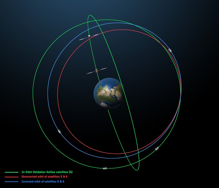
    The original (in red) and corrected (in blue) orbits of the fifth and sixth Galileo satellites, along with that of the first four satellites (green).
    The original (in red) and corrected (in blue) orbits of the fifth and sixth Galileo satellites, along with that of the first four satellites (green).

    On March 17, some stations participating in the International GNSS Service Multi-GNSS Experiment acquired E1 and E5a signals from Galileo 6 (FOC-FM2, GSAT0202). The satellite is using pseudorandom noise code E14.

    This development follows the successful repositioning of the sixth Galileo satellite into a corrected orbit, which will now allow detailed testing to assess the performance of its navigation payload. A 20-meter-diameter antenna at the European Space Agency’s (ESA’s) Redu center in Belgium will study the strength and shape of the navigation signals at high resolution.

    Launched with the fifth Galileo last August, its initial elongated orbit saw it traveling as high as 25,900 kilometers above Earth and down to a low point of 13,713 kilometers — confusing the Earth sensor used to point its navigation antennas at the ground.

    A recovery plan was devised between ESA’s Galileo team, flight dynamics specialists at ESA’s ESOC operations centre and France’s CNES space agency, as well as satellite operator SpaceOpal and manufacturer OHB. This involved gradually raising the lowest point of the satellites’ orbits more than 3,500 km while also making them more circular.

    The fifth Galileo entered its corrected orbit at the end of November 2014. Both its navigation and search-and-rescue payloads were switched on the following month to begin testing. Now the sixth satellite has reached the same orbit.

    This latest salvage operation began in mid-January and concluded six weeks later, with 14 maneuvers performed in total. Its corrected position is effectively a mirror image of the fifth satellite’s, placing the pair on opposite sides of the planet. The exposure of the two to the harmful Van Allen Belt radiation has been greatly reduced, helping to ensure future reliability.

    The corrected orbit means they will overfly the same location on the ground every 20 days. This compares with a standard Galileo repeat pattern of every 10 days, helping to synchronize their ground tracks with the rest of the constellation.

    “I am very proud of what our teams at ESA and industry have achieved,” said Marco Falcone, head of the Galileo system office. “Our intention was to recover this mission from the very early days after the wrong orbit injection. This is what we are made for at ESA.”

    The decision whether to use the two satellites for navigation and search-and-rescue purposes will be ultimately made by the European Commission, as the system owner, based on the in-orbit test results and the system’s ability to provide navigation data from the improved orbits.

    March 27 Launch Date for Galileo Seven, Eight

    The seventh and eighth Galileo satellites, set for launch together on March 27, were placed onto the Fregat upper stage of their Soyuz ST-B launcher in mid-March. [The satellites have been successfully launched.]

    The Fregat stage will hold the satellites in place during their four-hour flight into orbit 22,300 kilometers above the Earth. Then, at the correct altitude, the two satellites are sprung away in opposing directions.

    The Fregat upper stage was blamed for the  August mis-delivery of Galileo satellites five and six. The root cause of the anomaly producing the wrong orbits was a shortcoming in the system thermal analysis performed during stage design, according to findings by an independent inquiry board.

    The anomaly occurred during the flight of the launcher’s fourth stage, Fregat. It occurred about 35 minutes after liftoff, and was due to a temporary interruption of the joint hydrazine propellant supply to the Fregat thrusters. The interruption in the flow was caused by freezing of the hydrazine, resulting from the proximity of hydrazine and cold helium feed lines, these lines being connected by the same support structure, which acted as a thermal bridge. Ambiguities in the design documents allowed the installation of this type of thermal bridge between the two lines.

    IRNSS Launch Scheduled for March 29

    The launch of the fourth satellite for the Indian Regional Navigation Satellite System, previously scheduled for March 9, was postponed until March 29 at 13:00 UTC, due to the replacement of a faulty telemetry transmitter on the satellite. [The satellite has been successfully launched.]

    IRNSS-1D will be fourth in the seven-spacecraft IRNSS constellation.

    BeiDou, Too, in Late March

    There are indications that the first satellite in the BeiDou Phase 3 expansion may be launched by the end of March [since successfully launched]. Apparently, a BeiDou satellite has been shipped to the Xichang launch site, and tracking ships have left port for the open ocean. Also, a philatelic first day cover for the launch (a common Chinese practice) has been issued with a March 2015 inscription. This is likely a launch of a medium Earth orbit (MEO)satellite.

    Where It All Began for Galileo and EGNOS

    The European Space Agency issued a press information notice on June 11, 1995 — in the same timeframe as the GPS FOC announcement noted on the previous page — titled “Europe’s Contribution to a Navigation Satellite System.”

    “The European Commission, the European Space Agency (ESA), and the civil aviation organisation EUROCONTROL have agreed to cooperate on a joint programme).  The European Satellite Navigation (ESN) Action Programme, elements of which are GNSS-1 [First Generation Global Navigation Satellite System] and GNSS-2, is planned to run for five years (from mid-1995 to mid-2000) with a budget of the order of 150 million euros.

    National aviation authorities and the parties involved in the action programme see Europe’s commitment to satellite navigation as being of strategic significance for the future.

    “The main objective of the programme is to develop technologies that will ensure that data from the two existing Global Navigation Satellite Systems — the United States’ GPS and Russia’s GLONASS — which are both under military control, will also be available for civil use on a reliable basis and will provide the requisite precision.  In parallel, studies will be conducted in order to make preparations for a second generation satellite-navigation and positioning system (GNSS-2), to be deployed as from 2005.

    “In the first phase (GNSS-1), ESA’s contribution to the joint action programme will be EGNOS [European Geostationary Navigation Overlay Service].  Satellites stationed in geostationary orbit at an altitude of about 36,000 km will relay to aircraft, shipping or road vehicles information that will enable the recipients to determine their actual positions with greater precision than is possible by using GPS/GLONASS data alone.  Civil users of those systems receive artificially degraded data deviating by about 100 metres.  EGNOS, will enable in particular, to increase the number of satellites that can be seen by a given user within the geostationary broadcast area.

    “Around the period 2005–2008, after completing a trial period, the new system is due to be used as sole means.” 

    Galileo, Previously GNSS-2

    “It is planned to develop GNSS-2 in the period between 2005 and 2020, building on experience acquired under GNSS-1.  From the technical viewpoint, the second generation will be a considerable improvement on the first in terms of reliability, precision and availability. 

    “However, if Europe were to confine itself to developing the relevant technologies, its industry would have only a very slim chance of being involved in the construction of the satellites for the system or in the control and user segments for a second-generation civil system (GNSS-2). Given that U.S. and Russian firms are the current leaders in this area, it is necessary for strategic reasons for Europe to carry out a comprehensive development and demonstration programme as it must be able to prove it has the requisite capabilities before GNSS-2 becomes operational, which, in the experts’ opinion, will be from 2005.

    “The time schedule foreseen for the different steps can be summarised as follows:

    • GNSS-1 mission analysis and definition studies: mid-1995 to mid-1996
    • European GNSS-1 pre-operational mission (task 1): to end 1997. Development of the geostationary network, following the Inmarsat III launch and first ranging demonstration phase
    • GNSS-1 (task 2): 1996 to end 1998. In parallel to the development of the network, the Ground Integrity Channel will be set up, followed by a second demonstration phase
    • GNSS-1 (task 3): 1997 to early 2000. Wide Area Differential service for precision approaches to be set up and tested
    • Introduction of GNSS-1 as sole means: 2000/2003.”

    GPS World is indebted to Richard Langley’s CANSPACE archive of historical documents for this note of interest.
  • Spectracom Adds India’s IRNSS, Japan’s QZSS to Simulator Capabilities

    Spectracom Adds India’s IRNSS, Japan’s QZSS to Simulator Capabilities

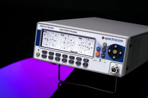
    Spectracom’s GSG-6 Series multi-frequency GNSS signal simulator. Photo: Spectracom
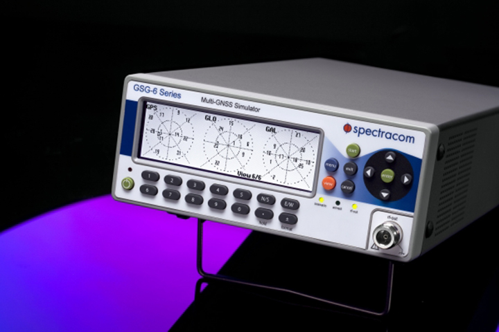
    Spectracom’s GSG-6 Series multi-frequency GNSS signal simulator. Photo: Spectracom

    Spectracom has added capability to simulate India’s global navigation satellite system, IRNSS, and Japan’s regional satellite system, QZSS, to its GSG-6 Series multi-frequency GNSS signal simulator. The simulator is designed to be field upgradeable to simulate all current and future GNSS constellations so current customers can benefit from these features without the need for a factory return in most cases.

    “Spectracom understands the need for system developers and integrators to be compatible with various GNSS systems. Support for multiple constellations is a requirement in many markets and additional satellites add signal diversity for improved reliability,” said Spectracom Global Sales and Marketing Vice President Rohit Braggs. “Our easy-to-use, compact and affordable GNSS simulator can now be configured with IRNSS and QZSS capability in addition to the big four: GPS, GLONASS, BeiDou and Galileo. Our customers can buy what they need now and easily upgrade in the future, often times without a hardware upgrade.”

    In anticipation of the deployment of new GNSS systems, Spectracom ensures that every GSG simulator that leaves the factory is tested for compliance with all L-band signal frequency and modulation specifications as defined in their ICDs, the company said.

    The Series 6 multi-frequency simulator is fully capable of all four bands of any system: L1 / E1 / B1; L2 / L2C; L5 / E5 / B2; and E6 / B3.

    “As we have seen with our recent roll-out of Beidou and Galileo signal compatibility, when the need for new signals arise, we will offer those capabilities with a simple upgrade path,” Braggs said. “This ensures our customer’s investment is always protected.”

  • India’s IRNSS-1D Launched into Orbit

    India’s IRNSS-1D Launched into Orbit

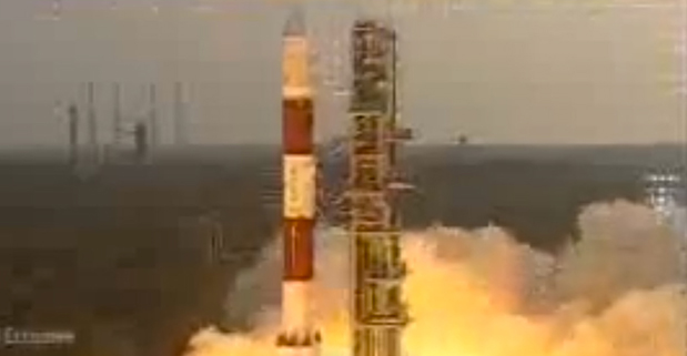
    IRNSS-1D-1-launch
    Photo credit: ISRO

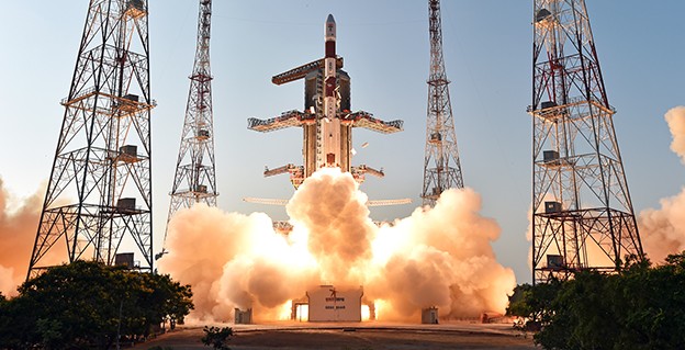
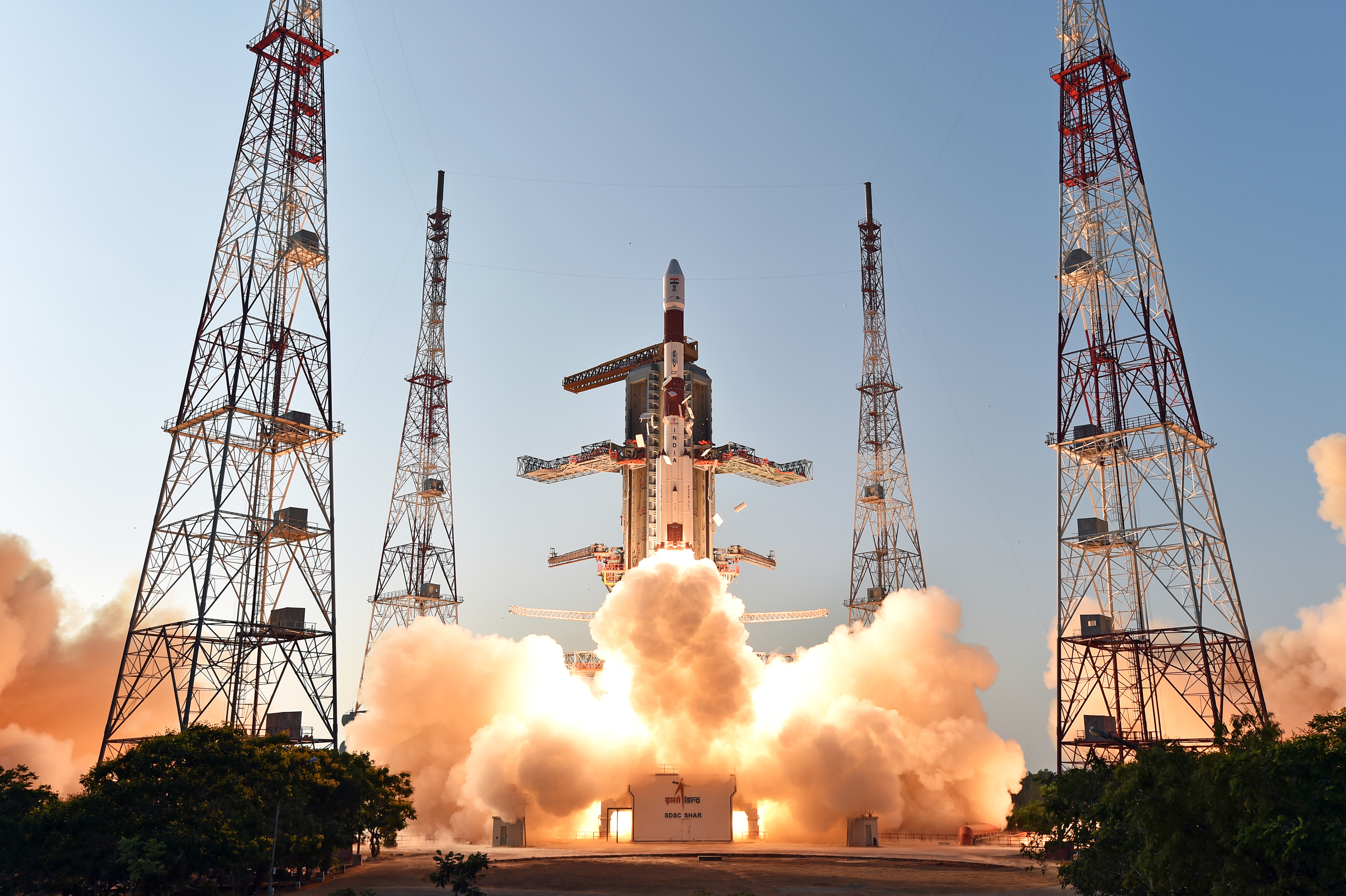
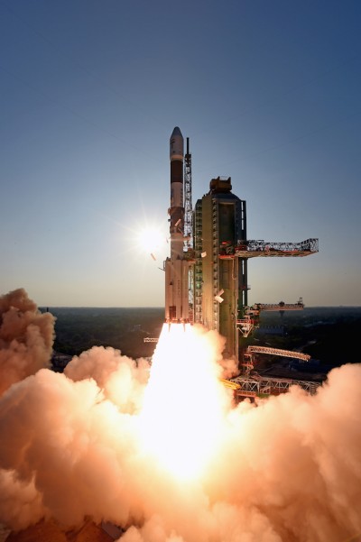
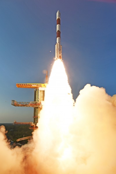
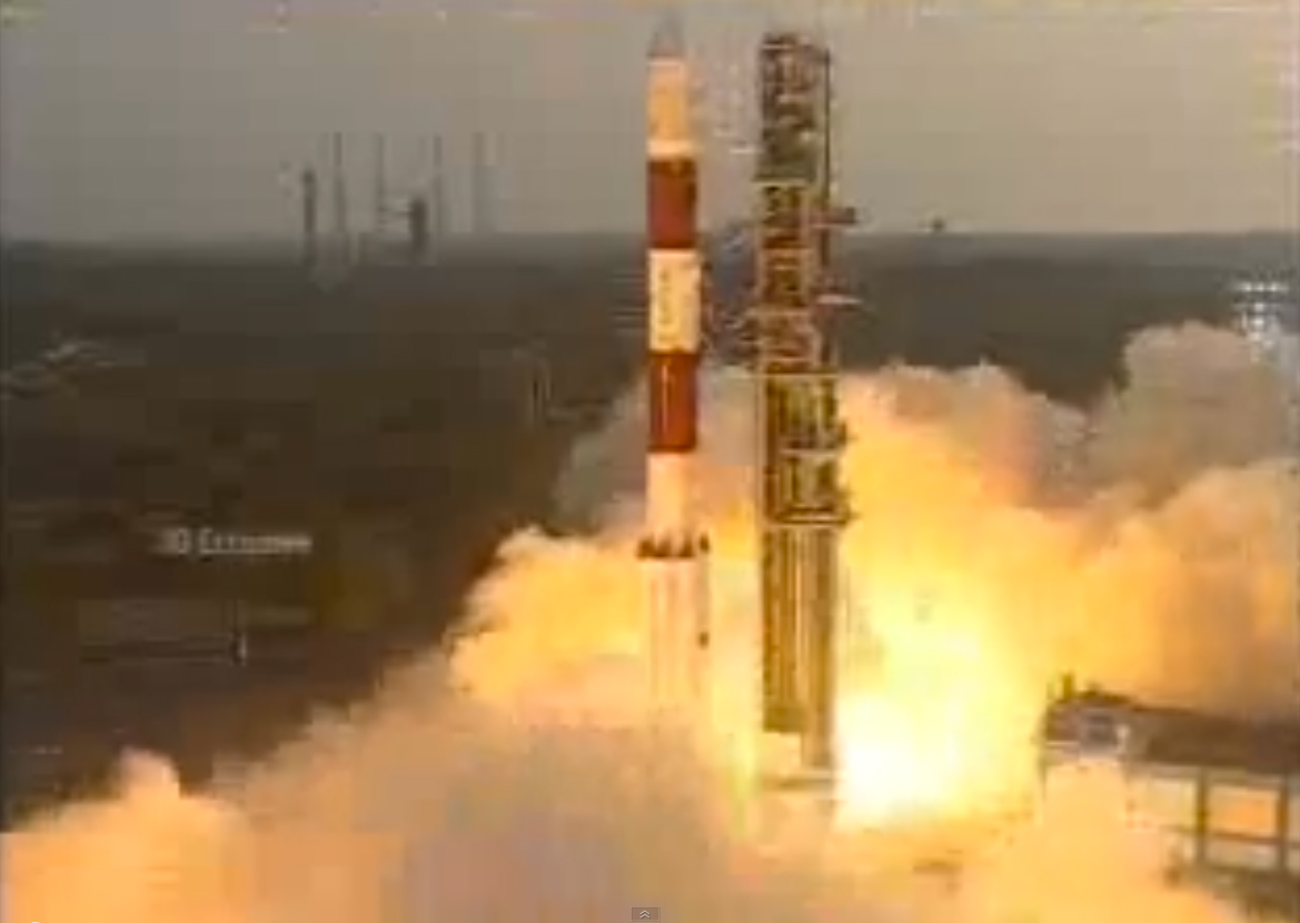
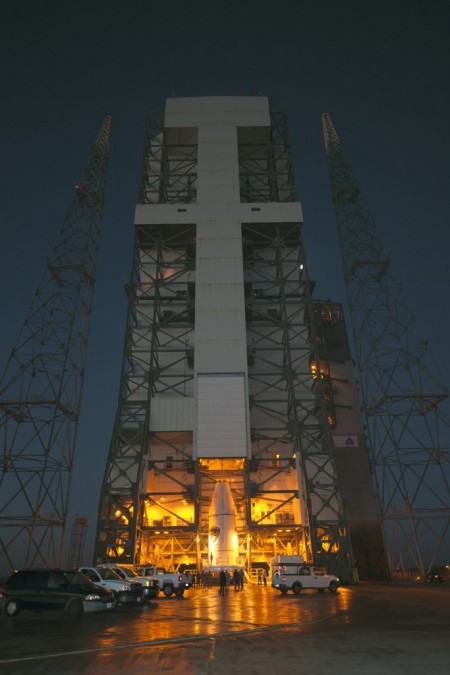
    The fourth satellite of IRNSS satellite navigation constellation, IRNSS-1D, was launched onboard PSLV-C27 on Saturday, March 28, according to the Indian Space Research Organization (ISRO). The Polar Satellite Launch Vehicle blasted off at 11:49 GMT (7:49 a.m. EST), or 5:19 p.m. local time, at the Satish Dhawan Space Center on India’s east coast.

    This is the fourth successful launch of a navigation satellite in less than a week, following GPS IIF-9 on Wednesday and Galileo 7 and 8 on Friday. A fifth navigation satellite, for the BeiDou constellation, is expected to launch tomorrow.

    This is the 28th consecutively successful mission of the PSLV, the ISRO said. The “XL” configuration of PSLV was used for this mission. Previously, the same configuration of the vehicle was successfully used seven times.

    After the PSLV-C27 lift-off with the ignition of the first stage, the subsequent important flight events took place as planned. After a flight of about 19 minutes, 25 seconds, the IRNSS-1D satellite was injected to an elliptical orbit of  282.52 km X 20,644 km, very close to the intended orbit, and successfully separated  from the PSLV fourth stage.

    After injection, the solar panels of IRNSS-1D were deployed automatically. ISRO’s Master Control Facility (at Hassan, Karnataka) took over the control of the satellite. In the coming days, four orbit maneuvers will be conducted from the Master Control Facility to position the satellite in geosynchronous orbit at 111.75 degrees East longitude with 30.5 degrees inclination.

    IRNSS-D is the fourth of seven IRNSS satellites to be launched to provide navigational services to the region, according to the ISRO. The satellite was placed in geosynchronous orbit. Predecessors IRNSS-1A, 1B and 1C were launched by PSLV-C22, PSLV-C24 and PSLV-C26 in July 2013, April 2014 and October 2014 respectively. All the satellites are functioning satisfactorily from their designated orbital positions.

    The IRNSS navigational system is regional, and targeted towards South Asia. The satellite will enable navigation, tracking and mapping services.

    The next satellite, IRNSS-1E, is scheduled to be launched by PSLV. The entire IRNSS constellation of seven satellites is planned to be completed by 2016.

    IRNSS-1D-2-launch
    Photo credit: ISRO
    IRNSS-1D-3-launch
    Photo credit: ISRO
  • Launch of IRNSS-1D Now Set for Saturday

    The launch of India’s fourth Navigation Satellite, IRNSS-1D, is now scheduled for 17:19 IST (11:49 UTC) on Saturday, March 28, from Satish Dhawan Space Centre, Sriharikota.

    The launch was previously scheduled for March 9, then postponed until March 29 to replace a faulty telemetry transmitter on the satellite, according to the Indian Space Research Organization.

    IRNSS-1D will be fourth in the seven-spacecraft Indian Regional Navigation Satellite System constellation. It will be flown into space in the Indian Polar Satellite Launch Vehicle-XL.

    The space segment of the IRNSS consists of seven satellites: three  in geostationary orbit and four in inclined geosynchronous orbit. The ground segment consists of infrastructure for controlling, tracking and other facilities. The entire IRNSS constellation of seven satellites is planned to be completed by 2015.

    Both IRNSS-1A and 1B are functioning satisfactorily from their designated geosynchronous orbital positions. The first three satellites in the IRNSS series were launched from Sriharikota on July 1, 2013, April 4, 2014, and October 16, 2014. IRNSS-1E and IRNSS-1F satellites are expected to be launched before year end.

    IRNSS is an independent regional navigation satellite system designed to provide position information in the Indian region and 1,500 kilometers around the Indian mainland. IRNSS will provide two types of service: Standard Positioning Services (SPS) — provided to all users — and Restricted Services (RS), provided to authorized users.


  • IRNSS-1D Launch Rescheduled for March 29

    The launch of the fourth satellite for the Indian Regional Navigation Satellite System, previously scheduled for March 9, has been postponed until March 29 at 13:00 UTC. The delay is due to the replacement of a faulty telemetry transmitter on the satellite.

    “We are targeting the last few days of March for the launch. A team is working on a new telemetry transmitter to replace the [faulty] one that failed in the satellite. After fixing it, all numerous tests that we conducted earlier must be repeated,” M.Y.S. Prasad, Director of the launch unit, Satish Dhawan Space Centre, Sriharikota, told The Hindu on Tuesday.

    The launch, originally scheduled for March 9,  was delayed March 4 when routine checks found a transmitter malfunctioning. The ISRO delayed the flight and removed the satellite from its launcher to put a new transmitter.

    IRNSS-1D will be fourth in the seven-spacecraft IRNSS constellation.

    — With information provided by the CANSPACE listserv.

  • Launch of IRNSS-1D Postponed

    The launch of India’s fourth navigation satellite, IRNSS-1D, originally scheduled for March 9, has been postponed.

    During the integrated electrical checks on March 3 of the launch vehicle and satellite following closure of the heat shield, an anomaly was observed in one of the telemetry transmitters of the satellite, according to a post on the Indian Space Research Organization (ISRO)’s Facebook page.

    “In order to resolve the technical anomaly through further test, simulation and analysis, the launch of PSLV-C27 with IRNSS-1D has been postponed,” the post states. IRNSS-1D will be flown into space in the Indian Polar Satellite Launch Vehicle-XL (PSLV-C27) from Satish Dhawan Space Centre, Sriharikota.

    IRNSS-1D is the fourth navigation satellite in the Indian Regional Navigational Satellite System, and will make the constellation operable.

  • ISRO to Launch Fourth Navigation Satellite March 9

    The Indian Space Research Organization (ISRO) is expected to launch IRNSS-1D on March 9, reports The Times of India. IRNSS-1D is the fourth navigation satellite in the Indian Regional Navigational Satellite System, and will make the constellation operable.

    The launch is tentatively planned for March 9 around 6:35 p.m. However, final go for the launch will be given by the ISRO’s Launch Authorization Board, which will meet March 6.

    IRNSS-1D will be flown into space in the Indian Polar Satellite Launch Vehicle-XL.

    The space segment of the IRNSS consists of seven satellites: three  in geostationary orbit and four in inclined geosynchronous orbit. The ground segment consists of infrastructure for controlling, tracking and other facilities. The entire IRNSS constellation of seven satellites is planned to be completed by 2015.

    Both IRNSS-1A and 1B are functioning satisfactorily from their designated geosynchronous orbital positions. The first three satellites in the IRNSS series were launched from Sriharikota on July 1, 2013, April 4, 2014, and October 16, 2014. IRNSS-1E and IRNSS-1F satellites are expected to be launched before year end.

    IRNSS is an independent regional navigation satellite system designed to provide position information in the Indian region and 1,500 kilometers around the Indian mainland. IRNSS will provide two types of service: Standard Positioning Services (SPS) — provided to all users — and Restricted Services (RS), provided to authorized users.


  • The System: Fregat Design Ambiguity Steered Galileo Wrong

    Cross-Installed Hydrazine, Helium Lines Froze Thrusters

    The root cause of the anomaly that sent two Galileo satellites into the wrong orbit on August 22 was a shortcoming in the system thermal analysis performed during stage design, and not an operator error during stage assembly, according to findings by an independent inquiry board.

    The independent inquiry board was created by Arianespace, in conjunction with the European Space Agency and the European Commission. Its conclusions draw on data supplied by Russian partners in the program, and are consistent with the final conclusions of the inquiry board appointed by the Russian space agency Roscosmos.

    The anomaly occurred during the flight of the launcher’s fourth stage, Fregat, designed and produced by NPO Lavochkin. It occurred about 35 minutes after liftoff, at the beginning of the ballistic phase preceding the second ignition of this stage.

    The board’s conclusions confirm that the first part of the mission proceeded nominally, which means that the three-stage Soyuz launcher was not at fault. The inquiry board also eliminated the hypothesis that the anomaly could have been caused by the abnormal behavior of the Galileo satellites.

    The scenario that led to an anomaly in the orbital injection of the satellites was precisely reconstructed, as follows:

    The orbital error resulted from an error in the thrust orientation of the main engine on the Fregat stage during its second powered phase.

    This orientation error was the result of the loss of inertial reference for the stage.

    This loss occurred when the stage’s inertial system operated outside its authorized operating envelope, an excursion that was caused by the failure of two of Fregat’s attitude-control thrusters during the preceding ballistic phase.

    This failure was due to a temporary interruption of the joint hydrazine propellant supply to these thrusters. The interruption in the flow was caused by freezing of the hydrazine.

    The freezing resulted from the proximity of hydrazine and cold helium feed lines, these lines being connected by the same support structure, which acted as a thermal bridge.

    Ambiguities in the design documents allowed the installation of this type of thermal “bridge” between the two lines. In fact, such bridges have also been seen on other Fregat stages now under production at NPO Lavochkin.

    The design ambiguity is the result of not taking into account the relevant thermal transfers during the thermal analyses of the stage system design.

    The system thermal analyses have been reexamined in depth to identify all areas concerned by this issue. The board has chosen these corrective actions for the return to flight.

    • Revamp of the system thermal analysis.
    • Associated corrections in the design documents.
    • Modification of the documents for the manufacture, assembly, integration, and inspection procedures of the supply lines.

    Arianespace said these measures can immediately be applied by NPO Lavochkin to the stages already produced, meaning that the Soyuz launcher could be available for its next mission from the Guiana Space Center in December.

    “We are looking at the resumption of Soyuz launches from the Guiana Space Center, as early as December 2014,” stated the Arianespace CEO. “The resolution of this anomaly will enable a consolidation of the reliability of Fregat, which had experienced 45 consecutive successes until this mission.” 

    Galileo Service Controls Handed to GNSS Agency

    Full Operability Set for 2020

    The European GNSS Agency (GSA) and the European Commission have concluded an agreement that delegates a range of exploitation tasks for Galileo to the GSA, providing a framework and budget for the development of services and operations through 2021.

    The signing of the Galileo Exploitation Delegation Agreement serves as an initial step towards the full Galileo Exploitation Phase. According to the governance structure set out in the agreement, the European Commission is responsible for the overall programme supervision, the European Space Agency (ESA) is entrusted with the deployment phase, while the GSA is responsible for the exploitation phase. The GSA’s responsibilities include:

    • provision and marketing of the services
    • management, maintenance, continuous improvement, evolution and protection of the space and ground infrastructure
    • research and development of receiver platforms with innovative features in different application domains
    • development of future generations of the system
    • cooperation with other GNSS
    • all other required activities to ensure the development and smooth running of the system.

    “With Galileo, we aim to provide a tangible service to European citizens, and this Delegation Agreement ensures we have the tools and funding necessary to achieve this,” said GSA Executive Director Carlo des Dorides.

    Full operability of Galileo is now scheduled for 2020, a slight revision of the previous 2018 projection.

    The agreement specifically sets the actions to be implemented, the amount of funding provided, and the conditions for the overall management. The maximum current EU contribution amounts to EUR 490 million, which will cover procurement and grant activities, including the GSA-ESA working arrangements and a programme management reserve, along with related research and development activities. The financing of the full exploitation phase will be confirmed during a mid-term review before the end of 2016.

    India Launches Third Satellite and ICD

    India successfully launched IRNSS-1C, the third satellite in the Indian Regional Navigation Satellite System (IRNSS), on October 16. The satellite was injected to an elliptical orbit of 282.56 x 20,670 kilometers, very close to its intended final geostationary orbit at 83 degrees East longitude. 

    IRNSS-1C is the third of the seven satellites constituting the space segment of the Indian Regional Navigation Satellite System. Tthe first two were launched in July 2013 and April of this year. Both are functioning satisfactorily from their designated geosynchronous orbital positions. 

    IRNSS is an independent regional navigation satellite system designed to provide position information in the Indian region and 1,500 kilometers around the Indian mainland. IRNSS will provide two types of services: Standard Positioning Services (SPS), provided to all users, and Restricted Services (RS), provided to authorized users. Ground stations have been established in at least 15 locations across India.

    The next satellite of the constellation, IRNSS-1D, is scheduled to be launched in the coming months. The full IRNSS constellation of seven satellites is planned to be completed by 2015.

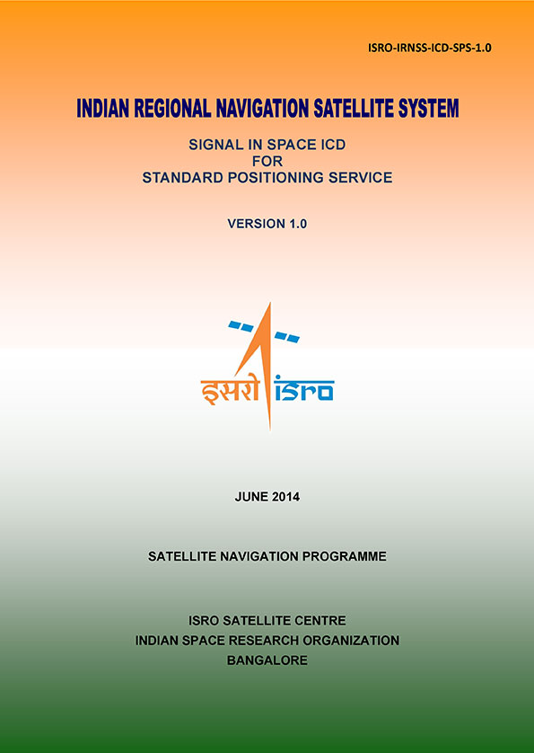
    IRNSS ICD Released. In late September, the Indian Space Research Organization (ISRO) released version 1 of the IRNSS Signal in Space Interface Control Document (ICD) for the Standard Positioning Service.

    The document provides information on the signals and structures of the IRNSS system, including signal modulations, frequency bands, received power levels, the data structures and their interpretations, and user algorithms.

    Registration is required for ICD download access at a new IRNSS website

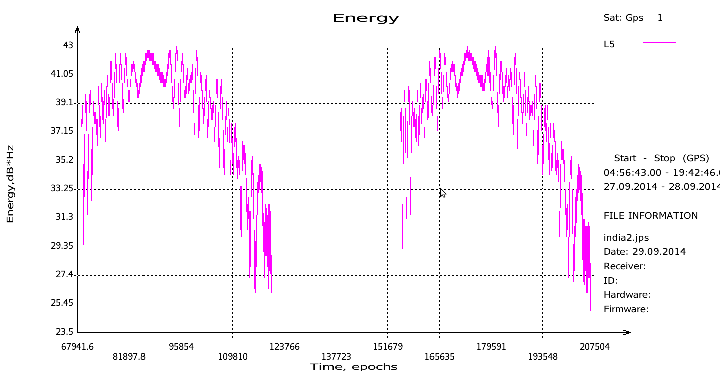
    JAVAD Tracks Signal. JAVAD GNSS published a chart showing that it has tracked the IRNSS L5 signal.

    Shortly after ISRO released its IRNSS Signal in Space Interface Control Document (ICD), JAVAD GNSS tracked the L5 BPSK signal from both 1A and 1B satellites. Ability to track IRNSS L5 will be added to all JAVAD L5-capable receivers in the near future, the company said.

    SNR of two passes of 1A satellite (IGSO) over Moscow.
    SNR of two passes of 1A satellite (IGSO) over Moscow.

    Let’s All Be GPS III for Halloween

    As this magazine goes to press on October 23, the U.S. Air Force is set to launch the eighth GPS IIF satellite from Cape Canaveral Air Force Station on Wednesday, October 29.  An 18-minute launch window will open at 1:21 p.m. U.S. Eastern time. If all goes well, the satellite will be accomplishing its early-orbit checkouts and beginning maneuvers towards its final orbital plane as U.S. children make their costumed Halloween rounds, collecting candy. Other Western countries celebrate All Hallows’ Eve followed by All Saints’ Day on November 1.

  • JAVAD GNSS Tracks IRNSS Signal

    JAVAD GNSS has published a chart showing that it has tracked the IRNSS (Indian Regional Navigational Satellite System) L5 signal.

    Shortly after the Indian Space Research Organization (ISRO) released its IRNSS Signal in Space Interface Control Document (ICD), JAVAD GNSS was able to track the L5 BPSK signal from both 1A and 1B satellites. Ability to track IRNSS L5 will be added to all JAVAD L5-capable receivers in the near future, the company said.

    SNR of two passes of 1A satellite (IGSO) over Moscow.
    SNR of two passes of 1A satellite (IGSO) over Moscow.
  • IRNSS Signal in Space ICD Released

    News courtesy of CANSPACE Listserv.

    IRNSS_ICD_Cover-W
    Photo: CANSPACE Listserv

    The Indian Space Research Organization (ISRO) has released Version 1 of the Indian Regional Navigational Satellite System (IRNSS) Signal in Space Interface Control Document for the Standard Positioning Service.

    The document provides information on the signals and structures of the IRNSS system, including signal modulations, frequency bands, received power levels, the data structures and their interpretations, and user algorithms.

    According to ISRO, the document is being released to the public to facilitate research and development and to aid the commercial use of the IRNSS signals for navigation-based applications.

    Registration is required for ICD download access at a new IRNSS website. At the moment, only the ICD is available at this website.

    The next IRNSS satellite launch is scheduled for the second week of October. The most recent launch was in April, of the second IRNSS satellite, IRNSS-1B.

    IRNSS is an independent regional navigation satellite system being developed by India. It is designed to provide accurate position information service to users in India and the region extending up to 1,500 kilometers from its boundary. IRNSS will provide two types of service: Standard Positioning Service (SPS) and Restricted Service (RS). It is expected to provide a position accuracy of better than 20 meters in the primary service area.

  • The System: GLONASS Fumbles Forward

    The System: GLONASS Fumbles Forward

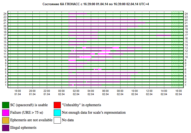
    GLONASS PLOT from the Roscosmos GLONASS Information-Analytical Centre, showing the 12-hour outage, with full service eventually restored on April 2.
    GLONASS PLOT from the Roscosmos GLONASS Information-Analytical Centre, showing the 12-hour outage, with full service eventually restored on April 2.

    Two April Disruptions Furnish Fodder for Multi-GNSS Receivers and Alternative PNT

    In an unprecedented total disruption of a fully operational GNSS constellation, all satellites in the Russian GLONASS broadcast corrupt information for 11 hours, from just past midnight until noon Russian time (UTC+4) on April 2 (or 5 p.m. on April 1 to 4  a.m. April 2, U.S. Eastern time). This rendered the system completely unusable to all worldwide GLONASS receivers. Full service was subsequently restored.

    “Bad ephemerides were uploaded to satellites. Those bad ephemerides became active at 1:00 a.m. Moscow time,” reported one knowledgeable source. GLONASS navigation messages contain, as they do for every GNSS in orbit, ephemeris data used to calculate the position of each satellite in orbit, and information about the time and status of the entire satellite constellation (almanac); user receivers on the ground processed this data to compute their precise position.

    The GLONASS fix could not take effect until each satellite in turn could be reset, during its pass over control stations in Russian territory, in the Northern Hemisphere, thus taking nearly 12 hours.

    During the outage, CEO Neil Vancans of Altus Positioning Systems reported “We are currently experiencing calls from customers all over the world who are experiencing GLONASS ‘outages’ and we have advised customers to switch GLONASS tracking off on our receivers.”

    Such a — possibly human, possibly computer-generated — error could conceivably occur with GPS, Galileo, or BeiDou. “Another reason to have backups,” mused Richard Langley of the University of New Brunswick. “And not just other GNSS.”

    Trouble Chronolog. The constellation suffered a second failure two weeks later. On April 14, eight GLONASS satellites were simultaneously set unhealthy for about half an hour, meaning that most GLONASS or multi-constellation receivers would have ignored those satellites in positioning computations. In addition, one other satellite in the fleet was out of commission undergoing maintenance. This might have left too few healthy satellites to compute GLONASS-only receiver positions in some locations.

    The two blackouts followed two other high-profile disasters: the destruction-upon-launch of three new GLONASS satellites in July 2013, and the Pacific drowning-upon-launch of three satellites in December 2010.

    Internal Dialog. The semi-official Russian news daily Izvestia (“Truth”) reported that the loss of service was inconsequential for Russian users. Loose translation courtesy of Google:

    “Temporary GLONASS failure has not led to tangible consequences for consumers of services because chip manufacturing exclusively with GLONASS for the mass market is practically nil: there are chips that work only with the GPS signals, and there are those that see both GPS and GLONASS.”

    In other words, there are practically no mass-market devices, even in Russia, that use exclusively GLONASS.

    “In any case, the failure of the entire system for a long period is a serious blow to the image of GLONASS, especially in a situation where Russia has made efforts to promote domestic navigation system to external markets. Plus in 2012, the Russian government officially promised to maintain the characteristics of the international community GLONASS at the proper level for 15 years.”

    Industry View, Multi-GNSS. During the first outage, chip company Broadcom was conicidentally conducting multi-constellation receiver tests in Asia. Frank van Diggelen, the company’s chief GNSS scientist, stated, “We have definitive data to show how a multi-constellation receiver survives such an outage. Test data coincident with the GLONASS ephemeris disruption show how a GPS/GLONASS/QZSS/BeiDou receiver survives the complete disruption of one of the constellations.”

    A Broadcom 47531receiver tracking GPS/GLONASS/QZSS/BeiDou signals simultaneously and using logic to analyze redundant measurements to check the validity of all measurements successfully identified and removed the bad GLONASS ephemeris, maintaining position continuity and accuracy. Another receiver under test at the same time, tracking only GPS and GLONASS, wandered significantly in its position reports.

    Industry View, Back Up PNT. Calling it an “unprecedented and deeply worrying total disruption…[that] shook the industry,” Locata Corporation reiterated its call for redundant terrestrial systems to back up GNSS in the wake of the outage.

    Nunzio Gambale, Locata CEO, said “We have been telling the industry for years that you cannot have a critically important capability like GPS without also having a backup! What is Plan B if the satellite systems fail? What replaces the space signal when there is a problem? This event should terrify every nation, government, and company that depends on navigation satellites for their business or, in some cases, their very lives.”

    GNSS navigation and timing functions underpin the world’s banking systems, stock exchanges, digital TV and Internet, cell-phone networks, and, in some cases, the national electricity supply, Locata pointed out. GPS, in particular, plays a crucial role in transportation, shipping, and logistics, serving as the enabling technology for critical functions like air traffic control. Reliability is therefore not just important; it is essential across all applications.

    “We ignore the possibility of these ‘Black Swan’ events at our own peril,” added Chris Rizos of the University of New South Wales.

    eLoran Authorization in Progress

    Russia’s April 1 GLONASS blackout occurred, ironically, only hours after the U.S. House of Representatives passed legislation to preserve infrastructure that could support a backup system for GPS that could be used for critical infrastructure and applications in the event of a similar disaster occurring in the United States.

    The 2014 Coast Guard Authorization Act requires the Department of Homeland Security (DHS) to halt dismantling and disposal of infrastructure that could be used for a terrestrial system during times and in places where GPS is not available.

    DHS had announced in 2008 that it would build such a backup system, but it never did so, and actually began dismantling, destroying, and divesting itself of Loran equipment and properties. The equipment, facilities, and sites could be used to implement a new generation eLoran system for GPS backup, among other applications. Despite strong recommendations to the contrary by its own panel of experts, the Obama administration, DHS, and the Coast Guard moved in 2009 to kill the Loran program.

    Watchdogs. Congress has lately become more visibly concerned about the vulnerability of the nation’s space systems. The 2014 National Defense Authorization Act tasked the administration with reporting on how it was going to provide necessary national security capabilities when space systems were disrupted. More recently, Congressmen Duncan Hunter (Republican, California), chair of the House Coast Guard and Marine Transportation Subcommittee, held a hearing at which he expressed his concern that the nation has no backup for GPS. He also expressed his frustration with the Department of Homeland Security, reporting that “They said they need to do a study about their study.”

    Congressman John Garamendi (Democrat, California), commented “GPS will go down one day. The question is, is there a backup?”

    The legislation passed by the House authorizes DHS to partner with public or private entities to build a system that would not only back up GPS, but also work indoors, underground and underwater — all characteristics of long-wave Loran technology.

    Resilient PNT. Dana Goward, president of the Resilient Navigation and Timing Foundation, said such a project would be relatively inexpensive. “If the existing equipment and infrastructure are preserved and reused, the system could be restored and put into operation for less than half the cost to dispose of it.”

    “It isn’t an issue of money,” Goward continued. “It is a question of the government taking this problem seriously and acting on it.”

    The foundation has as offered to partner with the government to build the system.

    “Our government has known about this issue for a long time,” Goward said. “At least since 2001. And there has been a standing presidential direction to obtain backup capability since 2004. But for some reason, it hasn’t yet happened.”

    The government’s official website about GPS (www.gps.gov) has recently updated its page on eLoran and Loran-C with a tracking log for Coast Guard and Maritime Transportation Act of 2014, which now goes to the Senate.

    IRNSS’s Second of Seven

    India’s Space Research Organisation launched a navigation satellite on April 4. IRNSS-1B is the second of seven that will comprise the first-generation Indian Regional Navigation Satellite System (IRNSS). It joins IRNSS-1A, already in orbit.

    IRNSS will consist of three geostationary satellites and two pairs in inclined geosynchronous orbits. Each IRNSS satellite uses a rubidium-based atomic clock to keep time, transmitting signals on L and S-band frequencies at 1176.45 and 2492.028 megahertz respectively.

    Lag in Recent GPS IIF’s Health Status

    By Richard Langley

    The GPS Block IIF satellite, IIF-5 or SVN64 (PRN30), launched on February 21, had not as of press time been set healthy. Typically, GPS satellites are checked out and made operational within about a month after launch.

    The delay is due to an extended navigation test being performed by the GPS master control station. A navigation upload for SVN64 was performed in March with ephemeris and clock data as usual streching weeks in advance. However, unlike with operational satellites, no further updated uploads have been performed. The aging ephermis and clock data gradually becomes less and less accurate as time goes by, but should degrade gracefully.

    Some observers will have noticed that the received navigation data from SNV64 changes infrequently. Currently, the navigation data changes once per day with an epoch of 13:00 GPS Time, unlike every two hours with operational satellites. And the data fit interval is 26 hours, compared to four hours.

    The test is scheduled to run until mid-May.


  • Second of Seven Satellites for IRNSS Launched

    Second of Seven Satellites for IRNSS Launched

    IRNSS-B is launched April 4, 2014.
    IRNSS-B is launched April 4, 2014.

    India’s Indian Space Research Organisation (ISRO) launched its second navigation satellite today, April 4, at 11:44 UTC. A Polar Satellite Launch Vehicle (PSLV) rocket launched the IRNSS-1B spacecraft in a mission originating from the Satish Dhawan Space Centre.

    Liftoff was on schedule. IRNSS-1B is the second of seven satellites that comprise the first-generation Indian Regional Navigation Satellite System (IRNSS). IRNSS-1B will join IRNSS-1A already in orbit in forming the first pair of satellites for the IRNSS.

    Watch the launch in this video:

    The IRNSS system will consist of three geostationary satellites and two pairs of spacecraft in inclined geosynchronous orbits. Each IRNSS satellite uses a rubidium-based atomic clock to keep time, transmitting signals on L and S-band frequencies at 1,176.45 and 2492.028 megahertz respectively. A C-band transponder and an array of retroreflectors will be used to determine ranging data for calibration, according to NASASpaceflight.com.