OEM boards — the beating heart of the industry — power an ever-growing list of applications.
JAVAD Board Guides ESA Vega Mission
GNSS Makers Share Insights: OEMs Discuss Their Boards, Markets and Company Growth
“Original equipment manufacturer (OEM)” is a widely used but poorly defined term. In general, it refers to a manufacturer that provides components or sub-assemblies to another one for use in the latter’s end products. In the GNSS industry, the purchasers of OEM boards typically are manufacturers of products that require positioning or navigation capabilities, such as guidance systems for tractors, UAVs or automobiles. Sometimes, such manufacturers integrate the OEM GNSS receivers with other sensors, such as inertial measurement units and lidar devices. Often, the OEM also will provide technical support to the integrator.
Much of the OEM business is not visible to the end user of the equipment that contains OEM components, let alone to the casual observer, because those components are “inside the box,” such as a guidance system, and “the box,” in turn, is under the hood or in some other hidden place. There is almost never a sticker on the outside analogous to the one that says “Intel inside” on many computers to distinguish the Intel CPU inside from, say, an AMD processor. Furthermore, OEM sales are typically obscured by confidentiality provisions in OEM licensing agreements that also address issues of branding, payment, quality assurance, and the timing of deliveries.
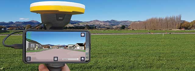
Integrators can choose from a wide variety of OEM GNSS boards depending on their intended use; the environment in which they will operate; their performance requirements; and their size, weight, power consumption and (of course) cost. OEM GNSS boards range from development kits that assist users to integrate GNSS into their product design to differential, multi-frequency, and, increasingly, multi-constellation boards.
In the following pages, six GNSS OEM manufacturers address these questions:
- How do you define OEM?
- What distinguishes your latest generation of OEM receiver boards from previous ones?
- What are the markets for your GNSS OEM receiver boards? Which ones are growing the most?
Additionally, each one showcases a product.
JAVAD GNSS Ready for Lift-Off
JAVAD GNSS has been transitioning to a new position in the market since the passing in May 2020 of its founder, president and CEO Javad Ashjaee, a giant of the GNSS industry. For several decades, the company eschewed mass production for such markets as the automobile industry and cellular phones, choosing instead to focus primarily on high-accuracy surveying applications.
“Our founder really loved the surveying market, created a lot of technology, and drove the rest of the industry through the evolutionary process to where it is today,” said Tom Hunter, the company’s chief sales officer. “You can see a little bit of JAVAD GNSS in just about any GNSS-based land survey product on the market today.”
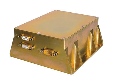
At the heart of each of JAVAD GNSS’ OEM boards is a proprietary ASIC. The boards it sells are the same ones it uses in its own reference stations, land survey products and marine systems, Hunter said. Aerospace is a key focus, an industry that requires very high accuracy, precision and reliability despite operating in environments of extreme shock, vibration, acceleration and temperatures.

“Our successes have been in working with many of the companies that build these very large launch vehicles used to carry heavy payloads into orbit,” Hunter said. “Our customers are companies such as Orbital, Northrop Grumman and SpaceX.” Those heavy-duty launch vehicles, he pointed out, must also follow a pre-described flight path. “You don’t want to start another world war because another country sees something heading its way.”
Tracing All Components. JAVAD GNSS’ boards “have complete component traceability,” Hunter said. The company does not buy any of its components from brokers. “We have to buy either directly from the manufacturer or from the manufacturers’ designated distributor, and it has full part traceability in our own factory in San Jose, California.” Should a component ever fail, the company could quickly trace when and where it was made. “That’s very important when we’re dealing with customers such as NASA, the Air Force or Boeing, because the safety of flight depends upon the performance and the quality of the product.”
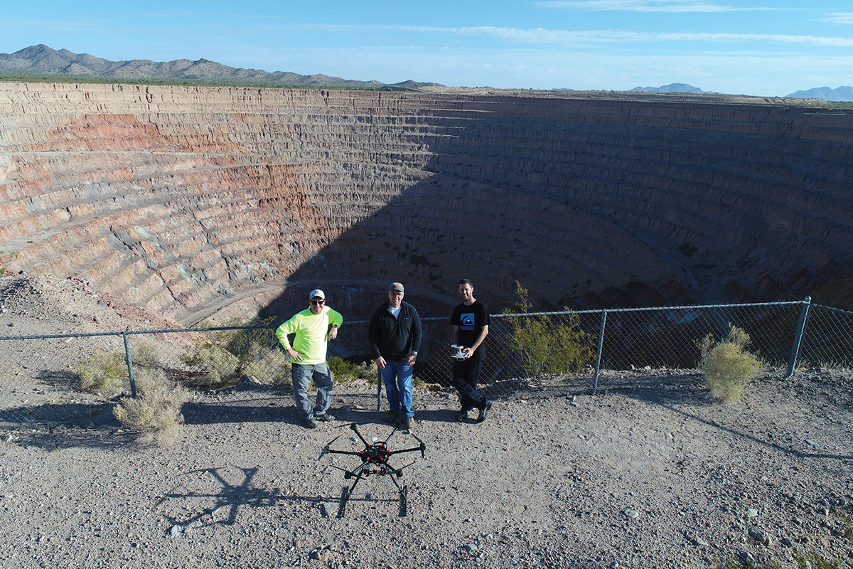
The company will soon supply a receiver that will spend about four and a half to five years in orbit on a cluster of small low-Earth-orbit satellites, Hunter said. (See “JAVAD Board Guides ESA Vega Mission” below.)
To make sure none of its products are exported illegally from the United States, JAVAD GNSS also traces where each one ends up. “We know where every one of those boards is.”
JAVAD GNSS must guarantee its aerospace customers, which have invested millions of dollars in designing their systems, that each model of its devices will remain exactly the same. Hence, it bought from some manufacturers their entire inventory of certain components, in case they discontinued making them, and certifies each
JAVAD GNSS’ products are more expensive than those from other manufacturers because they are better, Hunter claimed. “We use really high-performance, temperature-compensated oscillators in our boards to make sure we have precise timing. We use a custom ASIC that we designed and built. Our receivers have 864 channels, so they can receive just about anything broadcast in the L-band.” The company constantly upgrades its devices to match modernization of the signal structures.
“I can remember when the rest of the industry was saying, ‘You have a 12-channel GPS receiver? You’re nuts! I mean, who uses that much information?’,” Hunter recalled. “Today, we’re using every signal that comes out of GPS, whether it be L1, L2, L5, L1C, and the same thing with all of the GNSS constellations.” For example, when Japan will begin to broadcast its new QZSS signal soon, “we’re ready not only to find it, but to track it, decode it, and utilize it for position and timing solutions.” Anti-jamming and in-band interference rejection are standard in JAVAD GNSS’ products, while those from other manufacturers require external filtering or different types of antennas, Hunter pointed out.
New Leaders and Markets
After Javad Ashjaee — JAVAD GNSS’ founder, president and CEO — died in May 2020, Tom Hunter, who co-founded Ashtech with Ashjaee in 1987, returned to the company after a five-year retirement.
“He left the company with an awful lot of technology, a lot of patents, and a lot of people who knew how to design and build products, not only for today, but for the future,” Hunter explained. “They needed some guidance.”
So, in January, Nedda Ashjaee — Javad Ashjaee’s daughter and his close collaborator for the previous 25 years — and the board of directors asked Hunter to rejoin the company. “They said that they wanted me to help them make sure that we can be on a path where we can use our core technologies and enter into new market segments and new marketplaces.”
Hunter added, “We made some changes to how we introduce surveying products into the marketplace.” The company no longer sells its products directly to end users. Rather, it goes through a new process and channel for getting products into the marketplace. It also brought on board a new chief technology officer this summer who will be driving engineering efforts. “We are becoming market driven. And to do that we needed to expand our marketing, sales and engineering capabilities. We are changing every aspect of the company,” Hunter said.
JAVAD GNSS actually consists of two companies in San Jose: JAVAD GNSS, which designs, markets and sells products, and JAVAD GNSS EMS, which manufactures them. It also has a presence in Moscow — the company hired many engineers following the collapse of the Soviet Union, many of whom had worked on GLONASS. “Javad looked at that as an opportunity to hire them and use them to develop a multiple constellation receiver,” Hunter recalled. However, as a subcontractor for U.S. government projects, it is much easier for JAVAD GNSS to operate on U.S. soil with engineers who are U.S. citizens. “We’re expanding our San Jose operation to include on-site engineering development, not only in RF, but also in digital signal-processing software.” The company will continue to receive schematics from its Russian subsidiary. “Instead of exporting technology, we’re importing it.”
JAVAD GNSS is now moving into markets that did not interest Javad Ashjaee. It recently launched new products in the machine control, marine navigation and accurate heading markets, as well as the agricultural and construction markets, with integrated sensors that can be readily installed on various machines. Other GNSS manufacturers have been producing such devices for decades, Hunter acknowledges. However, he adds, “ours will be able to use multiple sources not only for satellite- and terrestrial-based corrections, but a combination of those.”
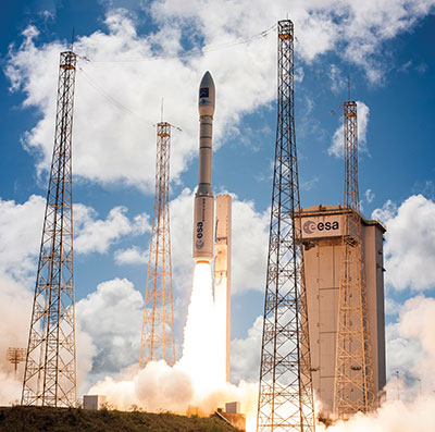
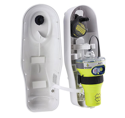
JAVAD Board Guides ESA Vega Mission
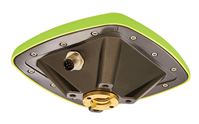
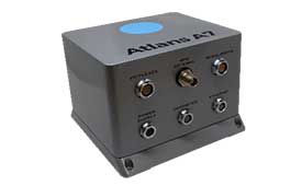
A JAVAD OEM GNSS board is at the heart of the navigation system of the Vega space vehicle developed by the European Space Agency (ESA). ESA developed Vega to launch small satellites into low Earth orbit. It provides great flexibility of mission at an affordable cost and represents the European solution for space accessibility.
The JAVAD OEM GNSS board is embedded in the gle/RGU/G2T/HDA/MB1 — a cost-effective, high-performance, compact and rugged GNSS receiver specifically designed and environmentally qualified. Installed on the upper stage of the VEGA launcher, it allows accurate trajectory verification during the entire flight mission.
ESA’s initial request was for a GNSS unit built with commercial off-the-shelf components, thus maintaining low costs, but which could still operate in the extreme vibration and shock conditions typical of a space launcher. After an initial feasibility analysis, GreenLake Engineering — a subsidiary of Instrumentation Devices — developed the unit mechanically and electronically to satisfy ESA technical specifications. Its biggest challenge was to pass ESA’s extensive qualification and quality process.
For many years, Instrumentation Devices (based in Como, Italy) and JAVAD GNSS have been partners. Instrumentation Devices sub-contracted for the Vega project with Avio (based in Colleferro, near Rome), which is the prime contractor with ESA. Avio is an international group that designs and produces space launchers and both liquid and solid propulsion systems for space transportation.
ESA supervised the project and is responsible for all activities relating to flight safety and qualification of the equipment installed on board. JAVAD GNSS supported GreenLake Engineering with the integration and low-level configuration of the OEM board for this challenging application.

GNSS Makers Share Insights
OEMs Discuss Their Boards, Markets and Company Growth

Five prominent GNSS original equipment manufacturers discuss their current products and future markets.
How do you define OEM?
While all six manufacturers agree on the general definition of OEM given above, they focus on different aspects. OEM customers of JAVAD GNSS “require reliable, accurate and stable high precision measurements for positioning and timing,” Hunter said.
The performance of OEM products from Hexagon | NovAtel reflects on its customers and itself, Gerein said. “Our OEM receiver cards are selected, valued and relied upon as the core positioning elements in many applications across vertical markets. We offer full rebranding options with custom logos, colors and industrial designs to seamlessly integrate our technology into their offerings.”
At Trimble, OEM customers “combine Trimble’s GNSS technology with their domain expertise to deliver solutions to the end customer,” Norse said.
For Hemisphere GNSS, OEM clients can range “from a tinker/maker hobbyist working with GNSS, to a large multinational organization designing navigation solutions for global clients,” Burnell said, but the company looks at all of them “in the same light.” Additionally, “Some OEM clients have all the tools they need already built into the Hemisphere products, while others come to us looking for advanced or custom features to help set their products apart in the market.”
Septentrio has a worldwide support team that assists its OEM clients “in all the stages of their integration process, from validation to product release,” Freulon said.
What distinguishes your latest generation of OEM receiver boards from previous ones?
Septentrio’s most recent OEM receiver boards integrate the latest Septentrio GNSS and INS technology and algorithms. AsteRx-m3 OEM receiver boards use all GNSS constellations, can track all available satellites, and can be used as a base station to deliver RTK corrections or as a rover with a single or dual antenna.
Improvements include lower power consumption, increased security with secure boot, and greater resilience with anti-jamming and anti-spoofing. Its new receiver boards, Freulon said, “are backward compatible with extended capabilities of the latest GNSS signals and several variants of the inertial navigation system.” Upcoming software releases will include Galileo’s free High Accuracy Service (HAS) as well as OSNMA, the latest anti-spoofing mechanism.
Trimble’s latest generation of OEM GNSS boards are based on Trimble Maxwell 7 technology, which features the company’s seventh-generation baseband GNSS ASIC (application-specific integrated circuit). Trimble designed the Maxwell family of products to maximize the quality of observables derived from available signals transmitted from all GNSS constellations as well as satellite-based augmentation systems, Norse explained. This results in stronger signals, greater availability, reduced power consumption, advanced multipath mitigation and protection against spoofing.
The boards also run Trimble’s ProPoint positioning engine, which improves performance in challenging environments such as tunnels, urban canyons and tree canopies and provides continuous RTK using a base station or Trimble RTX correction services delivered via cellular or satellite connections.
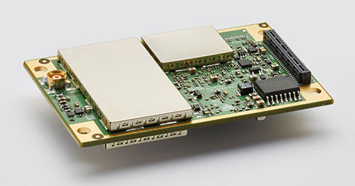
JAVAD GNSS’ latest OEM products are “more cost effective” and integrate an IMU with an 874-channel multi-GNSS band module with up to 200Hz positioning and data output. “All are still proudly made in the United States,” Hunter said.
NovAtel’s OEM7 receiver boards feature added options for interference robustness and situational awareness “to help protect the user’s GNSS signals from an increasingly crowded RF spectrum and growing jamming and spoofing threats,” Gerein said. The company enhanced the sensor fusion capabilities with SPAN GNSS+INS technology, enabling a deeply coupled integration with IMUs that strengthens positioning through GNSS interruptions and allows the rapid reacquisition of signals post-outages. The boards are compatible with PPP TerraStar Correction Services “for precise positioning anywhere in the world.”
Hemisphere GNSS’ Phantom and Vega series of OEM board products can track all L-band GNSS signals, enabling the company’s OEM clients to upgrade the capabilities of their integrations and “tap into the performance of multi-GNSS, multi-frequency RTK and Atlas PPP solutions,” Burnell said.
The boards consume less power than the previous generation and introduce Hemisphere’s Cygnus automatic interference mitigation technology, which monitors the GNSS signal bands for interference and automatically deploys filters “with no need for integrators or users to understand signal theory,” Burnell explained. Cygnus, which turns off the filters when the interference fades away, is “automatic interference mitigation for the masses.”
What are your markets for your GNSS OEM receiver boards? Which ones are growing the most?
NovAtel said its receiver cards are highly configurable and integrate easily across a wide range of markets, including survey, mobile mapping, agriculture, defense, marine and autonomous platforms for both on- and off-road applications.
In particular, the company’s OEM7 cards “uniquely support the defense market and their requirements for increased protection against jamming and spoofing in mission-critical applications.” The cards also “meet the positioning availability and increasingly rigid product quality standards required in agriculture, automotive and autonomous system markets.”
Trimble lists precision agriculture, construction, mining, forestry, autonomous vehicles, port automation, distribution centers and mobile mapping among the uses of its GNSS OEM receiver boards. “We are seeing growth in markets where reliable, robust and high-precision positioning is required for a solution such as autonomous platforms,” Norse said.
Septentrio reports growing demand for its mosaic GNSS modules “due to their small footprint and impressive performance.” OEM boards, Freulon said, “remain very popular for applications where a quick integration is needed or where ultimate performance is expected.”
However, the most important markets for its OEM boards remain “UAV, together with industrial-grade automations in agriculture, construction or logistics.”
Septentrio sees an increase in “the number of positioning and mapping systems that require the ultimate performance of our receivers, especially when combined with other sensors,” Freulon said. In particular, he cites the performance of its single- and dual-antenna AsteRx-m3 receiver boards and of the AsteRx3i INS boards, which “provide a solution which combines industrial-grade IMU and GNSS all on a single OEM board, greatly simplifying the integration process in systems where both positioning and orientation are needed.”
Hemisphere GNSS, which has a significant OEM presence in the agriculture, marine, survey and GIS markets, reports seeing growth in several markets. “We have seen significant growth in all aspects of autonomous integrations, from ground vehicles for on-road or off-road, to in-flight applications with UAVs, to maritime applications focusing on dynamic positioning in both nearshore and offshore environments,” Burnell said. “There is a recognition that using precision navigation equipment benefits everyone and protects our environment through efficiencies of operation, either in resource management or by improved operational capacity.”
JAVAD GNSS lists maritime positioning and docking, timing, launch vehicle positioning and range safety, autonomous vehicle testing, in orbit positioning and drone guidance among the markets for its OEM receiver boards, with space-related applications the fastest growing market.
Briefly describe one of your GNSS OEM receiver boards.
The OEM7700 receiver card from NovAtel is used in agricultural auto-steering applications. “The OEM7700 can receive all GNSS constellations across all frequencies, enabling a highly available position,” Gerein said. “When combined with TerraStar corrections and our SPAN GNSS+INS technology for sensor fusion applications, the OEM7700 ensures highly precise positioning scalable from meter- to centimeter-level accuracy.”
OEM7700 receiver boards help the company’s agriculture customers “solve the positioning challenge of repeatable pass-to-pass accuracy for auto-steering,” Gerein said. Plus, the card meets their strict environmental requirements for agriculture vehicles.
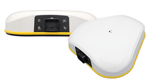
Septentrio’s OEM client iXblue uses the company’s AsteRx OEM boards inside its Atlans A7 positioning and orientation system. “Atlans A7 was developed in close cooperation with Septentrio and is designed to provide continuous and accurate positioning in urban environments,” Freulon said.
Atlans A7 combines iXblue’s inertial navigation system (INS), which is based on a fiber-optic gyroscope (FOG), with Septentrio’s multi-frequency GNSS receiver technologies. To develop this INS-GNSS mobile mapping solution, experts from iXblue and Septentrio worked closely with the aim to develop a smart coupling method that combines the advantages of the two companies’ technologies. The same smart coupling technique is also applied in the post-processing software for an optimal result. The main advantage of Atlans A7 is to maintain a high heading precision in any circumstance, which “allows precise georeferencing for both land and air applications and drastically limits the drift during GNSS outages,” Freulon said.
At Trimble, Norse cites the case of an agribusiness company that wanted to make its robotic tractors able to drive autonomously, requiring centimeter-level positioning and orientation at high update rates in challenging environments. The company chose the Trimble AX940i because of its “combination of GNSS and inertial technology in an easy-to-install smart antenna.” The Trimble ProPoint engine tightly couples the onboard IMU sensor data with the GNSS observations to provide up to 100-Hz outputs utilizing the NMEA-2000 standard or other interfaces. Additionally, Trimble VRS Now service provides instant access to RTK corrections and an operator can use the built-in Wi-Fi to configure and monitor the receiver from nearby.

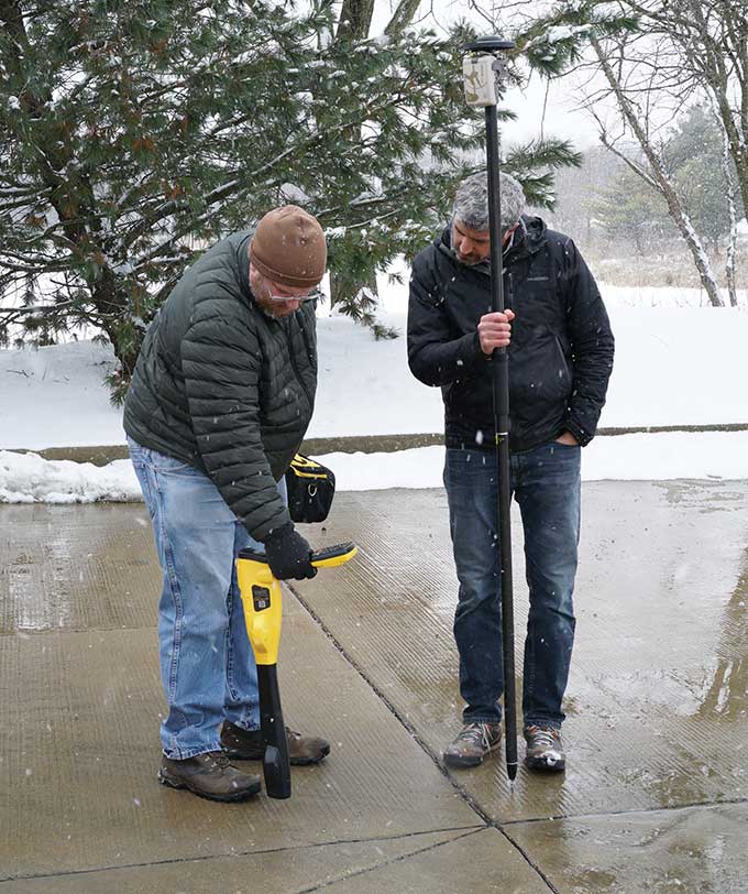
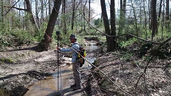
Hemisphere GNSS’ Phantom 34 RTK receiver and antenna is employed by SonTek in its RiverSurveyor M9 product used by water districts and the U.S. Geological Survey to help monitor and manage water resources. The M9 is one in a series of SonTek products focused on determining flow rates for rivers, streams and irrigation canals. It consists of a small flotation platform with an acoustic doppler current profiler that measures the flow rate of the water column underneath it, a data telemetry system, and the Phantom 34 RTK to pinpoint the data collected.
The platform is floated from shore to shore across a channel using a tether, measuring along the way. “Using RTK simplifies collecting measurements as the survey will have continuous velocity profile measurements the entire way across the waterway,” Burnell said.