SimActive Inc., developer of photogrammetry software, has purchased the Correlator3D software by Altoa from French Guiana. The software will be used to process images and lidar data for the production of orthomosaics.
“Following our recent acquisition of two digital cameras including the Phase One color and infrared, we needed precise, powerful, and versatile photogrammetric software,” said Walid Mostafa, manager of Altoa. “After analyzing the available tools, we decided to choose Correlator3D.”
“We are pleased to see an important company in South America such as Altoa adopt Correlator3D,” said Philippe Simard, president of SimActive. “Their use of Correlator3D demonstrates the software’s ability to adapt to different production environments and to integrate a lidar sensor with a camera.”
For a live demonstration at Commercial Unmanned Show Asia 2015 (June 30-July 1, Singapore), visit booth B10 or send an email to [email protected].
Geodetics Inc. has teamed up with Silicon Valley’s Velodyne Lidar. Velodyne and Geodetics will work on a variety of initiatives to enhance each others technologies and products with the goal of offering a small-size integrated inertial navigation and LiDAR-based mobile mapping payload for UAVs and other autonomous platforms.
Payloads will include Velodyne’s HDL-64E, HDL-32E and VLP-16 real-time LiDAR systems combined with Geodetics’ Geo-iNAV inertial navigation systems.
Geodetics and Velodyne are exhibiting this week at AUVSI’s Unmanned Systems Show in Atlanta, being held May 4-7 (booth 1500J and booth 2838 respectively). See our show coverage page for more information.
Velodyne’s LiDAR sensors are the highest performance LiDAR systems on the market in their size, weight and power class. Geo-iNAV is a fully-integrated GPS-aided inertial navigation system that provides real-time, high-precision positioning and navigation for manned and unmanned air, sea and ground vehicles. It combines GPS and proprietary sensor fusion technologies to achieve centimeter-level real-time positioning and navigation for dynamic platforms.
“We’re delighted to work with Geodetics to ease the integration process for our customers,” said David Oroshnik, Technical Sales Engineer, Velodyne LiDAR. “Our decision to support Geodetics is based upon the growing demand for cost-effective, small-sized, fully-integrated mobile mapping payloads that deliver performance traditionally associated with higher-end systems.”
“Velodyne’s LiDAR systems enable Geodetics’ products to reach new markets and customers by delivering high performance in a smaller package and for a lower cost than competing devices,” said Lydia Bock, Geodetics president and CEO.
With recent advances in unmanned vehicle technologies, the GNSS ecosystem has expanded to support such mission-critical applications as mobile mapping. These applications increasingly require more accurate navigation to accomplish their mission. The Geo-iNAV family of inertial navigation products delivers this capability with features that support reliable and precise navigation with a low SWaP (size, weight and power) profile for autonomous vehicles and payloads on manned vehicles.
Geo-iNAV is offered in several configurations designed to meet a wide range of requirements. It is available in commercial as well as SAASM configurations, meeting a wide range of inertial navigation application requirements.
Optech will be exhibiting its latest lidar and imaging solutions at the Unmanned Systems 2015 Conference in Atlanta, Ga., May 4-7, at the Teledyne Booth 2311. Optech’s solutions include a fully implemented lidar/camera workflow for UAV operations, as well as other airborne, mobile and stationary sensors.
Visitors can drop by the booth to learn more about Optech’s UAV solution, which combines the rugged Optech ILRIS terrestrial laser scanner and the new Optech XR6 photogrammetry small UAV with an integrated software workflow. The solution merges aerial camera imagery from the UAV with high-resolution data from Optech lidar to deliver comprehensive, georeferenced and highly accurate 3D planimetric data. The ILRIS lidar system can also be operated remotely through a web interface.
For advances in airborne sensing and surveillance using mid-size to larger UAVs, Optech will discuss the features of the compact Optech Galaxy lidar system and its PulseTRAK technology, which ensures a continuous operating envelope and steady point density even in rugged terrain, vastly simplifying mission planning, and eliminating “blind zones” — overcoming a long-standing limitation inherent to lidar sensors lacking PulseTRAK technology. Galaxy is compatible with all Optech mounts for integrating digital metric cameras, enabling clients to customize their solution with the right mix of LiDAR, multispectral, LWIR, MWIR and RGB sensors for their application.
Optech will also be showcasing the Optech Titan, a commercial multispectral airborne lidar, which accomplishes highly automated land classification using its separate 532, 1064 and 1550 nm laser channels, and performs combined topographic/bathymetric mapping down to a depth of 15 meters in clear conditions.
Visitors who need rapid coastal monitoring and object detection will be particularly interested in the new Optech CZMIL Nova, Optech’s upgrade of the award-winning CZMIL airborne bathymetric mapper. CZMIL Nova maintains its predecessor’s sensing power, including its unmatched turbid water penetration, while boosting installation flexibility and cost savings with a more efficient laser and much lighter hardware, facilitating operation in smaller aircraft.
Skip Miller, UASUSA’s founder and CEO, stands with with the Tempest ET.
UASUSA will unveil its payload advancements in booth 631 at AUVSI’s Unmanned Systems 2015, held May 5-7 in Atlanta.
The new Trimble RTK high-accuracy GPS positioning system will be available through UASUSA. It covers up to 2,300 acres per flight for photo mosaic and mapping missions with manufacturer specified sub-centimeter accuracy.
UASUSA also modified its leading aircraft, the Tempest, to create the Tempest ET. The new aircraft has added payload storage interchangeable in the wing tip extensions, yet still offers the same level of stability, endurance, efficiency and aesthetics as the Tempest, UASUSA said.
The Tempest ET is designed for magnetometer use in the mining industry and offers interchangeable regular, extended and payload tips. With its 10- to 15-pound payload capacity, it may carry the Phoenix Aerial LiDAR system to cover large areas and create survey-grade point clouds.
Fugro has commissioned an additional airborne laser bathymetry system to underpin its position in the development and application of bathymetric LiDAR technology. The combined Fugro LADS Mk 3 and Riegl VQ-820-G systems provide seamless measurements and mapping of nearshore and shallow water environments. The increased capability will enable Fugro to deliver simultaneous topographic and bathymetric surveys in multiple geographical areas.
With high power and frequency, the combined systems achieve superior coverage that minimizes gaps and outperforms lower energy alternatives and single-sensor systems in all conditions, particularly in difficult environments, Fugro said. They are highly adaptable and small enough to be installed in a variety of light aircraft.
With continued operations across the Middle East during 2015, Fugro will also begin a South West Pacific ALB survey campaign following the award of projects in multiple locations to support nautical charting, coastal engineering, scientific assessments, coastal management, benthic habitat mapping and climate change initiatives.
Since 2012, Fugro has operated simultaneous topographic and bathymetric LiDAR systems in France, Japan, New Zealand and the Middle East. Successful results from Japanese coastal areas include returns from the Fugro LADS Mk3 sensor to 50 meters while recent surveys in Saudi Arabia had even more impressive results, with 65-meter depth returns. The deep water returns combined with high-density shallow water and near coastal returns result in a seamless dataset from ridge to deep reef.
Leica Geosystems has announced a group of six major new products for terrestrial laser scanning: three new laser scanners and three new point cloud software products. Together, thes products raise the industry’s bar for laser scanning data quality and productivity, both in the field and the office, Leica said.
Leica ScanStation P40, P30 and P16 Laser Scanners. Leica ScanStations P40, P30 and P16 feature advances in LIDAR and digital imaging as the eighth-generation of Leica Geosystems’ high-performance laser scanners. These new, ultra-high-speed scanners increase field and office productivity, while simultaneously grabbing users’ attention with strikingly sharper, crisper scans and HDR true color images — even under many conditions traditionally difficult for scanning, the company said.
Users will be able to capture more useful data from a single set-up, which translates into fewer instrument setups and greater productivity. Three models meet different user needs: the Leica ScanStation P40 and P30 add survey functionality, longer range capabilities (to 270m for P40), and advanced scanner controls for additional versatility and productivity while the Leica ScanStation P16 is a short-range introductory model.
Point Cloud Software. In addition to the major new software releases Leica JetStream and TruView Global products, Leica Geosystems is now offering Leica CloudWorx for Navisworks — a popular design review application from Autodesk — as its newest family member of CloudWorx plug-ins for CAD and VR applications.
JetStream is a combined project data vault and high-performance data streaming server that takes Cyclone data and serves it up in a high-performance format that enables a CloudWorx user to be up to 40 percent more productive when working with point clouds. Much of that gain comes from instantaneous loading and navigation of point clouds — eliminating traditional “waiting times” long associated with point cloud office work.
Lastly, TruView Global greatly increases anyone’s access to TruViews — Leica Geosystems’ application for viewing and measuring scans. Shaking free from prior constraints, TruViews will be accessible within any Internet browser on any mobile device or computer, with no app or plug-in to install.
Taken together, advances in the new scanners and software elevate laser scanning to a new performance and data quality level, Leica said. The new scanners are all ultra-high speed (up to 1 million points/sec) and can capture more useful data from a scene. In addition, increased user access to TruViews plus good HDR digital images will encourage users to publish TruViews even more frequently.
All of these factors drive users to create more dense scans and larger data sets. With the complementary Leica JetStream software, users have the ability to handle these larger data sets with astonishing ease.
The Leica ScanStation P40, P30 and P16 are immediately available. Leica JetStream, Leica TruVeiw Global and Leica CloudWorx for Navisworks are planned for release Q2 2015.
Harris Corporation has developed a commercially available Geiger-mode lidar sensor. The Harris IntelliEarth Geospatial Solutions Geiger-Mode LiDAR sensor will provide customers with the ability to collect high-quality, wide-area elevation data faster and more affordably than before, Harris said.
Additionally, the company’s fully automated, high-volume production capabilities allow for rapid processing of large amounts of raw sensor data and automates quality control. Thousands of square kilometers of data can be processed in a few hours.
Harris is applying technology and processing methods it has perfected over the past 15 years in support of the U.S. Department of Defense to deliver superior, LiDAR-based data and derived products to commercial users at cost-effective prices, the company said.
With 10 times the collection speed and resolution of today’s best traditional lidar sensors, the Geiger-Mode lidar sensor makes wide area collections affordable for the first time.
The new ASPRS accuracy standards fill a critical need for map users and map makers alike. For centuries, map scale and contour interval have been used as an indication of map accuracy. Users want to know how accurately they can measure different things on a map, and map makers want to know how accurate maps need to be in order to satisfy user requirements. Those contracting for new maps depend on some form of map accuracy standard to evaluate the tradeoff between the accuracy required vs. how much time and expense are justified in achieving it, and then to describe the accuracy of the result in a uniform way that is reliable, defensible, and repeatable, ASPRS explains in a statement.
The new ASPRS standards address recent innovations in digital imaging and non-imaging sensors, airborne GPS, inertial measurement units (IMU) and aerial triangulation (AT) technologies. Unlike prior standards, the new standards are independent of scale and contour interval, they address higher levels of accuracies achievable by the latest technologies (such as unmanned aerial systems and LiDAR mobile mapping systems), and they provide enough flexibility to be applicable to future technologies as they are developed. Finally, the new standards provide cross references to older standards, as well as detailed guidance for a wide range of potential applications.
No prior U.S. accuracy standard comprehensively addresses the current state of mapping technology, which is why the new ASPRS standards were developed. The National Map Accuracy Standards (NMAS), developed in 1947, are still used because they are simple, but there is no scientific correlation between those standards and current mapping methodologies.
The ASPRS 1990 Standards were an improvement over NMAS; however, they did not do well in representing the capabilities of LiDAR, orthoimagery, digital mapping cameras or other current technologies in wide-spread use today.
The National Standard for Spatial Data Accuracy (NSSDA) is a reporting standard that references the old ASPRS 1990 standards and is cross-referenced in the new ASPRS standards. NSSDA provides no accuracy thresholds and does not by itself provide any new or updated guidance on how to select or specify an appropriate accuracy for intended applications.
The new ASPRS standards were developed by the ASPRS Map Accuracy Standards Working Group, a joint committee under the Photogrammetric Applications Division, Primary Data Acquisition Division and LiDAR Division, which was formed for the purpose of reviewing and updating ASPRS map accuracy standards to reflect current technologies. A subcommittee of this group, consisting of Qassim Abdullah, David Maune, Doug Smith, and Hans Karl Heidemann, was responsible for drafting the document.
Draft versions of the standard underwent extensive review, both within ASPRS as well as through public review by other key geospatial mapping organizations, prior to final approval by the ASPRS Board of Directors on November 17, 2014.
The Routescene LidarPod 3D mapper, a self-contained turnkey solution new to the market, is being showcased for the first time in the United States at the International Lidar Mapping Forum in Denver, Colo., Feb. 23-25. Routescene is based in Edinburgh, United Kingdom.
The flexible LidarPod was developed for use on unmanned aerial vehicles, but can also be fitted onto any mobile platform such as a car or boat. The flexibility makes it attractive for many sectors and situations where accurate mapping is essential but difficult to achieve, enabling surveys to be conducted in areas that previously would not have been considered, Routescene said.
The technology offers a non-intrusive method to obtain detailed and precise geo-referenced 3D datasets, Routescene said. LidarPod 3D can be used for 3D mapping; powerline inspection; scoping, planning and management of mines; forestry design, management and operation; large-scale topographic surveys; and city planning and management.
Routescene LidarPod costs less than a vehicle-based mobile mapping system, Routescene said. The turnkey solution includes LidarViewer, specially developed software to turn the raw data into valuable business information. It enables users to convert, analyze and filter huge volumes of point cloud data to improve productivity and workflow. Powerful filters enable users to extract relevant data for use in third party software, such as GIS and CAD packages, which are unable to cope with such large data volumes.
LizardTech, a provider of software solutions for managing and distributing geospatial content, has released an updated version of its GeoViewer and GeoViewer Pro for Windows application.
The application allows users to view MrSID and JPEG 2000 imagery and includes broad file format support.
GeoViewer is available as a free application enabling users to display raster imagery, LiDAR point clouds and vector overlays. New features include the ability to connect to online base maps, combine local data with web map service (WMS) and JPIP sources, export imagery, save projects, and includes advanced display options such as dynamic range adjustment.
GeoViewer Pro is available for $50 and allows access to additional functionality, including support for printing, additional projection systems and advanced area measurement tools.
Editor’s Note: Tony Murfin is managing consultant for GNSS Aerospace LLC and editor of GPS World’s monthly Professional OEM newsletter. The views expressed are his own.
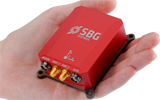
Another year has gone by, with another year of further improvements in navigation performance of micro-electro-mechnical systems (MEMS) inertial products. SBG Systems in France is now fielding a new generation of MEMS inertial products for much higher accuracy applications.
SBG Systems is based in Rueil-Malmaison, less than eight miles west of the center of Paris. Founded in 2007, SBG has developed a number of innovative MEMS inertial products over the last seven years, along with a respected reputation in the navigation industry, and by 2014 the company was recognized as the 26th fastest growing company in France.
The roots of the company began to form at the end of 2004, when a group of ECE School of Engineering students in Paris put a team together for a new UAV competition. The goal was to build a UAV of less than 1 kg, capable of flying autonomously indoors — at the time, a significant technical challenge. In 2004, miniature INS was not commercially available, so the team decided to build one, as well as other electronic parts such as the autopilot. The competition ran out of money, but the design was a success and led to a working UAV. The INS was by far the most advanced part of the project.
The students went back to their studies and took internships at UAV companies and ONERA (French aeronautics, space and defense research labs), but they still believed in the need for low-cost navigation solutions for the emerging civilian UAV market.
So, in 2007, three of the students — Raphaël Siryani, Thibault Bonnevie and Alexis Guinamard, S, B and G — formed SBG Systems with the goal of providing affordable, highly accurate MEMS inertial navigation systems for UAVs.
SBG quickly received its first Innovation Award from the French Research Ministry, and with this funding launched the IG-500 series of MEMS AHRS and INS in December 2008.
The company has since grown into a worldwide player with a strong product innovation focus. UAVs are still an important part of revenue, but the company has diversified into:
Aerospace and defense applications (UAVs, gimbaled cameras, antenna tracking, etc.)
Marine and offshore activities (ROV/AUVs, buoys, etc.)
Survey (hydrography, mobile mapping, aerial LiDAR, etc.)
SBG Systems has a small staff of mostly development and sales engineers — graduate students and experts. SBG has recruited navigation experts and some sales people from key players in the inertial business. Most (95%) have at least a master’s degree in engineering — R&D has 45% of the staff, and 40% are in sales, marketing and technical support. Production has been extremely automated and requires very few staff for in-house system assembly, calibration and final acceptance test. They do expect to double in size over the next two to three years.
The company is owned by the three founders, who still lead operations. SBG grew 1,304% over the last five years, and last year was ranked the 26th fastest growing company in France on the Deloitte Fast50. Today, SBG Systems has fielded more than 4,000 attitude and heading reference systems (AHRS) and INS (mostly INS), with almost a third of those delivered last year. The company forecasts growth for the next five years to be at this same phenomenal rate! SBG Systems currently offers a line of MEMS inertial sensors that include AHRS, inertial measurement units (IMU), and INS with embedded GPS (INS/GPS).
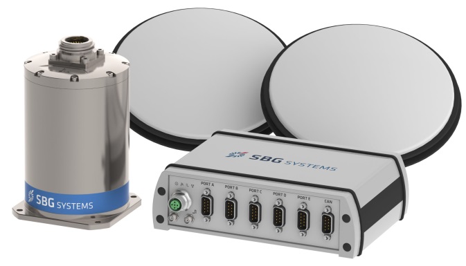
Ellipse-D dual-antenna mini INS/GNSS.
Not only have MEMS sensors improved in performance, but SBG has also developed advanced calibration capabilities that allow it to reach high-precision performance approaching high-end ring laser gyro accuracies in much smaller, less expensive packages. SBG owns an extensive set of temperature chambers combined with rotary tables and vibrating tables. Each SBG system gets to stay two to five days inside these calibration tools. But the “secret sauce” is in a state-of-the-art SBG developed calibration algorithm…
SBG buys MEMS gyros and accelerometers from MEMS manufacturers such as Colibrys, Analogue Devices and Silicon Sensing and builds complete inertial systems. The team embeds different GNSS receivers, depending on the product line and intended application — from miniature automotive-grade chipsets from u-blox to the very best from the key survey-grade players such as Septentrio, NovAtel and Trimble. Some customers may already have their own GNSS receiver, so SBG has developed and tuned their systems to work with any of these big manufacturers. The antenna employed depends on the receiver being used — from Tallysman Wireless and Antcom to Trimble, Septentrio or NovAtel — a very diversified range of antennas.
Ellipse-E.
SBG announced the Ellipse-D dual-antenna mini INS/GNSS earlier this month. The Ellipse-D is a miniature INS with an embedded dual-antenna survey-grade GNSS receiver for high-accuracy orientation and positioning.
Independent hydrographic testing in October 2014 of earlier model designs has already shown accuracy improvements, and the latest D version promises even better performance. The products tested were:
Ekinox-D
Ellipse-E, miniature inertial navigation system connected to a Hemisphere VS330 GNSS with two antennas.
Ekinox-D, inertial navigation system integrating a dual-frequency GNSS receiver with two antennas.
The test was a typical marine survey, with each leg about 550 meters long. Attitude performance was compared to a fiber-optic gyro compass reference system with much higher roll and pitch accuracy than the two SBG products under test.
Ellipse-E roll and pitch accuracy is better than the specs. The use of an RTK GNSS receiver additionally improves the sensor’s performance. The Ekinox-D also has good results — around 0.03° in both roll and pitch. SBG claims that low-noise gyroscopes and advanced algorithms are the basis for this performance.
The SBG list of 250 customers in 30 countries includes some impressive names, many outside Europe, and the company claims to have nearly 4,000 inertial sensors in the field. So this is not a prototype shop, but more a fully equipped production facility. SBG has opened an office in Chicago to address the North American market.
So, what are people doing with these devices? There are a number of applications in aerospace, land, marine and sub-sea.
In the aerospace industry, SBG sensors are used for UAV navigation and flight analysis — they could eventually be incorporated in certified avionics. They are also used for antenna tracking, camera stabilization and more demanding applications such as LiDAR orientation and data georeferencing.
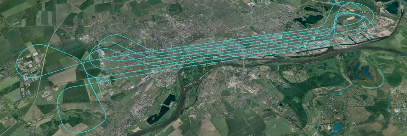
An Ekinox-N INS with embedded GNSS receiver was installed for the tests in a single-engine general aviation aircraft flying out of Magdeburg, Germany. A typical airborne survey-type flight was flown under mixed weather conditions with some turbulence, and roll, pitch, and altitude data was collected for real-time analysis and was also post-processed. A high-grade FOG-based AHRS was used as reference unit — with very high accuracy gyroscopes.
The flight pattern was typical of survey applications, with parallel straight lines of about 8.5 km. Altitude was 600 m and cruise speed was about 200 km/h.
Roll
Pitch
RMS Error Real Time (max)
0.043° (0.16)
0.043° (0.16)
RMS Error Post Processing (max)
0.017° (0.19)
0.025° (0.20)
Real-time accuracy remained below 0.05° RMS for roll and pitch. Post-processed output had a lower RMS error and a better stability over the whole flight. Only one GPS antenna was used in this test with Ekinox-N; nevertheless, heading reached an estimated accuracy of 0.06° when post-processed. The Ekinox-D model provides more accurate heading thanks to its integrated dual-antenna and GNSS receiver.
The Ekinox-N has been integrated on a UAV by Headwall in the U.S. for remote-sensing applications.
Headwall is a leading designer and manufacturer of high-performance hyperspectral imaging sensors for harsh environments. As a pioneer for remote-sensing applications, Headwall is the first to market a fully integrated remote-sensing solution combining hyperspectral and LiDAR sensors on a small UAV. This “total solution” approach has been welcomed by the remote-sensing market because it quickens time to deployment, decreases implementation costs, and enables operations in harsh environments.
The multi-rotor UAV carries Headwall’s lightweight Micro-Hyperspec VNIR hyperspectral sensor and a Velodyne LiDAR unit. The LiDAR collects a point cloud that reflects the field’s topographic relief, and the hyperspectral sensor delivers a picture showing spectral signatures of every object within the field of view. The SBG inertial navigation system has an embedded GPS and is used to provide positioning and orientation data. Weight is a key factor — Ekinox-N weighs only 500 grams, even though it integrates a survey-grade L1/L2 GNSS sensor to provide accurate positioning and precision roll, pitch, and heading data.
Mounted on the UAV, the Ekinox-N provides LiDAR and the hyperspectral camera with orientation and position during the whole flight. This and other data is recorded in real time at 200 Hz within the onboard computer. On the ground, the Headwall post-processing Hyperspec software fuses all sensor information. Ekinox-N data allows every scanned point and every pixel to be georeferenced and be tilt compensated to within a centimeter.
SLAM-based Indoor Mapping System by VIAmetris.
For miniature inertial sensors, smaller and lighter applications are possible at less cost. One of these applications includes the SLAM-based Indoor Mapping System by VIAmetris.
Simultaneous localization and mapping (SLAM) is becoming increasingly important to enable efficient indoor mapping. VIAmetris has created a different spin on indoor mapping with the “MID” portable SLAM-based scanner. This handheld system integrates a 2D LiDAR, a camera, an SBG Ellipse-A AHRS, and a tablet PC that shows the map being drawn while the user walks around inside the building. The AHRS also compensates for movement while orienting the generated maps to the north.
While the user walks, the 2D LiDAR scans in a horizontal plane by measuring 43,000 points per second across a 270° field of view. The SLAM technology progressively builds the map in the shape of lines made of points. At the office, the surveyor imports the data into the post-processing software and uses the lines of points to design the map. If there is any doubt about a specific shape — whether it is actually wall or furniture, for example — a photo of the location is available as MID automatically takes contextual pictures every meter, or whenever there is a change of direction, or manually.
The centimeter-level accurate map is then ready to be imported into most CAD software. As the system works without GPS, the generated map is not georeferenced or in a local coordinate reference system. To do so, the user links MID’s points cloud to a known point and all data is automatically referenced. MID is much easier to use than a laser distance meter, a tachometer, or a 3D scanner, and significantly reduces the time required for indoor mapping.
SBG is now working more often in the marine industry, equipping boat, cranes, or instrumented buoys. The company has even developed a specific solution for the hydrographic market. The SBG Ekinox Hydrography Solution integrates Ekinox-U which operates to a depth of 200 meters, and incorporates a SplitBox with a built-in tri-band RTK GNSS receiver and uses Terrastar, OmniSTAR, or Marinestar corrections.
The SBG Ekinox Hydrography Solution.
For subsea operations, positioning is required for ROVs and AUVs that navigate for minutes or sometimes for hours underwater. GPS fixes are only available when the vehicle comes close to the surface. But operators usually try to expend the time they are able to operate close to the seabed. To avoid typical INS drift, different aiding sources are used — the three main ones are acoustic positioning, Doppler velocity loggers (DVLs) and depth sensors.
Acoustic position is far more noisy and unstable than GPS.
DVL is a kind of 2D odometer, providing speed over the seabed.
The INS and the Kalman filter therefore play a key role to provide reference heading and reliable position data.
It’s a major concern when you have a massive ROV working on pipes under an offshore platform. Any mistake can cause severe damage and cost millions.
So SBG is moving along and taking on new, challenging applications with a range of MEMS inertial products that appear to be growing quite rapidly, with ever-improving performance. Once upon a time, we couldn’t stay anywhere within RTK-level performance during GPS outages because of the high drift-rate of MEMS inertial devices. Now, SBG has introduced its latest Ellipse-D dual-antenna mini INS/GNSS spec’ed at 0.1° real time for pitch and roll, with 2-cm RTK position.
The Apogee INS/GNSS.
And just today, SBG Systems has even bigger news with the release of the Apogee series, which is Apogee’s most accurate, robust and cost-effective MEMS technology inertial navigation system. The Apogee INS/GNSS integrates the very latest generation of MEMS sensors along with a triple-frequency GNSS receiver, achieving 0.008° in roll and pitch in real time, and 0.005° in post-processing. With two antennas, it also provides reliable and accurate heading.
Amazing what scientific skill, focused investment and time has done for MEMS inertial technology!
The International LiDAR Mapping Forum, set for February 23-25 in Denver, is a technical conference and exhibition focused on data acquisition, fusion, processing and point clouds for aerial surveying and mapping used to support transport, urban modeling, coastal zone mapping, utility asset management, and more.
Geospatial Technology Trends. ILMF is considered by many the premier conference for the latest geospatial technological developments, from innovations in photogrammetry to advances in aerial LiDAR systems. Attendees can explore an international exhibition of leading hardware and software suppliers showing their newest releases, and attend sessions where more than 60 experts will present best practices and case studies for cutting-edge technologies such as:
Geiger-Mode LiDAR
Focal Plane Array (FPA) LiDAR
Mobile Mapping Systems (MMS)
Unmanned Aerial Vehicles
Focus on UAVs. This year, ILMF features a UAV workshop and pavilion, where industry leaders discuss the current regulatory landscape and legal guidelines, UAVs versus aerial LiDAR, training and insurance considerations and more. Additional program content will cover topics like “Does Camera Quality Matter in sUAS Photography?” and “LiDAR Scanning with Supplementary UAV Captured Images for Structural Inspections.”
Other topics covered at the conference include:
Data fusion
Extracting from point clouds
Managing large data sets/point clouds
Airborne, terrestrial and bathymetric LiDAR
Coastal zone, defense and flood plain LiDAR
Corridor and utilities mapping
Data classification, GIS
Organizers say participants can gain much from networking with and gaining valuable information from other precision-measurement and imaging professionals across disciplinary lines. Attendance at ILMF 2015 is expected to exceed 800, and will include professionals from these organizations who have already registered: