Tag: location-based services

  • Location-based services are unseen guides

    Location-based services are unseen guides

    HERE Mapmaking allows users to create detailed interactive maps of private sites, outdoors and indoors. This includes sites not covered by public maps, such as warehouses, yards, farms, mines and ports. (Photo: HERE Technologies)
    HERE Mapmaking allows users to create detailed interactive maps of private sites, outdoors and indoors. This includes sites not covered by public maps, such as warehouses, yards, farms, mines and ports. (Photo: HERE Technologies)

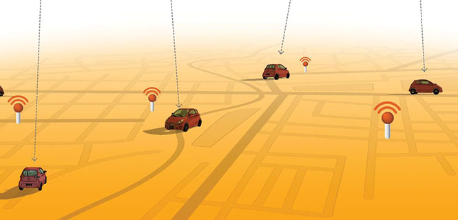
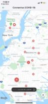
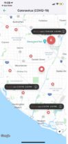
    Location-based services (LBS) are software services that allow apps to function as intended by collecting geodata and providing users with pertinent information based on their location. Examples include search, navigation, transportation, entertainment, social networking, marketing, shopping, remote health monitoring, parental control and asset tracking. These services rely on mobile networks to transmit and receive data and connect to analytics software operating on a remote server to process and send relevant data to the user.

    They have existed since the early 1990s but only gained traction after May 2000, when the U.S. government stopped degrading the civil GPS signal (a policy known as Selective Availability). This increased GPS accuracy by an order of magnitude overnight, making many more civilian applications possible. Since then, software engineers and developers have been designing LBS and building location-aware apps to deliver contextually relevant experiences to end users.

    Adoption of LBS has been extensive because these services produce quality geodata with personal, spatial and temporal dimensions. Although most people think of GPS when they think of geolocation, LBS is the unsung hero powering location-based online activities.

    LBS combines various positioning solutions — including GNSS, and trilateration from cell towers, Wi-Fi hotspots and other signals of opportunity — to collect the most accurate location data possible outdoors and indoors.

    LBS capitalizes on cell tower signals and Wi-Fi networks to gather geolocation when satellite reception is poor or entirely blocked, such as in urban canyons and underground parking lots. Although these alternative positioning systems are not as accurate as GNSS, the approximate location information they provide is generally sufficient for the purpose of the services — such as to find a store in a mall or a grader on a construction site.

    Monetizing LBS

    The advent of Web 2.0 and the mobile revolution have empowered Internet users to interact with their immediate physical world digitally. Suddenly, finding the shortest route in a new city, choosing from numerous restaurants for lunch, searching for the nearest gas station, consuming relevant stories on social media and snagging limited-time coupons and discounts are all possible at the tap of a button.

    Physical location has become instrumental in personalized online experiences, hence the need for location-aware apps. Software vendors have embedded seamless data collection capability into electronic devices, creating a business ecosystem surrounding people’s location details.

    Geodata collection is effortless but permission-based. While laws governing LBS vary by jurisdiction, they generally require users to accept an LBS-supported app’s privacy policy, which spells out what it does with location data. Additional steps include running the app and activating the device’s location service in the settings or approving on-screen permission request prompts before tracking can begin. Such a process helps ensure that users are aware of geodata collection and understand its inherent risks.

    In the early days of LBS, tech pundits argued that marketers would capitalize on the technology to bombard consumers with ads. Those were prophetic words — many heavily used apps today use LBS. The tech companies behind them leverage geodata to create valuable products and sell advertising space through their platforms.

    Although it is challenging to count the number of ads populating sites and apps, rough estimates say that average Internet users see thousands daily. It does not feel this way because in-your-face ads are no longer the norm in cyberspace — the discrete ones are, and they work. Experts predict that the $96 billion location-based advertising market will expand at a compound annual growth rate of 15.1% from 2023 to 2030.
    Unsurprisingly, tech titans enjoy the lion’s share of digital advertising revenue. In the United States, Google, Meta and Amazon collectively accounted for about 62% of the pie in 2023.

    Other corporate models exist to monetize geodata. The LBS-based game Pokémon Go is free to play, so it can grow a massive user base quickly and earn profits through in-game purchases. In addition to living off ad revenue, Tinder uses freemium pricing for its geographic matchmaking business and simplifies socialization and dating for paying subscribers.

    Moreover, Uber, Lyft and Airbnb swell their coffers through commissions, earning a cut for every transaction on their platforms. Big box store Target blends indoor mapping, beacon technology and geofencing to enable shoppers to pick up their orders at the nearest store’s entrance when they arrive. Aside from mostly Silicon Valley titans that have developed and gainfully used LBS for themselves to increase their valuations, others have decided to help non-tech enterprises innovate by integrating location-based technology into their operations.

    Democratizing Mapmaking

    Disrupting cartography is a low-hanging fruit. Humans have been drawing maps for millennia, yet many areas remain unmapped. Public maps usually exclude private locations. When they are part of the picture, these areas lack meaningful details to aid navigators.

    Solutions such as HERE Mapmaking aim to address these challenges. By combining GNSS positioning with satellite imagery, location data from cellular networks and Wi-Fi hotspots, and signals from a variety of sensors, HERE enables automotive and mass-market devices to map areas and features with sub-meter accuracy. To deliver a faster time-to-first-fix and display the positions of navigation devices correctly, this provider of digital mapping and location data leverages a full positioning technology stack, including power-efficient sensors and map tiles.

    Built on the HERE platform, this mapmaking solution primarily caters to automakers, transportation and logistics enterprises, e-commerce brands, public agencies and more. However, the company ensures its solution is powerful enough for developers by providing CLIs and APIs. At the same time, the platform remains intuitive for casual or less-technical users, such as students and data journalists, thanks to HERE XYZ — an interoperable, real-time, open location data management service.

    “Various elements of HERE XYZ are now embedded within HERE Mapmaking,” said Alex Gevrenov, senior director of product management at HERE Technologies. “This is where users can create unique (owned / proprietary), routing-capable maps that can be used at scale using simply our developer tools and HERE location services and SDKs.”

    The inclusion of HERE XYZ gives users live access to uploaded data and more flexibility in using rendering tools to pinpoint the precise whereabouts of devices and assets in indoor and outdoor settings. It also enables them to instantly share location data via the cloud. These capabilities are helpful when building offline and online interactive maps with spatial intelligence for location-aware apps with no or little code.

    Customization and responsiveness are crucial in interactive cartography. HERE XYZ complements the platform’s routing, geocoding and search functionalities.

    Furthermore, Gevrenov explains that with the rollout of UniMap — a new automated mapping system — interactive maps built on the HERE platform can now detect and reflect changes in the physical environment within 24 hours. “We are now externalizing these cutting-edge capabilities to make mapping at scale easy for our customers and partners.”

  • Swift Navigation adds tiers, BeiDou support to Skylark service

    Swift Navigation adds tiers, BeiDou support to Skylark service

    (Image: Swift Navigation)
    (Image: Swift Navigation)

    Swift Navigation has expanded the capabilities of its Skylark precise positioning service to several product tiers. With new services providing real-time kinematic (RTK) and differential GNSS (DGNSS) options, Swift meets the broadening needs of its growing customer base.

    In addition, new BeiDou signal support and regional coverage has been added.

    Skylark is Swift’s cloud-based GNSS corrections service designed to deliver affordability, high accuracy and fast convergence, eliminating the complexity of deploying and maintaining GNSS networks. The expansion of Skylark’s capabilities makes it possible for customers across industries to benefit from seamless corrections to applications across the globe, the company said.

    Skylark RTK delivers Swift’s highest tier of performance to third-party GNSS receivers. Compatible with leading RTK receivers on the market, Skylark RTK delivers corrections for applications that require sub-2 cm accuracy, including agriculture, machine control, drones and robotics in the United States, Europe and select Asian countries.

    Skylark DGNSS is suitable for mobile applications, delivering real-time, high-reliability differential GNSS corrections to mobile handsets, positioning engine modules and mass-market applications. Skylark DGNSS enables lane-level location accuracy, in turn enabling new consumer location experiences and improving location-based services to increase efficiency on a global basis.

    With BeiDou coverage already available across the United States, Japan and Korea, Swift has now added BeiDou signal support for the European Union, supplementing existing support for Galileo and GPS by providing corrections for GPS L1/L2/L5, Galileo E1/E5b/E5a and BeiDou B1/B2a. In addition, support for BeiDou B1C has been added to all regions.

    These additions help support newer mass-market RTK-enabled receivers to achieve high-accuracy performance in difficult GNSS environments and continue to push the envelope for positioning accuracy.

    “Swift was founded on the notion of improving GNSS positioning performance for mass-market applications,” said Holger Ippach, executive vice president of product, Swift Navigation . “We are pleased to expand the functionality of Skylark to improve the positioning functionality for many more customers across the globe.”

    The suite of Skylark products was built from the ground up for scale, resilience and ease of integration. Skylark delivers seamless corrections to continents and countries across the globe including the United States, Europe, South Korea, Japan, Taiwan and Australia.

  • Keysight combines GNSS and 5G to accelerate assisted-Galileo LBS

    Keysight combines GNSS and 5G to accelerate assisted-Galileo LBS

    Tbe company has received Global Certification Forum validation of 5G LBS Assisted-Galileo test case

    Keysight Technologies Inc. has gained Global Certification Forum (GCF) validation of a 5G location-based services (LBS) assisted-Galileo (A-Galileo) test case by combining 5G new radio (NR) and GNSS technology.

    The achievement will accelerate implementation of LBS in smartphones by enabling mobile phone vendors to verify that designs comply to the latest 3GPP specifications that support accurate location positioning in a wide range of sectors.

    Sectors include healthcare, road and aerial transportation, emergency and rescue services, public safety, and homeland security.  Highly precise positioning services also enable mobile operators to deliver personalized services supporting entertainment, hospitality and retail applications.

    LBS leverages different technologies, including GNSS, beamforming and round-trip time to geographically locate a user. LBS test cases allow users to verify sensitivity, accuracy and dynamic range in mobile phones that leverage GNSS constellations to identify precise geographic location.

    S8705A RF/RRM DVT and Conformance Toolset. (Photo: Keysight)
    S8705A RF/RRM DVT and Conformance Toolset. (Photo: Keysight)

    GCF conformance agreement group meeting #72, held Oct. 21, confirmed the validation of the first 5G LBS A-Galileo test case, which was supported by Keysight’s S8705A RF/RRM DVT and Conformance Toolset. The toolset provides access to a wide range of radio frequency, radio resource management, and development validation test cases used to verify 5G NR designs in both non-standalone and standalone deployment modes.

    The S8705A toolset uses the E7515B UXM 5G Wireless Test Platform, a compact signaling test platform with multi-format stack support, rich processing power and abundant RF resources for emulating various mobility scenarios in a 5G network as well as a recommended GNSS emulator to deliver the LBS test case.

  • 5G LBS features verified on R&S TS-LBS test solution

    5G LBS features verified on R&S TS-LBS test solution

    Photo: Rohde & schwarz
    Photo: Rohde & schwarz

    Rohde & Schwarz and MediaTek have verified new location-based services (LBS) features for 5G new radio (NR), which are now available on the R&S TS-LBS test solution.

    The features will improve emergency caller location and support LBS-related use cases in challenging indoor and outdoor environments with both satellite-based and terrestrial technologies. The R&S TS-LBS now support these and other 3GPP Release 16 network-based positioning features.

    A 5G chipset from MediaTek also has been verified for Release 16, which ensures the chip’s  positioning features.

    The two companies verified the NR positioning reference signals (NR-PRS), which are central to network-based positioning features such as round-trip time (RTT), time difference of arrival in uplink and downlink (UL- TDOA and DL-TDOA), or angle of arrival and departure (AoA and AoD), and which meet the 5G requirements for indoor and outdoor positioning use cases.

    With R&S TS-LBS supporting these features, mobile device and chipset manufacturers as well as test houses and network operators can carry out verification for GCF, PTCRB and network-operator certification using a single test solution.

    About the R&S TS-LBS System

    The R&S TS-LBS is a test system for testing GNSS and network-based positioning. It consists of an R&S CMX500 OBT one-box signaling tester as the network simulator and an R&S SMBV100B GNSS simulator.

    The R&S CMX500 OBT setup provides full network simulation capabilities including the support of multiple 4G or 5G cells at a time. In addition, it provides LBS assistance data to the DUT while the R&S SMBV100B simulates the GNSS satellites.

    The R&S TS-LBS test system can be used for pre-conformance tests and to obtain GCF and PTCRB certification as well as network-operator-specific certification acceptance and validated tests.

    “Adding network-based positioning features such as DL-TDOA based on NR-PRS to the existing satellite based location signals shows the advanced level of our test solution,” said Christoph Pointner, senior vice president, Mobile Radio Testers, Rohde & Schwarz. “We are happy to continue our collaboration with MediaTek to push 5G location-based services further for 3GPP Release 16.”

  • Swift Navigation to provide South Korean telecom with precision positioning

    Swift Navigation to provide South Korean telecom with precision positioning

    Swift Navigation logoKT Corp., a major South Korean telecommunications company, has partnered with Swift Navigation Co., a San Francisco-based technology firm, to commercialize an ultra-precision location data service, reports The Korea Economic Daily.

    The companies on June 29 signed a precise-positioning business partnership agreement that KT hopes will enable precision location services for autonomous vehicles, drones and urban air mobility.

    Swift Navigation’s precise-positioning platform improves location accuracy from several meters to centimeters, enabling safer driving, improved efficiency for last-mile delivery and commercial transport operations, and enhanced accuracy for mobile devices.

  • Companies join on E112 caller location compliance for Europe

    Companies join on E112 caller location compliance for Europe

    Collaboration supports emergency services across the European Union

    Galileo-supported E112 will result in faster response times and more lives saved. (Image: EUSPA)
    Galileo-supported E112 will result in faster response times and more lives saved. (Image: EUSPA)

    Keysight Technologies Inc. is collaborating with DEKRA to ensure that chipset and device vendors can validate E112 caller location (universal European emergency number) functionality in compliance to a new European Union (EU) regulation.

    The collaboration leverages GNSS and c (LBS) to verify E112 regulatory test cases used to validate mobile phones sold into the European market. The new regulation supports emergency services across the European Union by reducing response times from rescue services to save more lives.

    “Keysight is pleased to expand the company’s collaboration with DEKRA,” said Muthu Kumaran, general manager of Keysight’s Device Validation Solutions business. “With Keysight’s test solutions, DEKRA supports a global ecosystem of smartphone vendors by validating that their products are in compliance to the new regulation, newly created to improve emergency services’ ability to locate individuals in need of assistance from the fire brigade, medical teams or the police.”

    Keysight’s network emulation solutions enable DEKRA to validate E112-related test cases regulated by an EU-issued guideline document to assist notified bodies in the assessment of E112 compliance. The new EU regulation (Delegated Regulation (EU) 2019/320) went into effect on March 17, 2022. It mandates that all new mobile phones sold in the EU need to support GNSS technology based on the Galileo constellation, advanced mobile location (AML) protocol and Wi-Fi communications technology. As a result, emergency response call centers can accurately pinpoint the caller’s location.

    “DEKRA is founded on the principles of safeguarding human interaction with technology and environment,” said Juan Carlos Mora, vice president, Business Line Connectivity of Service Division, Product Testing at DEKRA. “This is why we are pleased to extend our collaboration with Keysight, which offers DEKRA the regulatory device test solutions needed to quickly and confidently validate E112 caller location functionality per the EU’s latest mandatory requirements.”

    Keysight’s device test solutions for regulatory and conformance validation are based on common hardware and software platforms for comprehensive test-case coverage. Keysight’s LBS solutions also support assisted GNSS (A-GNSS) test functionality. This enables users to comprehensively address 5G new radio (NR) conformance requirements mandated by the Global Certification Forum (GCF) and PTCRB, an organization comprised of North American mobile operators.

    DEKRA uses Keysight’s RF/RRM DVT & Conformance ToolsetRF Automation Toolset and Wireless IoT Regulatory Test Solution to address 5G and internet of things (IoT) device regulatory requirements and SA8700A C-V2X Test Solution to certify cellular vehicle-to-everything (C-V2X) devices.

  • Rohde & Schwarz provides testing to meet Europe’s E112 requirements

    Rohde & Schwarz provides testing to meet Europe’s E112 requirements

    Rohde & Schwarz adds an extension to its R&S TS-LBS location-based services test system to meet 112 emergency-call regulations for smartphones

    E112 emergency caller location tests are now available on the R&S TS-LBS test system. (Photo: Rohde & Schwarz)
    E112 emergency caller location tests are now available on the R&S TS-LBS test system. (Photo: Rohde & Schwarz)

    A new regulation requires all smartphones sold in the European Union from March 2022 onwards to support caller location for 112 emergency calls. To ensure this feature, the devices must be compliant with several positioning systems as outlined by the European Commission.

    In response, Rohde & Schwarz has added an extension to its R&S TS-LBS location-based services test system. Certification service provider CETECOM has already started E112 testing using these test sequences.

    All smartphones sold in the European Union have to be compliant as of March 17 with the Delegated Regulation (EU) 2019/320. A supplement to Radio Equipment Directive (RED) 2014/53/EU, it defines that 112 emergency calls provide caller location information to emergency services in a fast and accurate way, to make sure first responders can arrive at the site of an accident quickly.

    Instead of a harmonized standard, a guideline document from the European Commission recommends the testing procedures for Notified Bodies, who support the smartphone vendors in the conformance assessment procedure. Compliance with Galileo, advanced mobile location (AML) and Wi-Fi positioning will be mandatory.

    The software-based extension to the R&S TS-LBS location-based services test system makes it a tailored solution in line with the European Commission’s guideline document and the upcoming ETSI standard TS 103 825 for AML protocol testing.

    In the Rohde & Schwarz solution, the cellular network is emulated by the R&S CMW500 wideband radio communication tester, while the dual-frequency E1+E5 GNSS Galileo signal is generated by an R&S SMBV100B vector signal generator. Thanks to the automation software of the test setup, all the test cases described in the EC guideline can be executed automatically to ensure unified, fast and repeatable results.

  • Rohde & Schwarz provides testing for 5G LBS

    Rohde & Schwarz provides testing for 5G LBS

    Rohde & Schwarz supports 5G LBS with assisted GPS and 5G NR FR2 mmW performance testing

    Photo: Rohde & Schwarz
    Photo: Rohde & Schwarz

    Simulator and test company Rohde & Schwarz has verified assisted GPS (AGPS) performance in a commercial mobile device, while simultaneously transferring data using 5G millimeter wave (mmW). This capability is now available with the Rohde & Schwarz TS-LBS (location-based services) test system.

    As wireless network operators roll out 5G NR in the millimeter wave spectrum, it is critical to ensure continued reliability of E911 calls and accurate determination of location in mobile devices.

    5G NR utilizes frequencies in the FR1 frequency range (<7.125GHz) and in the FR2 mmW frequency range (>24GHz). FR2 creates unique challenges for mobile devices in terms of power consumption and heat. With FR2 becoming more common in North American mobile devices, performance of critical services such as E911 emergency calls cannot be allowed to degrade when utilizing this mmW spectrum.

    When used together in the TS-LBS test system, the R&S CMX500 radio communication tester and R&S CMW500 wideband radio communication tester provide a seamless and comprehensive test platform capable of testing LTE, 5G NR FR1 and FR2, while the R&S SMBV100B vector signal generator simulates the GPS L1 & L5, GALILEO, GLONASS & BEIDOU satellite constellations for A-GNSS.

    Other positioning technologies that use barometric pressure sensors, Wi-Fi and/or Bluetooth are also available in the same solution. Legacy technologies such as GSM, WCDMA and LTE are all supported using the same hardware.

    “The addition of FR2 mmW to our TS-LBS test solution gives customers the latest capabilities needed to continue certifying their mobile devices to evolving 5G standards,” said Bryan Helmick, Rohde & Schwarz. “Customers can easily add 5G to existing LTE TS-LBS systems with the simple addition of an R&S CMX500. FR2 support only requires some hardware on the R&S CMX500 and an R&S CMQ500 mmW shield cube.”

    5G NR in the sub 6 GHz frequency range (FR1) can be seen as a natural evolution of LTE to achieve higher bandwidth and more flexibility on the physical layer in order to realize all the new and additional use cases defined for a next-generation mobile network.

    The real technical challenge, however, comes with 5G mmWave (FR2), which opens up a new level of complexity in device development. mmWave frequencies imply measurement challenges that call for new testing approaches.

  • GSA’s MyGalileoSolution competition deadline is Sept. 30

    GSA’s MyGalileoSolution competition deadline is Sept. 30

    MyGalileoSolution is the biggest competition ever organized by GSA with a prize pool of almost €1.5 million

    News from the European GNSS Agency

    The European GNSS Agency (GSA) has launched the MyGalileoSolution competition. The contest is targeting European innovators and entrepreneurs ready to develop location-based solutions, such as mobile applications, wearable-based solutions, asset management and tracking solutions, or robotics, leveraging Galileo as a source of positioning, navigation and/or timing. A wide participation from all Member States is expected.

    GSA has a successful track record in supporting and boosting GNSS-based innovative applications. For years, the agency has been leading several research and innovation initiatives such as the Galileo Masters, Horizon 2020 projects, and more recently European competitions like the 2019 MyGalileoApp and Hackathons across Europe and beyond.

    Two tracks for 56 prizes

    With a prize pool of almost € 1.5 million, MyGalileoSolution is the largest competition ever organized by the GSA. It consists of two independent and parallel tracks, each one with a list of goals and deliverables.

    Track 1 , From Idea to Prototype, aims to develop a beta version of an application or a prototype of a solution implementing an idea, reaching a minimum of 50% of its functionality.

    Track 2, From Prototype to Product, aims to develop a fully functional solution ready to be commercialised starting from a beta version of an application or a prototype.

    Participants are expected to leverage Galileo’s robust positioning and accurate timing and synchronization capabilities, showing how it can enable the development of the next generation of applications and services across a wide range of areas. In this competition the GSA is challenging innovators in four different areas: Crisis & Emergency Response, Smart Transport for Green Deal, Solution for Digital Age, and Cybersecurity.

    Galileo for location-based services

    With more than 1.5 billion Galileo-enabled smartphones and more than 51 million GNSS-enabled wearable devices in the market, location-based services (LBS) are booming. Accurate positioning and timing are at the heart of the growth and evolution of LBS, in addition the access to Android GNSS raw measurements has allowed for the creation of advanced GNSS positioning algorithms that enable the development of more ambitious smartphone-based applications.

    ‘’Galileo has set the trend for dual-frequency chipsets, which provide better accuracy and are more resistant to multipath in urban environments,” said Pascal Claudel, GSA acting executive director. “We are looking forward to seeing innovators launching their disruptive GNSS solutions and turning them into real businesses, hence leading to European growth, competitiveness and sustainability. There is ‘space’ for all types of innovation and we expect the participation of all Member States.”

    “Competitions like MyGalileoSolution are a great opportunity to quickly move from idea to market,” said Francesco Fiorito, leader of Argeo, the winning team of the 2019 MyGalileoApp competition. “It is a confidence boost for young entrepreneurs and their capacity to grow and generate new solutions and business,” Claudel concluded.

    Deadlines and more information

    The deadline for submission for both categories is Sept. 30. Projects will be evaluated in terms of their innovative nature, market potential, feasibility and Galileo relevance by a panel of GSA experts.

  • Number of trained US geodesists at crisis level

    Number of trained US geodesists at crisis level

    By David Zilkoski, contributing editor, survey scene

    David B. Zilkoski
    David B. Zilkoski

    I attended The Ohio State University (OSU) to obtain my graduate degree in Geodetic Science in 1979. Therefore, I will admit that I am a little biased — once a geodesist, always a geodesist. The basic definition of geodesy is the applied science for determining the size and shape of the Earth, designing and realizing reference frames, and determining where you (and anything else) is on the Earth.

    In OSU’s geodesy heyday (1960–1990s), many Americans trained were sent by federal agencies: National Geospatial-Intelligence Agency (NGA), NOAA/National Geodetic Survey (NGS), USGS, Army, Navy and Air Force. During the 1970s, NGS was sending two employees back to school every year. These agencies needed geodesists because they were undertaking major projects such as NGS’ to readjust the U.S. national horizontal (NAD83) and vertical geodetic (NAVD88) networks.

    I was one of the employees that NGS sent to OSU to be trained to support the NAD83 and NAVD88.

    The advancements in satellites and computers have enabled geodesy to expand into many different disciplines. Geodetic science and technology now underpin many sciences, large areas of engineering (such as driverless vehicles and drones), navigation, precision agriculture, smart cities and location-based services. Geodesy is actually more important than ever.

    Today, the environment is different. U.S. federal agencies still need geodesists for developing enhanced and refined geodetic models and tools. However, major U.S. companies, such as Google and FedEx, as well as the automobile industry, precision farming companies and mining companies also need more accurate geodetic models, tools and algorithms. Therefore, these companies also need trained geodesists to perform important research on topics that address their specific geodetic requirements.

    Today, OSU’s Geodesy Department is training very few American citizens. As the U.S. moves toward achieving geodetic-grade positioning in real-time in support of new applications such as driverless vehicles and drones, the number of trained geodesists should be increasing, not decreasing [Note: In 1990, there were 92 geodetic science graduate students. In 2019, there were 25; only three were U.S. citizens]. OSU and other universities need to educate and train the next generation of the nation’s scientific workforce of highly skilled research geodetic scientists that will expand industry’s research expertise.

    The shortage of American geodesists poses a significant economic risk for the U.S. Europe and China train many more geodesists than the US. There are very few geodetic science programs in the U.S. today, and education in geodetic proficiencies has been fragmented. The OSU graduate program is one of few surviving geodetic science programs.

    Users of geodetic products and services need to support geodetic departments in universities so that U.S. geodesy programs can grow to meet the geospatial demands of the future. The geospatial component of the economy is worth about $500 billion/year. So why are we allowing its foundational discipline to shrink in this country?

  • Vesedia proposes COVID-19 contact tracing platform

    Vesedia proposes COVID-19 contact tracing platform

    Vesedia Mobile Technologies is offering to deploy its location platform to help control the COVID-19 pandemic through tracking and dissemination of information about “at risk” infection areas and places, and times when they were known to have infection — a process referred to as contact tracing.

    Vesedia is a technology startup with a suite of mobile apps for children and family safety based on a location-sharing platform and location-tracking artificial intelligence (AI).

    “The platform would warn people that passed through these places at matching times,” explained Ruslan Shalaev, co-founder and team leader, Vesedia. Shalaev developed a popular app for family safety: Safely – Family Location; and serves as a lead research on user-location monitoring AI in an academic partnership with Binghamton University and Lviv National University.

    The Safely – Family Location app could be used to disseminate data on infection areas, and access to the API would be provided for other application developers and sites, Shalaev said.
    The platform would be applicable after the initial pandemic is contained. “It would help with restarting the economy and resuming normal business operations by providing a mechanism to track, control and suppress new outbreaks,” Shalaev said.

    Data Sources

    Under the plan, people that test positive to COVID-19 would be asked to provide information about public places they visited in the preceding days, and at what times. Individuals that provide the information can confirm that it’s accurate from their phone location history.

    The information would be anonymized by healthcare officials, and entered into a database that would be publicly accessible via a website and mobile app.

    Image: Vesedia
    Image: Vesedia

    Mobile App

    The mobile app aspect is especially valuable from information dissemination standpoint, because other people in “at risk” areas can receive automated alerts to self-quarantine and get tested based on their device location history.

    The app is ready and available for download in Google Play and Apple App Store.

    Workflow diagram

    Workflow diagram. (Image: Vesedia)
    Workflow diagram. (Image: Vesedia)

    System architecture

    System architecture. (Image: Vesedia)
    System architecture. (Image: Vesedia)

    Approach validity

    The approach has been successfully applied in Singapore, but without active alerts, with dissemination of information being done manually. The Singapore government was able to contain the virus without shutting down businesses, schools, public transit and restaurants.

    Vesedia location apps

    Vesedia is a tech startup founded in 2016 by SUNY Binghamton Computer Science graduates. It developed SmartAI location tracking and sharing platform. Its apps include Safely – Family Location, Virtual Nanny, MeetCity – Live Events, Blind Date, Sponter – Social Network in partnership with Lviv National University and Binghamton University.  The apps are available for download in the Google Play and Apple App stores.

    Vesedia research on “Location-Based Behavioral Patterns Modeling” was published at Institute of Electrical and Electronics Engineers – Intelligent Data Acquisition and Advanced Computing Systems (IEEE/IDAACS) conference in Metz, France in 2019.

    For more information, contact Ruslan Shalaev at [email protected].

  • AirDroid offers geofencing to enhance efficiency, device security

    Mobile device management solution allows users set up a digital perimeter, view the current location of a device, and track where it’s been

    Image: Shomiz / DigitalVision Vectors / Getty Images
    Image: Shomiz / DigitalVision Vectors /Getty Images

    Sand Studio, a mobile device management (MDM) solution provider, is offering AirDroid Business Geofencing, a location-based solution for businesses to monitor and track device location, automate tasks and receive notification alerts in one place.

    With geofencing, organizations that have vehicles, personnel or valuable assets in the field can use tracking data and workflows to enhance security and optimize operational efficiency.

    Geofencing integrates seamlessly with AirDroid Business’ easy-to-use yet powerful device management solution, enabling IT managers to apply different configurations to existing or newly created device groups at any time.

    Adding to the existing location tracking feature, AirDroid Business Geofencing brings new capabilities like geofencing, path tracking, automated workflow, logs, and notification management.

    Geofencing: Location-based technology where a customizable virtual fencing zone can be created for devices that are coming in and out of a predefined area on a map. Single devices or groups of devices can be added to multiple profile zones for different scenarios, which provides flexibility and more control over deployed devices.

    Path Tracking: Admins can track a device and see its extensive path history. This allows for an in-depth analysis by combining time and location. For instance, admins can track a delivery truck and see if it has deviated from the assigned route, analyze the data, and improve operational efficiency.

    Workflow, Logs and Notifications: Workflows work together with geofences. Triggered by a device entering or exiting a geofence, workflow will activate automated tasks such as device locking and factory reset. Working side-by-side with workflow is log management, where point of time, device activity, device status and events can be filtered to spot abnormal activities or insights for improvements.

    “With mobile transformation continuing to take place in every industry, more businesses and organizations are deploying mobile devices in the field. However, they are also faced with the challenge of managing these devices,” said Anson Shiong, CEO of Sand Studio. “To help with this transition, AirDroid Business’ focus on remote device management and the new geofencing solution will help businesses maintain security and operational efficiency. These new features are designed to monitor and track remote devices with precision from anywhere in the world.”

    Geofencing is beneficial to a range of industries such as medical and health institutions, public agencies who need to track people at risk in situations like the coronavirus outbreak, transportation and logistics companies that need specific details on fleet activity, corporations that disseminate company devices with confidential information, food delivery services and more.

    The new tracking capabilities ensure consistent employee productivity levels as well as enhance security by knowing where the employees and devices are while also enabling confidential materials to be remotely wiped from a device when outside of the safety zone.