Tag: Lockheed Martin

  • Lockheed Receives $200M for GPS III 5 and 6

    Lockheed Receives $200M for GPS III 5 and 6

    During the August test, the GPS III Non-flight Satellite Testbed (GNST) proved that it could connect with and receive commands from the Launch and Check Out System.
    During the August test, the GPS III Non-flight Satellite Testbed (GNST) proved that it could connect with and receive commands from the Launch and Check Out System.

    Lockheed Martin Corporation has been awarded $200 million to produce GPS III satellites SV05 and SV06 by the U.S. Air Force. Lockheed Marin originally received funding to procure long-lead parts for satellites five through eight (SV05-08) in February.

    The award is a $200,700,415 cost-plus-incentive-fee modification (P00276) on an existing contract (FA8807-08-C-0010). Work will be performed at Littleton, Colorado, and Clifton, New Jersey.

    Work is expected to be completed by December 14, 2017, for space vehicle 05, and June 14, 2018, for space vehicle 06.

    Fiscal 2013 missile procurement funds in the amount of $200,700,415 are being obligated at time of award. The Air Force Space and Missile Systems Center Contracting Directorate, Los Angeles Air Force Base, California, is the contracting activity.

  • New Report on Global Military GPS/GNSS Market Looks at Next Decade

    Reportstack has announced a new report on The Global Military GPS/GNSS Market 2013-2023.  This report offers the reader detailed analysis of the global military GPS/GNSS  market over the next 10 years, alongside potential market opportunities to enter the industry, using detailed market size forecasts, Reportstack said.

    A satellite navigation system provides GPS positioning from a global perspective, and is therefore of utmost importance for modern-day military operations, which rely on accurate real-time data on hostile forces in order to carry out precision attacks, Reportstack said. It is here that GPS/GNSS devices assume an important role, as they are imperative to transfer signals from these satellites back to earth.

    The U.S. is the highest spender on military GPS/GNSS navigation, and is responsible for 42.9% of the global military GNSS devices market. Others major spenders in this sector include Russia, the UK, China and India. In July 2013, India launched the IRNSS-1A, the first of seven satellite constellation to be deployed under the Indian Regional Navigation Satellite System (IRNSS) program to be completed between 2015-2016. And China’s BeiDou is scheduled to be operational by 2020.

    Another factor driving the market is the integration of satellite navigation technology with other navigation systems, such as the inertial navigation system (INS) and gyro, as GPS devices are to be used in order to decipher data correctly, Reportstack said.

    The increasing demand for satellite navigation and communications is driven primarily by the desire of militaries to monitor more areas and derive accurate information by a range of GNSS receivers/sensors in the shortest time possible. Major military aircraft and helicopters are dependent on GPS embedded INS systems for effective navigation. Similarly, naval vessels and guided munitions are increasingly relying on the collaboration of laser, gyro, INS, and satellite navigation technologies to derive accurate real time data.

    Furthermore, it has been observed that the usage of standard positioning services/open service receivers, which use unencrypted signal for non-combat purposes has increased, and is expected to drive demand and encourage expenditure, Reportstack said. The military GPS/GNSS technology is expanding its horizon beyond the basic characteristics of navigation and tracking. The use of GPS, in conjunction with a number of software applications, has expanded its use in military operations. A number of new technologies are now embedded with GPS receivers to produce a more sophisticated military tool.

    Recently, a Swiss-based company developed a device called GPS Log Book based on u-blox technology. The new device has extended the scope of GPS technology to the administrative side of military operations. It provides an easy way for military drivers to automatically keep an accurate travel log book which can be securely accessed later from anywhere via a web interface. Information logged includes route, speed, and distance traveled. It also keeps a close record of fuel used by the vehicle, based on the distance traveled at various speed levels.

    The advent of Differential GPS (DGPS), an enhancement to GPS, which provides improved location accuracy, from the 15-meter nominal GPS accuracy to approximately 10 cm, has further expanded the scope of GPS in missile technology. The intercontinental ballistic missiles, which are capable of hitting targets across thousands of miles navigation, use inertial navigation with DGPS receivers. The advent of DGPS is expected to be one of the most significant steps in accurate missile targeting for militaries across regions.

    The companies mentioned in this report are Northrop Grumman, Raytheon, Rockwell Collins , Lockheed Martin, ITT Exelis, Thales, and BAE Systems. More details and table of contents about this report can be found by visiting The Global Military GPS/GNSS Market 2013-2023 report.

  • GPS III Prototype Proves Compatibility with Existing Constellation

    GPS III Prototype Proves Compatibility with Existing Constellation

    The GNST arrives at Cape Canaveral Air Force Station, Florida, in July.
    The GNST arrives at Cape Canaveral Air Force Station, Florida, in July.

    The Lockheed Martin prototype of the next-generation GPS satellite, the GPS III, has proven that it is backwardly compatible with the existing GPS satellite constellation in orbit.

    During tests that concluded on October 17, Lockheed Martin’s GPS III testbed successfully communicated via cross-links to Air Force simulators of the current GPS constellation in orbit. The current GPS constellation includes GPS IIR, GPS IIR-M, and GPS IIF satellites.

    Testing also demonstrated the ability of an Air Force receiver to track navigation signals transmitted by the GPS III Nonflight Satellite Testbed (GNST). The GNST is a full-sized, functional satellite prototype at Cape Canaveral Air Force Station.

    “These tests represent the first time when the GNST’s flight-like hardware has communicated with flight-like hardware from the rest of the GPS constellation and with a navigation receiver,” explained Paul Miller, Lockheed Martin’s director for GPS III Development. “This provides early confidence in the GPS III’s design to bring advanced capabilities to our nation, while also being backward-compatible.”

    Lockheed Martin is under contract to produce the first four GPS III satellites (SV 01-04), and has received advanced procurement funding for long-lead components for the fifth, sixth, seventh, and eighth satellites (SV 05-08). The first flight-ready GPS III satellite is expected to arrive at Cape Canaveral in 2014, for launch by the Air Force in 2015.

    Testing took place with the GNST — a test version of the GPS III — at Cape Canaveral.
    Testing took place with the GNST — a test version of the GPS III — at Cape Canaveral.

    GPS III, a critically important program for the Air Force, will replace aging GPS satellites in orbit while improving capability to meet the evolving demands of military, commercial and civilian users. GPS III satellites will deliver three times better accuracy; provide up to eight times more powerful anti-jamming capabilities; and include enhancements to extend spacecraft life 25 percent further than the prior GPS block. It will be the first GPS satellite with a new L1C civil signal designed to make it interoperable with other international global navigation satellite systems.

    An innovative investment by the Air Force under the original GPS III development contract, the GNST has helped to identify and resolve development issues prior to integration and test of the first GPS III flight space vehicle (SV 01). Following the Air Force’s rigorous “back-to-basics” acquisition approach, the GNST has gone through the development, test, and production process for the GPS III program first, significantly reducing risk for the flight vehicles, improving production predictability, increasing mission assurance, and lowering overall program costs.

    The GNST arrived at the Cape on July 19 to test facilities and pre-launch processes in advance of the arrival of the first flight satellite. On August 30, the GNST successfully established remote connectivity and communicated with the GPS Next Generation Operational Control System (OCX), being developed by Raytheon.

    Before shipment to the Cape, the GNST completed a series of high-fidelity activities to pathfind the integration, test and environmental checkout that all production GPS III satellites undergo at Lockheed Martin’s GPS III Processing Facility (GPF) in Denver, Colo.

    The GPS III team is led by the Global Positioning Systems Directorate at the U.S. Air Force Space and Missile Systems Center. Lockheed Martin is the GPS III prime contractor, with teammates including ITT Exelis, General Dynamics, Infinity Systems Engineering, Honeywell, ATK, and other subcontractors. Air Force Space Command’s 2nd Space Operations Squadron, based at Schriever Air Force Base, Colo., manages and operates the GPS constellation for both civil and military users.

  • The System: Ground Control Readied for GPS III

    The System: Ground Control Readied for GPS III

    rtn_iis_gps-ocx_banner4.jpg

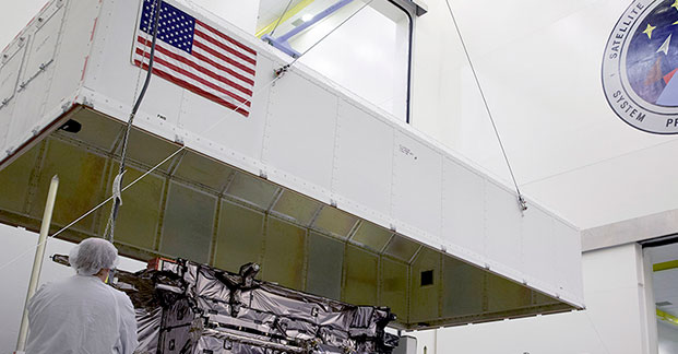
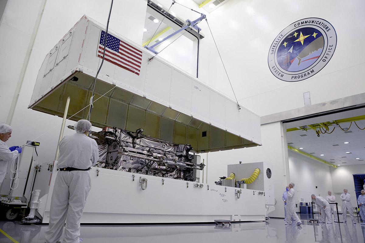
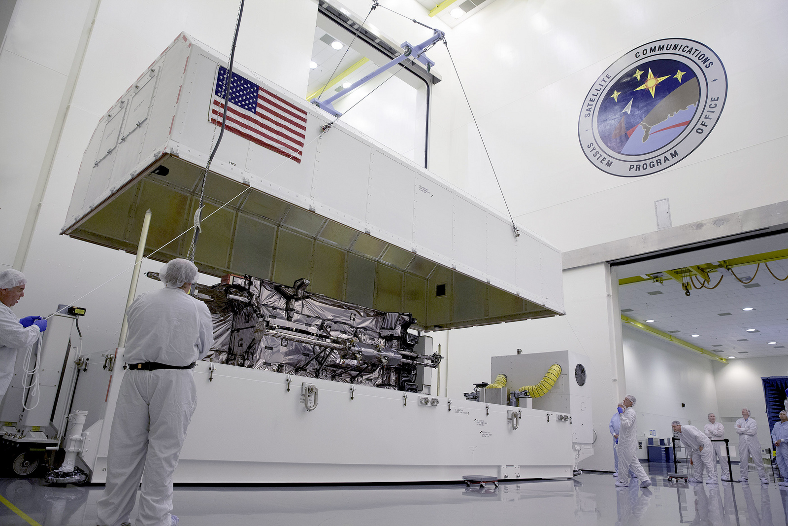
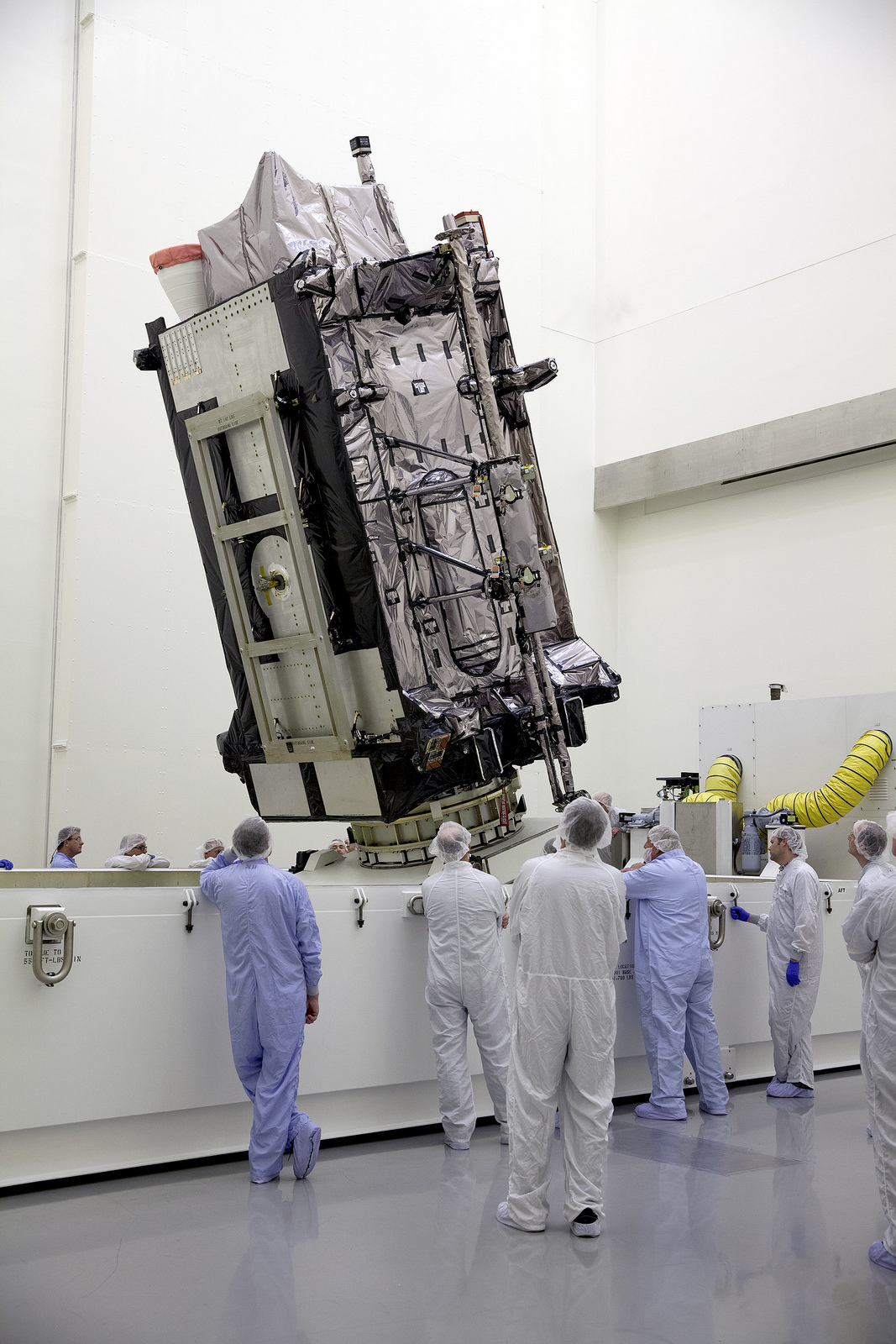
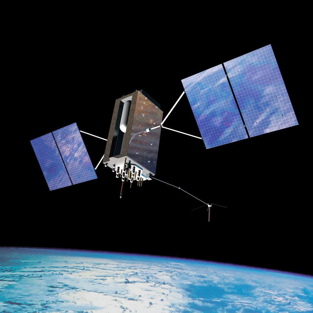
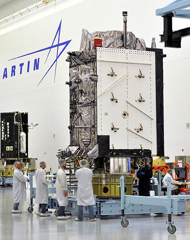
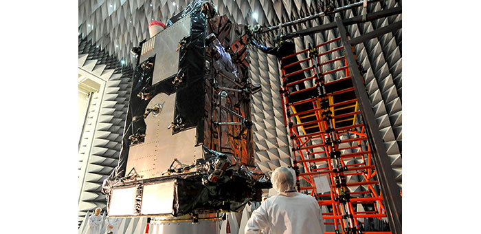
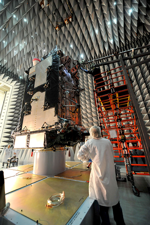
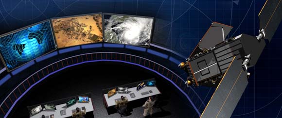
    Raytheon Company reached several milestones recently in its development of the GPS Next -Generation Operational Control System (GPS OCX). Lockheed Martin’s GPS III Non-flight Satellite Testbed (GNST) — a full-sized, functional satellite prototype currently residing at Cape Canaveral Air Force Station — successfully established remote connectivity and communicated with OCX during pre-flight tests.

    GNST proved that it could connect with and receive commands from Raytheon’s Launch and Check Out System (LCS), a part of OCX that supports the satellite and mitigates risks prior to launch. The GNST received commands from Lockheed Martin’s Launch and Checkout Capability (LCC) node in Newtown, Pennsylvania via the OCX servers at Raytheon’s facility in Aurora, Colorado; the system then returned satellite telemetry to the control station. The tests mirror launch and early orbit testing planned for all flight vehicles.

    “While we have connected OCX with ground-based simulators before, these tests were the first time that OCX and a GPS III satellite have actually communicated,” said Keoki Jackson, vice president for Lockheed Martin’s Navigation Systems mission area.

    Ahead of Schedule. Raytheon received Interim Authorization to Test (IATT) security certification from the U.S. Air Force for OCX LCS four months ahead of schedule. The company received a one-year certification with no liens, meaning the government does not require any changes.

    “Typically, IATT certification is given for six-month increments,” said Matthew Gilligan, Raytheon’s GPS OCX program manager and a vice president in Raytheon’s Intelligence, Information, and Services business. “The LCS one-year accreditation speaks to the quality of the information assurance design and threat protection.” The IATT not only includes the LCS, but also Lockheed Martin’s GPS III satellite support systems, Exercise and Rehearsal Training Tool, and Upload Generation Tool.

    OCX is being developed in two blocks. There are seven iterations in Block 1 and one in Block 2. LCS is the fifth Iteration of Block 1; it successfully completed Critical Design Review in June 2013.

    Early Orbit Exercises. Lockheed Martin and Raytheon also completed the third of five planned launch and early orbit exercises to demonstrate launch readiness of GPS III and OCX.

    Exercise 3 demonstrated space-ground communications; first acquisition and transfer orbit sequences; orbit-raising maneuver planning and execution; and basic anomaly detection and resolution capabilities. In addition, the industry and Air Force GPS Directorate teams jointly executed mission planning activities, such as orbit determination and the generation of upload command files.

    Two additional readiness exercises and six 24/7 launch rehearsals are planned before launch of the first GPS III satellite. The first flight GPS III space vehicle (SV-01) is expected to be available for launch in 2014, and launched by the U.S. Air Force in 2015.

    Exelis Encryptors. Exelis delivered the first three of a planned 14 ground-based encryptors to Raytheon Company for OCX. Designed to automatically code and decode GPS signals, encryptors facilitate the exchange of user information by securely transmitting navigation payload data between the OCX ground station and the orbiting constellation of satellites.

    Delivery followed successful thermal, electromagnetic interference and security verification testing. Exelis provides critical elements of software in the navigation processing subsystem that will enable controllers to better understand the exact position of GPS satellites. This helps ensure accurate navigation information is securely broadcast to users. In addition to encryptors, Exelis is building high-precision receivers for use in GPS ground monitoring stations and satellite signal simulators for testing purposes.

    Exelis is also on contract with Lockheed Martin to provide the payloads for the GPS III satellites.


    Fire_engine_galileoEurope Tests Galileo Public Regulated Service

    European Union member states began their independent testing of the Public Regulated Service (PRS) broadcast by the four Galileo navigation satellites in orbit. Transmitted on two frequency bands with enhanced protection, PRS offers a highly accurate positioning and timing service, with access strictly restricted to authorized users, such as government defense, security, and emergency services.

    PRS access was initially considered for Galileo’s Full Operational Capability phase, but it has been enabled in 2013 in response to the strong interest of member states in this service. To allow early access to PRS during the current phase, the European Commission and ESA began the joint project PRS Participants To IOV (PPTI) in July 2012.

    ESA ensured the availability of several tools developed under ESA contracts, including test receivers and other qualification equipment. ESA’s PRS Laboratory, based at the Agency’s ESTEC technical centre in Noordwijk, the Netherlands, provided training, demonstrations and sample data.

    “Belgium, France, Italy, and the UK have now performed independent PRS acquisition and positioning tests. In parallel, ESA, through collaboration with Dutch and Italian authorities, is conducting PRS fixed and mobile validation in several locations in the Netherlands and Italy,” said Miguel Manteiga Bautista, head of ESA’s Galileo Security Office.

    The PRS tests have demonstrated a current autonomous positioning accuracy of less than 10 meters when in the correct geometrical configuration. This is an impressive result considering the small number of Galileo satellites in orbit and the limited ground infrastructure so far deployed.

    Italy has developed its own PRS receiver, and tests have confirmed the feasibility of independent PRS receiver development and verification based on specifications provided by ESA.

    “The PPTI project is still ongoing to test more advanced functionalities this coming autumn and to run the first aeronautical PRS tests in collaboration with the Dutch authorities. Other member states have also expressed their willingness to join the IOV PRS experimentation campaigns soon,“ concluded Miguel Manteiga.

    The project is a first step to ensure use of the PRS as soon as it becomes operational. It will be complemented by PRS pilot projects, focused on PRS applications, which are currently under definition in a common effort between European agencies.

    The United States has submitted a request to be able to use Galileo’s PRS. Other non-EU countries have also expressed a desire to be associated with the program.


    System Briefs

    Way to Go GAO, Part II. The Air Force should come up with better cost estimates and options for new GPS satellites, according to a September 9 report from the U.S. Government Accountability Office (GAO). The GAO was responding to an Air Force study on lower-cost space solutions for GPS.

    “More information on key cost drivers and cost estimates, and broader input from stakeholders would help guide future investment decisions,” the GAO concluded. Specifically, the key cost drivers include dual-launch capability, navigation satellites (smaller GPS-type satellites yet to be developed), and a nuclear detection capability.”

    New Birds by Fall. Galileo satellite-builder OHB AG said it should know by late September whether tests of the first Full Operational Capability (FOC) Galileo satellites are proceeding well enough to permit their delivery later this year. The first FOC satellite began testing at ESA’s European Space Research and Technology Centre in May, and the second arrived August 9.

    The OHB satellites either “bear a strong resemblance” or “are identical” to the four in-orbit validation spacecraft now in medium-Earth orbit, depending on the source. However, the on-board power of the OHB spacecraft exceeds that of the validation satellites built by a different manufacturer. According to one source, Galileo managers made the modification in part to enable Galileo’s encrypted Public Regulated Service signal to overcome a signal frequency overlap issue with China’s BeiDou constellation.

  • GPS III Prototype Successfully Integrated with OCX Ground Control Segment

    GPS III Prototype Successfully Integrated with OCX Ground Control Segment

    During the August test, the GPS III Non-flight Satellite Testbed (GNST) proved that it could connect with and receive commands from the Launch and Check Out System.
    During the August test, the GPS III Non-flight Satellite Testbed (GNST) proved that it could connect with and receive commands from the Launch and Check Out System.

    The prototype for Lockheed Martin ‘s next generation GPS III satellite reached a major milestone on August 30 when it successfully established remote connectivity and communicated with the GPS Next Generation Operational Control System (OCX), being developed by Raytheon, during a series of pre-flight tests.

    During the Compatibility and Integration (C&I) Tests, Lockheed Martin’s GPS III Non-flight Satellite Testbed (GNST) — a full-sized, functional satellite prototype currently residing at Cape Canaveral Air Force Station — proved that it could connect with and receive commands from Raytheon’s Launch and Check Out System (LCS), part of the next-generation OCX that supports the satellite and mitigates risks prior to launch.

    The GNST received commands from the LCC node at Lockheed Martin’s facility in Newtown, Pennsylvania, via the OCX servers at Raytheon’s facility in Aurora, CO, the system then returned satellite telemetry to the control station. The tests mirror launch and early orbit testing planned for all flight vehicles.

    “The GNST is essentially a non-flying, functional GPS III satellite. While we have connected OCX with ground-based simulators before, these C&I tests were the first time that OCX and a GPS III satellite have actually communicated,” explained Keoki Jackson, vice president for Lockheed Martin’s Navigation Systems mission area.

    Matthew Gilligan, a vice president with Raytheon’s Intelligence, Information and Services business and Raytheon’s GPS OCX program manager, stated, “This was an invaluable early opportunity to demonstrate command and control of the GPS III satellite with LCS, proving the end-to-end system capabilities well before putting an actual GPS III in orbit. The positive results tell us that we are right on track for the first GPS III launch.”

    The LCS works hand-in-hand with Lockheed Martin’s Launch and Checkout Capability (LCC) contract, which brings online some of OCX’s GPS III-specific capabilities early to provide on-orbit checkout and control of the satellites.

    The GNST has been at the Cape since July dry-running launch base space vehicle processing activities and pre-launch testing that all future flight GPS III satellites will undergo. The first flight GPS III space vehicle (SV-01) is expected to be available for launch in 2014, and launched by the U.S. Air Force in 2015.

    Prior to shipment to the Cape, the GNST was developed and then completed a series of high-fidelity activities to reduce program risks, improve efficiencies and pathfind the integration, test and environmental checkout that all production GPS III satellites undergo at Lockheed Martin’s new GPS III Processing Facility in Denver, Colo.

    An innovative investment by the Air Force under the original GPS III development contract, the GNST has helped to identify and resolve development issues prior to integration and test of SV-01. Following the Air Force’s rigorous “Back-to-Basics” acquisition approach, the GNST has gone through the development, test and production process for the GPS III program first, significantly reducing risk for the flight vehicles, improving production predictability, increasing mission assurance and lowering overall program costs.

    The Lockheed Martin-developed GPS III satellites and Raytheon’s OCX are critical elements of the U.S. Air Force’s effort to modernize the GPS enterprise more affordably while improving capabilities to meet the evolving demands of military, commercial and civilian users worldwide.

    GPS III satellites will deliver three times better accuracy; provide up to eight times more powerful anti-jamming capabilities; and include enhancements which extend spacecraft life 25 percent further than the prior GPS block. The GPS III also will carry a new civil signal designed to be interoperable with other international global navigation satellite systems, enhancing civilian user connectivity. The spacecraft bus and antenna assemblies for the first GPS III satellite have been delivered to Lockheed Martin’s GPS III Processing Facility and are in the integration and test flow leading to the planned space vehicle delivery in 2014.

    Lockheed Martin is currently under contract for production of the first four GPS III satellites (SV 01-04), and has received advanced procurement funding for long-lead components for the fifth, sixth, seventh and eighth satellites (SV 05-08).

    OCX will revolutionize GPS command and control and mission management capabilities, controlling all legacy and new military and civil signals, providing protection against evolving cyber threats and ensuring continuity of operations during cyber attacks, and reducing operation and sustainment costs through efficient software architecture, automation and performance-based logistics. OCX represents a quantum leap in capabilities over the current Operational Control System and provides flexibility and adaptability to meet future GPS mission needs. Raytheon is the OCX prime contractor and is on track to deliver the final Launch and Checkout System in 2014.

    The GPS III team is led by the Global Positioning Systems Directorate at the U.S. Air Force Space and Missile Systems Center. Lockheed Martin is the GPS III prime contractor with teammates ITT Exelis, General Dynamics, Infinity Systems Engineering, Honeywell, ATK and other subcontractors. Raytheon is the GPS OCX prime contractor with teammates ITT Exelis, Boeing, Braxton, Infinity Systems Engineering, and NASA’s Jet Propulsion Laboratory. Air Force Space Command’s 2nd Space Operations Squadron (2SOPS), based at Schriever Air Force Base, Colo., manages and operates the GPS constellation for both civil and military users.

  • GPS III and OCX Satellite Launch, Early Orbit Ops Successfully Demonstrated

    GPS III and OCX Satellite Launch, Early Orbit Ops Successfully Demonstrated

    Artist's concept of the nextgen GPS III satellite (courtesy of the USAF).
    Artist’s concept of the nextgen GPS III satellite (courtesy of the USAF).

    Lockheed Martin and Raytheon Company successfully completed the third of five planned launch and early orbit exercises to demonstrate the launch readiness of the world’s most powerful and accurate Global Positioning System (GPS), the U.S. Air Force’s next-generation GPS III satellite and Operational Control System (OCX).

    Successful completion of Exercise 3, on August 1, was a key milestone demonstrating Raytheon’s OCX software meets mission requirements and is on track to support the launch of the first GPS III satellite, being produced by Lockheed Martin. Two additional readiness exercises and six 24/7 launch rehearsals are planned before launch of the first GPS III satellite in 2015.

    Using new installments of Raytheon’s OCX software and Lockheed Martin’s GPS III Launch and Checkout Capability (LCC), the Air Force Global Positioning System Directorate and the industry team completed a launch and early orbit exercise over a three-day period in late July. Exercise 3 demonstrated space-ground communications; first acquisition and transfer orbit sequences; orbit-raising maneuver planning and execution; and basic anomaly detection and resolution capabilities. In addition, the industry and customer teams jointly executed mission planning activities, such as orbit determination and the generation of upload command files.

    Exercise 3 expands on two previous exercises, with a longer mission timeline, and the introduction of simulated vehicle and ground anomalies to evaluate the combined response capabilities of the control segment, satellite and operations crew. “Successful completion of Exercise 3 clearly demonstrates that OCX is on track to support the first GPS III satellite launch,” stated Matt Gilligan, a vice president with Raytheon’s Intelligence, Information and Services business and Raytheon’s GPS OCX program manager. “The system responded as designed, and met all of the launch exercise success criteria and successfully demonstrated our anomaly response.”

    “Exercise 3 demonstrated that the cross-organizational operations team is on track to support successful GPS III launch and on-orbit checkout missions from our Newtown facility,” said Keoki Jackson, vice president of Lockheed Martin’s Navigation Systems mission area. “I look forward to the team’s continued success as they progress through the complex mission readiness program towards the first GPS III launch.”

    The Lockheed Martin-developed GPS III satellites and Raytheon‘s OCX are critical elements of the U.S. Air Force’s effort to modernize the GPS enterprise more affordably while improving capabilities to meet the evolving demands of military, commercial and civilian users worldwide.

    GPS III satellites will deliver three times better accuracy; provide up to eight times more powerful anti-jamming capabilities; and include enhancements which extend spacecraft life 25 percent further than the prior GPS block. The GPS III also will carry a new civil signal designed to be interoperable with other international global navigation satellite systems, enhancing civilian user connectivity.  The spacecraft bus and antenna assemblies for the first GPS III satellite have been delivered to Lockheed Martin’s GPS III Processing Facility and are in the integration and test flow leading to the planned space vehicle delivery in mid-2014.

    OCX is being developed in two Blocks using a commercial best practice iterative software development process, with seven iterations in Block 1 and one iteration in Block 2. Exercise 3 was conducted using the recently completed Iteration 1.4 software. Exercise 4, scheduled for early 2014, will use Iteration 1.5 software, which includes the Launch and Checkout System capability as well as all critical information assurance features needed to support launch of the first GPS III satellite.

    The GPS III team is led by the Global Positioning Systems Directorate at the U.S. Air Force Space and Missile Systems Center. Air Force Space Command’s 2nd Space Operations Squadron (2SOPS), based at Schriever Air Force Base, Colorado, manages and operates the GPS constellation for both civil and military users.

  • Lockheed Martin’s Paveway II with GPS/INS Successfully Employed In Navy Exercises

    Lockheed Martin’s paveway II Dual Mode Laser Guided Bomb (DMLGB) was successfully employed in recent U.S. Navy Tactics Development exercises at the Naval Strike and Air Warfare Center in Fallon, Nevada.

    During four missions over a two-day period, F/A-18C/D Hornets and F/A-18E/F Super Hornets released 36 GBU-12F/B bombs fitted with recently upgraded paveway II DMLGB guidance kits. The weapons were used in tactically representative engagements against fixed targets and met all mission success criteria, demonstrating the increased operational utility of the enhancements.

    By adding the GPS/Inertial Navigation System (INS) guidance to standard laser-guided paveway II weapons, the U.S. Navy and Marine Corps can execute precision-strike missions against stationary and relocatable targets in all weather conditions. The kits can operate in laser mode only, INS/GPS mode only or dual mode to provide pilots with the flexibility to engage various types of targets in a single mission. The most recent paveway II DMLGB upgrade to Block II Operational Flight Program software improves overall weapon performance and effectiveness in all three release modes.

    “We worked closely with our U.S. Navy and Marine Corps customers to develop the Block II Operational Flight Program software upgrade to the paveway II DMLGB guidance kits,” said Joe Serra, precision guided systems manager at Lockheed Martin Missiles and Fire Control. “Delivered to the fleet earlier this year, the enhanced fire-and-forget technology of our DMLGB kits provides naval warfighters with a mature and highly maneuverable all-weather direct-attack capability.”

    Aircrews from the Naval Strike and Air Warfare Center, along with Air Test and Evaluation Squadron Nine (VX-9) “Vampires” from Naval Air Weapons Station in China Lake, California, participated in the exercises.

    “The same company-wide discipline that provides customers with affordable single-mode LGB targeting capability is applied to our current and future dual-mode weapons to provide U.S. and international customers with the most affordable and reliable precision capability,” said Serra.

    Lockheed Martin has upgraded more than 7,000 paveway II LGB guidance kits with dual-mode, all-weather capability for the U.S. Navy. Additionally, the company has delivered more than 65,000 LGB kits and over 125,000 Enhanced Laser Guided Training Rounds to the U.S. Navy, Marine Corps, Air Force and international customers. Lockheed Martin is the sole-source developer and provider of the paveway II DMLGB kits to the U.S. Navy and U.S. Marine Corps.

    Lockheed Martin Missiles and Fire Control is a 2012 recipient of the U.S. Department of Commerce’s Malcolm Baldrige National Quality Award for performance excellence. The Malcolm Baldrige Award represents the highest honor that can be awarded to American companies for achievement in leadership, strategic planning, customer relations, measurement, analysis, workforce excellence, operations and business results.

    Headquartered in Bethesda, Maryland, Lockheed Martin is a global security and aerospace company that employs about 116,000 people worldwide and is principally engaged in the research, design, development, manufacture, integration and sustainment of advanced technology systems, products and services. The Corporation’s net sales for 2012 were $47.2 billion.

  • Lockheed Martin Prototype to Help Prep for GPS III Launch

    The GPS III Non-Flight Satellite Testbed completed pathfinding activities at Lockheed Martin’s GPS III Processing Facility outside of Denver prior to it shipping to Cape Canaveral Air Force Station to test facilities and pre-launch processes there in advance of the arrival of the first GPS III flight satellite.
    The GPS III Non-Flight Satellite Testbed completed pathfinding activities at Lockheed Martin’s GPS III Processing Facility outside of Denver prior to it shipping to Cape Canaveral Air Force Station to test facilities and pre-launch processes there in advance of the arrival of the first GPS III flight satellite. Photo: Lockheed Martin

    Lockheed Martin has delivered a full-sized, functional prototype of the next-generation GPS satellite to Cape Canaveral Air Force Station to test facilities and pre-launch processes in advance of the arrival of the first GPS III flight satellite.

    The GPS III Non-Flight Satellite Testbed (GNST) arrived at the Cape on July 19 to begin to dry run launch-base space-vehicle processing activities and other testing that future flight GPS III satellites will undergo. The first flight GPS III satellite is expected to arrive at the Cape in 2014, ready for launch by the U.S. Air Force in 2015.

    The GNST arrived at the Cape by Air Force C-17 aircraft from Buckley Air Force Base near Lockheed Martin’s GPS III Processing Facility (GPF) in Denver, Colorado. Prior to shipment, the GNST was developed and then completed a series of high-fidelity activities to pathfind the integration, test and environmental checkout that all production GPS III satellites undergo at Lockheed Martin’s new satellite manufacturing facility.

    An innovative investment by the Air Force under the original GPS III development contract, the GNST has helped to identify and resolve development issues prior to integration and test of the first GPS III flight space vehicle (SV 01).  Following the Air Force’s rigorous “back-to-basics” acquisition approach, the GNST has gone through the development, test and production process for the GPS III program first, significantly reducing risk for the flight vehicles, improving production predictability, increasing mission assurance and lowering overall program costs.

    “We call the GNST a ‘pathfinder’ because it has truly blazed the trail for every one of our GPS III processes from initial development, production, integration and test, and now pre-launch activities,” explained Keoki Jackson, vice president for Lockheed Martin’s Navigation Systems mission area. “All future GPS III satellites will follow this same path, so the GNST was a smart initiative to help us discover and resolve any issues in advance, implement production efficiencies, and ultimately save a tremendous amount of time and money in the long run.”

    GPS III is a critically important program for the Air Force, affordably replacing aging GPS satellites in orbit, while improving capability to meet the evolving demands of military, commercial and civilian users. GPS III satellites will deliver three times better accuracy, include enhancements which extend spacecraft life 25 percent further than the prior GPS block, and a new civil signal designed to be interoperable with international global navigation satellite systems.

    Lockheed Martin is currently under contract for production of the first four GPS III satellites (SV 01-04), and has received advanced procurement funding for long-lead components for the fifth, sixth, seventh and eighth satellites (SV 05-08).

  • Lockheed Martin Delivers Antenna Assemblies for First GPS III Satellite

    Lockheed Martin has completed and is preparing to install the navigation, communication, and hosted payload antenna assemblies for the first satellite of the next-generation GPS III.

    Seven antenna assemblies, produced at Lockheed Martin’s Newtown, Pennsylania, facility were delivered to the company’s GPS III Processing Facility (GPF) near Denver, Colorado, on June 14.  The antennas will be installed on the first GPS III space vehicle (SV01), which Lockheed Martin will deliver to the U.S. Air Force on schedule, “flight-ready,” in 2014.

    The new antennas for GPS III SV01 will provide the satellite’s capability to send and/or receive data for Earth-coverage and military Earth-coverage navigation; a UHF crosslink for inter-satellite data transfer; telemetry, tracking and control for satellite-ground communications; and data acquisition and communication for the nuclear detection system hosted payload. The antenna designs enable three to eight times greater anti-jamming signal power to be broadcast to military users across the globe when compared to previous GPS generations.

    “These antennas on the next generation of GPS III satellites will transmit data utilized by more than one billion users with navigation, positioning and timing needs,” explained Keoki Jackson, vice president of Lockheed Martin’s Navigation Systems mission area. “We have become reliant on GPS for providing signals that affect everything from cell phones and wristwatches, to shipping containers and commercial air traffic, to ATMs and financial transactions worldwide.”

    GPS III is a critically important program for the Air Force, affordably replacing aging GPS satellites in orbit, while improving capability to meet the evolving demands of military, commercial and civilian users. GPS III satellites will deliver three times better accuracy, include enhancements which extend spacecraft life 25 percent further than the prior GPS block, and a new civil signal designed to be interoperable with international global navigation satellite systems.

    The production of the first GPS III satellite continues on schedule. Recent testing of the SV 01 bus — the portion of the space vehicle that carries mission payloads and hosts them in orbit — assured that all bus subsystems are functioning normally and that they are ready for final integration with the satellite’s navigation payload.
    This milestone follows February’s successful initial power on of the SV01 spacecraft bus, which demonstrated  the electrical-mechanical integration, validated the satellite’s interfaces and led the way for functional electrical hardware-software integration testing.

    Lockheed Martin is under contract for production of the first four GPS III satellites (SV01-04), and has received advanced procurement funding for long-lead components for the fifth, sixth, seventh and eighth satellites (SV05-08).

    The GPS III team is led by the Global Positioning Systems Directorate at the U.S. Air Force Space and Missile Systems Center. Lockheed Martin is the GPS III prime contractor with teammates ITT Exelis, General Dynamics, Infinity Systems Engineering, Honeywell, ATK and other subcontractors. Air Force Space Command’s 2nd Space Operations Squadron (2SOPS), based at Schriever Air Force Base, Colorado, manages and operates the GPS constellation for both civil and military users.

  • Lockheed Martin GPS III Prototype Validates Test Facilities

    Lockheed Martin GPS III Prototype Validates Test Facilities

    Lockheed Martin’s GPS III Non-Flight Satellite Testbed (GNST) has successfully completed a series of high-fidelity pathfinding events which validate the process and facility for vehicle integration checkout, as well as signals interference testing, that the next-generation satellites of GPS III will go through before delivery for launch.

    An innovative investment by U.S. Air Force under the original GPS III development contract, the GNST is a full-sized GPS III satellite prototype which has helped to identify and resolve development issues prior to integration and test of the first GPS III space vehicle (SV 1). Following the Air Force’s rigorous “back-to-basics” acquisition approach, the GNST has gone through the development, test and production process for the GPS III program first, significantly reducing risk for the flight vehicles, improving production predictability, increasing mission assurance and lowering overall program costs.

    During this latest milestone, the GNST successfully completed thermal vacuum (T-Vac) chamber trail blazing, demonstrating facility, mechanical and electrical ground equipment integration, and ran a series of vehicle integration test procedures. The GNST also completed Passive Intermodulation (PIM) and Electromagnetic Compatibility (EMC) testing, which assures that multiple high-powered signals generated from the satellite’s navigation downlink transmissions, or transmitted from the hosted nuclear detection system payload on the satellite, do not interfere with each other or themselves.

    “As the GNST serves as a pathfinder for the GPS III program, its successful completion of this testing validates that development risks have been retired and our engineering and technology is sound for the flight vehicles being built,” explained Keoki Jackson, vice president for Lockheed Martin’s Navigation Systems mission area.

    The GNST is now being prepared for shipment to Cape Canaveral U.S. Air Force Station, Florida, for more risk reduction activities related to satellite launch.

    The GPS III prototype in an anechoic chamber where it completed Passive Intermodulation (PIM) and Electromagnetic Compatibility (EMC) testing at Lockheed Martin’s GPS III Processing Facility outside of Denver, Colorado. Photo:  Lockheed Martin’s Navigation Systems
    The GPS III prototype in an anechoic chamber where it completed Passive Intermodulation (PIM) and Electromagnetic Compatibility (EMC) testing at Lockheed Martin’s GPS III Processing Facility outside of Denver, Colorado. Photo: Lockheed Martin’s Navigation Systems

    GPS III is a critically important program for the Air Force, affordably replacing aging GPS satellites in orbit, while improving capability to meet the evolving demands of military, commercial and civilian users. GPS III satellites will deliver three times better accuracy and — to outpace growing global threats that could disrupt GPS service — up to eight times improved anti-jamming signal power for additional resiliency. The GPS III will also include enhancements adding to the spacecraft’s design life and a new civil signal designed to be interoperable with international global navigation satellite systems.

    Lockheed Martin is currently under contract for production of the first four GPS III satellites (SV 1-4), and has receivedadvanced procurement funding for long-lead components for the fifth, sixth, seventh and eighth satellites (SV 5-8).

    The Lockheed Martin team remains on track to deliver the first GPS III satellite, with its enhanced capabilities over current orbiting systems, for launch availability in 2014.

    The GPS III team is led by the Global Positioning Systems Directorateat the U.S. Air Force Space and Missile Systems Center. Lockheed Martin is the GPS III prime contractor with teammates ITT Exelis, General Dynamics, Infinity Systems Engineering, Honeywell, ATK and other subcontractors. Air Force Space Command’s 2nd Space Operations Squadron (2SOPS), based at Schriever Air Force Base, Colorado, manages and operates the GPS constellation for both civil and military users.

  • Lockheed Martin Completes Functional Testing of GPS III Electronic Systems

    A Lockheed Martin-led industry team has completed successful functional integration tests of the spacecraft bus and network communications equipment on the first satellite of the next generation Global Positioning System, known as GPS III.

    The recent testing of GPS III space vehicle 1 (SV 1) bus — the portion of the space vehicle that carries mission payloads and hosts them in orbit — assured that all bus subsystems are functioning normally and ready for final integration with the satellite’s navigation payload. Systems tested included: guidance, navigation and control; command and data handling; on-board computer and flight software; environmental controls; and electrical power regulation. The SV 1 satellite’s network communication equipment subsystem that interfaces with the ground control segment and distributes data throughout the space vehicle also passed all tests as expected.

    This milestone follows February’s successful initial power-on of SV 1, which demonstrated the electrical-mechanical integration, validated the satellite’s interfaces, and led the way for functional and hardware-software integration testing.

    “The successful completion of the SV 1 bus functional check out validates that the spacecraft is now ready to begin the next sequence of payload integration and environmental testing, prior to delivery,” explained Keoki Jackson, vice president of Lockheed Martin’s Navigation Systems mission area.

    GPS III SV 1’s navigation payload, which is being produced by ITT Exelis, will be delivered to Lockheed Martin’s GPS Processing Facility (GPF) near Denver later in 2013. The hosted nuclear detection system payload has already been delivered and mechanically integrated. The satellite remains on schedule for flight-ready delivery to the U.S. Air Force in 2014.

    GPS III is a critically important program for the Air Force, affordably replacing aging GPS satellites in orbit, while improving capability to meet the evolving demands of military, commercial and civilian users. GPS III satellites will deliver three times better accuracy and — to outpace growing global threats that could disrupt GPS service — up to eight times improved anti-jamming signal power for additional resiliency. The GPS III will also include enhancements adding to the spacecraft’s design life and a new civil signal designed to be interoperable with international global navigation satellite systems.

    The U.S. Air Force has produced a video about the GPS satellite modernization program:

    Lockheed Martin is under contract for production of the first four GPS III satellites (SV 1-4), and has received advanced procurement funding for long-lead components for the fifth, sixth, seventh and eighth satellites (SV 5-8).

    The GPS III team is led by the Global Positioning Systems Directorate at the U.S. Air Force Space and Missile Systems Center. Lockheed Martin is the GPS III prime contractor with teammates ITT Exelis, General Dynamics, Infinity Systems Engineering, Honeywell, ATK and other subcontractors. Air Force Space Command’s 2nd Space Operations Squadron (2SOPS), based at Schriever Air Force Base, Colo., manages and operates the GPS constellation for both civil and military users.

    Headquartered in Bethesda, Maryland, Lockheed Martin is a global security and aerospace company that employs about 118,000 people worldwide and is principally engaged in the research, design, development, manufacture, integration, and sustainment of advanced technology systems, products, and services. The corporation’s net sales for 2012 were $47.2 billion.

  • Lockheed Martin Team Completes Delta Preliminary Design for Next GPS III Satellite Capabilities

    Lockheed Martin has successfully completed a Delta Preliminary Design Review (dPDR) for the next Global Positioning System (GPS) III satellite vehicles planned under the U.S. Air Force’s GPS III program.

    The GPS III program will replace aging GPS satellites, while improving capability to meet the evolving demands of military, commercial and civilian users. GPS III satellites will deliver three times better accuracy and up to eight times improved anti-jamming signal power while enhancing the spacecraft’s design life and adding a new civil signal designed to be interoperable with international GNSS.

    The Air Force plans to purchase up to 32 GPS III satellites. Lockheed Martin is under contract for production of the first four GPS III satellites, and has received advanced procurement funding for long-lead components for the fifth, sixth, seventh and eighth satellites.  The successful dPDR addresses design modifications, agreed on by the Air Force and the Lockheed Martin-lead industry team, which will provide new capabilities for GPS III Space Vehicle 9 (SV09) and beyond, including the addition of a search and rescue satellite payload and a Laser Retroreflector Array (LRA). An innovative new waveform generator permits the addition of new navigation signals after launch to upgrade the constellation without the need to launch new satellites.

    “We have worked very closely with the Air Force and GPS community to make GPS III the most affordable and lowest risk solution for bringing new capabilities to the GPS constellation,” said John Frye, Lockheed Martin’s GPS III capability and affordability insertion manager. “The design modifications from this dPDR address ways to further reduce Air Force launch costs by $50 million per satellite through dual launch of two GPS III space vehicles on a single booster. This successful dPDR milestone sets the stage to proceed with SV09 design maturation.”

    From the beginning of the program, the Lockheed Martin team has remained focused on affordability for GPS III, the company said, while working to ensure the enhanced satellite system can evolve to continue to meet the world’s global navigation and timing needs for the next 30 years. To help reduce risks and cut costs, the GPS III team developed a GPS Non-Flight Satellite Testbed (GNST), which serves as the program’s ground pathfinder and vehicle demonstrator for the first complete satellite. The entire GPS III development and production sequence uses the GNST to provide space vehicle design level validation; early verification of ground support and test equipment; and early confirmation and rehearsal of transportation operations.

    Lockheed Martin team has met recent milestones and appears to be on track to deliver the first GPS III satellite, for launch availability in 2014.

    In February, the Lockheed Martin team successfully turned on power to the system module of the program’s first spacecraft, designated GPS III Space Vehicle 1 (SV01), demonstrating mechanical integration, validating the satellite’s interfaces, and leading the way for electrical and integrated hardware-software testing.  The satellite will complete its Assembly, Integration and Test (AI&T) in Lockheed Martin’s new GPS Processing Facility (GPF) designed for efficient and affordable satellite production.

    The GPS III team is led by the Global Positioning Systems Directorate at the U.S. Air Force Space and Missile Systems Center. Lockheed Martin is the GPS III prime contractor with teammates ITT Exelis, General Dynamics, Infinity Systems Engineering, Honeywell, ATK and other subcontractors. Air Force Space Command’s 2nd Space Operations Squadron (2SOPS), based at Schriever Air Force Base, Colorado, manages and operates the GPS constellation for both civil and military users.