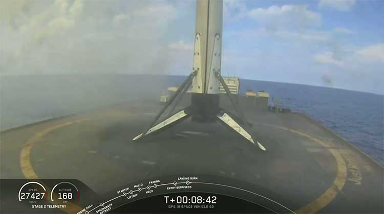
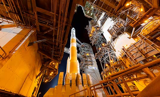
The United States Space Force (USSF) and the Space and the Missile Systems Center achieved another major GPS milestone on July 27 when the GPS III Space Vehicle (SV) 03 received USSF’s Operational Acceptance approval.
This marks the third GPS III satellite to receive operational acceptance in less than a year.
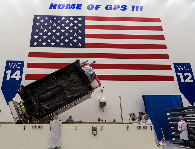
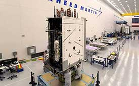
GPS III SV-03 satellite packed prior to shipment to Cape Canaveral. (Photo: Lockheed Martin)
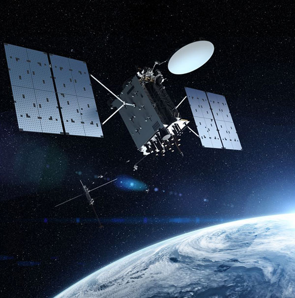
The GPS III satellites are the newest generation built by Lockheed Martin that provide precise positioning, navigation and timing information with three times better accuracy, and up to eight times improved anti-jamming capability than previous generations of GPS satellites.
SV03 was launched on June 30 and was the second National Security Space Launch (NSSL) mission launched on a SpaceX Falcon 9 rocket. This was the first NSSL mission where a Launch Service Provider recovered a booster, with SpaceX successfully recovering the first stage and fairings as part of the launch.
The GPS III SV03 mission was dedicated to Colonel Thomas G. Falzarano, 21st Space Wing commander, who passed away in May.
“We are adding GPS warfighter capability and resiliency with each new GPS III satellite. The on-boarding of GPS III SV03 enables our first use of cross link commanding capability for assured nuclear detection,” said Lt. Col. Michael Schriever, 2nd Space Operations Squadron commander. “With the GPS III SV03 addition to the constellation, our modernized signals capable satellites increases to 22 vehicles. This results in nearly a fully capable Military-Code constellation, which our space warfighters will operate to deliver expanded capabilities to the joint force.”
The USSF’s Space and Missile Systems Center, located at Los Angeles Air Force Base, California, is the center of excellence for developing, acquiring and delivering military space systems. Its portfolio includes
GPS, military satellite communications, defense meteorological satellites, space launch and range systems, satellite control networks, space based infrared systems, and space situational awareness capabilities.
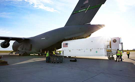
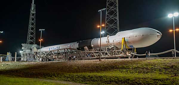
The U.S. Space Force Space and Missile Systems Center on July 14 delivered the fourth GPS III satellite to Cape Canaveral Air Force Station, Florida. The satellite is scheduled for launch on Sept. 30.
GPS III Space Vehicle (SV) 04 was safely transported from the Lockheed Martin facility in Waterton, Colorado to Space Coast Regional Airport in Titusville, Florida. The satellite was carried aboard a C-17 Globemaster III originating from Joint Base Lewis-McChord, Washington.
The fourth GPS III satellite arrived at Cape Canaveral July 14 for launch on Sept. 30. (Photo: USAF)
The delivery of GPS III SV04 starts the clock for final testing and checkout prior to launch. The satellite will be processed at the Astrotech Space Operations facility in Florida to ensure the full functionality of the satellite, prepare the satellite for propellant loading, and encapsulate the satellite in its protective fairing. At the completion of these activities, the satellite will be horizontally integrated with the SpaceX Falcon 9 launch vehicle.
“The shipment of the fourth GPS III satellite was successfully conducted just two weeks after the launch of our GPS III-SV03 satellite. This operation is a remarkable achievement and testament to the hard work of the entire GPS team members from all across the country,” said Col. Edward Byrne, SMC’s Medium Earth Orbit Space Systems Division chief. “The delivery of SV04 marks the start of our third GPS III launch campaign on a SpaceX Falcon 9 rocket and brings us another step closer in advancing the GPS constellation with more capable satellites.”
GPS III SV04 is slated to launch in September. Once on-orbit, it will join the operational constellation of 31 GPS satellites, delivering enhanced resiliency, better accuracy, and advanced anti-jam capabilities.
The United States Space Force’s Space and Missile Systems Center on July 27 completed the military code (M-code) Early Use (MCEU) hardware and software upgrade to the GPS Operational Control System (OCS).
Completion of the upgrade is a major step toward Operational Acceptance of the long-awaited GPS M-code.
Photo: U.S. Air Force photo/Dennis Rogers
The encrypted M-code signal enhances anti-jamming and anti-spoofing capabilities for the warfighter. M-code signals are currently available on all 22 GPS Block IIR-M, IIF and III space vehicles currently on orbit.
The installs were completed at the Master Control Station at Schriever Air Force Base, Colorado, and Alternate Master Control Stations at Vandenberg Air Force Base, California.
The MCEU upgrade allows the OCS Architecture Evolution Plan to task, upload and monitor M-code within the GPS constellation, as well as support testing and fielding of modernized user equipment.
Operational Acceptance Set for November. MCEU will be in a trial period before Operational Acceptance in November. Once Operational Acceptance is granted, upcoming Military Ground User Equipment (MGUE) will be able to leverage the M-code signal-in-space to provide more secure position, navigation and timing (PNT) to warfighters.
“Working closely with Lockheed Martin and our other mission partners — with the common national goal of providing enhanced PNT signal security and safety always in sharp focus — means we’re able to deliver the right mission capability faster to our warfighters,” said Lt. Col. Steven A. Nielson, program manager of the MCEU project.
MCEU serves as a gap-filler for M-code operations before the entire GPS constellation’s operational transition to the Next Generation Operational Control System Block 1, which is now in development.
A key to enabling M-code is a new software-defined receiver being installed at all six Space Force Monitoring Sites. The M-code Monitor Station Technology Improvement and Capability receiver uses commercial, off-the-shelf hardware to cost-effectively receive and process M-code signals, enabling OCS operators to monitor the signals.
Third Lockheed Martin-Built GPS III satellite climbs to orbit on its own power
GPS III SV03 increases number of secure military code (M-code) enabled satellites in GPS constellation to 22 total.
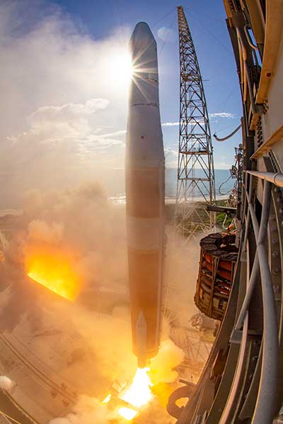
After a successful launch on June 30, the third Lockheed Martin-built GPS III satellite headed to orbit under its own propulsion. The satellite separated from its rocket and used onboard power to climb to its operational orbit, approximately 12,550 miles above the Earth.
GPS III Space Vehicle 03 is responding to commands from U.S. Space Force and Lockheed Martin engineers in the Launch & Checkout Center at the company’s Denver facility. There, they declared rocket booster separation and satellite control about 90 minutes after the satellite’s June 30 launch aboard a SpaceX Falcon 9 rocket from Cape Canaveral Air Force Station, Florida.
“In the coming days, GPS III SV03’s onboard liquid apogee engines will continue to propel the satellite towards its operational orbit,” said Tonya Ladwig, Lockheed Martin’s acting vice president for Navigation Systems. “Once it arrives, we’ll send the satellite commands to deploy its solar arrays and antennas, and prepare the satellite for handover to Space Operations Command.”
After on-orbit testing, GPS III SV03 is expected to join the GPS constellation — including GPS III SV01 and SV02, which were declared operational in January and April — in providing positioning, navigation and timing signals for more than four billion military, civil and commercial users.
Lockheed Martin designed GPS III to help the Space Force modernize the GPS constellation with new technology and capabilities. The new GPS IIIs provide three times better accuracy and up to eight times improved anti-jamming capabilities over any previous GPS satellite. They also offer a new L1C civil signal, which is compatible with other international global navigation satellite systems, like Europe’s Galileo, to improve civilian user connectivity.
GPS III also continues the Space Force’s plan to field M-code, a more-secure, harder-to-jam and spoof GPS signal for our military forces. GPS III SV03 brings the number of M-code enabled satellites to 22 in the 31-satellite GPS constellation.
“As a nation, we use GPS signals every day — they time-stamp all our financial transactions, they make aviation safe, they make precision farming possible, and so much more,” added Ladwig. “GPS has become a critical part of our national infrastructure. In fact, the U.S. economic benefit of GPS is estimated to be over $300 billion per year and $1.4 trillion since its inception. Continued investment in modernizing GPS — updating technology, improving its capabilities — is well worth it.”
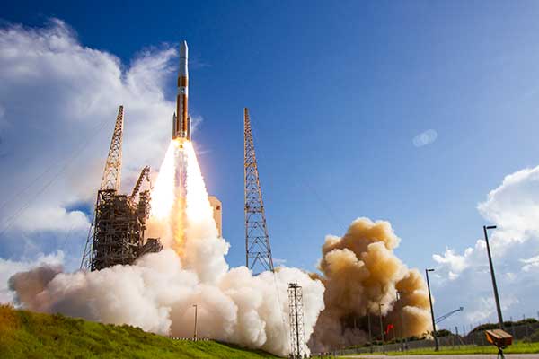
Update (U.S. Space Force news release): The U.S. Space Force and its mission partners successfully launched the third GPS III satellite at 4:10 p.m. EDT June 30 from Space Launch Complex 40 at Cape Canaveral Air Force Station, Florida. The Lockheed Martin-built satellite was carried to orbit aboard a Space Exploration Technologies Corporation (SpaceX) Falcon 9 Launch Vehicle.
“Our team is committed to achieving excellence and reaching the Gold Standard of position, navigation, and timing. GPS III satellites will pioneer innovation and I look forward to seeing new technologies developed for the United States Space Force,” said Cordell DeLaPena, program executive officer for SMC’s Space Production Corps. “At SMC, we are proud to deliver our third GPS III satellite and will continue to operate at a high caliber.”
The first-stage booster of SpaceX’s Falcon 9 Launch Vehicle was successfully recovered approximately 20 minutes after liftoff by the company’s autonomous spaceport drone ship in the predicted landing area. This launch marks the first NSSL mission where a launch provider has attempted to recovered flight hardware.
“The successful GPS III SV03 launch and recovery serves as another step in our journey with industry partners to create innovative, flexible, and affordable services to meet NSSL mission objectives and propel U.S. dominance in space.” said Col. Robert Bongiovi, Launch Enterprise director. “I’m proud of my team’s 81st successful National Security Space Launch and look forward to our additional National Security Space missions with SpaceX.”
GPS III’s SV03 separated from its upper stage approximately 88 minutes after launch. Engineers and operators at Lockheed Martin’s Waterton facility will now begin on-orbit checkout and tests which are estimated to complete in two weeks. Operational use is expected to begin as early as August 2020.
“The GPS III program continues to build on its successes by delivering advanced capabilities for the United States Space Force, and maintaining the “gold standard” for position, navigation and timing.” said Col. Edward Byrne, Medium Earth Orbit Space Systems Division chief.
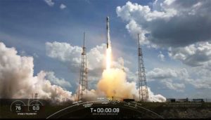
UPDATE: The SpaceX Falcon 9 successfully launched the third GPS III satellite at 4:10 ET. The reusable Stage 1 successfully returned and landed on its launchpad less than nine minutes after launch.
Screenshot: SpaceX live feed of launchSpaceX live feed show Stage 1 returning to landing pad at sea. (Screenshot: Space X)
The U.S. Space Force’s newest Global Positioning System (GPS) III satellite, Space Vehicle 03 (SV03), rolled out to Cape Canaveral’s Space Launch Complex-40 launch pad a during the overnight hours on June 27 and 28, ready for launch June 30 at 3:55 p.m. Eastern time.
The Lockheed Martin-built GPS III SV03 is scheduled to launch aboard a SpaceX Falcon 9 rocket. GPS III SV03 will be the third USSF mission launch, the second National Security Space launch (NSSL) mission to be launched on a SpaceX Falcon 9 rocket, and the first NSSL mission where a launch service provider will be attempting to recover the booster.
The launch window opens at 3:55 p.m. EDT and will remain open for 15 minutes. A live-feed will begin 20 minutes prior to the launch, concluding approximately 45 minutes afterward. A simulcast of the broadcast can be viewed at www.spacex.com.
“The NSSL program’s number one priority is to achieve mission success on each and every National Security Space launch,” said Col. Robert Bongiovi, Launch Enterprise director. “We also strive to procure affordable launch services that maintain assured access to space for the Nation. Our goal with GPS III SV03 was to maintain our mission assurance record, while exploring unique cost saving opportunities like recovering a booster to deliver the capabilities our warfighters demand.”
“The GPS III program brings a new standard of excellence for the entire space community. Our production team and contract partners have developed an indispensable tool that is available to military and civil users around the world.” said Cordell DeLaPena, program executive officer for SMC’s Space Production Corps. “Our team will continue to advance the launch campaign for the remaining space vehicles and I anticipate the successful launch of SV03 on the Falcon 9.”
Originally scheduled to launch on April 29, the GPS III-3 mission took a 60-day tactical pause in order to implement new health and safety measures to protect launch and operations crew during the ongoing COVID-19 pandemic. This pause allowed SMC to design and implement these measures in collaboration with contractor and launch provider partners as well as medical professionals. The tactical pause resulted in no impact to the readiness and availability of the GPS constellation, which remains in strong health. There were minimal impacts to cost and schedule due to the pause.
GPS III SV03 will be launched to augment the current GPS constellation comprised of 31 operational spacecraft. GPS satellites operate in Medium Earth Orbit (MEO) at an altitude of approximately 20,200 km (12,550 miles) in six orbital planes. Each satellite circles the earth twice per day.
GPS is the premier space-based provider of positioning, navigation, and timing services for more than four billion users worldwide. This latest generation of GPS satellite boasts a 15-year design life — 25 percent longer than the last generation of GPS satellites on-orbit. GPS III brings new capabilities to users such as the new L1C civilian signal, which opens the window for future interoperability with international satellite navigation systems.
“Our space systems division is filled with exceptional, highly talented team members focused on delivering the next generation of GPS satellites. They are extremely motivated and resourceful, and had to overcome numerous challenges imposed by the COVID-19 pandemic to successfully get us into a position where we can safely launch. I couldn’t have asked for a better team,” said Col. Edward Byrne, MEO Space Systems Division chief. “SV03 is set to join the first two GPS III satellites as we continue our journey to modernize the constellation.”
GPS III satellite signals are more accurate and more powerful than previous generations, providing improved performance for civilian and military users. SV03 will add another military code (M-Code) capable satellite as the team continues to modernize the GPS fleet. M-Code will provide more accurate military signals with improved anti-jamming capabilities for the warfighter. Full M-Code capability is set to rollout with the GPS OCX Block 2 ground segment.
GPS III SV 03 rolls to Cape Canaveral’s Space Launch Complex-40 launch pad in preparation for its June 30 launch aboard a Falcon 9. (Photo courtesy of SpaceX via USAF)
Honeywell, under a contract with Lockheed Martin, will supply guidance and navigation systems for NASA’s upcoming Artemis missions, which will fly humans to the moon for the first time since 1972.
The companies are supplying key components to NASA’s Orion spacecraft fleet for the Artemis missions. Components include the barometric altimeter, the inertial measurement system, and the GPS receiver.
Honeywell will provide 14 product types for Artemis missions III through V, including both hardware and software solutions, to support NASA’s lunar missions. NASA awarded Lockheed Martin a long-term, multibillion-dollar production contract for the Orion spacecraft, aimed to meet the space agency’s anticipated needs into the 2030s.
Working in collaboration with the Orion team over the next decade, Honeywell will support Lockheed Martin and its partners through the development and production of essential guidance and navigation systems, command data handling, and display and control products. The focus of the missions is to conduct science and learn lessons that will help take humans to Mars.
Honeywell will supply the following types of technology for the Artemis missions:
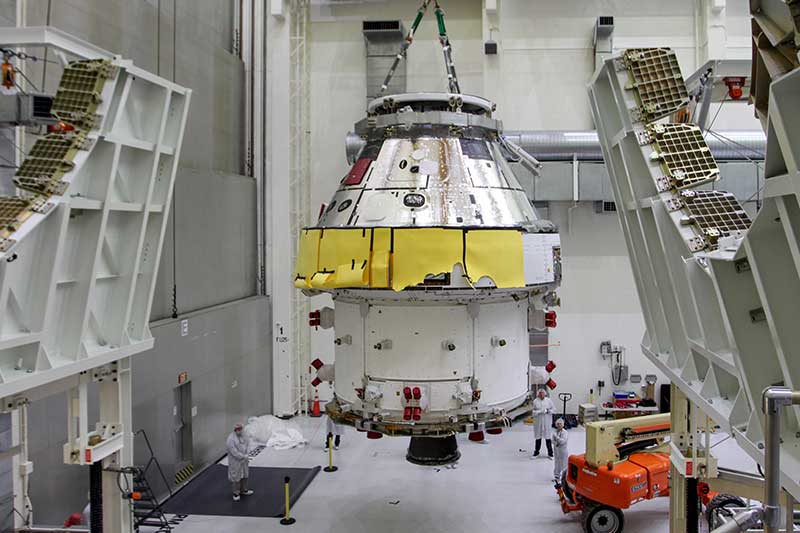
First Orion Spacecraft: In this March 30 photo, Orion I is moved to the Final Assembly and Systems Test cell at Kennedy Space Center. The spacecraft returned from Ohio after a successful series of environmental tests at Glenn Research Center’s Plum Brook Station. (Photo: NASA)
• Guidance and Navigation Systems. Key navigation and guidance solutions, including the barometric altimeter, which tracks the altitude of the Orion capsule in Earth’s atmosphere, as well as the inertial measurement system (INS) and GPS receiver, which track the position and movements of the capsule.
• Command Data Handling. Several data-handling products, including the vehicle management computer, which acts as the central computing platform supporting flight and vehicle control, as well as spacecraft communication functions.
• Displays and Controls. Three display units and struts, seven control panels, and two hand controllers used inside the spacecraft to help astronauts in the Orion capsule monitor and control the vehicle.
• Core Flight Software. Includes the integrated modular avionics software, a key system responsible for supporting maintenance functions sharing flight data information.
The contract to supply key components of the Orion crew module and service module is being managed and performed out of Honeywell’s facility in Clearwater, Florida. Work is also being conducted at the company’s facilities in Glendale, Arizona, and Puerto Rico.
Honeywell was part of NASA’s previous crewed space missions, including those that took humans to the moon.
The United States Space Force’s GPS III program reached another milestone with the successful core mate of GPS III Space Vehicle 08 at Lockheed Martin’s GPS III Processing Facility in Waterton, Colorado, April 15.
With core mate complete, the space vehicle was named in honor of NASA trailblazer and “hidden figure” Katherine Johnson.
The two-day core mate consisted of using a 10-ton crane to lift and complete a 90-degree rotation of the satellite’s system module, and then slowly lowering the system module onto the satellite’s vertical propulsion core. The two mated major subsystems come together to form an assembled GPS III space vehicle.
Despite the COVID-19 pandemic, the Space and Missile Systems Center (SMC) and its mission partner Lockheed Martin ensured that SV08 core mate took place, in accordance with all Centers for Disease Control and local guidelines to minimize exposure or transmission of COVID-19. The GPS III Processing Facility’s cleanroom high bay was restricted to only key personnel directly supporting the operation.
“Core mate is the most critical of the GPS space vehicle single-line-flow operations,” said Lt. Col. Margaret Sullivan, program manager and materiel lead for the GPS III program. “Despite the restrictions presented by the COVID-19 pandemic, our team adapted and worked tirelessly to achieve this essential milestone.”
Katherine Johnson. (Photo: NASA)
Katherine Johnson. When the core mate operation is successfully completed, a GPS III satellite is said to be “born.” In keeping with the team’s tradition of naming GPS III satellites after famous explorers and pioneers, SV08 was named “Katherine Johnson” in honor of the trailblazing NASA mathematician and “human computer” who designed and computed orbital trajectories for NASA’s Mercury, Apollo and space shuttle missions.
One of four African-American women at the center of the nonfiction book by Margot Lee Shetterly and the movie Hidden Figures, Johnson was awarded the Presidential Medal of Freedom in 2015 for her groundbreaking contributions to the U.S. space program.
Other GPS III satellites have been named in honor of explorers including GPS III SV01 “Vespucci” after Amerigo Vespucci; GPS III SV02 “Magellan” after Ferdinand Magellan; and GPS III SV03 “Columbus” after Christopher Columbus.
Next up, performance tests. The next step for the newly christened “Katherine Johnson” is the post-mate Systems Performance Test (SPT) scheduled to begin in August. SPT electrically tests the performance of the satellite during the early phase of build and provides a baseline test data set to be compared to post-environmental test data.
GPS III SV08 is currently scheduled to launch in 2022.
The Mobile Service Tower rolls back from the ULA Delta IV rocket carrying the GPS III SV02 satellite in preparation for launch. (Photo: ULA)
GPS III is the most powerful GPS satellite ever developed. It is three times more accurate and provides up to eight times improved anti-jamming capability over previous GPS satellites on orbit. GPS III brings new capabilities to users as a fourth civilian signal (L1C), designed to enable interoperability between GPS and international satellite navigation systems, such as Europe’s Galileo system.
GPS III satellites will also bring the full capability of the Military Code (M-code) signal, increasing anti-jam resiliency in support of the warfighter. These continued improvements and advancements to the GPS system makes it the premier space-based provider of positioning, navigation, and timing services for more than four billion worldwide.
GPS III SV03 is scheduled to launch on June 30.. (Photo: Lockheed Martin)
GPS III SV03 to Launch June 30. Launched in December 2018 and August 2019, GPS III SV01 and SV02 became part of today’s operational constellation of 31 satellites, on January 13 and April 1, 2020 respectively. GPS III SV03 is scheduled to launch on June 30.
The SMC, located at the Los Angeles Air Force Base, California, is the center of excellence for acquiring and developing military space systems. Its portfolio includes the GPS, military satellite communications, defense meteorological satellites, space launch and range systems, satellite control networks, space based infrared systems, and space situational awareness capabilities.
By Airman 1st Class Jonathan Whitely, 50th Space Wing Public Affairs
News from Schriever Air Force Base
The 2nd Space Operations Squadron performed the first station keeping maneuver on a GPS III satellite to Satellite Vehicle Number 75 on May 14 at the Schriever Air Force Base in Colorado.
The maneuver set a new standard for how GPS maneuvers should be conducted for the squadron that provides precision, navigation and timing signals to billions of users around the world.
A station keeping maneuver is performed to keep vehicles in their node (or parking spots in orbit) and involves burning the satellite’s thrusters and changing the vehicles speed at a particular point in its orbit. This causes the orbit to change, in turn, keeping the vehicle in the ideal position to provide coverage.
“All operational GPS vehicles are assigned nodes, when all nodes are filled with healthy vehicles there is good global GPS coverage,” said 1st Lt. Michael Gallagher, GPS subsystems analyst. “When new vehicles are launched they typically aren’t launched directly into their final node. This means that the 2 SOPS analysis flight must perform a re-phase maneuver to put a vehicle in its node.”
The maneuver required GPS III’s signal to be turned off. Turning off the navigation signal while performing the maneuver prevents users from receiving inaccuracies generated by a change in satellite velocity.
“This was a new process that we could learn from as it was the first station keeping [maneuver] performed for the newest generation of GPS satellites,” said Senior Airman Harrison Sherwood, 2 SOPS satellite systems operator, who sent the commands to the satellite during the maneuver. “[Since] this was the first [maneuver] of the newest generation satellites, it was a bit of a guinea pig for future maneuvers.”
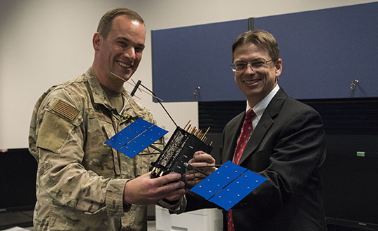
Johnathon Caldwell, Lockheed Martin Space vice president of navigation systems, right, presents Lt. Col. Stephen Toth, 2nd Space Operations Squadron commander, with a GPS III model satellite as a token of appreciation for the 2nd SOPS critical mission in space at Schriever Air Force Base, Colorado, July 29, 2019. The squadron performed its first station keeping maneuver on a GPS III satellite May 14, 2020, at Schriever AFB. (Photo: U.S. Air Force/1st Class Jonathan Whitely)
However, the unit was able to complete the maneuver flawlessly. The maneuver was completed in a special mission area and there were no changes to the normal operations floor.
“This maneuver had no effect on the rest of the [GPS satellite] constellation,” Gallagher said. “SVN-45 was in the node SVN-75 was being placed into, so there was no decrease in GPS signal quality as a result of this maneuver.”
This procedure was also the first of its kind to be performed with the 2nd SOPS Architecture Evolution Plan, which all active satellites in the program are operated. Since GPS III vehicles are fully integrated into the program with this maneuver, all maintenance is conducted through AEP.
“Station keeping maneuvers are essential to satellite operations and must be done for regular maintenance,” said 2nd Lt. Tyler Gorman, 2nd SOPS navigation payload engineer. “This activity helped validate a nominal maintenance activity for a new generation of vehicles.”
The unit plans to continue to use this new method and program for future GPS satellites that are being launched and need to be re-phased into their operation slots. The next satellite that will need a station maneuver performed is SVN-76, which is scheduled to launch in the next few months.
“GPS maintenance requires a coordinated effort to ensure our worldwide service is preserved,” Gorman said. “That means careful planning and execution from our analysts in 2 SOPS, our satellite system operator and the operational support from Lockheed Martin and the Aerospace Corporation.”
The USGIF Awards Program annually recognizes the exceptional work of the geospatial intelligence (GEOINT) tradecraft’s brightest minds and organizations pushing the community forward.
Award winners are usually recognized at the annual GEOINT Symposium. This year’s event, scheduled for April 26-29 in Tampa, Florida, was canceled because of the COVID-19 pandemic.
“Unfortunately, you will not see the awardees recognized on the GEOINT Symposium stage this year,” said Kevin Jackson, chair of the USGIF Awards Subcommittee. “So please take a moment to read their accomplishments and join me and the USGIF in congratulating the 2020 USGIF Achievement Awardees and the runners-up.”
Award winners are nominated by their colleagues and selected by the USGIF Awards Subcommittee.
“The 2020 USGIF awardees reflect the importance and the significance of the outstanding work that occurs daily in the GEOINT community,” Jackson said. “You will see how the GEOINT community always rises to the occasion to face head on the world’s toughest problems and this year is no exception.”
Academic
James Martin Center for Nonproliferation Studies, Middlebury Institute
On Dec. 7, 2019, after denuclearization negotiations between the United States and North Korea collapsed, North Korea reversed commitments made in Singapore and resumed engine testing at its Sohae Satellite Launch Center. Using new technological opportunities offered by high-cadence moderate resolution satellite imagery and flexible high-resolution satellite image tasking provided by Planet Labs, analysts at the CNS, through the use of open-source GEOINT, detected and correctly identified preparations for the engine test 39 hours before it occurred. Announcing in advance that North Korea was preparing to violate an international nonproliferation commitment.
Community Support
NGA Expeditionary Operations Office
NGA’s Office of Expeditionary Operations provides deployed personnel and technology to support GEOINT activities of worldwide U.S. military operations, humanitarian assistance and disaster relief efforts, and other national security objectives. The team’s world-class workforce seamlessly enables trusted global GEOINT capabilities today, while developing programs and processes to meet emerging challenges. Robust partnerships with DoD and IC allies fuel innovation and expertise, helping U.S. and foreign partners build programs that anticipate their needs, expanding the GEOINT community and optimizing meaningful consequence across the GEOINT enterprise.
Government
Mark A. Skoog and Loyd R. Hook
Implementing digital terrain solutions for safer aviation has been a career-long goal for Mark Skoog and Loyd Hook. As true innovators and lifelong proponents of using digital terrain data, Skoog and Hook lead the development efforts of NASA’s award-winning Automatic Ground Collision Avoidance System (Auto GCAS), which prevents imminent collisions with the ground. Auto GCAS is the culmination of a decades-long effort to bring geospatial intelligence to aircraft safety. This work involved traveling the world, evaluating myriad digital terrain from Sweden to Hawaii. The team extensively tested the system to ensure against every category of controlled flight into terrain mishaps—and found it would have prevented every one, which resulted in ten lives saved thus far in the USAF operations.
Industry
Lockheed Martin Space GATR Team
Globally-scalable Automated Target Recognition (GATR) is an artificial intelligence system that finds objects of interest in satellite imagery on a worldwide basis. It was developed by a team of scientists and engineers from Lockheed Martin Space who combined state-of-the-art deep learning algorithms with scalable high-performance computing in a cloud-based framework to achieve high-speed global automated target recognition (ATR). Unlike other ATR systems, GATR searches extremely large geographic regions with accuracy and speed. The GATR team, led by Dr. Mark Pritt, includes Tyler Bartelmo, Gary Chern, Dr. Austen Groener, Michael Harner, Andy Lam, Stephen O’Neill, Ryan Soldin, and Steve Wozniak.
Military
RS/GIS CX, The GRiD Team
David Finnegan and the Geospatial Repository & Data Management System (GRiD) program provide the Department of Defense (DoD), intelligence community and geospatial community with a centralized repository for the storage, discovery, and dissemination of critical terrain and 3D data. Prior to the GRiD program, the National System for Geospatial Intelligence (NSG) lacked a centralized mechanism for the storage and discovery of this essential content. Historically, the data was subject to local storage, limiting visibility and resulting in retasking collection assets for previously characterized areas, putting military personnel and equipment at risk. By partnering with the National Geospatial-Intelligence Agency (NGA) and the DoD, the GRiD program is now the community standard and enterprise solution for 3D/elevation data discovery across the NSG.
USGIF, the United States Geospatial Intelligence Foundation, is dedicated to bringing together the many disciplines involved in GEOINT to exchange ideas, share best practices and promote the education and importance of a national geospatial intelligence agenda. For more on the awards program, visit the USGIF website.
A ULA Delta IV rocket carrying GPS III SV02 lifts off from Space Launch Complex-37 on Aug. 22. (Photo: ULA)
The Space and Missile Systems Center achieved a major GPS milestone on March 27 with the Contingency Operations (COps) program and GPS III Space Vehicle (SV) 02, both of which received U.S. Space Force’s Operational Acceptance approval.
COps is an upgrade to the current GPS Operational Control System to operationally command and control GPS III satellites. These satellites are the newest generation built by Lockheed Martin, providing precise positioning, navigation and timing information with three times better accuracy, and up to eight times improved anti-jamming capability than previous generations of GPS satellites.
The first GPS III satellite, SV01, was launched on Dec. 23, 2018, and achieved Operational Acceptance on Jan. 2, 2020. USSF made SV01 available for use by military and civilian users for critical missions worldwide on Jan. 13.
Operating in a trial period since October 2019, COps supports developmental testing of the GPS III ground and space capabilities. The trial period culminated in a fully mission capable rating from the Air Force Operational Test and Evaluation Center’s Operational Utility Evaluation conducted on the new GPS III satellite and COps upgrade. This event successfully completed on Feb. 20.
Subsequently, GPS Operational Control System and COps received the second GPS III satellite — SV02, nicknamed “Magellan” — which the Space and Missile Systems Center launched on Aug. 22, 2019.
“The COps and GPS III SV02 Operational Acceptance marks another major milestone for the GPS enterprise and presents a clear picture that the Department of Defense is moving to the future,” said Lt. Col. Stephen Toth, 2nd Space Operations Squadron commander. “Of all the programs that will be delivered this year, there are few that carry with it as significant an impact to the warfighter and civilian users as this program will. This is truly a remarkable leap forward for the GPS enterprise and the capability it provides, and I couldn’t be more proud of the team that came together to make it happen.”
Photo: ULAA ULA Delta IV rocket carrying GPS III SV02 lifts off from Space Launch Complex-37 on Aug. 22. (Photo: ULA)
GPS IIIF’s M-code can be broadcast from a high-gain directional antenna in a concentrated, high-powered spot beam, in addition to a wide-angle, full-Earth antenna. (Artist rendering: Lockheed Martin)
U.S. Space Force, Lockheed Martin upgrade Operational Control System (OCS) and refresh GPS constellation with new satellites.
The final steps to fully enable the ultra-secure, jam-resistant military code (M-code) signal on GPS are now underway.
As part of the U.S. military’s effort to modernize GPS, the U.S. Space Force has been steadily upgrading its existing GPS Ground Operational Control System (OCS). The Space Force recently announced Operational Acceptance of the GPS Contingency Operations (COps) upgrade, developed by Lockheed Martin.
The Space Force’s M-Code Early Use (MCEU) upgrade, delivered earlier this year, will enable the OCS to task, upload and monitor M-code within the GPS constellation, as well as support testing and fielding of modernized user equipment, prior to the completion of the next-generation ground control systems.
This spring, work will begin to install the components needed to command and monitor the M-Code encrypted GPS signal, which enhances anti-jamming and protection from spoofing, as well as increases secure access for our forces, into the GPS OCS. M-code signals are available on all the on-orbit GPS IIR-M, IIF and III space vehicles.
A key to enabling M-code is a new software-defined receiver Lockheed Martin developed and is installing at all six Space Force monitoring sites. The M-code Monitor Station Technology Capability (M-MSTIC) uses a commercial, off-the-shelf general purpose graphics processing unit (GPU) to cost effectively receive and monitor M-code signals. Operators can monitor the signal as needed. M-MSTIC complements MSTIC’s, which Lockheed Martin developed and fielded to replace aging hardware receivers that were becoming difficult and expensive to maintain.
“Our warfighters depend on GPS signals every day for many critical missions, so anything we can do to make these signals more resistant to jamming and spoofing is extremely important — and available today,” said Johnathon Caldwell, Lockheed Martin vice president of Navigation Systems. “The more powerful GPS III/IIIF satellites coupled with Lockheed Martin’s upgrades to the GPS ground system are making that possible.”
GPS III also provides a new L1C civil signal, compatible with other international GNSS, such as Europe’s Galileo.
Lockheed Martin is contracted to build up to 32 GPS III/GPS III Follow On (GPS IIIF) satellites to help modernize the GPS constellation with new technology and advanced capabilities. The delivery tempo for these modernized GPS satellites will allow for several launches per year. The third M-code enabled GPS III satellite, named “Columbus,” is expected to launch in April, 2020.
Red Dragon Cybersecurity Suite
Cyber defenses across the upgraded GPS system were recently evaluated by a government assessment team and passed the Operational Utility Evaluation. Lockheed Martin delivered the Red Dragon Cybersecurity Suite (RDCSS) Phase III upgrade during the fourth quarter of 2019, dramatically improving Defensive Cyber Operations (DCO) visibility into GPS network traffic.
Other add-ons include user behavior analytics to analyze patterns of traffic and network taps to improve data collections.
“GPS is an attractive target for our adversaries, so it was critical we bring our best cybersecurity defenses to the table,” said Stacy Kubicek, vice president of Mission Solutions Defense and Security. “Since we began sustaining the Ground OCS in 2013, we have systematically upgraded and replaced software and hardware — it’s now a very secure system.”
Lockheed Martin has sustained the GPS Ground OCS since 2013. In November of 2018, the team completed the AEP 7.5 architectural change – replacing the hardware and software to improve resiliency and cybersecurity. In December of 2018, the Air Force awarded Lockheed martin the GPS Control Segment Sustainment II (GCS II) contract to further modernize and sustain the AEP OCS through 2025.
The GPS III team is led by the Production Corps, Medium Earth Orbit Division, at the Space Force’s Space and Missile Systems Center, at Los Angeles Air Force Base. The GPS OCS sustainment is managed by the Enterprise Corps, GPS Sustainment Division at Peterson Air Force Base. 2 SOPS, at Schriever Air Force Base, manages and operates the GPS constellation for both civil and military users.
The U.S. Space Force’s Space and Missile Systems Center’s GPS Next Generation Operational Control System (OCX) program on March 26 instructed Raytheon to replace the computer hardware in OCX prior to system delivery.
The IBM computer product line used in the system was sold to a Chinese company, Lenovo, in August 2014. At the time of the sale, the U.S. government identified this as a major impact to OCX by creating an unacceptable cyber risk. However, the government waited implement a fix until Raytheon showed promising program performance in delivering OCX.
“Over the last two and a half years, since OCX came out of its Nunn-McCurdy breach, Raytheon has been executing as planned, giving us confidence in OCX’s ability to transition into operations,” said Lt. Gen. John Thompson, SMC commander.
Software development was completed in the fall of 2019, and the program is in the integration and test phase. Within a year, Raytheon is expected to deliver a qualified software baseline capable of operating the GPS constellation, Thompson said.
In 2017, the federal government sponsored a hardware trade study with U.S.-based vendors to replace IBM’s hardware. As a result of the study, Hewlett Packard Enterprise (HPE) was selected as the vendor. The program then conducted a pilot project replacing the IBM hardware in the 17 external monitoring stations and four ground antenna sites, resulting in successful HPE replacement.
“This gave us confidence that we had a viable OCX technical solution providing a long term sustainable hardware baseline that meets our stringent cyber security requirements,” said Lt. Col. Thomas Gabriele, SMC’s OCX materiel leader. “As Raytheon continues to track to their contractual commitments, addressing the unsupportable IBM cyber security risk is prudent to do pre-system delivery to the government.
“Although this government-directed change will impact the Raytheon schedule, the government is holding Raytheon accountable to deliver qualified software prior to integrating on the HPE platform and deploying to operational sites,” Gabriele said.
“By executing the fix now we eliminate $150 million in rework and retesting, and ensuring we deliver a system that is capable of transitioning to operations,” said Barbara Baker, SMC Command and Control Division’s senior materiel leader.
Decades-old hardware
Another benefit of the $378 million government-directed contract change is the opportunity to replace the now decade-old IBM hardware. This will improve system performance and increase the OCX program supportability posture.
“OCX is critical to continuing high priority national efforts to modernize GPS with new military and civil positioning capabilities, including enhanced security, precision, reliability, and integrity. OCX will deliver sustained, reliable GPS capabilities to America’s warfighters, allies, and civil users,” Baker said.
The OCX program is part of the GPS Enterprise Modernization. OCX will deliver two times more satellite capacity, modern cyber-secure infrastructure, improved accuracy, globally deployed modernized receivers with anti-jam capabilities, and improved availability in difficult terrain.
“As a high interest program, we will continue to work with our industry partners to deliver a global GPS capability, Gabriele said.