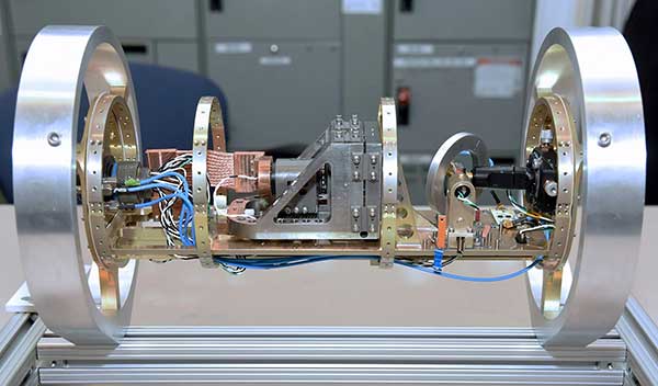
Scientists continue to search for new technologies to serve the PNT mission. One novel way to augment GPS comes from a newly developed technology involving a quantum magnetometer.
Researchers at Lockheed Martin call it Dark Ice; it uses magnetic sensing as an alternative means of determining location without use of satellite signals.
Mike DiMario and his team have developed a prototype magnetometer that uses a synthetic diamond the size of a salt crystal to measure the direction and strength of nearly imperceptible magnetic field anomalies. They overlay that data with maps of Earth’s magnetic field, supplied by the National Oceanic and Atmospheric Association, to produce precise location information.
Special quantum-level impurities in the molecular structure of the diamond, where intermittently a carbon atom drops out and its neighbor is a nitrogen atom, enable the detection of magnetic field waves. These nitrogen vacancy (NV) centers are hyper-sensitive magnetic sensors. When illuminated by a laser, the diamond emits more or less light depending on the surrounding magnetic field’s strength.
The Dark Ice quantum magnetometer measures about 31 centimeters in length. (Image: Lockheed Martin)
Position + Direction. Dark Ice differs from current magnetic sensors aboard ships and planes in that it can measure both the field strength and the direction the field is pointing. “The real advantage of this quantum-based technology is its ability to produce a true magnetic field vector, while at the same time having a very large dynamic range and bandwidth,” DiMario explained.
Project development “was like peeling an onion: with each new layer removed, the team advanced. We had no idea of the expected outcome, other than what system modeling, the laws of physics and good engineering could predict. There was always something we could not have predicted or even thought of.”
In addition to developing this navigational capability, the team has also demonstrated that Dark Ice can harness Earth’s magnetic field to transmit communications across barriers intended to block all traditional signals, and track moving vehicles in real time.
Unjammable. “This project was designed for times when extenuating circumstances might prohibit your use of traditional GPS signals, and you need something that is unjammable, passive and always available. The Earth’s magnetic field meets this description if we can adequately sense and make use of it,” DiMario said.
He wants to downsize Dark Ice to hockey-puck size for convenient use on multiple platforms. “In real-world conditions, if I can get within 200 meters of GPS accuracy, that would be a huge success,” he claimed. Such precision would serve as a backup or verification to GPS, not a sole-means navigation system.
With its powerful sensing capabilities and small size, Dark Ice could function as the most reliable way to do things like identify hard-to-find watercraft in search-and-rescue missions and fly aboard aircraft in the battlefield. Navigation, search and communications — all in one compact sensor.
Harris Corporation has received a $243 million contract from Lockheed Martin to provide fully digital navigation signals for the first two GPS III Follow-On (GPS IIIF) satellites — to deliver stronger signals, with greater operational flexibility.
Harris’ GPS IIIF fully-digital Mission Data Unit (MDU), the heart of the satellite’s navigation payload which generates the GPS signals, will provide more powerful signals, assure flawless clock operations for GPS users, and add flexibility to adapt to advances in GPS technology, as well as future changes in mission needs.
It will provide improved capabilities over Harris’ 70-percent-digital MDU used for GPS III Space Vehicles 01-10 (GPS III SV01-10).
The new MDU also offers the Air Force a smooth transition to its GPS OCX ground control segment. Harris will seamlessly port its digital signal design, minimizing both integration risks and associated costs.
In September 2018, the U.S. Air Force selected Lockheed Martin, with Harris as its navigation signal partner, to build up to 22 GPS IIIF satellites, with a total estimated contract value up to $7.2 billion.
The Air Force expects the first GPS IIIF satellite, SV11, to be available for launch in 2026.
Launched aboard GPS III SV01 in December 2018, Harris’ first GPS III navigation payload began broadcasting navigation signals on January 8. While testing of the first-of-its-kind satellite continues, the payload has performed beyond expectations.
Harris has provided navigation technology for every U.S. GPS satellite ever launched, enabling the reliable GPS signal that millions of people — including U.S. soldiers — and billions of dollars in commerce depend on every day.
When managed by a new ground control system, GPS III satellites will offer triple the accuracy and eight times the anti-jamming capabilities of the satellites currently comprising the U.S. Air Force’s GPS constellation. Users military and civilian will reap ample benefits.
Everything changed for space-based positioning, navigation and timing around the world on Dec. 23, 2018. Or maybe it didn’t. The innovations heralded by the launch of the first GPS III satellite will take years more to occur. We tabulate here the advances that Generation Three will bring over GPS-to-date, and review the timeline for their actual arrival.
While these new capabilities exist — in concept — in space, they can’t be leveraged on the ground (or in the air, or at sea) until a sufficient number of additional GPS III satellites have joined the constellation, and until a new ground control system comes online. This will occur — perhaps — in 2023. At that time the satellites’ talents will be unleashed.
“As more GPS III satellites join the constellation, it will bring better service at a lower cost to a technology that is now fully woven into the fabric of any modern civilization,” stated Lt. Gen. John Thompson, commander of the U.S. Air Force’s Space and Missile Systems Center and the Air Force’s program executive officer for space.
The many GPS III upgrades should make the service more reliable and accurate for civilians, more secure against those who want to jam military users, and more cyber-secure for everyone.
TALKIN’ ‘BOUT OUR GENERATION
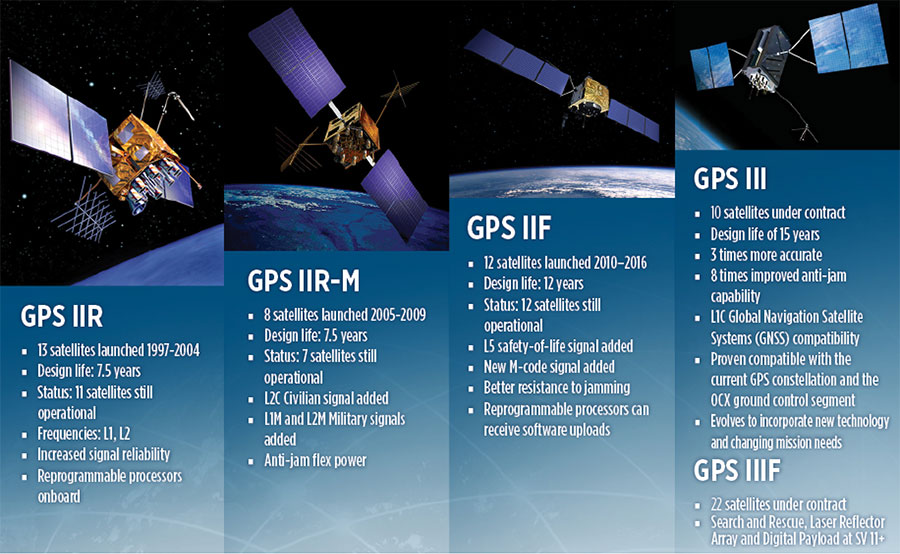
GPS constellations have grown through six major iterations since 1978. The sixth, GPS IIF, rose during the years 2010 to 2016. Those 12 satellites are all designed to last 12 years. Some of their notable features include the ability to receive software uploads, better jamming resistance and increased accuracy.
GPS III, the seventh generation, will launch nine more satellites to join SV01 already in space. GPS III SV02 is scheduled to launch in July of this year, SV03 in late 2019, and SV04 in 2020. The final III payload should rise in 2023. From that point on, the follow-on era of GPS IIIF takes over.
How Long, How Long? “Projections for how long the current constellation will [continue to] be fully capable have increased by nearly two years to June 2021, affording some buffer to offset any additional satellite delays,” reported the Government Accounting Office at the end of 2017. This provided some schedule buffer for launching the first GPS III satellite, but it did not reduce the desire to launch as soon as the booster rocket became available.
The new birds will introduce new capabilities to meet higher demands of both military and civilian users: once filled out, the GPS III constellation will bring three times better accuracy and up to eight times improved anti-jamming capabilities. Spacecraft life requirement will extend to 15 years, 25 percent longer than the latest GPS satellites and twice the original design life of the oldest satellites on orbit today.
The new L1C civil signal broadcast by GPS III is an interoperable signal with other international global navigation satellite systems, like Galileo, improving connectivity for civilian users.
GPS III will eventually actualize full M-code capability — carried aboard the IIR-Ms and IIFs but not yet completely implemented — in support of warfighter operations. GPS III M-code capability exceeds that of GPS IIR-M and GPS IIF.
GPS III will complete the deployment of the L2C civil signal and the L5 safety-of-life signal capabilities that began with \GPS IIR-M and GPS IIF satellites.
Finally, GPS III will enact improved integrity: the ability of the satellite to detect and issue alerts on its own reduced accuracy, should that phenomenon ever occur.
Military Signal Power Up. Encrypted M-code signals will be up to eight times more powerful than currently. This makes them more reliable. but also enables the sats to overcome efforts to jam their signals.
Other signals also offer increased signal power at the Earth’s surface. L1 and L2: −158.5 dBW for aC/A code signal and −161.5 dBW for the P(Y) code signal. L5 will be −154 dBW.
Family Features. The most recent generations of the GPS constellation. IIR, IIR-M and III were produced by Lockheed Martin, while IIF was built by Boeing. One GPS IIA satellite is still in operation, at 25 years young (design life was 7.5 years). All satellites carry Harris Corporation payloads. (Graphic sourced from: Lockheed Martin and Boeing Co.)
L SIGNALS
L2C, the second open GPS signal, after L1 C/A, has been available from every new GPS satellite since the first IIR-M launch in 2005. L5, the third open GPS signal, became available with the first IIF launch in 2010. Now L1C, the fourth open GPS signal, joins the band, broadcasting from every new GPS satellite, starting with the recent GPS III launch (see First Light).
The first GPS III satellite is in checkout and testing that could last up to 18 months before it enters service. “After its Dec. 23 launch, GPS III SV01 successfully completed its orbit raising and deployment of all of its antennas and solar arrays. On Jan. 8, the satellite’s navigation payload began broadcasting navigation signals,” said Johnathon Caldwell, Lockheed Martin vice president for navigation systems. “On-orbit testing continues, but the navigation payload’s capabilities have exceeded expectations and the satellite is operating completely healthy.”
Testing, Testing. Using the Air Force’s Back-to-Basics program, which involved early prototyping and simulations, Lockheed Martin developed GPS III with an approach that involved rigorous quality-build certificates, component testing and system-level testing. The comprehensive requirements verification and validation process ensured more than 30,000 requirements were achieved. The system functional qualification includes the performance verification in multiple environmental tests, including the acoustic, thermal vacuum (TVAC) and electromagnetic spectrum.
“We consider thermal vacuum the gold standard for testing any satellite before it goes into operations,” Col. Steve Whitney, director, GPS Directorate, wrote in GPS World in December. “It really is putting the craft through the paces. When it goes through the testing, the satellite is on. It is working. It is exposing it to the heat and the cold and the zero pressure while the satellite is functional. The entire thermal vac testing from start to end is about 70 days. Test like you fly. From the time it launches and deployment sequence, we test it like it is real. Minus the shaking, the satellite thinks it is getting launched. Meanwhile, our people are looking at the data and its health. TVAC is a huge milestone for a satellite to go through and come out no issues.”
To date, more than 90 percent of parts and materials for all 10 GPS III satellites have been received from more than 250 aerospace companies in 29 states.
BRAIN OF THE BUNCH
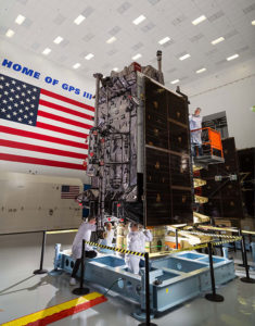
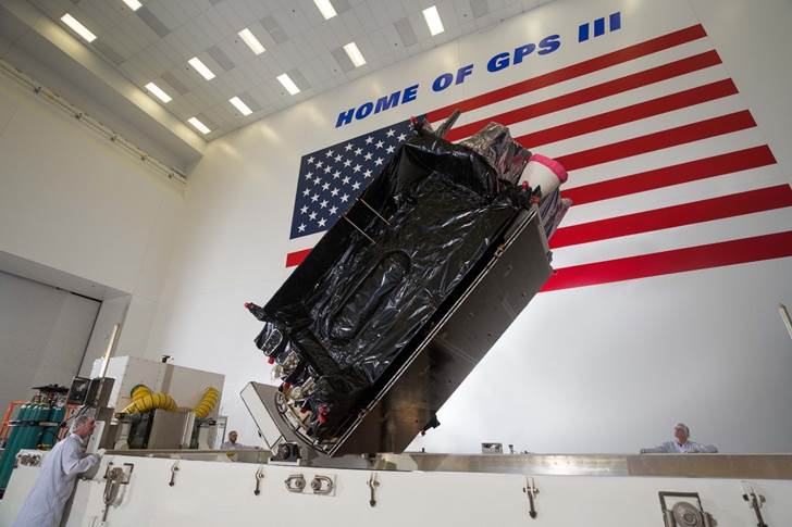
THE FIRST GPS III satellite was fully assembled and entered into SV single-line flow when Lockheed Martin technicians integrated its system module, propulsion core and antenna deck. (Photo: Lockheed Martin)
Harris Corporation is a subcontractor to Lockheed Martin for development and production of GPS III Mission Data Units (MDUs) and transmitters for the GPS space section. Six have been delivered.
The Harris MDU, together with the Atomic Frequency Standards and the L-band transmitter equipment, make up the Navigation Payload Element. The MDU performs the primary mission of the GPS satellite: generation of the navigation signals and data on a continuous basis. The MDU controls the generation of the precise timing signals used for navigation signals while distributing the timing signals to other satellite components.
This MDU is 70 percent digital. The next to come, aboard GPS IIIF satellites, will be fully digital.
When asked about the advantages of an all-digital payload, Harris Corporation’s Jason Hendrix, PNT program director, told GPS World in April 2018, “The advantages and the 30 percent difference are the timekeeping system portion. We’re moving from manual, analog timing to digital to deliver to the Air Force more flexibility. It’s a nice option to have to be able to reprogram in orbit and maybe enhance capabilities desired in the future.”
LIVING BETTER, LIVING LONGER
Greater mission longevity is one of the key improvements GPS III delivers over those currently in service. Space Vehicles 1–10 have a planned mission life of 15 years, 25 percent longer than their predecessors. That begs the question, “How long should a satellite live in space, with technology innovation occurring almost annually?”
Advanced payload technology provides a partial answer. Lockheed Martin and Harris point to new payload capabilities with built-in flexibility to adapt satellites in orbit to technology advances, as well as changes in missions. According to Harris, the fully digital navigation payload will provide the ability to change and upgrade the satellites incrementally over mission life.
In late 2017, Lockheed announced a partnership with NEC Corporation to introduce artificial intelligence for computer learning in orbit. The company touted significant advances in processors and a move toward next-generation antennas, arrays and transmitters to drive more satellite flexibility, capability and resilience.
FROM THE GROUND UP
GPS IIIF’s M-Code can be broadcast from a high-gain directional antenna in a concentrated, high-powered spot beam, in addition to a wide-angle, full-Earth antenna. (Artist rendering: Lockheed Martin)
GPS III’s military upgrades require new ground control stations, a replacement effort called OCX that has suffered repeated delays and cost increases, due to the complexity of the programming and requirements modifications. The new jamming-resistant military signal will not be available until the new, highly complex ground control system is available, and that is not expected until 2022 or 2023. Delay and cost considerations were driven in part by full implementation of all Department of Defense 8500.2 “Defense in Depth” information assurance standards without waivers, giving it the highest level of cybersecurity protections of any DoD space system.
Deliverables for GPS OCX are divided into three blocks. Block 0 delivery took place in fall 2017, enabling it to support the December launch. Block 1 delivery will take place in 2021, providing full operational capability to control both legacy and modernized satellites and signals. Block 2, delivered concurrently with Block 1, adds operational control of L1C and modernized M-code.
In 2018, wrote Col. Whitney of the GPS Directorate, “We have actively utilized the [Block 0] system in a variety of exercises, training events, compatibility tests and launch readiness events. We also completed a comprehensive security review of the system to demonstrate our readiness to start operations. The system is ready to go. We continue to work the development of the OCX Block 1 system and are wrapping up the initial coding of the system early in 2019, leading into our integration and test campaign.”
Given delays in OCX, “the Directorate is actively working two major upgrades to bridge the gap,” Whitney continued. “The first is GPS III Contingency Operations (COps) modification which will allow the 2nd Space Operations Squadron (2SOPS) to command and control the GPS III family of vehicles in a mission state matching today’s legacy signals for all users world-wide. The second modification is M-code early use (MCUE), which enables 2 SOPS to operationalize the Modernized GPS military (M-code) navigation signals for the warfighter.”
Before December’s launch, OCX underwent rigorous cybersecurity vulnerability assessments that tested the system’s ability to defend against both internal and external cyber threats. GPS OCX prevented the broadcast of corrupt navigation and timing data in all tests, bolstering the program’s readiness for GPS III.
“We’ve built a layered defense and implemented all information assurance requirements for the program into this system,” said Dave Wajsgras, president of Raytheon Intelligence, Information and Services. “The cyber threat will always change, so we’ve built OCX to evolve and to make sure it’s always operating at this level of protection.”
The new Harris navigation payload offers a smooth transition to use of OCX. The payload for the first 10 GPS III satellites has been verified for OCX compatibility so the same OCX commands will seamlessly port to the Harris fully digital design, minimizing integration risks and associated costs.
According the the GAO, “Full M-code capability —which includes both the ability to broadcast a signal via satellites and a ground system and user equipment to receive the signal — will take at least a decade once the services are able to deploy military GPS user equipment (MGUE) receivers in sufficient numbers.” The April 2019 issue of GPS World will review M-code implementation across U.S. DoD platforms.
THE FUTURE’S NOT OVER YET
In spring 2018, Lockheed Martin submitted a proposal for the GPS III Follow On (GPS IIIF) program, which will add enhanced capabilities to the satellites. New hardware — a high-gain directional antenna — aims signals in a spot beam at a limited area, but blasts the signal at high power for strategic use by the military.
Inter-Satellite Links. Block IIIF satellites will carry laser retro-reflectors to enable orbit tracking independently of the satellites’ radio signals, which in turn will allow satellite clock errors to be disentangled from ephemeris errors. A standard feature of GLONASS, this is included in the Galileo positioning system, and was flown as an experiment on two older GPS satellites, 35 and 36.
In September 2018, the Air Force selected Lockheed Martin to build up to 22 additional satellites under the GPS IIIF program.
The U.S. Air Force’s second new GPS III satellite, bringing higher-power, more accurate and harder-to-jam signals to the GPS constellation, has arrived in Florida for launch.
On March 18, Lockheed Martin shipped the Air Force’s second GPS III space vehicle (GPS III SV02) to Cape Canaveral for an expected July launch.
Designed and built at Lockheed Martin’s GPS III Processing Facility near Denver, the satellite traveled from Buckley Air Force Base, Colorado, to the Cape on a massive Air Force C-17 aircraft. The Air Force nicknamed the GPS III SV02 “Magellan” after Portuguese explorer Ferdinand Magellan.
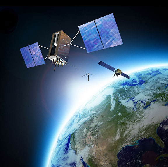
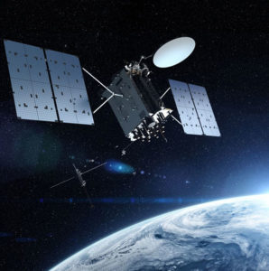
GPS III is the most powerful and resilient GPS satellite ever put on orbit. Developed with an entirely new design, for U.S. and allied forces, it will have three times greater accuracy and up to eight times improved anti-jamming capabilities over the previous GPS II satellite design block, which makes up today’s GPS constellation.
GPS III also will be the first GPS satellite to broadcast the new L1C civil signal. Shared by other international global navigation satellite systems, like Galileo, the L1C signal will improve future connectivity worldwide for commercial and civilian users.
The Air Force began modernizing the GPS constellation with new technology and capabilities with the December 23, 2018 launch of its first GPS III satellite. GPS III SV01 is now receiving and responding to commands from Lockheed Martin’s Launch and Checkout Center at the company’s Denver facility.
Lockheed Martin shipped the U.S. Air Force’s first GPS III to Cape Canaveral, Florida ahead of its expected July launch. (Photo: Lockheed Martin}
“After orbit raising and antenna deployments, we switched on GPS III SV01’s powerful signal-generating navigation payload and on Jan. 8 began broadcasting signals,” Johnathon Caldwell, Lockheed Martin’s Vice President for Navigation Systems. “Our on orbit testing continues, but the navigation payload’s capabilities have exceeded expectations and the satellite is operating completely healthy.”
GPS III SV02 is the second of ten new GPS III satellites under contract and in full production at Lockheed Martin. GPS III SV03-08 are now in various stages of assembly and test. The Air Force declared the second GPS III “Available for Launch” in August and, in November, called GPS III SV02 up for its 2019 launch.
In September 2018, the Air Force selected Lockheed Martin for the GPS III Follow On (GPS IIIF) program, an estimated $7.2 billion opportunity to build up to 22 additional GPS IIIF satellites with additional capabilities.
GPS IIIF builds off Lockheed Martin’s existing modular GPS III, which was designed to evolve with new technology and changing mission needs. On September 26, the Air Force awarded Lockheed Martin a $1.4 billion contract for support to start up the program and to contract the 11th and 12th GPS III satellite.
Once declared operational, GPS III SV01 and SV02 are expected to take their place in today’s 31 satellite strong GPS constellation, which provides positioning, navigation and timing services to more than four billion civil, commercial and military users.
As a risk reduction effort for the U.S. Air Force’s GPS III Follow On (GPS IIIF) satellite program, Frequency Electronics Inc. has received a contract from Lockheed Martin Space, valued at $5.9 million, for the qualification of FEI’s Digital Rubidium Atomic Frequency Standard (DRAFS).
The contract’s intent is to qualify FEI’s DRAFS for potential use on the new GPS IIIF satellites, securing the industrial base for high-accuracy GPS atomic clocks.
To help the Air Force modernize its GPS satellite constellation with new technology and capabilities, Lockheed Martin Space designed and built the most powerful GPS satellite, GPS III. With 10 satellites under contract, in 2018, the Air Force selected Lockheed Martin to build up to 22 additional GPS IIIF satellites, adding new features and resiliency to the flexible satellite design. The Air Force began launching GPS III satellites in December 2018. Today, more than 4 billion users rely on GPS.
“We are extremely pleased to be awarded this contract and the opportunity to play a significant role in the GPS IIIF program,” Stanton Sloane, FEI’s CEO commented. “This award is the culmination of 50+ years of research and development of advanced quartz and atomic clocks based on FEI’s proprietary technologies. We are also pleased to continue our long-standing relationship with Lockheed Martin Space on critical national security programs.”
Martin Bloch, FEI’s Executive Chairman added, “I congratulate the FEI team on the development of this digital Rubidium clock for GPS IIIF program. FEI will continue the development of advanced clock technologies for future generations of Satellites and Terrestrial applications.”
Frequency Electronics designs, develops and manufactures high-precision timing, frequency control and synchronization products for space and terrestrial applications. Its products are used in satellite payloads and in other commercial, government and military systems including C4ISR and EW markets, missiles, UAVs, aircraft, GPS, secure radios, energy exploration and wireline and wireless communication networks.
Its subsidiaries and affiliates include FEI-Zyfer, which provides GPS and secure timing (“SAASM”) capabilities for critical military and commercial applications; and FEI-Elcom Tech, which provides subsystems for the Electronic Warfare markets and added resources for RF microwave products.
Lockheed Martin has received a $172 million contract from the U.S. Navy and Air Force for Long Range Anti-Ship Missile (LRASM) production. The LRASM is designed to reduce dependence on GPS.
The contract continues the production for the air-launched variant of LRASM, including a full production run of missiles and engineering support. This is the second of several expected annual production lots that will deliver next-generation anti-ship missiles to the U.S. Navy and U.S. Air Force.
LRASM is designed to detect and destroy specific targets within groups of ships by employing advanced technologies that reduce dependence on intelligence, surveillance and reconnaissance platforms, network links and GPS navigation in electronic warfare environments.
LRASM will play a significant role in ensuring military access to operate in open ocean/blue waters, owing to its enhanced ability to discriminate and conduct tactical engagements from extended ranges.
LRASM is a precision-guided, anti-ship standoff missile based on the successful Joint Air-to-Surface Standoff Missile – Extended Range (JASSM-ER). It is designed to meet the needs of U.S. Navy and U.S. Air Force Warfighters in contested environments.
The air-launched variant provides an early operational capability for the U.S. Navy’s offensive anti-surface warfare Increment I requirement. With the recent EOC declaration by the U.S. Air Force for the B-1B, the focus is now on the U.S. Navy’s F/A-18E/F Super Hornet in 2019.
“LRASM brings a game-changing capability to both the U.S. Air Force and the Navy,” said David Helsel, LRASM director at Lockheed Martin Missiles and Fire Control. “This second production lot will provide anti-ship missiles for both the B-1B and F/A-18E/F, bringing sea control back to our warfighters.”
GPS Control Segment Sustainment II (GCS II) contract continues the modernization of the GPS Operational Control Segment (OCS).
The U.S. Air Force has awarded Lockheed Martin the GPS Control Segment Sustainment II (GCS II) contract to continue to sustain and further modernize the GPS constellation’s ground control system through 2025.
This is a follow-on contract to Lockheed Martin’s current GCS contract, awarded in 2013.
Under the GCS II contract, the continued upgrade of the GPS Architecture Evolution Plan Operational Control Segment (AEP OCS) will allow GPS’ legacy ground control system to support GPS III satellite on-orbit operations, developed under the GPS III Contingency Operations (COps) program.
SpaceX’s Falcon 9 rocket orbited the first GPS III satellite on Dec. 23, 2018. (Photo: SpaceX)
COps will enable the AEP OCS to support the positioning, navigation and timing missions of the Air Force’s new GPS III satellites, which began launching in December 2018.
In addition, GCS II will sustain the operational M-code capability being deployed in 2020 that is in development under the M-code Early Use (MCEU) contract. Operational M-code is a critical warfighter capability to support missions in contested environments.
Under the GCS contract, Lockheed Martin executed numerous engineering modifications to the OCS, including:
the COTS Upgrade 3(CUP3)/Ground Antenna Air Force Satellite Control Network (AFSCN) Interface Technology Refresh (GAITR) upgrade
the Remote Site COTS Network (RSCN) project
the GPS Information Protection Reinforcement (GIPR) project
the COTS Upgrade #2 (CUP2) project
Red Dragon Cybersecurity Suite (RDCSS).
These projects modernized the infrastructure, improved the cyber posture and added mission capability. The GCS II contract continues that commitment to evolving the OCS to address today’s mission needs.
Under GCS II, LM will continue to manage the technical baselines for the OCS and GPS Information Network (GIN) and regularly procure, develop, fabricate, integrate, test and install software and hardware modifications into the GPS operational baseline. Focus areas will be performing a technical refresh of the GIN and increasing the resiliency of the OCS.
“Lockheed Martin’s experience integrating GCS projects as well as the system engineering and software integration performed on GPS III Contingency Operations (COps) and M-Code Early Use (MCEU) position us well to deliver GCS II,” said Maria Demaree, vice president/GM Mission Solutions for Lockheed Martin Space. “We look forward to supporting the Air Force as it deploys the next generation GPS III satellites and their new capabilities for our warfighters.”
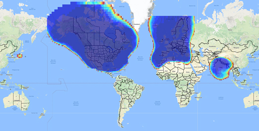
Space Based Augmentation Systems (SBAS) – known in North America as the Federal Aviation Administration’s (FAA’s) Wide Area Augmentation System (WAAS) – have been fully operational in one form or another for several years. The FAA’s incremental improvements to integrity, accuracy and reliability in WAAS have brought the system to a point where we have precision en-route navigation for aircraft, and we can also land aircraft using WAAS signals at thousands of airports in the US and in Canada.
Why not Mexico, which also benefits from the same WAAS coverage? More on that later, as we piece together the many parts of the complex SBAS mosaic.
SBAS precision approach coverage, May 2016. Graphic: FAA Tech Center, Lockheed Martin, GMV
Europe benefits from high-accuracy en-route navigation, and there are also hundreds of operational approaches using the European Geostationary Navigation Overlay Service (EGNOS) SBAS.
In India, the GPS Aided Geo-Augmented Navigation (GAGAN) system provides accurate en-route navigation and approach capability. However, ionospheric disturbance may limit some aspects of performance.
Japan established the Multi-functional Satellite Augmentation System (MSAS) SBAS, and has benefited from improved en-route navigation, but it’s possible that the more limited geographic distribution of GPS ground reference stations has restricted improvements to approach capabilities.
But what happened to the International Civil Aviation Organization (ICAO) concept from 2007, supported by all the ‘aviation-going’ countries of the world, that SBAS would evolve and eventually multiple national systems would provide coverage around the rest of the world, maybe even by 2016?
Countries in Asia, South America, Africa and the continent of Australia all appear to have looked closely into establishing their own SBAS, but nothing seems to have come out of these investigations. Technical issues, cost, and political obstacles have all hindered global SBAS progress.
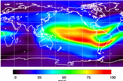
The ionospheric challenge. Graphic: GMV and Lockheed-Martin
Technical Issues. Ionospheric scintillation problems around the Equator seem to be at the root of most technical problems for SBAS. Getting to the required level of probable, bounded system error is hugely difficult. The iono disturbance ‘blob’ follows the sun around the Equator and wipes out any chance of satisfactory system performance when it passes over Equatorial countries.
As total electron count (TEC) increases, the ionospheric grid, which most SBAS use to predict ionospheric variation across their geographic area between fixed reference stations, well, it just doesn’t work anymore.
Cost. The capital cost of building a satellite-based augmentation system and the on-going cost of maintaining a bunch of geographically distributed reference sites, building and launching GEO satellites or renting transponders on someone else’s orbiting asset, establishing, operating and maintaining redundant uplink stations, redundant terrestrial data links, and setting up control systems that collect and create the SBAS uplink message — it all adds up. Millions and maybe even billions of dollars or equivalent, in total, have been spent by those select countries who could afford their own SBAS. Others named above have lesser financial resources upon which to draw.
Political Obstacles. One of the trickiest issues is sovereignty: the need for a country to control its own navigation and landing system. This has likely been the source of most resistance to more SBAS systems being set up and shared by bordering countries around the world.
For a large number of smaller countries, SBAS would only make sense if it was shared across a number of neighboring countries, but that means relinquishing sovereignty to some degree. In several regions of the world a number of geographically adjacent countries don’t particularly like each other, never mind thinking of such sharing/collaboration.
National sovereignty, by the way, isone of the main reasons that existing satellite navigation systems underpinning SBAS, such as Galileo, GLONASS, IRNSS (now NAVIC), QZSS and of course BeiDou have all been put in place.
Another problem with potential SBAS sharing across adjacent countries stems from responsibility for liability. Should something not work and an accident ensues from such a malfunction, who’s liable? Mexico seems to have adopted the view that since the US provides WAAS on what could be called an ‘as-is’ basis, then the potential liability issue seems to trump using the system.
Solutions? Technical issues with the ionosphere may soon be resolved by using dual-frequency L1/L5 airborne receivers that directly calculate their own ionospheric corrections, rather than using the computed SBAS iono grid. If we add in dual-frequency E1/E5a signals from Galileo, things start to get even better. New requirements and prototype equipment are already being developed for dual frequency multi-constellation airborne receivers. Airbus anticipates equipping aircraft with such receivers around 2025. Could this solve the SBAS technical issue for Equatorial countries?
ARINC (now a UTC/Rockwell Collins company) and SITA (in Europe) have been providing commercial aircraft with operational communications services on a pay-for-use basis for a number of years, and this is notarized as an accepted means of compliance within ICAO policy/requirements:
From ICAO Doc. 9161, Sec. 3.99: “A group of states or a regional organization might also undertake to operate the augmentation satellite service required, either by themselves or by contracting a commercial or government organization to do so on their behalf.”
ARINC en-route coverage. Graphic: ARINC
Aireon has partnered with NAV CANADA, the Irish Aviation Authority (IAA), Enav, NATS and Naviair, as well as Iridium Communications and Harris Corporation to provide real time ADS-B data (GPS position output from aircraft) to air-traffic control providers. Aireon’s payloads on the new Iridium NEXT Low-Earth Orbit (LEO) satellite constellation will receive aircraft ADS-B messages and relay them to Air Traffic Controllers in real-time.
There are 66 Iridium NEXT satellites in operation, with significant overlap and redundancy built into the system to enable this safety-of-life service to be provided on a pay-for-use basis to the aviation industry. We could at last know the location of every suitably equipped aircraft in the air, in almost real-time. The ICAO requirement is for an update rate of 15 minutes.
Inmarsat ADS-C is a similar service available to aircraft on a contracted, pay-for-use basis via Inmarsat GEO satellites.
Market Solutions. If a substantial company showed up with a worldwide distributed SBAS solution and offered it on a fee for service basis, why wouldn’t countries that are already accustomed to ARINC and SITA pay-for-use communications? The Aireon international aircraft tracking system, to be provided on the same basis, adds to the credibility of such a pay-for-use service.
So why wouldn’t these accepted services demonstrate to those countries concerned about control and national sovereignty that an SBAS service could be provided on this basis?
The liability for provision of service sits with the providers, so user countries/airlines would have someone to turn to about liability issues, and there presumably could be contract terms to provide system performance guarantees.
No huge capital costs, no system to construct, nor staff to operate or maintain, and yet a level of control similar to that which has been around for commercial aircraft communications for decades.
Would this be of interest to countries that have not yet jumped on the SBAS bandwagon? A definite ‘maybe,’ we could imagine? What’s not to like?
The punch line to all this is that Lockheed Martin and GMV (Spain) have teamed to challenge these non-SBAS countries with a solution which may appeal.
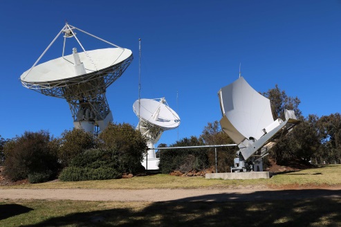
Uralla reference test site. Photo: Lockheed-Martin
To present convincing evidence that it would work, a dual frequency GPS (L1/L2) + Galileo (E1/E5a) reference site has been set up in collaboration with Geoscience Australia and Land Information New Zealand. The reference site is located at Uralla, New South Wales on Australia’s East Coast, where it gathers data demonstrating bounded errors within the operational range which could enable GNSS approach capability.
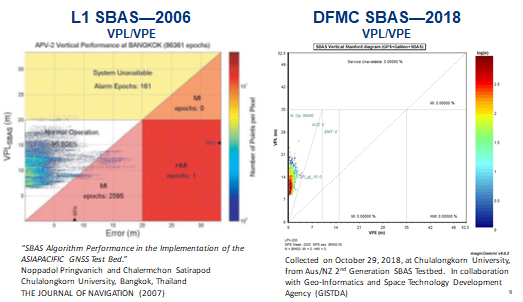
L1 (2006) vs. DFMC (2018) SBAS at Bangkok. Graphic: Lockheed-Martin, GMV
Another test site in Bangkok, Thailand has demonstrated that existing L1-only SBAS in this area cannot manage this performance (all current SBAS are L1 only), but that with dual-frequency multi-constellation (DFMC) GPS L1/L2+Galileo E1/E5a, the required performance limits could be met.
Lockheed Martin has also been using the Uralla uplink site to test the uplink and downlink of dual-frequency SBAS-like test messages.
The Moral of the Story. There are no miracles as yet, but interest in the pay-as-you-go SBAS concept appears to be growing, and the LM/GMV team continues to work to bring their approach to market.
A large number of countries could well benefit from the high accuracy, integrity and continuity of SBAS service if this all comes together.
The scheduled launch of the first GPS III satellite on December 18 was scrubbed, reportedly due to first stage liquid oxygen thermal limit constraints aboard the SpaceX Falcon 9 Block 5 launch vehicle’s first stage reaching safety limits. A second attempt on December 19 was later ruled out due to ongoing evaluations into the sensor issue.
The launch window may open again on Dec. 20.
This was to have been the first GPS launch aboard a SpaceX rocket, as well as the first SpaceX contracted U.S. National Security mission.
A Falcon 9 rocket awaits launch. (Photo: SpaceX)
The first GPS III satellite was originally scheduled to ride aboard a United Launch Alliance (ULA) Delta IV M+ rocket. ULA and/or its prime partners, Lockheed-Martin and Boeing, have conducted every GPS satellite launch since the start of the program. However, due to an assortment of issues variously involving delayed technology development and lawsuits regarding competitive bidding, the Air Force re-opened bidding for the contract as part of its Evolved Expendable Launch Vehicle (EELV) program — “evolved” signifying that the rocket can be recovered and reused.
Recycling Rockets. ULA did not bid on the re-opened contract, citing concerns over the selection process and potential risks with the anticipated lower launch cost. In 2016, the Air Force selected SpaceX to take over most GPS III launches.
SpaceX’s Falcon 9 for this launch will use a new first stage core, the B1054. Although it has re-use capability, it will fly in an expendable configuration this time, with no landing legs and no grid fins. It will be disposed of into the Atlantic Ocean after separation from the second stage.
In other missions, after the satellite-bearing stage separates from the rest of the rocket, the remaining core launcher fires additional fuel to return intact to land or to sea aboard an Autonomous Spaceport Drone Ship (ASDS), a converted barge awaiting in the Atlantic or Pacific Ocean.
New Generation of GPS. As attentive readers already know, GPS III SV01 is the first of an entirely new design of GPS satellite that will help the Air Force modernize today’s GPS constellation with new technology and advanced capabilities.
GPS III has three times better accuracy and up to eight times improved anti-jamming capabilities. Spacecraft life will extend to 15 years, 25 percent longer than any of the GPS satellites on-orbit today. GPS III’s new L1C civil signal also will make it the first GPS satellite broadcasting a compatible signal with other international global navigation satellite systems, like Galileo, improving connectivity for civilian users.
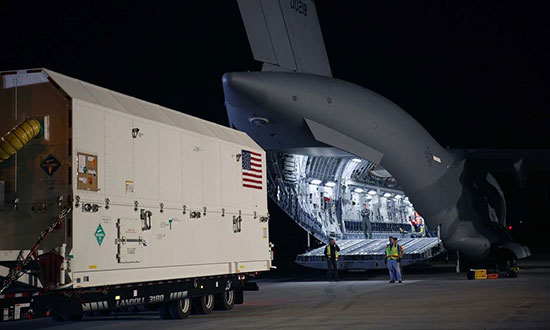
Lockheed Martin developed GPS III and manufactured GPS III SV01 at its GPS III Processing Facility near Denver. In September 2017, the Air Force declared the satellite “Available for Launch” (AFL) and had the company place it into storage. In 2018, the Air Force called up the satellite for launch and Lockheed Martin delivered it to Florida on Aug. 20. The Air Force nicknamed the satellite “Vespucci” after Italian explorer, navigator and cartographer Amerigo Vespucci.
GPS III SV01 is the first of 10 GPS III satellites originally ordered by the Air Force. GPS III SV03-08 are now in various stages of assembly and test. In August, the Air Force declared the second GPS III AFL and in November called GPS III SV02 up for 2019 launch.
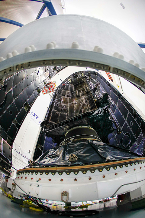
GPS III SV01 is now encapsulated and will be placed on the SpaceX rocket for Dec. 18 launch. (Photo: Lockheed Martin)
The U.S. Air Force’s first Lockheed Martin-built GPS III satellite is now encapsulated for its planned Dec. 18 launch from Cape Canaveral Air Force Station, Florida, on a SpaceX Falcon 9 rocket.
GPS III Space Vehicle 01 (GPS III SV01) underwent pre-launch processing, fueling and encapsulation at Astrotech Space Operations in Titusville, Florida. During encapsulation, GPS III SV01 was sealed in its launch fairing — an aerodynamic, nose-cone shell that protects the satellite during launch.
In the coming days, the fairing-enclosed satellite will be mounted to the rocket as launch preparations continue.
GPS III SV01 is the first of an entirely new design of GPS satellite that will help the Air Force modernize today’s GPS constellation with new technology and advanced capabilities.
GPS III has three times better accuracy and up to eight times improved anti-jamming capabilities. Spacecraft life will extend to 15 years, 25 percent longer than any of the GPS satellites on-orbit today. GPS III’s new L1C civil signal also will make it the first GPS satellite broadcasting a compatible signal with other international global navigation satellite systems, like Galileo, improving connectivity for civilian users.
“The world is dependent on GPS. More than four billion military, commercial and civilian users connect with signals generated by GPS satellites every day,” said Johnathon Caldwell, Lockheed Martin’s vice president for Navigation Systems. “The launch of GPS III SV01 will be the first step in modernizing the Air Force’s GPS constellation with the most powerful and resilient GPS satellites ever designed and built.”
Lockheed Martin developed GPS III and manufactured GPS III SV01 at its advanced $128-million GPS III Processing Facility near Denver. In September 2017, the Air Force declared the satellite “Available for Launch” (AFL) and had the company place it into storage.
In 2017, the Air Force “called up” the satellite for launch and Lockheed Martin delivered it to Florida on Aug. 20. The Air Force nicknamed the satellite “Vespucci” after Italian explorer Amerigo Vespucci.
GPS III SV01 is the first of 10 GPS III satellites originally ordered by the Air Force. GPS III SV03-08 are now in various stages of assembly and test. In August, the Air Force declared the second GPS III “AFL” and, in November, called GPS III SV02 up for 2019 launch.
In September, the Air Force selected Lockheed Martin for the GPS III Follow On (GPS IIIF) program, an estimated $7.2 billion opportunity to build up to 22 additional GPS IIIF satellites with additional capabilities.
GPS IIIF builds off Lockheed Martin’s existing modular GPS III, which was designed to evolve with new technology and changing mission needs. On Sept. 26, the Air Force awarded Lockheed Martin a $1.4 billion contract for support to start up the program and to contract the 11th and 12th GPS III satellite.
The National Geospatial-Intelligence Agency (NGA) has awarded GeoNorth Information Systems (GNIS) a five-year, $15 million contract for persistent surveillance services of the Arctic region. Lockheed Martin will provide a scalable geospatial processing platform to enable the surveillance project.
GNIS will leverage Lockheed Martin’s Rosetta technology, which includes a versatile and highly automated set of commercial and civil image processing tools that scale and adapt to deliver precision geospatial intelligence products to the NGA.
GNIS, a wholly owned subsidiary of the Tatitlek Corporation, an Alaska Native Village Corporation, will work with Lockheed Martin and the University of Alaska Fairbanks’ (UAF) Alaska Satellite Facility (ASF), under the banner of the Arctic GeoData Cooperative. GNIS and the partners will build, improve, monitor and maintain terrain elevation models of the Arctic region.
“The Arctic region has significant global implications for environmental, economic and security factors,” said Gil Metzger, director of Applied Research at Lockheed Martin. “It is critical that we document and monitor this demanding environment with the best technologies available. Lockheed Martin is proud to be part of this innovative cooperative that establishes both an operational domain awareness capability and a foundation for advanced research.”
The cooperative team will leverage each member’s unique expertise and capabilities to provide a one-of-a-kind solution to partners like the NGA.
As the prime contractor, GNIS will perform overall project management, conduct day-to-day operations and provide access to commercial remote-sensing platforms through its existing direct receiving station located at ASF.
UAF brings broad Arctic-related research and development, problem solving and the ability to refine existing scientific algorithms and methods to support specific project requirements.
Lockheed Martin’s Rosetta toolset will transform the large volumes of sensed data into correlated geospatial intelligence products.
“The Arctic domain poses many challenges,” said Jon Heinsius, general manager of GNIS. “Not only is it an area much larger than the whole United States and Canada combined, but its remoteness, intense weather conditions and unique characteristics are not found anywhere else in the world. The cooperative’s combined academic and commercial approach provides the NGA with tremendous flexibility to meet their current and future needs.”
“The cooperative is going to be a supportive environment where participants can bring ideas, technologies, algorithms and research for development, testing and validation,” said Nettie La Belle-Hamer, director of the Alaska Satellite Facility. “The concept is to explore and nurture new ideas to take what we learn today to build for tomorrow.”
The U.S. Air Force has awarded Lockheed Martin a $7.2 billion contract to build 22 more GPS III satellites.
Like the first batch of 10 GPS III satellites, the GPS III Follow-On (GPS IIIF) satellites “will provide greater accuracy, and improved anti-jamming capabilities, making them more resilient,” said Air Force Secretary Heather Wilson in a statement.
The satellites will be built at the company’s Waterton campus in the Denver suburb of Littleton.
Under a previous contract, Lockheed is in the process of building 10 GPS III satellites, the first of which is slated to launch in December. The first GPS IIIF satellite could be ready for launch in 2026.
GPS III SV01 on Aug. 20 boards a U.S. Air Force C-17 for its flight to Cape Canaveral, Florida. (Photo: Lockheed Martin)
“We’re grateful for the U.S. Air Force’s continued confidence in Lockheed Martin on the GPS III/IIIF program,” said Johnathon Caldwell, Lockheed Martin’s program manager for Navigation Systems. “We’ve worked hard to develop and produce GPS III to help the Air Force modernize the GPS constellation with new, more powerful, and more resilient, technology.
“This new contract for GPS IIIF will bring GPS to a whole new level. It takes full advantage of our flexible satellite design to incorporate additional new technology like a 100% digital navigation payload, Regional Military Protection and new search-and-rescue payloads into the constellation. We are proud to be bringing these new capabilities to our warfighters and the world.”
Both Boeing and Northrop Grumman declined to bid on the contract, leaving Lockheed Martin the lone provider.