Tag: MEMS

  • Unicore Announces BeiDou/GPS+MEMS GNSS Module, High-Precision Heading Board at ION GNSS+

    UM220-INS BDS/GPS+MEMS dual-system inertial navigation module.
    UM220-INS
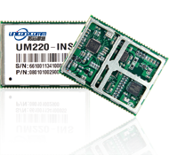
    BDS/GPS+MEMS dual-system inertial navigation module. Photo: Unicore

    Unicore Communications, Inc., is showcasing two new products at ION GNSS+, being held September 10-12 in Tampa, Florida.

    The UM220-INS is a BeiDou/GPS+MEMS dual-system inertial navigation module for in-dash automotive navigation and high-end navigation. Besides dual-system (BeiDou+GPS) GNSS navigation, the UM220-INS features a built in six-axis MEMS and can output a GNSS+MEMS inertial positioning result, making it suitable for applications requiring high accuracy, high reliability, and high continuity positioning.

    The second product is the UB280, a BeiDou/GPS dual-system dual-antenna high-precision heading board for precise RTK position and heading. According to Unicore, UB280 is based on Unicore’s mature BeiDou compatible multi-system GNSS system-on-chip (SoC), features low-power design and dual-antenna input, can offer millimeter-level carrier phase observation value and centimeter-level RTK positioning accuracy, and supports multi-path mitigation. Its advanced technology of instant and long-distance RTK is designed for high-precision positioning, navigation, and heading applications in static and dynamic environments.

    Features of the UM220-INS include:

    • Built-in six-axis MEMS. UM220-INS has a built-in MEMS with a 3-axis gyroscope and a 3-axis accelerometer. The solution fusing GNSS and inertial MEMS enables car-navigation devices to provide a continuous and stable position under complicated environments such as basement parking and tunnels, regardless of satellite visibility.
    • High-Sensitivity Design. With Unicore’s Ultra-Sense high-sensitivity design, UM220-INS can provide excellent acquisition and tracking sensitivity under weak signal conditions, maintaining the position continuity and reliability of the receiver.
    • High-Integrated Design. Different from traditional GPS navigation products, built-in MEMS devices support the odometer / speed pulse, the reversing signal input, and more integrated, simplified overall unit manufacturers’ design.
    • DGNSS and AGNSS Supprt. UM220-INS has extended support for differential GNSS and assisted GNSS positioning functions, and supports RTCM2.3/3.0.
    • Backward Compatibility with UM220. The UM220-III N module is backward-compatible with the UM220 in size and interface, which makes upgrades easy.
    UB280 BDS/GPS dual-system dual-antenna high -precision heading board. Photo: Unicore
    UB280 BDS/GPS dual-system dual-antenna high -precision heading board. Photo: Unicore

    Features of the UB280 incude:

    • Design standard. This board is totally compatible with mainstream OEM boards in dimensions and electrical standards for the convenience of user’s further development. Apart from this, more hardware interfaces are available.
    • Rapid RTK Integer Ambiguity Resolution. With super strong RTK algorithms, it ensures more rapid initializing speed and can make a GNSS-RTK solution on multi-constellation, thus ensuring users take the lead in the interoperability era.
    • Web Interface. The UB280 supports an Ethernet interface, so users can configure the board through Ethernet, managing, upgrading, and restarting the device remotely.
    • Instant Heading Technology. With an innovative RTK algorithm, Unicore has developed the real-time dynamic heading technology on variable baseline length for a moving base station. High-quality carrier observation and perfect RTK algorithm can provide a 0.2° heading accuracy on a 1-meter baseline.
    • Graphical Interface. Based on the graphical Control and Display Tool (CDT), the state, SNR and elevating angle of the satellites of all the constellations could be displayed on the screen, which is convenient for application development.

    Unicore Communications is located in Booth 118 in the ION GNSS+ exhibit hall.

  • LORD MicroStrain Offers GPS/INS High-Performance MEMS

    LORD MicroStrain Offers GPS/INS High-Performance MEMS

    The 3DM-GX4-45 by LORD MicroStrain.
    The 3DM-GX4-45 by LORD MicroStrain.

    The 3DM-GX4-45 by LORD MicroStrain is a miniature, industrial-grade GPS-aided inertial navigation system that uses high-performance MEMS sensor technology. It combines a triaxial accelerometer, triaxial gyro, triaxial magnetometer, temperature sensors, pressure altimeter, and dual on-board processors running a sophisticated Extended Kalman Filter (EKF) to provide excellent position, velocity, and attitude estimates.

    It offers a range of fully calibrated AHRS measurements, including acceleration, angular rate, magnetic field, deltaTheta and deltaVelocity vectors. GPS measurements include LLH position, ECEF position and velocity, NED velocity, UTC time, GPS time, and SVI.  The receiver is a 50-channel u-blox 6, which receives GPS L1 C/A code, and the SBAS signals WAAS, EGNOS, and MSAS.

    The 3DM-GX4-45 provides accurate navigation and orientation under dynamic conditions for applications such as GPS-aided navigation; unmanned vehicle navigation; camera stabilization; robotic control; and reconnaissance, surveillance, and target acquisition.

    Learn more at the LORD MicroStrain website.

  • ABI Research: MEMS Sensors and Hands-Free Interfaces Will Revolutionize Mobile Devices

    ABI Research: MEMS Sensors and Hands-Free Interfaces Will Revolutionize Mobile Devices

    Photo: ABI Research

    Accelerometers, gyroscopes, near field communications (NFC), and gesture recognition are predicted to be the big winners in mobile devices. These mobile technologies are projected to make the greatest penetration gains over the coming years, according to a recent study by market intelligence firm ABI Research.

    “Hands-free operation or gesture recognition is soon going to become a key differentiator in high-end flagship smartphones, media tablets, and smart glasses,” says senior analyst Joshua Flood. “Samsung’s latest Galaxy S4 has already incorporated the technology within its handset and has received significant plaudits for its new innovative user experience. Furthermore, with a host of new smart glass products soon to be released, it is easy to imagine the usefulness of the interface with this product.” In 2013, almost 12% of smartphones shipped will have vision-based gesture recognition capabilities.

    Accelerometers and gyroscopes play a crucial role with today’s mobile devices, enabling devices to be more intuitive and take action without a user pressing a button. Simple actions like switching from portrait to landscape when a smartphone is tilted are made possible by including these components. Additionally, the fast growing mobile gaming market is highly dependent upon smartphones including gyroscopes, which enhance gaming experience. Nearly half of the smartphones shipped this year will include these MEMS sensor types.

    NFC has been one of the most talked about mobile technologies that has not quite taken off. The technology has primarily been focused around mobile payments; however, mobile OEMs have begun to see other potential capabilities for the technology such as photo-sharing and location information tag points that could open a huge market for advertising and marketing campaigns. Within three years, it is anticipated one in two smartphones shipped will include NFC and have gesture recognition capabilities. Furthermore, accelerometers and gyroscopes will be the “norm” with most smartphones.

    These findings are part of ABI Research’s Next Generation Mobile Devices and Mobile Handset Go-to-market Strategies Research Services.

  • SBG Systems Releases Ekinox Land Solution

    SBG Systems Releases Ekinox Land Solution

    The Ekinox Land Solution by SBG Systems.
    The Ekinox Land Solution by SBG Systems.

    At ION GNSS+ this week, SBG Systems announced the release of the Ekinox Land Solution, an all-in-one solution combining the cost-effective inertial navigation system with an odometer, and a GNSS RTK reference station for smooth positioning in land applications. GPS positioning in urban canyons, forests, or tunnels has always been challenging. By taking the best of these complementary technologies, Ekinox Land Solution provides reliable positioning in an affordable package, the company said.

    SBG Systems is exhibiting the system Wednesday through Friday at Booth 519/521 at ION GNSS+ in the Nashville Convention Center.

    The combination of the Ekinox inertial navigation system with complementary technologies such as wheel-speed sensor (DMI) and RTK GNSS is the key to providing smooth vehicle positioning, even during GPS outages, SBG Systems said. To save users and integrators both time and money, the best equipment has been tested and selected to build a cost-effective and all-in-one package — Ekinox Land Solution.

    Ekinox Land Solution is an integrated package built from the Ekinox Series, a range of inertial navigation systems based on robust and cost-effective MEMS technology. Mounted on a vehicle, Ekinox Land Solution provides real-time roll, pitch, and true heading (0.05° accuracy) while delivering a smooth position (2 cm). Data is output at 200 Hz and recorded in an 8-GB datalogger. Post-processing software is offered to increase attitude accuracy (up to 0.02°).

    Ekinox Land Solution is designed to answer the growing need of vehicle real-time positioning, imagery sensor triggering, and data georeferencing at an affordable price. Examples of applications include mobile mapping, machine control, car motion analysis, and unmanned ground vehicle navigation.

    The Ekinox series includes the Ekinox-A, and Attitude and Heading Reference System; the Ekinox-E, an Inertial Navigation System (INS) whose position feature depends on aiding equipment; the Ekinox-N, an INS with an embedded L1/L2 GNSS receiver; and the Ekinox-D, an INS with an integrated Dual Antenna GNSS receiver.

    SBG Systems is a French supplier of MEMS-based inertial motion sensing solutions. The company provides a wide range of inertial solutions from miniature to high accuracy. Combined with calibration techniques and advanced embedded algorithms, SBG Systems products are designed for defense, industrial and research projects, such as unmanned vehicle control, antenna tracking, camera stabilization, and surveying applications.


  • NovAtel Offers Commercial Tactical-Grade MEMS IMU

    NovAtel Offers Commercial Tactical-Grade MEMS IMU

    NovAtel OEM-IMU-STIM300.
    NovAtel OEM-IMU-STIM300.

    NovAtel has added Sensonor’s commercially exportable OEM-IMU-STIM300 to its SPAN GNSS + INS line of positioning products. The OEM-IMU-STIM300 is a Micro Electromechanical System (MEMS) Inertial Measurement Unit (IMU) that integrates with NovAtel’s OEM6 receiver technology to provide a powerful 3D continuous position, velocity and attitude solution, the company said.

    The distinguishing characteristic of the OEM-IMU-STIM300 is its small form factor with tactical-grade performance capabilities. “As an OEM supplier, our customers come to us with a wide range of application demands. The addition of the OEM-IMU-STIM300 to our SPAN portfolio enables us to provide a cost-effective solution for weight and space constrained environments without having to compromise performance in any way,” said Jason Hamilton, NovAtel director of marketing.

    NovAtel’s proprietary MEMS Interface Card (MIC) integrates the OEM-IMU-STIM300 with NovAtel’s OEM6 receiver products for full SPAN navigation capabilities. The product will be available as an integrated single-enclosure SPAN solution (SPAN-IGM-S1), enclosed standalone IMU (IMU-IGM-S1) for use with external SPAN-enabled receivers, and as an OEM component (OEM-IMU-STIM300).

    OEM-IMU-STIM300 is available for delivery in September, followed by SPAN-IGM-S1 and IMU-IGM-S1 in November 2013.


  • Trimble Launches AP15 GNSS-Inertial Board Set for Positioning

    Trimble Launches AP15 GNSS-Inertial Board Set for Positioning

    AP15Trimble introduced today the Trimble AP15, the latest member of the AP series of OEM GNSS-Inertial board sets. The introduction was made at the AUVSI 2013 Conference and Exhibition, being held in Washington, D.C.

    The AP15 uses a custom Micro Electromechanical Machined (MEMS) based Inertial Measurement Unit (IMU). It is the first product to take advantage of Applanix’ proprietary calibration process — Applanix SmartCal, a new software compensation technology that allows Trimble to achieve exceptional performance from IMUs manufactured specifically for mobile mapping applications.

    The AP15 combines high-precision GNSS positioning with Applanix IN-Fusion GNSS-Inertial integration technology, all running on a powerful, dedicated Inertial Engine (IE) board. AP products provide the performance and functionality of Applanix’ POS systems in an embedded form-factor that is specifically designed for third-party manufacturers and systems integrators, Trimble said. The AP Series is designed for a variety of commercial mobile positioning and orientation applications including airborne, terrestrial and marine mapping and guidance for unmanned vehicles.

    Combined with a wheel-mounted Distance Measurement Instrument (DMI), the AP15 provides a full 6-degrees-of-freedom navigation solution for land vehicles that is capable of providing robust position and orientation information regardless of obstructions to GNSS-only positioning such as multipath or complete signal loss. Applanix IN-Fusion technology produces uninterrupted position, roll, pitch and true heading measurements of moving platforms by combining IMU data with raw GNSS observables and DMI velocity.

    GNSS functionality is provided by a Trimble GNSS module, a dual-antenna, 440 channel, multi-frequency survey-grade GNSS receiver that supports a wide range of satellite signals, including GPS L1/L2/L2C/L5 and GLONASS L1/L2 signals. The module also supports Satellite-Based Augmentation Service (SBAS) corrections, including the U.S. Wide Area Augmentation System (WAAS), European Geostationary Overlay Service (EGNOS), Japan’s Multi-functional Satellite Augmentation System (MSAS) and the OmniStar VBS, HP and XP/G2 corrections.

    “Trimble is a leading provider of technology for positioning and orientation solutions and the introduction of the AP15 module continue this tradition,” said Kevin Andrews, product manager. “The AP15 has been designed as a more compact, lighter unit which can deliver excellent performance at lower cost.”

    The Trimble AP15 is expected to be available in October of 2013 through Applanix’ sales channel.


  • NovAtel SPAN-CPT Receiver Supports OEM6 GNSS Platform

    NovAtel’s single-box SPAN-CPT GNSS/INS receiver now supports the company’s next-generation OEM6 GNSS technology platform. The OEM6 GNSS engine significantly improves positioning performance through its support of GPS and GLONASS, all-in-view satellite tracking and intelligent measurement selection, the company said.

    “We kept the design of the enhanced SPAN-CPT identical to our legacy product to ensure a seamless upgrade process for our customers who would like to take advantage of the improved positioning capabilities,” said Jason Hamilton, NovAtel director of marketing. “The enhanced SPAN-CPT is fully backwards compatible with the previous generation of product. It retains the same compact form factor with identical pin-out and log structure.”

    As with the previous generation product, the upgraded SPAN-CPT integrates NovAtel’s precision receiver technology with fiber optic gyro and MEMS accelerometer inertial components from KVH Industries in one compact unit. The tight-coupling of the GNSS and INS technologies optimizes the raw GNSS and IMU data, delivering a superior position, velocity and attitude solution, NovAtel said. Comprised entirely of commercial components, the SPAN-CPT minimizes the operational complexities of working across international boundaries.

    Production of the OEM6 supported SPAN-CPT begins June 1.

  • New Series of SPAN MEMS IMU Products Introduced by NovAtel

    New Series of SPAN MEMS IMU Products Introduced by NovAtel

    NovAtel Inc. has announced a new SPAN-IGM series of Micro Electromechanical Systems (MEMS) inertial sensor products, including the IMU-IGM-A1 MEMS enclosure and the SPAN-IGM-A1 GNSS/INS enclosure.

    The IMU-IGM-A1 is a small, rugged enclosure that houses a MEMS inertial sensor. The IMU-IGM-A1 can be configured from the factory as an integrated GNSS + Inertial Navigation System (INS) or as a standalone IMU sensor for pairing with a customer’s existing NovAtel SPAN enabled OEM6 receiver. Featuring regulated 10-30 VDC input and a dedicated wheel sensor input to enhance GNSS outage bridging capabilities, the IMU-IGM-A1 delivers a 200 hertz navigation solution and raw measurement output.

    “The IMU-IGM-A1 is the smallest, lightest IMU enclosure in our SPAN GNSS/INS product portfolio,” said Jason Hamilton, director of marketing for NovAtel. “It provides NovAtel customers with the ability to leverage our powerful SPAN technology in new applications that are size and weight constrained but still require highly precise position, velocity, roll, pitch, and heading.”

    The SPAN-IGM-A1 combines NovAtel’s OEM615 GNSS receiver card with a MEMS inertial sensor in a single enclosure. By integrating the MEMS IMU with NovAtel’s tightly coupled OEM6 GNSS/INS SPAN engine, advanced positioning options such as AdVance RTK, ALIGN heading technology and RAIM are available to maximize performance.

    Shipments of the new IMU-IGM-A1 enclosure and the SPAN-IGM-A1 GNSS/INS integrated enclosure commence early Q2 2013.

  • NovAtel Announces New SPAN MEMS Enclosed Receiver

    Photo: NovAtel
    Photo: NovAtel

    Today at Intergeo, NovAtel Inc., NovAtel announced the addition of a new commercially exportable single-enclosure SPAN MEMS receiver to its line of SPAN GNSS/INS products. Available in the first quarter of 2013, the low-power, lightweight SPAN MEMS enclosure incorporates a diminutive Micro Electromechanical Systems (MEMS) Inertial Measurement Unit (IMU) and a NovAtel high-precision OEM615 GNSS/INS SPAN receiver to provide continuously available position, velocity and attitude (roll, pitch and yaw) in a small, single-unit form factor, the company announced.

    “This product ensures we meet crucial price/performance and size/weight requirements for our customers,” Jason Hamilton, director of Marketing at NovAtel, said. He added, “By integrating this IMU with our powerful OEM6 GNSS/INS SPAN engine, which provides many advanced positioning options such as AdVance RTK, ALIGN heading technology and RAIM, we are able to offer a GNSS/INS solution for a wide range of applications.”

    The lightweight SPAN MEMS enclosure provides a rugged housing for demanding applications. Serial and USB communication interfaces plus several I/O options support additional peripherals. An embedded wheel sensor interface is also available to enhance GNSS outage bridging capabilities. Tight coupling of the GNSS and inertial technologies enables continuous, robust positioning in difficult environments where satellite signals are unreliable or unavailable for short periods of time.

    This product will be available as an integrated single-enclosure SPAN solution, enclosed standalone IMU for use with external SPAN-enabled receivers, and as an OEM component.

    Shipments of the new receiver start Q1 2013 with OEM availability Q4 2012. A limited supply of enclosure evaluation units will be available in Q4 for integrators looking to get a head start on their projects.

  • Trimble Launches AP20-C GNSS Inertial OEM Module with MEMS Inertial Sensors

    Trimble AP series module

    Trimble has introduced the AP20-C, the latest addition to its AP Series of embedded GNSS-Inertial OEM boards plus Inertial Measurement Unit (IMU). Using a compact, custom-built IMU based on commercial Micro Electromechanical Machined (MEMS) inertial sensors, the AP20-C enables system integrators to achieve high-rate position and orientation measurements with exceptional accuracy, Trimble said.

    The announcement was made at AUVSI’s Unmanned Systems North America 2012 Conference and Exhibition being held this week in Las Vegas.

    Featuring proven Applanix IN-Fusion GNSS-Inertial integration technology, the AP20-C is an embedded GNSS-Inertial OEM board set plus IMU designed for continuous mobile positioning in poor signal environments and high-accuracy direct georeferencing of imaging sensors. The AP20-C delivers full, high-rate position and orientation measurements at 200 Hz, ensuring it can be used in the most demanding mobile environments without sacrificing performance. It is fully compatible with the industry-leading Applanix POSPac MMS office software for enhanced accuracy using network differential GNSS.

    “Compact in form and low in power consumption, the AP20-C can provide cost-effective, accurate, reliable and robust position and orientation measurements suitable for a broad range of survey and mapping applications, including airborne, terrestrial, and marine mapping as well as guidance for unmanned vehicle applications,” said Joe Hutton, director of Inertial Technology and Airborne Products at Applanix, a Trimble Company.

  • Indoor Positioning May Need Several Solutions, Says IMS Research

    A range of solutions are vying to replicate what GPS does outdoors in an indoor environment, from Wi-Fi to Bluetooth to “terrestrial” GPS, plus many others. Which one is likely to be successful? IMS Research (recently acquired by IHS Inc.) said the answer will not simply be just “one.” Locating a smartphone in an outdoors environment is straightforward, with more than 90 percent of smartphones providing GPS functionality. However, GPS becomes less useful in built-up areas and can be useless indoors, reports IMS Research.

    Indoor location enables a number of exciting applications that may previously have been considered impossible, for both the consumer and the venue owner, said IMS Research. Not only can it provide analytics, tracking footfall and understanding consumer behavior, but also improve the shopping experience, helping the consumer to find a particular store or product. Whilst these examples are useful, the real benefit and revenue generation is likely to arrive in the shape of advertising.

    Bluetooth in Nokia’s HAIP variety can provide accuracies claimed to be less than one meter, making it suitable for “aisle level” positioning. NextNav is beginning to roll out a technology described as “terrestrial GPS” in the United States, using transmitters based on the ground, and the existing GPS chipsets found in many smartphones. Other solutions include the IMES system in Japan and cellular-based solutions from companies such as Path Intelligence.

    While the roll out of commercial solutions has only recently begun, Wi-Fi has, to date, been the primary technology used. “Its high penetration in smartphones, combined with an existing infrastructure of access points, in venues such as shopping malls and airports etc., means minimal additional investment is required to support some level of positioning solution,” noted Alex West, Connectivity and Location research director at IMS Research. “For this reason, a range of different companies from Google, to Qualcomm and CSR, to Qubulus, all have solutions incorporating Wi-Fi.” Current location accuracies through Wi-Fi make it suitable for “store-level” positioning but less so for product or aisle-level, although IMS Research forecasts that consumers’ exposure to store-level accuracy will drive demand for aisle/product-level accuracy.

    In reality, it is unlikely that one solution will meet all requirements, and among recent announcements is CSR’s SiRFusion platform, which uses not only Wi-Fi, but also cellular and MEMS sensors such as accelerometers and gyroscopes, to provide a hybrid solution. MEMS sensors, which are becoming increasingly common in smartphones, are expected to play a bigger part in positioning, not only improving accuracy levels but also aiding in cutting down power consumption.

    Other leading IC suppliers, including Broadcom and Qualcomm, have announced solutions incorporating these technologies, and Bluetooth in some cases, with the necessary software. As such, a more accurate indoor positioning service is expected to be included on smartphones over the next 12 months, and is expected to provide the platform for the many apps and services that are being developed utilizing indoor location, according to IMS Research.