Tag: mobile mapping

  • Leica Geosystems Launches Mobile Mapping Solution Pegasus:One

    Leica Geosystems Launches Mobile Mapping Solution Pegasus:One

    Leica_PegasusOne_web-o
    Photo: Leica Geosystems

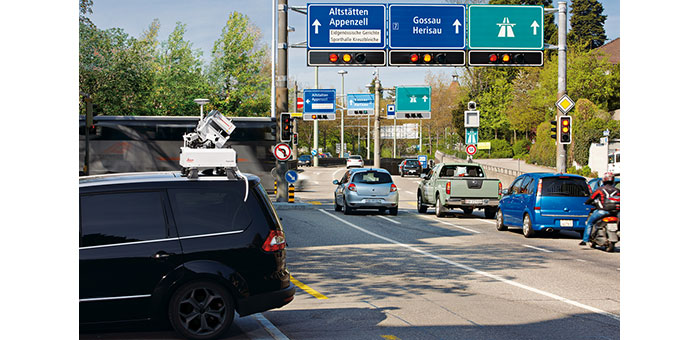
    Leica Geosystems has launched Pegasus:One, a flexible, mobile mapping platform that offers an intuitive mobile mapping solution for professionals. Pegasus:One allows service providers to use their existing terrestrial scanner in profiler mode for mobile mapping. Pegasus:One is vehicle independent and comes self-contained in two Pelican cases, enabling users to fly in, map, and fly out.

    The Leica Pegasus:One mobile mapping software platform, ArcGDS, draws on synergies resulting from Leica Geosystems’ recent acquisition of Geosoft S.r.l. and is a complete solution from data acquisition to post-processing to database, Leica Geosystems said. It offers users immediate access to their imagery and point cloud data together in the same GUI. Users navigate visually through their images, clicking in their street views, and can add GIS metadata or calculate distances on the fly. Both the imagery and point cloud are calibrated together, so clicking in one immediately provides access to the data in the other.

    With nearly 1 billion stop signs and 3.9 million miles of public road in the United States alone, transportation-related asset management provides substantial opportunities, Leica Geosystems said. Additionally, the introduction of new driver assisted technology for cars is putting tremendous pressure on transportation departments to document their highway systems to enable this technology to work successfully. The Leica Pegasus:One provides a solution for both applications.

    In the United States, more than 700 thousand billboards exist with new laws limiting the total number of billboards allowed and their placement. Ensuring compliance will generate revenue for states and municipalities around billboard placement, and is now cost effective with the Leica Pegasus:One platform – by simply driving by, Leica Geosystems said.

    “Leica Pegasus:One is an enabling product,” said Stuart Woods, vice president for Leica Geosystems’ Geospatial Division. “By providing a single integrated solution and by making our customers’ scanners mobile, we enable our customers to be more efficient.”

    In situations where users want or can only afford to capture images, Leica offers an image-only system without a scanner. This provides the same calibrated camera and leverages photogrammetry software to calculate distances from the images – ideal for GIS applications. No longer is the only option a “video recorder on wheels” — now images can be used for distance calculations, Leica Geosystems said.

  • Applanix Introduces POS LV 120 for Improving Land Mobile Mapping Productivity

    Photo: Applanix
    Photo: Applanix

    Applanix has introduced the POS LV 120, the latest version of its positioning and orientation systems for land vehicles. Using commercial Micro-Electro-Mechanical (MEMS) inertial measurement unit (IMU) technology, the Applanix POS LV 120 is a small, lightweight system and provides an economical solution for any continuous positioning and orientation application.

    POS LV 120 is a fully integrated, turnkey position and orientation system, using integrated inertial technology to generate stable, reliable and repeatable positioning solutions for land-based vehicle applications, Applanix said. Redesigned to be smaller and lighter, it maintains identical data interfaces and software compatibility with the established POS LV line of products.

    “With a MEMS IMU and a 220 channel, dual-antenna GNSS receiver integrated into a single enclosure, the POS LV 120 is a cost-effective GNSS-Inertial solution designed to support many types of land-based mobile mapping projects,” said Kevin Andrews, product manager for Land Products at Applanix.  “The integrated system is smaller than the standard POS LV computer system (PCS), making it ideal for use in lightweight applications such as robotics, autonomous vehicles, centerline mapping, asset mapping and short-range direct georeferencing.”

    POS LV 120 is available now through the Applanix sales network.

  • Trimble Introduces Receivers for GIS and Mobile Mapping

    Trimble has introduced the next-generation of its Trimble GPS Pathfinder family — the Trimble Pro 6H and Pro 6T receivers for GIS and mobile mapping. The Trimble Pro series with advanced features allows mobile workers to configure a solution for a wide range of applications, delivering flexibility in professional GIS data collection, Trimble said. The series offers a new streamlined form-factor and dramatic productivity improvements in difficult GNSS environments with Trimble Floodlight technology.

    The modular Trimble Pro series receiver gives users the flexibility to choose their setup configurations:

    • Optimized for use with Trimble data collection devices such as the Trimble Juno or Nomad G series handhelds, or Yuma tablet computer, the Trimble Pro series can also be used with other tablets and handhelds with NMEA output.
    • Real-time or postprocessed GIS workflows.
    • The receiver can be deployed in a backpack, on a pole or mounted on a vehicle.
    • Two models are available: the Trimble Pro 6H delivers decimeter accuracy, while the Pro 6T is the submeter model for standard GIS applications.

    “With the availability of the new Pro series receivers, data collection professionals now have access to the productivity-enhancements of Floodlight technology in both integrated and modular configurations,” said Daniel Wallace, general manager of Trimble’s GIS Data Collection Division. “While some prefer the convenience of an integrated, all-in-one handheld, others will appreciate the Pro series’ flexibility to choose from a range of data collection devices such as a high-resolution tablet or lightweight Trimble Juno.”

    Trimble Floodlight technology allows users to collect decimeter accuracy data in tough GNSS environments, Trimble said. Buildings and trees can cause satellite shadow and limit the environments where high-accuracy GNSS data collection can be performed. Trimble Floodlight technology combines a range of techniques to increase the availability of positions and boost accuracy in areas affected by satellite shadow. Using Floodlight technology, the Pro series can keep teams productive without compromising on accuracy. Users can work with fewer disruptions and ensure better data, faster data collection and higher field efficiency.

    Trimble Pro series receivers are rugged and built to withstand the rigors of long hours in tough outdoor conditions, yet optimized for high-accuracy GIS data collection workflows, Trimble said. For applications such as utilities inspections and timber stand valuations, Trimble Pro receivers provide long battery life and tough construction for dependable service over the course of rigorous data-collection projects.

    With its IP65 rating, the receivers offer reliable operation, even after prolonged exposure to water and dust, Trimble said. An integrated antenna reduces the complexity of the system for fast setup and swift data collection campaigns. Field workers can be up and running with minimal training, saving time and money. Combined with a Trimble handheld solution and Trimble TerraSync software, the complete system provides dedicated field workflows to simplify data collection and improve integration with the GIS for total workflow improvements.

    The new Trimble Pro 6H and 6T receivers are available from Trimble’s worldwide Mapping & GIS authorized distribution channel.

  • Indianapolis Awards Multi-Million Dollar Mapping Contract to Woolpert

    Woolpert announced its Indianapolis office has been awarded two contracts totaling approximately $2 million by the City of Indianapolis Department of Public Works (DPW) to survey pavements and develop a street sign inventory using mobile mapping technology.

    According to the announcement, the project requires collection of data across 3,200 miles of city streets, one of the single largest mobile light detection and ranging (LiDAR) collection efforts to date. LiDAR technology uses pulses from a laser to produce highly accurate measurements and map physical features.

    “We’re proud to be at the front of using this industry-leading technology for a cost-effective approach to collecting data and developing a 3D model of the city. This truly maximizes taxpayers’ dollars by reducing the cost of a data collection effort while also providing us with the data necessary to perform government functions more efficiently, such as street rehabilitation,” said Jeremy Jobe, Woolpert project manager in Indianapolis. “Further, the dataset can be used for safety improvements through viewshed or line-of-sight analysis to proactively identify potential traffic hazards caused by the surrounding environment.”

    Nearly half of the cost associated with the project is being covered through a federal grant, according to Woolpert. The city leveraged this grant to significantly reduce using local dollars for the project. Remaining funds were generated from the RebuildIndy program and other local funding sources.

    Woolpert will use its Optech LYNX M1 Mobile LiDAR system to collect the data and then use that data to develop a street sign database for compliance with Federal Highway Administration’s (FHWA) Manual on Uniform Traffic Control Devices (MUTCD) requirements for sign inventories. This manual provides the U.S. standard for signs, signals and pavement markings.

    “The benefit of using a high-accuracy mobile LiDAR system with survey-grade capabilities on such projects is the rich dataset that it captures from which assets can be extracted, in this case signage,” said Jobe. “The city will not only be able to use the data for its sign database, it will also be able to extract or call on the Woolpert team to extract additional features in the future without remobilizing the team and assuming associated costs or placing additional field crews in harm’s way, which provides the true value in this collection effort.”

    Woolpert will team with VS Engineering and DB Engineering on the sign inventory and Dynatest on the pavement analysis. Upon completion of the project, data will be integrated with the city’s existing computerized maintenance management system.