A roundup of recent products in the GNSS and inertial positioning industry from the August 2020 issue of GPS World magazine.
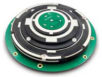
OEM
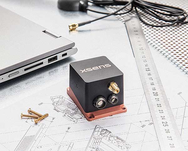
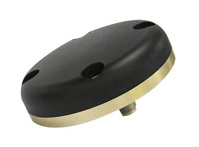
RTK motion sensor
Provides Centimeter positioning
The MTi-680G is an integrated GNSS/inertial navigation system (INS) module that features an integrated real-time-kinematic (RTK) GNSS receiver, as well as providing synchronized 3D attitude and heading outputs. Its firmware accelerates the module’s internal signal processing compared to non-RTK modules. Synchronizing the global position coordinates with the module’s attitude, heading and velocity outputs, the MTi-680G can provide a comprehensive positioning and navigation output for any carrier device, including high-speed drones, at a maximum output data rate of 400 Hz. Other applications include precision agriculture, autonomous vehicles and coastal maritime equipment. Xsens provides out-of-the-box operation with MTi development kits.
Xsens, xsens.com
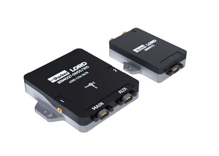
RTK + inertial system
Accurate measurements
The 3DM-GQ7 is a dual-antenna real-time kinematic (RTK) inertial navigation system with multiple integrated aiding sensors and support for external aiding. It has two integrated RTK-capable multi-band multi-constellation GNSS receivers, integrated barometric pressure sensor, magnetometer, and hardware support for wheel odometry. It also has an application programming interface (API) for external sensor measurements. The 3DM-GQ7 provides seamless operation during temporary GNSS signal outages and online tracking of inertial measurement unit (IMU) error sources for superior dead reckoning. An optional network RTK receiver, the 3DM-RTK, allows users to communicate with the company’s SensorCloud RTK Connection network for an all-in-one solution.
Parker LORD, lord.com
![]()
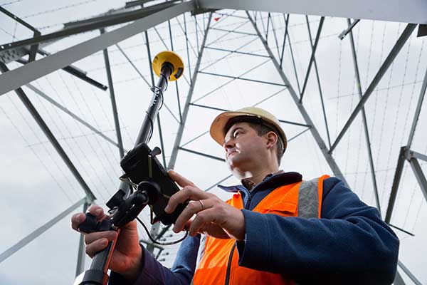
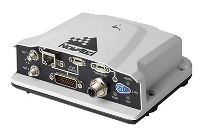
ROS driver
Supports OEM7 GNSS receivers
Hexagon | NovAtel has released its first purpose-built driver, powered by Robot Operating System (ROS), to support its OEM7 family of GNSS receivers. The driver provides an optimized interface enabling users to accelerate autonomous development projects by quickly incorporating NovAtel OEM7 receivers into custom applications. The driver is available for immediate download through the new NovAtel GitHub repository or as a ROS Binary Package for direct installation.
Hexagon | NovAtel, novatel.com
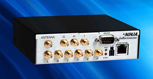
Timing module
Compact, high performance
The third-generation Ninja Precision Timing Module (PTM) — optimized for size, weight and power (SWaP) — can be easily integrated into 1U host systems or deployed as a cost-effective standalone time and frequency standard. The resilient GPS-synchronized Ninja is based on the core of EndRun’s Meridian II Precision TimeBase instrument, providing time accuracy of <10 nanoseconds RMS to UTC(USNO). Up to nine optional, user configurable, time and frequency outputs are available with accuracy, stability and ultra-low phase noise. Ninja’s network interface includes a robust Network Time Protocol (NTP) server as well as secure management.
EndRun Technologies, endruntechnologies.com
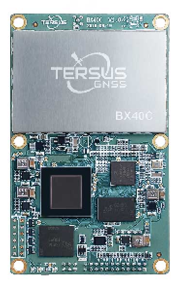
RTK board
Supports 576 channels
Powered by ExtremeRTK GNSS technology, the BX40C board can support multi-constellation and multi-frequency all-in-view satellite tracking to achieve centimeter-level positioning and improve the continuity and reliability of the RTK solution, even in harsh environments. Its enhanced positioning accuracy and constellation tracking can control deviation within 3 centimeters for surveying and mapping applications. It also is suitable for high-precision positioning. It can be integrated with autopilots and inertial navigation units. It offers 4 GB of built-in memory for data collection, and is compatible with other GNSS boards via flexible interfaces, smart hardware design and commonly used log/command formats.
Tersus GNSS, tersus-gnss.com

Rubidium oscillator
Miniature design for low SWAP-C
The Spectratime mRO-50 is designed to meet the latest commercial, military and aerospace requirements where time stability and power consumption are critical. It provides a one-day holdover below 1 microsecond and a retrace below 1 x 10⁻¹⁰ in a form factor sized 50.8 x 50.8 x 19.5 millimeters. It takes up only 51 cc of volume and consumes only 0.45 W of power. The Spectratime mRO-50 provides accurate frequency and precise time synchronization to mobile applications, such as military radio-pack systems in GNSS-denied environments. It is also suitable for UAVs and underwater applications.
Orolia, orolia.com
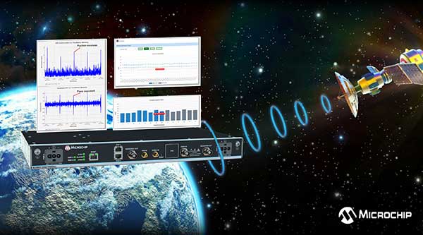
Firewall software
For critical infrastructure
The BlueSky GNSS Firewall has received a major software update. The firewall provides a higher level of resiliency against GPS vulnerabilities for systems dependent on GPS signal reception. Microchip developed Release 2.0 to address operators’ evolving requirements after participating in GPS Testing for Critical Infrastructure events hosted by the Department of Homeland Security. It performs real-time analysis to detect jamming and spoofing for protecting reception of the GPS signal and hardening response and recovery to avoid signal disruption. Release 2.0 includes charting and advanced threshold settings of GNSS observables such as satellites-in-view, carrier-to-noise, position dispersion, phase time deviation and radio frequency power level to simplify system turn-up and deployment.
Microchip Technologies, microsemi.com
Transportation
Tracking system
Supports IoT deployments
Particle’s Tracker SOM (system-on-module) provides a powerful GNSS receiver, microcontroller and advanced peripherals in a compact form factor. Tracker SOM can be tailored for organizations or serve as a fully certified foundation for OEMs developing commercial products. A high-gain GNSS antenna accurate to 1.8 meters is provided. The asset-tracking system is built on the Particle platform, spanning integrated internet-of-things (IoT) hardware, edge software, connectivity and cloud-based management software. It can track the real-time location of critical assets and capture additional intelligence such as temperature and acceleration as well as remotely control mobile equipment and vehicles.
Particle, particle.io

Fleet management
Public works solution for government fleets
The Geotab Public Works solution for North America helps state and municipal government agencies improve fleet operations and increase operational efficiencies. Fleet managers receive operational data on all government vehicle types on a single platform, with toolsets to remain compliant, reduce costs and maintain road safety. Vehicles tracked include salt spreaders, snowplows, street sweepers and waste-management vehicles. It supports material management, compliance, accountability and liability. Fleets can more accurately measure material usage, such as salt, and are better able to control costs and environmental impact. It is available as a configurable add-on for the MyGeotab platform, allowing municipalities of all sizes to customize their databases to help meet specific needs.
Geotab, geotab.com
UAV
Remote ID platform
Unmanned aircraft system traffic management (UTM)
Scout provides the capability to securely obtain and broadcast a form of network remote ID. Because it is open source, both hardware and firmware can be enhanced and incorporated into a virtually limitless set of scenarios. Altitude Angel also has made available a surveillance API that allows integrators to both share and receive flight data from a variety of sensors and devices in near real time, providing a comprehensive real-time picture of the airspace. Scout offers two-way communication enabling the Altitude Angel UTM service to help the drone avoid collisions or restricted airspace. It will work in combination with a pre-flight (flight-plan sharing) service and is supported through integration with Altitude Angel’s Tactical Conflict Resolution Service. Scout will enable the drone to report its real-time location using GPS-type sensors and relay this data via a secure, encrypted mobile communications link to Altitude Angel.
Altitude Angel, altitudeangel.com
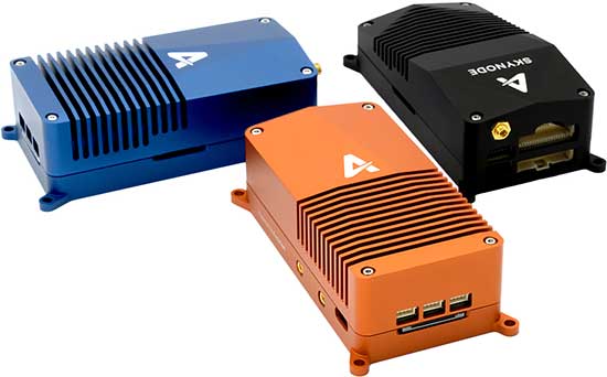
UAV platform
Unifies flight controller, mission computer and connectivity
Skynode unifies a flight controller, mission computer and wireless connectivity in a compact embedded design. It enables the complete Auterion software platform to accelerate the development of enterprise-ready products for drone manufacturers.Skynode can be integrated into any type of airframe: quads, multi-rotors, vertical-takeoff-and-landing (VTOL) and fixed-wing drones. Skynode enables the Auterion software platform with enterprise workflow integration, advanced autonomy features, mission planning, live video streams, operations dashboard, flight analytics and cloud-based predictive maintenance. Built on stable open-source software and industry standards, Auterion is highly interoperable with integrations from a host of partners in an open, future-proof ecosystem.
Auterion, auterion.com
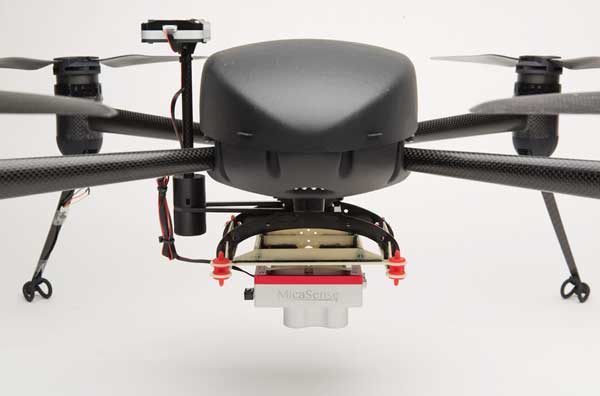
Agriculture package
For crop imaging, data
The Draganflyer Commander Ag-Pro Package includes everything needed to perform crop health assessment, irrigation monitoring and yield optimization. It combines the MicaSense RedEdge-MX multispectral sensor and the Draganflyer Commander UAV for projects requiring long flight times, a high level of data resolution and accuracy and data security. The Commander is an electric multirotor UAV built on Draganfly’s patented carbon fiber folding airframe. Its dual-battery system powers 35-minute flight times, and its automated flight planning tool allows users to quickly create coverage areas and flight plans. The RedEdge-MX features five narrowband imagers that capture high-quality images that can produce maps for a multitude of agricultural uses and has two calibration methods to produce accurate data that can be compared across time, allowing for temporal analysis throughout the season and from year to year.
Draganfly, draganfly.com;
MicaSense, micasense.com
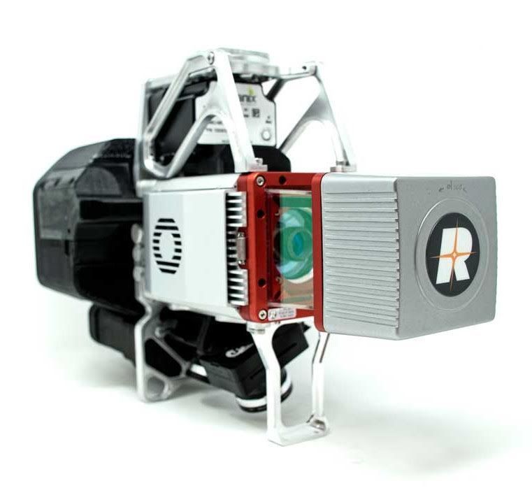
3D imaging systems
Creates bare Earth models, cross sections, contours, volumetric analysis
The True View 615 and 620 UAS lidar 3D imaging systems are compact, survey-grade sensors designed for small UAS. They are equipped with Riegl’s miniVUX-2UAV laser scanner integrated with dual photogrammetric cameras. Position and orientation is provided by an Applanix APX-15 (True View 615) or extreme accuracy APX-20 (True View 620). The systems are bundled with Applanix POSPac, True View EVO post-processing software and True View Reckon data-management solution. The system includes full post-processing software that generates a ray-traced 3D colorized point cloud and geocoded images.
GeoCue Group, geocue.com;
Riegl, riegl.com; Applanix, applanix.com
Mapping

Wearable mapper
Generates both survey-grade point clouds and high-resolution panoramas
The NavVis VLX wearable mapping system captures high-quality data in built environments such as construction sites, staircases and technical rooms. The compact, economical design enables high-quality data to be captured for architecture, engineering and construction (AEC) projects. Uses include conventional building documentation such as CAD drawings and BIM models, as well as web-based digital-twin solutions. NavVis VLX is equipped with two lidar sensors and captures survey-grade point clouds using the company’s SLAM technology, originally developed for the NavVis M6 indoor mobile mapping system. NavVis VLX also captures high-resolution panoramic images in a 360-degree field of view. The wearable device gives the operator more control over where the sensors are scanning. A built-in screen provides live feedback of what has been scanned and the quality of the data being captured.
NavVis, navvis.com
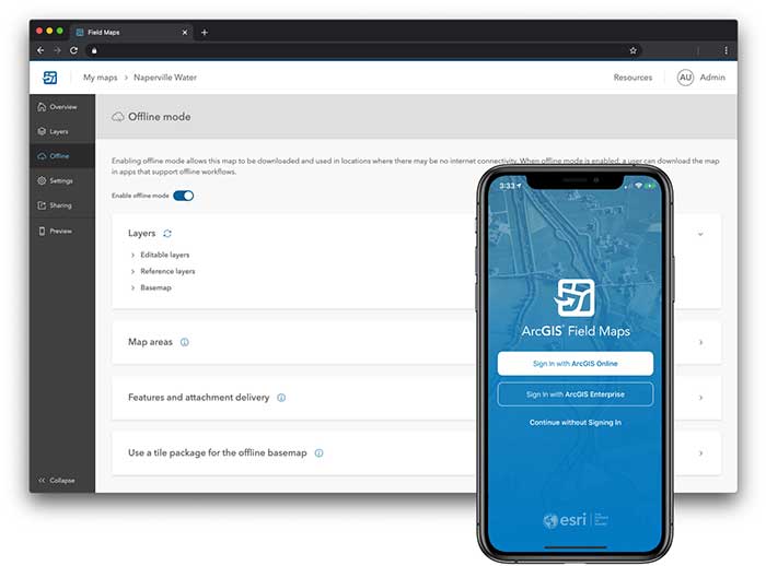
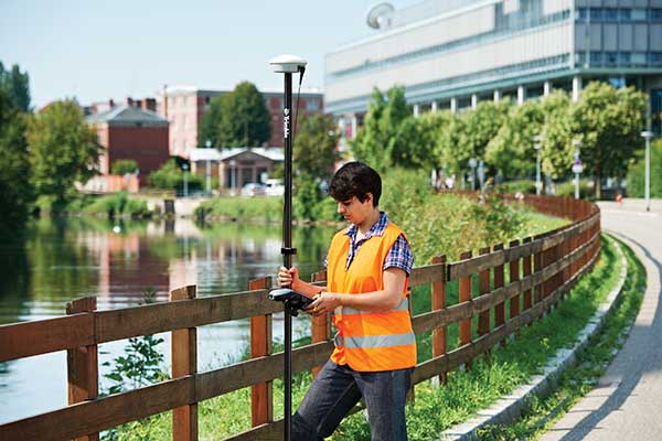
Mapping app
Supports Eos Arrow GNSS receivers
ArcGIS Field Maps, coming in September, will combine the following capabilities into a single app: map viewing and markup, high-accuracy field data collection and inspection, battery-optimized location tracking, work planning and task management and turn-by-turn navigation. Field Maps also will include a new web app, integrated with ArcGIS, that can be used to configure and deploy maps optimized for your mobile workforce needs, create and assign tasks to mobile workers, and create and share views of worker locations. ArcGIS Field Maps combines the functionality of five Esri ArcGIS mobile apps: Collector, Explorer, Tracker, Workforce and Navigator. Field Maps will also support the two formerly Collector-exclusive Eos solutions: Eos Locate and Eos Laser Mapping.
Esri, esri.com;
Eos Positioning, eos-gnss.com