Purchase Decisions in the Evolving Landscape of GPS, Multi-GNSS and Alternative PNT
Sponsored by: NavCom
Broadcast Date: Thursday, June 5, 2014
Moderator: Alan Cameron, Group Publisher, GPS World & Geospatial Solutions
Speakers: Steve Ault, Product Manager, NavCom Technology Inc.; John Pottle, Fellow, Institute of Engineering Technology and Royal Institute of Navigation; Philip Mattos, R&D scientist for several GNSS companies; Paul Benshoof, Global Business Development Manager, Locata Corporation
Summary: Last month’s two GLONASS stumbles prompted some industry leaders to resume their calls for multi-GNSS and for redundant PNT. But neither concept yet exists, truly and pervasively, that is to say effectively for all users. When will reliable, robust, consistent and continuous positioning, navigation, and timing become a reality? Should we rely on whatever technology we currently possess until the perfect system comes available, or should we continuously upgrade at each iterative step along the way?
Tag: PNT
-
How Much Farther to the Promised Land?
-
Antennas for the Future: Design and Use
Sponsored by: NavCom
Broadcast date: Thursday, February 19, 2015
Moderator: Alan Cameron, Group Publisher, GPS World and Geospatial Solutions
Speakers: Maged Shenouda, Project Manager, Antenna Group, NovAtel Inc.; Kenneth M. Pesyna Jr., Ph.D. candidate, department of electrical and computer engineering, The University of Texas at Austin; Dr. Stani Licul, Co-Founder, President and CEO, Maxtena
Summary: Understand the whys and hows of simulating signal problems now to avoid real-world problems later when newly released GNSS products encounter unanticipated problems in the field. As the number of critical applications that rely on positioning, navigation and timing (PNT) increases, the list of considerations for testing also grows. Topics addressed include leap seconds (next one coming up in June!), multipath, and interference of all sorts. The stakes for attacks on GNSS technologies are rising as incidents increase from occasional, often accidental, interference to more structured and organized approaches to jamming and spoofing. Moderated by Alan Cameron, Group Publisher, GPS World and Geospatial Solutions. -
Networking for assisted PNT
A networked radio from Thales is designed to meet soldiers’ need for assured positioning, navigation and timing (PNT) while on foot.
The MBITR2 is part of a broader defense effort to provide PNT solutions in case of GPS jamming or interference. The MBITR2 is one of a number of devices and technologies, many still in development, to address this need.
For instance, under a Small Business Innovation Research (SBIR) contract with the Air Force Research Laboratory, Navsys Corporation is testing a network-assisted PNT acquisition algorithm to run on tactical radios such as the MBITR2. The algorithm is designed to provide improved acquisition performance in a GPS jammed environment by leveraging an innovative assisted GPS (A-GPS) architecture where navigation and timing data are shared across the tactical radio network.
The AN/PRC-148B MBITR2 ground tactical handheld radio is small, light and power-efficient. It builds on the legacies of both the earlier narrowband AN/PRC-148 MBITR tactical handheld radio and the wideband AN/PRC-154 tactical handheld radio. It covers the 30–512 MHz frequency range.
When equipped with the MBITR2, dismounted warfighters can connect with the wideband tactical Internet protocol and the voice network via the Soldier Radio Waveform wideband channel, while maintaining contact via the legacy narrowband channel.
The MBITR2 is interoperable with MBITR radios already deployed. More than 200,000 are now in the field, and Thales said the earlier generation radios can be upgraded with a low-risk and cost-effective approach.
Further, the MBITR2 retains compatibility with the existing installed base of ancillaries.
 MBITR2 features
- Two radios in one
- Simultaneous two-channel (narrowband and wideband) operations
- Adds a second wideband channel to the AN/PRC-148 to provide networking, data, and video capability
- Retains the existing AN/PRC-148 JEM Type-1 capabilities and waveforms
- Embedded GPS
- Supports fielded ancillaries
-

User location data could support satellite launches
Let’s look through the other end of the telescope this month. The satellites are nattering along, lining up in orderly fashion at the rocket pad, extending their solar arms smoothly in space once they arrive on orbit. The constellations accrue and new signals inch closer to maturity.
The only blips on the horizon come from Ligado’s terrestrial impulse and a looming gap in GPS ground control. Just possibly, the latter might coincide with activation of the full European constellation and Galileo could come to the rescue of suitably equipped users who hunger for greater accuracy. This has been Galileo’s raison d’etre for two decades now, and it may actually be on the cusp of coming true.
At any rate, back to the telescope’s other end. What might that be? Facebook.
 “When you think back to the beginning of online advertising, this is what advertisers have been waiting for.” That is Facebook’s director of monetization product marketing — an actual job title, and a powerful one in time to come.
All this — what advertisers have been waiting for — is made possible by GPS. Soon, by all GNSS. And by your smartphone.
From a GNSS Design & Test point of view, this means we are about to see some real money come available for constellations. Fast-multiplying applications of position, navigation and timing data have always shaped GNSS evolution, to some degree. Making this latest development different by a degree of magnitude is its potential to alter the way GNSS policy is shaped and the way GNSS funding is provided.
Facebook will soon roll out a new Store Visits metric for business clients: location data and purchases correlated to Facebook ad performance. Partnerships with point-of-sale systems like Square and Marketo will “prove” (let’s use that word loosely for now) who bought what after seeing Facebook ads.
The way the company tells it, “While people use mobile in 45 percent of all shopping journeys, more than 90% of sales still happen in brick-and-mortar businesses.”
Even if you don’t buy something, Facebook will know that you — assuming, and this is a big jump, that you are a Facebook user — visited a store by aligning GPS, beacon, Wi-Fi and other radio-frequency signals and cell-tower locations with brick-and-mortar coordinates. You may not be a Facebook user, but I’ll bet one of your loved ones is.
With the new feature, instead of having to (gasp!) leave Facebook to visit an unfamiliar website for a store locator, users can view the address, hours, phone number and estimated travel time without exiting the social network.

I know people who rarely or never leave Facebook. Do you? This is a plus for them.
Facebook, one of the new corporate mega-giants, duels with Google, Apple and Microsoft over various pieces of digital turf. One of the most hotly contested treasures — the Holy Grail, in marketing execs’ terms — is the capture and use of user data. It is getting more than a little bit creepy.
To date, the even-bigger giant that is advertising has used metrics such as ad views and clicks to measure effectiveness: how much an ad actually inspires purchase or response to other calls to action. I know this because I use these metrics, or someone in my organization does. Such metrics are now deemed “flimsy” by the standards of aligning GPS, beacon, Wi-Fi data and so on as outlined above.
Facebook is not alone in exploring the fertile ground. Google recently launched ads that show maps of nearby locations, and the others surely do not lag far behind. For the moment, these massive integrators aggregate and anonymize the data to protect privacy, but that’s not to guarantee they would always do so. Currently, there’s no specific opt-out other than turning off location services for the app on the user’s device, which people might be reluctant to do if it degrades other app functionality.
Let’s shield our eyes from the dark side for the moment, and consider what this means for GNSS.
We, you and I, those of us in the PNT industry, have known for some time how integral to critical infrastructure GPS is and GNSS soon will be. But the vast public does not. And lawmakers, bless their little hearts, largely do not either. That will change when the desperate craving of large companies to reach billions of buyers enters the PNT arena.
We can envision mega-marketing bolstered by alliance with the transportation industry, both ground and air, as driverless vehicles and drones become more commonplace. With powerful lobbying interests behind it, GPS might finally get some respect, and other systems around the world with it. Modernization might proceed more smoothly and quickly, without funding hiccups and capability gaps. That’s the bright side of all this.
It reminds me of nothing so much as an old rock’n’roll song. In “Top of the Pops,” the Kinks sang:
Now my agent called me on the telephone
He said, son your record’s just got to number 1
And you know what this means?This means you can earn some real money.
-
Expert Opinions: UAV PNT commercial requirements
Q: What different requirements for UAV PNT performance will be seen as the market shifts from a military focus to commercial uses and users?

Neil Gerein, Portfolio Manager, NovAtel A: PNT accuracy, availability and assurance will increase in importance. UAV payloads for military applications routinely require precise PNT information to geolocate sensor data for intelligence, surveillance and reconnaissance missions. High-end commercial applications for survey and mapping will require similarly high levels of accuracy and availability. As commercial UAV operations enter the national airspace, PNT assurance levels will increase with the need for GNSS receivers designed for safety critical applications.

Jay Napoli, Vice President, KVH Industries A: Whether for military or commercial use, the accuracy requirements of a UAV’s positioning, navigation and timing system depend on the UAV’s size/weight, the mission duration and complexity, and the information being gathered. Commercial UAV applications such as mobile survey, mapping, surveillance and virtual imagery real-time overlays require higher levels of accuracy, particularly for UAVs in urban or heavily populated areas with tight restrictions. Many higher-end UAV accuracy requirements dictate the use of FOG-based inertial systems.

Christian Ramsey, UAS Program Manager, Harris Critical Networks A: As the growth of small UAS operations increase in the National Airspace System, it will be interesting to track how PNT standards and certifications evolve in order to adapt to a more versatile UAV aircraft certification system. Likely a tiered system will be required to map PNT requirements for lower risk, lower accuracy and lower cost applications to higher risk systems or those which require higher precision due to their mission profiles.
-

Iridium and GPS revisited: A new PNT solution on the horizon?
How many times have you heard of a nearly 20-year-old space constellation being modified with a new technology? It almost never happens.
I will never forget when the general slid the sensitive Iridium folder across my desk; I knew from his facial expression that he was not happy. The folder contained a controversial civilian plan to de-orbit the entire multi-billion dollar Iridium communications satellite constellation less than a year after it was launched.
Fortunately, the folder also contained a proposed military, U.S. government (USG) and joint civilian proposal to sustain the constellation, with the only caveats being that a buyer be found and that the military and/or USG provide “indemnity” (insurance policy) for the Iridium constellation if it were to be utilized by the USG and our Allies, especially during wartime. At the time I was serving as the deputy chief scientist at Air Force Space Command headquarters. Our job was to determine the technical feasibility of both proposals and make a recommendation.
Iridium satellites

Replica of Iridium satellite. (Photo courtesy of Iridium) Launched in 1998 by Motorola, Iridium is a satellite communications constellation that is a “technological marvel,” as John Bloom writes in his new book about Iridium, Eccentric Orbits. Additionally, Iridium was and remains a capability sorely needed by the USG that in many ways revolutionized global communications — unfortunately, just not in the manner or time frame Motorola originally envisioned.
Indeed, eventually not 66 or 77, or even 88, Iridium satellites would be launched, as you will read in many places. Rather, a total of 95 Iridium satellites have been launched to date, which should give the constellation the name Americium, since 95 is the atomic number for the element americium. But I digress.
The problem with Iridium was not technical or even space-related. Motorola, which developed the technology and launched the constellation into low Earth orbit (LEO) — an amazing feat in so many respects — totally missed the correct marketing strategy. Motorola developed Iridium as a quick (five-year lifetime) money-making capability and profit center when in fact it proved to be a much longer term project. Today, there are Iridium satellites that are fully expected to be on orbit and fully functioning for more than 20 years.
The original Iridium satellite was — and still is — a technological marvel that broke almost all the so-called rules for manufacturing spacecraft:
- The satellites were built without any fully space qualified or certified parts.
- The satellites were not built in a clean room.
- The satellites were built “horizontally” on a moving assembly line, like automobiles, versus vertically, individually and historically as a stationery static device. The moving assembly line produced a satellite every five days by a little-known company that eventually became part of Lockheed Martin (LMCO).
- The satellites were launched by nearly every space-faring nation that had a launch capability at the time.
- The original Iridium satellites were built for a projected lifetime of five years — that was more than 18 years ago. The current Iridium constellation of 66-plus satellites (remember, 95 have been launched) has exceeded its projected lifetime by nearly 400 percent, and is still going strong.
In 2010, Iridium Communications entered into a long-term agreement with Boeing for maintenance, operations and support of the satellite network. Boeing operates the constellation and provides support for Iridium’s satellite control system (SCS).
Recently, the corporation that owns Iridium announced a global space-based capability that promises to compliment GPS and other PNT constellations.
How many times have you heard of an almost 20-year-old space constellation being modified with a new technology? It almost never happens.
The constellation’s legacy
Amazingly, the only reason the Iridium constellation still exists today, in several respects, is due to the intervention of the USG and a major program that suffered a production failure. Originally Motorola contracted for an additional hosted payload that just never came to fruition. The nameless company developed an Iridium test program, on which it failed to deliver. This “major glitch” caused a weight and balance problem for the Iridium satellites, which Danny Stamp, an Iridium program engineer, solved at the time by recommending a quick fix: adding an additional fuel load of the same weight as the failed payload to the satellite. It was a simple fix just to get the satellites launched on time that no one thought much about at the time. However, the result was a key component — remaining or residual fuel — that ensures the satellites are still in orbit, and can be maneuvered and working properly today.
As I mentioned earlier, one of the major reasons the entire Iridium constellation was not de-orbited was because the USG decided it was a necessary tactical capability during wartime for our warfighters, as well as being an amazing R&R tool for morale purposes. (The Iridium system enabled conversations with loved ones back home.)
Add to that a civilian plan put together by some true visionaries, individuals such as Dan Colussy and corporate partners such as Boeing, that were able to purchase the entire constellation for pennies on the dollar, and you have an incredible success story.
The result is one of the most successful — certainly the largest and most well known — satellite communication constellations ever flown. Plus, as I mentioned earlier, Iridium has proposed a brand-new capability that, if it comes to fruition, has the potential be a huge boon for GPS by serving as a key global PNT augmentation.
The way ahead
Just last week, Iridium announced that it is proposing, or has developed, in conjunction with other companies, an augmentation or compliment to GPS. Reuters quoted the CEO of Iridium Communications, Matthew Desch as saying the new technology used chips that were the size of a postage stamp, and could ultimately be integrated into other devices, heavy machinery, automobiles and the power grid.
The system, known as STL or Iridium Satellite Time and Location System, transmits signals via Iridium’s satellite constellation, delivering codes to ground positions that are independently authenticated, Reuters reported.
Both Iridium and the private firm Satelles said STL as a system has been demonstrated in military, academic and commercial applications. The Reuters article didn’t provide specific details on the exact nature of the devices or any launch customers. (Satelles and Boeing entered into a patent and technology license agreement for STL in 2013).
Iridium NEXT, Iridium’s next-generation global satellite constellation, will support the STL solution. Iridium NEXT is scheduled for completion by late 2017. Along with supporting the current Iridium constellation, Boeing is under contract from prime contractor Thales Alenia Space to provide system integration and testing support for Iridium NEXT.
So, while STL is far from concrete, it makes for an interesting possibility that Iridium is proposing or has apparently built an on-orbit satellite augmentation to GPS, and PNT in general. My government inquires brought the to-be-expected, “We can neither confirm or deny” response. As far as Iridium and Satelles are concerned, I suppose it is a wait-and-see proposal.
Still, it is good to see company internal R&D funding being used to further support our global PNT infrastructure. Now that the word is out, we can look for more details on the horizon. So stay tuned. By the way, many of you may remember that this is not the first time Iridium has gone down this path; perhaps this time it will actually work.
Yes, sometimes 18 years ago seems just like yesterday.
Note: You can read about Iridium as a GPS augmentation solution in “Iridium/GPS Carrier Phase Positioning and Fault Detection Over Wide Areas, a paper by M. Joerger, J. Neale and B. Pervan presented at ION GNSS 2009. It is available for download per ION’s current download policies.
Abstract: The iGPS high-integrity precision navigation system combines carrier-phase ranging measurements from GPS and low-Earth orbit Iridium telecommunication satellites. Large geometry variations generated by fast moving Iridium spacecraft enable the rapid floating estimation of cycle ambiguities. Augmentation of GPS with Iridium satellites also guarantees signal redundancy, which enables fault-detection using carrier phase Receiver Autonomous Integrity Monitoring (RAIM). Over short time periods, the temporal correlation of measurement error sources can be exploited to establish reliable error models, hence relaxing requirements on differential corrections.
In this paper, a new ionospheric error model is derived to account for Iridium satellite signals crossing large sections of the sky within short periods of time. Then, a fixed-interval positioning and cycle ambiguity estimation algorithm is introduced to process Iridium and GPS code and carrier-phase observations. A residual-based carrier phase RAIM detection algorithm is described and evaluated against single-satellite step and ramp-type faults of all magnitudes and start-times. Finally, a sensitivity analysis focused on ionosphere-related system design variables (ionospheric error model parameters, code-carrier divergence, single and dual-frequency implementations) explores the potential of iGPS to fulfill some of the most stringent navigation integrity requirements with coverage at continental scales.
ION Joint Navigation Conference
The highly anticipated and always rewarding Institute of Navigation Joint Navigation Conference (ION JNC) kicks off this week, June 6-9, at the Convention Center in Dayton, Ohio, and at Wright Paterson Air Force Base.
There are the expected technical and joint presentations, along with a classified day (U.S. only) and a Warrior Panel. It all sounds like a great time and an educational experience. Be sure to visit the National Museum of the U.S. Air Force, including the website where you can take a virtual tour; it is an amazing venue. Also take time to visit the Wright Brothers exhibits in the “Birthplace of Aviation” while you are there.

Wright Brothers 1901 Wind Tunnel on display in the Early Years Gallery at the National Museum of the United States Air Force. (Photo: U.S. Air Force) ION always puts on a great event. I hope many of you are there to participate.
Until next time, happy navigating, and remember: GPS is brought to you free of charge, courtesy of the United States Air Force.
-
GNSS jam-proof test range ready for customer testing

Locatalite transceiver installation in the White Sands Missile Range Ultra High-Accuracy Reference System, provided by the U.S. Air Force for testing equipment under conditions of GPS jamming. A new dimension in real-world PNT testing has arrived. One of the most critical things to predict for chips, receivers and devices using alternative or back-up PNT technologies is how they will actually perform without GPS.
Filling this need, the U.S. Air Force 746th Test Squadron has declared Initial Operational Capability (IOC) for its new truth reference, the Ultra High-Accuracy Reference System (UHARS) at the White Sands Missile Range in New Mexico. Even when GPS — or any other GNSS system — is being completely jammed, UHARS provides extremely accurate positioning, navigation and time (PNT) over the large area that the system was designed to cover.
“Initial testing shows that UHARS delivers accurate independent PNT as good as, or better than, the Air Force’s current Central Inertial and GPS Test Facility (CIGTF) Reference System (CRS), so it is perfectly able to support current customer requirements,” said Dr. Jim Brewer, Chief Scientist of the 746th Test Squadron. “However, more data are required to tune the UHARS filter and optimize its accuracy to meet even tighter PNT requirements, which is our objective. When this is achieved, UHARS will deliver truth accuracy for next-generation military capabilities, and we will declare UHARS Full Operational Capability.”
“UHARS is a rack-mounted, tightly integrated system of improved navigation sensors, a data acquisition system (DAS) and a new post-mission Kalman filter, all of which need to work together,” explained John Cao, Technical Director of the 746th Test Squadron. “It’s working very well, but once we completely measure and characterize the individual components and then tune and validate the filter, the complete system will provide a significantly more accurate reference solution for future airborne and land-based test vehicles in navigation warfare environments where modernized and legacy GPS signals are jammed from friendly or hostile systems.”
To achieve these accurate reference solutions, UHARS requires a core Non-GPS Based Positioning System (NGBPS) component capable of operating and providing sub-meter position accuracy in a GPS-denied (jamming) environment. The NGBPS subsystem of the UHARS program employs a network of ground-based LocataLite transceivers and test vehicle receivers manufactured by the Locata Corporation. The Locata network deliver centimeter-level positioning and navigation as well as nanosecond-level synchronization, which may be useful for military applications requiring precise time transfer in GPS-denied environments.
White Sands Missile Range (WSMR) is a United States Army rocket range of almost 3,200 sq mi (8,300 sq km) in parts of five counties in southern New Mexico. It is the largest military installation in the United States.
The importance and uniqueness of the WSMR as GPS test facility spring from the fact that it is illegal to jam GPS elsewhere without a special permit. Thus it is extremely difficult to create a real-world test scenario for various GPS and other PNT devices, to see how they perform under denied or restricted circumstances. This is of critical importance for flight testing (UAVs and other avionics) for which the UHARS was primarily designed and optimized.
The LocataNet truth reference system can also provide a 2D solution to support ground vehicle testing. Reportedly, the 2D solution, while also very good, has not yet been fully characterized. Once the filter has been fully tuned in this respect, WSMR could serve as a test facility for autonomous driving. There are many miles of paved highway on the WSMR, possibly in the hundreds of miles.
History of UHARS Development. Based on successful results of the original technical demonstration at WSMR in a real-world end-to-end environment, the USAF proceeded to the NGBPS production and fielding phase in 2012. The Locata Corporation was contracted to provide production ground transceivers and receivers, navigation algorithms required for data analysis and subject matter expertise. The TMC Design Corporation, the integrating contractor for this program, was tasked to develop the production hardware to house the Locata hardware, develop the command and control hardware and software, and field the production hardware at WSMR. The Locata network was fielded in September 2014, and its NGBPS capability is now core to the UHARS that is replacing the CRS.
“Our team is thrilled to be part of this historic USAF capability,” said Nunzio Gambale, CEO and co-founder of Locata Corporation. “Locata products developed and fielded by important commercial partners like Hexagon and Perrone Robotics routinely prove our technology is a game-changer for positioning over industrial-sized areas. However, leveraging Locata technology as the core non-GPS-based PNT solution over a vast military area when GPS is jammed instantly elevates our achievements into a completely new league. Clearly, we are witnessing the arrival of one of the most important technology developments for the future of the entire PNT industry.”
Customers wishing to leverage UHARS into their test programs should contact the 746th Test Squadron at (575) 679-2123 or [email protected] for scheduling information.
-
Air Force jam-proof reference system ready to support testing
The U.S. Air Force 746th Test Squadron has declared Initial Operational Capability (IOC) for its new truth reference, the Ultra High-Accuracy Reference System (UHARS), which employs LocataLite transceivers.
Even when GPS is being completely jammed, UHARS provides extremely accurate positioning, navigation and time (PNT) over the large area of White Sands Missile Range (WSMR) in New Mexico that the system was designed to cover.
To achieve these accurate reference solutions, UHARS requires a core Non-GPS Based Positioning System (NGBPS) component capable of operating and providing sub-meter position accuracy in a GPS-denied (jamming) environment. The NGBPS subsystem of the UHARS program employs a network of ground-based LocataLite transceivers and test vehicle receivers manufactured by the Locata Corporation.
Further details on the White Sands UHARS appear in the GNSS Design & Test e-newsletter from GPS World. For a free subscription, visit env-gpsworld-integration.kinsta.cloud/subscribe.
-
Iridium launches alternative GPS PNT service

Iridium Communications Inc. has introduced its Satellite Time and Location (STL) service, an alternative or complement to traditional indoor and outdoor location-based technologies, and declared it ready for use. STL’s position, navigation and timing (PNT) technology is deployed through Iridium’s 66 cross-linked, low-earth orbit satellite constellation.
Through Iridium satellites and in GNSS receivers, STL technology can work to verify GPS, GLONASS, Galileo and other navigation services, and also can serve as an alternative for those services when GPS signals are degraded or unavailable. STL also can provide an alternative source of time when testing GPS signals.
Iridium is working with Satelles, a division of iKare Corporation, as its primary technology partner. Satelles enables Iridium’s paging channels to reach small, low-cost receivers in nearly any environment, the company says in a news release.
“We think STL can help solve an important and growing problem for governments and businesses, and serve as a platform for continued innovation,” says Matt Desch, chief executive officer at Iridium. “With STL, we are introducing a global capability that is already in space, technologically ready for use and is independent of any particular location technology. The team at Satelles has been able to leverage the unique capabilities that our network offers to create a solution that can ultimately be integrated into almost any kind of platform, including other Iridium machine-to-machine devices, heavy machinery, automobiles and even the power grid, to name a few. Once implemented, STL could revolutionize the way the world’s largest, global companies and governments operate and manage cyber security.”
In a chipset about the size of a postage stamp, the technology can be embedded into many devices. STL’s signal strength may make spoofing GPS systems more difficult, the company says. STL transmits its signals through Iridium’s satellite constellation to deliver a unique code to each position on the ground that can be independently authenticated, which allows operation or access only if the user is in the location expected.
“Commercial users are now able to use STL to deliver trustworthy timing solutions for critical infrastructure, such as LTE networks, transactional data centers and the power grid,” says Greg Gutt, president and chief technology officer of Satelles. “Military and government users can also acquire these commercial off-the-shelf solutions for the Department of Defense and other government applications. In addition to enhancing the security and resiliency of GPS, STL technology can be embedded into servers anywhere in the world to geo-fence data and applications, providing trusted time and location data as an independent factor for end-point authentication.”
The STL solution has been successfully demonstrated across multiple sectors, including military, academia and commercial applications. The technology is available today and will be supported by Iridium NEXT, the Iridium’s next-generation global satellite constellation, which is scheduled for completion by late 2017, the company says.
-
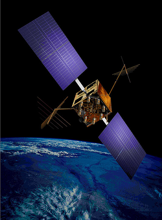
In defense of PNT: Multi-GNSS to the rescue

An artist’s concept of a GPS IIR-M satellite in orbit (courtesy of Lockheed Martin). For more than 41 years, many of us who were there in the beginning have been discussing the attributes, capabilities, enabling features and shortcomings of GPS and other space-based PNT (position, navigation and timing) systems. You have likely heard most of them; historically they go something like this:
- The signal is weak.
- The signal is easily jammed.
- The signal can be spoofed.
- The signal is subject to atmospheric perturbations.
- The signal doesn’t penetrate buildings.
- The signal doesn’t penetrate dense canopies (urban or natural).
I am sure you have heard most of these. Now, allow me to update the situation with some of the developments enabled by modern signals, new techniques, and multi-frequency, multi-GNSS (Global Navigation Satellite System) “all-in-view” receivers. All of the above bulleted statements are still true, but to a lesser extent, virtually each day. As some well-known pop musicians once sang, “It’s getting better all the time.”
- Today, multi-GNSS signals in a fully modern multi-GNSS receiver can to some degree resist interference — intentional (jamming) or unintentional — and spoofing. It is extremely difficult for a jammer or spoofer to disrupt GPS, GLONASS, Galileo and BeiDou all at the same time. And more help is on the way.
- Today, multi-GNSS signal corrections remove a large amount of error due to atmospheric perturbations and can sometimes deliver centimeter and millimeter accuracy in real time (in the case of short-baseline real-time kinematic (RTK) using only L1 carrier-phase as data, and/or in some other special situations.)
- Today, multi-GNSS signals and augmentation signals show some improvement in penetrating dense canopies and canyons by virtue of their multiplied numbers and dispersed geometry.
- Today, new ground-based technologies show promise at penetrating buildings to provide indoor location. When combined with GPS/GNSS, this is starting to get us closer to the Holy Grail, the ubiquitous PNT solution.
Debate
The future looks bright for PNT solutions, ground and space-based. I know it all sounds like a debating society, and you may have heard some of these arguments before. My point, my premise if you will, or bottom-line-upfront in military parlance, being: the GPS (space-based) limitations of the past are gradually giving way to the improved multi-GNSS capabilities of today and the combined ground-based and space-based PNT technologies of the present and rapidly arriving future.
Unfortunately, there are many uninformed so-called PNT pundits who love to posture for the press — and who are living in the past. The future is right in front of them, or in many cases in their hands, and they cannot or will not acknowledge its existence.
It’s all in the numbers
Current estimates are that more than 4 billion users depend on PNT daily for position, navigation and timing, or the multitude of services each of these resources enables. More than half of that number is attributable to smartphone users, which means, at a minimum, more than 2 million PNT users have a two-way communications device incorporated into their PNT receiver/sensor.
Let’s look at current high-end smartphones as examples of commercial multi-frequency, multi-GNSS “all signals available” devices. The user has a true multi-GNSS device incorporating:
- GPS — Global Positioning System, United States government
- GLONASS — Globalnaya Navigazionnaya Sputnikovaya Sistema, the Russian space-based PNT system
- BeiDou — the Chinese BeiDou Navigation Satellite System, a regional system now, soon to be global (2020 the advertised date).
with augmentations such as
- WAAS — U.S. Wide Area Augmentation System
- EGNOS — European Geostationary Navigation Overlay Service
- Other SBAS — additional Satellite-Based Augmentation System signals by region
- Wi-Fi — Signals compatible with a set of broadband wireless networking standards.
The latest high-end smartphones incorporate an inertial system, a digital compass, a rate gyro, and a pressure sensor integrated with pedometer software that keep track of position, heading and velocity when external signals are lost. Add cellular tower and network-enabled positioning and timing technology, and you have a two-way communications and PNT-based multi-GNSS sensor that, as long as it has power, is never lost.
Atomic numbers
The rubidium-based (atomic-reference system) timing signals from GPS satellite vehicles (SV) are among the most stable timing frequencies ever broadcast from space. The true accuracy of the signal in space is classified, but approaches an accuracy 10 times better than what was once thought to be adequate for our warfighters.
The best clocks in any current GNSS system are the passive hydrogen masers of Galileo. Thus a PNT set-up that adds Galileo to GPS improves in more ways than one.
Ephemeris numbers
Twenty-five years ago, the U.S. military kept track of GPS satellite orbit locations (known as the ephemeris of the satellite) using actual GPS measurements at the control segment tracking stations. The GPS satellite ephemeris was known to a much lesser degree of accuracy than now. At the time, that accuracy was considered good enough.
Today, the ephemeris is known much more precisely, and this can be on the order of some centimeters. This has to do with not only the location of the satellite’s center of mass (c.o.m.), but the actual location from which the signal is broadcast. The position of the satellite’s broadcast antenna is known reasonably well most of the time, by very high-end users, after correcting for the arm lever between the c.o.m. and the antenna phase center. The c.o.m. itself can vary by some centimeters over time because of depletion of onboard expendables, but here we are getting into very high-order minutiae.
Suffice it to say that certain multi-GNSS scientific high-precision receivers today are used to measure tectonic movements on the order of centimeters over the course of a full year.
Number of signals
Just recently, with the addition of certain QZSS signals (the Japanese Quasi-Zenith Satellite System) along with the Indian (GAGAN) and Russian (SDCM) equivalents of WAAS and EGNOS, the number of multi-GNSS PNT signals available to a truly international multi-GNSS receiver exceeds 200. For example, one set of global commercial receivers routinely receive and process more than 190 PNT signals in a six-hour period. The receivers are both static and dynamic, and they are networked. The static receivers know their actual location to within millimeters, and use this location as a truth set from which all other signal data is compared.
Accuracy numbers
For our example (and all parameters are software-defined and user-programmable), the location parameter may be set at 10 centimeters, meaning that any position derived from PNT signals or augmentations that differ by more than 10 centimeters from the “truth set” are immediately rejected, and that data is broadcast on the systems network, which keeps the dynamic receivers in sync as well.
The individual receivers each contribute to their own and a networked website with metadata usable by Kalman filters to which other users may choose to subscribe. This makes the multi-GNSS receivers not only receivers, but system and PNT monitors and sensors that can detect jamming, interference and spoofing attempts, which are reported.
This monitoring and tracking system is constantly evolving and incorporating new technologies while becoming more secure everyday. This is not a totally new concept, as the core system is a mature enterprise system that has been in operation and commercially viable for more than seven years.
This should be comforting information for those of you who stay up at night worrying about the safety of autonomous vehicles on land, sea and in the air.
Don’t let me give you the impression that GPS is just waiting around for other GNSS to come to its aid. GPS is aggressively modernizing itself. In Air Force parlance, “GPS III space vehicles will introduce new capabilities to meet higher demands of both military and civilian users.” As stated by GPS III contractor Lockheed Martin, the modernized system will:
• Deliver signals three times more accurate than current GPS spacecraft.
• Provide military users up to eight times improved anti-jamming capabilities.Augmentations and improvements
The bottom line is that a greatly increased number of space-based PNT platforms — along with quantum improvements in computing power, cheap non-volatile memory and software-defined capabilities — have produced a multi-GNSS PNT capability that increases availability via sheer numbers, with more security and reliability on the way.

A pair of LocataLite transmit antennas overlook a section of the White Sands Missile Range blanketed by the Locata high-precision ground-based positioning system. We are rapidly developing a PNT system that goes far in countering the naysayers. It takes advantage of augmentations and complimentary systems such as newer versions of Loran, (Long-Range Navigation System) and local PNT implementations such as Locata, just to name a couple of examples.
These ground-based systems are critical to the future of PNT, and have very strong signals. For instance, eLoran is extremely difficult to jam, if not actually unjammable. If a monstrous sunspot were to temporarily knock out the majority of space-based systems, the ground-based systems would more than likely still be available, if — big if here — they are fully developed. At the moment, this is not a sure thing. It is a work in progress.
Ground-based augmentations and complimentary/backup systems can in the future add a level of security for GPS and other space-based PNT systems: Why bother trying to knock out these space-based systems when there is a suitable and readily available ground-based system as a backup?
The U.S. government maintains a number of monitor stations around the globe. However, it has not historically taken advantage of the incredible capabilities of multi-GNSS receivers and sensor technology. Although NASA and other U.S. non-military agencies have been involved with multi-GNSS — specifically the Russian GLONASS — for the past 20 years or so, the use has not been widespread. Fortunately, recent changes now permit multi-GNSS receivers for government users, including the military, in certain non-targeting activities, and the government would do well to take advantage of the changes. The good news is that the majority of the capability is in the receiver design, a capability on which the current director of the GPS Directorate at the Space and Missile Systems Center (SMC) “made his bones.”
To all those critics who take every opportunity to denigrate space-based PNT, both inside and outside the government, I say: Pay attention to multi-GNSS. Stop your diatribes, because the future is arriving. Secure space-based PNT systems are here to stay.
They continue to improve and become more secure as they incorporate space- and ground-based augmentations, new PNT technologies, software-defined capabilities, multi-GNSS signals, and enhanced computing. “It’s getting better all the time.”
Allow me to repeat myself all over again. Space-based PNT is here to stay.
Until next time, happy navigating, and remember: GPS is brought to you free of charge by the United States Air Force.
-
PNT Roundup: Navigating GPS-free, MEMS inertial trends and non-GPS tracking
Navigating GPS-free and MEMS inertial trends
Keynotes at February’s Inertial Sensors conference summarize initiatives to provide continuous, high-frequency and high-accuracy position spanning GPS outages or obstructions.GPS-Free. Robert Lutwak, program manager at the U.S. Defense Advanced Research Projects Agency (DARPA), spoke on “Precise Robust Inertial Guidance for Munitions: Navigating in a GPS-free World.”
Over the past decade, the DARPA Micro-Technology for Position, Navigation, and Timing (micro-PNT) program developed low-CSWaP inertial sensors as a backup or “flywheel” PNT solution for GNSS augmentation, validation and holdover in obfuscated environments. New programs, such as the Precise Robust Inertial Guidance for Munitions (PRIGM) program, seek to ruggedize and deploy devices developed under micro-PNT and to extend the performance to support longer and more dynamic mission scenarios. In addition to maturing micro-electro-mechanical systems (MEMS) and atomic technologies developed under micro-PNT, PRIGM is exploring new sensing modalities and architectures, including those enabled by integrated photonics and by the tight integration of photonic and MEMS technologies.
Accuracy One-Thousandfold. Lutwak also gave an overview of DARPA’s new Atomic Clocks with Enhanced Stability (ACES) program. A technology challenge budgeted for up to $50 million, ACES’ goal is to design and build a new generation of palm-sized, battery-powered atomic clocks that perform up to 1,000 times better than the current generation — DARPA’s Chip-Scale Atomic Clock.
The new clocks must fit into a package about the size of a billfold and run on a mere quarter-watt of power. Success will require advances that counter accuracy-eroding processes in current atomic clocks, among them variations in atomic frequencies that result from temperature fluctuations and subtle frequency differences that can occur if the power shuts down and then starts up again.
“It will take a collaboration of teams with skill sets from diverse fields, including atomic physics, optics, photonics, microfabrication and vacuum technology, to achieve the unprecedented clock stability that we seek,” Lutwak said.
MEMS Transition. Stephen Breit, director of engineering for Coventor, gave his predictions for the “Future of the Commodity MEMS Inertial Sensor Design and Manufacturing.”
Emerging trends that could lead to disruptive changes include commoditization of MEMS process technology, consolidation of advanced semiconductor technology, More-than-Moore integration, and the Internet of Things (IoT). These trends motivate industry efforts toward a transition similar to the one that occurred in the CMOS industry: from integrated device manufacturers to a fabless/foundry business model.
This will require a design automation flow that provides a platform for process design kits (PDKs) that foundries can supply to their fabless customers.
Exploiting fingerprints, other smartphone features
Tiny irregularities in an Android or iPhone’s accelerometer can be turned into a unique signature to track users, Stanford researchers found in 2013. These flaws essentially fingerprint an individual smartphone and allow it to be traced. Highly focused activity since then, some of it summarized here, has advanced the frontiers of non-GPS tracking. Developments could prove interesting to privacy advocates, online marketers and law enforcement.Security researcher Hristo Bojinov demonstrated how, in a matter of seconds, he induced his smartphone to give up its “fingerprints.” Code running on a website in the device’s mobile browser measured the tiniest defects in the device’s accelerometer, producing a unique set of numbers — exploitable to identify and track most smartphones. Marketers could use the ID the same way they use cookies to identify a particular user, monitor their online actions and target ads.
The research team was also able to identify phones using their microphones and speakers. They found they could produce a unique frequency response curve, based on how devices play and record a common set of frequencies.
Amplifiers and Oscillators. A team at the Technical University of Dresden developed a tracking method that exploits variations in the radio signal of cell phones. The collection of components such as power amplifiers, oscillators and signal mixers can all introduce radio-signal inaccuracies.
Bojinov and colleagues presented further work at the RSA Conference 2015, in “Sensor ID: Mobile Device Identification via Sensor Fingerprinting.” Among findings:- We have found ways to construct a device ID by sensor fingerprinting.
- All the sensors’ fingerprints may sum up to enough bits to identify all devices.
- It is hardware dependent.
- It can be used by web application.
A related presentation stated that “this is only the beginning. Many more unexpected information leakages will be found in the coming years. Treat every app you install as having ‘root’ on the phone. And think twice before installing that ‘harmless’ game.”
Engineers at Robert Bosch GmbH in Germany focused on MEMS-based gyroscopes and showed via wafer-level measurements and simulations that it is feasible to use the physical and electrical properties of these sensors for cryptographic key generation, a key requirement for full rollout of the Internet of Things.
Teams from Virginia Tech and the University of Essex have published papers detailing similar approaches, basically turning this vulnerability into a tool. “We prove that device identification can be generated by using the accelerometer found in many pervasive devices,” wrote the Essex researchers. “Our experiments are based on a set of health sensors equipped with a MEMS accelerometer. Periodic readings are obtained from the sensor and analyzed mathematically and statistically to generate a stable ICMetric number.”
Alissa Fitzgerald aided in assembling this overview report.
-
ESA to host 2016 Summer School on GNSS at JRC

Photo: ESA The European Space Agency (ESA) will host its Summer School on GNSS program for students July 18–29 at the European Commission Joint Research Centre (JRC) in Ispra, Varese, Italy.
The 11-day event is open to graduate students that have studied more than three years; Ph.D. students and postdoctoral researchers younger than 35 years old; and young engineers and professionals in the industry who are less than 35 years old.
Participants will learn a comprehensive overview of satellite navigation, starting from the GNSS system, its signals, the processing of the observations in a receiver and determining the position-navigation-time solution. They will be able to work hands-on in JRC labs and attend lectures on intellectual property rights, patents, business insights and the future of satellite systems.
There also will be a comprehensive group project, where participants will use their innovative ideas to develop a product or service and create a business plan, technical realization and marketing of that product or service.
Lectures, exercises and lab work will be given by internationally renowned scientists and specialists.

