Tag: Raytheon

  • GPS OCX software ready for 2018 GPS III launch

    Raytheon Company’s GPS OCX program is ready for the U.S. Air Force’s launch of the first modernized GPS satellite later this year.

    Raytheon’s GPS Next-Generation Operational Control System, known as GPS OCX, is in its final software development phase. This phase focuses on increasing automation and building controls for both L1C, a civilian GPS signal aimed at increasing international access, and M-code, a military GPS signal with better anti-jam capability.

    Once complete, the team will begin integration and testing to keep the program on track for full system delivery in June 2021.

    The GPS Operational Control System’s launch and checkout system will control launch and early orbit operations and the on-orbit checkout of all GPS III satellites. (Image: Raytheon)

    “Our team has two primary goals this year,” said Dave Wajsgras, president of Raytheon intelligence, information and services. “We will support the U.S. Air Force’s GPS III launch this fall and complete the software build for the full operational system by year’s end.”

    GPS OCX is the enhanced ground control segment of a U.S. Air Force-led effort to modernize America’s GPS system. The program is implementing 100 percent of DODI 8500.2 “Defense in Depth” information assurance standards without waivers, giving it the highest level of cybersecurity protections of any DoD space system, Raytheon said.

    For protection against future cyber threats, the system’s open architecture allows it to integrate new capabilities and signals as they become available.

    Because GPS OCX can manage nearly twice the satellites of the current system, it will increase signal strength in hard-to-reach areas like dense cities and mountainous terrain.

    Also, advanced automation will free crews to focus on mission-critical tasks such as updating satellite positions more often.

    Learn more about the program’s progress here.

  • Raytheon, NOAA win award for unmanned hurricane tracker

    Raytheon, NOAA win award for unmanned hurricane tracker

    Raytheon Company and the National Oceanic and Atmospheric Administration received Aviation Week magazine’s Laureate Award for using the Raytheon Coyote unmanned aerial vehicle (UAV) to provide near-real-time, potentially life-saving data during hurricanes.

    Joseph Cione, hurricane researcher at NOAA’s Atlantic Oceanographic and Meteorological Laboratory and principal investigator of NOAA’s Coyote project, holds the UAV in front of NOAA’s P-3 aircraft at MacDill Air Force Base in Tampa, Florida. (Photo: National Oceanic and Atmospheric Administration) (PRNewsfoto/Raytheon Company)

    Developed for the military, Coyote is a small, expendable UAV that’s air- or ground-launched into environments too dangerous for manned aircraft. The system can fly for more than an hour and up to 50 miles from its host aircraft.


    Learn more about the Coyote in this February 2016 GPS World article.


    “Weather forecasters are able to better understand storm behavior and improve hurricane models based on the real-time information provided by our Coyotes,” said Thomas Bussing, Raytheon vice president of Advanced Missile Systems. “Coyote UAVs are collecting and delivering robust storm data that could ultimately save lives.”

    In 2017, NOAA researchers deployed six Coyote UAVs to track and model Hurricane Maria. Launched from a NOAA WP-3D Orion hurricane hunter aircraft, the Coyotes flew directly into the storm, giving researchers an unprecedented view of Maria.

    Traditional weather instruments are dropped from planes and capture only a snapshot of storm behavior, but Coyote’s winged design allowed it to linger and return to key areas of a hurricane to gather more data and transmit it near-real-time to researchers.

    “We think unmanned technologies that explore dangerous and difficult to observe regions of the storm may improve our physical understanding, provide enhanced situational awareness and might ultimately improve the accuracy of hurricane intensity forecasts in the future,” said Joseph Cione, a hurricane researcher at NOAA’s Atlantic Oceanographic and Meteorological Laboratory and principal investigator of NOAA’s Coyote project. “The Coyotes we deployed in Hurricane Maria collected critical, continuous observations in the lower part of the hurricane, an area impossible to reach with manned aircraft.”

    The Coyote UAV was first deployed in 2014, when NOAA launched four of the systems into Hurricane Edouard, a Category 3 storm. Scientists on board the aircraft collected meteorological data in both the eye of the storm and the surrounding eye wall.

  • First GPS III satellite receives commands from OCX

    First GPS III satellite receives commands from OCX

    The first advanced GPS III satellite successfully established remote connectivity and communicated with the next-generation Operational Control System (OCX), further validating the U.S. Air Force’s modernized GPS is ready to launch its first satellite.

    On Nov. 2, GPS III Space Vehicle 01 (GPS III SV01), the first of 10 GPS III satellites designed by Lockheed Martin, and OCX, being developed by Raytheon Corporation, successfully completed Factory Mission Readiness Testing (FMRT).

    The FMRT validated the command and control interaction between GPS III and the OCX’s Launch and Checkout System (LCS) through a simulated full launch and early orbit mission event sequence.

    During this end-to-end system demonstration, command signals were sent from the latest OCX LCS software installed at Lockheed Martin’s Launch and Check Out Capability node in Denver to Schriever Air Force Base in Colorado Springs, Colorado.

    From there, the commands were uplinked back to the GPS III SV01 satellite, currently awaiting a call up for launch at Lockheed Martin.

    “During FMRT, GPS III SV01 received and successfully processed OCX commands that are routinely sent during launch, transfer orbit maneuvers, deployments and payload initialization,” said Mark Stewart, Lockheed Martin’s vice president for Navigation Systems. “We thoroughly tested the first GPS III satellite just like we are going to fly it in 2018.”

    GPS III SV01 and OCX first “talked” to each other during a link check on October 3, 2017.

    “This was the first time the launch and checkout system directly interfaced with the GPS III satellite,” said Bill Sullivan, vice president of Raytheon’s GPS OCX program. “We’re making consistent, steady progress, and that’s driving us toward a successful launch next year.”

    The demo further verifies the space-to-ground compatibility between GPS III satellites and OCX. During a 2013 Compatibility & Integration test, Lockheed Martin’s GPS III Nonflight Satellite Testbed (GNST) — a full-sized, functional satellite prototype — also connected with and received commands from an earlier version of Raytheon’s OCX LCS software.

    On Sept. 22, the Air Force declared GPS III SV01 “available for launch,” with launch expected in 2018. The successful FMRT was the final validation that GPS III SV01 is ready to be shipped to the launch pad.

    GPS III will have three times better accuracy and up to eight times improved anti-jamming capabilities. Spacecraft life will extend to 15 years, 25 percent longer than the newest GPS satellites on-orbit today. GPS III’s new L1C civil signal also will make it the first GPS satellite to be interoperable with other international global navigation satellite systems, like Galileo.

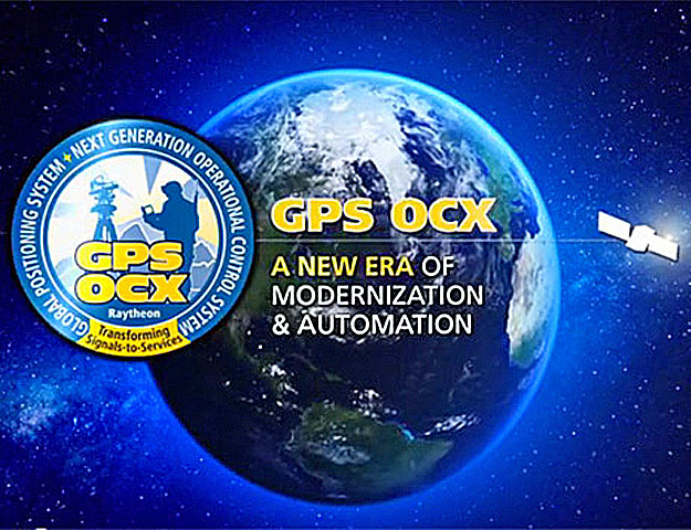
    OCX will revolutionize GPS command and control and mission management capabilities. It will control all legacy and new signals, provide protection against evolving cyber threats, and reduce operation and sustainment costs through efficient software architecture, automation and performance-based logistics. OCX represents a quantum leap in capabilities over the current system, providing flexibility and adaptability to meet future GPS mission needs.

    The GPS III and OCX teams are led by the Global Positioning Systems Directorate at the U.S. Air Force Space and Missile Systems Center. Air Force Space Command’s 2nd Space Operations Squadron (2SOPS), based at Schriever Air Force Base, Colorado, manages and operates the GPS constellation for both civil and military users.

  • New M-code GPS capability tested onboard B-2 bomber

    New M-code GPS capability tested onboard B-2 bomber

    M-code receiver enhances security, positioning, navigation and timing capabilities

    The U.S. Air Force recently completed a series of successful flight tests of its next-generation military-code GPS using a Raytheon Company receiver onboard a B-2 Spirit at Edwards Air Force Base, California.

    This first M-code test onboard the B-2 is an important milestone for the U.S. government-led GPS modernization effort to enhance security, positioning, navigation and timing capabilities for U.S. military and civilian applications.

    Military GPS user equipment (MGUE) M-code receivers will give military aircraft, ships and ground vehicles access to the modernized GPS network.

    “M-code receivers unlock the next-generation GPS network for military users,” said Rick Yuse, president of Raytheon Space and Airborne Systems. “This test demonstrated M-code capability onboard the B-2 for the first time, marking an early milestone for the overall GPS modernization effort.”

    The tests verified the integration of an MGUE-equipped risk reduction prototype of Raytheon’s miniaturized GPS airborne MAGR-2K-M receiver with B-2 systems in representative flight and mission profiles.

    Raytheon is developing M-code receivers under a contract with the USAF Global Positioning System Directorate GPS User Equipment Division. The company is also under contract with the USAF Joint Service Systems Management Office to qualify and certify the MAGR-2K-M and deliver production representative units to support platform integration and testing.

  • Ground system ready for Joint Polar Satellite launch

    The northernmost Joint Polar Satellite System Common Ground System station in Svalbard, Norway. (Photo: Raytheon)
    The northernmost Joint Polar Satellite System Common Ground System station in Svalbard, Norway. (Photo: Raytheon)

    Newest version of Raytheon’s Joint Polar Satellite System Common Ground System is now operational

    Raytheon’s next-generation Common Ground System for the Joint Polar Satellite System (JPSS CGS 2.0) is now operational, supporting 11 polar-orbiting satellites and delivering observations to NOAA’s National Weather Service almost 50 percent faster than before.

    Svalbard, Norway, is the location of the northernmost Joint Polar Satellite System Common Ground System station.

    JPSS CGS 2.0 was designed to support the upcoming NASA launch of NOAA’s JPSS-1 satellite on Nov. 14.

    “The new ground system significantly improves the mission capabilities of the JPSS program,” said Matt Gilligan, vice president of Raytheon’s Navigation and Environmental Solutions. “It can handle even more data from the full constellation of satellites now and in the future.”

    Developed by NASA for NOAA, the JPSS CGS collects and disseminates observations from polar-orbiting weather satellites from the United States, Europe and Japan.

    The polar orbiters provide critical weather and environmental data to ensure meteorologists and forecasters have robust, reliable information to make timely and accurate weather predictions that help save lives, protect property and decrease the devastating economic impact caused by severe weather.

  • U.S. Air Force accepts delivery of GPS OCX baseline

    U.S. Air Force accepts delivery of GPS OCX baseline

    The GPS Operational Control System's launch and checkout system will control launch and early orbit operations and the on-orbit checkout of all GPS III satellites. (Image: Raytheon)Image: Raytheon
    The GPS Operational Control System’s launch and checkout system will control launch and early orbit operations and the on-orbit checkout of all GPS III satellites. (Image: Raytheon)

    The Space and Missile Systems Center announced that the United States Air Force has accepted delivery of the GPS Next Generation Operational Control System (GPS OCX) Launch and Checkout System (LCS) baseline from Raytheon Intelligence and Information Systems.

    Also known as Block 0, LCS demonstrated conformance through test and analysis with all contractual requirements. OCX Block 0 is the foundation for Raytheon’s future Block 1 and 2 delivery, slated for delivery in 2022.

    LCS is a fully modernized cyber-secure ground system complete with the computing hardware, operations center workstations, and mission application software necessary to launch the first GPS III satellite into orbit and perform initial on-orbit testing.

    LCS forms the basis for the full system delivery, referred to as Block 1, which will provide higher accuracy and globally deployed modernized receivers, to ensure anti-jam capability for military users. It will also provide control of both legacy and modernized satellites and signals, including the new international L1C and modernized Military Code.

    Currently, mission operators are utilizing LCS as part of the GPS III Mission Readiness Campaign. The ground system is performing as expected during the rehearsals and space vehicle checkout, giving the Air Force confidence in its readiness to support launch and on-orbit operations.

    OCX has had numerous challenges delaying the delivery of this critical capability, and this delivery marks a significant program milestone providing the Air Force with a cyber-hardened ground system to support the launch and on-orbit checkout of the GPS III satellites.

    “This is a major milestone for the program, and it keeps the U.S. Air Force on track to launch the first modernized GPS satellite into space next year,” said Dave Wajsgras, president of Raytheon Intelligence, Information and Services. “We have strong forward momentum on the program, and we will deliver the full capability in 2021.”

    The first launch of a GPS III satellite is scheduled for 2018.

  • DigitalGlobe selects Raytheon as satellite imaging payload provider

    Solution doubles DigitalGlobe’s capacity to collect 30-centimeter commercial satellite imagery.

    Raytheon Company has been selected by DigitalGlobe as the next-generation WorldView Legion satellite imaging constellation payload provider.

    Under the contract, Raytheon will deliver the telescopes, detectors and combined electronics to Space Systems Loral, the WorldView Legion space vehicle integrator.

    Raytheon’s new payload doubles DigitalGlobe’s capacity to capture multispectral and 30 cm imagery, while tripling to quadrupling the company’s capacity to image high-demand areas.

    Once the WorldView Legion constellation is on orbit, DigitalGlobe’s combined constellation will be able to image the most rapidly changing areas on Earth every 20 to 30 minutes, from sunup to sundown. WorldView Legion will begin launching in 2020.

    “We’re leveraging 45 years of extensive global experience in space imaging to provide DigitalGlobe with an unmatched view of the world from space,” said Rick Yuse, Raytheon Space and Airborne Systems president.

    Raytheon’s payload solution maximizes efficiencies while maintaining quality, extending mission life, delivering a larger field of view and increasing coverage area.

    “DigitalGlobe is proud to select Raytheon to develop the imaging payloads for our next-generation WorldView Legion satellite constellation,” said Walter Scott, DigitalGlobe founder, EVP and CTO. “We have exceptional confidence in the quality, performance and value of Raytheon’s instrument design, which will give our customers even greater insights into global events of significance and allow them to make critical decisions with confidence for many years to come.”

  • Boomerang system locates gunfire on the battlefield

    Boomerang system locates gunfire on the battlefield

    Surrounding sounds may not be a common way of determining location. But on the battlefield, warfighters need to know the direction of gunshots to enable a proper response.

    Weighing 12 ounces, the Boomerang Warrior-X by Raytheon BBN Technologies provides immediate hostile fire location awareness to individual soldiers and gives unit leaders shooter grid coordinates, according to the company. These situational awareness enhancements improve coordinated team responses to hostile fire.

    Incoming shot announcements are transmitted to a built-in speaker or an earpiece while a lightweight display provides range and azimuth of the shooter position. As the soldier moves, the system compensates for the soldier’s motion and continually updates the threat’s location on a wrist display.

    The Boomerang Warrior X system.

    This summer, an undisclosed Gulf nation has awarded a direct commercial sales contract to Raytheon BBN Technologies valued at more than $10 million for the delivery of 2,000 Boomerang Warrior-X systems during the next 12 months.

    “This technology is a proven life saver on the battlefield,” said Ed Campbell, president of Raytheon BBN Technologies. “Boomerang delivers the best performance of any available shooter detection system today at the lowest cost.”

    Raytheon BBN Technologies is a wholly owned subsidiary of Raytheon Company.

  • Raytheon launches WAAS payload to improve GPS accuracy for air travel

    Raytheon launches WAAS payload to improve GPS accuracy for air travel

    Raytheon Company has launched its GEO 6 satellite payload into orbit for its 12-year mission. It is the latest payload to support the Federal Aviation Administration’s (FAA) Wide Area Augmentation System (WAAS), which enhances the reliability and accuracy of GPS signals for directing air travel.

    The Raytheon-developed payload is a key element of WAAS, which offers commercial, business and general aviation pilots more direct flight paths, greater runway capability and precision approaches to airports and remote landing sites without dependence on local ground-based landing systems.

    “This latest payload launch is the next step in our journey with the FAA to bolster navigation safety and efficiency for commercial and general aviation,” said Bob Delorge, vice president of transportation and support services for Raytheon Intelligence, Information and Services.

    In June 2016, Raytheon launched WAAS GEO 5, which was recently accepted by the FAA for integration into the operational WAAS system. Both WAAS GEO 5 and GEO 6 were launched to replace aging satellites and enhance GPS precision for the FAA. WAAS increases GPS accuracy from 10 meters to approximately two meters and supports nearly all of the national airspace.

    The WAAS GEO 6 payload is hosted on a geostationary satellite, SES-15, owned and operated by SES. The satellite was successfully launched May 17 from Arianespace’s Guiana Space Center in French Guiana aboard a Soyuz launch vehicle.

  • ‘DevOps’ best practices drive progress on next-gen GPS OCX control system

    New tech development approach speeds progress on improved GPS

    Raytheon’s use of technology development best practices — DevOps — and its completion of a systems engineering milestone are driving progress on the GPS  Next-Generation Operational Control System (OCX), according to the contractor.

    Raytheon has completed its latest major systems engineering milestone for the final software iteration, a marker of the progress achieved by the GPS OCX program course corrections implemented over the last two years.

    The milestone provided extra rigor and accountability around the systems engineering for the rest of the GPS OCX program, Raytheon said. It also enables more efficient completion of the remaining software development and associated cyber protection capabilities that will harden the system against hackers, double GPS accuracy, enhance its availability, and eventually replace the stop-gap and patching measures currently used on the legacy GPS ground system.

    DevOps. The OCX team reduced development cycle times to create more efficient and effective software development by using a commercial best practice called DevOps. DevOps combines commercial cloud technologies, new automation and software development processes.

    This is the first use of DevOps in a large-scale U.S. Department of Defense acquisition program.

    “The recent milestones achieved for OCX demonstrate our resolve to meet long-term schedule commitments and keep our momentum in 2017,” said Dave Wajsgras, president of Raytheon’s Intelligence, Information and Services business. “These software development innovations are helping to drive OCX capabilities, the replacement of the legacy GPS ground system, and significant enhancements to GPS overall.”

    The U.S. Air Force-led GPS Modernization Program will yield new positioning, navigation and timing capabilities for U.S. military and civilian users across the globe.

    Developed by Raytheon under contract to the U.S. Air Force Space and Missile Systems Center, GPS OCX is replacing the current GPS operational control system and will support the launch of the GPS III satellites. The new system will provide enhanced performance, the effective use of modern civil and military signals and secure information-sharing with unprecedented cyber protection.

  • Raytheon, US Air Force upgrade navigation in decoy-jammer vehicle

    Raytheon, US Air Force upgrade navigation in decoy-jammer vehicle

    Raytheon Company and the U.S. Air Force validated performance of an upgraded navigation system for the Miniature Air Launched Decoy-Jammer (MALD-J) in six flight tests from B-52 and F-16 aircraft at White Sands Missile Range, New Mexico.

    The system upgrade, designated as GAINS II (GPS-Aided Inertial Navigation System), includes an enhanced multi-element GPS-controlled antenna assembly. The new technology improves MALD-J navigation performance in a GPS jamming environment. Improvements and efficiencies within the design helped to reduce GAINS II unit costs.

    “Improving performance while reducing costs is a win for Raytheon and our customer,” said Brian Burton, director of MALD Programs for Raytheon.

    Raytheon Space and Airborne Systems in El Segundo, California, supported design work for GAINS II, while Raytheon Missile Systems in Tucson, Arizona, supplied systems engineering, integration and testing. Raytheon is now producing and delivering MALD-J systems with the upgraded navigation.

    About MALD and MALD-J

    MALD is a state-of-the-art, low-cost expendable flight vehicle that is modular, air-launched and programmable. It weighs fewer than 300 pounds and has a range of approximately 500 nautical miles. MALD-J adds radar-jamming capability to the basic MALD platform.

    MALD confuses enemy air defenses by duplicating friendly aircraft flight profiles and radar signatures.

    MALD-J maintains all capabilities of MALD and adds jamming capabilities.

  • Raytheon completes qualification testing of GPS launch and checkout system

    Raytheon reached another milestone in developing the GPS Next-Generation Operational Control System, known as GPS OCX, with the completion of the factory qualification test of the Launch and Checkout System (LCS).

    GPS OCX will enable dramatically increased performance and security of the GPS system that benefits millions of people worldwide.

    Raytheon tested 74 OCX segment requirements at its Aurora, Colorado, factory in a cyber-hardened environment, verifying that the LCS is well on its way to meeting U.S. Air Force requirements.

    Next, the remaining OCX segment requirements will be qualified in a retest period, and those requiring external interfaces will be qualified onsite at Schriever Air Force Base before delivery of the overall OCX LCS in 2017.

    The final phase of testing — Site Acceptance Testing — will follow the delivery of the system.

    “The completion of the Factory Qualification Test proves we can meet the U.S. Air Force requirements and are on a path to delivering the OCX LCS in 2017,” said Bill Sullivan, vice president and program manager for Raytheon’s GPS OCX. “This critical system will enable the launch of the GPS III satellites, which represents the first major capability deployment in the U.S Air Force’s effort to modernize GPS.”

    The Factory Qualification Test achievement builds upon other OCX milestones achieved in 2016, including:

    • Completion of Black Wide Area Network testing of unclassified external interfaces for GPS OCX with perfect scores on mission capability and cyber controls
    • 100 percent requirements pass rate on Electro-Magnetic Interference testing on the OCX Monitor Station Receiver Element, or OMSRE
    • Successful Critical Design Review for OMSRE hardware development
    • Completion of the LCS component-level qualification test
    • Risk-reduction testing functional checkout for the OCX ground system software, demonstrating OCX’s capabilities for precision navigation and timing in a fully cyber-hardened environment

    The U.S. Air Force-led GPS Modernization Program will yield new positioning, navigation and timing capabilities for U.S. military and civilian users across the globe. Developed by Raytheon under contract to the U.S. Air Force Space and Missile Systems Center, GPS OCX is replacing the current GPS operational control system and will support the launch of the GPS III satellites.

    The new system will provide enhanced performance, the effective use of modern civil and military signals and secure information-sharing with unprecedented cyber protection.