The Pentagon’s Defense Advanced Research Projects Agency, better known as DARPA, has awarded Raytheon multiple contracts to research and develop technologies that will detect and respond to cyber attacks on the U.S. power grid infrastructure.
The contracts, which total $9 million, were awarded under DARPA’s Rapid Attack Detection, Isolation and Characterization Systems program.
“During the last two decades, industrial control systems have evolved so that most are now connected to the Internet, making them vulnerable to cyber attack,” said Jason Redi, vice president for the Raytheon BBN Technologies Networking and Communications unit. “A significant power disruption would have profound economic and human costs in the U.S, so our goals are to prevent attacks and to reduce the time required to restore power after an attack.”
Raytheon BBN will create technologies to enhance situational awareness by providing early warning of an impending attack and detecting adversary spoofing of power grid data collection and communication. These technologies will also maintain situational awareness in the immediate aftermath of an attack.
The company will also examine methods to maintain secure emergency communication networks in the aftermath of an attack. Raytheon BBN’s approach seeks to isolate affected organizations from the internet and establish a secure emergency network to coordinate power restoration without depending on external networks.
Raytheon BBN Technologies is a wholly owned subsidiary of Raytheon Company.
System equips the F-35 and unmanned aircraft with safer, more accurate landing guidance
The U.S. Navy has awarded Raytheon Company a $255 million contract for development and production readiness of its next generation precision landing system. The Joint Precision Approach and Landing System uses GPS satellite navigation to provide more accurate landing guidance for manned and unmanned aircraft, replacing radar and beacons used in older systems.
This contract, announced by the Department of Defense on Sept. 21 and Raytheon on Oct. 19, includes options which, if exercised, would bring the value to $270 million.
Raytheon will complete development for an auto-land capability to be used by both manned and unmanned aircraft, as well as finalize the integration with the F-35 Joint Strike Fighter: the first aircraft to be equipped with JPALS technology.
A U.S. Navy F-35C Lightning II lands aboard the aircraft carrier USS Nimitz in the Pacific. (Photo: US Navy)
When operational in 2018, the U.S. Navy and Marine Corps will use JPALS on the F-35C carrier variant, F-35B short takeoff/vertical landing variant and the MQ-25A multi-mission unmanned vehicle.
“The JPALS solution revolutionizes landings for manned and unmanned military aircraft,” said Dave Wajsgras, president of Raytheon’s Intelligence, Information and Services business. “Aviators will be able to trust this technology to provide safe, secure, and reliable landing guidance, at any time of day, in all kinds of weather and environments.”
Developed in partnership with the U.S. Navy to provide pinpoint landing guidance on carriers in rough seas, JPALS is tailorable to a wide range of environments including contingency operations requiring rapid deployment, or land-based airfields with curved, segmented and specialized approaches, and can integrate and modernize landing systems on legacy aircraft for joint interoperability.
JPALS improves navigational alignment prior to approach, allowing aircraft to land on any aircraft carrier or amphibious assault ship, day or night, even in adverse weather conditions. As the only military ground-based augmentation system in the world, the system features anti-jam protection to ensure mission continuity throughout a range of threat environments.
Raytheon has reached another milestone in its development of the U.S. Air Force’s Global Positioning System Next Generation Operational Control System, known as GPS OCX. This new system offers significant improvements to the GPS on which the U.S. military and millions of civilians rely, including enhanced availability, accuracy and security.
OCX’s development is delivered in “blocks,” with Block 0 comprising the Launch and Checkout System to take GPS III satellites into early orbit. Block 1 is built on Block 0 and delivers the full OCX capability, which allows the Air Force to transition from its current GPS ground controls to the modernized and secure GPS OCX master control station.
Raytheon recently completed a series of Risk Reduction functional checkouts of OCX Block 1 capabilities, with a focus on OCX software. This latest development activity integrated iteration 1.5 of the OCX Block 1 Master Control Station with the GPS System Simulator and ran operational scenarios, representing the first end-to-end integration of available Block 1 capabilities. The testing included GPS constellation management and sustainment, demonstrating OCX’s abilities for precision navigation and timing capabilities in a fully cyber-hardened environment.
The test included running Kalman filters and generating GPS satellite navigation uploads. The completion of the Risk Reduction functional checkout informs and benefits future OCX development efforts. Future development will add to the existing capability and expand capability to include both the civil and military modernized signals.
The U.S. Air Force-led GPS Modernization Program will yield new positioning, navigation and timing capabilities for both the U.S. military and civilian users across the globe. GPS OCX is being developed by Raytheon under contract to the U.S. Air Force Space and Missile Systems Center, which is replacing the current GPS operational control system.
GPS OCX provides a number of significant modernized capabilities for GPS users, including robust cybersecurity and deployment of jam-resistant, operational military code, or M-code. The OCX Launch and Checkout System provides an early delivery of much of the overall block 1 OCX capability, and will support the GPS III satellite launches.
Harris Corporation delivered the first of 34 modernized receivers to support the GPS Next-Generation Operational Control System (OCX). They will receive the signals sent by the current GPS satellite constellation plus the new signals sent by the next generation GPS III — 13 military and civilian signals in all.
The receiver was shipped to the prime contractor, Raytheon Company, in Aurora, Colorado, after it passed a critical electromagnetic interference test, the first of many stringent qualification requirements. Though the receivers will be placed throughout the world, this first production unit will be installed in Aurora as OCX software development and integration continues.
OCX will replace the existing ground control system that receives signals from the 31 operational GPS satellites already orbiting Earth. Only OCX will be able to receive and decrypt all GPS III military and civil signals, however.
In addition to receivers, Harris has delivered 14 ground encryptors that will help protect the GPS signal. Harris also is providing critical software elements, which provide the fundamental navigation data to the GPS satellites and enable U.S. Air Force operators to better know and monitor the exact position and timing of the GPS constellation.
Pictured here is the advanced MDU on navigation payloads being delivered for GPS III Space Vehicles 1-10. (Photo: Harris)
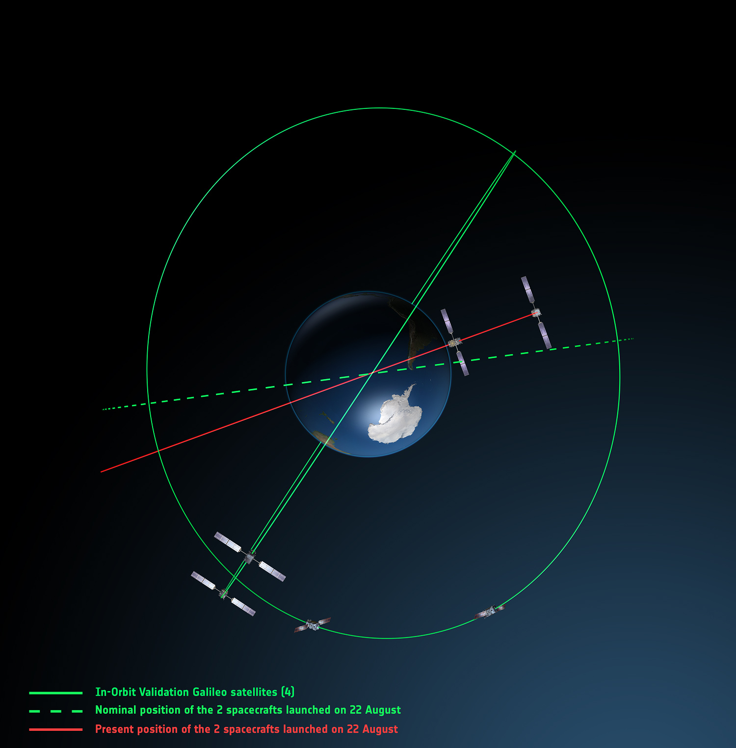
Europe’s fifth and sixth Galileo satellites, salvaged from their faulty 2014 Soyuz launch, will begin broadcasting working navigation signals for test purposes, for the benefit of receiver manufacturers, service providers and scientific researchers. The European Commission will decide later whether the two satellites will become part of the operational Galileo constellation.
The European Space Agency performed a complex series of in-orbit maneuvers to raise and circularize the two after they arrived in space too low and too elliptical for full Galileo use. Their initial orbits dipped the satellites too close to Earth to keep their antennas properly locked on the planet.
“Once their orbits were modified, their navigation payloads could be turned on and in-orbit testing could take place,” explained Marco Falcone, head of the Galileo System Office. “The good news was their performance was excellent.
“The navigation signals will include a signal health status reading that ‘signal component currently in test’ and its navigation data validity status will be ‘working without guarantee.’ In this way, these signals will not disturb the performance of any receivers using the Galileo signals coming from the other satellites. On the user community side, some application providers are interested in harnessing as many available satellites as possible for precision applications.”
Testing will take place in two phases: initially their navigation signal will be updated via the Galileo ground segment every 14 hours or so. Later this year, the ground segment will be reconfigured to send updates more often, enhancing navigation precision, although they will remain outside the official constellation until decided otherwise.
The two satellites are also midway through an ambitious space experiment to test Einstein’s General Theory of Relativity more precisely than ever before, by measuring how their onboard time varies in accordance with their altitude and therefore gravity, known as their gravitational redshift.
New Activation. Galileo GSAT-0210 (PRN E01), one of two launched May 24, began dual-frequency broadcast on Aug. 17, transmitting E1 and E5a signals.
GPS III launch RFP
Competitive bids invited
The U.S. Air Force released a Request for Proposal (RFP) in August for GPS III-3 launch services, scheduled to begin in 2019. The contract will be a standalone for a single GPS III launch.The United Launch Alliance (ULA) and Space Exploration Technologies (SpaceX) are expected to compete for the contract. In April, SpaceX was chosen to launch the GPS III-2 satellite in May 2018. ULA chose not to compete.
The RFP seeks an Evolved Expendable Launch Vehicle (EELV) Launch Service. The Air Force’s acquisition strategy seeks a balance between mission success/operational needs and lowering launch costs, reintroducing competition for national security space missions.
This is the second competitive launch service solicitation under the current procurement strategy. Previously, ULA was the only certified launch provider. In 2013, ULA was awarded a sole-source contract for launch services as part of an Air Force Block Buy of 36 rocket cores. In May 2015, SpaceX was certified for EELV launches, yielding two qualified launch service providers.
M-code, OCX updates
The Air Force awarded a $52.6 million contract to Raytheon for modernization of the Miniature Airborne GPS receiver 2000 (MAGR-2K): test and delivery of an M-code automatic dependent surveillance and broadcast-capable system. Congress has mandated the military buy only M-code GPS equipment by 2018. Last year, Rockwell Collins received a $36.6 million contract for such equipment.
OCX. Raytheon is implementing changes to its GPS Next-Generation Operational Control System (OCX). “Momentum is very good” towards a December 2020 deadline for software delivery, said the program manager. A Pentagon review in July followed breach of a critical cost-growth cap. The complexity of cyber security requirements contributed to delays to date. The company expects to deliver Block 0 software in 2017, in conjunction with plans to launch GPS III satellites. However, the capability will not be turned on until 2018, when an OCX Block 0 launch-and-checkout capability for GPS III launches is to begin.
The I-want-free-advice syndrome was once called the “Doctor Syndrome” or “Expert Syndrome.” I have recently heard it referred to as the “unsolicited advice” syndrome, because there is a new version that involves shaming the expert in to giving free advice.
Occasionally those of us with expertise in an area of interest, which certainly include doctors and lawyers, are faced with tough decisions involving rules, regulations, laws and conflicts of interest.
We are all guilty of these ethical violations in one way or another. On an airplane you discover your seatmate is a doctor of osteopathic medicine; not five minutes have gone by and you are telling him or her about all your aches and pains and seeking advice. My daughter, a clinical psychologist, says this frequently happens to her, but legally it is not a syndrome, although it could certainly be described as a phenomenon.
Regardless of the nomenclature, the newest wrinkle goes like this, as stated by a congressman at our table at a fundraiser I attended recently, when he was asked about the troubled OCX program (Next Generation GPS Operational Control System) and GPS funding in general. “Well, I don’t know much about GPS or navigating, but this is what I know about OCX and GPS. I am sure Don will correct me if I am wrong…”
I mention this phenomenon because for position, navigation and timing (PNT) issues, it is growing at an alarming rate. For instance, my 10-20 emails per day asking about PNT issues have grown over the past few weeks more than tenfold. I perceive that many of you are confused and concerned about the future of GPS, PNT and GNSS in general.
With the House Armed Services Committee deleting more than $420 million from the GPS budget line for OCX in the 2017 budget and canceling funding for certain Acquisition, Technology and Logistics (AT&L) positions dealing with acquisition, there are all kinds of rumors and innuendo floating around. [Editor’s Note: the Senate did not make the same deletions, so this must be worked out in congressional committee meetings before the end of September]. So, I went out and formally asked the experts (GPS Directorate, Lockheed Martin and Harris Corp among others) what they think the future holds for GPS. Here is what I learned…
Artist’s concept of the nextgen GPS III satellite (courtesy of the USAF).
GPS III Spacecraft. According to Colonel Steve Whitney (USAF), the director of the Global Positioning Systems Directorate, Space and Missile Systems Center (SMC), Air Force Space Command (AFSPC), Los Angeles AFB, California: “The GPS III program is actively engaged in production of the first eight [GPS III] satellites (SV), while proceeding ahead with contracting actions for the ninth and tenth spacecraft. “
Colonel Whitney went on to explain, “We have had several notable successes over the last year, including delivery of the first two navigation payloads [from Harris Corp] and completion of the first spacecraft’s environmental tests (acoustic, thermal vacuum and electromagnetic compatibility). As we prepare to accept delivery of the first spacecraft, the directorate is gearing up for the Mission Readiness Campaign and satellite launch.”
I spoke independently with representatives from both Harris Corp and Lockheed Martin, and they expressed the same opinions. Work is progressing toward a launch of the first GPS III SV hopefully sometime in 2017.
Of course, all of the companies mentioned and many others are also involved in the follow-on production of GPS III satellites known officially, oddly enough, as the:
GPS III SV11 + Follow-On Production Phase One (1). According to Colonel Whitney, “The GPS SV11+ program is implementing a phased acquisition approach to determine first if viable alternate sources exist for a production-ready spacecraft. We successfully awarded three Phase 1 contracts on 5 May 2016, and are working with all three vendors to inform our follow-on approach.”
For those of you who have not been keeping up, the three Phase 1 contracts were in the amount of $5M to each company. LMCO is included in the competition and was one of the three companies. To go into a bit more detail, the three GPS III awards are firm-fixed-price contracts that are not-to-exceed $6 million; the base contract plus two $500,000 options. The base contract period of performance is 26 months, and each option extends that time by six months for a total period of just over three years or 38 months.
At the end of the competition, the GPS Directorate will award one GPS III Phase 1 Production Readiness Feasibility Assessment contract to one or more of the three companies:
Colonel Whitney’s boss, Lt. Gen. Sam Greaves, who is the Space and Missile Systems Center commander and Air Force program executive officer (PEO) for space, said: “Industry told us they were ready to compete for the GPS III space vehicles. We look forward to working with Boeing, Lockheed Martin, and Northrop Grumman to assess the feasibility of a follow-on, competitive production contract.”
The USAF has issued an artist’s concept of the GPS III satellite, but seriously, I have listened to the proposals from all three companies in detail, and the proposals are all so radically different that the picture is just that, an artist’s concept, it may not even be close to reality.
Artist’s concept of the nextgen GPS III satellite (courtesy of the USAF).
Certainly, $5-6M is not much money in the scheme of things, certainly not enough to design and build a GPS satellite from scratch, but it is a show of good faith on behalf of the U.S. government, proving they are serious in their search for a new and improved PNT satellite in the GPS III family.
Next-Generation Operational Control System (OCX). The original OCX contract was awarded for somewhere slightly south of $900M for a six-year total effort to deliver a new Full Operational Capability (FOC) ground control system for all GPS satellites except the long-lived GPS IIAs. The federal government, having watched programs like OCX go south before, took the Raytheon bid and quietly doubled it and assured everyone they had the program well in hand. The government assured us time and again that OCX would never breach Nunn- McCurdy levels as they planned for double the cost. Smart move, but OCX costs finally reached double the original estimate plus 25 percent, which triggered the Nunn-McCurdy breach on June 30.
Now Raytheon and the government have until October to decide whether to continue with the OCX program. However, Colonel Whitney and the folks at SMC remain confident; he kindly describes the current status of OCX this way: “The OCX team continues to pursue a restructured plan approved by the Defense Acquisition Executive [USD (AT&L)] and will hold its next deep dive with the Secretary of the Air Force [SECAF] and USD (AT&L) in early July [maybe this week]. Raytheon is driving for Functional Qualification Testing of the GPS III Launch and Checkout System (GPS LCS and OCX Block 0) in August 2016.”
My sources tell me that a realistic date for OCX FOC, based purely on past performance, software issues and cyber-security concerns, is 2023 with a total cost of $4.2B. This may all be academic if OCX cannot clear the Nunn-McCurdy hurdles.
The interesting story here is that there are alternatives. This brings us to the…
GPS III Contingency Operations or Cops, which Colonel Whitney described this way when I asked him about it. “We [USAF, SMC] awarded the GPS III Contingency Operations effort on 3 February 2016 on an expedited basis with the task of delivering the capability to put on-orbit GPS III spacecraft into operations, providing legacy mission capabilities. We successfully completed the Preliminary Design Review (PDR) on 11 May 2016 and are on-track for Critical Design Review (CDR) in November 2016.”s
What the Colonel meant to say — my words, not his — is that we (the U.S government) are finally hedging our bets. Just in case OCX does not come to fruition, both for launch and operations, we know we need to put a GPS III satellite on orbit soon so we can check it out before all the satellites are produced and sitting in a warehouse and we discover a major anomaly. We are running out of time.
If all of the GPS satellites are produced (and there are only six or eight more to be built under the current contract depending on the future award schedule), and not one of them has been launched, then the program is in trouble. If LMCO does not win the follow-on contract, then the GPS III production line will be shut down at LMCO and experts scattered to the winds. Spare parts for a satellite in storage will be hard if not impossible to find, much less repair or install. If the first GPS III satellite is not launched until after production ceases and a major flaw or anomaly is discovered, then the government’s options are slim to none.
To prevent a worst-case scenario, the government must launch a GPS III satellite, and soon. Certainly a date in 2016 is preferable, but a 2017 date will suffice, according to my sources. However that is doubtful with an OCX-based launch program that has yet to launch a satellite.
Kudos to the government for looking at OCX alternatives, and for looking down the road at…
Military GPS User Equipment or MGUE. Colonel Whitney, who successfully ran this program for several years before becoming the overall GPS SPO director, knowledgeably described the current MGUE effort this way. “We have taken delivery of the first GPS Military GPS User Equipment (MGUE) Final Test Articles this past month. These articles are going through initial checkout in the test labs as we prepare for integration into our lead platforms, like the B-2 Bomber.”
Approving the final test articles is a big deal for MGUE because it not only puts the products in the hands of operational integrators and users, but opens the door for a multitude of changes necessary to incorporate the latest up-to-date technology. This technology hopefully includes the use of GNSS signals and capabilities as well as other PNT signals and augmentations that can now be incorporated.
By the way, the congressman at the fundraiser dinner that I mentioned at the beginning did a credible job, but managed to get most of it wrong. But then, congress has so much more on its plate than GPS. That’s why the real experts need to make sure they keep everyone informed.
Wooldridge and Ramo on the cover of Time Magazine, 1957.
Simon Ramo
I hate to end on a sad note, but I must acknowledge the passing of a legend in the aerospace industry. Dr. Simon “Si” Ramo, who I knew well and worked with for many years early in my career, passed away on June 27 at the age of 103.
Si, who held two doctorates, was already a leader in the aerospace industry when I was born, and I credit many of his well-known books (he was a prolific author) for drawing many a young person to space, rockets, the dynamics of space launch, and engineering.
Dr. “Si” Simon Ramo
Si cofounded TRW Inc. in the late 1950s by taking two companies — Ramo-Wooldridge and Thompson Products — and leading them into the ICBM (Intercontinental Ballistic Missile) world. He was a tireless promoter of the space industry. The world will not soon see another character, gifted leader and entrepreneur like Si Ramo.
Until next time, happy navigating, and remember: GPS is brought to you free of charge by the United States Air Force.
The Pentagon is seeking an additional $39.2 million from Congress to help develop the United States Air Force’s next-generation GPS ground control system (OCX), reports Inside Defense. Without the additional funding, the OCX would be delayed an additional four months and cost $90 million more to complete, the Pentagon said.
The embattled OCX showed progress in its July 7 quarterly review, according to an Air Force statement. Acquisition Undersecretary Frank Kendall and Air Force Secretary Deborah Lee James — “with support of Lt. Gen. Samuel Greaves, Space and Missile Systems Center commander and Air Force program executive officer for Space — concluded Raytheon has made progress implementing these critical changes.”
On June 30, the Air Force declared a Nunn-McCurdy breach for its next-generation GPS control system. The declaration means that the U.S. Air Force notifies Congress that the program would exceed baseline cost estimates by at least 25 percent, triggering regimented cost control measures.
“Factors that led to the critical Nunn-McCurdy breach include inadequate systems engineering at program inception, Block 0 software with high defect rates and Block 1 designs requiring significant rework,” a statement from the Air Force said. “Additionally, the complexity of cybersecurity requirements on OCX and impact of those requirements on the development caused multiple delays. The corrective actions to resolve these problems took much longer than anticipated to implement.”
The program enters a review period led by Kendall, which is scheduled to conclude in October.
In December, Kendall did not rule out a re-compete, and the Pentagon announced it was delaying initial operations for the ground system until July 2021. The GPS III satellites cannot use their full capabilities with the current ground control systems, but the Air Force plans to use old ground systems retrofitted to work with the GPS III designs until the OCX is operational.
On March 4, Raytheon successfully passed the first formal qualification test milestone for the U.S. Air Force’s GPS Next Generation Operational Control System (GPS OCX). The new system offers significant improvements to the GPS on which the U.S. military and millions of civilians rely, including enhanced availability, accuracy and security.
The event was the Configuration Item Qualification Test (CIQT) milestone for the Launch and Checkout System (LCS). The system provides launch and early orbit checkout capabilities for the modernized GPS III satellites and implements 77 percent of the cybersecurity capabilities for the overall OCX program. The testing was successfully conducted in a representative operational environment with a government-provided GPS III satellite simulator.
“The completion of this test milestone validates the maturity of the OCX launch and checkout system,” said Bill Sullivan, GPS OCX program director for Raytheon. “As a result of strong collaboration with the Air Force, we were able to demonstrate the system’s performance and increase confidence in the program’s path ahead.”
The LCS CIQT Run-for-Record was completed more than one month ahead of the plan established in mid-2015, clearing the way for LCS to proceed toward the Factory Qualification Test, the next major qualification event. The FQT test will be at the integrated system level and will take place this summer.
When completed, the U.S. Air Force-led GPS Modernization Program will provide new positioning, navigation, and timing capabilities for both the U.S. military and civilian users around the globe.
GPS OCX is being developed by Raytheon under contract to the U.S. Air Force Space and Missile Systems Center, which is replacing the current GPS operational control system. The OCX Launch and Checkout System provides an early delivery of a large subset of the overall OCX capability, and will support the GPS III satellite launches.
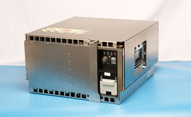
The Block 0/Launch and Checkout System infrastructure before being shipped to Schriever Air Force Base and installed. (Photo: Raytheon)
A team from the National Oceanic and Atmospheric Administration (NOAA) and Raytheon has successfully demonstrated advancements of the Coyote Unmanned Aircraft System (UAS), verifying new technology that improves Coyote’s ability to collect vital weather data on hurricanes.
Coyote drops out of a P-3 weather surveillance plane, spreads its wings and flies straight at a hurricane, braving violent winds and punishing rain to gather weather data and beam it back to meteorologists.
Drew Osbrink and Eric Redweik of Sensintel and NOAA hurricane researcher Joe Cione monitor data from the Coyote as it flies into Hurricane Edouard in 2014. (Photo: NOAA)
Coyote solves a problem that has limited forecasters’ ability to tell how hard a hurricane will hit. The secret behind the storm’s punch lies in what is known as the “boundary layer” — a low-altitude area that includes the surface of the ocean. Because hurricanes are fueled by warm ocean water, information collected at the interface of atmosphere and ocean is vital to the understanding and prediction of a storm’s strength.
“That’s where the energy is extracted from the ocean to the atmosphere,” said Joe Cione, a NOAA hurricane researcher. “Unfortunately, it is too difficult for us to go with manned aircraft to fly down there.”
The Coyote can maneuver in the most violent regions of a hurricane.Traditional weather instruments parachute from a plane and grab only a snapshot of humidity, wind speed and other factors, but Coyote’s winged design enables it to linger and return to certain areas for more measurements.
“Coyote will gather data specifically in the eye wall where it can provide information for forecasters to predict intensity from a safe distance,” said John Hobday, Raytheon. “This is a significant difference for researchers: instead of providing a snapshot of data, it’s a full-length movie.”
The Coyote after a successful flight on Jan. 7. (Photo: NOAA)
Operational Upgrades
In a Jan. 7 test, the Coyote was released from NOAA’s Hurricane Hunter P-3 aircraft and flew over the Avon Park Air Force Range in Florida, to measure the transmission range of upgraded technologies. It set a new distance record for flight control and data transmission to the P-3, and provided hurricane forecasters with real-time data on atmospheric air pressure, temperature, moisture, wind speed and direction as well as surface temperature.
Data collected will help improve the accuracy of forecasts. “Here at the National Hurricane Center (NHC), we are keenly interested in obtaining measurements from the Coyote of the strongest winds near the center of the storm,” said Chris Landsea, science operations officer at NHC. “Coyote could help us paint a better picture of current storm intensity for our storm updates.”
In 2014, NOAA deployed four of the Coyote planes into Hurricane Edouard, a Category 3 storm, at controlled altitudes as low as 400 feet. Scientists on board the P-3 received meteorological data in both the eye of the storm and the eye wall.
However, the P-3 had to fly 5 to 7 miles from the Coyote to pick up its signal. So engineers at Raytheon and the NOAA Aircraft Operations Center upgraded Coyote’s sensor systems and improved its communications package to allow it to talk to the plane over longer distances. Now, Coyote can fly for 50 miles away from the launch aircraft, which will be free to continue its own mission.
Coyote also was outfitted with an upgraded instrument package that includes an infrared sensor to measure sea surface temperature, which will help scientists understand how a hurricane extracts energy from the ocean — and how it might intensify or change. The team also is working toward optimizing battery life.
The test flight verified the Coyote’s ability to transmit the data collected from its instrument package to operators aboard the P-3 as well as at the NHC, where personnel monitor storms and develop forecasts.
NOAA scientist Paul Reasor demonstrates the Coyote. (Photo: NOAA)
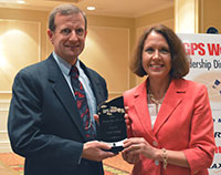
GPS World‘s Leadership Awards were presented during a sponsored ceremony and dinner at ION GNSS+ 2015 in September in Tampa. The awards recognize significant recent achievement in four fields of position, navigation and timing: satellites, signals, services and products.
Nominations came from a group of industry executives and the magazine’s Editorial Advisory Board. Votes were cast by a slightly larger group of added VIPs from the community.
The Leadership Dinner was sponsored by Lockheed Martin, Harris, Raytheon and Braxton Technologies.
Satellites category winner
Marco Falcone, Galileo System manager, European Space Agency
Falcone led the Galileo program through a very difficult time, following the faulty orbital injection of the first two operational Galileo satellites in August 2014. He gave detailed descriptions of the anomalous launch, the planned activities to salvage what was possible from the event, and the likely impact of this event on the program. His mission control team worked around the clock to ensure that the satellites were configured so that final orbits would provide some utility to the Galileo program.
Remarks delivered by Daniel Blonski, system performance engineer at ESA, on behalf of Marco Falcone:
Marco Falcone, Galileo System manager, European Space Agency, winner of the 2015 Leadership Award for Satellites.
I would like to thank GPS World and the GNSS Community.
The recovery of satellites 5 and 6 of the Galileo constellation following the August 2014 launch wrong-orbit injection demonstrates the multidisciplinary capability of the European Space Agency and its industry. In fact, this recovery involved around 300 experts from our mission analysis and flight-control teams, system engineering signal and user receiver teams, space segment engineering teams, ground control and mission segment teams, as well as security operations. This award goes first of all to them for having believed in this recovery from the very first moment.
I apologise for not having been able to join this event in person due to the Launch and Early Operations Phase of the 5th Galileo Launch, which occurred Sept. 10. Galileo has now 10 (I repeat, 10) Satellites in orbit and operations are running smoothly. I count on GNSS chipset manufacturers to introduce Galileo constellation in their chipsets and eventually have Galileo-enabled devices as of next year.
In addition, the European Space Agency is also preparing for the future. In fact, we need already now to plan those system improvements that are necessary to replenish the constellation after 2020. These improvements go into the direction of higher positioning and timing accuracy, long-term validity ephemeris and faster time to first fix, improved interoperability with other GNSS and contribution to space users service volume, additional spoofing/jamming protection through authentication, enhanced online monitoring and signal-in-space flagging functionalities, as well as flexible digital signal generation to cope with the rapid time to market required for new services evolution.
Again, I thank you for recognizing the efforts of our teams at ESA and in industry. This award gives us even more energy.
Serving over A billion users every day
The most powerful GPS satellite ever is on its way
Remarks delivered by John Frye, program manager, Navigation Systems Advanced Programs, Lockheed Martin:
John Frye, program manager, Navigation Systems Advanced Programs, Lockheed Martin.
I would like to thank GPS World for the opportunity to speak briefly at this year’s GNSS Leadership Awards.
At Lockheed Martin, we are proud to continue our support of the U.S. Air Force’s GPS program. We applaud the Air Force on this year’s 20th anniversary of the GPS constellation reaching full operational capability.
This is a tremendous milestone in the history of positioning, navigation and timing, as well as global navigation satellite systems. In addition, I’d like to recognize tomorrow’s 68-year anniversary of the establishment of the Air Force.
Lockheed Martin is honored to have contributed to the GPS milestone. Right now, 19 of our GPS IIR and IIR-M satellites make up about 60 percent of the current GPS constellation. It is a real privilege to be serving more than a billion military, commercial and civilian users every day. But our commitment doesn’t end there. If you had the opportunity to see the pictures in our booth, you know that Lockheed Martin will soon be introducing the world to GPS III — the most powerful GPS satellite ever developed — and GPS III will be the first GPS satellite to field the internationally compatible L1C signal, offering a new level of GNSS compatibility.
So, thank you. It has been an honor to speak before you, the international PNT community. Thank you for all that you do, and congratulations to all of tonight’s honorees.
New messages: Any SBAS, any GNSS
Signals category winner
Todd Walter, senior research engineer, Stanford University
This past year, Todd completed the message design for dual-frequency, multi-constellation SBAS, a huge step forward for aviation and other multi-constellation users. It means that SBAS will be able to provide corrections and integrity data for all constellations, leading to better accuracy and availability.
Remarks delivered by Todd Walter:
Todd Walter, senior research engineer, Stanford University, and Ellen Mitchell, senior communications manager, Space and Intelligence Systems, Harris Corporation.
I ’d like to thank GPS World for this award. In reality, the work on the dual-frequency, multi-constellation SBAS messages has been a long ongoing group effort. Numerous people at Stanford, the FAA, Zeta, MITRE, ESA, CNES, RTCA, EUROCAE and others have contributed to the development of the planned messages on L5. ESA and CNES in particular have been handling the document management and comment resolution.
I would also like to especially thank my colleagues at Stanford University for their hard work and support.
The new messages now planned for L5 will allow any SBAS to correct any constellation that it chooses. Rather than only supporting L1-only signals on GPS, as the current systems do, SBASs will be able to support the use of two frequencies, using as many constellations and satellites as they choose to monitor.
We will no longer need to suffer availability outages due to limited satellite geometries. Furthermore, we will not suffer availability limitations due to ionospheric disturbances. Dual-frequency operation will allow precise vertical guidance throughout the globe, and in particular in equatorial regions.
The original L1 SBAS specification took more than 20 years of development. The new dual-frequency multi-constellation specifications are even more complicated and will require a similarly long development time. Our latest effort started many years ago when the GPS L5 was initially planned to be fully operational in 2018. Since that time, the GPS L5 date has moved back to 2024.
And in the mean time, the other constellations have progressed in their development. Our original efforts changed from a dual-frequency update to the SBAS messages into a truly multi-constellation concept.
In order to utilize new constellations and new signals for aviation, it is essential that the designs of these signals be stable and clearly documented. Furthermore, we require performance commitments from the constellation providers so that we can know what to expect.
To date, GPS leads the way in both of these requirements. Its signal designs have been stable and well described for many years, and it has published performance standards documenting the level of performance we can count on. There is widespread expectation that the other constellations will be very similar to GPS. However, this will not necessarily be the case.
We need to be prepared to deal with constellation-specific behaviors. Already we recognize differences in how GPS and GLONASS operate. We can only expect to uncover additional differences as we further utilize these constellations. Also, as we field new satellites and a new control segment on GPS, we can expect to see behavior that might be different from some of our fundamental assumptions.
It is important to plan for the future in order to incorporate new signals and new constellations; however, we must remain flexible with our planning to incorporate the reality of what we actually get.
— Postscript added in November: Thanks again for the award, it looks very nice on my desk!
All about the signal
Remarks delivered by Ellen Mitchell, senior communications manager, Space and Intelligence Systems, Harris Corporation:
On behalf of the Harris Corporation and its more than 22,000 employees, I congratulate the award recipients this evening. It is particularly fitting that Harris has the honor of presenting the Signals award. As the GPS navigation payload provider, we create and deliver the GPS signal. Furthermore, our products help our customers better utilize the GPS signal and detect and prevent jamming of the GPS signal. We’re all about the signal.
This is our first year at this dinner as Harris employees. As a result of Harris Corp. acquiring Exelis on May 29, there now are 9,000 engineers and scientists in the new company. Many Harris colleagues have expertise in areas directly applicable to cutting-edge GPS payload development, for example. Current and future customers will benefit from working with this larger and even more capable new team.
We believe the combination of Exelis’ heritage of proven, assured GPS navigation payloads joined with Harris’ skill in the RF spectrum, satellite communications and reprogrammable payloads gives the new company a unique and innovative edge to support the next generation of GPS satellites.
We look forward to telling you more about our progress at next year’s Leadership Dinner. But this year, now, without further ado, I’d like to call Todd Walter to the dais to receive the Leadership Award for significant recent achievement in the area of Signals. Thank you for this opportunity.
After the awards ceremony and dinner, attendees played the Interference Event, competing to see which team could generate the strongest, most accurate signal, conveying critical information in a GNSS trivia game.
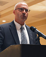
Unprecedented opportunities
Services category winner
Jade Morton, professor, Colorado State University
For her work on advanced GNSS receiver algorithms for accurate and reliable operations in challenging environments; studies of the atmosphere using radar and satellite signals; and development of new applications using satellite navigation technologies. Her research has contributed to understanding of space weather phenomena and their effect on GNSS signals.
Remarks delivered by Morton:
Jade Morton, professor, Colorado State University
Thank you for a wonderful evening, and for offering the GPS World Leadership award to me. I am humbled!
Over the past decade, we have witnessed rapid progress in the development of multiple constellations of GNSS. While much of the focus has been on improvements in the availability, integrity, continuity, and inter-operability of multi-GNSS for PNT applications, a real winner as far as scientific discovery is concerned is in the use of GNSS in atmospheric and space weather studies. With a large and growing number of free open signals across a wide range of frequencies in the L-band, multi-GNSS will be able to provide distributed, low-cost, passive remote sensing of the atmosphere on a global scale. It is fair to say that there is no other technology that offers comparable potentials, coverage and cost-effectiveness.
In the coming decade, multi-GNSS will offer unprecedented opportunities for researchers to measure atmospheric and ionospheric parameters with high spatial and temporal resolution, and monitor atmospheric responses to solar, geomagnetic and other natural and man-made events.
This is an exciting time for multi-GNSS technological development and atmospheric research. I am fortunate to have the opportunity be a part of it and to explore and contribute to the interesting intersection between GNSS and the atmosphere.
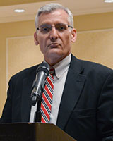
Securing GPS against attack
Remarks delivered by Steve Moran, business development director, Raytheon:
Steve Moran, business development director, Raytheon
It’s great to be here with colleagues who understand the importance of a modernized GPS infrastructure.
I was asked to speak tonight because Raytheon is partnered with the Air Force in modernizing the GPS ground segment, which is at the core of the Air Force’s GPS modernization initiative. We like to call OCX the brains of GPS.
Over the past 30 years, GPS has ensured the safety and effectiveness of our nation’s warfighters and has become an integral component of global and national telecommunication, commerce and transportation infrastructures.
The GPS modernization initiative is essential to protecting our economy and the homeland, as GPS is an ingrained part of our nation and our world’s infrastructure. As critical as GPS is to so many key functions of daily life, it must be secured against cyber attacks.
The emergence of growing cyber threats creates daily headlines and drives an urgent need for GPS modernization. GPS has been recognized as an enabler of nearly all U.S. critical national infrastructure, such as the power grid or the water supply, and is a global utility that must be ready for emerging cyber threats.
OCX is a pathfinding program that answers that need and will deliver many other benefits to GPS users across the globe. Some of the new capabilities include enabling new civil and military signals; improving system accuracy and integrity; providing flexibility and evolvability to meet future mission needs; setting the bar for information assurance at an unprecedented level; and securely sharing information with net-connected users.
Raytheon’s OCX represents new approaches to emerging and even unimaginable changes and threats. We are confident that we have the right technology, team and resources in place to deliver the OCX program. It is critical we do so.
Thank you for inviting me here tonight, and I offer a sincere congratulations to all of the GPS World Leadership Award winners.
Novel GPS/GNSS uses just keep coming
Products category winner
Larry E. Young, GPS systems group supervisor, Jet Propulsion Laboratory
For many years he has been key in the development of radiometric technology. Specific areas of research include the development of GPS science receivers, multipath mitigation, sub-nanosecond clock synchronization, and sub-centimeter formation flying. He has been instrumental in developing the TriG multi-Global Navigation Satellite System receiver used in radio occultation to measure physical properties of the atmosphere, and key to NASA’s efforts to protect radionavigation satellite services from interference.
Remarks delivered on behalf of Larry E. Young by James J. Miller, deputy director, Policy and Strategic Communications, Space Communications and Navigation, NASA:
James J. Miller, NASA
I would like to thank GPS World and the GNSS community.
I greatly appreciate the honor conveyed by this award. We all know that most advances in technology are made by a team of smart, enthusiastic and hard working scientists and engineers. JPL’s advanced GNSS receivers are a true example of teamwork.
In particular, Don Spitzmesser was a prolific inventor who could quickly conceive of, build and test novel circuits and antennas. I do not think he ever passed kitchen utensils without thinking of antennas. There are actually “heli-wok” antennas in space. The original helix was wound onto a glass, glued onto a wok backplane.
Lyle Skjerve was a highly skilled experimentalist. His previous job was detecting incoming ground-to-air missiles from the backseat of a Marine jet, and conducting electronic countermeasures to steer the oncoming missile off course. In addition to being smart, he was quick to debug problems during an experiment, and never gave up.
NASA headquarters has provided great support to GNSS technology, continuing the program Jim Miller leads today. I especially thank John LaBrecque, who provided critical early support for our speculative development of the “all-digital” receivers that produced 0.1-millimeter baseline precision.
I have been very happy to be able to work on GPS, and I am most thankful for the great group of colleagues I’ve had the fortune to work with at JPL and from other NASA centers.
My training was in experimental nuclear physics, where I was excited to measure the anomalous orbital magnetic moment of a neutron orbiting inside a superconducting magnet on the beam line of a tandem Van deGraff accelerator. I always enjoyed building measurement systems for first-time measurements.
After graduation, I got an opportunity to shift from nuclear scales too small to see (femptometer) to those too large to imagine (109 lightyears), characteristic of the distances to quasars. In all, that was a change of 40 orders of magnitude! The Jet Propulsion Laboratory hired me to help develop Very Long Baseline Interferometry to measure tectonic plate drifts in real time, and oh yes, to precisely navigate NASA’s interplanetary spacecraft.
Larry e. Young, GPS Systems group supervisor, Jet Propulsion Laboratory
From VLBI, it was a short step to GPS. Even though quasars produce the greatest power levels known to man, the power per square meter is much higher from nearby GPS satellites. Scientists and engineers at JPL and elsewhere quickly realized that GPS would provide precision geodesy as soon as the first satellites were launched circa 1978.
During a 1984 receiver shootout among JPL’s SERIES and SERIES-X receivers, the MIT Macrometer, and Texas Instrument’s TI4100, we set up for the night’s experiment near an old Bilby tower in the desert. These were used in the old days to provide line-of-sight optical surveys. Now that we had GPS, those days were gone, and we (the shootout adversaries) teamed together and pulled down the tower, burning it to ward off the pre-dawn cold. It seemed quite symbolic. Remember, back then the only time four satellites were mutually visible in the winter was during early morning.
The current set of JPL’s receiver developments started when Tom Yunck realized we could use radio occultation, developed for interplanetary spacecraft, as a very useful means to probe the Earth’s atmosphere.
Novel uses for GPS/GNSS just seem to go on and on, as smart innovative people around the world continue to find productive new applications. Some of the older ideas we are working on include using non-GNSS signals for navigation and remote sensing, using GNSS signals as sources for bistatic radar measurements, and applying the GPS receiver’s precise phase shifters to form dynamic multiple high-gain antenna beams.
As always, advances in computers and chips will help drive applications. Our receivers have always been software driven and flexible, and the exponentially growing throughput of digital devices shows no signs of slowing. We are at a point where the number of GNSS satellites is exploding. Other signal sources are available to aid navigation and remote sensing. I do not want to call the exact shot, but I am confidant that at least one person reading this magazine today is already thinking of a new GNSS breakthrough, which will delight the world with its applications!
Commercialization and competition
Remarks delivered by Edward Baron, director, Braxton Technologies:
Edward Baron, director, Braxton Technologies
I would like to thank the GPS World team for organizing another wonderful awards dinner. As a commercial product company, Braxton is honored to help sponsor this event recognizing tonight’s Product Award innovator.
I’ve heard a few requests for innovation from the government this week. If they’re interested in innovation, I would like to make an argument for commercialization and competition as a key driver for it.
Within the navigation world, the receiver and application markets are excellent examples where innovation is driven by daily competition in a commercial market. It’s amazing to see the accelerating global pace of innovation these highly competitive markets drive — creating new and better products, along with their economic and social benefits.
We are also seeing competition between the constellations themselves, as they compete to increase their global market share.
If commercialization and competition drive innovation, and could benefit the performance of a constellation, who will take steps to commercialize other segments to improve their performance?
Galileo has already taken steps to commercialize their ground operations, and the U.S. is starting to talk about it.
It’s not possible to predict, but maybe in the future, GPS World will recognize someone for an innovation from a commercially operated GNSS system.
The latest variant of the Excalibur precision-guided projectile will be used by armies and be available for naval ships.
The Netherlands Ministry of Defense is adding Raytheon Company’s Excalibur Ib artillery rounds to its arsenal under a previously announced foreign military sales agreement, underscoring growing international interest in the precision-guided projectile.
The Netherlands is the second Excalibur lb customer in Europe after Sweden, the U.S. government’s development partner for the 155-mm round. Deliveries are expected to begin later this year.
“The Netherlands joins a growing list of nations acquiring this highly sophisticated artillery munition, which uses GPS guidance to provide accurate, first-round effects capability at extended ranges,” said Mark Hokeness, Raytheon’s Excalibur program director. “When fired from the Dutch PzH 2000 artillery system, Excalibur can fly up to 50 kilometers, score a direct hit and deliver lethal effects in all types of weather and battlefield conditions.”
A Dutch Panzerhaubitze 2000 (PzH 2000) fires a round in Afghanistan. (Image courtesy Dutch Ministry of Defense)
The U.S. Army has determined Excalibur Ib is fully compatible with the PzH 2000, a self-propelled howitzer produced in Germany and fielded by several nations.
The Excalibur precision-guided, extended-range projectile uses GPS guidance to provide accurate, first-round-effects capability in any environment. Excalibur’s level of precision delivers a major reduction in the time, cost and logistical burden associated with using other artillery munitions. Excalibur has been fielded by the U.S. Army, Marines and several international military forces.
Excalibur Facts
Combat-proven: Nearly 770 Excalibur rounds have been fired in combat with exceptional accuracy and lethality.
Precise: Excalibur consistently strikes less than two meters from a precisely-located target, Raytheon said.
Safe: Excalibur’s precision avoids collateral damage and has been employed within 75 meters of supported troops.
Affordable: With its first round effects, Excalibur reduces total mission cost and time and the user’s logistics burden, according to Raytheon.
Evolving: Raytheon has demonstrated a dual-mode GPS/semi-active laser seeker Excalibur variant to compensate for target location error, maintain precision in GPS denied or degraded environments, and enable engagement of relocated or moving targets.
Navies: With Excalibur N5, navies will be able to deliver extended range, precision naval surface fires from existing 5-inch/127-mm guns.
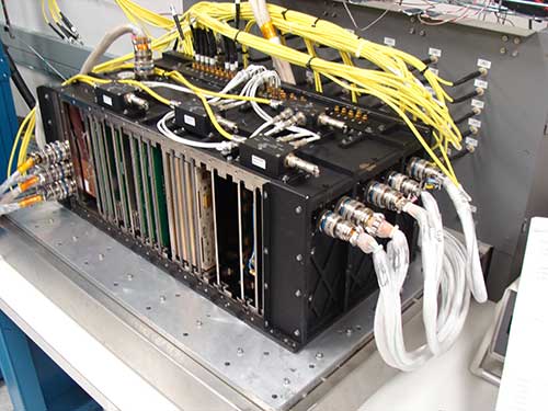
Raytheon has installed the first operational hardware for the GPS Next Generation Operational Control System, known as GPS OCX. The new ground command and control system will significantly modernize U.S. GPS capabilities and manage the next generation of GPS satellites. Installation of the Launch and Checkout System (LCS) hardware was completed in early July at Schriever Air Force Base in Colorado, the eventual home for the new GPS OCX Master Control Station.
“Installation of the initial OCX hardware at Schriever AFB represents a key milestone for the program, demonstrating further progress toward next year’s acceptance of the OCX Launch and Checkout System for the GPS III satellites,” said Matt Gilligan, vice president of Navigation and Environmental Solutions at Raytheon Intelligence, Information and Services. “Raytheon is committed to delivering a modernized, secure GPS ground system to support the millions of U.S. military, civil and commercial users of GPS worldwide,” added Gilligan.
GPS OCX will deliver a host of new capabilities, including automation for operational efficiencies, improved accuracy, interoperability with geo-positioning and navigation systems of other nations for better global coverage, and a cybersecurity architecture that provides unprecedented levels of protection. The Launch and Checkout System delivers a large subset of the full OCX ground system capabilities, and establishes the OCX cyber-hardened infrastructure for additional mission applications that will be added to complete the Block 1 capability.
U.S. warfighters use GPS services to support air, land, sea and space missions. GPS is also used by millions of people to enhance daily life activities, including personal navigation. It’s also required for industry and businesses and is essential to support safety-of-life missions for air traffic controllers and emergency responders. The modernized ground system will bring new capabilities and precision to the GPS enterprise.