Tag: Research Roundup

  • Precise positioning for autonomous vehicles

    Precise positioning for autonomous vehicles

    GNSS researchers presented hundreds of papers at the 2024 Institute of Navigation (ION) GNSS+ conference, which took place Sept. 16-20 in Baltimore. The following papers focus on high-accuracy positioning for autonomous vehicles in various environments. The papers are available here.

    High-accuracy and resilient GNSS receiver for autonomous vehicles

    The G3STAR GNSS receiver, a key component of the GAMMS Horizon 2020 project, is designed to improve high-definition navigation map production for autonomous vehicles. This Galileo-based receiver leverages the constellation’s Open Service features, including the High Accuracy Service (HAS) and Navigation Message Authentication (OSNMA). The research team shared that G3STAR’s ability to obtain and decode HAS messages from Galileo E6-B signals, as well as to process OSNMA bits from live Galileo E1-B I/NAV messages, demonstrates its advanced capabilities in providing secure and precise navigation data.

    Preliminary tests highlight G3STAR’s proficiency in utilizing Galileo’s new services. However, the research team shared that further evaluation is necessary to fully assess its impact within the GAMMS project. Plans include validating the HAS data’s effect on navigation accuracy, conducting field tests to evaluate OSNMA availability in various environments and assessing the influence of the Chip Scale Atomic Clock on receiver performance. Additionally, comparing the G3STAR’s performance to commercial off-the-shelf receivers will be crucial in determining its overall contribution to the GAMMS navigation system and HD map generation. These evaluations will be carried out during upcoming test campaigns, providing valuable insights into G3STAR’s potential to advance autonomous vehicle navigation.

    Filipe Carvalho, Ricardo Prata, Bruno Cardeira, Carlota Cardoso, Rui Nunes and António Fernández; “High-Accuracy and Resilient GNSS Receiver for an Autonomous Vehicle.”

    GNSS/INS positioning software library

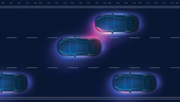
    The autonomous vehicle industry has seen significant interest and investment throughout the past 15 years, with numerous practical applications emerging in the market. However, the technology for functionally safe GNSS/INS localization in autonomous vehicles is still not fully established. This gap is particularly crucial in safety-critical applications, where positioning algorithms must be robust against potential faults, especially in challenging environments. This paper highlights Hexagon’s Safety-Critical Positioning Solution, which addresses this need by providing both precision and safety for autonomous land vehicles.

    The Positioning System is a safety-first software library that integrates GNSS signals, state space corrections from the TerraStar-X Enterprise service, inertial measurement units (IMUs) and additional vehicle sensors. This system employs an extension of Receiver Autonomous Integrity Monitoring techniques, originally developed for the aviation industry. It computes multiple navigation solutions using a solution separation technique, including an “all-in-view” solution and several subset solutions that exclude various fault hypotheses. These solutions are used to calculate Protection Levels (PLs), which provide an estimated upper bound on positioning errors, accounting for systematic biases and measurement faults. The PLs can be compared against alert limits to determine whether the navigation solution is sufficiently accurate for autonomous decision-making.

    Eduardo Infante, Rudi Gaum and Laura Norman; “Demonstration of a Functionally Safe GNSS/INS Positioning Software Library for Autonomous Land Vehicles.”

    Unmanned ground vehicles in off-road environments

    This paper explores the emerging potential of radar for localization in GNSS-denied scenarios, particularly in challenging off-road environments where lidar-based systems struggle. The research focuses on two distinct settings: a dense forest and an underground mine. To address the localization challenges in these environments, the team developed a pipeline that combines an adaptive extended Kalman filter (EKF) for unstructured forested regions with a factor graph approach that fuses EKF estimates and point-to-plane radar iterative closest point (ICP) measurements for structured underground environments. The results demonstrate significant improvements in localization accuracy compared to existing methods, with the adaptive EKF proving particularly effective in forested areas.

    The study provides valuable insights into the integration of radar and IMU data for vehicle localization in GPS-denied scenarios. While the adaptive EKF outperformed conventional EKF in structured outdoor settings, the standard EKF showed better performance in the highly dynamic conditions of the underground mine. The factor graph approach exhibited improved tracking performance, especially in reducing lateral drift along straight trajectory segments. The research also highlights the importance of selecting high-quality ICP registrations for radar-based SLAM. These findings pave the way for future research directions, including refining adaptive EKF for varied environments, exploring radar-based navigation on feature-sparse roads and enhancing the factor graph framework to incorporate additional sensor modalities.

    Petar Mitrev and Mohamed Atia, “Radar-Inertial Localization for Unmanned Ground Vehicles in GNSS-Denied Off-Road Environments.”

    Clock drift monitoring-based GNSS spoofing detection

    GNSS plays a vital role in autonomous systems, providing essential positioning, velocity and timing (PVT) information for platforms such as autonomous vehicles, UAVs and ships. However, GNSS vulnerability to spoofing attacks poses significant security risks, potentially disrupting decision-making processes in these systems. To address this issue, researchers have developed a novel approach called Clock Drift Monitoring (CDM) for detecting GNSS spoofing in autonomous vehicles. Unlike previous methods that focused on directly detecting Doppler bias from measurements, CDM indirectly monitors the adverse impact of Doppler bias on the PVT solution, overcoming challenges associated with bias extraction from raw measurements.

    The CDM technique exploits user clock drift derived from Doppler positioning as a detection metric. Under normal conditions with authentic GNSS signals, the clock drift remains stable, reflecting the user’s frequency source stability. However, spoofing conditions introduce counterfeit signals with consistent Doppler bias across all measurements, resulting in abnormal clock drift variations. A Generalized Likelihood Ratio Test-based detector identifies these variations, offering a practical and flexible method for GNSS spoofing detection. Field tests have validated the CDM technique’s effectiveness in real-world scenarios, demonstrating its robustness as a solution for autonomous vehicles to counter emerging cyber threats. This method’s ease of implementation, broader applicability and inherent robustness make it a promising approach for safeguarding autonomous systems against counterfeit GNSS signals.

    Ziheng Zhou, Hong Li, Yimin Deng and Mingquan Lu Tsinghua; “Clock Drift Monitoring Based GNSS Spoofing Detection Method for Autonomous Vehicles.”

  • Research roundup: Advancing space and lunar navigation

    Research roundup: Advancing space and lunar navigation

    SpacePNT and European Engineering and Consultancy (EECL) delivered the final presentation of the European Space Agency (ESA)-funded project, “Earth Moon GNSS Spaceborne Receiver for In-Orbit Demonstration.” This project aims to develop the NaviMoon GNSS receiver for lunar applications. (Photo: SpacePNT)
    SpacePNT and European Engineering and Consultancy (EECL) delivered the final presentation of the European Space Agency (ESA)-funded project, “Earth Moon GNSS Spaceborne Receiver for In-Orbit Demonstration.” This project aims to develop the NaviMoon GNSS receiver for lunar applications. (Photo: SpacePNT)

    GNSS researchers presented hundreds of papers at the 2024 Institute of Navigation (ION) GNSS+ conference, which took place Sept. 16-20 in Baltimore. The following papers focused on lunar and space applications. The papers are available here.

    Clock and Orbit Determination for LEO Satellites

    More than 50 years after the Apollo program, there is a growing interest in establishing a sustainable human presence on the moon, with various missions being planned in different lunar orbit regimes to support lunar exploration. To address the challenges of navigation in the lunar environment, researchers have proposed a technique leveraging time-differenced carrier-phase (TDCP) measurements from GPS satellites, which offer millimeter-level accuracy when integer ambiguities are correctly fixed.

    The proposed framework utilizes an extended Kalman filter that combines intermittently available terrestrial GPS TDCP values with gravitational accelerations predicted by an orbital filter. To handle the unique challenges of the lunar environment, such as weak gravity and strong third-body perturbations, the researchers implement an adaptive state noise compensation algorithm and introduce an augmented state vector to address time correlations across TDCP measurements. Through Monte Carlo simulations of lunar satellites in various orbits, the technique demonstrates improved positioning and onboard timing accuracy compared to pseudorange-only navigation solutions.

    Keidai Iiyama, Sriramya Bhamidipati and Grace Gao, “Precise Positioning and Timekeeping in a Lunar Orbit via Terrestrial GPS Time-Differenced Carrier-Phase Measurements.”

    Satellite Ephemeris Parameterization for Lunar Navigation

    This paper explores the development of satellite ephemeris parameterization methods for lunar navigation systems. As space agencies plan to establish satellite networks around the moon for communication and positioning, navigation and timing (PNT) services, the authors investigate optimal techniques for efficiently and accurately broadcasting satellite ephemeris data to lunar users. They propose a framework that directly approximates satellite position and velocity in the inertial frame, using signal-in-space-error requirements as constraints to guide the search for the best ephemeris parameter set.

    The study evaluates different methods based on ephemeris prediction precision, fit interval and message size. It demonstrates the framework’s ability to approximate satellite ephemeris for both low lunar orbits and elliptical lunar frozen orbits while meeting signal-in-space-error requirements. The research considers polynomial and Chebyshev basis types for surrogate models and evaluates performance based on precision and orbital coverage. By quantifying the broadcast message’s fit interval and size, the authors aim to guide the selection of optimal parameterization methodologies for lunar navigation systems.

    Marta Cortinovis, Keidai Iiyama and Grace Gao, “Open Access Satellite Ephemeris Parameterization Methods to Support Lunar Positioning, Navigation, and Timing Services.”

    Improving Navigation Accuracy in GEO

    The authors introduce a new approach to improving the accuracy of satellite position determination in geostationary equatorial orbit (GEO). They propose integrating a regional navigation satellite system (RNSS) with GNSS. Specifically, they suggest using RNSS signals, such as those from the Quasi-Zenith Satellite System (QZSS), to complement the signals provided by GNSS for GEO satellites.

    The research addresses the challenges faced by GEO satellites in using GNSS signals, including poor dilution of precision (DOP) and significant radial errors due to limited observability. By incorporating RNSS signals, the researchers aim to improve the diversity of signal directions and enhance navigation precision. The paper demonstrates the feasibility of receiving QZSS signals across a substantial range in GEO through link budget analyses. Two comprehensive simulations were conducted: a point solution and an extended Kalman filter-based orbit determination. The results confirm the anticipated improvement in navigation precision indicated by the DOP analysis.

    While RNSS signals can be received from any longitude in GEO, enhanced navigation precision depends on the distance between the satellite and the RNSS. The authors suggest that this concept can be adapted to various longitudes within GEO by selecting appropriate RNSS options and promoting stable, high-precision navigation.

    Yu Nakajima and Toru Yamamoto, “Enhancing Navigation Accuracy in a Geostationary Orbit by Utilizing a Regional Navigation Satellite System.”

    Integrating Orbit and Attitude Precision for CubeSat Positioning

    This research paper addresses ways to enhance CubeSat capabilities for demanding missions, particularly in low Earth orbiting positioning, navigation and timing (LEO-PNT) systems. The authors propose an array-aided combined precise orbit and attitude determination model that offers an optimal solution to improve orbital accuracy and provide reliable attitude information. By utilizing multi- and affine-constrained models for precise attitude determination and reconstructing highly precise observations for an antenna array, the method addresses the challenges of higher orbital accuracy and reliable attitude information required for advanced applications.

    The authors recorded significant improvements in orbital accuracy and attitude determination. Validation results show that reconstructed observations outperform original ones, leading to improved orbital components with a three-dimensional root mean square (RMS) of 4.1 cm. Additionally, observation residuals are smoother, with an RMS of 6 mm, half of that obtained via a single antenna. The results show a promising solution for enhancing CubeSat capabilities, particularly for applications requiring high-precision orbit and attitude information.

    Amir Allahvirdi-Zadeh and Ahmed El-Mowafy, “Array-Aided Precise Orbit and Attitude Determination of CubeSats using GNSS.”

  • Research roundup: Enhancing GNSS resilience

    Research roundup: Enhancing GNSS resilience

    GNSS researchers presented hundreds of papers at the 2023 Institute of Navigation (ION) GNSS+ conference, which took place Sept. 11-15, 2023, in Denver, Colo., and virtually.

    The following four papers focused on ways to combat GNSS jamming and spoofing. The papers are available here.

    GPS World will attend this year’s ION conference in Baltimore, Maryland on Sept. 16-20.


    Approximating Regional GNSS Interference Sources Using ADS-B Data

    Photo: zhanghaitao / iStock / Getty Images Plus / Getty Images
    Photo: zhanghaitao / iStock / Getty Images Plus / Getty Images

    The Automatic Dependent Surveillance-Broadcast (ADS-B) system, widely used for air traffic operations and management, also has potential applications in identifying, detecting and localizing (IDL) GNSS/RFI jamming sources in regions with high air traffic. With the rise in global GNSS interference reports, it is crucial to identify and eliminate jammers to ensure safe air travel operations.

    The Navigational Integrity Category (NIC) value included in the ADS-B message is a key indicator for detecting potential jamming from ADS-B data. Although NIC is not the most effective metric for interference detection, it can still signal the presence of jamming and offer a means to localize the source in real time.

    This research aims to approximate the area of GNSS/RFI interference by fitting a Euclidean Cone to ADS-B data that reports low NIC values. The problem is formulated as a convex optimization problem, derived from an alternative version of the maximum inscribed ellipsoid approach. By fitting an optimal cone to the data affected by interference, the cone’s apex indicates the estimated jamming location. The research team processed, decoded, interpolated and filtered ADS-B data to enhance localization accuracy.

    The proposed convex formulation was tested on two reported interference events: one near Denver International Airport in January 2022, for 36 hours, and another near the Dallas-Fort Worth area in October 2022, over roughly eight hours. In Denver, four estimated jamming locations, calculated from four six-hour time windows, were grouped between downtown Denver and the airport. In Dallas, three estimated jamming locations, determined from three one-hour windows, showed a tighter grouping on the southern side of the Dallas/Fort Worth area, indicating spoofing was nearby.

    Michael Dacus, Zixi Liu, Sherman Lo and Todd Walter, “Approximating Regional GNSS Interference Sources as a Convex Optimization Problem Using ADS-B Data.”

    Hybrid Autoencoder for Interference Detection

    Malfunctions or failures in GNSS services can result in significant personal, material, and financial damages. Early identification of anomalous behavior in GNSS signals can enable timely countermeasures. However, many interference monitoring or mitigation techniques are only feasible with high-end receivers and demand a certain level of expertise to be used effectively.

    This paper presents a GNSS interference monitoring approach employing machine learning methodologies for users of any expertise level and with any type of GNSS receiver capable of outputting raw GNSS observations. The research team used simple signal-to-noise ratio (SNR) observations and different hybrid autoencoder models, including denoising or variational autoencoder combined with recurrent neural network (RNN) models, which are trained and tested on real jamming and spoofing events. The developed monitoring system is represented by a “traffic lights” system, indicating the severity or level of concern associated with each detected anomaly.

    The results compare different RNN-based autoencoder implementations and have been tested on input data from high-end to low-end GNSS receivers. The analysis of the test set showed that there is a 95 percent probability of catching anomalies. Additionally, similar results were achieved when applied to other geodetic receiver types such as u-blox or JAVAD GNSS receivers. However, smartphone data is subject to some limitations. Notably, missed anomalies are primarily attributed to the low transmitting power from the jamming and spoofing devices, which poses challenges for detection.

    Karin Mascher, Stefan Laller and Philipp Berglez, “Hybrid Autoencoder for Interference Detection in Raw GNSS Observations.”

    A Tool to Monitor, Analyze and Record Navigation Signals

    Given the heavy reliance on GNSS for numerous critical applications, any disruption caused by intentional or unintentional RFI could pose significant threats to operations that depend on these systems, from transportation and logistics to emergency services and national security. Developing advanced countermeasures against RFI has become a priority to ensure the functionality and resilience of GNSS-dependent systems.

    This paper presents an architecture for real-time detection and classification of RFI affecting multi-band GNSS signals based on a machine learning method. The study proposes an architecture combining an actual GNSS monitoring station for recording GNSS signals — a Navigation Signals Monitoring, Analysis, and Recording Tool (N-SMART) system — with a deep neural network approach to detect and classify different classes of interferences.

    Researchers propose a novel architecture for real-time interference detection and classification of RFI, which can continuously monitor and record multi-band GNSS signals and provide timely warnings in case of RFI. The proposed architecture utilizes the N-SMART system to capture and store the GNSS signals, while detection and classification are implemented using a deep neural network technique. The core principle of the suggested method is to implement a convolutional neural network (CNN) classifier inside a Docker container, running on top of the N-SMART system.

    The results of the experimental test campaign on real interfered GNSS signals showed an overall accuracy of 85 percent, demonstrating the potential for effective, real-time classification of RFIs in GNSS. The research team explains that future work could focus on optimizing the model or exploring new architectures of CNN to improve accuracy and reduce task completion time across a variety of applications.

    Iman Ebrahimi Mehr, Alex Minetto and Fabio Dovis, “A Navigation Signals Monitoring, Analysis and Recording Tool: Application to Real-Time Interference Detection and Classification.”

    GNSS RFI Mitigation in Commercial Airborne Receivers

    Reports from air navigation service providers worldwide indicate that commercial airborne GNSS receivers are increasingly being subjected to jamming and spoofing attacks. Consequently, there is a growing need to ensure that the raw GNSS measurements provided to aircraft systems are not compromised by spoofing. Validating these measurements is critical to maintaining the integrity and reliability of navigation systems used in aviation.

    This paper focuses on two techniques under development by Collins Aerospace to be incorporated via a field-loadable software update to the Collins GLU-2100 multi-mode receiver to combat spoofing attacks. The first method, Receiver Autonomous Signal Authentication (RASA), uses the known characteristics of the GNSS receiver oscillator to detect whether the received signals are from a spoofer.

    A second technique, Staggered Examination of Non-Trusted Receiver Information (SENTRI), uses the inertial sensor data already available from the aircraft’s IRS/INS, to monitor the coherence between pure GNSS, pure inertial (INS) navigation solutions or tightly coupled inertial GNSS hybrid solutions without augmentation. SENTRI further allows the computation of position integrity levels (HPL and VPL) in the presence of GNSS spoofers. The paper will describe the overall RFI mitigation architecture that is implemented on the GLU-2100.

    RASA and SENTRI can be used together in a complementary fashion to detect the presence of spoofers reliably. It will also provide improved robustness to data spoofing attacks that induce errors in ephemeris, almanacs, GPS time jumps, etc., and will enable the GLU-2100 to coast through GNSS outages that are induced due to spoofing or jamming.

    Future technologies will use antenna techniques, signal analysis, DFMC signals and APNT to increase the robustness to new and evolving threats. The goal of this RFI mitigation roadmap is to continue to ensure that GNSS can be used safely and reliably in civil aviation.

    Angelo Joseph, Joseph Griggs, Patrick Bartolone, Bernard Schnaufer, Huan Phan, Vikram Malhotra, “GNSS Radio Frequency Interference Mitigation in Collins Commercial Airborne Receivers.”

  • Research roundup: Navigating urban environments

    Research roundup: Navigating urban environments

    GNSS researchers presented hundreds of papers at the 2023 Institute of Navigation (ION) GNSS+ conference, which took place Sept. 11-15, 2023, in Denver, Colorado, and virtually.

    The following four papers focused on ways to combat GNSS jamming and spoofing. The papers are available at bit.ly/3UMAS13.

    GPS World will be attending this year’s ION conference in Baltimore, Maryland on Sept. 16-20.


    Photo: flashfilm / The Image Bank / Getty Images
    Photo: flashfilm / The Image Bank / Getty Images

    Fault free integrity of urban driverless vehicles

    For positioning in urban environments, systems can be integrated with an inertial navigation system (INS) to help provide continuous navigation through GNSS signal outages. Besides GNSS, another approach for positioning in urban environments is feature-matching. For example, light detection and ranging (lidar) can measure distances and angles for environmental features, such as local landmarks, which can then be associated with known feature locations stored in an onboard database.

    This paper investigates how GNSS and INS, when augmented by lidar ranging from local landmarks, can offer safe navigation through a real-world urban environment under fault-free assumptions to achieve 100% availability of fault-free integrity, with requirements corresponding to maximum standard deviations between 0.05 m and
    0.1 m in both lateral and longitudinal directions. The team determined which system elements and parameters are the most critical to urban navigation performance, including individual INS noise parameter specifications, average vehicle speed, kinematic constraints, landmark density, integrity requirements and the effects of velocity updates.

    The team simulated GNSS availability along a 9 km urban transect in downtown Chicago. They considered multi-sensor integrated navigation architectures consisting of INS, ZUPT, GNSS, lidar, WSSs, and NHL and HL kinematic constraints to improve navigation availability. The simulation involved developed measurement models and a tightly coupled INS/multi-sensor integration scheme using an extended Kalman filter (EKF).

    The results revealed that the accelerometer and gyroscope random walks contribute to the total position error considerably more than the accelerometer and gyroscope drift for the driverless vehicle application, especially when the vehicle is moving at low speeds. Intentional vehicle stops with ZUPT inputs mitigate the error propagation but increase drive time. Velocity updates from WSSs can partially calibrate along-track position errors but do not completely reset the INS drifting position errors. Position reference updates are required to handle the concentrated succession of GNSS-denied conditions in the Chicago transect.

    Kana Nagai, Matthew Spenko, Ron Henderson and Boris Pervan;“Fault-free integrity of urban driverless vehicle navigation with multi-sensor integration: A case study in downtown Chicago.”

    3D vision-aided GNSS

    In this work, researchers aim to solve the major problem of GNSS/RTK positioning for autonomous systems through a deep exploration of the relationship between GNSS satellite measurements and visual landmarks in urban canyons. A 3D vision-aided method was proposed to improve GNSS real-time kinematic (RTK) positioning. The effectiveness was verified through several challenging data sets collected in urban canyons of Hong Kong using low-cost automobile-level GNSS receivers together with an automobile visual/inertial sensor suite.

    To mitigate the impact of reflected non-line-of-sight (NLOS) reception, a sky-pointing camera with a deep neural network was employed to exclude these measurements. However, NLOS exclusion results in distorted satellite geometry. To fill this gap, complementarity between the low-lying visual landmarks and the high-elevation satellite measurements was explored to improve the geometric constraints. Specifically, inertial measurement units (IMUs), visual landmarks captured by a forward-looking camera, and healthy GNSS measurements were tightly integrated to estimate the GNSS-RTK float solution. The integer ambiguities and the fixed GNSS-RTK solution were then resolved. The effectiveness of the proposed method was verified using several data sets collected in urban canyons in Hong Kong.

    The research indicated that GNSS-RTK promises potential solutions that may provide accurate, cost-effective, and drift-free positioning services for autonomous systems with specific navigation requirements. Unfortunately, the performance of the GNSS-RTK is significantly challenged in urban canyons due to the poor quality of GNSS measurements and satellite geometric distributions caused by signal blockage and reflections from surrounding buildings.

    Weisong Wen, Xiwei Bai, and Li-Ta Hsu; “3D vision aided GNSS real-time kinematic positioning for autonomous systems in urban canyons.”

    Low-cost inertial aids for GNSS

    The rise of connected and automated vehicles has created a need for robust globally referenced positioning with increasing accuracy. Carrier-phase differential GNSS (CDGNSS) — a real-time variant for mobile platforms commonly known as real-time kinematic (RTK) GNSS — is a centimeter-accurate positioning technique that differences a receiver’s GNSS observables with those from a nearby fixed reference station to eliminate most sources of measurement error.

    In this paper, researchers expand the navigation filter component of the CDGNSS system by tightly coupling with an inertial sensor and with vehicle dynamics constraints, and by incorporating measurements from multiple vehicle-mounted GNSS antennas. It also develops a novel robust estimation technique to mitigate the effects of multipath and allow for graceful recovery from incorrect integer fixes.

    The estimator was evaluated using the publicly available TEX-CUP urban positioning data set, yielding a 96.6% and 97.5% integer fix availability, and a 12 cm and 10 cm overall (fix and float) 95th-percentile horizontal positioning error with a consumer-grade and industrial-grade inertial sensor, respectively, over more than two hours of driving in the urban core of Austin, Texas.

    A performance sensitivity analysis showed that the false-fix detection and recovery scheme is key to achieving an acceptably low false integer fixing rate of 0.3% and 0.4%, respectively. Having a second vehicle-mounted GNSS antenna significantly increased integer-fix availability, decreased false-fix rate, and improved both root-mean-square and 95th-percentile positioning performance as compared to a single-baseline CDGNSS configuration.

    James E. Yoder and Todd E. Humphreys; “Low-cost inertial aiding for deep-urban tightly coupled multi-antenna precise GNSS.”

    Benchmarking urban navigation algorithms

    In this work, to facilitate the research and development of reliable and precise positioning methods using multiple sensors in urban canyons, the research team built a multisensory dataset, UrbanNav, collected in diverse, challenging urban scenarios in Hong Kong. The dataset provided multi-sensor data, including data from multi-frequency GNSS receivers, an IMU, multiple light detection and ranging (lidar) units and cameras.

    Meanwhile, the ground truth of the positioning — with centimeter-level accuracy — is postprocessed by commercial software from NovAtel using an integrated GNSS real-time kinematic and fiber optics gyroscope inertial system.

    Detailed presentations are provided for sensor systems, spatial and temporal calibration, data formats, and scenario descriptions. Also, the benchmark performance of several existing positioning methods is included as a baseline.

    Based on the evaluations, the team concluded that GNSS can provide satisfactory results in a middle-class urban canyon if an appropriate receiver and algorithms are applied. Both visual and lidar odometry are satisfactory in deep urban canyons, whereas tunnels are still a major challenge. Multisensory integration with the aid of an IMU is a promising solution for achieving seamless positioning in cities.

    Li-Ta Hsu, Feng Huang, Hoi-Fung Ng, Guohao Zhang, Yihan Zhong, Xiwei Bai, and Weisong Wen; “Hong Kong UrbanNav: An open-source multisensory dataset for benchmarking urban navigation algorithms.”

  • Applying Precise-Point Positioning

    Applying Precise-Point Positioning

    Photo: Abscent84/iStock/Getty Images Plus/Getty Images
    Photo: Abscent84/iStock/Getty Images Plus/Getty Images

    GNSS researchers presented hundreds of papers at the 2023 Institute of Navigation (ION) GNSS+ conference, which took place Sept. 11-15, 2023, in Denver, Colorado, and virtually. The following four papers focused on the use of precise-point positioning for various applications. The papers are available here.

    Smartphone Positioning Resiliency

    Ultra-low-cost GNSS receivers used in smartphones have several drawbacks that include insufficient observations and poor signal reception quality compared to higher-cost receivers. The authors of this article proposed that using native sensors and precise-point positioning (PPP) augmentation can offer resilient smartphone positioning.

    During their research, the authors deployed only inertial measurement unit (IMU) and GNSS sensors native to existing smartphones. They were able to achieve a standalone solution using PPP and IMU integration that performed better than standard techniques.

    In vehicle experiments with unobstructed sky, the sensor integration algorithm achieved 1.6 m horizontal RMS. This reduced 80% of horizontal errors in GNSS-challenged environments through a tightly coupled GNSS-PPP solution that has not appeared in any other publications according to the authors.

    To address resilient smartphone positioning, the authors stated that sensor fusion is also being explored by using smartphone sensors, including IMUs, cameras, and other fusion techniques.

    Yang, Yi, Vana, and Bisnath, “Resilient Smartphone Positioning Using Native Sensors and PPP Augmentation.”


    Multi-GNSS PPP and MEMS IMU Integration for Navigation in Urban Environments

    This paper addressed the issue of accurate, precise and continuous navigation in obstructed environments for vehicles. To provide a low-cost lane-level navigation solution for automotive applications, the authors proposed an integrated solution featuring low-cost GNSS PPP and MEMS-based IMUs.

    During the authors’ research, they introduced a low-cost, triple-frequency GNSS, a MEMS-based IMU and a patch antenna to achieve decimeter-level accuracy in suburban and urban environments. Low-cost hardware and software were used to bridge GNSS gaps in urban environments to provide a continuous, accurate, and reliable position solution that is novel and has not been previously published, according to the authors.

    The low-cost navigation system demonstrated an accuracy of less than a decimeter in the presence of a sufficient number of satellites. During half a minute of introduced GNSS signal loss, the overall RMS of the algorithm was 10% to 40% better than dual-frequency PPP with IMU as the satellite availability was reduced.

    The results obtained during partial GNSS availability indicated a step forward in the low-cost navigation area for applications such as low-cost autonomous vehicles, intelligent transportation systems, and more that demand a decimeter level of accuracy.

    Vana and Bisnath, “Low-Cost, Triple-Frequency, Multi-GNSS PPP and MEMS IMU Integration for Continuous Navigation in Simulated Urban Environments.”


    Message Authentication for PPP/PPP-RTK Data

    This paper analyzed candidate schemes for PPP/PPP-real-time kinematic (RTK) data authentication. As current PPP/PPP-RTK services are not authenticated, the motivations behind the authors’ research were the new availability of GNSS authentication services such as the Galileo Open Service Navigation Message Authentication (OSNMA), new PPP/PPP-RTK services such as QZSS Centimeter Level Augmentation Service (CLAS) and Galileo High Accuracy Service (HAS), and more.

    In this paper, asymmetric schemes were proposed based on existing standards and compatibility with GNSS messages. Post-quantum cryptographic signatures were also reviewed and discussed. Two of the schemes were selected for analysis: digital signature based on ECDSA, and delayed disclosure based on a hybrid scheme using the TESLA protocol.

    Each of the schemes was described in detail for both Galileo HAS and QZSS CLAS. The performance of the schemes in terms of time to receive the corrections message and the increase in the age of the data was analyzed. The analysis was complemented by a review of the CPU consumption at receiver level.

    Fernandez-Hernandez, Hirokawa, Rijmen, and Aikawa, “PPP/PPP-RTK Message Authentication.”


    Creating Consistent RVIM By Estimating Receiver Biases

    Ionospheric augmentation is one of the most important dependences of PPP-RTK. Due to the dispersive features of the ionosphere, the ionospheric information is usually coupled with satellite- and receiver-related biases. This could result in inconsistent ionospheric corrections if a different number of reference stations are involved in the calculation.

    In this paper, the authors aimed to introduce a consistent regional vertical ionospheric model (RVIM) by estimating receiver biases. First, they presented the inconsistent ionospheric corrections under sparse networks. Then the RVIM was compared with the International GNSS Service (IGS) final global ionospheric map (GIM) product, and the average of differences between them is 1.13 TECU.

    The slant ionospheric corrections were then employed as a reference to evaluate both RVIM and GIM. The RMS values were 1.48 and 2.23 TECU for the RVIM and GIM. Finally, the authors applied the RVIM into PPP-RTK.

    The results showed that the PPP-RTK with RVIM constraints improved horizontal errors, vertical errors, and convergence time by 43.45%, 29.3%, and 22.6% under the 68% confidence level, compared with conventional PPP-AR.

    Lyu, Xiang, Tang, Pei, Yu, and Truong, “A Consistent Regional Vertical Ionospheric Model and Application in PPP-RTK Under Sparse Networks.”

  • Research roundup: GNSS in urban canyons

    Research roundup: GNSS in urban canyons

    Image: Predrag Vuckovic/E+/Getty Images
    Image: Predrag Vuckovic/E+/Getty Images

    GNSS researchers presented hundreds of papers at the 2022 Institute of Navigation (ION) GNSS+ conference, which took place Sept. 19-23, 2022, in Denver, Colorado, and virtually. The following four papers focused on the use of GNSS in urban environments. The papers are available here.

    GPS World will be attending this year’s ION conference in Denver, Colorado, on Sept. 11-15.

    FGO-based GNSS/INS integration improves performance in urban canyons in Hong Kong

    The integration of GNSS and inertial navigation systems (INS) has the potential to improve performance due to their complementariness. In this paper, the authors investigated positioning based on the integration of GNSS and INS using factor graph optimization (FGO). This ultimately showed improved performance in urban canyons in Hong Kong. The effectiveness of the proposed method was verified using challenging datasets collected using two automobile-level GNSS receivers in the urban canyons of Hong Kong.

    For the experiment conducted in this paper, only the GNSS pseudorange measurement was utilized in the existing FGO-based GNSS/INS integration. The overall potential of the Doppler frequency and carrier-phase measurements has yet to be explored by the authors. To fill this gap, the authors proposed a tightly coupled GNSS/INS integration, using FGO, by exploiting the potential of diverse raw GNSS measurements. The GNSS pseudorange, Doppler frequency, and time-differenced carrier-phase measurements were integrated with the INS, using FGO.

    The authors believe the improved performance using FGO-based GNSS/INS integration positioning was due to the global optimization property and the increased measurement redundancy of FGO, compared with the method based on extended Kalman filtering.

    Weisong, Hsu; “Factor Graph Optimization for Tightly-Coupled GNSS Pseudorange/Doppler/Carrier Phase/INS Integration: Performance in Urban Canyons of Hong Kong.”

    3D mapping in urban environments aided by surround mask GNSS/lidar SLAM

    Automatic driving with coupled GNSS/INS and lidar sensors has been implemented in many urban environments successfully over the years. However, this technology is still prone to errors. These potential errors are especially evident in challenging environments, such as urban canyons with several moving objects and building layouts that provide unexpected and abnormal features for lidar sensors and multi-path for GNSS signals.

    To address these error challenges in urban environments, the authors of this paper proposed a surround mask that explores error sources from surrounding environments, which could subsequently improve the performance of an integrated mapping system. The surround mask in this experiment extracted a two-layer factor, including non-line-of-sight detection and static objects detection, to collectively compensate for the specific drawbacks of the lidar-based SLAM and the navigation system.

    The authors explain that the surround mask eliminated the need to apply complex post-processing to eliminate the accumulated error for each observing unit.

    The experimental results demonstrated that the proposed surround mask detected the represented error sources in the local coordinate and provided environment-awareness information for the integrated mapping system.

    Ai, Luo, El-Sheimy; “Surround Mask Aiding GNSS/LiDAR SLAM for 3D Mapping in the Dense Urban Environment.”

    Novel process noise model helps GNSS Kalman filter degradation in busy cities

    Improving the accuracy of GNSS positioning in urban environments is difficult, especially when using low-cost GNSS receivers. In this paper, the authors showed that if the process noise covariance is turned up in a “naïve” manner for poor satellite geometry, the estimation-error covariance could become unintentionally large in a certain direction.

    The unintentional inflation of estimation-error covariance could cause the degradation of accuracy. The authors also proposed a fictitious process noise covariance based on an extension of a novel process noise model, which was proposed in their previous work.

    The authors stated that in Kalman filter for GNSS positioning, the process noise covariance is often bumped up to avoid the filter divergence in the presence of unknown model errors, by assuming there is a fictitious process noise in addition to the nominal process noise. In this study, the fictitious noise covariance is determined based on the observation matrix, step-by-step, and it reduced the estimation errors without causing the unintentional inflation of estimation-error covariance.

    The effectiveness of the derived process noise model is demonstrated for the data sets that simulate GNSS signals from the antenna that moves from open sky areas to urban areas. The estimation errors with the derived process noise model were significantly reduced, compared to the ones with other two process noise models.

    Takayama, Yoji, Urakubo, Takateru, Tamaki, Hisashi; “Avoiding GNSS Kalman Filter Degradation in Urban Canyons with a Novel Process Noise Model.”

    3D lidar-aided GNSS RTK positioning for increased accuracy mapping in urban canyons

    The GNSS real-time kinematic (RTK) positioning technique has shown centimeter-level absolute results in open-sky areas; however, it can suffer from polluted GNSS measurements and poor satellite geometry in urban environments. This is due to the non-line-of-sight (NLOS) and multipath reception caused by signal blockage and reflection.

    In this paper, the authors stated that lidar sensors integrated with odometry systems that include an inertial measurement unit (IMU) provided a precise environment description and short-term accurate relative positioning capabilities that could be utilized for aiding GNSS-RTK to obtain better performance.

    While 3D lidar-aided GNSS RTK positioning methods detect the GNSS NLOS receptions via an incrementally built map and improve the satellite geometry using the low-lying virtual satellite from lidar features, the high-elevation angle NLOS receptions cannot be fully detected, and the multipath signals cannot be effectively mitigated.

    In response to this, the authors proposed a 3D lidar-aided GNSS RTK positioning method with iterated coarse to fine batch optimization by a global 3D NLOS exclusion aided by a point cloud map, which enables the detection of high-elevation angle NLOS receptions. Additionally, the authors proposed iterated batch optimization based on a devised, tightly coupled, factor graph that fully exploited the global consistency among the constraints of lidar, IMU and GNSS RTK to exclude potential multipath signals.

    The proposed method aimed to achieve lifelong accurate positioning performance in deeply urbanized areas. The effectiveness of the proposed method has been proved by the evaluation conducted on the author’s open-source challenging dataset, UrbanNav, which contains various sequences collected by automobile-level low-cost GNSS receivers in urban canyons of Hong Kong.

    Liu, Wen, Hsu; “3D LiDAR Aided GNSS Real-time Kinematic Positioning via Coarse-to-fine Batch Optimization for High Accuracy Mapping in Dense Urban Canyons.”

  • Research roundup: Autonomous applications in transportation

    Research roundup: Autonomous applications in transportation

    Image: gorodenkoff/iStock/Getty Images Plus/Getty Images
    Image: gorodenkoff/iStock/Getty Images Plus/Getty Images

    GNSS researchers presented hundreds of papers at the 2022 Institute of Navigation (ION) GNSS+ conference, which took place Sept. 19–23, 2022 in Denver, Colorado, and virtually. The following four papers focused on autonomous applications in transportation. The papers are available here.

    Addressing integrity monitoring of autonomous navigation

    There are critical issues for the integrity monitoring of autonomous navigation applications, which include an adequate uncertainty budget in the observation domain, redundancy for the determination of the navigational states, and the capability of fault detection and exclusion.

    Several aspects are addressed in the paper, including how to: determine interval bounds to handle GNSS multipath effects in urban environments, realize fault detection and exclusion based on constraint satisfaction and set membership, and improve the detector using weighting models.

    The authors of the paper aim to contribute to the alternative integrity approach based on interval and set representations for bounding and propagating system uncertainty. Simulated and real-world experiments are carried out to demonstrate the feasibility of the authors’ proposed methods.

    The authors note that statistical evaluation of integrity will not always suffice due to the presence of remaining systematic uncertainty, but state the alternative integrity approach will contribute to future autonomous navigation applications.

    Su, Jingyao; Schön, Steffen; “Advances in Deterministic Approaches for Bounding Uncertainty and Integrity Monitoring of Autonomous Navigation.”

    Estimation and reference systems in automation

    For a high level of automation, estimation is crucial, and to achieve a full and reliable navigation evaluation, a trustable reference system needs to be developed.

    Although the presence of a reference system and of an inertial measurement unit with GNSS through the multi-sensor fusion scheme was integrated, in GNSS-denied or challenging environment the navigation solution could not be accurately estimated and still needs to be fixed.

    The authors of the paper propose new strategies to better estimate the lidar-based position uncertainty and to update the reference system.

    The first strategy proposed involves determining the appropriate position error covariance matrix, based on the Hessian matrix and the scale of covariance obtained from a normal distribution transform (NDT) scan matching technique and the geometric dilution of precision computed from the distribution of point cloud segments in each scan.

    In the second strategy proposed in the paper, the updated reference system was post-processed according to the loosely coupled INS/GNSS/NDT integration scheme with a forward and backward smoothing process.
    The results of the proposed strategies indicated that the updated reference system provides more reliable navigation estimation compared to an existing reference system from commercial software and can be used for accurate evaluation of positioning, navigation and timing with automated vehicle applications.

    Srinara, Surachet; Chiu, Yu-Ting; “Adaptive Covariance Estimation of Lidar-Based Positioning Error for Multi-Sensor Fusion Scheme with Autonomous Vehicular Navigation System.”

    Evaluating TerraStar-X

    GNSS performance using typical, low-cost GNSS devices in vehicles is not enough to achieve the positioning and availability needed for lane-level accuracy on autonomous vehicles. The antenna and receiver hardware available in standard vehicles limits the position accuracy and convergence performance. These limitations make the positioning more susceptible to error sources such as receiver multipath, noise, carrier tracking and stability.

    GNSS correction services with additional design considerations and sophisticated algorithms are needed to work within the constraints of automotive-grade GNSS devices to achieve the performance required for lane-level positioning.

    TerraStar X technology from NovAtel enables these applications. It includes an orbit and clock determination system (OCDS), which produces a set of corrections, precise satellite orbits and clocks, and satellite-specific biases for individual signals augmented by the computation of additional regional corrections.

    The authors of the paper outline the design and performance of the combined OCDS and regional correction system. They demonstrate the performance of the TerraStar X technology across a variety of applications.
    The addition of regional corrections enables automotive and mass-market applications to achieve in-lane positioning in seconds, using any dual-frequency, dual-constellation GNSS hardware. The result is software that provides a continuous stream of multi-constellation, multi-frequency GNSS corrections — enabling a correction service that makes the affordable GNSS device ecosystem possible.

    Regional corrections also improve the performance of survey-grade GNSS receivers.

    Mervart, Leos; Lukes, Zdenek; Alves, Paul; “TerraStar X Technology: Design of GNSS Corrections for Instantaneous Lane-Level Accuracy on Large Scale Connected Vehicles and Devices.”

    Solving the localization problem in autonomous driving

    The localization problem in autonomous driving imposes two criteria on the navigation solution: accuracy and reliability or integrity. According to the authors of this paper, solving the localization problem is a key requirement to enabling the development of autonomous platforms.

    This paper presents AUTO, a real-time integrated navigation system that tightly integrates INS, GNSS-RTK, odometer, and multiple radars sensors with high-definition maps to achieve a high-rate, accurate, continuous, and reliable navigation solution. It also shows how AUTO leverages a tight integration of imaging radars with other traditional sensors to provide a robust navigation solution with corresponding estimates of the uncertainty.

    The AUTO solution was tested in a variety of environments and locations, including a range of conditions such as winter weather, to assure the robustness and reliability required by autonomous applications.

    The results demonstrate the lane level accuracy of the solution in a variety of challenging urban and downtown environments. Additionally, the tight integration enables the determination of protection levels to describe upper bounds on the uncertainty.

    The results in the paper are illustrated using a Stanford Diagram, along with a user-defined alert limit to describe the solution integrity and availability. The proposed algorithm uses a map matching technique between the imaging radar data and a globally referenced high-definition map to better estimate the solution uncertainty and protection levels.

    AUTO’s tightly integrated approach to integrity monitoring means uncertainties and protection levels can be determined even in areas where the system may experience extended periods of GNSS unavailability.

    Krupity, Dylan; Chan, Billy; Ali, Abdelrahman; Salib, Abanob; Georgy, Jacques; Goodall, Christopher; “Integrity Monitoring and Uncertainty Estimation with AUTO’s Non-linear Integration of Multiple Imaging Radars and INS/GNSS for Autonomous Vehicles and Robots.”

  • Research roundup: Space and lunar applications

    Research roundup: Space and lunar applications

    The Moonlight initiative will provide sustainable lunar data-relay services for communication and navigation around the Moon. (ESA Moonlight Study conceptual drawing.) (Image: SSTL/Airbus/ESA)
    The Moonlight initiative will provide sustainable lunar data-relay services for communication and navigation around the Moon. (ESA Moonlight Study conceptual drawing.) (Image: SSTL/Airbus/ESA)

    GNSS researchers presented hundreds of papers at the 2022 Institute of Navigation (ION) GNSS+ conference, which took place Sept. 19–23 in Denver, Colorado, and virtually. The following five papers focused on lunar and space applications. The papers are available now.

    MTO Navigation Using Lunar Signals

    The moon transfer orbit (MTO) is becoming increasingly important as several national space agencies are planning moon exploration soon, with projects such as NASA’s Artemis. In previous research, the GPS navigation accuracy on the MTO reached 200 m at the moon altitude by using GPS signals emitted from the far side of Earth. As accuracy on a low-Earth orbit (LEO) using GPS is a few meters, 200 m accuracy is not accurate enough to support lunar exploration. The deterioration of accuracy is due to the poor geometry of the GPS satellites that became visible from the MTO.

    The authors want to achieve an accuracy of less than 100 m in MTO by using other navigation sources, including the lunar navigation satellite system (LNSS) to be deployed in the moon’s orbit. The LNSS signals will come from the far side of the moon, similar to the signals of GPS satellites coming from the opposite side of Earth. Its satellites will be pointed towards the moon to provide positioning, navigation and timing services on the moon surface, especially at the lunar South Pole region

    The researchers have been conducting the simulation evaluation for the MTO navigation accuracy using signals coming from the moon and assume that these signals will be emitted from beacons on the moon surface or the LNSS.

    Murata, Masaya; Kogure, Satoshi; “Moon Transfer Orbit Navigation Using Signals Coming from the Moon.”

    Designing the Smallsat-Based LNCSS

    There is growing interest in the use of a smallsat platform for the future lunar navigation and communication satellite system (LNCSS); however, many design considerations are not finalized for the smallsat-based LNCSS, such as choice of the satellite clock, satellite orbital parameters and the constellation size.
    Using the Systems Tool Kit simulation software, the authors examined various LNCSS constellation case studies based in elliptical lunar frozen orbit and with a low-grade chip-scale atomic clock.

    They evaluated case studies of navigation design considerations including position and timing accuracy, lunar user equivalent ranging error, and dilution of precision. As for case studies of communications design considerations, the authors examined daily data volume, availability and data rate. Finally, they examined smallsat factors including the cost, size, weight and power of the satellite payload.

    The paper includes trade-off analysis in satisfying the preliminary design criteria outlined by international space agencies and commercial space companies.

    Bhamidipati, Sriramya; Mina, Tara; Sanchez, Alana; Gao, Grace; “A Lunar Navigation and Communication Satellite System with Earth-GPS Time Transfer: Design and Performance Considerations.”

    Developing an SDR for Space

    A geostationary satellite (GEO) equipped with the satellite-based augmentation system (SBAS) function has a transmitter for GNSS correction signals at the L1 and L5 bands. This transmitter could interfere with the GNSS space service volume (SSV) receiver in the same satellite, so L1 and L5 signals cannot be used for the GEO SBAS satellite. However, the use of GPS L2C signals can be an alternative.

    The authors of this paper present the development of a GPS L2C signal generator for the SSV in GEO simulation. They present the simulation process for GEO satellites and the structure of the GPS L2C signal generator.

    In this study, a verification through the receiver test with a GNSS software-defined receiver is included to show the possibility of the designed signal simulator. The validation is performed by analyzing the programmable system device, the results of the acquisition, code/carrier tracking, and the C/N0 estimation.

    Lee, Hak-beom; Choi, ByeongHyun; Song, Young-Jin; Won, Jong-Hoon; Kwon, Ki-Ho; “Development of GPS L2C Signal Generator for SSV in Geostationary Orbit Simulation.”

    Differential Positioning on the Moon

    This paper introduces a new concept of delivering the pseudorange correction calculated at a reference station on the lunar surface, as a part of the lunar navigation satellite system (LNSS) navigation message. The concept enables LNSS users to apply differential positioning using pseudorange correction without adding new hardware to their receivers.

    The authors propose the differential positioning technique to reduce the signal-in-space range error of LNSS satellites and the coordinate transformation errors from Earth-centered fixed frame to lunar reference frame — the dominant errors in satellite positioning by LNSS.

    The proposed reference station is equipped with instruments to externally estimate its own position relative to the lunar reference frame. The user on the lunar surface would then perform differential positioning using the station coordinate and pseudorange correction obtained at the reference station.
    In this study, the simulation results using eight elliptical lunar frozen orbit satellites show that the real-mean-squared values for both horizontal and vertical positioning errors with differential correction are reduced to 1/10 of those without differential correction, even at 10 degrees latitude from the reference station at the lunar South Pole.

    Akiyama, Kyohei; Murata, Masaya; Kogure, Satoshi; “Differential Positioning Performance on Lunar South Pole Region Using Lunar Navigation Satellite System.”

    GEO Precise Orbit Determination

    Using GPS in satellites in geostationary (GEO) orbits provides advantages by improving position, velocity and timing data, reducing operating costs and providing autonomous orbit control for station keeping. This paper presents the result of the onboard data evaluation and precise orbit determination of an optical data-relay satellite (ODRS) using GPS L1 C/A code and carrier-phase observations for 74 days.

    As a result of precise orbit determination, the authors found that both code- and carrier-phase observations are affected by the ionospheric delay when signals pass through the plasmasphere located above the ionosphere.

    Several methods were implemented during this research to reduce the effect of the plasmasphere, including setting a higher cut-off altitude, applying correction sequences generated from orbit determination residuals, and applying a new observation noise model depending on the GPS off-nadir angle. Results show that the correction sequences and the new noise model improve the internal orbit consistency. The authors also found that the orbit bias in radial direction due to negatively biased carrier-phase observations is mitigated from –51 cm to –17 cm by setting a higher cut-off altitude and applying correction sequences.

    Matsumoto, Takehiro; Sakamoto, Takushi; Yoshikawa, Kazuhiro; Kasho, Sachiyo; Nakajima, Ayano; Nakamura, Shinichi; “GEO Precise Orbit Determination Using Onboard GPS Carrier Phase Observations of Optical Data Relay Satellite.”

  • Research Roundup: Mitigating GNSS interference

    Research Roundup: Mitigating GNSS interference

    Photo: traveler1116/iStock/Getty Images Plus/Getty Images
    Photo: traveler1116/iStock/Getty Images Plus/Getty Images

    GNSS researchers are presenting hundreds of papers at the 2022 Institute of Navigation (ION) GNSS+ conference, taking place Sept. 19–23 in Denver, Colorado, and virtually. The following five papers focus on GNSS receiver technology and interference mitigation. The papers will be available at www.ion.org/publications/browse.cfm.


    FINDING INTERFERENCE WITH ADS-B

    Conference Presentation: Sept. 23, 1:50 p.m.; Session F6

    The growing dependence of critical and safety-of-life systems on GNSS makes the ability to rapidly detect and localize the presence of GNSS interference events increasingly important. Ground-based GNSS jammer detection can be used to detect local interference sources. However, this approach is limited by line of sight, hence applying it to large areas is costly in both time and money.

    A complementary technique is to use the airborne GNSS receiver data provided by Automatic Dependent Surveillance—Broadcast (ADS-B). As these receivers are at altitude, their lines of sight can cover a wide area. The drawback is that ADS-B was not designed for this purpose, and the messages contain limited information for the assessment of interference.

    The authors have developed and will demonstrate an algorithm for real-time detection and localization of GNSS interference sources using ADS-B transmissions on the 1090 MHz (Mode S ES) radio frequency channel. They demonstrate this capability using recorded ADS-B transmissions from known interference events.

    Zixi Liu, Sherman Lo, Todd Walter, Juan Blanch, Stanford University; “Real-time Detection and Localization of GNSS Interference Source.”


    TESTING A GNSS MONITORING SYSTEM

    Conference Presentation: Sept. 23, 4:04 p.m.; Session F6

    Even interference at low levels can be catastrophic to systems that depend on GNSS. It can prevent GNSS signals from reaching the user (interference or jamming) or give false signals, resulting in an incorrect position and time solution (spoofing). The capability to confidently detect and localize interference quickly could help mitigate this threat. Furthermore, if the system could also provide information characterizing the interference, it could help law enforcement not only interdict, but also prosecute the threat.

    Building a consumer-level commercial-off-the-shelf (COTS) GNSS monitor would also make it cost effective for widespread utilization. This paper describes the development and field testing of a system to provide this capability.
    The monitor uses the u-blox F9, an inexpensive commercial receiver offering multi-constellation and dual-frequency position and time solutions, as well as powerful interference-detection metrics. Initial analysis of the receiver’s measurement capabilities determined that it provides many features useful for assessing the operational environment across a geographical region. Performance and output of the receiver is characterized under different jamming and spoofing scenarios.

    Different receivers and antennas may react differently based on both hardware and software configurations and offer the user varying interference rejection techniques and detection metrics. As a result, it is important to gain a good understanding of the receiver’s behavior. Another way to test behavior is to examine its performance in nominal conditions in various scenarios and locations, as presented in this paper.

    Benon Gattis, Dennis Akos, University of Colorado Boulder; Yu-Hsuan Chen, Sherman Lo, Todd Walter, Stanford University; “Test and Measurements from a Global Navigation Satellite System (GNSS) Monitoring System.”


    GEOLOCATING INTERFERENCE WITH SMARTPHONES

    Conference Presentation: Virtual; Session F6

    With the availability of RAW GNSS measurements on Android smartphones, detecting GNSS interference using modern handsets has become a realistic crowdsourcing possibility, especially with the inclusion of automatic gain control (AGC) in Android 8 (Oreo).

    While crowdsourcing jamming detection — and knowing whether your smartphone is subject to jamming or spoofing  — is valuable, locating the interference source may be even more important. This work explores the feasibility of crowdsourcing interference source localization with modern Android smartphones.

    The work has three goals:

    • To examine localization of a civilian-type GPS L1 jammer using a network of smartphones
    • To investigate how best to approach current obstacles regarding such localization
    • To estimate how accurate this type of positioning can be.

    An important part of this work is to investigate differences in GNSS data reported by various Android smartphones. The smartphones in this study were specifically selected by the manufacturer of the GNSS chipset to enable the authors to examine how their GNSS receivers perform under the same circumstances. Three parameters were specifically investigated as measures of received jamming power: carrier-to-noise ratio (C/N0), AGC and the number of tracked satellites.

    The selected smartphones were put through a series of tests to examine how these three parameters vary with changing conditions. These tests include subjecting the smartphones to an actual jammer in a controlled lab setup and an investigation of the impact of smartphone (GNSS antenna) position and orientation on C/N0 and AGC. Using the data collected in these tests, several interference geolocation strategies will be discussed.

    The authors also consider whether interference localization from consumer-off-the-shelf (COTS) smartphones is currently accurate enough for this use. The shortcomings of smartphone GNSS hardware may be resolved using more clever positioning strategies such as using a larger number of handsets. Alternatively, it may require upgraded hardware and standardization.

    Søren Skaarup Larsen, Daniel Haugård Olesen, Anna B. O. Jensen, Lars Stenseng, Technical University of Denmark, DTU Space; “Assessment of RFI Geolocation Using Modern Android Smartphones.”


    MITIGATING MULTIPATH IN AN L5 CHANNEL

    Conference Presentation: Sep. 21, 4 p.m.; Session F2

    Multipath mitigation with machine learning relies on offline training with an exhaustive number of labeled observations. Current super-resolution correlation methods, which include MUltiple SIgnal Classification (MUSIC), operate online by testing and choosing from a high number of candidate signal hypotheses.

    A new method of MUSIC is presented that reduces numerical complexity and is applied to processing L5 correlation vectors to reduce multipath by identifying the earliest path. The rank of this estimator is examined in static and dynamic conditions in various signal environments. Higher rank allows more signal paths to be identified.

    This method is also complementary with various L5 signal-tracking methods such as open- and closed-loop tracking.

    Paul McBurney, Norman Krasner, Florean Curticapean, Miguel Ribot, Mahdi Maaref and Lionel Garin, OneNav; “Application of Super Resolution Correlation to Multipath Mitigation in an L5 Channel.”


    USING A VIRTUAL ANTENNA ARRAY

    Conference Presentation: Sep. 22, 11:03 a.m.: Session F3

    One of the simplest ways to increase GNSS anti-jamming and anti-spoofing (AJ/AS) performance is increasing the number of controlled reception pattern antenna (CRPA) array elements. However, this increases the size, cost, complexity and required processing power of the overall system. To counter this constraint, the researchers applied a new development in antenna hardware design to GNSS threat mitigation techniques. This resulted in better CRPA performance without increasing the footprint. The work improves AJ/AS performance without adding additional elements, and serves as proof of concept of the application of an adaptively spaced virtual array created with multimodal elements to GNSS AJ/AS.

    New breakthroughs in antenna-array research extend the case of non-uniform excitation of elements to the elements’ individual positions. By using multimodal antennas as elements, it has been shown that elements’ phase centers, or perceived locations, can be adjusted with purely electronic means. When applied to each element in an antenna array, this realizes a reconfigurable array.

    This research extends the concept of a virtual array with adaptive inter-element spacing into GNSS AJ/AJ methods. A new way to integrate a virtual array into a GNSS application is explored and incorporated into current space-time adaptive processing (STAP) algorithms.

    Gabriel Wiggins and Scott Martin, Auburn University; “Applications of a Virtual Antenna Array to GNSS Threat Mitigation: First Results.”

  • Research Roundup: Lunar GNSS applications

    Research Roundup: Lunar GNSS applications

    Artist's rendering of the Lunar Pathfinder. (Image: SSTL)
    Artist’s impression of the Lunar Pathfinder satellite built by Surrey Satellite Technology Ltd. (SSTL) that will provide communications and navigation services for the Moon.

    NASA and its international partners are planning a return to our natural satellite. The following three papers — presented at the Institute of Navigation (ION) GNSS+ conference Sept. 20–24, 2021 — discuss the role of GNSS in lunar exploration. The full papers are available at www.ion.org/publications/browse.cfm.

    Using GPS for Time Transfer

    NASA and the European Space Agency have conceptualized the initial framework for a GPS-like constellation for the Moon, which will ensure uninterrupted navigation and communication services for future lunar missions. The authors designed a smallsat-based Lunar Navigation Satellite System (LNSS) with time-transfer from Earth-GPS to alleviate the size, weight and power (SWaP) and timing stability requirements of the onboard clocks. A timing filter corrects the lower grade clock when Earth-GPS signals are available and propagates these clock estimates forward in time when no Earth-GPS signals are available. The authors analyzed their proposed time-transfer technique using high-fidelity simulations of an LNSS satellite with an onboard chip-scale atomic clock for three cases of elliptical lunar frozen orbits.

    Bhamidipati, Sriramya, Mina, Tara, Gao, Grace, “Design Considerations of a Lunar Navigation Satellite System with Time-Transfer from Earth-GPS,” https://doi.org/10.33012/2021.18021

    GNSS Nav for Moon Missions

    The authors show the potential of autonomous GNSS signal-based navigation for a set of Moon scenarios. This technology could be a game changer for the future of lunar exploration, representing an extremely low cost and effective alternative for Moon navigation. Results show that not only autonomous GNSS navigation for lunar orbiters is possible, but it also delivers good navigation performance. In fact, navigation with root-mean-square (RMS) errors on the order of 50–100 meters were obtained for scenarios of high interest, such as for the planned Lunar Pathfinder and near-rectilinear halo orbit of the Lunar Gateway space station around the Moon.

    Mangialardo, Marco, Jurado, María Manzano, Hagan, David, Giordano, Pietro, Ventura-Traveset, Javier, “The full Potential of an Autonomous GNSS Signalbased Navigation System for Moon Missions,” https://doi.org/10.33012/2021.18040

    Finding the best lunar orbit

    A continuous and reliable lunar positioning and timing system, such as a GNSS-like constellation, is considered essential infrastructure for lunar exploration. The authors focus on halo orbits with the aim of defining an optimal halo constellation for supporting and delivering a navigation service on the Moon. This paper shows the performance of a GNSS-like constellation deployed in Halo orbits around Earth-Moon L1 and L2 collinear libration points. Different phases have been considered, from a minimum number of satellites able to provide a local PNT service on the South Pole (Initial Operational Capability), to a final, extended constellation able to cover the whole lunar surface (Final Operational Capability).

    Musacchio, Daniele, Iess, Luciano, Carosi, Mattia, Capolicchio, Jacopo, Eleuteri, Massimo, Stallo, Cosimo, Di Lauro, Carmine, “Design of Earth Moon Halo Orbits for a Global Lunar PNT Service,” https://doi.org/10.33012/2021.18020

  • Research Roundup: Combatting jamming and spoofing

    Research Roundup: Combatting jamming and spoofing

    Image: MF3d/E+/Getty Images
    Image: MF3d/E+/Getty Images

    Of the hundreds of papers researchers presented at 2020’s annual Institute of Navigation (ION) GNSS+ conference, which took place virtually Sept. 21–25, the following six focused on combating jamming and spoofing. The papers are available at www.ion.org/publications/browse.cfm.

    Using Direction of Arrival

    The author presents a scheme to combine multiple measurements for GNSS spoof detection for safety-of-life applications. The author’s algorithm combines both independent and correlated direction of arrival measurements that result in an analytic solution for the detection threshold, which can be computed online by the receiver. The scheme is validated for correlated azimuth measurements with data recorded by a dual-polarization antenna mounted on a C12 aircraft in flight, and applied to data from a live spoofing event. Results show an increase in detections of 47% using just two sequential measurements, with equal robustness for false alerts compared to snapshot-based detection. The results also show using sequential spoof detection is a powerful way to improve the detection capability of an anti-spoof defense, costing only added computational complexity while introducing a timely component to the detection.

    Citation. Rothmaier, Fabian; “Optimal Sequential Spoof Detection Based on Direction of Arrival Measurements.” https://doi.org/10.33012/2020.17538

    Using Neural Networks

    Spoofing attacks are difficult to model and counteract. Data-driven schemes become useful if enough training data is available. This article explores such an approach using the cross-ambiguity function delay/Doppler map as input to a deep neural network for classification purposes. Several neural network models are trained, and their performance compared for detection and false-alarm probabilities. Results are promising, particularly with more complex neural networks, which are able to capture the nature of spoofing attacks. The method operates on a per-satellite basis.

    Citation. Borhani-Darian, Parisa; Li, Haoqing; Wu, Peng; Closas, Pau; “Deep Neural Network Approach to Detect GNSS Spoofing Attacks.” https://doi.org/10.33012/2020.17537

    Using Networks for Timing

    Information cross-validation can be a powerful tool to detect manipulated, dubious GNSS timing data. Opportunistic time providers, Wi-Fi beacons and dedicated timing infrastructures provide largely available, precise sources of time information. A promising approach is to leverage time obtained over networks to which a mobile device can connect, and detect discrepancies between the GNSS-provided time and the network time. The paper investigates different options to secure augmentation time information, notably Network Time Security (NTS) and modified Wi-Fi beacons to support authentication. This scheme requires limited overhead, does not disrupt the normal operation of the Wi-Fi access points, and can be readily deployed.

    Citation. Spanghero, Marco; Zhang, Kewei; Papadimitratos, Panagiotis; “Authenticated Time for Detecting GNSS Attacks.”

    Using Cooperative Positioning

    This paper highlights possible metrics to be checked to identify malicious attacks to the positioning and navigation systems in mass-market connected devices. The network-based exchange of GNSS data — such as GNSS raw measurements recently disclosed in Android smart devices — could offer the possibility to compare or combine such metrics to better identify spoofing and meaconing attacks.

    This paper provides experimental tests and analysis toward devising an anti-spoofing strategy in connected GNSS devices. Included are a classical spoofing approach (simplistic RF attack) and its effects on the raw GNSS observables. With two synchronized devices in a cooperative framework, possible metrics are highlighted to identify a spoofing attack to one of the devices by observing anomalies.

    Also included is work on simulated meaconing of an already-developed collaborative positioning framework based on the exchange of raw GNSS measurements through the network. The different approaches of an attack to the framework are laid down, and the anomalies to be considered to detect an attack in a network of cooperating devices are presented.

    This paper represents a part of a larger goal to develop an anti-spoofing detection and coping mechanism in connected commercial GNSS devices.

    Citation. Rustamov, Akmal; Gogoi, Neil; Minetto, Alex; Dovis, Fabio; “GNSS Anti-Spoofing Defense Based on Cooperative Positioning.”

    Using OSNMA in the GIANO GNSS receiver

    In recent years, the awareness about jamming and spoofing risks has been increasing, particularly in the timing community because they may cause the disruption of critical services and infrastructures in the telecommunication, energy and finance sectors, which rely on GNSS timing to operate. To overcome these hazards, the European GNSS Agency (GSA) has funded the development of timing receivers for professional applications, with the aim to address specifically the above vulnerabilities, improving the receiver’s robustness and the accuracy and reliability of time transfer.

    In this context, the GIANO (Galileo-based timing receiver for critical infrastructures robustness) project consortium, coordinated by Thales Alenia Space Italy and with the support of Deimos Engenharia S.A. (Portugal), the Space Research Centre PAS in Poznan (Poland), Piktime System SP. Zoo (Poland) and Business Integration Partner S.p.A. (Italy), has been awarded a contract in the framework of the GSA’s “Fundamental Elements” program to develop a timing receiver for critical infrastructure applications. Besides the implementation of some interference and spoofing detection and mitigation techniques, the GIANO receiver makes use of Galileo’s authentication service OSNMA (Open Service Navigation Message Authentication), which can be employed as an added defense against some types of spoofing.

    OSNMA exploits the TESLA (Time Efficient Stream Loss-tolerant Authentication) scheme, which is a protocol based on the transmission of message authentication codes generated with a key broadcast with some delay. The receiver authenticates the satellite messages through a digital signature algorithm and a public key known by the receivers, which also validates the root key of the TESLA chain, and through message authentication codes (MAC) used to authenticate specific fields of the navigation message. The receiver will also support public key renewals over the air.

    This paper presents the OSNMA implementation within GIANO receiver, including the cryptographic operations required. The GIANO OSNMA capability will be extensively tested and validated with the support of the European Commission Joint Research Centre (Ispra, Italy).

    Citation. Catalano, Valeria; Prata, Ricardo; Carvalho, Filipe; Nunes, Rui; Marradi, Livio; Franzoni, Gianluca; Puccitelli, Marco; Campana, Roberto; Gioia, Ciro; “Galileo OSNMA Preliminary Implementation in the GIANO GNSS Receiver.” https://doi.org/10.33012/2020.17714

    Using Chimera Authentication

    Chimera is a signal authentication enhancement suitable for protecting the L1C GPS signal. As specified by the acronym itself (chips-message robust authentication), Chimera is based on the insertion of authentication features both at the message and spreading code levels. The data are digitally signed, while the spreading code is protected by the insertion of cryptographically generated punctures.

    The Chimera interface specification document was made public in 2019, while its first transmission is expected to be broadcast from the Navigation Technology Satellite 3 (NTS-3) satellite, set for launch in 2023.

    This paper describes the software implementation of the functions required to enable a GNSS software receiver to elaborate the Chimera authentication service. It includes a description of the development work and a detailed software profiling analysis, allowing for evaluation of the additional computational burden required by the Chimera verification and useful for providing important guidelines for receiver implementation.

    Citation. Gamba, Micaela Troglia; Nicola, Mario; Motella, Beatrice; “GPS Chimera: A Software Profiling Analysis.” https://doi.org/10.33012/2020.17717

  • GPS data help warn of rare tsunamis

    GPS data help warn of rare tsunamis

    Using data from GPS receivers and seismographs, three seismologists may have found a way to identify tsunami earthquakes in time to warn people

    A few times a century, a medium-sized earthquake causes a large and devastating tsunami. The most recent occurrence was in 2010, when a magnitude 7.8 earthquake off the Mentawai Islands in Indonesia set off a tsunami that was more than 50 feet high in some places, killing 509 people and displacing 15,000.

    While rare, these tsunami earthquakes are particularly dangerous because they can hit coastal communities within five to 15 minutes, before officials can issue a warning. Now, however, using data from GPS receivers and seismographs near the 2010 Mentawai event, three seismologists — Valerie Sahakian and Diego Melgar at the University of Oregon and Muzli Muzli at the Earth Observatory of Singapore — may have found a way to identify tsunami earthquakes in time to warn people.

    Very large earthquakes under an ocean break both the deeper part of a subduction zone, where one tectonic plate is sinking beneath another, as well as its shallow part, in a rapid motion that creates a tsunami. Tsunami earthquakes, on the other hand, happen almost entirely in the soft, weak section of a fault, moving slower and creating much more movement on or near the sea floor compared to earthquakes of the same size that happen in rigid rock. This creates much larger tsunamis than expected. A tsunami earthquake might have the same magnitude as an earthquake that occurs in rigid rock but produces much less of what seismologists call high-frequency energy.

    Currently, officials issue tsunami warnings within tens of minutes of detecting an earthquake above a certain magnitude within a certain distance of a coastal area. This method, however, fails in the case of tsunami earthquakes, which produce tsunamis that are disproportionate to their magnitude.

    Indian Ocean (Jan. 2, 2005): A village near the coast of Sumatra lays in ruin after the Tsunami that struck South East Asia. (Photo: U.S. Navy/Photographer's Mate 2nd Class Philip A. McDaniel)
    Indian Ocean (Jan. 2, 2005): A village near the coast of Sumatra lays in ruin after a tsunami struck South East Asia. (Photo: U.S. Navy/Photographer’s Mate 2nd Class Philip A. McDaniel)

    Traditionally, scientists have detected tsunami earthquakes by comparing their seismic magnitude with the amount of high-frequency energy they radiate, both recorded by distant stations. Tsunami earthquakes have a very low ratio of energy to magnitude; their energy, instead of strong shaking, produces a large slow movement of the seafloor.

    In the past, scientists had to measure this ratio using seismic waves that had traveled from the earthquake’s epicenter to seismographs hundreds or thousands of miles away. This did not give them enough time to identify tsunami earthquakes and warn people before the tsunami’s wave hit the coast.

    The recent analysis, however, enabled scientists to figure out a faster way to identify these rare tsunami earthquakes by using two proxies:

    • data from seismic stations onshore near the epicenters of 16 earthquakes that measured directly how much the ground shook in each case, to determine the amount of high frequency energy in each earthquake, and
    • data from GPS stations close to the earthquakes, to measure the magnitude of each one on the basis of how much it moved the ground.

    The GPS stations used in this study were from the Badan Informasi Geospasial (BIG) network from Indonesia. The data were acquired in real-time but processed with final orbits and clocks using precise point positioning (PPP). The scientists averaged the 3-component displacement, using centimeter-level solutions, and saw 3-10 centimeter vertical displacement.

    This methodology, using data available during and immediately after an earthquake, enables scientists to compare the amount of energy in each earthquake with its magnitude, without waiting for their seismic waves to travel to distant measuring stations. Seismologists will be able to use this approach to identify tsunami earthquakes immediately and warn nearby coastal communities before a tsunami wave reaches them.

    Citation. Sahakian, V. J., Melgar, D., & Muzli, M. (2019). “Weak near-field behavior of a tsunami earthquake: Toward real-time identification for local warning.” Geophysical Research Letters, 46(16), 9519–9528.