Tag: RTK

  • Research Roundup: Advanced high-precision GNSS

    Research Roundup: Advanced high-precision GNSS

    Photo: William Barton/iStock/Getty Images Plus/Getty Images
    Photo: William Barton/iStock/Getty Images Plus/Getty Images

    Of the hundreds of papers researchers presented at the Institute of Navigation’s annual ION GNSS+ conference, which took place virtually Sept. 21–25, the following five focused on advanced technologies in high-precision GNSS. Papers are available at www.ion.org/publications/browse.cfm.

    Railway health with GPS + Galileo

    Railway infrastructure and vehicle maintenance expenditures are estimated to cost more than €20 billion per year at the European level. This indicates the demand for developing a low-cost system capable of providing prognostic information about the health status of the railway at the points of the interaction between the vehicle and the infrastructure (wheelset, pantograph, rail and catenary). To achieve these capabilities, SIA (System for vehicle-infrastructure Interaction Assets health status monitoring) is being developed by a consortium from five different European countries. Within the SIA, events are captured by a network of sensors, which are time stamped and then accurately geo-referenced by the positioning sub-system of SIA. The positioning sub-system is based on European GNSS (EGNSS) positioning algorithms tailored for the railway environment and comprises onboard as well as back-office processing.

    GNSS-based positioning in the railway environment is very challenging. Hence, Galileo with its advanced signal structure is utilized in SIA (in addition to GPS) to improve availability as well as accuracy.

    The onboard positioning algorithm has been developed based on a novel GNSS-inertial measurement unit (IMU) hybridized approach. The new approach can overcome frequent measurement gaps within the GNSS observations and maintain the accuracy level required by the SIA. An overview of the back-office positioning in SIA complements the presentation of the onboard processing.

    Citation. Moradi, Ramin, Zheng, Yuheng, Hutchinson, Michael, Roth, Michael, Jahan, Kanwal, Goya, Jon, Alvarado, Unai, “Positioning for Train-infrastructure Asset Health Status Monitoring within the SIA-project,” Proceedings of ION GNSS+ 2020, pp. 2948–2959. https://doi.org/10.33012/2020.17636

    Snapshot positioning

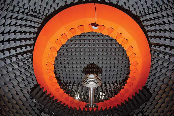
    Snapshot positioning — from a very brief interval of the received satellite signal — is becoming popular for various applications. This paper studies the feasibility of achieving real-time kinematic (RTK) positioning using snapshot data, a method termed Snapshot RTK (SRTK). A major difference of this positioning method is the generation of code and carrier-phase GNSS observables, a procedure the authors explain. To explore the feasibility of achieving RTK under different scenarios, the rate of integer ambiguity resolution (IAR) is assessed by using snapshot measurements generated with different integration times and signal bandwidths under zero-baseline configuration. Under these assumptions, the key factor that influences the RTK fix rate is the code measurement noise. Double difference code measurement errors are evaluated and plotted with the resulting IAR fix rates to find the relationship between them. The performance of using multi-constellation and multi-frequency signals is tested as well. The fix rate can reach 100% when multiple constellations are used. The achieved positioning accuracy is shown to be less than 5 mm in horizontal domain when IAR is achieved successfully.

    Citation. Liu, Xiao, Ribot, Miguel Ángel, Gusi-Amigó, Adrià, Closas, Pau, Garcia, Adrià Rovira, Subirana, Jaume Sanz, “RTK Feasibility Analysis for GNSS Snapshot Positioning,” Proceedings of ION GNSS+ 2020, September 2020, pp. 2911–2921. https://doi.org/10.33012/2020.17768

    Cooperative positioning

    Advances in low-latency communications networks combined with the paradigm of Intelligent Transportation Systems (ITS) have opened opportunities to develop network-based collaborative positioning and navigation. Recent research has fostered the concept of networked GNSS receivers supporting the sharing of raw measurements with other receivers connected to the network. Such measurements (for instance, pseudorange and Doppler) can be processed through Differential GNSS techniques to retrieve inter-receiver distances that can be integrated to improve positioning performance.

    This paper investigates an improved Bayesian estimation for a sensorless, tight integration of Differential GNSS-based collaborative measurements through a modified particle filter. A particle filter natively supports the non-Gaussian noise distribution characterizing GNSS-based inter-receiver distances, so the proposed particle filter was designed, implemented and optimized according to the architecture of a proprietary INS-free GNSS software receiver and tested with realistic RF signals, thus showing remarkable improvement in positioning accuracy.

    Citation. Minetto, Alex, Gurrieri, Alessandro, Dovis, Fabio, “DGNSS-based Cooperative Positioning using Statistics-Adaptive Particle Filter,” Proceedings of ION GNSS+ 2020, pp. 2652–2666. https://doi.org/10.33012/2020.17530

    Virtual base station

    RTK (Real Time Kinematic) is a positioning approach that provides centimeter level accuracy by using a reference station. When the rover and the base station are in proximity (short baseline), all common mode errors are eliminated by the double difference, allowing carrier phase ambiguity resolution. But in medium and long baseline cases, ionospheric and tropospheric delays are not completely eliminated, which affects positioning accuracy. This has limited the application of RTK, especially in certain regions where the closest base station is more than 50 km away.

    Algorithms like RTK long baseline and VBS (virtual base station) have emerged as an alternative. The virtual base station (VBS) algorithm processes surrounding bases to generate a virtual one within a short distance of the moving rover. By doing so, atmospheric errors will continue to be eliminated in the double-difference model, and, presumably, RTK processing will be assured all across continents.

    In this paper, a performance assessment of the algorithm is conducted under various conditions, including high ionospheric activity, high baseline, harsh multipath environments and, finally, in a long trajectory. The results show that the developed VBS algorithm ensures centimeter-level accuracy even under the harshest conditions.

    Citation. Saidani, M., Sarri, P., Guinamard, A., Maya, D. Gallego, “Virtual Base Station Algorithm and Performance Assessment,” Proceedings of ION GNSS+ 2020, pp. 2696–2709. https://doi.org/10.33012/2020.17533

    Open-world virtual reality

    The Open-World Virtual Reality (OWVR) concept combines precise GNSS positioning and a smartphone-grade inertial sensor to provide globally-referenced centimeter-and-degree accurate tracking of a virtual reality headset. Unlike existing augmented and virtual reality systems, which perform camera-based inside-out headset tracking relative to a local reference frame (for instance, an ad-hoc frame fixed to a living room), OWVR’s globally referenced tracking enables a VR experience in which the user’s outdoor exploration is robust to extremes in lighting conditions and local visual texture. This paper introduces the OWVR concept and presents a prototype system with two candidate sensor-fusion architectures, one loosely and one tightly coupled. Comparative performance is evaluated in terms of tracking accuracy and availability of an integer-aperture-test-validated fixed tracking solution. For scenarios with degraded GNSS availability, which will be typical for outdoor VR, the tightly coupled architecture is shown to offer a critical tracking robustness advantage.

    Citation. Humphreys, Todd E., Kor, Ronnie Xian Thong, Iannucci, Peter A., Yoder, James E., “Open-World Virtual Reality Headset Tracking,” Proceedings of ION GNSS+, pp. 2931–2947. https://doi.org/10.33012/2020.17635

  • Editorial Advisory Board PNT Q&A: PPP versus RTK

    Editorial Advisory Board PNT Q&A: PPP versus RTK

    Every month, we ask members of our Editorial Advisory Board to weigh in on a topic. For the January 2021 issue, we asked,

    Will precise point positioning (PPP) replace real-time kinematic (RTK)? If so, for which applications and when?

    Headshot: Miguel Amor
    Miguel Amor

    “Recently, Hexagon’s Autonomy & Positioning division demonstrated RTK levels of performance — globally —through PPP technology; we call it RTK From the Sky (see page 29). I believe that PPP adoption rates will grow significantly in the coming years and eventually replace RTK — especially in areas that are not well served by RTK networks or similar services. Adoption rates will depend on which applications can field GNSS receivers capable of the signals and constellations to perform like RTK.”

    Miguel Amor
    Hexagon’s Autonomy & Positioning division


    Headshot: Alison Brown
    Alison Brown

    “For many applications, the improved accuracy provided by PPP (10 cm) is sufficient and RTK solutions are not needed. However, the typical convergence time of PPP is between 20 and 40 minutes, depending on the number of satellites available, satellite geometry, the quality of the correction products, the receiver’s multipath environment, and atmospheric conditions. This slow convergence compared to RTK solutions will limit application for many real-time applications such as mobile solutions.”

    Alison Brown
    NAVSYS Corporation


    Jean-Marie Sleewaegen
    Jean-Marie Sleewaegen

    “PPP-RTK combines near-RTK accuracy and quick initialization times with the broadcast nature of PPP, over internet or L-band. PPP-RTK can be seamlessly integrated into GNSS receivers, bringing convenient sub-decimeter accuracy to applications where configuring RTK is not practical or where there is no internet connection. PPP-RTK is likely to be adopted by emerging mass-market applications such as UAVs, while RTK will probably remain prevalent in applications where it is already well established, such as precision agriculture.”

    Jean-Marie Sleewaegen
    Septentrio


    Photo:
    Bernard Gruber

    “I do not believe that PPP will replace RTK technology solutions anytime soon. Satellite-based GNSS correction services with an emphasis on global provide worldwide access, but achieving the required accuracy, due to convergence, can be slow. Today, myriad users and emerging customers may utilize corrections augmented with RTK transmitter/base stations that hybrid solutions can provide, thus solving both the age-old navigation issue of obscuration and near real-time positioning simultaneously.”

    Bernard Gruber
    Northrop Grumman

  • Antenna innovator Q&As spotlight advancements

    Antenna innovator Q&As spotlight advancements

    Photo: Trimble
    Photo: Trimble

    Antenna development, going all the way back to the first antennas, has been one of continuous innovation,” Richard Langley wrote in our September issue. Even after more than 30 years of GNSS technology development, he pointed out, GNSS antenna development continues.

    His statement is borne out by the responses submitted by manufacturers of GNSS antennas to four questions we posed to them:

    • What specific challenges are your antennas designed to address?
    • Over the past three years and the next three years, what have been/will be your key innovations?
    • How are advances in real-time kinematic (RTK) and precise point positioning (PPP) changing requirements for GNSS antennas?
    • What technical challenges or industry trends do you find most interesting or noteworthy?

    The responses display a wide range of antenna designs for a wide range of applications. They show how manufacturers must constantly balance requirements for positioning accuracy, form factor, interference management and cost. For the GNSS user segment, antennas are the first link in the processing chain and the first line of defense against jamming, spoofing, multipath  and, increasingly, adjacent band interference. Antenna designers are also challenged by the growing adoption and sophistication of RTK, PPP and similar technologies. All these variables, challenges and scenarios are reasons for the constant evolution of GNSS antennas.

    Finally, it is not always obvious whether a device should be classified as a receiver or an antenna. For example, what Harxon calls a “smart antenna” others might call a receiver.


    NOVATEL HARXON TALLYSMAN WIRELESS
    TAOGLAS TOPCON TRIMBLE

    Headshot: Sandy Kennedy

    NovAtel

    With Sandy Kennedy, VP of Innovation

    Specific challenges
    NovAtel antennas enable exceptional tracking for multi-constellation precision and are packaged for practical use in the field. Our antennas are designed to be the first link in the processing chain to deliver centimeter-level precision in harsh operating environments and applications, including contested or crowded RF environments through our CRPA antennas.

    Key innovations
    Over the past three years, we have focused on multi-frequency support and simultaneous L-band reception (seen in the NovAtel GNSS-850) to provide exceptional positioning solutions and support future technology like RTK From the Sky. Optimized to work with OEM7 receivers, NovAtel antennas leverage patented multi-point feeding networks to providΩe symmetric radiation patterns across all frequencies for excellent multipath rejection and minimal phase-center variation and offset. In the next three years, we expect to further reduce the size of antennas needed in a resilient high-precision solution. At the same time, we are continuing to improve robustness to adjacent band interference. We work to optimize the full GNSS ecosystem, from the signal in space reaching the antenna, to the final position, velocity and time (PVT) solution exiting the receiver.

    Anechoic chamber testing. (Photo: NovAtel)
    Anechoic chamber testing. (Photo: NovAtel)

    Advances in RTK and PPP
    Advances in corrections expose measurements from low-quality antennas. You need an antenna with sub-millimeter phase-center variation (PCV) accuracy and stability on par with the algorithms delivering centimeter-level solutions. When the processing chain eliminates errors down to the centimeter level (or less), you must avoid adding errors from unstable phase centers, for example.

    Technical challenges and industry trends
    A difficult challenge facing the antenna industry is the commercial demand to reduce the size and weight of antennas while maintaining functionality and performance. The industry will need to continue balancing between size and performance while producing innovative GNSS antenna solutions integrated with other technologies, for example with anti-jam capabilities.


    Headshot: Leo Wang

    Harxon

    With Leo Wang, Product Technical Director

    Specific challenges
    The design of Harxon’s GNSS antennas aims to achieve a perfect balance between easy integration with RTK solutions and the ultimate product performance by meticulously dealing with wideband, positioning accuracy, form factor, and interference management.

    Key innovations
    Over the past three years, our signature antenna innovation is our 4-in-1 X-Survey HX-CSX100A multifunctional GNSS antenna, which integrates a GNSS antenna, 4G, Bluetooth and Wi-Fi in one compact enclosure. This multifunctional antenna simplifies receiver integration into an RTK solution and facilitates industry development. In the next three years, Harxon looks forward to more breakthroughs in positioning technology and delivering pragmatic innovations.

    Photo: Harxon
    Photo: Harxon

    Advances in RTK and PPP
    The development and maturity of these technologies require a higher standard for more delicate GNSS antenna structure design that takes product form factor into consideration while upgrading performance via wideband, high gain and positioning accuracy.

    Technical challenges and industry trends
    The 5G era has arrived, and the application of 5G technology for the internet of things (IoT) is extensive. China has also proposed the integration of 5G technology and BeiDou. We believe that, in the next few decades, GNSS positioning and 5G technology will be widely applied in the IoT industry and create huge benefits.


    Headshot: Gyles Panther

    Tallysman Wireless

    With Gyles Panther, President and CTO

    Specific challenges
    The challenge faced by Tallysman was manufacturing a full-band GNSS and L-band correction antenna, with high efficiency, tight PCV, low-gain roll-off and low axial ratio down to the horizon, and minimized multipath. Plus, a narrowly filtered low noise amplifier (LNA) to mitigate interference, all in the smallest possible package.

    Key innovations
    Over the past three years, Tallysman has released the VeraChoke, helical and VeroStar lines. The VeraChoke serves the geodetic and survey reference station markets with PCV and full-band GNSS coverage.

    Our helical GNSS and Iridium antennas are lightweight, compact and robust. They provide a precise phase center and radically reduced dependence on a ground plane because of their differential mode of operation. Their exceptional low weight makes them an excellent choice for copter-style UAVs.

    Photo: Tallysman
    Photo: Tallysman

    The patented VeroStar element combines full coverage of the upper and lower GNSS bands, plus L-band corrections service, with reception of L-band downlink Mobile Satellite Service (MSS) signals and exceptional low elevation angle reception. It is rugged, compact and lightweight — ideal for land and marine rover applications. It also provides minimal and symmetric PCV with outstanding all-around performance.

    Advances in RTK and PPP
    Both correction systems require rover receivers to phase-lock on low-amplitude GNSS satellite signal carriers, and both are hugely dependent upon the GNSS antenna. The corrections are critical for precision agriculture and land survey applications. Our precision antennas are specifically designed to minimize phase-lock loop (PLL) cycle slips.

    Technical challenges and industry trends
    Interference, accidental or intentional, is a major challenge and threat to GNSS, particularly from encroaching L-band 5G cellular systems. Tallysman offers tightly filtered LNAs and single-band omnidirectional anti-jam antennas with a deep null at low elevations. We plan to introduce a new multiband omnidirectional antijam antenna in the second quarter of 2021.


    Headshot: Dave Ghilarducci

    Taoglas

    With Dave Ghilarducci, VP of Worldwide Engineering

    Specific challenges
    Our antennas are designed for key internet of things (IoT) verticals. Our high-precision, multi-band GNSS antennas offer centimeter-level positioning and timing accuracy for applications where small size and high performance are required. We address the industry’s most compact form factors with out-of-band rejection for operation near transmitters.

    Key innovations
    Over the past three years, we have focused development on a portfolio of GNSS antennas with centimeter-level positioning accuracy in different form factors:

    • Photo: Taoglas
      EDGE Locate GNSS with RTK. (Photo: Taoglas)

      lighter, more robust antennas through our patent-pending Terrablast-based products (the GGBTP.35); which are impact resistant and 35% lighter than traditional ceramic patches

    • developing low-cost, compact, high-performance, multi-band antennas for OEM integrations (XAHP.50, AA.200, GPDF5012).
    • high-rejection internal patch modules for rejection for OEM integrations (AGGBP.SL and AGGBP.SLS series)
    • surface-mount active patch antennas with embedded active circuitry for easier integration (ASGGB Simplicity series)
    • off-the-shelf module with an integrated multi-band RTK antenna, electronics and receiver technology for ease of integration.

    Over the next three years, we expect to expand our portfolio and support additional bands like E6, L6 and the L-band correction band. Plus, we are working with the European Space Agency to design IoT devices with integrated high-precision RTK and GNSS technologies.

    Advances in RTK and PPP
    Expansion of RTK, PPP and similar technologies into new domains has demanded better performance from mainline and OEM antennas. These correction technologies stress antenna gain and polarization purity to maximize signal strength. We address these issues in our integrated designs to mitigate multipath errors and maximize ease of integration.

    Technical challenges and industry trends
    The release of lower-cost multi-band receivers and modules could be the most significant shift the GNSS industry has seen in the last decade. This innovation is already expanding applications and challenging suppliers to provide better performance for size, weight and cost.


    Headshot: Alok Srivastava

    Topcon

    With Alok Srivastava, Senior Director, Product Management, Topcon Positioning Group

    Specific challenges
    Topcon is a proven provider of GNSS antennas for innovative products. Our GNSS product portfolio offers antennas with excellent multipath mitigation, near-band interference rejection, and quality signal tracking from zenith to the horizon. We strive to provide affordable solutions for our geodetic, machine control and agricultural customers.

    Key innovations
    Topcon antenna technology is applied within standalone antennas along with integrated GNSS receivers. Antennas inside our integrated receivers, such as the HiPer HR, are distinctive in supporting Bluetooth and Wi-Fi in a common antenna stack without sacrificing GNSS tracking and positioning performance. These offerings also support compact designs of integrated receivers.

    As the number of GNSS constellations expands and new communication methods become available, potential inference from neighboring signals grows with congestion of the RF spectrum. Our standalone antennas, PN-A5 and CR-G5 with cavity filter option, uniquely address these challenges.

    Topcon’s PN-A5 semi-hemispherical ground plane GNSS antenna. (Photo: Topcon)
    Topcon’s PN-A5 semi-hemispherical ground plane GNSS antenna. (Photo: Topcon)

    In the coming years, antenna technology will need to stay strongly focused on interference rejection and mitigation, lower cost and smaller size. These demands challenge antenna providers to make technical advancements while investing in cost-sensitive manufacturing along with higher testing standards. In this regard, our new antenna test facility in Concordia sulla Secchia, Italy, will soon be offering robotic calibration services.

    Advances in RTK and PPP
    With increased demand and services available for PPP, Topcon antennas support both GNSS and L-band frequencies, such as in the HiPer VR/HR receivers, and standalone antennas (PG-F1, G5-A1, PN-A5 and CR-G5). As data communications continue to expand beyond L-band and RTK/network RTK, Topcon systems will support them without compromising positioning performance.

    Technical challenges and industry trends
    As GNSS antennas are one of the integral items within the GNSS system, the significance of delivering a cost-effective and miniaturized solution that provides robust positioning is critical to meeting needs in ever-growing precise positioning markets and applications. Topcon will continue to emphasize innovative antenna products through our research.


    Headshot: Stuart Riley

    Trimble

    With Stuart Riley, Vice President of GNSS Technology

    Specific challenges

    Each application has different requirements. For applications that require the highest position accuracy, the stability of the phase center, multipath mitigation, and the unit-to-unit production consistency are critical.

    Some markets require high performance, and often in challenging environments such as high vibration experienced on construction equipment. Other customers require smaller, lower cost antennas and can tolerate a slight accuracy reduction.

    The antenna is typically a combination of a passive antenna element with an active low-noise amplifier (LNA). The LNA needs to be carefully designed to remain linear in the presence of in-band jamming while rejecting out-of-band signals.

    Key Innovations
    For high-precision applications, Trimble first released the Zephyr series of antennas in the late 1990s. This antenna provides excellent phase center stability and unit-to-unit production repeatability; the antenna has exceptional multipath mitigation performance, which is enhanced in the geodetic version.

    Since the Zephyr was first introduced, we have added support for additional GNSS systems and RF bands (L1/E1, L2, L5/E5 and L6/E6), transitioned to a RoHS-compliant manufacturing process, improved the LNA performance, developed rugged versions for construction vehicle mounting, and produced a smaller version used in the Trimble R10, R12 and SPS986 GNSS receivers.

    More recently, we developed a lower cost high-performance antenna for the Trimble Catalyst software-defined GNSS receiver for Android phones and tablets. We also introduced an antenna in the Nav-900 guidance controller for agriculture that implements a meta-material design.

    Looking forward, we will continue to innovate by providing antennas optimized to meet the needs of the markets, including cost, performance and morphology. Enhancements will include novel antenna architectures, production technique improvements, and careful material selection.

    Advances in RTK and PPP
    Applications for GNSS are expanding to include more non-technical users, and the markets are calling for small, light and low-cost antennas — especially for technologies like PPP and positioning products such as Catalyst. These requirements extend across all arenas, especially in applications served by RTX. The needs must be balanced against increased technical demands stemming from the expansion in GNSS bands supporting new frequencies and signals, including PPP correction data.

    Technical challenges and industry trends
    The challenges come in balancing seemingly conflicting needs for performance, size, weight and cost for the various applications.

    Because Trimble focuses on specific user segments, we can provide antenna solutions that are the best fit for the various applications. For example, an antenna in a handheld device must be small and lightweight; however, on a construction machine, durability takes precedence over size and weight.

  • SkyTraq offers multi-band GNSS receiver with 1-cm position accuracy

    SkyTraq offers multi-band GNSS receiver with 1-cm position accuracy

    Photo: SkyTraq
    Photo: SkyTraq

    SkyTraq is offering a 12 x 16 millimeter multi-band real-time kinematic (RTK) receiver for centimeter-level accuracy positioning applications. The PX1122R works with all the four GNSS, using GPS L1/L2C, Galileo E1/E5b, GLONASS L1/L2 and Beidou B1I/B2I signals concurrently to maximize positioning availability even in difficult urban environments.

    A single-chip system-on-chip, the PX1122R is designed to deliver reliable, centimeter-level accuracy positioning for autonomous unmanned ground or aerial vehicles, the internet of things, and traditional land surveying and precision farming applications.

    The PX1122R has an RTK initialization time under 10 seconds and a maximum update rate of 10 Hz. Its update rate provides in-time positioning with a fast response time and improved guidance for fast-moving applications, the company said.

    Moving-base RTK for GNSS precise heading is also supported. By using two PX1122R and two antennas with 1-meter separation, highly accurate 1-sigma heading accuracy of 0.13 degree can be obtained; such heading accuracy is immune to magnetic interference and unaffected by the receiver’s speed.

    The PX1122R can serve as a key component to provide precise position and heading information for autonomous applications. PX1122R sample, data sheet and evaluation boards are available now.

    Founded in 2005, SkyTraq Technology Inc. develops high-performance chipset and module solutions for the consumer market. Its initial product is L1-GPS-centric, and now its products cover L1, L2, L5, L6 band GPS/GLONASS /Beidou/Galileo/QZSS/NavIC/SBAS applications.

  • Editorial Advisory Board PNT Q&A: Advancing bathymetry

    Editorial Advisory Board PNT Q&A: Advancing bathymetry

    Which recent GNSS/INS innovations have been most helpful in advancing bathymetry? Which upcoming ones will be?

    Headshot: Miguel Amor
    Miguel Amor

    “Development of PPP removed reliance on shore-based RTK base stations, allowing operation almost anywhere on the oceans. Continued performance improvement in FOG and MEMS INS, along with bathymetric sensors, provide cost-effective solutions while also providing more accurate seabed maps. The future will see increased PPP accuracy with faster convergence and continued improvement in INS, coupled with increased resolution of bathymetric sensors, leading to more of the oceans mapped using autonomous platforms.”
    Miguel Amor, 
    Hexagon Positioning


    Bernard Gruber
    Bernard Gruber

    “While GNSS has been a clear contributor to Earth mapping, it is an altogether different dilemma to solve ‘submarine topography’ mapping. Given recent developments in the IMU and lidar markets, one can readily utilize these sensors to correct for roll, pitch, and yaw, and produce digital maps, respectively. Combining these sensors with GNSS receivers, mounted on a drone for example, can allow for precise measurements in areas of tidal shifts or dynamic variations of water depth.”
    Bernard Gruber,
    Northrop Grumman

  • U-blox positioning enables massive drone light show

    U-blox positioning enables massive drone light show

    The 10-minute-long drone show included a flying dove with a wingspan of 600 meters, visible from three kilometers away. (Photo: u-blox)
    The 10-minute-long drone show included a flying dove with a wingspan of 600 meters, visible from three kilometers away. (Photo: u-blox)

    U-blox supplied the high-accuracy technology that made it possible to fly a massive swarm of drones. The simultaneous flight of 2,198 miniature unmanned aerial vehicles (UAVs) was launched into the night sky over Saint Petersburg, Russia, on Sept. 3.

    The 10-minute-long drone show included a flying dove with a wingspan of 600 meters, visible from three kilometers away.

    Geoscan, which built and programmed the drones and ran the display, chose u-blox positioning technology for its combination of accuracy, reliability, performance and ability to access positional data from both the GLONASS and GPS satellite navigation constellations.

    The 10-centimeter-wide Geoscan Salute drones were designed for use in group flights and drone shows. The drones use u-blox NEO-M8P high-precision GNSS modules to provide the positioning data to create a fluid drone show. Salute drones return to their base stations automatically at the end of a show.

    The NEO-M8P module implements a real-time kinematic (RTK) approach that improves positional accuracy by comparing the phase of a signal being broadcast from a positioning satellite with that of the same signal that has been received and rebroadcast from a fixed base station. The accuracy gained in this way enables drones to calculate their relative positions to within millimeters, and their absolute positions to within 1 centimeter of the intended position.

    Geoscan has been producing drone displays for the past two years, starting with 40 drones flying at once. “The u-blox modules in our Geoscan Salute drones have improved our drones’ positioning accuracies to about one centimeter, and have helped reduce pre-launch preparation time,” said Semen Lapko, head of Drone Show Project, Geoscan. “Drones now move more quickly and accurately, while also operating more efficiently.”

  • Guiding an unmanned vessel

    Guiding an unmanned vessel

    U.K.-based Unmanned Survey Solutions (USS) has created a unique unmanned surface vessel called the Accession Class USV. It’s modular design offers three variable boat lengths depending on the desired application. The base boat length of 3.5 m can be extended to 4.25 m or 5 m by adding additional hull sections.

    The standard USV configuration includes sensors for meeting International Hydrographic Organization (IHO) special-order surveys. The sensors consist of an R2Sonic SONIC 2024 multibeam sonar; an SBG Apogee Navsight Inertial + GNSS solution, and a Valeport MiniSVS and Swift SVP for measuring sound velocity.

    Image: Unmanned Survey Solutions
    Image: Unmanned Survey Solutions

    The data is acquired in either Hypack or QINSy hydrographic software and used for mission planning, data acquisition, post processing and final products. Designed for operations in both nearshore and offshore environments, the autonomous platform is safer and more cost-effective than comparative manned vessels, USS said.

    Image: Unmanned Survey Solutions
    Image: Unmanned Survey Solutions

    Although the Accession USV is payload agnostic and fully customer configurable, the standard configuration can also be interfaced with a mobile lidar such as the Carlson Merlin laser scanner for mapping terrestrial structures to create a full 3D point cloud above and below the water. This is achievable because of the embedded SBG inertial navigation system (INS), which is extremely versatile for both shallow or deeper water regions as well as challenging GNSS environments such as under bridges. In such situations, the centimeter-level RTK position accuracy is greatly improved using the SBG’s Qinertia post-processing software. This PPP- and PPK-capable software offers single or virtual base-station modes and can even incorporate users’ own base-station RINEX data.

    “Not only did we want to create an autonomous vessel specifically for surveyors, but we also wanted to incorporate the latest advanced sensor technologies,” said James Williams, USS director. “It was also extremely important that the final combined solution had a low CO2 footprint and was more cost effective than similar manned vessels.”

  • Aceinna joins ST Partner Program for precise positioning

    Aceinna joins ST Partner Program for precise positioning

    Photo: gorodenkoff/iStock/Getty Images Plus/Getty Images
    Photo: gorodenkoff/iStock/Getty Images Plus/Getty Images

    Partnership combines Aceinna’s integrated precise positioning and advanced guidance expertise with ST’s products, technologies and solutions.

    Innovative sensing technology company Aceinna Inc. has joined the STMicroelectronics Partner Program to make its inertial measurement unit (IMU) and real-time kinematic (RTK) precise positioning solutions available to engineers and developers working on next-generation solutions that safely and accurately position autonomous automobiles, trucks, robots and delivery vehicles.

    Aceinna is also participating in the Virtual ST Developers Conference on Oct. 20 and Oct. 21 from 8:30 a.m. to 4 p.m. ET, which discusses precise positioning for autonomous vehicles. Register here.

    “By leveraging ST technology, Aceinna is providing customers with vertically integrated performance sensing platforms,” said Yang Zhao, CEO of Aceinna. “These system-level solutions help customers greatly accelerate development time as well to reduce the time to market for new autonomous vehicle technologies.”

    “The ST Partner Program helps customers’ design teams access extra skills and resources to aid engineering development and shorten time-to-market for new products,” said Alessandro Maloberti, partner ecosystem director, STMicroelectronics. “By selecting, qualifying, and certifying our program partners like Acennia Inc., we are taking yet another major step in helping customers accelerate design and development, and ship to market the most robust and efficient products and services.”

    STMicroelectronics, a global semiconductor leader serving customers across the spectrum of electronics applications, created the ST Partner Program to speed customer development efforts by identifying and highlighting to them companies with complementary products and services. The program’s certification process assures that all partners are periodically vetted for quality and competence.

  • Septentrio unveils AsteRx-m3, its next generation of high-precision GNSS receivers

    Septentrio unveils AsteRx-m3, its next generation of high-precision GNSS receivers

    The new AsteRx-m3 family features state-of-the-art GPS/GNSS OEM boards optimized for power consumption and ease of integration.

    Photo: Septentrio
    Photo: Septentrio

    Septentrio has expanded its GPS/GNSS OEM portfolio with the AsteRx-m3 product family. AsteRx-m3 receivers target various use cases and offer flexibility and affordability with no compromises of performance.

    The AsteRx-m3 family features very low power consumption, allowing longer operation times. Its easy-to-integrate design enables short set-up times and faster time-to-market.

    “With the AsteRx-m3 product family, Septentrio redefines state-of-the-art GNSS positioning performance,” said Danilo Sabbatini, product manager at Septentrio. “It was a challenge to design a product that delivers multi-frequency and multi-constellation positioning, combined with Septentrio’s renowned GNSS+ technology while optimizing power. The AsteRx-m3 product not only excels in this but does so at a reduced cost.”

    All AsteRx-m3 products represent the next generation of technology in the GNSS OEM market, delivering centimeter-level accuracy, availability and reliability in a credit-card sized board, Septentrio said.

    The new product family includes three types of GNSS OEM boards.

    • The AsteRx-m3 Pro rover receiver tracks signals from all available GNSS constellations on three frequencies. Simple and powerful, it operates both in single- and dual-antenna modes.
    • The AsteRx-m3 ProBase is designed to operate as a reference station for RTK and PPP-RTK networks. It can be used as a base station or for network densification.
    • The AsteRx-m3 Pro+, a full-feature OEM receiver board flexible enough to fit into any application and to be used either as a rover or a base station in a single- or dual-antenna mode.

    By offering its next-generation GNSS technology in a diversity of products Septentrio aims to improve customer experience while optimizing prices.

  • Inertial Labs releases INS-DU GPS-aided unit for high-accuracy positioning

    Inertial Labs releases INS-DU GPS-aided unit for high-accuracy positioning

    The new INS-DU delivers high-accuracy RTK positioning for air, land and marine applications

    Photo: Inertial Labs
    Photo: Inertial Labs

    Inertial Labs has released a new GPS-aided inertial navigation system (INS). The INS-DU is a high-performance strapdown system that determines position, velocity and absolute orientation to any platform it is mounted to.

    The INS-DU has a dual-antenna u-blox GNSS receiver that provides 1-cm real-time kinematic (RTK) position from RTCM 3 RTK corrections and supports a wide range of GNSS constellations.

    Designed for UAVs, land vehicles and marine vessels, the INS-DU is an effective, low-cost solution that uses a range of aiding data for different applications. With highly accurate navigation in GNSS-denied environments, the INS-DU delivers a cost-effective GNSS-denied solution, according to Inertial Labs.

    One of the key elements to the success of the INS-DU is its use of the miniAHRS, which utilizes 3-axes each of precision magnetometers, accelerometers and gyroscopes to provide orientation of the device under measure. It contains cutting-edge algorithms for the motion of robots, unmanned and autonomous vehicles, and antennas.

    MiniAHRS mini fluxgate magnetometers have an advantage over commonly used magneto-inductive or magneto-resistive alternatives and have been a trusted North reference for more than 70 years.

    The INS-DU provides a full navigation solution for both GNSS and GNSS-denied environments. With custom interfaces and a power consumption of two and a half of a Watts, the INS-DU is a versatile solution fit for a wide variety of users with power consumption restrictions.

    In addition, the INS-DU contains our on-board sensor-fusion filter, state-of-the-art navigation, and guidance algorithms and calibration software.

  • Septentrio expands SECORX-S GNSS receiver product line

    Septentrio expands SECORX-S GNSS receiver product line

    Septentrio’s SECORX-S GPS/GNSS receiver product line offers sub-decimeter accuracy without the need for additional positioning service subscriptions.

    The mosaic-Sx module. (Photo: Septentrio)
    The mosaic-Sx module. (Photo: Septentrio)

    Septentrio has expanded its SECORX-S product line. The multi-constellation multi-frequency GNSS receivers of the SECORX-S family deliver sub-decimeter positioning out of the box, without the need for any additional correction service subscription or maintenance.

    Users benefit from always-on high accuracy provided by a PPP-RTK correction service integrated directly into Septentrio’s latest core GNSS technology. The SECORX-S product line, already including GNSS OEM boards, now also offers a compact mosaic-Sx module as well as a ruggedized receiver in an IP68 chassis, AsteRx SB Sx.

    By adding modules and boxed receivers to the SECORX-S product line, Septentrio brings its innovative approach of plug-and-play accurate positioning to industrial applications including precision agriculture, UAV, robotics and construction.

    The AsteRs-m2-Sx. (Photo: Septentrio)
    The AsteRs-m2-Sx. (Photo: Septentrio)

    Receivers of the SECORX-S family offer lifelong sub-decimeter accuracy in U.S. and Europe. The PPP-RTK correction service integrated in these receivers uniquely combines near-RTK accuracy with short convergence time.

    “By launching the SECORX-S product family a few months ago, we have taken a ground-breaking step towards easy-to-use and accessible high-accuracy positioning,” said Francois Freulon, head of product management at Septentrio. “Our SECORX-S product range now includes compact modules, versatile OEM boards as well as boxed receivers. With this expansion of the product family our customers now have the flexibility to choose from a wider range of receivers, the one that perfectly fits their needs.”

    For more product details visit the SECORX-S product page or contact [email protected]. To find out more about positioning correction services, see “Septentrio demystifies GNSS corrections.”

  • Verizon to deploy RTK stations for ‘hyper-precise’ location info

    Verizon to deploy RTK stations for ‘hyper-precise’ location info

    Verizon logoUsing RTK’s pinpoint-level location data in the Verizon network is a building block to bring to scale emerging technologies such as driverless city zones, expansion of precision agriculture and drone delivery.

    Verizon has launched what it calls hyper-precise location using real-time kinematics (RTK) to provide accuracy within one to two centimeters on the Verizon network.

    Verizon has built and deployed RTK reference stations nationwide so that compatible internet of things (IoT) devices can receive the higher accuracy. Verizon is working to make RTK accessible with myriad device makers.

    RTK will also support emerging technologies that depend on high-level location accuracy, such as delivery drones and customer-approved location data for first responders in emergencies.

    RTK technology reduces the cost and risk associated with inaccurate location data, Verizon said in a press release. “Billions of IoT devices across a multitude of industries will benefit from improved location accuracy, with hyper-precise location information enabling a host of new services.

    “For instance, robotics at distribution centers will be able to perform more efficient, accurate and safe logistics operations. More accurate positioning can help speed deployment of high-value assets in emergency situations to the precise location, and more precise tracking of emergency equipment can provide faster redeployment in disaster response scenarios.”

    The rollout of its hyper-precise location services along with Verizon’s 5G Ultra Wideband network and 5G Edge will pave the way for more autonomous technologies, the company said.

    “We are scaling RTK to enable mobile location accuracy to within a few centimeters, transforming what is currently possible when it comes to location-enabled services and new IoT solutions coming onto the market,” said Nicola Palmer, chief product development officer for Verizon. “Continued growth in the IoT environment means billions of devices in fields where precision location services are becoming more critical, such as vehicle automation, unmanned aerial vehicles, precision agriculture technology, infrastructure monitoring, asset tracking and high-value shipping.”

    Image: 4X-image iStock / Getty Images Plus / Getty Images
    Image: 4X-image iStock / Getty Images Plus / Getty Images

    Reimagining road safety

    In partnership with HERE Technologies, Verizon is building next-generation technologies for vehicle and pedestrian safety using hyper-precise high-definition mapping and RTK.

    This work paves the way for connected services that are designed to drive road safety improvements. By creating a vehicle-to-network (V2N) communication system equipped with hyper-local location accuracy, collision avoidance applications can precisely identify vehicles, pedestrians and bicycles, and relay the information through Verizon’s 5G Edge and HERE’s AI to predict likely travel paths and warn vehicles of impending potential collisions. This partnership is one of multiple recent initiatives Verizon has taken to increase road safety.

    “Moving beyond the static fidelity of satellite-based location data enables an exciting new generation of connected, autonomous experiences,” said Jørgen Behrens, SVP, chief product officer at HERE Technologies. “By pairing HERE’s live, hyper-precise HD Map and HD Positioning technologies with intelligent RTK algorithms, and making that scalable, Verizon is putting a transformative level of location insights into the hands of developers and consumers alike.”

    Powering the autonomous future

    Hyper-precise location accuracy will be critical to advancing autonomous driving and together, Verizon and Renovo are ushering in a new era of transformative solutions critical for the future of autonomy on the road. These solutions leverage machine learning and RTK technology, powered by a combination of next-generation solutions such as 5G.

    “RTK is a critical technology for advanced driving assistance systems (ADAS). Accurate positioning helps ADAS vehicles navigate better, drive smoother, and react faster to the surrounding environment,” said Christopher Heiser, CEO and Co-Founder of Renovo. “Nationwide, reliable RTK networks make for a viable way to deliver these enhanced capabilities to mass-market cars and trucks. For companies that manage the huge datasets that power next-generation vehicle platforms like Renovo, this is very exciting.”

    IoT devices currently using RTK can be accessed and managed through Verizon’s ThingSpace management platform and APIs.