Tag: SBG Systems

  • Launchpad: OEM simulator, IMU, antennas

    Launchpad: OEM simulator, IMU, antennas

    A roundup of recent products in the GNSS and inertial positioning industry from the March 2019 issue of GPS World magazine.

    MEMS INS/GPS

    Update improves heading performance and reduces jitter

    Photo: Systron Donner
    Photo: Systron Donner

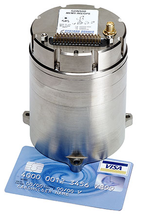
    The SDN500 digital quartz micro-electro-mechanical systems (MEMS) GPS inertial navigation system (GPS/INS) has been updated. Model SDN500-xE provides a newer generation JF2 (C/A) code GPS receiver and tightly couples the 1 PPS GPS signal to the SDI505 IMU synch pulse to improve heading performance and reduce jitter after long periods of operation without dynamic inputs. The 25-inch-square SDN500 provides for maximum packaging flexibility in dense systems and delivers accuracies to within 1.0 mrad in attitude, 0.1 m/s in velocity and 3.9 meters spherical error probability (SEP). It offers tactical-grade performance, integrating SDI’s latest quartz gyros capable of 0.5°/hr. bias in-run stability and low angular random walk (ARW, 0.02°/√ hr), quartz accelerometers delivering 0.5 milli-g in-run bias stability and low velocity random walk (VRW, 80 µg/√ Hz), plus high-speed digital signal into a tightly coupled GPS/INS for tactical navigation and geo-location applications.

    Systron Donner Inertial, www.systron.com

    A-GNSS antenna testing

    Testing location accuracy performance of mobile devices

    The R&S SMBV100B vector signal generator simulates GNSS and MBS signals. (Photo: Rohde & Schwarz)
    Photo: Rohde & Schwarz

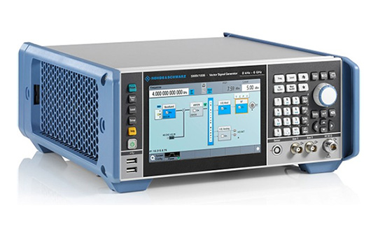
    To create test concepts for over-the-air (OTA) antenna measurements, Rohde & Schwarz and Bluetest have integrated the R&S LBS Server, a software component running on the R&S CMW500 wideband radio communication tester, and the Bluetest over-the-air (OTA) test solution for A-GNSS systems based on Bluetest’s RTS65 reverberation chamber and Bluetest’s Flow measurement software. The R&S LBS Server controls the Rohde & Schwarz base-station simulator R&S CMW500 for LTE, WCDMA and GSM, and uses the R&S SMBV100B vector signal generator for simulation of GNSS and metropolitan beacon systems (MBS) signals. An upgrade for 5G will be available soon. The R&S LBS Server is an essential part of the R&S TS8991 OTA Performance Test System.

    Rohde & Schwarz, rohde-schwarz.com
    Bluetest, bluetest.se
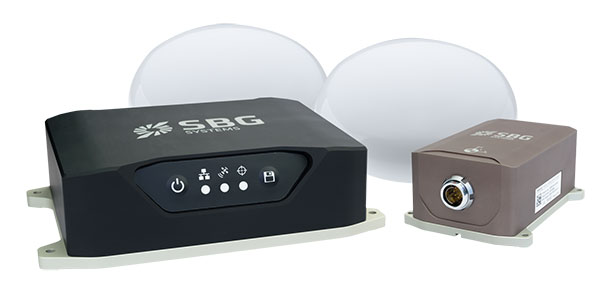
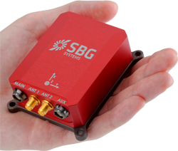
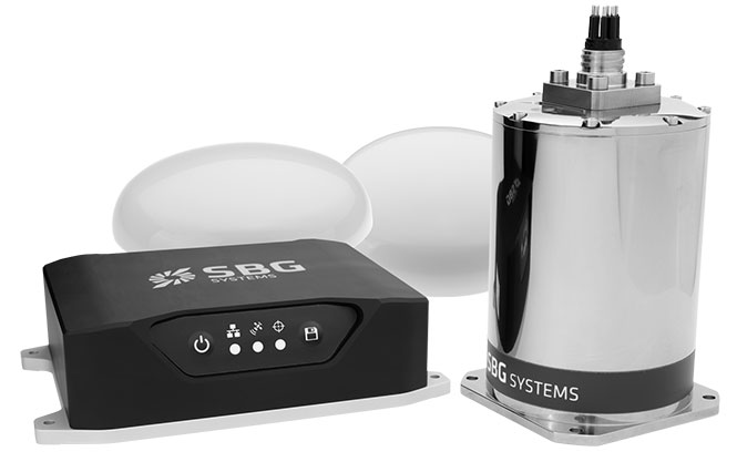
    Fog-based IMU

    Brings Navsight technology to the most demanding environments

    Photo: SBG Systems
    Photo: SBG Systems

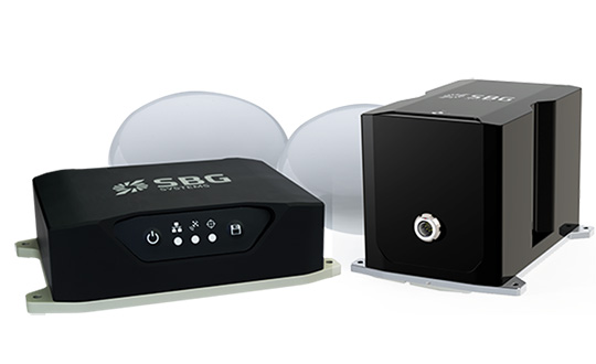
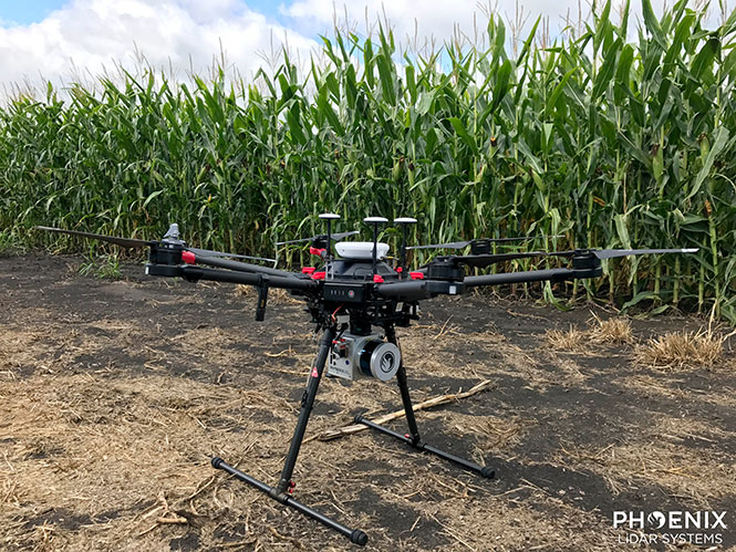
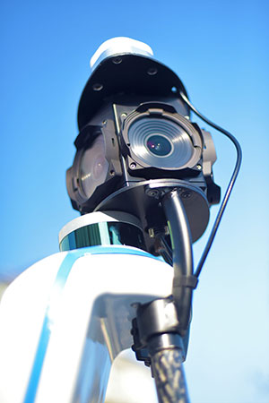
    The Horizon IMU adds a third choice to SBG System’s Navsight Land/Air Solution. It is a FOG-based high-performance inertial measurement unit (IMU) designed for highly demanding surveying applications such as high-altitude data collection or mobile mapping in dense areas such as urban canyons. The Horizon IMU joins the Ekinox and Apogee IMUs as options for Navsight. The different levels of accuracy enable the solution to meet various application requirements and can be connected to various external equipment such as odometer, lidar and more. The Horizon IMU allows customers to use Navsight in high-altitude and highly dense areas, as well as where only a single antenna can be used. It is based on closed-loop FOG technology that enables ultra-low bias and noise levels. The Navsight solution can be installed in a plane or car — the sensor alignment and lever arms are automatically estimated and validated. The Navsight unit also integrates LED indicators for satellite availability, real-time kinematic (RTK) corrections and power. Qinertia post-processing software provides access to offline RTK corrections from more than 7,000 base stations in 164 countries.

    SBG Systems, www.sbg-systems.com

    Dual-band antenna

    For mobile and fixed deployments

    Photo: PCTEL
    Photo: PCTEL

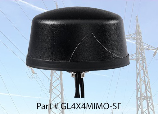
    The Coach 4×4 Wi-Fi/DSRC GNSS multi-band antenna enables smart grids, mobile workforce communications, and advanced automation technologies. The dual-band 802.11ac/p MIMO antenna helps boost data rates and reliability for utility networks, intelligent transportation systems and other industrial internet of things (IoT) applications. The low-profile antenna features four-port 2.4/5-GHz coverage along with PCTEL’s high-rejection GPS/GLONASS technology for network timing and tracking in a single IP67-rated housing.

    PCTEL, www.pctel.com

  • Horizon IMU adds choice to SBG’s Navsight Land/Air Solution

    Horizon IMU adds choice to SBG’s Navsight Land/Air Solution

    Photo: SBG Systems
    Photo: SBG Systems

    SBG Systems has released the Horizon IMU, a FOG-based high performance inertial measurement unit (IMU) designed for highly demanding surveying applications such as high-altitude data collection or mobile mapping in dense areas such as urban canyons.

    SBG Systems made the announcement at the International LiDAR Mapping Forum (ILMF) in Denver.

    The Horizon IMU joins the Ekinox and Apogee IMUs as options for the Navsight Land/Air Solution. The solution consists of a powerful and ready-to-use inertial navigation solution dedicated to surveyors for mobile data collection.

    The new Horizon IMU allows customers to bring the Navsight technology to the most demanding environments such as high-altitude surveying and highly dense areas, as well as application where only a single antenna can be used.

    The different levels of accuracy enable the solution to meet various application requirements and can be connected to various external equipment such as odometer, lidar and more. The Ekinox and Apogee MEMS-based IMUs address most surveying markets for camera or lidar motion compensation and data geo-referencing.

    The Horizon IMU is based on a closed-loop FOG technology which enables ultra-low bias and noise levels. This technology allows robust and consistent performance even in low dynamics survey.

    The Navsight solution is easy to install in a vehicle — the sensor alignment and lever arms are automatically estimated and validated. Once connected to the Navsight processing unit, the web interface guides the user to configure the solution.

    A 3D view of the vehicle shows the entered parameters so that the user can check the installation. By choosing the vehicle — a plane or a car, for example — the inner algorithms are automatically adjusted to the application.

    The Navsight unit also integrates LED indicators for satellite availability, real-time kinematic (RTK) corrections and power.

    Full INS/GNSS Post-Processing Software

    Completing the Navsight offer, Qinertia, the SBG post-processing software, gives access to offline RTK corrections from more than 7,000 base stations in 164 countries. The software delivers the highest level of accuracy without having to set up a base station. Trajectory and orientation are then greatly improved by processing inertial data and raw GNSS observables in forward and backward directions.

    Navsight is ITAR-free. All models are available for order. Ordering information and delivery time are available from SBG Systems representatives and authorized SBG Systems dealers.

  • SBG Systems showcases Qinertia INS/GNSS post-processing software at Intergeo 2018

    SBG System’s Raphael Siryani gives an overview of the company’s Qinertia INS/GNSS post-processing software at Intergeo 2018, which took place Oct. 16-18 in Frankfurt, Germany. The system gives access to offline RTK corrections from more than 7,000 base stations.

  • Live from Intergeo 2018

    Logo: IntergeoThe GPS World staff is reporting from Intergeo Oct. 16-18 in Frankfurt, Germany. The massive trade show, dubbed the “global hub of the geospatial community,” brings together more than 17,000 visitors from more than 107 countries and features approximately 640 exhibitors. Check out the latest industry news, as well as photos and videos from the event.

    Videos

    Choose the video you’d like to watch by clicking the icon in the top left hand corner of the video screen.

    News

  • SBG Systems offers GNSS+inertial navigation for surveying, UAVs

    SBG Systems offers GNSS+inertial navigation for surveying, UAVs

    SBG Systems is launching the Navsight Land & Air Solution, high-performance inertial navigation designed to make surveyors’ mobile data collection easier, whether for mobile mapping, GIS or road inspection.

    SBG Systems will release the Navsight Land & Air Solution at the Intergeo show in Frankfurt, Germany, Oct. 16-18.

    The solution consists of an inertial measurement unit (IMU), available at two different performance levels, connected to Navsight, a rugged processing unit embedding fusion intelligence and a GNSS receiver. It also has connections for external equipment such as lidar, cameras or computer.

    Photo: SBG Systems
    Photo: SBG Systems

    The Navsight Land & Air Solution is the result of more than 10 years of experience in the mobile positioning industry, especially in the unmanned industry where position reliability is mandatory. SBG’s fusion algorithms allow the company to get the best performance from inertial, odometer and GNSS technologies; exclude false GNSS fixes; and improve the trajectory in complicated areas such as urban canyons, forests and tunnels.

    According to the company, the Navsight Land & Air Solution supports all GNSS constellations, real-time kinematic (RTK) and precise point positioning services such as Omnistar and TerraStar.

    SBG IMUs are easy to install, the company said. The sensor alignment and lever arms are automatically estimated and validated. Once connected to the Navsight processing unit, the web interface guides the user to configure the solution. A 3D view of the vehicle shows the entered parameters so that the user can check the installation. By choosing the vehicle, such as a plane or a car, the inner algorithms are automatically adjusted to the application. The Navsight unit also integrates LED indicators for satellite availability, RTK corrections and power.

    INS/GNSS Post-Processing Software. Qinertia, the SBG post-processing software, provides access to offline RTK corrections from more than 7,000 base stations in 164 countries. Trajectory and orientation are greatly improved by processing inertial data and raw GNSS observables in forward and backward directions.


  • SBG Systems presents Ellipse 2 Micro Series at ION GNSS+ 2018

    SBG Systems’ Alexis Guinamard discusses the company’s Ellipse 2 Micro Series at ION GNSS+ 2018 in Miami. The series includes the Ellipse 2 Micro IMU, Ellipse 2 Micro AHRS and Ellipse 2 Micro INS.
     
     
    (Background image: iStock.com/imaginima)

  • SBG Systems showcases inertial sensors, MEMS INS, more at Xponential 2018

    SBG Systems’ Christophe Nicolopoulos offers GPS World a rundown on its latest products, including the Apogee Series, the Ekinox 2 Series, the Ellipse 2 Series and Ellipse Micro Series, at Xponential 2018 in Denver.

  • AUVSI Xponential preview: IMUs key to UAV imaging advances

    AUVSI Xponential preview: IMUs key to UAV imaging advances

    Phoenix Lidar’s Scout System features NovAtel SPAN GNSS/IMU equipment and a pinwheel antenna. Combined with Phoenix’s hardware and software, this lightweight UAV lidar system serves in agriculture, construction and other general mapping applications. Here the Scout is integrated with the DJI M600 Pro UAV. (Photo: Phoenix Lidar Systems)

    As a UAV flies, it is subject to roll, pitch and yaw movements, adversely affecting the high-definition imagery that industrial-grade UAVs are designed to collect. Three measures combat unwanted movement: a stabilizing gimbal, a high-quality GPS/inertial measurement unit (IMU) integration, and orthorectification of the data during post-processing.

    Imaging applications are driving all sectors of the booming UAV market. The increasing availability and variety of compact, robust, lightweight sensors, employing a range of super-resolution and often multi-spectral and hyperspectral technologies, continuously expand and improve UAV applications.

    Three companies exhibiting at the Association for Unmanned Vehicle Systems International’s (AUVSI’s) massive Xponential show May 1-3 will showcase recent advances in this arena.

    Challenges of Airborne Imaging. Size and weight govern UAV deployment.Imaging sensors must fit compact payload bays. An integrated UAV solution will typically include an imaging sensor, a high-performance GPS/inertial measurement unit (IMU), and a data storage hub to collate streams of data from all connected instruments.

    Software geared specifically to flight supplies image orthorectification and manages sensor operation during the mission, enabling users to input GPS coordinates for sensor operation. Outside of defined coordinates, the sensor will not collect data, reducing the amount of data to store or transmit.

    Immediate or real-time processing and georeferencing of imaging products has always been key to defense and security applications; it becomes critical for precision agriculture, cartography, civil engineering, remote monitoring and surveillance, intelligent inspection, disaster preparedness and risk study, newsgathering, cinematography, tourism and even commercial advertising. A multisensor landscape view can improve a UAV’s ability to react intelligently without operator input.

    Integrated GPS/INS exhibitors at the Xponential show include:

    NovAtel (Booth 3219). The company uses a flexible technology platform and diverse OEM products, which include SPAN technology: tightly coupled GNSS receivers with IMUs for reliable, continuously available, position, velocity and attitude, to deliver its vision of assured positioning — anywhere.

    NovAtel offers TerraStar Correction Services to provide accurate real-time sub-meter or decimeter positioning around the world, anytime. Its Waypoint Inertial Explorer Xpress post-processing software provides the same core processing and utilities as Inertial Explorer along with simplified functions and workflows tailored for UAV markets and small project areas.

    VectorNav (Booth 2214). Engineers at Octopus ISR integrated the VectorNav VN-200 GPS/INS directly into the optical bench of a gimbal to deliver positioning accuracy under flight conditions such as high vibrations, accelerations and temperature fluctuations. The device flies aboard the UAV Factory’s miniature Epsilon series of gyro-stabilized gimbals, enabling the Precision Geo-Lock feature, which combines a GPS-aided inertial navigation system with dedicated software algorithms and payload operator software.

    The VN-200 features 16g accelerometers and 2000°/sec gyros in a postage-stamp-sized surface-mount device and a rugged package. Epsilon gyro-stabilized turrets are available with both VectorNav’s VN-200 single GPS-based INS solution and the VN-300 dual GPS-based INS.

    SBG Systems (Booth 2535). The company developed specific calibration procedures to provide reliable heading even when UAVs tilt. Magnetometer calibration can be processed in 2D on the ground, or in 3D in flight. Qinertia software enhances inertial navigation systems performance by post processing inertial data with raw GNSS observables.

    SBG Systems’ Ellipse 2 Micro high-performance inertial sensors reduces size and costs and for volume projects. It is available as an inertial measurement unit (IMU), or as an attitude and heading reference system (AHRS) or inertial navigation system (INS) running an extended Kalman filter, connected to an external GNSS receiver.

  • New Viametris backpack scanner integrates SBG Systems product

    Viametris, specialist of SLAM-based mobile scanning systems, has launched a backpack-based scanning system called the bMS3D-360. The company continues to rely on SBG Systems’ expertise in inertial navigation by integrating the Ellipse2-D, an inertial navigation system with embedded real-time kinematic (RTK) GNSS receiver.

    Photo: Viametris
    Photo: Viametris

    Viametris has been developing SLAM-based scanning systems for more than 10 years, including the iMS3D, a full indoor mapping system and the VMS3D, a car-based mapping system.

    The bMS3D-360 has been designed for the most challenging environments where GNSS is not accessible (indoor) or highly perturbed (urban canyons, forest, etc.). The surveyor starts the system, checks on a tablet that the GNSS and inertial information are computed, and starts the survey.

    Back at the office, the user launches the INS/GNSS post-processing software to increase orientation and position accuracy, and then uses the Viametris software to georeference and colorize the point cloud.

    Collected data are ready to be imported into common design software. This workflow (from collection to plan drawing) is seven times faster than a traditional method.

    The bMS3D-360 offers a 360-degree camera, which greatly simplifies the treatment work. When navigating in the point cloud, the user opens a unique picture of the 360-degree scanned environment instead of looking at four different camera points of view.

    Photo: SBG Systems
    Photo: SBG Systems

    The Ellipse2-D from SBG Systems is a compact inertial navigation system integrating an L1/L2 GNSS receiver. This industrial-grade INS computes roll, pitch and heading as well as position because of its embedded Extended Kalman Filtering.

    In real time, Ellipse2-D orientation data are used to correct the equipment attitude and help the SLAM computed heading. The embedded GNSS receiver provides absolute positioning to the point cloud as well as altitude constraint.

    When the GNSS faces sources of disturbance, the INS maintains the trajectory were the SLAM technology is limited.

  • SBG Systems releases Navsight inertial for marine surveys

    SBG Systems has released the Navsight marine solution, a full high-performance inertial navigation solution designed to make surveyors’ tasks easier in both shallow and deep water.

    Navsight consists of an inertial measurement unit available at two different performance levels (from shallow to deep water). According to SBG Systems, the Navsight marine solution is based on 10 years of the company’s experience in marine inertial sensing products.

    Whether the IMU comes with a surface or a subsea enclosure, they are all lightweight and easy to install, the company said. Navsight connects to any computer, with no software installation. Once connected through Ethernet, the web interface guides the user to configure the solution.

    A 3D view of the boat shows the entered parameters so that the user can check in real time the installation. Navsight allows quick installation and initialization thanks to new mechanical calibration module. The embedded filtering controls and validates lever arms and antenna alignment during this procedure.

    Navsight Marine Solution provides high-performance motion and navigation data as well as a real-time heave accurate to 5 cm, which automatically adjusts to the wave frequency, SBG Systems said.

    To allow surveying when wave frequencies are large or complex, Navsight comes with a delayed heave feature resulting in a heave accurate to up to 2-cm computed in real-time with a little delay.

    If higher performance is required, the surveyor can count on SBG INS/GNSS post-processing software named Qinertia. By processing inertial and GNSS raw data forward and backward, Qinertia greatly increases accuracy especially during GNSS outages; it also fixes set up mistakes.

    Highly versatile, Navsight comes as a Motion Reference Unit, providing roll, pitch and heave or as a full navigation solution with embedded tri-frequency GNSS receiver, or using an external one. Fusing inertial data with satellite position in real-time, Navsight INS offers continuous position in all conditions, such as surveying under a bridge, or during a GNSS outages due to coastal infrastructures (buildings, harbor cranes, etc.).

    The Navsight Marine Solution supports RTK and every precise point positioning service (Marinestar, TerraStar, etc.). It is compatible with the main hydrographic software such as Hypack, QINSy or Teledyne PDS for seamless integration into existing workflows.

    Navsight is ITAR-free. All models are available for order. Ordering information and delivery time are available from SBG Systems representatives and authorized SBG Systems dealers.

  • Qinertia post-processing software now available

    After years of development and an intensive beta testing phase with key partners, Qinertia post-processing kinematic software is now being offered by SBG Systems.

    Qinertia has been designed to help surveyors get the most of their surveys, according to SBG Systems.

    After the mission, Qinertia gives access to offline real-time kinematic (RTK) corrections from more than 7,000 base stations in 164 countries — and always up-to-date. By creating a virtual base station near a project, the software delivers the highest level of accuracy without having to set up your own base station.

    An advanced tight coupling algorithm has been designed by SBG Systems to deliver the highest accuracy and maximize RTK availability. Trajectory and orientation are greatly improved by processing inertial data and raw GNSS observables in forward and backward directions, especially in GNSS challenging environments (urban canyons, forest, etc.).

    With advanced quality control indicators such as standard deviation, separations and GNSS quality feedback, Qinertia provides full understanding of a survey. With Qinertia, surveyors can quickly identify and solve issues such as mechanical installations or sensor alignment.

    Qinertia has been designed to be easily integrated in a production workflow. It supports RINEX industry standard, and Septentrio, Novatel and Trimble native binary format.

    A powerful ASCII export feature allows seamless integration with any third-party software. SBET and Google Earth are also supported for improved interoperability.

  • SBG Systems offers industrial-grade IMU for high-volume projects

    SBG Systems has released the Ellipse 2 Micro series, a new product range designed to reduce the size and cost of high-performance inertial sensors for volume projects. The Ellipse 2 Micro series is available as an inertial measurement unit (IMU), or as an attitude and heading reference system (AHRS) or inertial navigation system (INS) running an extended Kalman filter.

    The new Ellipse 2 Micro is available as an IMU for calibrated sensor data, or as an AHRS/INS delivering accurate orientation and navigation using an external GNSS receiver.

    The Ellipse 2 Micro series provides excellent navigation data when connected to an external GNSS receiver. The INS fuses in real-time inertial and GNSS information to maintain the vehicle position in air, marine or land applications. For automotive projects, the inertial sensor comes with CAN protocol and connects to the odometer for higher performance in harsh environments, such as tunnels and urban canyons.

    “With the Ellipse 2 Micro, integrators benefit from SBG Systems high expertise in motion sensing and positioning in the smallest package,” said Alexis Guinamard, CTO of SBG Systems.

    The high-quality micro IMU is calibrated from -40 degrees to 85 degrees Celsius.  Combining state-of-the-art MEMS-based gyroscopes, accelerometers and magnetometers, the new Ellipse 2 Micro series is fully calibrated in temperature to eliminate measurement errors such as sensor bias, gain, linearity, alignment and g-sensitivity to provide a constant behavior in all conditions.

    Weighing 10 grams, the Ellipse 2 Micros provide a 0.1 degree accurate attitude and connects to external GNSS for navigation, offering a remarkable weight/performance ratio to integrators.

    All Ellipse 2 Micro models are now available for order. Product and pricing information is available from SBG Systems representatives and authorized dealers.