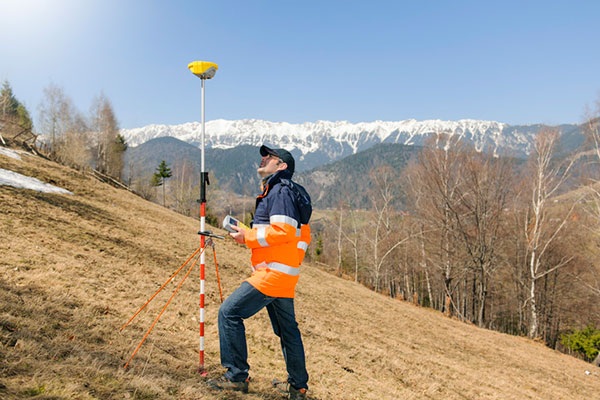
Rokubun has launched JASON, a satellite navigation service for accurate geolocation. With JASON, users can achieve highly accurate geolocation without a base station, Rokubun said.
JASON works under a “freemium” pricing model, making it possible to use it for free or to subscribe to monthly professional or premium plans.
JASON is a post-processed kinematic (PPK) satellite positioning service in the cloud that allows users to achieve highly accurate geolocation by uploading GPS/GNSS campaign data. JASON will try to obtain the best possible positioning solution on a best-effort basis. It will use PPK with the nearest GNSS continuously operating reference station (CORS) in the service’s database or with he user’s own provided station if no close CORS are available, or precise point positioning. The data can be processed interactively by using the Rokubun website or automating the workflow via the Rokubun API.
JASON also features a free data-conversion service for GNSS raw measurements.The service is compatible with Argonaut, u-blox, Septentrio, Android GnssLogger and any receiver able to export industry standard RINEX v2 or v3 file formats.
According to Rokubun’s CEO Xavier Banqué-Casanovas, JASON cloud service allows users to get the best possible performance out of their GNSS equipment using an internet browser, without the need for special installation or updates requirements.
In a first for any satellite navigation system, Galileo has achieved a positioning fix based on open-service navigation signals carrying authenticated data. Intended as a way to combat malicious spoofing of satnav signals, this authentication testing began at ESA’s Navigation Laboratory — the same site where the very first Galileo positioning fix took place back in 2013.
These historic first authenticated signal position, velocity and timing fixes were made using a total of eight Galileo satellites for around two hours on Nov. 18. The tests represent a first proof of concept for an eventual operational service offering positioning with authenticated data to users.
Spoofing has, for instance, been demonstrated as a means of forcing down drones or redirecting ships, while some high security locations — as well as disrupted international borders — have become notorious for spoofing signals that prevent the reliable use of satnav in their vicinity.
The Galileo Control Centres send the navigation signal to the GSC for the addition of the authentication code, which is then returned for uplink to the satellites.
“When a receiver picks up a navigation signal from a satellite, up until now it has no way of confirming that was indeed its source,” said navigation engineer Stefano Binda, overseeing the project for ESA. “This can result in spoofing — malicious people and organisations using false signals to mislead users about their actual position. This authentication service offers a way to prevent such deception.”
“In recent years, this problem has become sufficiently pronounced as a weak point that the European Commission, ESA and European GNSS Agency (GSA) decided to develop signal authentication as a differentiator for Galileo,” Binda said.
An ESA Navigation Directorate team at the Agency’s ESTEC technical centre in the Netherlands worked with its GSA counterparts at the twin Galileo Control Centres (GCCs) in Italy and Germany and the Galileo Service Centre (GSC) in Spain. “In everyday authentication you might send a document that has been digitally signed, where both sender and recipient use compatible cryptographic keys to validate the document’s source of origin,” Binda said.
“In this case we were working with a constrained amount of bandwidth within the navigation signal, so instead opted for a ‘delayed key’ approach. This means the initial data come along together a short tag which, within a short stretch of time usually not exceeding 30 seconds, is followed by a key, which is able to validate the tag and authenticate the data associated with it.”
During the test campaign, the Galileo Control Centres send the navigation signal to the GSC for the addition of the authentication code, which is then returned for uplink to the satellites, to be received and authenticated by the test receivers at ESTEC’s Navigation Lab and elsewhere in Europe, in participating laboratories.
To enabled the authentication test campaign, Thales Alenia Space in France served as prime contractor to upgrade of the Galileo Mission Segment — the world-spanning system that determines and create the navigation messages broadcast by Galileo satellites. Thales Alenia Space in Italy was responsible for the system level integration.
No modification of onboard satellite systems has been required to support Open Service Navigation Message Authentication (OSNMA), as spare bandwidth was made use of.
“We used our standard laboratory Septentrio test user receivers with a software add-on,” Binda said. “The beauty of this approach is that receivers will be able to make use of the future authenticated service without needing any new hardware, only software updates — apart from additional measures that might be mandated for operation in practice.”
ESA and GSA are continuing their authentication testing, with a view to introducing an operational Open Service Navigation Message Authentication service for users in the near future.
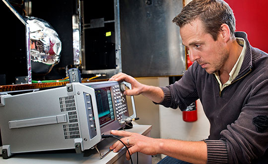
ESA’s Radio Frequency Systems, Payload and Technology Laboratories perform RF research for both the space and ground segments. (Photo: ESA)
OSNMA (Open Service Navigation Message Authentication) offers end-to-end authentication on a civilian signal, protecting receivers from spoofing attacks.
OSNMA is being pioneered by the Galileo Program, with Septentrio providing a testbed for this technology from the end-user point of view. The anti-spoofing capabilities of OSNMA will complement Septentrio’s already available anti-jamming technology, AIM+, and further strengthen the overall security of Septentrio GNSS receivers.
“The authentication of the Galileo signal using the OSNMA technology is yet another first that we are pleased to share with our close partner ESA [European Space Agency],” commented Bruno Bougard, R&D director at Septentrio. “Septentrio is proud and thankful to be able to contribute to the realization of one of Galileo’s key differentiators. “
With OSNMA, Galileo is the first satellite system to introduce an anti-spoofing service directly on a civil GNSS signal.
OSNMA is a free service on the Galileo E1 frequency. It enables authentication of the navigation data on Galileo and even GPS satellites. Such navigation data carries information about satellite location — if altered, it will result in wrong receiver positioning computation.
While currently in development, OSNMA is planned to become publicly available in the near future. GPS is experimenting with satellite-based anti-spoofing for civil users with its Chimera authentication system.
Within the scope of the FANTASTIC project led by GSA, OSNMA anti-spoofing protection was implemented on a Septentrio receiver.
“Septentrio is committed to providing highly accurate and secure positioning and timing solutions to industrial applications and critical infrastructure. This is another example where Septentrio demonstrates its leadership in end-to-end GNSS receiver security with its breakthrough anti-jamming and anti-spoofing technology,” said François Freulon, head of Product Management at Septentrio. “Thanks to our future proof products, we will be rolling out OSNMA in our portfolio as soon as it is available. This will further enhance the security of our receivers, ensuring robust, trustworthy and reliable operation even in the most challenging environments.”
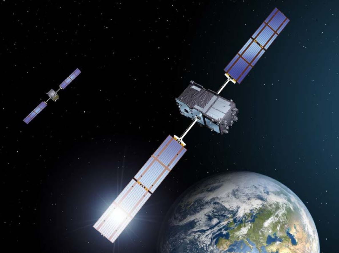
European Galileo satellites provide an open authentication service on the E1 signal and a commercial authentication service on the E6 signal. (Image: European Space Agency)
ESA and GSA (European GNSS Agency) have now commenced the testing phase of the OSNMA authentication, which will continue during the coming months. To find out more about spoofing and OSNMA, see this article. For more information about GNSS signals and the value they bring, see Septentrio’s free webinar More GNSS signals: What’s in it for you?
As in January 2020, we are starting the year by providing insights from manufacturers of GNSS receivers. We asked these industry leaders to look back at the past two years and forward at the next two, and discuss key innovations in the following areas:
utilizing Galileo and BeiDou
dealing with jamming and spoofing
integration with inertial measurement units (IMUs) and other sensors
positioning using cell phones and other consumer devices
any other areas or challenges they find particularly significant
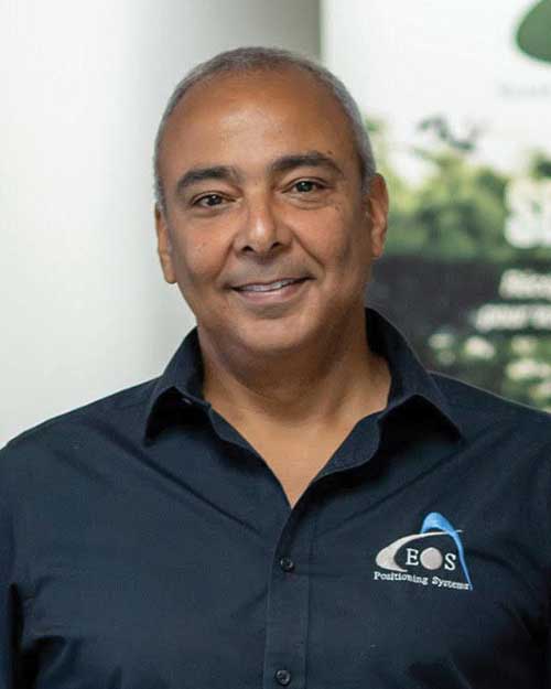
Photo: Emma Hardy/Eos Positioning Systems
The single most important trend that emerges from manufacturers’ responses is the improvement in receiver performance due to the increase in the number of satellites (now 150) and signals (now more than 100). With four usable constellations, GNSS is now a reality. Multi-constellation receivers are quickly becoming the norm, even in consumer devices, and new user segments are benefiting from satellite-based PNT. Already, some smartphones and tablets are achieving decimeter-level or even centimeter-level accuracy. Over the next two years, new GNSS services will become available and, as the GNSS constellations continue to develop, the availability, reliability and repeatability of their signals will improve further.
A second important trend is the growth in satellite-delivered correction data, which substantially lowers the entry barrier for high accuracy applications by obviating the need for costly local infrastructure. This is starting to change the traditional cost-benefit calculation regarding real-time kinematic (RTK) vs. precise point positioning (PPP) corrections (see also our Editorial Advisory Board PNT Q&A).
A third and continuing trend is the increasing threat from intentional and unintentional jamming and interference across the globe, paralleling the increasing ubiquity of GNSS and potentially impacting most users. Therefore, receiver manufacturers continue to improve hardware and software techniques to defeat, or at least mitigate, this threat, greatly assisted by the increase in the number of available signals.
Finally, as automakers and high technology companies continue their efforts to develop autonomous vehicles (aka “self-driving cars”), the concept of GNSS integrity is getting renewed attention. Here, too, the increase in the number of available signals is extremely helpful.
With François Martin, Vice General Manager, International Division
Utilizing Galileo and BeiDou
The addition of Galileo and BeiDou to GPS and GLONASS not only extends GNSS positioning to more obstructed environments, but also allows the use of new survey methods, such as the hybrid IMU-GNSS pole-tilt compensated surveying and stakeout with survey-grade accuracy. Further expansion of GNSS navigation systems will result in even greater availability, reliability and repeatability.
Dealing with jamming and spoofing
As an integrator and developer of GNSS systems, we focus our design on strong electromagnetic shielding and sealed isolation chambers. From a technology standpoint, the combination of advanced GNSS signal processing, optimized antenna design, and advanced filtering ensures minimal interference.
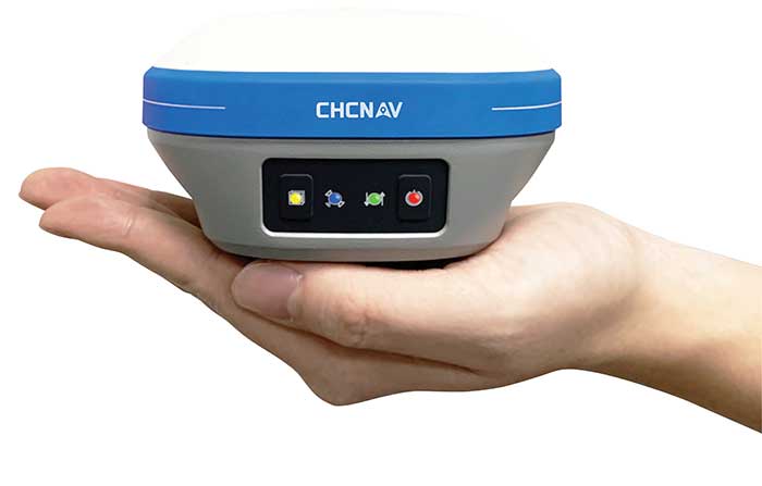
Photo: CHC Navigation
Integration with IMUs and other sensors
The integration of interference-free, high-dynamic IMU fused with GNSS technology brings an obvious benefit to surveying and autonomous navigation applications. The latest algorithm developments make it possible to get rid of tedious initialization processes, increase the productivity of typical survey tasks, bring extra safety to operators, and compensate for transient GNSS outages.
Positioning with consumer devices
Multi-constellation GNSS chips are accelerating the development of untapped user segments, but the repeatability of position accuracy remains an issue. The integration of high-performance GNSS chips and helical antennas as high-precision add-on modules on smartphones and tablets enables centimeter- or decimeter-level accuracy. This democratization of technology is increasing earlier adoption of GNSS technologies by a broader user base.
Eos Positioning Systems
With Jean-Yves Lauture, Chief Technology Officer
Utilizing Galileo and BeiDou
The past two years have seen considerable maturation of the Galileo and BeiDou constellations. Considering the now four usable GNSS constellations and the aggressive launches of Galileo and BeiDou, the number of available satellites and the list of frequencies they use have considerably increased. Accuracy itself is slightly improving with the availability of BeiDou phase 3 signals, whereas performance and productivity experience a significant boost under tougher conditions with more satellites and stronger signal availability. It is not uncommon for our customers to use 30 to 35 satellites out of 40+ in view using an Arrow Series GNSS receiver. We are waiting for the availability of the High Accuracy Service (HAS) (PPP) on the Galileo E6 frequency, hopefully in a couple of years.
Photo: Eos Positioning Systems
Integration with IMUs and other sensors
Eos has put a lot of effort recently in supporting external sensors and accessories to facilitate mapping of certain types of assets or mapping in certain types of conditions. For instance, this past year Eos released our underground mapping solution called Eos Locate for ArcGIS (see cover photo), which integrates with external utility locate devices to allow a user to precisely map buried assets. Eos Laser for ArcGIS interfaces with laser rangefinders to map assets in GNSS-impaired environments.
Positioning using consumer devices
With our bring-your-own-device (BYOD) approach on the market to support high-accuracy data collection for GIS, we have made it possible to override the consumer devices’ locations with accuracies down to the centimeter from our Arrow receivers. Customers can use any of their cell phones or tablets and immediately start mapping with submeter or centimeter accuracy.
Hemisphere GNSS
With Kirk Burnell, Senior Product Manager
Utilizing Galileo and BeiDou
The Galileo and BeiDou phase 3 systems introduce modern signal structures that allow more accurate measurements to be made than GPS first introduced. The new signals and increased satellite count are significantly improving receiver performance. Our Phantom and Vega product lines harness these new signals.
Dealing with jamming and spoofing
The increasing number of incidents of intentional and unintentional jamming and interference across the globe has impacted nearly every type of GNSS user. Our Cygnus interference mitigation technology automatically detects and mitigates the interference in real time, as well as providing spectrum analysis of the GNSS signal bands.
Photo: Hemisphere GNSS
Integration with IMUs and other sensors
Today’s autonomous-focused environment increases the need to share data across platforms. Both Vector and Vega provide robust GNSS heading, position and velocity to marine, machine control, UAV and internet of things (IoT) integrators, helping augment their sensor data.
Positioning with consumer devices
Positioning in consumer products will continue to drive innovation, while chasing accuracy and precision requires a strong understanding of geodesy fundamentals. As design requirements push well beyond the limits of what consumer GNSS delivers, and with the help of our knowledgeable staff, our precision receivers are delivering reliable performance in some very impressive applications.
Other significant challenges and opportunities
New GNSS signals and new surrounding technologies continue to come online, and the RF environment continues to see increased activities. Our underlying Lyra II ASIC technology and Cygnus enable our Phantom and Vega integrators and users to reliably coexist with these changes.
Hexagon | Novatel
With Sandy Kennedy, Vice President Innovation, Hexagon’s Autonomy & Positioning division
Utilizing Galileo and BeiDou
GNSS is now reality, not just inclusive phrasing to replace GPS. We are well into the era of multi-constellation receivers, and users will notice distinct improvements in solution availability with the addition of Galileo and BeiDou measurements. Over the next two years, we expect users in a variety of applications to start exploiting our globally available, fast-converging RTK From the Sky technology, which is enabled by the addition of quad-frequency signals supplied by Galileo and BeiDou (see page 29).
Dealing with jamming and spoofing
The RF spectrum is crowded and will only become more crowded over time. In 2020, we introduced our GNSS Resilience and Integrity Technology (GRIT), a suite of firmware options for the OEM7 receiver family. In addition to interference detection and mitigation, GRIT adds spoofing detection and time-tagged digitized samples for advanced situational awareness of the RF spectrum. With GRIT’s spoofing detection, opponents can try to spoof us. But fool us? Not a chance.
Photo: Hexagon | NovAtel
Integration with IMUs and other sensors
IMUs have become more accessible to more applications due to size, weight, power and cost reductions. At the same time, our algorithmic capability has significantly advanced to use lower quality inertial measurements for greater benefit. Originally reserved for truth systems, high-end mapping, and aerospace and defense applications, GNSS+INS solutions are now available in products like our SMART7 line of smart antennas for precision agriculture applications. Closer integration of the inertial and GNSS processing will bring further benefits in hostile RF or just plain difficult positioning environments. There is no perfect single sensor, but you can get more accurate by combining a set of sensors that offset each other’s vulnerabilities and limitations.
Positioning with consumer devices
The general population is accustomed to looking at their smartphone to see not only their location, but also the size of the “blue dot” of positioning uncertainty that accompanies it. We have always said accuracy is addictive, and we will no doubt start to see consumer demands for smaller blue dots with increasingly accurate positions. Making the digital reality match our real world demands continuously available and reliable positioning. Being lost is a terrifying feeling, especially for those who have been staring at their phone for the past 30 minutes and have no recollection of the physical world through which they have passed.
Other challenges and opportunities
The transition to autonomous vehicles, for both on-road consumer and off-road industrial applications, is inevitable. It is becoming increasingly necessary to prioritize the development of functional safety and integrity requirements to achieve the safe operations of autonomous systems. These requirements are necessary and entirely non-trivial to develop.
Photo: Stephen Drake
Javad GNSS
With the Javad GNSS Team
Utilizing Galileo and BeiDou
Simultaneous RTK and PPK processing of all available GPS, GLONASS, Galileo and BeiDou signals in receivers powered by our 874-channel TRIUMPH chip has resulted in significant productivity gains. User Darren Clemons told us “These Plus units are at least 40%–50% faster… The combination of the four super engines and the RTPK is unbeatable. You can get an accurate shot just about anywhere.”
Dealing with jamming and spoofing
Usually, more than 100 signals are available at any given time, and we need only a small number to compute a position. By tracking and verifying all these constellations and their signals, it is extremely unlikely that we can be spoofed without our knowledge. Javad GNSS receivers will immediately recognize spoofing and take corrective actions. Spoofing protection is available on all Javad GNSS receivers and OEM boards.
Integration with IMUs and other sensors
The Javad GNSS engineering team relentlessly works to identify and integrate the latest sensor technologies that can boost productivity. Our TRIUMPH-LS’s integrated camera sensor has for years supported onboard photogrammetry, and now our TRIUMPH-3 receiver’s integrated IMU provides high-precision tilt compensation.
Other challenges and opportunities
Our innovative RTPK feature is improving GNSS surveying and monitoring. Our Triumph-LS and Triumph-3 RTK rover systems combine the strengths of RTK and PPK into a system that can post-process RTK data and verify its results in parallel and real time. Users get the best of both worlds. If RTK fails, RTPK comes to the rescue in a fraction of a second.
Septentrio
With Gustavo Lopez (pictured) and Stef van der Loo, Market Access Managers
Utilizing Galileo and BeiDou [GL]
With 150 GNSS satellites in space, multi-constellation has been a natural transition for improved GNSS availability. We see this in rover applications and in upgraded reference networks modernizing correction services. The next two years will be transcendent as constellations finally start delivering new services. We see our products soon integrating
GAL-OSNMA for anti-spoofing and then moving to new high-accuracy services.
Dealing with jamming and spoofing [GL]
We have witnessed a large increase in jamming and spoofing events as GNSS ubiquity increases. Users are becoming conscious of this, yet many integrations are still using vulnerable receivers, and we see manufacturers falsely claiming to have proper resilience. Septentrio’s AIM+ technology uniquely mitigates all these risks, and users come to us for expert advice on this area. In the coming years, we expect further receiver innovations and developments in adjacent technologies.
In 2020, Septentrio opened an R&D center in Espoo, Finland. (Photo: izhairguns/iStock/Getty Images Plus/Getty Images)
Integration with IMUs and other sensors [SVL]
Integration of sensors and sensor fusion moved from the research stage to the major production and adoption phase as an element in autonomous systems. Using a GNSS/INS (see our AsteRx-i products) is crucial for various applications — for example, being able to work in difficult environments — and for vehicle orientation. The development of lower cost IMUs while keeping high performance will enable a shift in focus from hardware to software. This will result in multi-sensor technology that is better scalable, easier to use, and more stable to integrate in relation to a full system with various sensors.
Positioning with consumer devices [GL]
We see further integration of dual-frequency GNSS chipsets in mobile technology for increased accuracy, which is key for future consumer applications. Septentrio has also witnessed the important involvement of telecom operators in GNSS correction services. Septentrio products (such as the PolaRx5 or AsteRx-SB) are deployed on new generation networks as operators prepare for the new generation of positioning in cell technology.
Other significant challenges and opportunities [GL]
Two areas are emerging thanks to the autonomy era and due to further regulations in the market. The first is the concept of GNSS integrity, which has a strong link to the reliability of autonomous solutions. The second is security, which, beyond anti-spoofing, is linked to the cybersecurity of GNSS systems as the demand increases for the protection of electronics and software.
Trimble
With Stuart Riley, Vice President of GNSS Technology
Utilizing Galileo and BeiDou
Most Trimble precision receivers can utilize any combination of GNSS satellite constellations (GPS, GLONASS, Galileo, BeiDou and QZSS) to deliver centimeter accuracy and optimize performance, even in degraded conditions. Users can select the constellations they want the receiver to use.
Dealing with jamming and spoofing
Spoofing is rare and low risk in locations in which Trimble’s precision GNSS agriculture, construction and geospatial customers operate. However, to protect users, modern Trimble Maxwell-based GNSS receivers implement hardware- and software-based techniques to detect and mitigate spoofing. Jamming sometimes impacts customers, but is not their primary challenge. The same issues are still present today as they were in the early days of precision GNSS. The main productivity concerns remain related to multipath and problems around obstructions and trees. Trimble continues to improve our GNSS systems’ robustness with advances in processing algorithms and hardware enhancements such as integrating inertial technology.
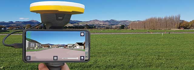
Trimble SiteVision uses Catalyst and augmented reality to preview a new housing development in an open field. (Photo: Trimble)
Integration with IMUs and other sensors
The Trimble R12i and SPS986 represent Trimble’s third-generation receivers (preceded by the R10 and the R12) capable of integrating inertial measurements into 3D GNSS positioning. In addition to speed and convenience for the user, integration with IMU provides immunity to magnetic interference and real-time integrity monitoring.
With the introduction of the Trimble R12 with the ProPoint GNSS positioning engine, we significantly improved the performance in challenging environments. This was further enhanced with the addition of an IMU for tilt compensation in the R12i. The new solution provides a system that delivers more accurate results in more places and in less time.
Positioning with consumer devices
The Trimble SiteVision augmented reality solution and Trimble Catalyst GNSS receiver operate on Android devices. Trimble Catalyst technology provides a software-defined GNSS receiver capable of survey-grade accuracy. Catalyst is the ideal solution for third-party applications that benefit from precise real-time positioning. Trimble SiteVision combines Catalyst positioning with augmented reality to deliver real-time, on-site visualization of proposed structures and existing underground assets.
Other significant challenges and opportunities
An ongoing challenge in GNSS positioning is the ability to obtain positions with suitable accuracy when and where they are needed. Solutions such as RTK and VRS provide solid performance at local and regional levels. Today, these technologies are complemented by subscription-based Trimble RTX positioning services, a global approach that uses a network of GNSS tracking stations and satellite-delivered correction data to achieve required accuracies. In 2020, coverage for Trimble CenterPoint RTX Fast, which enables users to achieve two-centimeter or better accuracy with initialization time of less than one minute, was expanded to cover the continental United States as well as much of Canada and Western Europe. The CenterPoint RTX Fast network now covers more than 5 million square miles worldwide. Trimble RTX coverage enables global users such as farmers, land surveyors and GIS professionals using RTX-capable receivers, to untether from the cost and complexities of GNSS base stations. In addition, the service offers a single, continuous corrections network ideal for enabling a broad range of safety-critical autonomous applications in markets such as automotive, agriculture and construction.
A roundup of recent products in the GNSS and inertial positioning industry from the December 2020 issue of GPS World magazine.
OEM
Inertial system
Ready for UAVs, robotics
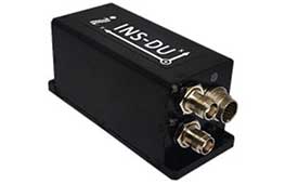
Photo: Inertial Labs
The INS-DU is a high-performance strapdown inertial navigation system (INS) that determines position, velocity and absolute orientation of a platform it is mounted to. Its dual-antenna u-blox receiver provides 1-cm real-time kinematic (RTK) position from RTCM 3 RTK corrections and supports multiple GNSS constellations. Designed for UAVs, land vehicles and marine vessels, the INS-DU uses a range of aiding data to deliver a highly accurate solution for GNSS-denied environments. It uses a miniAHRS with 3-axes each of precision magnetometers, accelerometers and gyroscopes to provide orientation. It contains algorithms for the motion of robots, autonomous vehicles and antennas.
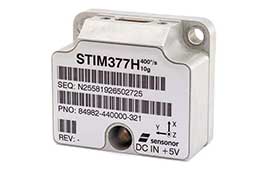
The high-accuracy tactical-grade STIM277H gyro module and STIM377H inertial measurement unit (IMU) were designed to meet space segment needs. Both have hermetic aluminum enclosures, and all parts are tested for fine and gross leak to conform to MIL-STD-883J, Class H. While a commercial off-the-shelf (COTS) product, Sensonor has carried out extensive radiation characterizations. The design is tested for a 20+ years operating life through high-temperature operating life (HTOL) testing. Backwardly compatible with Sensonor’s other IMU and gyro modules, STIM277H and STIM377H are designed for satellite attitude and orbit control systems (AOCS), launchers, portable target acquisition systems, UAV payloads, land navigation systems, turret stabilization, missile stability and GNSS-supported navigation systems.
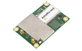
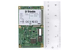
The AsteRx-m3 family features GPS/GNSS OEM boards optimized for power consumption and ease of integration. An easy-to-integrate design enables short set-up times and faster time-to-market. The AsteRx-m3 offers multi-frequency, multi-constellation positioning combined with Septentrio’s GNSS+ technology while optimizing power. The AsteRx-m3 Pro rover receiver tracks signals from all available GNSS constellations on three frequencies, and operates both in single- and dual-antenna modes. The AsteRx-m3 ProBase is designed to operate as a reference station for RTK and PPP-RTK networks. The AsteRx-m3 Pro+ is a full-feature OEM receiver board flexible enough to fit into any application and to be used either as a rover or a base station in a single- or dual-antenna mode.
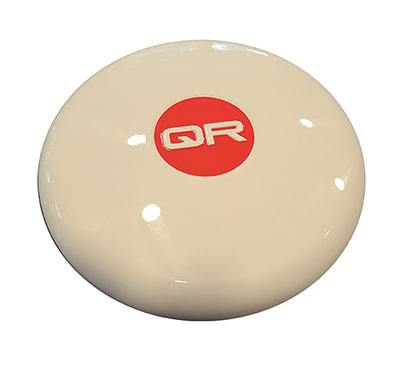
New anti-jamming antennas available are the QR200 GPS dual-frequency L1/L2 anti-jamming antenna, the QR201 GNSS multi-frequency band anti-jamming antenna, and the QR202 GNSS multi-frequency band anti-jamming antenna with additional L-band reception (1520–1560 MHz). All models provide robust GPS or GNSS navigation and block intentional jamming and unintentional RF interference timing or 3D positioning. All three are lightweight (230 grams for the QR1xx series and 500 grams for the QR2xx series) with low power consumption (1–1.5W typically, depending on configuration), and can be mounted on any platform (cars, poles, drones, etc.).
The Vision-RTK positioning sensor is a compact centimeter-accurate solution with high reliability and availability in challenging environments. The module integrates two real-time kinematic (RTK) GNSS receivers and visual inertial navigation. Its sensor-fusion algorithm is based on deep integration of GNSS, camera and inertial sensors. Real-time sensor fusion provides centimeter-accurate absolute positioning in any outdoor environment.
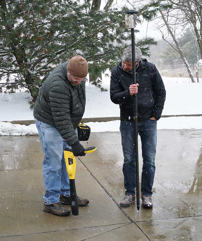
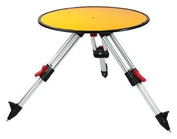
Deploying ground control targets on accurately surveyed ground control points (GCP) assures that a UAV lidar survey has been properly executed. UAV lidar surveys are typically undertaken in remote, rural and sometimes hazardous locations where no fixed points are available, such as solid surfaces or concrete features. Routescene’s GCPs are raised from the ground using a mini tripod. A built-in bubble level enables accurate leveling and removes the need for a tribrach. Robustly engineered, the targets stay in position during adverse and windy conditions, reducing the risk of repositioning during a survey. They are covered with highly retro-reflective material to provide high-intensity returns. As a result, the targets are easily identifiable and can be automatically extracted from the geo-referenced point cloud.
The Toughbook A3 Android tablet is aimed at the mobile workforce. It has an outdoor viewable screen and patented rain-touch functionality. With a 10.1-inch screen and 6-foot drop rating, the A3 enables users across industries to tackle tough jobs and critical applications. The Qualcomm SDM660 chipset, which supports BeiDou, Galileo, GLONASS, GPS, BeiDou QZSS and SBAS. 4G LTE Band 14 EM7511 multi carrier mobile broadband with GPS. The tablet has a powerful octa-core processor, an optional integrated barcode reader, an insertable smart card reader and an insertable stylus. The A3 has a 5-foot drop rating and IP65 certification for dust and water resistance.
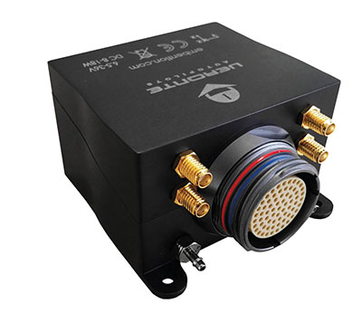
Veronte Autopilot 1X is a miniaturized avionics system for advanced control of unmanned systems. The control system embeds a suite of sensors and processors with datalink radio, with reduced size and weight. The control system Veronte Autopilot 1X adds fully autonomous control capabilities to any unmanned system for complete operation. The Veronte control system is fully configurable for payload, platform layout, control phases and control channels. It uses real-time kinematic (RTK) positioning and provides cloud connectivity, sense-and-avoid support, electromagnetic interference and vibration isolation.
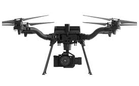
The Astro commercial drone platform is equipped with Freefly’s multi-band, real-time kinematic (RTK) system, which provides centimeter-level precision with a u-blox F9P GNSS module. The drone is equipped with a 60-megapixel Sony camera. A customized version of Skynode powers each Astro, providing LTE connectivity, an onboard Linux mission computer, and seamless connectivity to Auterion Mission Control and Cloud Suite. The Auterion ecosystem provides robust, secure and scalable drone planning, flight and compliance management solution.
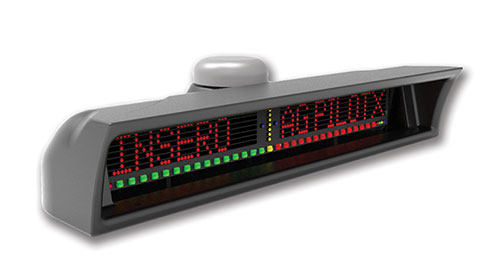
The guidance system AgPilotX for aerial applicators uses three wireless components: a GPS/GNSS lightbar, a hub and an Apple iPad. The smart components run off their own computer, communicating to each other wirelessly. The AgPilotX Smart Lightbar has onboard GPS+GLONASS as well as a GNSS antenna, so there is no need to run an antenna up to the aircraft canopy. The Lightbar logs the data, while a hub connects the switches (swath advance, swath decrement, spray on/off) and peripherals, and an iPad runs the interface software through an Apple App. All logs are saved as unique jobs and can be returned to at any time. The lightbar is not dependent upon the iPad to operate and will continue to work the active job even if you start using a different App or even shut the Apple device completely off.
Insero, inserosolutions.com
Antennas
High accuracy for autonomous vehicles, robotics
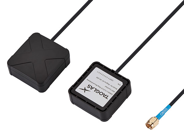
The Colosseum X XAHP.50 antenna. (Photo: Taoglas)
Two new active, multiband GNSS antennas are engineered for applications that require critical high-accuracy positioning and timing, including autonomous driving and precision agriculture. The MagmaX2 AA.200 is designed for space- and weight-constrained applications, such as robotic lawnmowers. Embedded versions are also available. It is a low-profile active multiband GNSS magnetic mount antenna for use across most major constellations including GPS (L1/L2/L5), GLONASS (G1/G2/G5), Galileo (E1/E5a/E5b) and BeiDou(B1/B2). The Colosseum X XAHP.50 is a geodetic-quality small-dome antenna suitable for a vehicle roof mount or pole mount. It is engineered to operate with high-precision capabilities on the full GNSS spectrum. Sub meter positional accuracy better than 55 cm is achievable, even without the use of RTK correctional services.
Aerial shot of Espoo, Finland, from a drone. (Photo: izhairguns/iStock/Getty Images Plus/Getty Images)
Expansion enables company to further accelerate cutting-edge GNSS/INS solutions for professional and industrial applications
Septentrio has opened a new Research & Development center in Espoo, Finland, to support the strong growth and ambitious expansion plans for its GNSS/INS solutions for professional and industrial applications.
The new office is strategically located in Espoo, well known as a high-tech hub with a long history of state-of-the-art GNSS and INS development, housing many leading technology companies as well as Aalto University.
“This new R&D center will support our strong growth and further accelerate our strategic agenda of becoming the leading independent GNSS/INS supplier for demanding applications in industrial, scientific and infrastructural domains,” said Antoon De Proft, CEO at Septentrio. “We also welcome Stefan Söderholm, who brings a wealth of experience to our team and will lead the new R&D center in Finland.”
“I am really excited to join Septentrio,” added Söderholm. “I have always been impressed by its technology and I look forward to be part of this great team that develops unique positioning solutions for the industry.”
Septentrio will be expanding its R&D team in the coming months with enthusiastic and highly qualified GNSS and INS engineers as well as software engineers. Stefan Söderholm will spearhead the establishment of the new R&D center and the recruitment efforts.
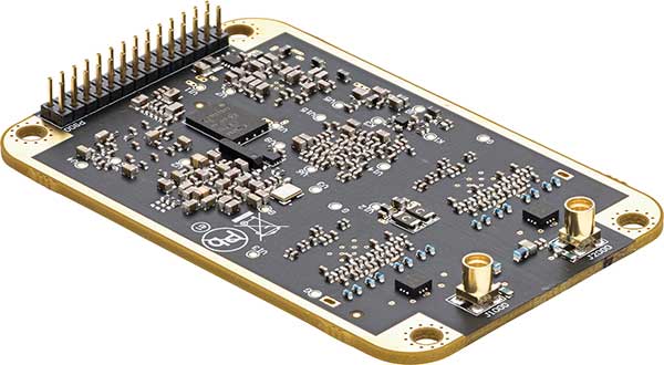
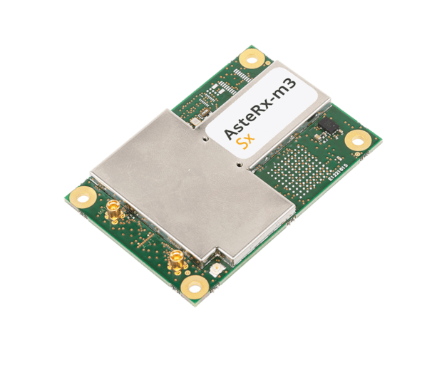
OEM receiver board includes Septentrio’s innovative SECORX-S service, bringing always-on sub-decimeter accuracy, without the need for additional correction subscriptions
Photo: Septentrio
Septentrio has launched the AsteRx-m3 Sx OEM board, a new dual-antenna receiver that combines Septentrio’s latest core GNSS technology with the SECORX-S sub-decimeter correction service to enable convenient plug-and-play positioning.
High-accuracy positioning is available directly out of the box as GNSS corrections are automatically streamed to the receiver. This significantly simplifies the user’s GNSS receiver set-up process and eliminates completely the hassle of corrections service subscription and maintenance.
Corrections are delivered via internet or via L-band satellites ensuring sub-decimeter service even in remote locations where there is no easy internet access.
“With the AsteRx-m3 Sx, we combine our latest GNSS innovations of the AsteRx-m3 family with the convenience of the SECORX-S always-on corrections, all in the same product,” said Danilo Sabbatini, product manager at Septentrio. “This offers higher reliability and operational efficiency to our customers, at an even lower cost.”
With its dual-antenna configuration, AsteRx-m3 Sx offers heading information immediately from power-up, allowing path optimization and fully informed navigation from mission start. Septentrio’s renowned GNSS+ algorithm suite ensures robust and reliable operation in challenging environments even in the presence of RF interference and under heavy vibrations, the company said.
AsteRx-m3 Sx offers PPP-RTK sub-decimeter accuracy with fast convergence time in the U.S. and Europe.
An autonomous freight barge moves through a lock. The barge is equipped with Septentrio GNSS positioning via Seafar navigation. (Photo: Seafar)
Seafar has integrated Septentrio’s AsteRx-U dual-antenna, multi-frequency, multi-constellation receivers into its autonomous vessels to provide sub-meter positioning for navigation and control.
AsteRx-U’s robust enclosure is equipped for harsh outdoor marine environments. The dual-antenna set-up provides precise heading information along with reliable positioning. A captain in a Remote Operating Center monitors several unmanned ships simultaneously, and can take over navigation control if the need arises.
The maritime industry is witnessing an emerging trend of navigation automation both in the open sea as well as inland. Lloyds Register predicts that the marine industry will undergo a shift toward full autonomy for seafaring as well as inland ships by 2035, a timeline similar to that of the automotive industry.
And GNSS positioning plays a key role. Unlike open sea transport, inland barges navigate narrow waterways, passing through locks, under bridges and near urban areas. The distance between ships can be down to 1 meter in a tight lock. Septentrio’s AsteRx-U provides the accurate and continuous positioning that enables ships to navigate in ports, stay on their predetermined routes and dock at harbors. The receiver also provides Septentrio’s Advanced Interference Mitigation (AIM+) to ensure reliable positioning in the face of jamming or spoofing.
Currently, only 6% of inland transport travels on waterways, though water transport is more energy efficient and safer than rail and road. Optimized route and fuel efficiency, increased cargo space and savings on human resources are ways automation helps inland barge owners increase their margins and gain a competitive edge.
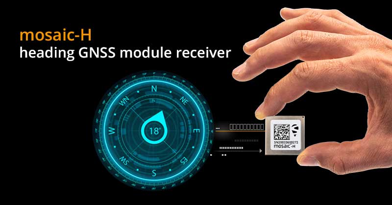
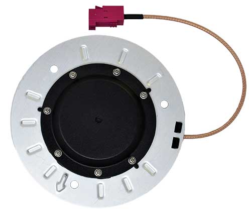
Septentrio has expanded its GNSS module portfolio with the launch of its mosaic-H heading receiver. According to the company, with dual-antenna capabilities, this surface mount module delivers reliable heading and pitch or heading and roll information on top of centimeter-level positioning.
mosaic-H is the new addition to Septentrio’s existing mosaic module family, which already includes RTK and timing modules, as well as modules with integrated GNSS corrections. According to Septentrio, having a single standard footprint across multiple specialized receiver modules enables integrators to create multiple application-specific products based on a single design.
“The mosaic GNSS receivers have set a new performance standard among high-precision GNSS modules,” said Francois Freulon, head of product management at Septentrio. “Adding a second antenna input into the single form factor of mosaic demonstrates Septentrio’s leading position in the high-precision module market. Thanks to its ultra-small dimensions and low power consumption, mosaic-H is the ideal navigation and control solution for robotics, UAVs and autonomous applications which require ultra-robust and secure positioning and heading.”
mosaic-H delivers orientation angles immediately from the start, helping initialize inertial systems which otherwise would require movement before they can measure 3D orientation. INS initialization with GNSS attitude from power-up allows machine trajectory path optimization and fully informed navigation of robotic systems immediately from mission start, Septentrio added.
A roundup of recent products in the GNSS and inertial positioning industry from the November 2020 issue of GPS World magazine.
OEM
GNSS receiver
Sub-decimeter accuracy without additional service subscription
The AsteRs-m2-Sx. (Photo: Septentrio)
The SECORX-S product line, which first offered GNSS OEM boards, now also includes a compact mosaic-Sx module and ruggedized receiver in an IP68 chassis, the AsteRx SB Sx. The multi-constellation multi-frequency SECORX-S receivers deliver sub-decimeter positioning without the need for additional correction service subscription or maintenance. The PPP-RTK correction service is integrated directly into Septentrio’s core GNSS technology. The addition of modules and boxed receivers to the SECORX-S line providesz accurate positioning to applications such as precision agriculture, UAVs, robotics and construction.
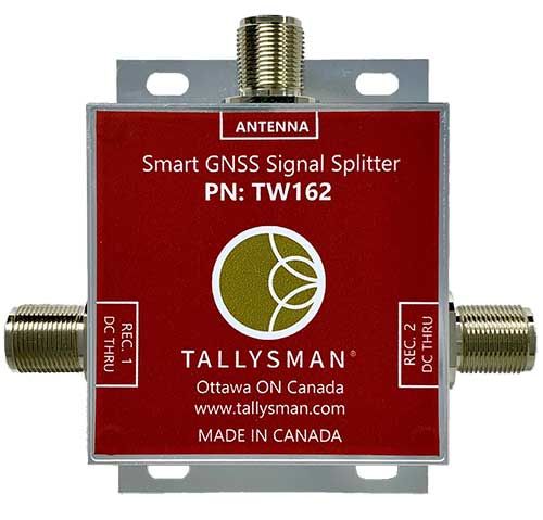
Smart Power GNSS signal splitters improve GNSS service reliability and minimize service interruptions. The professional-grade splitters — TW162 (one antenna/two receivers) and TW164 (one antenna/four receivers) — offer system redundancy and fail-over capability. The splitters are designed to improve GNSS service reliability and reduce signal reception failures. Both splitters offer system redundancy and fail-over capability. They support GPS/QZSS-L1/L2/L5, QZSS-L6, GLONASS-G1/G2/G3, Galileo-E1/E5a/E5b/E6, BeiDou-B1/B2/B2a/B3 and L-band correction services.
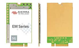
The EM919x 5G NR Sub-6 GHz and mmWave embedded modules include an integrated GNSS receiver. Based on the industry-standard M.2 form factor, the modules will enable original equipment manufacturers (OEMs) to securely deploy 5G connectivity worldwide at the highest possible speeds with ultra-low latency for routers and gateways. The modules support mmWave, sub-6 GHz and LTE, as defined by the 3GPP Release 15 standard. Applications include private networks, enterprise networking, edge processing, live streaming, video security, e-gaming, smart factories, robotics, drones, virtual reality, machine learning, and new Industrial IoT applications.
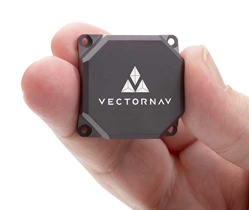
Tactical Embedded series of GNSS/IMUs. (Photo: VectorNav)
The Tactical Embedded series of GNSS/IMUs feature a tactical-grade inertial measurement unit (IMU) and a multi-band GNSS receiver. The line delivers milliradian attitude accuracy and centimeter-level positioning capability in a miniature 15-gram package. The small size enables cost reductions for a range of autonomous pointing and geo-referencing applications such as gimballed intelligence, surveillance and reconnaissance (ISR); satellite communication systems; lidar mapping; and photogrammetry. The line supports external SAASM GPS for defense applications in ISR, electronic warfare, munitions and UAV navigation. The line includes the VN-110E IMU/AHRS, the VN-210E GNSS-aided inertial navigation system (INS), and the VN-310E dual-antenna GNSS/INS.
VectorNav Technologies, vectornav.com
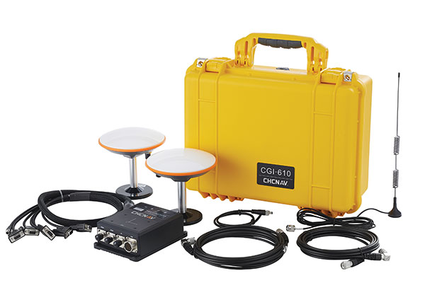
GNSS/INS Sensor
Designed for dynamic environments
Photo: CHCNAV
The CGI-610 GNSS/INS high-precision dual-antenna receiver offers reliable and accurate navigation and positioning for demanding land, marine and aerial applications. The tight fusion of the latest GNSS technology with an industrial-grade MEMS IMU is powered by CHCNAV’s algorithms to deliver accurate hybrid position, attitude and velocity data, even in complex and obstructed environments where GNSS outages can occur. The CGI-610 supports data output up to 100 Hz to meet the requirements of highly dynamic applications such as airplane, train and automobile. An optional external odometer sensor for ground vehicles can provide an additional measurement of displacement and speed, which is fused with the GNSS/INS navigation solution.
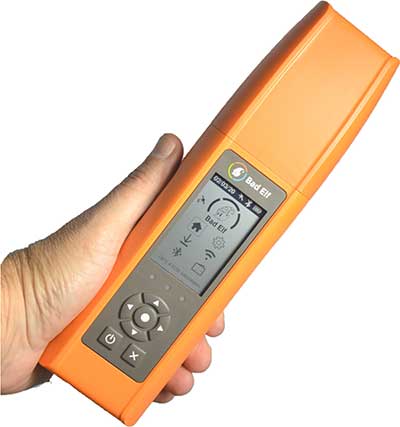
Bad Elf Flex is a scalable-accuracy GNSS receiver with a daily option to choose between L-band and real-time kinematic (RTK). In standard configuration, it achieves 30-60 cm accuracy in real time for GIS use. Consuming a Bad Elf Flex Token unlocks a full RTK workflow for a 24-hour period to deliver 1-cm horizontal accuracy. Bad Elf Flex stores the tokens directly on the receiver, making them available for use anytime. Customers requiring high accuracy at all times can purchase the Bad Elf Flex Extreme bundle, with RTK capabilities permanently unlocked, for a one-time upgrade fee.
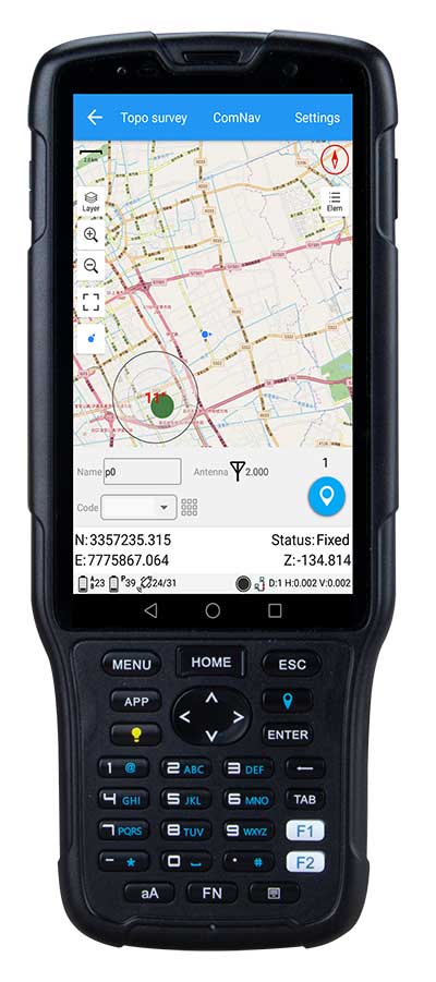
The R550 data collector features an industrial-level design and new hardware platform to ensure efficiency and productivity in the field. The IP67 dust-and-waterproof rating protects the R550 from most harsh environments. Equipping it with a 7,000 mA Li-ion battery allows more than 14 hours of continuous operation, while fast-charging technology means four hours for a full charge. The 5-inch-wide sunlight-readable, high-resolution screen provides a smooth experience for any operation. The integrated autofocusing camera helps enhance job documentation by taking photos on site and sharing job information with colleagues. Survey Master field software available on the R550 controller ensures efficient surveys in the field, including topographic surveys, stakeouts, coordinate geometry (COGO) and more. Powered by the Android 8.1 operating system and designed with 4G RAM, 64GB ROM and 4G/BT/Wi-Fi on board, users can run other third-party apps based on their specific requirements.
The Trimble AP+ Air OEM solution provides direct georeferencing of airborne sensor data and enables users to accurately and efficiently produce maps and 3D models without the use of ground control points. It is designed for manned platforms, yet small enough for use on UAVs. It is also compatible with airborne remote sensors, including photogrammetric cameras, lidar, hyper- and multi-spectral cameras, and synthetic aperture radar. The Trimble AP+ Air features dual embedded survey-grade GNSS chipsets, an onboard inertial measurement unit (IMU), an external IMU, and the new Applanix IN-Fusion+ GNSS-aided inertial firmware. It is configurable to support the direct georeferencing accuracy demands of low-flying UAVs and high-altitude manned platforms. Trimble AP+ Air is supported by Applanix POSPac MMS post-processing software with CenterPoint RTX post-processing for centimeter-level positioning anywhere in the world without the need for base stations.
American-made drone aimed at government agencies and military
Photo: Teal
The Teal Golden Eagle drone is designed for short-range surveillance and reconnaissance missions. It features a FLIR Handron dual-camera sensor on a two-axis stabilizer, giving it color vision at 4K 60 fps and thermal vision for extended operations. The payload is hot-swappable. It has a flight time of up to 50 minutes and can fly at speeds of 50 mph with a range of 2 miles. It is able to fly in wind speeds of up to 30 mph and can operate between –32° and 110° Fahrenheit. Forward-facing obstacle avoidance and rear-facing visual-inertial odometry estimates location without the need for GPS. The platform has received approval from the Department of Defense.
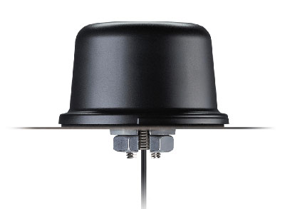
A new line of AccuAuto triple-band antennas are designed to provide strong clean code and phase signals to enable high-precision real-time kinematic (RTK) and precise point positioning (PPP) navigation. Model TWA928 supports GPS/QZSS-L1/L2/L5, GLONASS-G1/G2/G3, Galileo-E1/E5a/E5b, BeiDou-B1/B2/B2a and NavIC-L5 signals and frequency bands (the TWA928L includes support for L-band correction services). The AccuAuto line features patented Accutenna technology multi-constellation and multi-frequency antenna elements as well as an integrated ground plane, a radome and an underside cover that provides mist and condensation protection. A deep pre-filter minimizes out-of-band noise and maximizes in-band reception. All AccuAuto components are certified and designed to perform under challenging environmental conditions, such as extreme temperatures (–40° C to +125° C), shock and vibration.
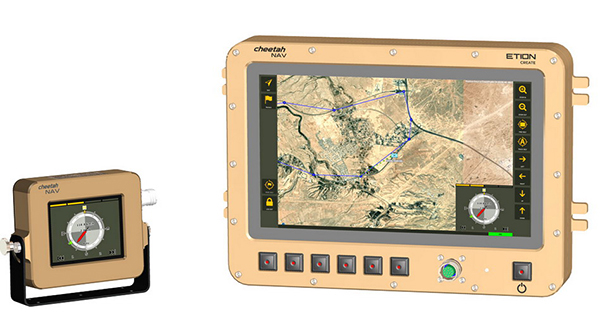
The CheetahNAV provides situational awareness for harsh environments and battlefield conditions, providing the crew of a light military vehicle with highly accurate position information through an advanced inertial measurement system (IMS) comprising several aids, including a gyro-compensated compass and an advanced Kalman-filter-based algorithm. The system provides dead-reckoning horizontal position accuracy of 0.2% of distance traveled in a GNSS-denied situation — accuracy of 200 meters over 100 kilometers. It can integrate with inertial navigation systems (INS). Combined with GNSS and compass information, the system enables dead-reckoning and accurate positioning of the vehicle in tactical situations. The tactical-grade integral inertial measurement unit (IMU) ensures jam-free operation.
Taoglas has unveiled active, multiband GNSS antennas engineered for applications that require critical high-accuracy positioning and timing, including autonomous driving and precision agriculture. Both the MagmaX2 AA.200 and Colosseum X XAHP.50 add to Taoglas’ high-precision GNSS range.
“Safety standards for autonomous vehicles (UAVs, robotics and vehicles) and precision agriculture is an ever evolving arena,” said Ronan Quinlan, co-CEO and founder of Taoglas. “However, it’s increasingly apparent that high-precision positional accuracy is critical for both. At Taoglas we’re continuously innovating our GNSS antennas to deliver the very best precise location capabilities, but in more lightweight, compact structures, compared to larger counterparts already on the market. We look at the impact the antenna has on the actual positioning performance of your system, not just the antenna itself.”
The MagmaX2 AA.200. (Photo: Taoglas)
The MagmaX2 AA.200 is designed for space and weight constrained applications, such as robotic lawnmowers, Quinlan said. Embedded antenna versions are also available.
The AA.200 is a low-profile active multiband GNSS magnetic mount antenna for use across most major constellations including GPS (L1/L2/L5), GLONASS (G1/G2/G5), Galileo(E1/E5a/E5b) and BeiDou(B1/B2). It exhibits excellent gain and good radiation pattern stability leading to a reliable GPS fix in areas of weaker signal strength.
Positional accuracy better than 60 cm (DRMS) is achievable, even without RTK corrections services. Accurate positioning down to 1.4 cm has been demonstrated with today’s multiband GNSS receivers and RTK services in the field.
The Colosseum X XAHP.50 antenna. (Photo: Taoglas)
The Colosseum X XAHP.50 is a geodetic-quality small-dome antenna suitable for a vehicle roof mount or pole mount. “Every element and aspect of the antenna performance has been optimized during the design of this antenna,” Quinlan said. “This includes many deep interlocking rf parameters for true accurate centimeter-level positioning, compared to legacy meter-only level systems. Phase center variation, group delay, multipath rejection, axial ratio over angle all become critical considerations and performance targets.”
The XAHP.50 is engineered to operate with incredibly high precision capabilities on the full GNSS spectrum. Sub meter positional accuracy better than 55cm (DRMS) is achievable, even without the use of RTK correctional services. This allows the user to achieve higher location accuracy, as well as stability of position tracking in urban environments.
The XAHP.50 has excellent performance across the full bandwidth of the antenna and its design has an even gain across the hemisphere giving excellent, broad axial ratio which in turn makes it resilient to multipath rejection and excellent phase centre stability. Accurate positioning down to 1.4 cm has been demonstrated with today’s multiband GNSS receivers and RTK services in the field.
Antenna Development
“In the design phase we simulate using electromagnetic analysis software and tweak every parameter,” Quinlan said. “Once we are happy with the results, we build our prototypes and test in scientifically controlled chamber and test environments validated by the European Space Agency, with repeatable GNSS signals.
“We then move onto field testing in open-sky conditions and in non-line of sight environments to verify real-world performance with today’s state-of-the-art receiver systems from such leading companies as u-blox and Septentrio.
What’s more, every single antenna coming off our production line goes through strict in-line sensitivity testing to ensure consistent validated performance. We take our commitment to quality and safety very seriously in the coming age of autonomous operation,” Quinlan concluded.
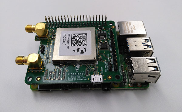
Septentrio, a leader in high-precision GNSS positioning solutions, is offering two open-source resources for its GPS/GNSS module receivers.
The first, ROSaic, is a Robot Operating System (ROS) driver for the mosaic-X5 module as well as other Septentrio GNSS receivers.
The second project, mosaicHAT, is an open source hardware reference design combining mosaic-X5 with a Raspberry Pi single-board computer.
Both projects facilitate integration of centimeter-level reliable positioning into robotic and other machine automation applications.
Photo: Septentrio
ROSaic driver operates on ROS, a widely used programming environment within the industry as well as academics, commonly used for integrating robot technology and developing advanced robotics and autonomous systems. ROS allows data from numerous sensors to be combined allowing high levels of autonomy.
The mosaicHAT project facilitates accurate and reliable GNSS positioning for robotics and automation on a hardware level. Numerous engineers today use Raspberry Pi for prototyping and initial integrations. The mosaicHAT board is an easy way for integrators to get started with Septentrio’s mosaic-X5 GNSS module.
By plugging mosaicHAT into a compatible Raspberry Pi, users have access to high-accuracy positioning with a high update rate, ideal for machine navigation and control, the company said. The small 56×65 mm board exposes basic interfaces such as USB, serial and general-purpose communication pins. The reference design, footprint and documentation are available for easy board printing or further customization.
“We are excited about both the ROSaic driver and the mosaicHAT being part of the GitHub community and we highly appreciate the initial authors work as well as the future contributors,” said Gustavo Lopez, market access manager at Septentrio. “Both projects are available as open source, thus empowering the community to easily fit autonomous or robotic systems with highly accurate and reliable GNSS positioning technology.”