Tag: Septentrio

  • GNSS industry adapts during COVID-19 pandemic

    GNSS industry adapts during COVID-19 pandemic

    Companies, contributors share success stories

    Social distancing and stay-at-home orders are affecting every sector of our economy. How are companies in our industry rising to this enormous challenge? What are they doing to keep their staffs, customers, and communities safe and to help slow down the spread of the pandemic? What are they learning in the process?

    We asked our marketing partners, Editorial Advisory Board members and “Innovation” Editor Richard Langley the questions below so that we could share their collective wisdom with you, our readers. The advertisers’ responses appear in alphabetical order by company, followed by the responses by EAB members.

    We will continue to publish these responses here as we receive them; we will also publish a selection of them in the May print issue of GPS World.


    The World of Academia: Lecturing from Home

    Richard Langley, GPS World Innovation” Editor

    Professor, Department of Geodesy and Geomatics Engineering,
    University of New Brunswick, Fredericton, Canada

    "Innovation" Editor and UNB Professor Richard Langley lectures to his students online. (Screenshot: Richard Langley/UNB)
    “Innovation” Editor and UNB Professor Richard Langley lectures to his students online. (Screenshot: Richard Langley/UNB)

    On March 13, the president of the University of New Brunswick announced that as of the following day due to the Coronavirus-19 outbreak in the province of New Brunswick, all in-person classes would be suspended for the remained of the school term, and that starting March 23, classes would resume using alternative methods to support delivery outside the classroom. Faculty members like me had a week to find other ways to deliver our courses to the students. Some of us turned to pre-recorded video presentations and some, like me, to live class sessions using online video conferencing tools like Zoom and Microsoft Teams. I tried both but ended up using Teams on the advice of the university administration.

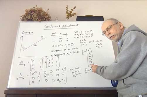
    This term I was teaching GGE 3111: Introduction to Adjustment Calculus. Basically, it’s an introductory course on the mathematical technique of least-squares analysis. Least squares, where one seeks to find the minimum of the sum of the squares of the estimated errors in measurements, is a fundamental technique for analyzing data in many application areas in the sciences and engineering disciplines, including the processing of GNSS data. It was pioneered back in the early 1800s by Gauss, the great German mathematician and father of modern geodesy.

    Incidentally, Kalman filtering also widely used for processing GNSS data, is essentially a recursive approach to the least-squares problem. The example I am doing on the board (see screenshot) is how to fit a straight line to data pairs x and y where both the x and y values contain random measurement errors. I have always taught GGE 3111 using the blackboard or, since lecturing from the dining room of my house by video link, a whiteboard.

    I recorded my home-delivered lectures and provided these to the students through the Desire to Learn platform that UNB uses for teaching. Not all of the students could attend the live lectures as some had returned home to provinces with several hour time differences from New Brunswick making it inconvenient to attend a morning lecture. Others no longer had a good Internet connection to view real-time video.

    The recordings also provided a useful resource to the students for reviewing the course material. When we eventually return to normality, I might continue to record my lectures. They could even form the basis of an online version of my course available to UNB students and non-students alike.


    CAST Navigation

    Susan Gove, President and CEO

    Susan Gove, CAST Navigation:
    Susan Gove, CAST Navigation:

    CAST Navigation has overcome many obstacles and challenges to be able to provide our customers with the products and services that are valuable to them during this difficult period. The company has instituted a set of strict policies and procedures that allow us to manage our facility hours and employee “distancing” practices.

    We have also enabled employees to work remotely if necessary and we continue to work very closely with our vendor supply chain to minimize delays and impacts to our schedule. These policies and procedures, along with a very focused and devoted staff, have allowed us to continue to provide the superior quality products and services on which our customers rely.


    Eos Positioning Systems

    Jean-Yves Lauture, Chief Technical Officer

    Jean-Yves Lauture, Eos Positioning Systems
    Jean-Yves Lauture, Eos Positioning Systems

    Eos Positioning Systems’ employees are able to work remotely in most cases. In fact, prior to the pandemic, a number of full-time employees worked remotely across Canada, the United States, and the Asia/Pacific region. Now, we’ve transitioned all employees to remote working and transitioned the tasks of individuals whose routine work was directly affected by the virus. We’ve also added a weekly all-staff video Zoom meeting to address everything from company questions to individual wellbeing.

    We were already grateful for our ecosystem of staff, partners, and customers, but everyone has shown their positive colors even more in response to this pandemic. Everyone remains responsive across platforms and time zones. The uptick in social media engagements of our customers and partners has been particularly great to see.

    In addition, we’ve heard from some customers that they are using our GNSS receivers more during this time. Because our receivers are easy to use for the novice, office workers who would typically not do fieldwork are being trained on field work, which can be a naturally socially distanced, one-person job.

    As expected, many of the events we enjoy sponsoring have been postponed or canceled. We’re working with event coordinators and our own team to ensure that when events start up again, we are prepared to go back to business as usual. We are really, truly looking forward to seeing our customers, partners, and colleagues in person again!


    GeoNumerics

    Ismael Colomina, Chief Scientist

    Editorial Advisory Board Member

    Ismael Colomina
    Ismael Colomina, GeoNumerics

    At GeoNumerics, we are all OK, including our families. As we are an R&D-intensive company focused on algorithms, software, and consultancy, we are lucky these days. Furthermore, some of our employees —women with young children — were already teleworking most of the time. Therefore, it was easy to extend this to the rest of the company.

    Since mid-March, everyone is at his/her place teleworking. This enables us to:

    • keep the company running
    • keep our employees busy like in “normal” days
    • protect our customers by meeting deadlines
    • protect the economy by not stopping the business
    • on a case-by-case basis, help our providers/partners who had to stop their business.

    Internally, we share a “good morning” short communication via WhatsApp and a daily 20 minute “virtual coffee break” after lunch via Skype.


    Hexagon | NovAtel

    Miguel Amor, Chief Marketing Officer, Autonomy & Positioning Division

    Editorial Advisory Board Member

    Miguel Armor
    Miguel Armor

    COVID-19 is affecting everyone on a global scale, which means that we all must work together to limit the spread of the virus and protect the people at risk. At Hexagon, our priority is keeping our employees and customers safe, and we are following all guidelines and recommendations set up at national, regional and local levels to do so.

    Through all of this, we recognize that our employees and our customers are relying on Hexagon more than ever. Rest assured that we are taking all necessary steps to protect our employees and to minimize risk to the supply of our products and our services to our customers.

    At Hexagon | NovAtel, we believe our size, reach, and position not only provide great opportunities but also carry great responsibilities. We understand that the GNSS community in general is relying on NovAtel more than ever and we are taking all the necessary steps to support the community and our customers.


    JAVAD GNSS

    Javad Ashjaee, President and CEO

    Javad Ashjaee (Photo: Javad GNSS)
    Javad Ashjaee (Photo: Javad GNSS)

    Just like many of you, we at JAVAD GNSS are quickly and actively adapting to the changing times caused by the global COVID-19 pandemic. We recognize that JAVAD plays an important role in many of your operations and in supporting the critical missions of our customers. To that end, we are following best practices to curtail the spread of this virus and protect the well-being of our employees and partners, while ensuring we meet the commitments to you that you have come to expect.

    Our primary message today is JAVAD GNSS is Open for Business! Our support team is here and ready to assist you as it always has. Please do not hesitate to contact us.


    Tony Agresta
    Tony Agresta

    Nearmap

    Tony Agresta, GPS World Editorial Advisory Board

    While there was a short pause in March when news broke in the U.S. about COVID, much of this now seems to be subsiding. At the same time, the value for instantly accessible aerial maps is more obvious than it ever was. As teams work from home and push to keep projects on track, the need for remote access to aerial photography remains strong at a time when travel and remote site inspection is lower than it ordinarily would be. Judging from very recent activity (all April 2020), there’s high interest from city government, engineering, construction, solar/energy and land development.


    Orolia

    Rohit Braggs, Chief Operating Officer

    Photo:
    Rohit Braggs, Orolia

    For Orolia, this crisis has highlighted the importance of the word “resilient.” As a leader in resilient positioning, navigation and timing (PNT) and as an essential business, we need a resilient organization that can keep delivering the critical solutions that our customers need. We can’t let our customers down because they support defense and critical infrastructure programs worldwide. Now more than ever, we recognize the essential nature of what we provide, and we must keep supporting our customers, even in times like this.

    Orolia plays an essential role in the Defense Industrial Base (DIB) in the Critical Infrastructure Sector, as defined in the Department of Homeland Security (DHS) Memorandum on Identification of Essential Critical Infrastructure Workers During COVID-19 Response and the DHS Guidance on the Essential Critical Infrastructure Workforce: Ensuring Community and National Resilience in COVID-19 Response.
    Many global companies need to continue operating as normally as possible to provide much needed capabilities in order to help governments, members of the armed forces and critical infrastructure to stay operational.

    Our Supply Chain/Sourcing team conducts regular risk assessments to ensure that Orolia partners can continue to provide uninterrupted service by securing materials and products. Our service, support, business development. and engineering teams also remain ready to respond to requests.


    OXTS

    Geoff Besbrode, Product Marketing Executive

    We use Skype extensively, to keep in touch with our customers and partners but also for internal conference calls and meetings. There isn’t really a substitute for face-to-face meetings, but Skype is as close as you can get. In terms of communicating with our partners we have very much moved into the digital space. We have instead held webinars using WebEx which have been very well received. We have more planned so watch this space!

    We have learned that we can work very well under pressure! With COVID-19 postponing some of our favorite shows we didn’t want to sit back and do nothing. We had to act very quickly and look at other ways of communicating our message. Not only have we as a business been agile enough to do this, despite working remotely, our channel partners have really taken on board what we’ve been trying to achieve and helped us exceed our goals.

    Don’t use COVID-19 as an excuse to rest on your laurels. Take it as an opportunity to do some of the things that you otherwise wouldn’t have done.


    Parker LORD

    Elena Shapiro, Marketing Manager

    Elena Shapiro, Parker LORD
    Elena Shapiro, Parker LORD

    To collaborate remotely, a safe distance from each other, we use video messaging (MS Teams) with team(s) daily, as well as Confluence (engineering documentation) and Jira (task management) for remote collaboration.

    Much of our team is able to continue efficient operations while working remotely. Collaborating with our customers has always been a service we offer – which, we believe, leads to better product performance and reliability. This pandemic has pushed the majority of the country/world into remote working. While we aren’t able to be in person with customers, accessible remote tools and collaboration help us continue to provide hands-on customer service, without actually using our hands.

    Parker LORD designs and produces MicroStrain inertial sensors that are used in robots that aid in delivery, mapping, and surveillance activities. Our inertial measurement units (IMU) and inertial navigation systems (INS) are designed to allow quick time-to-market development. We offer IMU/INS integration with our recently updated Robot Operating System (ROS) drivers for ease of use. By using our sensors, we have reduced development time while also offering top performance and competitive pricing. There are different levels of inertial sensors based on the performances available depending on the application being used.

    As the need for measurement and navigation solutions increase with the demand for delivery, safety and automated robotic monitoring, our new 3DMGQ7-GNSS/INS dual antenna RTK-enabled INS provides next level performance with integrated custom IMU, dual integrated RTK-capable multi-constellation GNSS receivers, integrated barometric pressure sensor, and magnetometer. Beyond the integrated sensors the GQ7 offers hardware support for wheel odometry and API support for external velocity sensor measurements. This sensor has been designed for use in markets such as beyond visual line of sight (BVLOS) unmanned aerial vehicles (UAV), unmanned vehicle navigation, legged robots, and autonomous vehicles. It’s an all-in-one system solution (GNSS-INS + RTK + SensorCloud RTK).

    Get ready for the robot revolution. There was momentum in that direction before, in areas such as delivery, recon and mapping. Acceptance of these technologies will only increase now and in the future.


    Racelogic

    Julian Thomas, Managing Director

    Julian Thomas, Managing Director. (Photo: Racelogic)
    Julian Thomas, Managing Director, Racelogic

    Racelogic, the company behind LabSat GNSS simulators, is based in Buckingham, UK. Like many companies, we are adjusting to new ways of working and remote collaboration. With the majority of our 100 staff now working from home, I have few concerns about their ability to adapt and am confident that the outcome will be one of success. However, I am also aware that the paths taken over the coming weeks or months are unlikely to be without a few bumps in the road.

    I am hearing reports from all corners of Racelogic about how staff are dealing with these unprecedented circumstances. For example, Katie Harland, our LabSat Support and Applications Technician, is continuing to support our customers from home. However, without a rooftop antenna on her building she has had to be a little inventive about how she gains a live satellite feed to record test scenarios. Her solution was to mount an antenna on a ground plate devised from the lid of a biscuit tin and set it on her garden wall. An effective solution, but one that is not straight forward when you are 5’2” and the garden wall is 7’ tall.

    I am also noticing changes to what a “normal” day at work now looks like. With so many staff working remotely I find myself walking through the office and instead of checking on project progress I am rebooting computers, connecting equipment, accessing server files, and generally servicing those who are working remotely. I think it is easy to fall into the trap of obsessing about perfecting remote working. I don’t think you can go too far wrong if you focus on the things you can do, even if you need a ladder to get there.


    Septentrio

    Jean-Marie Sleewaegen, System Architect

    Editorial Advisory Board Member

    Jean-Marie Sleewaegen
    Jean-Marie Sleewaegen

    During these challenging times, Septentrio continues to be operational and to serve its customers. We have taken measures to ensure health and safety within the company. Most of my colleagues and I are working from home, while manufacturing has been divided into two shifts to guarantee continuity and provide the safest possible working conditions. Although international travel is suspended for the moment, we continue to have regular meetings via phone or web with our partners, customers and prospective clients.

    This virus is forcing us to rethink the way we work and interact. As we adjust to the new situation, we are finding ways to continue working with as little disruption as possible, leveraging the efficient communication networks and remote-control solutions available to us today. Along the way we might even discover new more efficient and environmentally friendly ways of working.

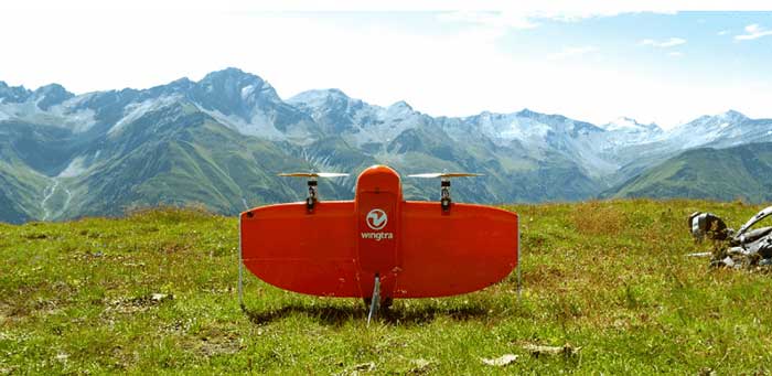
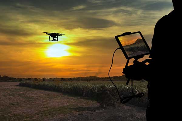
    In addition to ensuring employee safety, Septentrio is also dedicated to help fight the virus by providing reliable high-accuracy positioning solutions to technologies that are making a difference. For example, aerial drones have been used by police in Europe to announce new government regulations in public places and to scope out large areas for public gatherings. To ensure public safety it is vital that the sensors aboard these aerial drones, such as their positioning receivers, are robust and reliable even in challenging conditions.

    Septentrio receivers have already proven themselves in the field by providing reliable accurate positioning for safety-critical projects such as the senseFly eBee mission to map out the spread of infectious disease. Matternet delivery drones fly over busy cities to avoid traffic and deliver blood samples for testing faster.

    Other delivery drones such as Zipline and Wing are expected to ramp up speed with the increase of automation required to fight the coronavirus. In the European Union and the United States regulations around drone use are stricter than in China and thus the full potential of drones is not yet realized to its maximum.


    Spirent Federal

    Ellen Hall, President and CEO

    Editorial Advisory Board Member

    Ellen Hall
    Ellen Hall, CEO, Spirent Federal

    Since our inception, a few of our employees have worked from home due to traffic issues, work/home responsibilities, or simply geographical location issues. Over the years, we decided as a company not only that this was working very well, but that everyone who could work from home should be allowed to have the same privileges. In the past two years, we have allowed everyone to work from home, only requiring to come into the company offices those who must be in a lab or for security reasons. Everyone has a laptop computer and remote access to files. We use Zoom, email, and cell phones to communicate with each other and our customers.

    When the recommendations from the CDC and the President of the United States were issued to work from home, we were already doing this, so there were no adjustments needed. Those that must work in the lab are practicing social distancing and working on alternate days in some cases.

    When we first contacted our customers to attempt visits, we were told that they were not receiving visitors and that it was going to take a few days or weeks to get everyone outfitted with laptops and other technology to continue working from home. We were a bit surprised to learn that others were going through this as we were not having any of these issues.

    This crisis has taught us that being prepared and trusting our team to work independently pays off when we really need it. Everyone is being a little extra patient, kind, and understanding. We are seeing this general compassion outside of the office as well and we hope that this has a lasting effect on the world.


    Topcon Positioning Group

    Jackie Ferreira, Director of Corporate Communications

    Jackie Ferreira, Topcon
    Jackie Ferreira, Topcon

    We are fortunate in that our team is well-versed in online collaboration software, including teleconferencing and online digital asset management systems. We are leveraging tools such as those to keep productive in this crisis.

    We are working very well together via safe distancing practices. Our employees around the world are staying active with ongoing conference calls across multiple time zones. Our primary concern is the health and safety of everyone we interact with and we continue to be impressed with how all involved have responded.

    Topcon operates with a primary goal of the health and safety of its employees, customers, and suppliers and in accordance with applicable state and local orders, including social distancing requirements. To this end, we provide on-going guidance from the World Health Organization (WHO) and Center for Disease Control (CDC) to our employees to support their health in these critical times.

    We encourage compliance with applicable governmental orders concerning their ability to continue to operate, with the understanding of roles within the critical infrastructure supply chain.

    We are dedicated to supporting our customers at this critical time and have specific teams working to meet demands to the best of our ability.

    Our relationships with our customers and partners are important to us. Topcon strives to work closely together with our partners to protect the industries we serve and accelerate the economic recovery needed in light of the current world crisis. Together we can serve as a beacon of cooperation and commitment to successfully weather these unusual times.


    Unicore Communications

    Jingbo Gao, Marketing Director, Unicore Communications

    Jingbo Gao, Marketing Director
    Jingbo Gao, Marketing Director

    The outbreak of COVID-19 started around the Spring Festival, and strict control measures to stop the spread of the virus were taken even before the holiday ended. Unicore postponed the return-to-job date by one week and encouraged working from home, except for the key R&D and ST engineers, who cannot perform verification, testing, or debugging outside the labs. However, even then strict social distancing measures were guaranteed. As of February 10, Unicore’s return-to-work rate was more than 80%, with nearly 40% of the employees doing it from the office, while now nearly 90% of Unicore’s labor force is back to normal working mode. Thanks to the 4G networks, fast mobile and Web communications, as well as cloud computing technologies, we were able to easily organize video conferencing, online meetings and group messaging.

    Our R&D and product delivery were slightly affected by the COVID-19 due to the delays at some supply plants. However, Unicore has a well-run and organized inventory management system, so most of the orders can be fulfilled on time.

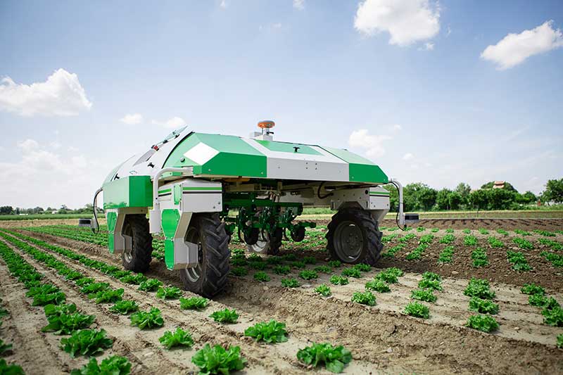
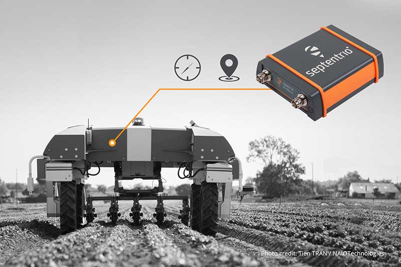
    Some of Unicore’s clients use drones to perform disinfectant spraying and logistics transportation, which help to ensure an uninterrupted supply of food and goods. Other clients make intelligent and autonomous sweepers that reduce the need for manual labor and keep the workers safely at home. In order to avoid personal injury, infection and transmission in epidemic areas, drones and/or unmanned vehicles with GNSS high-precision positioning technology have been used for cleaning and disinfection, supplies delivery, and aerial photography in engineering construction.

  • Wingtra brings wind energy to the Swiss Alps

    Wingtra brings wind energy to the Swiss Alps

    Photo: Wingtra
    Photo: Wingtra

    Site-survey preparations for a windfarm of 20 300-foot tall wind turbines might have been quite complex for a location in a 2,500-foot-high valley in the Swiss Alps.

    However, the contractor decided to use a drone with vertical take-off and landing (VTOL) capability supplied by Wingtra to speed up the work and produce highly accurate geo-referenced data. Although multirotor drones are normally used for detailed survey work, they can cover much less area than fixed-wing drones during the same flight time. Fixed-wing drones can fly longer, farther and carry more weight.

    Multicopters tend to carry more expensive, higher accuracy sensors because the sensors are not subject to potential damage from fixed-wing belly landings. Wingtra solved this problem by developing a drone with vertical take-off, the ability to transition to horizontal flight and to then land upright. When equipped with heavier, more accurate sensors, longer and more complex surveys are possible.

    The Septentrio AsteRx-m2 was also chosen for the WingtraOne drone. The AsteRx-m2 is a high-precision, multi-frequency, four-constellation, PPK, low weight and power GNSS module. The low-latency AsteRx-m2 works for both rotorary- and fixed-wing UAV applications.

    The WingtraOne VTOL drone is able to cover 400 hectares (an area of around 570 football fields) in one 55-minute flight. The resulting mapping accuracy is as high as 1.27 centimeters (0.5 inches). The drone was equipped with the full-frame 42MP Sony RX1RII camera, with seven ground control points for increased accuracy.

    The WingtraOne took off vertically and transitioned to fly horizontally at the planned 1,500-foot altitude. Each flight took about 20 minutes to plan and involved 30 minutes of flying time. The flights covered a total area of 1,100 hectares — each flight was 200–300 hectares.

    Aerial data collected from the site was converted to 3D models that allowed visualization of planned roads and wind-turbine locations in the wind farm. The data-collection workflow only took 4 hours rather than the days required with traditional surveying. Use of high-end sensors ensure survey-grade imagery and accuracy — in this case, the engineers obtained an accuracy of 3–4 cm.

    Flying in an area as difficult as the Swiss Alps to collect aerial data has been one of Wingtra’s most complicated challenges. By reducing costs and the time to complete the survey and evaluation of the proposed site, the customer was able to maintain the overall wind farm project timelines.

  • Septentrio begins production of mosaic-X5 for high-volume applications

    Septentrio begins production of mosaic-X5 for high-volume applications

    Image: Septentrio
    Image: Septentrio

    Septentrio is starting high-volume production of mosaic-X5, its next-generation multi-constellation and multi-band receiver module.

    Featuring the company’s latest GNSS technology, mosaic-X5 brings centimeter-level positioning to technologies such as robotics, automation, smart wearables and telematics among others. Its small form factor and low-power design makes high-performance positioning accessible to volume applications, the company said.

    “For smooth, uninterrupted operation in the field mosaic-X5 is the logical choice for an industrial-grade GNSS positioning module,” said Francois Freulon, head of Product Management at Septentrio. “In an industrial setting the cost of equipment downtime can quickly get out of hand. We designed mosaic to be robust in difficult environments, ensuring continuous operation as well as quick set-up times for our customers.”

    Septentrio’s mosaic-X5 was conceived to be the first GNSS receiver module on the market without performance compromises. Featuring complete multi-frequency multi-constellation technology mosaic receives every existing and future signal from all GNSS constellations including the American GPS, European Galileo, Russian GLONASS, Chinese BeiDou, Japanese QZSS, Indian NavIC and L-Band satellites. Such signal diversity allows maximum positioning availability even in difficult environments such as near tall structures or under foliage.

    The compact GNSS module features Septentrio’s proprietary Advanced Interference Mitigation (AIM+) technology, which shields the receiver from jamming and malicious spoofing. This allows machinery and robotics equipped with GNSS to keep on working, instead of being grounded by RF interference. mosaic-X5 also includes the unique RAIM+ integrity engine essential for safety-critical applications such as autonomous systems.

    For those who want to try out the mosaic-X5, evaluation kits can now be ordered directly at shop.septentrio.com.

    Volume order quotes can be requested at shop.septentrio.com/quote.

    For more information about mosaic or other Septentrio precise positioning and timing solutions, contact [email protected]/

  • Precision agriculture grows with RTK

    Precision agriculture grows with RTK

    The John Deere StarFire 6000 RTK receiver operating in the field. (Photo: John Deere)
    The John Deere StarFire 6000 RTK receiver operating in the field. (Photo: John Deere)

    Precision agriculture — the practice of optimizing inputs of seed, water, and fertilizers while maximizing yields by mapping variations in soil characteristics and guiding machinery accordingly — began in the United States in the early 1980s and has been growing steadily. Key components include soil mapping based on sampling and remote sensing, proximal sensing of soils and crops, variable rate irrigation and variable rate spraying of fertilizers and herbicides, and automatic tractor navigation.

    “GNSS-based guidance is probably the most highly adopted precision ag technology, followed by variable rate and section control,” said John Fulton, associate professor at The Ohio State University. “I suspect that somewhere around 40% of those GNSS receivers use RTK-level corrections — which provide sub-inch accuracy — and that number is increasing.”

    Need for sub-inch accuracy

    Water runs downhill, of course, which makes vertical accuracy critical for hydrology. “AgLeader builds a plow to put tile in soil to drain water,” said Bill Cran, AgLeader Technology’s GNSS product specialist. “It might only be 4 inches round; so, if we are off by 2 or 3 inches vertically, that affects where water can run.” To get the best vertical accuracy possible, he recommends farmers install a base station in the field where they are operating.

    Sub-inch accuracy also enables farmers to determine where to plant each seed, rather than monitoring planters at the row level. “That may not be a requirement today, but it is certainly coming,” Cran said.

    Market demand for RTK in agriculture is increasing, an important factor for drone guidance or machine control, said Gustavo Lopez, market access manager at Septentrio. “The robots are very close to the crops. When small robots are working in a corn field, the corn plants are causing multipath or shadowing GNSS signals,” Lopez said. “You need either a good RTK or GNSS-INS, because if you lose satellite lock you can still coast for a while with an IMU.”

    Services and options

    AgLeader’s displays have a built-in networked transport of RTCM via internet protocol (NTRIP) client that enables it to connect to NTRIP networks and CORS networks, as well as other free and subscription-based networks. “That allows us to get RTK from the internet for customers that want to go that route,” Cran said. Alternatively, the company offers NovAtel GPS receivers, including Satel- or Freewave-based RTK options with 400 MHz and 900 MHz radio options that can communicate with a similar base station. This spring, it will begin to offer NovAtel’s TerraStar-X service. “We are calling that ‘RTK from the sky,’” Cran said. “The expectation is sub-inch accuracy, with a convergence time of less than one minute. Many of our customers and dealers are very excited about that option.”

    Septentrio’s GNSS modules for agriculture are used mostly in mapping drones, Lopez said. The modules mitigate interference and spoofing. “We have also been quite successful in robotics for agriculture,” Lopez said. Septentrio is working closely with the French agriculture robotics company Naïo Technologies, which integrates its robots with Septentrio’s smart antenna GNSS products, providing a full RTK solution as well as autonomy.

    For areas without RTK networks, some farmers buy and install Septentrio base stations that provide corrections to their robots or UAVs. Septentrio provides agricultural mapping software for post-processing data gathered without RTK. Also on offer are L-band receivers — while not as accurate as a local RTK network and possibly with higher convergence time, the relative accuracy of L-band corrections is more than good enough for many ag robots, Lopez explained.

    On the baseline

    The vegetable weeding robot Dino — shown here operating in Yuma, Arizona — uses a Septentrio GNSS receiver. (Photo: Septentrio/Naio Technologies)
    The vegetable weeding robot Dino — shown here operating in Yuma, Arizona — uses a Septentrio GNSS receiver. (Photo: Septentrio/Naio Technologies)

    Most RTK users are on a short baseline — under 5 miles from the base station to the rover, according to Al Savage, manager of John Deere’s StarFire network. Medium baseline is about 5–8 miles, and long baseline is up to 12 miles. In 2015 John Deere released its Base Station Manager, which enables dealers to remotely upload firmware, upkeep the rover access list, and monitor their base stations.

    As dealerships and their RTK networks merged and farms expanded, it became difficult for farmers to keep track of which base station to use. So, in 2019 John Deere released an Automatic Base Station Switching feature that links the RTK radio configuration to the field boundary in its Generation 4 display.

    Also new: A John Deere StarFire receiver can continue to operate if it loses connection to a base station using the RTK Extend feature. The StarFire SF6000 rover receiver can continue operating with RTK-like accuracy for up to 14 days without connecting to an RTK base station, compared to only 14 minutes for a previous receiver, Savage explained. The increase “was very well received by customers, especially those operating in areas challenged by line of sight or trees and foliage on field boundaries.”

    In South America, John Deere’s RTK Flex feature, “will automatically switch between RTK and SF3 during a time in the day when scintillation causes the greatest interference,” Savage said, enabling farmers “to continue working with similar accuracy when RTK is unavailable due to scintillation.”

    Remaining obstacles to adoption

    Despite’s RTK’s growing popularity, there are a few remaining obstacles to its adoption.

    Cost. “Though the cost has been greatly reduced over the years, RTK is still more expensive than other correction signals out there,” Fulton said. Part of the cost is due to the hardware, Cran pointed out. “There are rover and base station radios, there are towers to put up. On the NTRIP side, there are cell modems to put in vehicles, and they require keeping a data plan active.” The agriculture market traditionally has been very cost-sensitive and conservative, Lopez said. “Farmers expect to implement very low-cost solutions. They want to know whether they will have an ROI (return on investment) on these solutions.”

    Satellite services offer a cheaper alternative to RTK. TerraStar-X, for example, gets rid of the cell modem hardware and the requirement for base station hardware, Cran said. “At a lower accuracy level, there are other satellite-based TerraStar signals: TerraStar-C and TerraStar-C Pro, which get an accuracy maybe under 5 to 20 cm. Those are less-expensive alternatives that growers are using without making the leap to RTK.”

    Lack of Internet Connectivity. While most RTK services, including NTRIP, require an internet connection, many rural areas have limited broadband and even cellular connections. Some areas lack support for RTK, Fulton said.

    Lack of cross-platform compatibility. Farmers with a mixed fleet want to run a mix of receivers. “For example, John Deere and Trimble RTK do not work together,” Cran said. “It is still very manufacturer-specific. I cannot take a NovAtel receiver that is AgLeader branded and use it with a John Deere RTK network.” NTRIP partially enables cross-platform mixing and matching. “We’re excited about TerraStar-X, too, because, while it is specific to NovAtel receivers, it is not tied to any base station hardware,” Cran said. “So, a John Deere guy can put an AgLeader receiver on their vehicle and use TerraStar-X and still get that accuracy without being tied to the Deere RTK network.”

    Liability. While safety is not nearly as big an issue as it is with autonomous vehicles on the roads, liability questions will soon loom. “If, for example, a robot destroys a whole plantation, someone must be liable,” Lopez pointed out. “Was it the robot? The GPS receiver? Other sensors? The farmer? What if there is a spoofing attack and the robot goes to a neighbor’s field?” Such challenges are slowing adoption. “That is where the reliability of the GNSS is becoming important,” he said.

    The future

    Soon, satellite-based internet connections could make RTK correction more widely available and give more growers the option of using NTRIP, though at a cost. WAAS, a free service of the U.S. government, is broadcast by satellites but does not achieve the accuracy level of RTK. “RTK is still a localized correction,” Fulton said. “We may see that shift to satellite, but it will more likely be an online or some other type of communication.

    “Once farmers start using RTK, it is very unlikely that they will ever revert to another type of correction,” he added.“RTK is a very addictive correction service for folks.”

    Savage concurs. “RTK is addictive because of its accuracy, efficiency and repeatability.” Ultimately, however, to achieve universal adoption, RTK solutions will need to work everywhere, with little intervention by the farmer.

  • Septentrio receiver tackles machine control in challenging environments

    Septentrio receiver tackles machine control in challenging environments

    Image: Septentrio
    Image: Septentrio

    Septentrio has added to its integrated GPS/GNSS receiver portfolio with the AsteRx SB ProDirect, which delivers reliable high-accuracy positioning for machine navigation and control in challenging environments.

    The AsteRx SB ProDirect dual-antenna receiver is designed as an “install-and-forget” device to provide continuous positioning for demanding industrial applications, Septentrio said. It gives machines and robotics access to heading and pitch or heading and roll information immediately on power-up. This allows for trajectory path optimization and fully informed navigation from mission start.

    The AsteRx SB ProDirect is designed to provide the GNSS positioning and position-independent heading needed for robotics, machine control and similar applications. It uses either a single or dual antennas and is designed for quick integration into any machine monitoring or control system.

    Contained in a single, waterproof ruggedized box, the robust receiver uses Septentrio’s LOCK+ technology, optimizing positioning and heading performance under intense mechanical vibrations, shakes or shocks.

    Septentrio also offers housed GNSS/INS receivers with inertial integration for a full attitude solution, including heading, pitch and roll, on top of high-accuracy positioning. Integration of the AsteRx SBi’s inertial sensor allows continuous positioning and attitude even during short GNSS outages, which can happen near high structures or under foliage.

  • Septentrio launches online shop for GNSS receivers

    Septentrio launches online shop for GNSS receivers

    Image: Septentrio
    Image: Septentrio

    Septentrio’s new web shop offers direct access to mosaic multi-frequency GNSS receiver module. Customers can purchase the mosaic development kit quickly and easily to evaluate this unique module.

    Septentrio has opened an online store shop.septentrio.com, selling high-performance GPS/GNSS module receivers. The web shop is accessible via the Septentrio website, offering customers multi-constellation multi-frequency GNSS technology, which provides reliable centimeter level positions suitable for demanding applications.

    The first product available for sale online is mosaic, Septentrio’s most compact GNSS receiver module. This light-weight, low-power receiver brings robust high-accuracy positioning to the mass market. With its security-centered anti-jamming and anti-spoofing technology, mosaic provides positioning to numerous demanding applications such as automotive ADAS, logistics automation, and robotics.

    “We see a growing demand for reliable high-accuracy positioning across various industries. As GNSS receivers move towards becoming a commodity, we are providing our customers with easier and faster access to GNSS technology,” said Francois Freulon, senior product manager, Septentrio. “We are happy to offer the mosaic development kit as the first product in the shop, which makes it easy for people to purchase and evaluate the mosaic module and discover its capabilities for delivering robust, highly-accurate positions. “

    True multi-frequency multi-constellation technology of mosaic ensures access to every possible signal from all available GNSS constellations including the U.S. GPS, European Galileo, Russian GLONASS, Chinese BeiDou and Japanese QZSS satellites. Septentrio’s advanced field-proven algorithms exploit this signal diversity to deliver maximum positioning availability even in the most difficult environments such as under foliage or in urban areas.

    GNSS signals can become jammed by nearby electronics or illegal jammers that emit radio signals interfering with GNSS. Mosaic uses jamming-resistant signal processing making it robust against interference. Its design focuses on continuous, reliable high-accuracy positioning making mosaic suitable for demanding applications such as ADAS, UAVs and industrial automation.

  • Receiver innovators log trends and product launches — Part 1

    Receiver innovators log trends and product launches — Part 1

    Cover photo: Topcon
    Cover photo: Topcon

    Lay of the GNSS Land

    Top receiver manufacturers discuss what’s on the horizon for GNSS receivers. The companies reveal recent and upcoming innovations, how to combat spoofing and jamming, fusing GNSS with other sensors, and the impact of increasing accuracy both for professional surveyors and consumers.

    With regard to jamming and spoofing, the preferred approach is a combination of monitoring, detection and filtering. However, shielding, the use of IMUs and other third-party sensors, and advances in processing algorithms also help mitigate interference. In a few years, hopefully, encrypted or “watermarked” signals will substantially reduce this problem.

    IMUs and other sensors are now routinely integrated with GNSS receivers, with their outputs fused. This trend is largely propelled on the demand side by the needs of the emerging market for autonomous vehicles and on the supply side by smaller, cheaper and more accurate IMUs and lidar scanners. Meanwhile, developments in algorithms have improved the modeling of errors to correct for the inherent tendency of IMUs to drift. Additionally, digital cameras, lidar and other industry-specific sensors are increasingly common, especially for collision avoidance in human-machine interactions.

    In surveying, the use of all constellations and frequencies, as they become available, is an industry trend. Costs will continue to drop as the growth in the adoption of GNSS solutions enables manufacturers to take greater advantage of economies of scale. Precise point positioning (PPP), which benefits greatly from the growth in GNSS constellations, is now giving real-time kinematic (RTK) positioning a run for its money. Available applications enable Android mobile devices to achieve centimeter accuracy, while innovations continue in core positioning algorithms.

    In the world of mobile consumer devices, dual-frequency, multi-constellation GNSS chipsets are increasingly prevalent. As increased accuracy fuels expectations for even higher accuracy, precision positioning may become the norm in the consumer space, and new applications for these devices may emerge. Already, crowdsourcing the monitoring of both GNSS signals and interference helps improve accuracy for everyone, in a positive feedback loop.

    Other notable trends include the introduction and expansion of 5G data networks, the increased use of satellite-based correction services, and continued efforts to develop precise positioning for indoor areas. (See part 2 of this feature here.)


    Topcon

    Jamming and Spoofing. “We continue to develop and deploy patented technology to detect spoofing,” said Alok Srivastava, director, product management. “We already have cutting edge GNSS antenna technology to provide stellar support for interference rejection and filtering.” All Topcon end products have this advanced antenna and filtering technology.

    Sensor Fusion. “Topcon has been using inertial systems for decades for a variety of positioning applications — such as machine control, mobile mapping, and agriculture,” said Srivastava. “In recent years, advancements in IMU technology have progressed to where the size and cost of these sensors are at levels to be utilized at a larger scale. For example, the recently released Topcon HiPer VR takes advantage of inertial technology to improve productivity in real time with our Topcon Integrated Leveling Technology (TILT), which compensates for mis-leveled field measurements out of plumb by as much as 15 degrees.”

    Surveying. Topcon continues to invest in its core positioning algorithms to innovate such features as quartz lock loop, advanced multi-engine platform, and VHD heading technology into its positioning engines, Srivastava said. “We also produce solutions such as our Millimeter GPS and Hybrid Positioning innovations, which are designed around improving accuracy, higher reliability, and greater flexibility by converging positioning technologies.”

    Consumer Devices. “GNSS in consumer devices and other commercial systems is used to aid other positioning sensors,” Srivastava said. “So, it may not be in the best of interest to offer that level of accuracy from GNSS alone.”

    Other Challenges. Precise indoor positioning is a requirement of the vertical construction industry. “Topcon’s combined optical instrument takes a unique approach to solve that problem by integrating a compact laser scanner with a fully featured robotic total station,” Srivastava said.


    Photo: CHC Navigation
    Photo: CHC Navigation

    CHC Navigation

    Jamming and Spoofing. CHCNav is currently taking a twofold approach to GNSS interference, said François Martin, vice general manager, International Division. “As a GNSS system integrator, we focus our design around strong electromagnetic shielding and sealed isolation chambers.” Additionally, he pointed out, the advanced filtering of GNSS signals and an antenna patch produce optimal interference mitigation.

    Sensor Fusion. Integrating interference-free, high-dynamic IMUs instead of MEMS has brought the full benefits of tilt compensation to users, Martin said. The latest development in algorithms dramatically obviated the need for the annoying process of initializing GNSS IMU receivers and boosted the availability of GNSS RTK in demanding environments.

    Surveying. The fast adoption of GNSS solutions by large user segments has reduced costs by enabling a sizable manufacturing economy of scale, Martin pointed out. “Tighter combination of embedded technologies such as GNSS and connectivity modules are sustaining that cost reduction process.”

    Consumer Devices. “The emergence of dual frequency multi-constellation GNSS chipsets supports the development of untapped user segments, but the position accuracy repeatability remains an issue,” Martin said. “The integration of GNSS chipset and high-performance helical antennas, as precision add-on modules, onto rugged Android cell phone and tablets is creating a prosumer-grade centimeter to decimeter accuracy answering to a wide range of mobile workforce applications.”

    Other Challenges. A growing number of positioning and navigation applications require the fusion of technologies to increase productivity, Martin said. “The integration of advanced tightly integrated positioning algorithms, scanners, IMUs, HDR cameras, IoT and cloud-based connected solutions are a clear trend.” However, their adoption by a large user base remains limited by their current price point.


    Photo: Septentrio
    Photo: Septentrio

    Septentrio

    Jamming and Spoofing. “Recent developments in receiver-antenna combinations maximize the benefits of anti-jamming techniques,” said Gustavo Lopez, market access manager. Third party sensors, such as IMUs, also help mitigate interference, he pointed out. “Septentrio’s advanced receiver technology such as AIM+, a standard feature on all the company’s products, bring not only real time monitoring but also jamming/spoofing mitigation. Galileo and GPS have clear roadmaps bringing signal authentication in order to avoid spoofing.”

    Sensor Fusion. Smaller IMUs with higher grade performance now on the market are enabling new use cases in autonomous applications, said Lopez. Other important elements are a new generation of compact high-performance sensors and the growing importance of multi-sensor technology “to provide even higher levels of positioning integrity.” He cited Septentrio’s AsteRx-i family of products as an example of GNSS/INS integrated solutions.

    Surveying. As an example of Septentrio’s survey-specific products, which “continuously benefit from advanced developments being rolled out in our platform,” Lopez cited the Altus NR3.

    Consumer Devices. The increasing positioning accuracy of cell phones, Lopez pointed out, “has spurred innovations such as PPP and the use of mobile phone measurements,” as well as “other purposes, such as interference detection and crowdsourcing.”

    Other Challenges. “Sensor fusion is a key element in positioning and orientation,” Lopez said. “Easy integration is a key element in this trend. Also, integrity in error reporting and positioning will be required as well as reliable raw measurements which can be integrated with other sensors. This drives the requirement for receivers capable of running customer proprietary software. Another important element will also be the possibility of running positioning algorithms on a third-party processor.”


    Photo: Hemisphere GNSS
    Photo: Hemisphere GNSS

    Hemisphere GNSS

    Jamming and Spoofing.Hemisphere’s new Lyra II ASIC platform used in our Phantom and Vega series positioning and heading boards,” said Miles Ware, director of marketing, “introduces new technology and filtering methods to identify and mitigate known and unknown interference sources that typically have an adverse effect on GNSS performance.”

    Sensor Fusion. “Advancements in IMU integration and sensor fusion,” Ware said, “will continue to be a key focus for Hemisphere to support the growth and adoption of the expanding autonomous vehicle and application marketplace. The positioning and heading technology offered in our Vega 28 will be a core component for autonomous marine, machine control, and agriculture solutions for new and emerging markets.”

    Surveying. “Access to modern and future signals like BeiDou Phase III, ALTBOC and BS-ACEBOC significantly enhance GNSS accuracy, especially in challenging environments where satellite visibility is compromised by the topography and or the structures present,” Ware pointed out. “Survey solutions that can not only track but also use all the available GNSS measurements in their RTK solution will have a substantial advantage in the market.”

    Consumer Devices. “As mobile phones and consumer devices continue to adopt hardware designs that can access the latest GNSS signals,” Ware said, “the opportunities for solutions where high precision measurement engines can be hosted within mobile devices opens up a new realm of solutions that can leverage the high accuracy positioning performance found in Hemisphere technology and products. We see this as a very exciting and emerging area.”

    Other Challenges. Ware pointed to “leveraging GNSS technology to further support environmentally friendly transportation solutions and sustainable agriculture,” for which GNSS continues to be an integral component.


    Photo: Unicore
    Photo: Unicore

    Unicore Communications

    Sensor Fusion. “We are implementing GNSS with different level IMUs, including low-cost and high-end, targeting automotive, intelligent driving, and robot application scenarios,” said Gao Jingbo, marketing director. “The algorithm can also integrate with the already-existing sensors on the platform, such as IMUs, cameras and odometers. The solution can be done on the GNSS side, with high information synchronization accuracy, or processed on the platform.”

    Surveying. Products with Unicore boards inside can provide centimeter- to millimeter-level positioning accuracy, said Jingbo. “Unicore’s high-precision boards and modules can track all frequencies of all satellite systems. The UGypsophila RTK technology can make the most of the observation data of all frequencies in all systems even without the observations of the base station in the RTK solution, thus greatly improving the usability, reliability and accuracy of RTK.” The company is now also working to reduce the dimensions and cost of its products, Jingbo pointed out. “With Unicore’s single GNSS SoC on board, the UB4B0M and UM4B0 modules are making affordable high-end high precision surveying possible.”

    Consumer Devices. Algorithms and hardware are ready now to implement PPP+RTK in cell phones, Jingbo said, and this increase in positioning accuracy will enable many more applications. “We have rich experience in high precision GNSS, but the antenna might be a challenge. Our new generation 22 nm GNSS SoC features low power consumption and support of sensor fusion. Additionally, true point technology by Rx-Networks (also a BDStar company) can provide sub-meter data service, which also enables users to access centimeter-level accuracy location data through their mobile phones and wearable technologies, without increasing the demand for processing power.”


    Photo: Trimble
    Photo: Trimble

    Trimble

    Jamming and Spoofing.Trimble’s latest GNSS receivers leverage our seventh-generation Maxwell technology, which implements hardware- and software-based techniques to detect and mitigate spoofing,” said Stuart Riley, vice president, GNSS Technology. “In addition, Trimble continues to improve the robustness of our GNSS receivers with advances in processing algorithms and hardware enhancements such as the integration of inertial technology.”

    Sensor Fusion. “For many years, IMUs have been widely used in Trimble agriculture and Applanix products,” Riley said. “Over the past few years, we’ve created a new line of lower-cost inertially integrated board-level GNSS receivers. We have also integrated inertial components into survey and construction products, including tilt compensation in the Trimble R10, R12 and SPS986 receivers. Trimble also combines its GNSS solutions with optical, laser, lidar and other sensors.”

    Surveying. Trimble’s GNSS products, Riley pointed out, range from GIS handhelds to high-performance mobile mapping systems.

    Consumer Devices. “The Trimble Catalyst system uses Android-based smartphones or tablets to run an application that includes a software-defined GNSS receiver,” Riley said. “The recently introduced SiteVision system builds on this ecosystem and integrates Google’s ARCore platform with precision GNSS to provide an augmented reality solution for a variety of professional applications.”

    Other Challenges. To address signal masking and multipath, Trimble has “continued to improve performance in difficult environments with products such as the Trimble R12 receiver, which provides sophisticated multipath mitigation and an advanced precision processing engine.” Riley said, “Trimble’s RTX Correction Services, delivered via satellite, enable users to achieve RTK speed and accuracy nearly anywhere on the planet without the need for local reference stations.”


    Photo: NovAtel
    Photo: NovAtel

    NovAtel

    Jamming and Spoofing. “The RF environment is at best crowded and at worst hostile,” said Sandy Kennedy, vice president of innovation, Hexagon’s Positioning Intelligence division. “The NovAtel OEM7 generation of receivers was launched in 2016, with interference detection and mitigation as key features on every variant. Protecting authenticity, availability, and precision for multifrequency measurements is the challenge going forward — in all segments of the system: constellation management and SIS, antenna, receiver design and processing in FW/SW.”

    Sensor Fusion. In the last three years, Kennedy pointed out, IMU manufacturers have made significant improvements in the performance offered in smaller, cheaper IMUs. “At the same time, new methods to improve error modelling (to control positioning errors) have been added to the NovAtel SPAN product line, especially in SPAN Land profile. Extended GNSS outages are easily handled now.”

    Surveying. “PPP has become a strong competitor to RTK, as convergence times have decreased, and this will continue in service offerings like Terrastar-X from NovAtel,” Kennedy said.

    Consumer Devices. The devices, Kennedy said, offer “the tantalizing promise of quality measurements from a common utility device with huge computing horsepower and data connectivity built in! It’s fun to watch, and we shall see if accuracy is truly addictive enough to fuel development for general use of precision positioning.”

    Other Challenges. “In the past 20 years, users have moved from awe and wonder that centimeter-level positioning is possible — to utter contempt when it is not,” Kennedy said. “This will continue, with an added requirement of integrity and functional safety. Continuously available positioning within a usable protection level is a requirement for autonomous vehicles.”

    Also read part 2 from our February issue, and our antenna feature.

  • Septentrio partners with NXP, Analog Devices for high-precision

    Septentrio partners with NXP, Analog Devices for high-precision

    Septentrio’s GNSS devices are being used for high-accuracy positioning solutions by two companies.

    • Compact multi-frequency GPS/GNSS receiver module provides robust centimeter-level positioning for advanced driver assistance systems (ADAS) provided by NXP.
    • Septentrio and Analog Devices collaborate on high-performance GNSS/INS solutions.
    Image: Sepentrio
    Image: Sepentrio

    NXP V2X Integration

    NXP, a leader in communication technology for embedded applications, is integrating Septentrio GNSS technology into its V2X (vehicle-to-everything) reference design and development boards.

    Septentrio, a leading high-accuracy GNSS positioning company, is providing to NXP its mosaic module. Mosaic is a multi-frequency, multi-constellation GNSS receiver that delivers accurate and reliable global localization even in harsh environments.

    V2X technology enables cars to communicate with infrastructure as well as other vehicles, making driving safer and more efficient. It enables cars to “see” what’s around the corner or through the dense urban environment warning the driver about road works, traffic congestion and emergency vehicles.

    Precise GNSS-assisted localization combined with V2X communication enables a wide array of ADAS functionality such as automatic braking if slowing traffic is detected ahead or truck platooning.

    Septentrio’s mosaic is a compact high-accuracy GNSS receiver module which is integrated into NXP’s V2X development boards. True multi-frequency multi-constellation technology gives mosaic access to every possible signal from all available GNSS constellations including the U.S. GPS, European Galileo, Russian GLONASS, Chinese BeiDou and Japanese QZSS satellites.

    Septentrio’s advanced, field-proven algorithms exploit this signal diversity to deliver maximum positioning availability even in difficult environments such as under foliage or in urban areas.

    “Reliable lane-accurate positioning is vital for many road-safety applications of V2X, such as queue and emergency stop warnings or blind spot warning,” said Andrew Turley, NXP’s senior director of innovation and V2X business development. “Septentrio’s unique easy-to-integrate GNSS module provides field-proven, reliable and robust positioning. Integration of mosaic into our reference design gives our customers a direct solution for developing these and other advanced V2X services.”

    ”We are excited that NXP selected our GNSS solution for their V2X reference design,” said Jan Van Hees, business development director at Septentrio. “NXP is a world-leader in complete solutions for V2X communications for active safety systems and intelligent transport system (ITS) management. Working with NXP gives us an excellent opportunity to bring the best of V2X and reliable GNSS to our customers.”

    Inside a car GPS signals can become “jammed” by nearby electronics or illegal devices called “jammers” which are used by some drivers to avoid road tolling. mosaic uses jamming-resistant signal processing making it robust against interference. Its design is centered around continuous, reliable high-accuracy positioning making mosaic suitable for safety-critical applications such as ADAS and autonomous navigation.

    Consumer Electronics Show. The Septentrio mosaic GNSS module will be showcased at CES in Las Vegas, January 7-10. Visitors are welcome to see mosaic and talk to Septentrio GPS experts about V2X, ADAS, INS and other automotive positioning solutions in booth 1135 at the Paradise West Center. A personal meeting can be booked in the Septentrio Suite at the Westgate Las Vegas Resort & Casino.

    Combining with Analog Devices on INS

    In December, Septentrio announced a collaboration with Analog Devices. The two companies are combining Analog Devices’ high-quality inertial measurement units (IMUs) with Septentrio’s multi-frequency, multi-constellation GNSS receivers.

    The resulting high-performance GNSS/inertial navigation systems (GNSS/INS) deliver centimeter-accurate positioning together with 3D orientation (heading, pitch and roll), suitable for applications such as automotive ADAS and industrial automation.

    “We are excited to work with Septentrio,” said Tony Zarola, general manager of inertial sensors, Analog Devices. ”Septentrio’s GNSS technology provides a unique combination of accuracy and robustness which is aligned well with the capabilities of our sensors. The company’s deep know-how of GNSS and focus on providing reliable solutions even in harsh environments complements Analog Devices’ focus to solve the toughest engineering challenges for our customers.”

    “ADI’s high-end industrial IMU systems are a reference in the industry and we are very pleased to be working together with them,” said Danilo Sabbatini, product manager at Septentrio. “Combining ADI’s IMU experience with our GNSS expertise enables creation of high-performance, easy-to-integrate systems that allow our customers to tackle demanding applications. As a result, customers can expect a faster go-to-market due to the interoperability between the GNSS and INS components.”

    Septentrio will incorporate Analog Devices’ advanced industrial-grade IMUs into a selection of its GNSS/INS products. Working directly with Analog Devices allows Septentrio to provide faster and more efficient GNSS/INS integration solutions for high-volume customers. This collaboration promises a solid foundation for design and production of top-performance integrated positioning and inertial solutions, with first products available in spring 2020.

  • Septentrio PPK gets a boost with BaseFinder

    Septentrio PPK gets a boost with BaseFinder

    Septentrio’s post-processing kinematic (PPK) software has been upgraded with multi-GNSS and BaseFinder functionality. BaseFinder improves project efficiency by automatically finding the most suitable reference station data needed for centimeter-level accuracy.

    Both GeoTagZ and PP-SDK now feature BaseFinder, which speeds up survey workflow by automatically finding reference data needed for augmenting GNSS logs with sub-centimeter accuracy. BaseFinder accesses an online database of reference networks and extracts the most suitable corrections available. BaseFinder is available via an app or via an API and can be incorporated into any existing software.

    PPK is often used for ground surveys with aerial drones, allowing high precision georeferencing without the need for a real-time base station link or ground control points (GCPs).

    “Surveying without a base station will allow users to reduce costs and set-up time. With this PPK upgrade we are improving the end-user experience as well as developer experience,” said Danilo Sabbatini, product manager at Septentrio.

    The new release of this GNSS post-processing software also includes two additional GNSS constellations: European Galileo and Chinese BeiDou. Having access to all the signals from all GNSS constellations improves reference network compatibility. It also improves positioning availability in difficult environments. This is particularly important when working in areas of low satellite visibility such as near tall structures or under foliage.

    When doing photogrammetry with a drone, GNSS data is often recorded and then post-processed together with base station data to achieve sub-centimeter positioning accuracy. This base station data can be obtained either with proprietary base stations or by using base station data from a public reference network (see diagram below). Septentrio receivers are designed to bring accurate and reliable positioning to photogrammetry, aerial inspection, marine survey as well as mobile mapping.

    GPS Post-Processing SDK architecture, bringing high-accuracy positioning without the need for a real-time correction stream. (Diagram: Septentrio)
    GPS Post-Processing SDK architecture, bringing high-accuracy positioning without the need for a real-time correction stream. (Diagram: Septentrio)
  • Septentrio and CORE receiver will use Japan’s centimeter-level service

    Septentrio and CORE receiver will use Japan’s centimeter-level service

    Septentrio and CORE partner up to develop a GPS/GNSS receiver which will make use of Japan’s Centimeter-Level Augmentation Service (CLAS). CLAS corrections are broadcast directly via QZSS constellation to enable high-accuracy positioning across Japan.

    Septentrio, a designer and manufacturer of high-precision GNSS technology, and CORE, a Japanese system integrator with extensive experience in GNSS, are jointly developing a receiver that can use the Centimeter-Level Augmentation Service (CLAS) of Japan’s Quasi-Zenith Satellite System (QZSS).

    Septentrio’s multi-frequency GPS/GNSS receiver AsteRx4 will be used as a platform for the development of CLAS functionality. Septentrio receivers already track the L6 signal and can use QZSS for increased positioning availability and reliability.

    CORE’s know-how will be instrumental for the deployment of CLAS on Septentrio receivers. The two companies are planning to launch their CLAS-enabled receiver in January 2020.

    Japan’s CLAS is a self-augmentation GNSS correction service. Without the need for a ground link, it allows real-time kinematic (RTK) centimeter-level positioning all over Japan with convergence times of less than a minute.

    It does this by broadcasting GNSS corrections directly via QZSS satellites, also known as Michibiki. These corrections are generated from the dense network of reference stations operated by Japan’s Geospatial Authority.

    The two companies have also entered into a distribution contract that allows CORE to sell Septentrio high-precision positioning technology, including CLAS-capable GNSS receivers, in the Japanese market.

    The new CLAS-enabled receiver will also incorporate Septentrio’s Advanced Interference Mitigation (AIM+) technology. In busy urban environments electromagnetic waves can interfere with GPS and GNSS signals.

    AIM+ offers protection against such interference resulting in faster set-up times and robust continuous operation.

    “QZSS Centimeter Level Augmentation Service has been limited to evaluation phase up till now. Realizing CLAS on Septentrio’s multifunctional, high-quality, cost-competitive platform allows our customers to finally use QZSS in their applications,” emphasized Takahiro Yamamoto, Director of GNSS Solution Development Center at CORE Corporation. “Galileo High Accuracy Service (HAS) is expected to start in 2020, so the demand for high accuracy GNSS receivers is also expected to increase. By complementing CORE’s QZSS technology and Septentrio’s Galileo technology, we can provide competitive products to global customers.”

    “CLAS is a first-of-its-kind service which will contribute to the proliferation of high accuracy GNSS applications in Japan. Europe is also taking similar initiatives with their Galileo High Accuracy Service (HAS),” commented Neil Vancans, Director of Global Sales at Septentrio. “We are excited to enter into an agreement with CORE to enable the support of CLAS on our receivers. CORE’s expertise allows us to get the best out of CLAS and to follow new developments in QZSS evolution. Moreover, CORE’s expertise in system integration will allow us to tackle new markets in Japan.”

  • How do we ensure GNSS security against spoofing?

    How do we ensure GNSS security against spoofing?

    By Maria Simsky
    Technical Writer, Septentrio

    As technological advances make GPS/GNSS devices more affordable, our lives are becoming increasingly dependent on precise positioning and timing. Industries such as survey, construction and logistics rely on precise positioning for automation, efficiency and safety.

    GNSS time provides the pulsating heartbeat for the backbone of our industry by synchronizing telecom networks, banks and the power grid. A single day of GNSS outage is estimated to cost $1 billion U.S. dollars alone.

    GNSS is a reliable system, and to keep it as such, professional GNSS receivers need to be wary of all possible vulnerabilities which could be exploited. Using GNSS receivers that are robust against jamming and spoofing is key for secure PNT (positioning, navigation and timing).

    What is GPS/GNSS spoofing?

    Radio interference can overpower weak GNSS signals, causing satellite signal loss and potentially loss of positioning. Spoofing, is an intelligent form of interference which makes the receiver believe it is at a false location. During a spoofing attack a radio transmitter located nearby sends fake GPS signals into the target receiver. For example, a cheap software-defined radio (SDR) can make a smartphone believe it’s on Mount Everest!

    Figure 1. A cheap SDR can overpower GNSS signals and spoofs a single-frequency smartphone GPS into believing it is on Mount Everest. (Image: Septentrio)
    Figure 1. A cheap SDR can overpower GNSS signals and spoofs a single-frequency smartphone GPS into believing it is on Mount Everest. (Image: Septentrio)

    Why GPS spoofing?

    Imagine a combat situation. Clearly, the side which uses GPS/GNSS technology would have an advantage over the side which does not. But what if one side could manipulate GPS receivers of their adversary? This could mean taking over control of autonomous vehicles and robotic devices which rely on GPS positioning.

    For example, in October 2018, Russia accused the U.S. of spoofing a drone and redirecting it to attack a Russian air base in Syria.

    Figure 2. GNSS spoofing could be used to manipulate movement of aerial drones. (Image: Septentrio)
    Figure 2. GNSS spoofing could be used to manipulate movement of aerial drones. (Image: Septentrio)

    In the last three years, more than 600 incidents of spoofing have been recorded in the seas near the Russian border. These ships appeared to be “transported” to nearby airports.

    This type of spoofing might have been introduced as a defense mechanism to ground spy drones. Most semi-professional drones on the market have a built-in geo-fencing mechanism that lands them automatically if they come close to airports or other restricted areas.

    Some of the most enthusiastic spoofers are Pokémon GO fans who use cheap SDRs to spoof their GPS position and catch elusive Pokémon without having to leave their room.

    Types of spoofing

    Spoofers overpower relatively weak GNSS signals with radio signals carrying false positioning information. There are two ways of spoofing:

    1. Rebroadcasting GNSS signals recorded at another place or time (so-called meaconing)
    2. Generating and transmitting modified satellite signals

    Spoof-proof: How can you protect your receiver against spoofing?

    To combat spoofing, GNSS receivers need to detect spoofed signals out of a mix of authentic and spoofed signals. Once a satellite signal is flagged as spoofed, it can be excluded from positioning calculation.

    GNSS receivers can offer various levels of spoofing protection. Let’s compare it to a house intrusion-detection system. You can have a simple entry alarm system or a more complex movement detection system. For added security you might install video image recognition, breaking-glass sound detection or a combination of the above.

    Like a house with an open door, an unprotected GNSS receiver is vulnerable to even the simplest forms of spoofing. Secured receivers, on the other hand, can detect spoofing by looking for signal anomalies, or by using signals designed to prevent spoofing such as Galileo OS-NMA and E6 or the GPS military code.

    Advanced interference mitigation technologies, such as the Septentrio AIM+, use signal-processing algorithms to flag spoofing by detecting various anomalies in the signal. For example, a spoofed signal is usually more powerful than an authentic GNSS signal.

    AIM+ won’t even be fooled by an advanced GNSS signal generator: Spirent GSS9000. With realistic power levels and with actual navigation data within the signal, AIM+ can identify it as a “non-authentic” signal.

    Other advanced anti-spoofing techniques such as using a dual-polarized antenna are being researched.

    Satellite navigation data authentication

    Various countries invest in spoofing resilience by building security directly into their GNSS satellites. With OS-NMA (Open Service Navigation Message Authentication), Galileo is the first satellite system to introduce an anti-spoofing service directly on a civil GNSS signal.

    OS-NMA is a free service on the Galileo E1 frequency. It enables authentication of the navigation data on Galileo and even GPS satellites. Such navigation data carries information about satellite location and if altered will result in wrong receiver positioning computation. While currently in development, OS-NMA is planned to become publicly available in the near future. Also GPS is experimenting with satellite based anti-spoofing for civil users with their recent Chimera authentication system.

    Figure 3. European Galileo satellites provide an open authentication service on the E1 signal and a commercial authentication service on the E6 signal. (Image: European Space Agency)
    Figure 3. European Galileo satellites provide an open authentication service on the E1 signal and a commercial authentication service on the E6 signal. (Image: European Space Agency)

    Recently, within the scope of the FANTASTIC project led by GSA, OS-NMA anti-spoofing protection was implemented on a Septentrio receiver.

    The strongest shield: signal-level GNSS authentication

    The Galileo system will be offering Commercial Authentication Service (CAS) on the E6 signal with the highest level of security for safety-critical applications such as autonomous vehicles. The signal level encryption will be based on similar techniques as the military GPS signals. Only the receivers who have the secret key are able to track such encrypted signals. The secret key is also needed to generate the signal making it impossible to fake. CAS authentication techniques are currently being prototyped at Septentrio in collaboration with the European Space Agency.

    Spoof-resilient GNSS means reliable precise positioning and timing, and a peace of mind for everyone touched by this indispensable technology.

    References

    1. Study finds that a GPS outage would cost $1 billion per day
    2. Russia Claims US Spoofed Drones to Attack Base
    3. Spoofing in the Black Sea: What really happened?
    4. Technical paper by Septentrio – Authentication by polarization: a powerful anti-spoofing method
    5. New Report Details GNSS Spoofing Including Denial-of-Service Attacks
  • Septentrio showcases AsteRx-i S UAS, Mosaic at Intergeo 2019

    Septentrio’s Gustavo Lopez gives GPS World an overview of the company’s AsteRx-i S UAS GNSS/INS receiver for drones and Mosaic GNSS receiver module at Intergeo 2019, which took place Sept. 17-19 in Stuttgart, Germany.

    Read more about the AsteRx-i S UAS, which was recently released, here.