Tag: Septentrio

  • Septentrio Q&A: Jammertest and real-world scenarios

    Septentrio Q&A: Jammertest and real-world scenarios

    Yasmine Hunter
    Yasmine Hunter

    As GNSS interference becomes more common and sophisticated across defense and mission-critical operations, resilient systems are now a core design priority.

    At Jammertest in Andøya, Norway, industry participants evaluated how GNSS technologies perform under realistic interference conditions designed to replicate operational challenges faced in the field. Among them was Septentrio, which used the event to assess resilience strategies, explore emerging threat scenarios and showcase its latest advancements in anti-jamming and anti-spoofing technology.

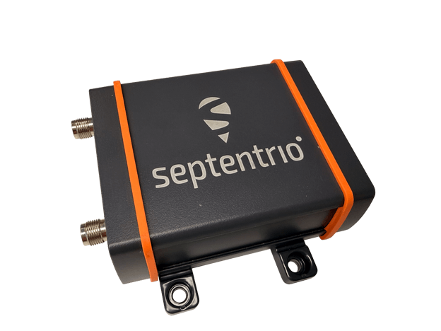
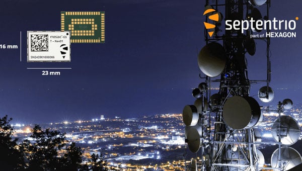
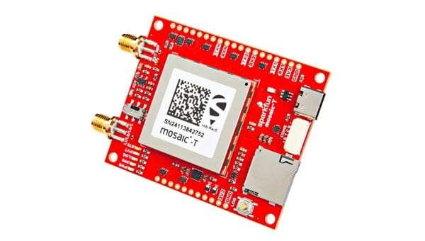
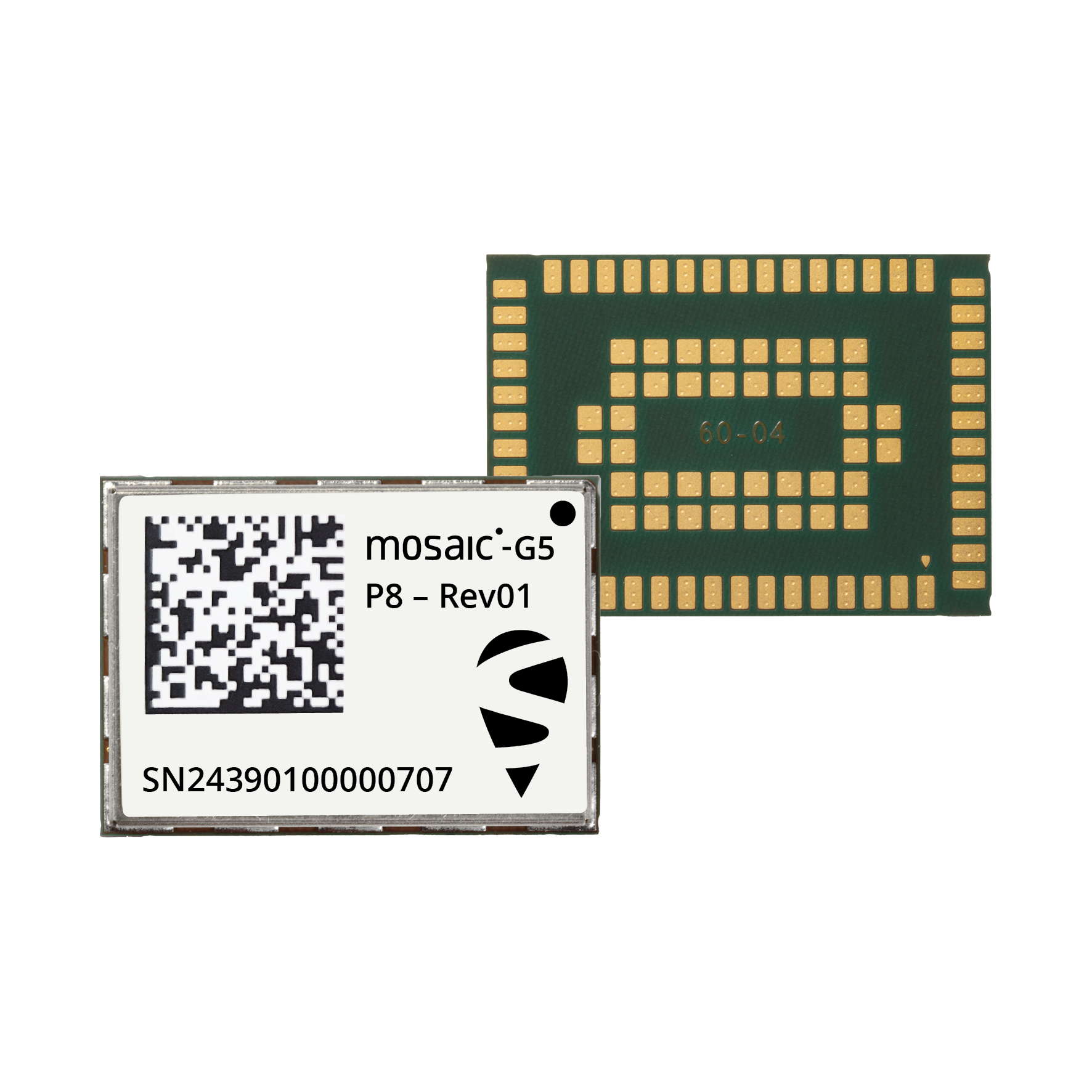
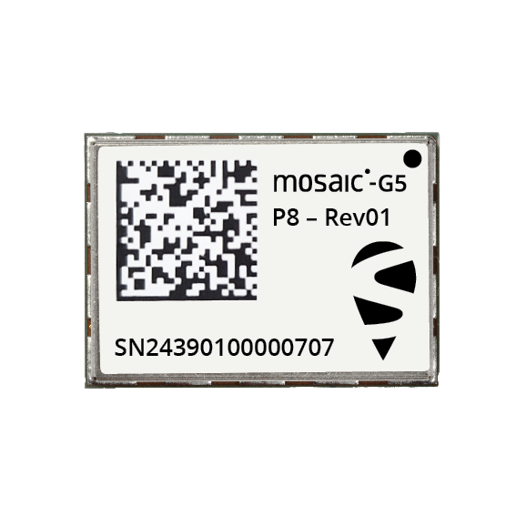
    GPS World spoke with Septentrio product manager, Yasmine Hunter, about Jammertest, the growing complexity of GNSS-denied environments and the company’s newly introduced mosaic-G5 P8 receiver designed for SWaP-sensitive, mission-critical applications operating in contested environments.

    Jammertest and Real-World Scenarios

    How realistic are the Jammertest scenarios, and how closely do they reflect real-world GNSS interference challenges?

    I would say quite realistic. One of the strengths of Jammertest is that participants can actively propose scenarios based on what we have encountered in the field, and organizers are often able to adapt to those. For us, this means providing feedback on settings/scenarios that we have seen with our customers.  

    In addition, it offers participants the opportunity to test the equipment under real environmental conditions. Propagation conditions, terrain, platform dynamics, and antenna behavior (including multipath) all play major roles. These factors significantly influence GNSS performance and are very difficult to fully replicate in a laboratory, so testing them in an operational environment adds a lot of value.

    To what extent do these scenarios mirror conditions in conflict zones (e.g., the Middle East or Ukraine)?

    In my view, it’s very difficult to fully replicate a conflict‑zone environment, even in a remote location like Andøya. Conflict zones involve a unique combination of sustained, coordinated interference, evolving tactics, and operational pressure that is hard to mirror exactly.

    Jammertest allows us to explore individual elements of those environments in a controlled and repeatable way and bridges lab and real‑world deployment by exposing systems to realistic threat profiles without the unpredictability and risk of an active conflict zone.

    What are the biggest takeaways from Jammertest?

    One clear takeaway is that jamming and spoofing scenarios are becoming more complex and sophisticated every year. It’s increasingly challenging as GNSS manufacturers to address these threats in isolation and still ensure robust operation across real-world use-cases.

    Which brings me to the second point; resilience is not only about maintaining position availability. Situational awareness – understanding what the receiver is experiencing and why – becomes increasingly critical. Knowing when GNSS can be trusted, and when it cannot, is just as important as maintaining a solution.

    What does Septentrio do differently from competitors when it comes to mitigating jamming and spoofing?

    Septentrio has been working on jamming and spoofing mitigation for a long time, and that experience is built on extensive real‑world use cases rather than purely theoretical approaches.

    This means that our receivers have been designed to be resilient, not just at the signal processing level, but also in how they disseminate this information to users. From my application‑engineering background, I’ve seen that these two aspects are equally important: strong mitigation technologies and clear insight into what is happening so users can make informed decisions.

    The mosaic-G5 P8 offers trustworthy positioning and seamless switching to alternative sensors during GNSS disruptions. (Photo: Septentrio)
    The mosaic-G5 P8 offers trustworthy positioning and seamless switching to alternative sensors during GNSS disruptions. (Photo: Septentrio)

    What are some of the most significant engineering or design challenges in developing resilient GNSS solutions?

    A key challenge is balancing performance, robustness, and usability. Advanced mitigation techniques often come with trade‑offs in complexity, power consumption, or cost. As we are targeting increasingly SWaP‑sensitive applications with our latest modules, this balance becomes especially critical and requires careful design decisions from the outset.

    From a usability perspective, it’s not just about rejecting interference or spoofing, but also doing so in a way that preserves continuity and transparency (or trust) in the solution that we provide.

    How is your approach evolving as interference becomes more sophisticated?

    We increasingly accept that GNSS will rarely operate alone in challenging environments. The focus is shifting toward deeper integration with complementary sensors and systems.

    From our side, that means ensuring the GNSS receiver provides reliable, high‑quality information — not just position — but also integrity metrics and interference indicators (like our jamming and spoofing flags) that other systems can use effectively. Understanding how GNSS fits into a broader navigation or mission architecture is becoming essential.

    Upcoming Product Releases in the Defense Market

    Can you provide an overview of the new product and the specific problem it is designed to solve?

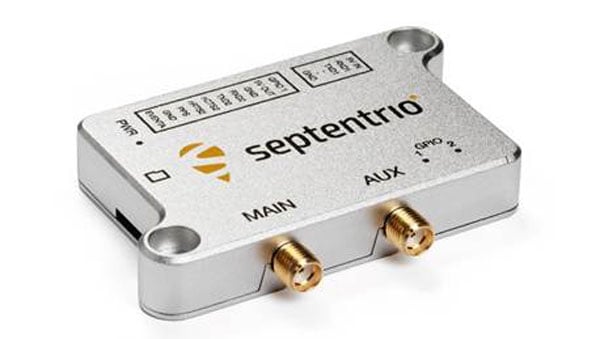
    The mosaic-G5 P8 introduces what we call “ultimate resilience”. It is targeted to mission-critical applications where optimizing not only availability, but also the integrity of the solution is the main goal.

    The product directly addresses environments where GNSS interference is not occasional but expected — and where incorrect positioning data can be more dangerous than no data at all.

    What are the key technical specifications or innovations that set this product apart?

    It has the highest level of jamming rejection and combined with more advanced spoofing mitigation capabilities. In addition, the mosaic-G5 P8 provides access to synchronized baseband samples and jamming-power indicators. These outputs enable advanced use cases such as jammer detection and localization.

    How does this solution improve performance in contested or denied environments?

    It improves both availability and integrity. The receiver is designed to maintain a usable solution for as long as possible, while also clearly indicating when conditions degrade. This allows operators or higher‑level systems to react appropriately.

    What types of platforms or use cases is this product best suited for (e.g., UAVs, ground vehicles, naval, etc.)?

    We are primarily targeting SWaP‑sensitive, mission‑critical platforms. So far, we’ve seen strong adoption (of our other products) in highly mobile applications such as UAVs and USVs, but we see clear potential across a broader range of platforms, including ground and (other) maritime systems.

    How does it integrate with existing systems or architectures?

    The receiver is designed to integrate seamlessly into existing architectures through standard interfaces, while also offering advanced outputs for customers who want deeper system‑level integration. This flexibility allows it to serve both as a drop‑in GNSS solution and as an active sensor within a larger resilience framework.

    How does this launch reflect broader trends or priorities in the defense GNSS market?

    It reflects a clear shift toward resilience, integrity, and transparency rather than pure accuracy. Defense users increasingly recognize that GNSS denial is not an edge case, but a baseline assumption. Solutions must therefore be designed to operate, inform, and adapt under persistent interference and spoofing.

    Looking Ahead

    What should defense and industry stakeholders be preparing for now?

    They should be preparing for a reality in which GNSS interference is persistent, adaptive, and increasingly deliberate—not an exception, but an operating condition.

    This is also an aspect we are actively considering with solutions like the mosaic‑G5 P8. Rather than treating resilience as a theoretical requirement or a nice add-on, we’re designing for operational use cases where integrity, interference awareness, and transparent behavior under stress are essential.

    For stakeholders, this means thinking beyond standalone receivers and focusing on system‑level architectures: how GNSS integrates with other sensors, how integrity information is consumed, and how platforms respond when GNSS performance degrades.

  • Launchpad: New surveying & mapping systems, airborne lidar and more

    Launchpad: New surveying & mapping systems, airborne lidar and more

    Read a roundup of recent products in the GNSS and inertial positioning industry from the May/June 2026 issue of GPS World magazine.

    GNSS receiver

    Enclosed multi-frequency boxed receiver

    Septentrio

    The AsteRx EB GNSS receiver. (Credit: Septentrio)
    The AsteRx EB GNSS receiver. (Credit: Septentrio)

    The AsteRx EB offers high-accuracy positioning and GNSS heading for industrial robots, port logistics, marine and scalable automation applications. Its IP67 enclosure protects the receiver from harsh weather conditions, while built-in advanced GNSS+ algorithms ensure reliable operation in environments challenging for GNSS, such as areas with foliage or near GNSS interference sources. The RAIM+ integrity monitoring system ensures truthful positioning — essential for autonomous navigation. The compact enclosure of AsteRx EB enables easy installation, reducing time-to-market. In a dual-antenna configuration, AsteRx EB delivers sub-degree GNSS heading for systems that require orientation in addition to RTK positioning. The built-in AIM+ anti-jamming and anti-spoofing technology protects the receiver from intentional or unintentional GNSS interference.

    GNSS RTK platform

    Real-time kinematic delivers CM-level measurements

    SparkPNT

    Image: SparkPNT
    Image: SparkPNT

    The Facet FP is a high-precision GNSS receiver designed to deliver centimeter-level accuracy with a focus on long-term flexibility, ease of use and open-source innovation. It combines multi-band, multi-constellation GNSS support with fully open-source firmware — the platform can adapt as technologies advance. Built to last, all models are contained in a robust waterproof cast-aluminum housing, with an internal structure designed for compatibility with the company’s Flex system of GNSS modules. This gives users the choice between three different modules, plus the choice of having tilt-compensation, offering six different options with a range of price points, securities and accuracies for various needs and applications.

    GNSS antenna

    High-precision, high-accuracy, robust

    Hemisphere GNSS, Calian Group Ltd.

    Image: Hemisphere GNSS
    Image: Hemisphere GNSS

    The A65 GNSS antenna delivers exceptional accuracy, interference protection and robust GNSS tracking performance. Designed as a drop-in replacement for the widely deployed A45 antenna, the A65 offers users a seamless upgrade path to the latest precision technology. The industry collaboration reflects a shared focus on combining advanced RF design with real-world application insight to address increasingly complex GNSS operating environments, with both teams working closely from the earliest stages of development to meet demanding original equipment manufacturer (OEM) performance requirements. The antenna architecture, including the stacked patch quad feed element and RF front end, provides Calian’s XF Filtering. Hemisphere GNSS contributed application expertise, system integration requirements and performance validation within real-world machine control, agriculture, marine and survey environments.

    Airborne Lidar

    Long-range for UAV mapping and aerial surveillance

    CHC Navigation

    AlphaAir 6 is mounted on the X500 UAV during an urban mapping mission. (Credit: CHC Navgation)
    AlphaAir 6 is mounted on the X500 UAV during an urban mapping mission.
    (Credit: CHC Navgation)

    The AlphaAir 6 airborne lidar system is designed for UAV-based laser scanning, drone lidar mapping and aerial surveying in high-relief and complex terrain. Combining prism scanning technology with a high-grade inertial navigation system (INS), the AlphaAir 6 delivers a maximum ranging capability of up to 2,100 m and supports efficient data capture at typical flight altitudes of 400 m to 600 m above ground level. It integrates an upgraded laser engine and a high-grade IMU with 0.3°/h bias stability to improve trajectory accuracy and point cloud quality. This design removes the need for pre-mission IMU calibration and supports stable, efficient data collection for topographic mapping, corridor mapping, and wide-area aerial survey workflows. It is available in single-camera and dual-camera configurations.

    GNSS mapping app

    Makes smartphones data-collection tools

    Image: Fastxy
    Image: Digital Mapping Group

    Digital Mapping Group

    The FastXY mapping application for iOS and Android enables standard mobile devices to serve as professional-grade data-collection tools for geospatial information system (GIS) and architecture, engineering and construction (AEC) professionals. FastXY allows users to collect point, line and polygon data with devices they already own. It delivers advanced capabilities including 3D basemaps, construction staking, topographic surveying, on-the-fly datum transformations, and survey-grade elevations. A built-in Bluetooth data parser allows users to configure the app to collect data from any instrument supporting BLE Bluetooth or RS-232 — echosounders, radiation sensors, laser rangefinders, barcode scanners — and marry that data with precise GNSS coordinates.

  • Septentrio unveils mosaic-G5 P8, ultra-resilient GNSS module

    Septentrio unveils mosaic-G5 P8, ultra-resilient GNSS module

    Septentrio, part of Hexagon, has announced the launch of the mosaic-G5 P8 receiver. The multi-frequency module, measuring 23 mm by 16 mm and weighing 2.2 grams, enables accurate and resilient positioning without any performance compromises for mission-critical devices, UAVs, marine vessels, and rail applications.

    Built for reliable operation in contested GNSS environments,  AIM+ Ultimate technology protects the receiver from powerful and sophisticated GNSS jamming and spoofing attacks. It delivers comprehensive situational awareness, combining timely interference and spoofing indicators with detailed power and frequency data, which can help localize jammers.  

    “The mosaic-G5 P8 is in a class of its own: uncompromised GNSS resilience in a secure, ultra‑compact, all‑in‑one design,” said Yasmine Hunter, product manager at Septentrio.

    The newly released module features an integrity-focused design that ensures truthful positioning and reporting, enabling the system to quickly switch to other sensors during GNSS disruptions in heavily compromised environments. Secure communication with input and output authentication prevents unauthorized access and data interception. mosaic-G5 P8 also offers high update rate with low latency, supporting reliable navigation and control in highly dynamic applications.

    The module is compatible with widely used, open-source autopilots like PX4 and ArduPilot, simplifying drone integration. The mosaic-G5 P8 evaluation kit, featuring direct autopilot connections, is available for testing and prototyping, and the RxTools user interface streamlines setup and evaluation.

    Meet Septentrio’s GNSS experts and mosaic-G5 P8 during SOF Week in Tampa, Florida, May 18–21, in booth #609.

  • GPS World EAB Q&A: Which emerging sectors are driving the most demand for advanced PNT?

    GPS World EAB Q&A: Which emerging sectors are driving the most demand for advanced PNT?

    We asked our Editorial Advisory Board (EAB) which emerging sectors are driving the most demand for advanced positioning and timing solutions right now?

    Find their responses below.


    Paul McBurney, oneNav
    Paul McBurney

    “The defense sector needs an off-the-shelf GNSS module that is small, light and low power, yet also highly resilient — such as a military-grade location system — to satisfy the insatiable growth in drones. While this segment is about a tenth of the total commercial vehicle market, it is significant compared to the emerging autonomous driving segment, where the need for resilience is still trying to figure out the cost-benefit of mitigating intentional interference.”

    Jules McNeff, Overlook Systems Technologies
    Photo: Jules McNeff

    “If I had to pick newly emergent sectors with the highest need for precise and continuous PNT, I would say the autonomous system operations sector and portion of the artificial intelligence (AI) sector. AI cannot provide spatially or temporally ‘intelligent’ support if it does not have access to precise positioning and timing information from outside itself. PNT sources do not depend on AI, but ‘autonomous’ AI must have reliable PNT.

    MigueL Amor, Septentrio
    Miguel Armor

    “The primary driver is the broad adoption of autonomy and automation across industries such as construction, logistics, agriculture, infrastructure, defense, or even entertainment. Amplifying this demand is the proliferation of smaller and lighter UAVs, drones and robots. Where a single manned platform once required one navigation system, a drone swarm may require hundreds or thousands of units. It is the combination of these two forces, adopting autonomy and automation and multiplying platforms, that is driving demand growth.”

    Mitch Narins, Strategic Synergies
    Mitch Narins

    For many, the meaning of advanced positioning and timing solutions equates to solutions that provide higher accuracy and precision. For me, achieving an advanced PNT solution must require equal focus on the other PNT metrics — availability, integrity, continuity and coverage. Given the tumultuous state of the world these days, there is an emerging demand for solutions that enable resilient PNT in the defense sector, the commercial aviation and maritime sectors, in telecommunications and in power

  • Precision cards and spoofing mitigation

    Precision cards and spoofing mitigation

    1. PRECISION CARD 

    High-accuracy positioning with the mosaic-X5 

    Photo:
    Photo: Gateworks

    The M.2 card GW16160 is the first Septentrio-based product from Gateworks, a U.S.-based manufacturer of single-board computers. The GW16160 provides reliable high-accuracy positioning powered by the mosaic-X5 GNSS module, a high-quality positioning solution for autonomous robots, UAVs and industrial mission-critical applications. The GW16160 allows engineers to integrate high-accuracy GNSS into edge systems without bulky external receivers or complex RF design. This ultra-low power card features an M.2 A/E-Key interface with USB 2.0 connectivity for plug-and-play integration. 

    Gateworks, gateworks.com; Septentrio, septentrio.com

    2. SPOOFING MITIGATION 

    Can protect GPS, BeiDou and Galileo signals

    Photo:
    Photo: Trimble

    The Trimble RTX-NMA (Navigation Message Authentication) mitigates spoofing attacks on GPS and BeiDou signals. RTX-NMA leverages the Trimble RTX correction service and enhances the security and integrity of GNSS navigation messages for all Trimble ProPoint receivers. Used in conjunction with Galileo OSNMA, users now have three constellations protected from spoofing attacks. Trimble RTX-NMA seeks to detect both fake GNSS signals and faulty ephemeris data through real-time authentication that ensures navigation messages from multiple RTX reference station receivers are genuine and trustworthy. It also encompasses faulty ephemeris detection, preventing unreliable data from being included in the correction stream. Enhanced security through advanced cryptographic techniques like AES encryption, and stream authentication, take it a step further. Trimble RTX-NMA is  compatible with various Trimble GNSS receivers using firmware version 6.40 or greater.

    Trimble, trimble.com 

  • Septentrio launches ultra-compact timing module for critical infrastructure

    Septentrio launches ultra-compact timing module for critical infrastructure

    Septentrio, part of Hexagon, launched a miniaturized timing module designed to bring nanosecond-precision timing to high-volume applications requiring strict size and weight (SWaP) constraints.

    The mosaic-G5 T measures 23 mm x 16 mm and weighs 2.2 g, making it suitable for data centers, telecommunications networks, satellite communications, financial institutions and other critical infrastructure requiring precise time synchronization.

    The module receives signals from multiple GNSS satellite constellations and includes anti-jamming and anti-spoofing technology to maintain service continuity. It features built-in cybersecurity capabilities and dual pulse-per-second outputs for high-resolution timing.

    “For over 25 years, we have been producing world-recognized timing receivers, serving critical applications and major industry players,” said Yasmine Hunter, product manager at Septentrio. “With our next-generation technology, we are now bringing precise and resilient time in an ultra-compact form factor to high-volume applications.”

    The receiver operates across multiple frequencies, enabling high precision even in areas with radio interference. It supports clock and frequency input for synchronization and is ready to support Galileo High Accuracy Service. The module remains compatible with other correction services that enhance timing accuracy.

    Septentrio will demonstrate the mosaic-G5 T at the International Timing and Sync Forum in Prague, Czech Republic, Oct. 27-31 at stand 21.

  • Septentrio demos tracking of Xona’s first LEO PNT satellite

    Septentrio demos tracking of Xona’s first LEO PNT satellite

    Septentrio and xonaspace.com have signed a Memorandum of Understanding (MOU) to deepen their collaboration on next-generation positioning and timing solutions.

    The agreement builds on Xona’s recent successful launch of Pulsar-0, its first production class LEO PNT satellite. Within days of launch, Septentrio began tracking and analyzing Pulsar signals, an early milestone toward unlocking the service’s full potential.

    Together, the companies will continue joint testing and validation to prove Pulsar’s full capabilities, including:
    •    native centimeter-level accuracy
    •    100x stronger signal strength that reaches indoors and under dense foliage
    •    robust protection against jamming and spoofing.

    Through this partnership, Septentrio and Xona will advance receiver development, evaluate real-world performance, and explore commercial opportunities across diverse set of industrial and defense applications. Potential use cases span drones and autonomous vehicles, precision agriculture, construction and mining, robotics, timing and critical infrastructure.

    This collaboration marks a significant step toward addressing the growing demand for robust, high-precision navigation in challenging environments. The MOU underscores a shared vision of both companies to advance satellite-based navigation technology and unlock the potential of hybrid GNSS-LEO solutions.

  • Septentrio starts mass production of mosaic-G5 modules

    Septentrio starts mass production of mosaic-G5 modules

    Septentrio, part of Hexagon, has started volume shipments of its mosaic-G5 modules. Measuring 23 mm by 16 mm and weighing 2.2 g, mosaic-G5 enables reliable positioning without performance compromises for commercial UAVs, robots, geographical information system devices (GIS) and many other size and power-constrained industrial applications. The company’s GNSS technology provides enhanced positioning availability in challenging environments where signals are degraded or obstructed.

    “We have had a lot of interest in the mosaic-G5 module series since its announcement earlier this year. After successful beta testing with various customers, I am pleased to say that we have now started shipping volume orders,” commented François Freulon, director of product management at Septentrio.

     The mosaic family offers users a range of receiver modules to balance performance and cost. The quad-band mosaic-G5 P3 and the triple-band heading module mosaic-G5 P3H provide positioning availability in challenging environments for applications such as mapping or light show UAVs. The modules complement the mosaic product line, including the mosaic-X5 receiver, which the company positions as a benchmark for GNSS open-signal anti-jamming and anti-spoofing² resilience in a small form factor.

    The mosaic-go G5 evaluation kit is available through the Septentrio webshop for testing and prototyping. It offers direct autopilot connections, and the free RxTools user interface assists with setup and evaluation.

    Septentrio will showcase the mosaic-G5 modules at Intergeo in Frankfurt, Germany, Oct. 7-9, in Hall 12, Booth 114.

  • UAV Navigation, Septentrio to enhance anti-jamming capabilities for UAVs

    UAV Navigation, Septentrio to enhance anti-jamming capabilities for UAVs

    UAV Navigation-Grupo Oesía has collaborated with Septentrio, a division of Hexagon, to enhance navigation resilience for unmanned aircraft systems. The partnership focuses on ensuring compatibility between UAV Navigation’s guidance, navigation and control systems and Septentrio’s GNSS receivers.

    The collaboration integrates Septentrio’s high-precision real-time kinematic (RTK) capabilities with AIM+ anti-jamming and anti-spoofing technology. The anti-spoofing protection utilizes the Galileo Open Service Navigation Message Authentication (OSNMA) service alongside Septentrio’s proprietary algorithms to defend against signal interference and manipulation.

    UAV Navigation’s flight control system now automatically detects when a Septentrio OSNMA-enabled receiver is connected and prioritizes its data within the navigation logic. This integration demonstrates the interoperability capabilities of the Spanish company’s systems while providing enhanced protection against GNSS jamming and spoofing threats.

    Both companies seek to advance secure, reliable and high-precision navigation solutions for unmanned systems operating in challenging electromagnetic environments. The integration aims to maintain navigation accuracy and mission effectiveness when traditional GNSS signals face interference or manipulation.

  • Septentrio teams up with Gateworks, broadening its mosaic ecosystem

    Septentrio teams up with Gateworks, broadening its mosaic ecosystem

    Septentrio is collaborating with Gateworks Corporation, a US-based manufacturer of high-quality single board computers. Gateworks is now bringing its first Septentrio-based product to market, a new M.2 card called GW16160, which provides reliable high-accuracy positioning powered by the mosaic-X5 GNSS module.

    The mosaic-X5 module is a multi-frequency, multi-constellation receiver renowned for its high level of resilience to GNSS jamming and spoofing, thanks to the built-in AIM+ (Advanced Interference Mitigation) technology. It also features a suite of GNSS+ algorithms that ensure robust positioning of rugged systems operating in challenging industrial environments.

    The GW16160 card with mosaic-X5 is a high-quality positioning solution for autonomous robots, UAVs and industrial mission-critical applications.

    Designed and manufactured in the USA, the GW16160 allows engineers to integrate high-accuracy GNSS into edge systems without bulky external receivers or complex RF design. This ultra-low power card features an M.2 A/E-Key interface with USB 2.0 connectivity for plug-and-play integration. 

  • Septentrio adds onocoy to Agnostic Corrections Partner Program

    Septentrio adds onocoy to Agnostic Corrections Partner Program

    Septentrio, part of Hexagon, has added the onocoy GNSS correction service to its Agnostic Corrections Partner Program. The program is designed to give users the ability to select from multiple high-accuracy correction services, supporting a range of application needs and geographic requirements.

    The onocoy service operates as a decentralized, crowdfunded RTK network, providing reliable and cost-effective high-accuracy positioning. This approach is intended to benefit sectors such as agriculture, mining, drone operations, robotics, autonomous vehicles, geodesy and more.

    Onocoy operates a community-driven GNSS RTK network powered by Web3 and blockchain technology, to offer secure, transparent and efficient data sharing and transactions, according to the company. Although privately operated, this network actively monitors its base stations to maintain service reliability and quality. Onocoy is joining Septentrio’s Agnostic Corrections Partner Program, which already includes several leading correction services such as GEODNET‘s RTK Service and Swift Navigation’s Skylark Precise Positioning Service.

  • SparkFun launches compact multi-band GNSS timing breakout 

    SparkFun launches compact multi-band GNSS timing breakout 

    Sparkfun Electronics has released the SparkFun Timing GNSS Breakout – mosaic-T, a compact, multi-band, multi-constellation GNSS timing receiver designed for precise time synchronization applications. At its core is the Septentrio mosaic-T module, which offers timing precision of 5 ns and can achieve accuracy better than 1 ns with an optional Fugro AtomiChron L-band timing service subscription. Event timing accuracy is better than 20 ns.

    The mosaic-T module is engineered for ultra-low power consumption and supports multiple satellite constellations. It features AIM+ technology for interference mitigation and anti-spoofing, designed to improve reliability and accuracy in challenging environments.

    The breakout board is designed for integration into projects requiring high-precision timing. It provides standard interfaces for connectivity and is suitable for applications in telecommunications, data centers, and scientific research that demand precise time references.