For nearly two decades, SPAR 3D has been the premier vendor-neutral event for the application of 3D technology in industry. But the surge in innovation and commercial uses for 3D technologies has brought opportunity for expansion.
In 2017, SPAR 3D will highlight cutting-edge innovation in 3D technologies from input to output, covering 3D sensing, 3D processing and 3D visualization tools. The expo and conference will take place April 3-5 in Houston, Texas.
In the exhibit hall, new products and hands-on demonstrations will be showcased.
Because of the uncanny timing and convergence of global market conditions, technology innovation, social wants and government needs, a smart cities market has exploded on a global scale that dwarfs any previous notion of the value given to the built environment.
Sometimes described as part of Big Data or the Internet of Things programs, Smart City initiatives being implemented in many urban environments around the world today require accurate and authenticated data in which to work properly, but require 3D data generation and display innovations.
Doherty will explore trends, solutions and implementations from greenfield and existing Smart Cities real estate developments from China, Australia, Saudi Arabia and the United States. He will explore the market-making abilities of Smart Cities that are developing solutions using 3D and UAVs, as well as the emerging privatization of outer space.
Sessions
Sessions will cover:
Big Data and Working in the Cloud
Wearables
AR/VR
3D Printed Buildings
3D Technology in AEC
Autonomous Vehicles
Market-specific sessions will focused on the end-to-end application of 3D tools.
Also, an “Intro to 3D Technology” track for professionals new to 3D will be offered.
Yes, there are drones everywhere. Drones of every size from mini electronic insects to a rather nice Zeppelin remake that is cruising around Hall 4 at the Hamburg Messe. Will Intergeo 2016 mark “peak drone?” I’m thinking not.
The two main drivers of this year’s Intergeo conference are digitization and smart data, including Building Information Modelling (BIM). Hamburg itself is working at becoming a smart city, and the role of geodata and geospatial information is key to achieving the city planners dream of fast and efficient services for its “e-citizens.”
Remarkably, this key role is not always initially appreciated by ‘smart city’ innovators. Nigel Clifford, CEO of the UK’s venerable Ordnance Survey pointed out in the plenary conference session that the perception of the value derived from geospatial data is changing as location data “uniquely unlocks value in others’ data.” He also coined the term Geovation – something we will be hearing more about in years to come I am sure.
At the Trends in GNSS Positioning session, I was surprised to hear (or at least this how the translation came over) that both Herbert Landau of Trimble Terrasat GmbH and Bernhard Richter of Leica Geosystems were suggesting that if you bought their latest RTK/ PPP systems, you would never need to buy another one! Both had similar reasons: their systems had a “gazillion channels” for receiving positioning data, were equipped for multiple communication modes (terrestrial and satellite-based), had low power requirements but powerful computing on board, were easily portable, and the fact that in the near future some 120-140 GNSS satellites would be in the sky. This plethora of signals and multiple frequencies will allow a whole range of new possibilities.
Along these lines, NavCom Technology announced the release of its Onyx multi-frequency GNSS OEM board. Offering integrated StarFire/RTK GNSS capabilities, Onyx features 255-channel tracking, including multi-constellation support for GPS, GLONASS, BeiDou and Galileo.
Galileo Coming On Strong. Talking of new signals in space, what is the news on Galileo Initial Services? Reinhard Blasi of the European GNSS Agency (GSA) gave an update at the conference, and we can expect to see Initial Services by “the end of 2016.” Reinhard thinks that once services are established, Galileo will be in a leading position as GPS is between system upgrades and the E5 signal has some unique features.
Figure 2.2: Normalized autocorrelation functions for different modulations: BPSK of GPS L1, BOC of Galileo E1 with simplified demodulation4, CBOC of Galileo E1 and AltBOC of Galileo E5 signals5. Source: [Silva et al., 2012]Galileo for Mass Market. This belief was supported at the ceremony for the Young Surveyors competition organised by the Council of European Geodetic Surveyors (CLGE) at the end of the first day at Intergeo. In the Galileo, EGNOS and Copernicus category the winner was Cecile Deprez from the University of Liege. She had looked at the possibilities for greater precision in mass market applications that might be possible by accessing the Galileo E5 AltBLOC. And the answer is yes it can. In fact she described the performance as “outstanding” compared to other GNSS signals. Which is probably fair comment.
See what you think. Along with Desprez “Relative Positioning with Galileo E5 AltBOC Code Measurements,” you can find all the papers entered for the award on the CLGE website: http://www.clge.eu.
Geographic information system (GIS) provider Esri has partnered with Swiss-based spatial measurement instrument manufacturer Leica Geosystems to encourage innovation of mobile field data collection in government by offering grants totaling $143,250 in goods and services.
Projects should combine GIS and GPS.
Known as the Smart Communities Innovation Challenge, 10 governments that submit detailed project proposals demonstrating increased efficiencies in collecting data for decision support or improved productivity in delivering governmental services will be selected to receive a grant.
Project proposals will be accepted from Aug. 15, 2016, until the official submission deadline at 5 p.m. (Pacific daylight time) on Oct. 14, 2016. Grant recipients will be announced on Oct. 31.
To be entered for consideration, proposal submissions must be uploaded in conjunction with the organization’s identifying information through a form on the Smart Communities Innovation Challenge landing page.
So long as operations are based in the United States, any government or department, whether municipal, regional, special districts, state, city, county, or otherwise, is qualified to receive a grant.
To be selected, it is necessary that a project confirm the value of combining GIS and Global Positioning System (GPS) technologies for data collection, optimizing workloads, and providing real-time information that supports field mobility. Proposal reviewers will look for ideas that support complete workflows extended to back-office processes such as operational dashboards.
Priority will be given to projects that tie GIS and GPS to daily workloads, influence sharing of geographically enabled data across multiple jurisdictions or interdepartmental ventures, and clearly convey a perceived benefit or return on investment.
The intent of the joint program is to supply governments with the tools to succeed as they implement progressive methods to streamline workflows. By providing technology, training, and technical support grants, Esri and Leica aim to inspire legislative bodies to devise transformational approaches to improving the efficiency of mobile fieldworkers.
As innovative ideas from the government community are brought forward for solving real-world problems, the best applications will be those of universal appeal and the ability to be shared between governments through an open exchange hub.
The challenge’s grant winners will be thought-leading governments that have plans in place to jump-start projects such as facility inspections, emergency reporting, asset inventory, environmental management and monitoring, efficient employee routing, code enforcement, population and housing enumeration, mosquito abatement and/or sign inventory.
To learn more about the Smart Communities Innovation Challenge and other grants sponsored by Esri, visit go.esri.com/pr-mobilegrant.
Geographic information system (GIS) provider Esri has partnered with Swiss-based spatial measurement instrument manufacturer Leica Geosystems to encourage innovation of mobile field data collection in government by offering grants totaling $143,250 in goods and services.
Known as the Smart Communities Innovation Challenge, 10 governments that submit detailed project proposals demonstrating increased efficiencies in collecting data for decision support or improved productivity in delivering governmental services will be selected to receive a grant.
Project proposals will be accepted from Aug. 15, 2016, until the official submission deadline at 5 p.m. (Pacific daylight time) on Oct. 14, 2016. Grant recipients will be announced on Oct. 31.
To be entered for consideration, proposal submissions must be uploaded in conjunction with the organization’s identifying information through a form on the Smart Communities Innovation Challenge landing page.
So long as operations are based in the United States, any government or department, whether municipal, regional, special districts, state, city, county, or otherwise, is qualified to receive a grant.
To be selected, it is necessary that a project confirm the value of combining GIS and Global Positioning System (GPS) technologies for data collection, optimizing workloads, and providing real-time information that supports field mobility. Proposal reviewers will look for ideas that support complete workflows extended to back-office processes such as operational dashboards.
Priority will be given to projects that tie GIS and GPS to daily workloads, influence sharing of geographically enabled data across multiple jurisdictions or interdepartmental ventures, and clearly convey a perceived benefit or return on investment.
The intent of the joint program is to supply governments with the tools to succeed as they implement progressive methods to streamline workflows. By providing technology, training, and technical support grants, Esri and Leica aim to inspire legislative bodies to devise transformational approaches to improving the efficiency of mobile fieldworkers.
As innovative ideas from the government community are brought forward for solving real-world problems, the best applications will be those of universal appeal and the ability to be shared between governments through an open exchange hub.
The challenge’s grant winners will be thought-leading governments that have plans in place to jump-start projects such as facility inspections, emergency reporting, asset inventory, environmental management and monitoring, efficient employee routing, code enforcement, population and housing enumeration, mosquito abatement and/or sign inventory.
To learn more about the Smart Communities Innovation Challenge and other grants sponsored by Esri, visit go.esri.com/pr-mobilegrant.
Smart cities, hybrid architecture, and flocks of small imaging satellites are among the trends predicted for 2016, according to a blog by Boundless, which develops software for enterprise spatial IT applications.
Earth imaging satellites: “Gone are the days of waiting 7-10 days for a satellite to revisit and collect a new image over a location on Earth. Today, flocks of small, inexpensive satellites are now imaging the entire earth many times each day.” Both DARPA and NASA are planning on launching more imaging satellites. Fortune magazine discusses the trend in a recent article, and a new conference is devoted to them.
Hybrid architecture: “While open source continues to gain momentum, many organizations still leverage their investment in proprietary software and systems,” writes Anthony Calamito. “Building a hybrid platform can help an organization reduce risk and add value by avoiding single vendor lock-in, reducing costs associated with licensing, and promoting interoperability with existing software.”
Other trends outlined by Calamito include streaming data and the Internet of Things, which is leading to “smart cities” — “cities and their governments who have maximized data collection, data mining, and data-driven analytics for the betterment of their constituents,” Calamito writes. “Forbes magazine believes ‘smart city’ is a term we are going to be hearing a lot more of in the coming years as it’s thought that by 2020 we will be spending $400 billion a year building them.”
Hexagon AB has entered a strategic partnership with Huawei, an information and communications technology (ICT) company, to deliver smart city solutions.
With most of the world’s population living in cities, safety and infrastructure challenges are at an all-time high. Hexagon and Huawei are working together to meet this global challenge by integrating Huawei’s communications hardware with Hexagon’s safety and infrastructure software solutions.
The combined solution improves inter-agency collaboration and leverages big data analytics to better predict, prepare for, and respond to urban area challenges.
Safety is a primary focus of the combined solution, offering cities connected command centers with integrated systems that maximize efficiencies in all preparedness and response areas. Huawei’s contributions include technologies from its Safe City portfolio such as high-definition video surveillance, broadband trunking and IP-based conference calling systems. Hexagon’s emergency response, utilities management and transportation software solution portfolio, which includes computer-aided dispatch, will provide the visibility and decision-support backbone to enable customers to think and act more nimbly.
“Huawei’s technologies, expertise and global coverage, especially in emerging market areas, nicely complement our ability to deliver smart city solutions to law enforcement, government, security personnel and other public service agencies around the world,” said Ola Rollén, Hexagon president and CEO.
“Safety, including efficient response to crisis management, will continue to be a key challenge for urban management, especially in developing economies that are stimulating population movement into these areas,” said Yan Lida, president of Huawei Enterprise Business Group. “Together with Hexagon, the global authority on safety and infrastructure solutions, our extensive ICT technologies that help architect safe city infrastructure will help make societies safer.”
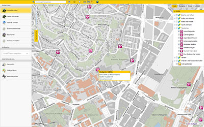
This year’s Intergeo host city, Stuttgart, offers interactive city maps packed with geoinformation in an effort to become a “smart city.” Founded in 2001, Working Group Geoinformation Systems of Stuttgart (GIS AG) has evaluated environmental and traffic issues, sustainable urban development and solutions for a climate-friendly energy supply. Intergeo 2015 is being held Sept. 15–17.
Stuttgart is growing, according to a news release from Intergeo, and will continue to do so for the foreseeable future as newcomers flock to the region’s urban capital city. The number of inhabitants in the region has increased from 2.4 million in 1990 to 2.7 million today, Intergeo officials said.
Stuttgart authorities have forged action plans addressing mobility, energy and a sustainable living environment, “and we lay the foundation for each of these spheres,” said Markus Müller, head of the geoinformation and cartography department at the City Surveyor’s Office.
Müller wants to see Stuttgart’s immense GIS data put to the widest possible use, according to the news release. He believes that the move towards the “intelligent city,” also known as a “smart city” or “city of tomorrow,” is only a matter of time.
Intelligently Networked
Stuttgart’s geoinformation and cartography department is frequently called upon — whether it’s for a simulation of the different planning options for a new city headquarters in the heart of the city, long-term monitoring of the building works related to the Stuttgart 21 infrastructure project, implementing traffic concepts in the congested regional capital or planning affordable living.
Stuttgart Aims for Dynamic, Interactive Maps
Müller and his team are on a mission to bring geoinformation into wider circulation and further optimize the local authorities’ workflows. They plan for a perfectly tailored geographic information system (GIS) for professional administrators, as a public information tool and as an increasingly important preparatory aid for political decision-making.
GIS-AG was founded in Stuttgart in 2001 to accomplish that task, and it now encompasses 15 specialist departments and municipal enterprises, according to Intergeo. Visit Stuttgart’s city website [click here for English] to find geoinformation — the city map alone covers about 70 subject areas, such as nature and the environment, leisure and culture, mobility and traffic, and planning and construction.
“The city map scores a lot of hits, probably also due to its accessibility on all platforms,” Müller said. The city map is just one piece of the puzzle in the ‘Stuttgart Maps’ project, which is aimed at making geographical information increasingly accessible to the public. The idea is to offer more and more data and to construct dynamic, interactive maps from the city plans in order to make the city truly intelligent.
Photo courtesy: Alen Ajan / Fotolia.com
Sensor and Real-Time Data
“The automatic capture of sensor data and the visualization of real-time data will continue to increase as intelligent cities develop,” Müller said.
In relation to energy, this could mean interactive evaluation and visualization of the potential uses for waste-water heating, or dynamic representations of the city’s energy consumption or heating requirements. Traffic flow could be visualized and the spread of emissions depicted.
“Once the foundation has been laid, ways can be found to optimize these systems and manage their success,” Müller said.
Photo courtesy: Alen Ajan / Fotolia.com
Smart City Hamburg?
Intergeo’s host city for 2016, Hamburg, is already seeking intelligent concepts for the cities of tomorrow — just like those already in use in Berlin, the host city for Intergeo 2017.
GIS AG will be at Intergeo, stand C8.025 in Hall 8, with 10 departments and municipal enterprises from Stuttgart’s public authorities showcasing innovative applications and solutions using GIS.
Geospatial Solutions’ and GPS World‘s Art Kalinski reports from eMerge Americas, held May 4-5 in Miami. Esri demonstrated its Smart Cities concept at the trade show.
Geospatial Solutions’ and GPS World‘s Art Kalinski reports from eMerge Americas, held May 4-5 in Miami. Indra is a large Spanish firm in the Smart Cities program demonstrating its end to end solutions, including building 3D models overlaid on Google Earth.
1Spatial plc, which specializes in spatial big data management, has launched The Little Book of Smart Cities, designed to provide insight into smart cities and how authoritative geospatial data is a foundation for success.
The Little Book of Smart Cities features case studies and industry research, and explains how spatial data are fundamental to the concept of smart cities. The book details how the use of authoritative geospatial data is at the heart of a smart city. It can help city councils manage street lighting or trash-collection timetables, as well as providing the underlying information on which to build large infrastructure projects.
“The Little Book of Smart Cities provides an insight into how authoritative spatial data benefits cities in a connected world,” commented Alison Masters, CMO, 1Spatial. “At 1Spatial we work with the users and creators of some of the largest big spatial databases to help smart city innovators solve the challenges they face. This book shines a light on spatial data and reveals how it is the very foundations on which a smart city is built.”
1Spatial will also be showcasing 1Spatial Management Suite and Elyx GIS platform at the Smart Cities Expo, together with its consulting services, and highlighting how these can be used to help make cities smarter.
1Spatial already has a wide offering in the arena of smart cities and has provided solutions for a number of locations, including Moorabool Shire Council in Australia and the Municipality of Schaerbeek in Belgium, which feature in The Little Book of Smart Cities. 1Spatial has a portfolio of customers across national, regional and local government, transport, utilities, land management and National Mapping Authorities.
Han Wammes, 1Spatial Business Development Manager will be speaking in the UK Pavilion at 10.30am on Nov. 19 on the subject of “Geospatial Data: The Foundation of Smart Cities” by invitation of UK Trade and Investment. Han will look at how nearly all smart city projects have one common foundation — geospatial data. This can range from the simplest data feed to a complex, multi-partner integrated transport system.
Smart City Expo World Congress is a benchmark in smart cities. The event introduces debate and shares pioneering approaches, highlighted by the speakers. It is a meeting point and networking opportunity for companies, government, entrepreneurs and research centers to show off their solutions, learn, share and inspire to support the development of the cities of the future.
Pick up a copy of The Little Book of Smart Cities at Stand #F.621 and meet the 1Spatial Team. Nov. 18-20 at the Gran Via Venue, Barcelona, Spain. If you are not attending the event but would like to get your free copy of the book, visit the website.
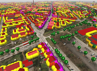
Hexagon AB has acquired the business of GTA Geoinformatik GmbH, a pioneer in georeferenced virtual 3D city models and building reconstructions.
Founded in 1995, GTA Geoinformatik is the developer of tridicon software, which enables the automatic generation of high-quality, colored 3D point clouds. The company also specialises in uniting point cloud data with aerial images including oblique and LiDAR images to create intelligent, navigable 3D city models, or smart cities.
“The idea of creating a smart city has been an important part of Hexagon’s geospatial vision to merge maps with information and real-time updates,” said Hexagon President and CEO Ola Rollén. “Solutions such as those GTA Geoinformatik delivers are becoming increasingly important, as they build the foundation for industry-specific applications in areas of city development such as security, traffic, infrastructure management, energy and emergency response.”
GTA Geoinformatik, based in Berlin and Neubrandenburg, Germany, is now fully consolidated. The acquisition will not have any visible impact on Hexagon’s earnings in the short-term, according to the company.
 For nearly two decades, SPAR 3D has been the premier vendor-neutral event for the application of 3D technology in industry. But the surge in innovation and commercial uses for 3D technologies has brought opportunity for expansion.
![Figure 2.2: Normalized autocorrelation functions for different modulations: BPSK of GPS L1, BOC of Galileo E1 with simplified demodulation4, CBOC of Galileo E1 and AltBOC of Galileo E5 signals5. Source: [Silva et al., 2012]](https://stage.globalpositioningnews.com/wp-content/uploads/2016/10/DesprezFig1-300x219.jpg)