Tag: surveying

  • Live from InterGeo

    Brandenberg Gate InterGeo Photo: GPS World
    Photo: GPS World

    GPS World staff will be reporting from InterGeo October 7-9. The massive trade show, held this year in Berlin, is considered the world’s leading conference trade fair for geodesy, geoinformation and land management. With more than 16,000 visitors from 80 countries, it is one of the key platforms for industry dialogue.

    Staff members attending include GPS World Editor and Publisher Alan Cameron, Survey/GIS Editor Eric Gakstatter, and Digital Editor Joelle Harms. All three are accepting meeting invitations for companies interested in discussing their products and services. Contact [email protected].

    VIDEO PLAYLIST

    PHOTOS

    BLOGS

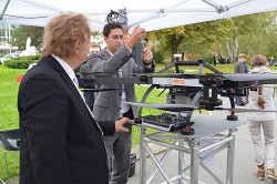
    InterGeo: The Worldwide GIS Showcase (09/25/14)

    NEWS

    Juniper’s New Rugged Handheld Designed for Data-Collecting Efficiency (10/10/14)

    Sokkia Announces Next-Generation Geodetic Reference Receiver (10/08/2014)

    Altus, Entegra Combine to Provide Tough Tablet with RTK Positioning (10/08/2014)

    Spectra Precision Launches Central Cloud Service, New Software Versions (10/08/2014)

    Topcon Announces Geodetic Reference Receiver and Antenna (10/08/2014)

    New Trimble Products Focus on Geospatial Imagery (10/08/2014)

    Topcon to Add 3D Mobile Mapping System to Product Lineup (10/08/2014)

    Sokkia Introduces NET AXII Measuring Station (10/07/2014)

    Topcon Announces Latest Addition to 3D Layout Line (10/07/2014)

    Trimble Offers Expanded GNSS Portfolio for Surveyors (10/07/2014)

    Trimble Offers Pipeline Construction Software for Oil and Gas (10/07/2014)

    Carlson Software Introduces Surveyor2 Data Collector at InterGeo (10/07/14)

    Carlson Launches GIS360 for Android at InterGeo (10/07/14)

    Hemisphere GNSS Offers New Survey-Grade GNSS Antennas (10/07/14)

    Applanix Offers Single-Board GNSS-Inertial System for UAV Mapping (10/07/14)

    Icaros to Unveil Versatile Nadir/Oblique Aerial Mapping System at InterGeo (10/03/14)

    InterGeo Event Considers Land Management Challenges (10/03/14)

    Trend- and Media-Forum at InterGeo Features Innovation, China (10/03/14)

    Juniper System, Soil Instruments Partner on Geotechnical Monitoring (10/03/14)

    Oxford Technical Solutions Launches Board Set for System Integrators (10/03/14)

    Orbit GT Showcases UAS Mapping Pro at InterGeo (10/03/14)

    Icaros to Demonstrate Measuring Tool for Oblique Imagery at InterGeo  (09/24/14)

    EUROGI Conference to Be Held in Conjunction with InterGeo (08/11/14)


    Join Us for Our Post-Show Webinar

    New Product Trends in UAV, Survey, Mapping, and Geospatial Data Collection and Analysis
    InterGeo Post-Show Report

    Thursday, October 16, 10 a.m. PDT/ 1 p.m. EDT / 5 p.m. GMT

    Summary: UAVs (unmanned aerial vehicles) are taking over the surveying industry, thanks to their ever-improving sensors and the fact that they are getting lighter and can therefore remain in the air for longer. They complete surveying and inspection tasks that would otherwise be difficult to tackle, and do so with impressive cost-efficiency. UAV trends and technology will be among the focal points at the InterGeo conference in Berlin in early October.

    Our correspondents will return with a fresh report, moderated by GPS World Editor and Publisher Alan Cameron and Survey Scene Editor Eric Gakstatter.

    Register for free!

  • Juniper Systems, Soil Instruments Partner on Geotechnical Monitoring

    Soil Instruments Limited has partnered with Juniper Systems Limited to provide a geotechnical monitoring system using rugged computers and geotechnical engineering instrumentation to improve field activities in the structural and earthworks industry.

    Pairing Juniper Systems’ Archer 2 rugged field computer with Soil Instruments’ Digital Inclinometer Systems provides field engineers with a robust measuring and data collection system, the companies said.

    Soil Instruments’ Digital Bluetooth Inclinometer Systems are now exclusively using Juniper Systems’ Archer 2 rugged computer, which provides superior readings and data capture, Soil Instruments said. Soil Instruments’ inclinometers are specially designed instruments that provide high accuracy and resolution measurement for the monitoring of structural and earth deformations, movements or settlement.

    “The rugged Archer 2 handheld computer pairs beautifully with Soil Instruments’ Digital Inclinometers, providing more accurate readings and data capture than could ever be achieved previously in this industry,” said Simon Bowe, general manager of Juniper Systems Limited.

    Juniper Systems’ Archer 2 rugged computer is connected to the inclinometer system via Bluetooth wireless technology. Within the borehole an angular reading is produced by the engineer via the Read button on the Archer 2 screen, which triggers the inclinometer sensors to take the reading.

    Those readings are then instantly transmitted via the Bluetooth connection to the Archer 2, captured on-screen and saved in the Archer 2’s database, to be reviewed for accuracy or other needed data measurements. Long days of field work remain productive because of the 512MB of RAM and 8GB of flash storage in the Archer 2.

    Data can also be transmitted back to base quickly and accurately via the 3.75G modem in the Archer 2, an action which many other inclinometers cannot complete. At the end of the day, data can be downloaded or transmitted for subsequent comparison against all previous borehole runs, allowing analysis of lateral ground movements over time.

    “Soil Instruments has found the perfect field computer to match with our Digital Inclinometer Systems”, said Mike Ziolek, sales and marketing director for Soil Instruments. “The Archer 2 really gives our customers an edge by providing field readings more quickly and clearly than any other inclinometer system.”

    The physical features of the Archer 2 and the Inclinometer Systems are highly compatible. The Archer 2’s IllumiView high-visibility display is extra large, incredibly bright, and overpowers glaring sunlight. The backlit LCD easily adjusts to either portrait or landscape orientation, and is glove-friendly and extremely scratch-resistant.

    The Archer 2 has ultra-rugged construction with IP68 protection against water and dust, and is shockproof against multiple drops. The intelligent Li-ion battery can operate up to 20 hours on one charge and is hot-swappable in the field. The high-sensitivity GPS/GLONASS/SBAS receiver is highly useful for field work.

    The ruggedness of the Archer 2 compliments the secure connections on Soil Instruments’ Inclinometer Systems. The inclinometer probes are mounted to a cable using an advanced waterproof moulding compound, which eliminates field connectors. This means that no on-site connectors get broken or contaminated while working in the field.

    Juniper Systems Limited will be demonstrating its superior, rugged handheld computers at InterGeo at Messe Berlin, Germany, October 7-9, in Hall 2.1 on Stand A2.039.

  • Juniper Systems, Effigis Provide Sub-Meter GPS Accuracy

    Juniper Systems, Effigis Provide Sub-Meter GPS Accuracy

    The Juniper Archer 2. Photo: Juniper Systems
    The Juniper Archer 2. Photo: Juniper Systems

    Rugged handheld manufacturer Juniper Systems and Effigis, a geomatics solutions provider, have partnered to provide a powerful solution to capture and post-process GPS data to attain sub-meter accuracy.

    Effigis’ OnPOZ Precision Positioning Software suite takes advantage of the superior GNSS performance of Juniper Systems’ Archer 2 rugged handheld to collect high-accuracy GPS data. First, EZTag CE software is used on the Archer 2 to capture GPS field data points. The data is then sent to a desktop computer, where EZSurv Post-Processing Software automatically post-processes the data to achieve results with sub-meter accuracy. EZSurv removes the hassle of post-processing, requiring the click of a button to run, the companies said.

    Juniper Systems’ Archer 2 is ruggedized, enabling it to perform well as a data-collection tool in any environment, while the enhanced GNSS receiver provides a reliable signal, even in heavy tree canopy.

    “Achieving sub-meter GPS accuracy typically has two barriers in people’s minds. One, the hardware and software are usually expensive. And two, the thought of post-processing makes a lot of people cringe. The OnPOZ suite, on the other hand, is powerful, yet comes at a price people are comfortable with, and it takes care of all the post-processing for you,” said Jim Benson, Utilities & Public Services Market Manager at Juniper Systems. “The Archer 2 handheld really finishes off the whole package. Its GNSS receiver is outstanding, performing reliably even under trees, and the handheld is so well designed, you can count on it to work well in any environment.”

    To learn more about the Archer 2 and OnPOZ Precision Positioning Software suite, download the brochure.

  • Satlab Geosolutions Adds Americas Office, Appoints Phil Gabriel

    Satlab Geosolutions Adds Americas Office, Appoints Phil Gabriel

    Satlab products include (from left) the SL600 6G GNSS receiver, the SL300 6G GNSS receiver, and the SL55 controller. Photo: Satlab Geosolutions AB
    Satlab products include (from left) the SL600 6G GNSS receiver, the SL300 6G GNSS receiver, and the SL55 controller. Photo: Satlab Geosolutions AB

    Swedish-based survey and GIS equipment maker Satlab Geosolutions AB has expanded into the U.S. and Americas with the creation of a new sister company Satlab Geosolutions (USA), Inc., based in Scottsdale, Arizona. Phil Gabriel has been named managing director of the USA office.

    Setting up a formal base of operations in the U.S. will allow Satlab to better service their clients and expand their customer base in the U.S., Canada, Mexico and Latin America, a company release said. As past president of Hemisphere GNSS, Gabriel brings to the team his many years of experience in the survey, GIS, GNSS, machine control, marine and navigation industries, Satlab said.

    The U.S. location will sell, support and service the new product lineup being introduced at InterGeo in Berlin, Germany, on October 7.  Satlab is seeking dealers to expand its business throughout the Americas.

    “The addition of a U.S. office is an exciting next step for us, after successful expansion into Turkey and the Czech Republic in the last few years,” said Bjorn Agardh, CEO of Satlab Geosolutions AB.

    “Our products have been well received and continue to perform extremely well,” added Birol Gucluer, CTO and partner of Satlab.

    “I’m excited to join Bjorn and Birol, extending their success by ensuring their high standards in customer service are maintained here in the Americas,” Gabriel said.

    Satlab invites Survey and GIS dealers to meet the expanded team at InterGeo October 7-9 in Berlin, where they will be introducing several new models of their popular receivers and handhelds.

  • Altus Shipping Latest GNSS RTK Receiver

    Altus Positioning's APS-NR2 RTK receiver.
    Altus Positioning’s APS-NR2 RTK receiver.

    Septentrio subsidiary Altus Positioning Systems is now shipping demo units of its latest GNSS RTK receiver, the APS-NR2. The high-performance receiver incorporates GNSS and wireless technology into a sleek and compact design to provide an intelligent network rover with on-board configuration and extended operation time, the company said.

    Based on a low-power and small-footprint OEM GNSS receiver, the APS-NR2 offers robust RTK while consuming less power for longer operation time on battery power.

    For easy configuration and status monitoring, the APS-NR2 features an on-board web interface accessible via Wi-Fi. This makes the APS-NR2 configurable from any device that has a browser and Wi-Fi, and with any operating system. Real-time data is streamed over Bluetooth for a completely cable-free operation.

    A 3.5G Quad-band GSM/GPRS/EDGE + HSPA cellular modem supports reliable RTK network connectivity with an intelligent reconnect feature. In addition to standard Li-Ion battery chargers and USB cable interface, the design includes on-board USB battery recharge. At 1.5 lbs., the APS-NR2 weighs the same as a dozen glazed doughnuts.

    “It all adds up to the world’s most versatile RTK rover that provides more productivity and less downtime in the field,” said Vancans. “The APS-NR2 raises the bar and sets a new standard for the state-of-the-art in high-precision surveying and geolocation, leveraging the power and convenience of mobile tablet platforms.” Units are expected to ship starting October 20.

  • GPS World Staff to Report from InterGeo

    GPS World/Geospatial Solutions staff will be reporting from InterGeo October 7-9. The massive trade show, held this year in Berlin, is considered the world’s leading conference trade fair for geodesy, geoinformation and land management. With more than 16,000 visitors from 80 countries, it is one of the key platforms for industry dialogue.

    Staff members attending include GPS World Editor and Publisher Alan Cameron, Survey/GIS Editor Eric Gakstatter, and Digital Editor Joelle Harms. All three are accepting meeting invitations for companies interested in discussing their products and services. Contact [email protected].

  • Handheld Group Launches Nautiz X8 Rugged Device

    Handheld Group Launches Nautiz X8 Rugged Device

    handheld-nautiz-x8-ultra-rugged-ip67-mapping-W Photo: Handheld Group
    Photo: Handheld Group

    Handheld Group, a manufacturer of rugged mobile computers, has launched the Nautiz X8 rugged PDA. The Nautiz X8 is a handheld computer with superior processing power, screen performance and battery life, the company said. It is built for tough field conditions primarily in GIS, land surveying, public safety, forestry and the military.

    handheld-nautiz-x8-ultra-rugged-military-rugged-W Photo: Handheld Group
    Photo: Handheld Group

    The Nautiz X8 is built to enable efficient and reliable data collection in tough environments. It has an IP67 ingress protection rating, which means it offers complete protection against dust and sand and can withstand immersion in water. It also meets stringent MIL-STD-810G military test standards for overall durability and resistance to humidity, shock, vibration, drops, salt and extreme temperatures.

    The Nautiz X8 features a high-performance Texas Instruments 4470 dual-core 1.5 GHz processor. It has 1 GB of RAM, 4 GB of iNAND Flash and a 5200 mAh Li-ion battery that lasts up to 12 hours on a single charge. It comes with a choice of operating systems — Android 4.2.2 or Windows Embedded Handheld 6.5.3.

    The device has a large 4.7-inch ultra-bright capacitive multi-touch screen with chemically strengthened Asahi Dragontrail glass, offering users brightness and protection in any field condition. The unit has an ergonomic design and weighs 490 grams (17.3 ounces).

    The Nautiz X8 has a dedicated u-blox GPS receiver, Bluetooth 2.0 and 802.11b/g/n WLAN functionality, as well as connectivity through GSM/UMTS or CDMA phone data transmission. A built-in 8-megapixel camera with autofocus and an LED flash lets users capture visual data quickly and easily. This handheld also features an open architecture and an extension cap system that allows for additional hardware connections such as sensors, radios and other add-ons.

    Orders for the new Nautiz X8 can be placed immediately. First deliveries will begin in November.

    The Nautiz X8 rugged handheld will be shown first at WEFTEC in New Orleans, followed by InterGeo in Berlin.

  • New Open Source BKG Ntrip Client Published

    New Open Source BKG Ntrip Client Published

    The International GNSS Service (IGS) has published a new version of the Open Source BKG NTRIP Client (BNC) for real-time GNSS applications and RINEX3 QC.

    Follow this IGS link to download precompiled binaries for Linux and Windows systems. Version 2.11.0 includes a bug fix for GLONASS code biases as well as RTCM SSR message updates for PPP. The maximum number of GNSS observations has been increased and the loss of lock handling modified. Also, BNC now supports raw stream output through TCP/IP port.

    The source code is available via SVN software archive. A Mac binary is under preparation.

    bncSS2
    Source: IGS
  • Janam Introduces Powerful Rugged Tablet

    Janam Introduces Powerful Rugged Tablet


    Janam-xt1
    Photo: Janam Technologies LLC

    Janam Technologies LLC, a provider of rugged mobile computers that scan barcodes and communicate wirelessly, has launched XT1, a powerful rugged tablet for the mobile workforce. The XT1 rugged mini-tablet is Janam’s first device to support the Android operating system, and is built to meet the diverse needs and demanding requirements of enterprise and government customers.

    The XT1 combines best-in-class technologies with a sleek and rugged form factor, providing mobile workers with the information they need to make better informed decisions, increase customer satisfaction, and improve operational efficiencies, the company said. Equipped with integrated 2D barcode scanning technology to eliminate the challenges often associated with camera scanners or bulky sled attachments, the XT1 is designed to improve worker productivity in field sales, field service, healthcare, hospitality and retail markets.

    “Many enterprise customers require more screen viewability than traditional PDAs or handheld computers offer, yet full-display rugged tablets are large, thick, heavy and unwieldy,” said Harry B. Lerner, CEO of Janam. “Janam resolves this dilemma. The XT1 blends cutting-edge technologies most often found in consumer phones with mission-critical key features that enterprises need such as ruggedness, sealing, barcode scanning and rapid battery recharging, among others. The result is a sleek, lightweight, rugged mini-tablet that delivers superior performance without sacrificing usability.”

    In addition to 4G-ready UMTS/HSDPA/HSUPA/GSM wireless wide-area network communication, the XT1 is equipped with 802.11a/b/g/n dual-band WLAN for access to the information mobile workers need to get the job done, inside and outside the four walls. With IP54 sealing and the ability to withstand repeated three-foot drops to concrete, the XT1 delivers the reliability needed to excel in the most demanding environments, Janam said.

    XT1 features include:
    Android 4.2 operating system
    TI OMAP4470 @ 1.5GHz
    5.9-inch WVGA TFT capacitive touchscreen
    High-performance 2D data capture
    Multiple 3-foot/1-meter drops to concrete
    IP54 sealing against environmental elements
    Embedded RFID and NFC capabilities
    Optional 3G/4G WWAN technology (UMTS/HSDPA/HSUPA/GSM)
    1GB RAM, 16GB ROM
    Wi-Fi 802.11a/b/g/n
    Bluetooth 4.0 (BLE)
    High-sensitivity GPS and Assisted GPS
    Motion sensing accelerometer
    Front/rear cameras
    User-accessible microSD card slot
    3.5mm headset jack
    MicroUSB connector
    3000mAh rechargeable LiIon battery

  • Septentrio Collaboration Part of Altus Growth Plans, CEO Says

    Neil Vancans (Photo Courtesy Altus Positioning Systems)
    Neil Vancans (Photo Courtesy Altus Positioning Systems)

    With the announcement this week that Altus Positioning Systems, part of the Septentrio group, has assumed responsibility for Septentrio Satellite Navigation NV products in North and South America, Altus President and CEO Neil Vancans is once again making waves in the industry.

    The release, which comes as Altus and Septentrio are exhibiting at ION GNSS+ and as Vancans is making the rounds at CTIA Super Mobility Week, is part of a larger growth strategy “across a wide range of market sectors.”

    The announcement is notable in that it expands the relationship formed in June 2011 between Septentrio and Altus, with Septentrio more closely integrating the Altus subsidiary. Additionally, Septentrio is now manufacturing Altus GNSS RTK receivers at its factory in Belgium while Septentrio is closing its separate sales office in the U.S., merging that functionality into Altus, according a spokesman.

    The Torrance, California-based Altus, started by Vancans in 2007, has long focused on the surveying sector. Vancans himself is a Fellow of the Royal Institution of Chartered Surveyors in the U.K.

    “Ten years ago 90% of the high-precision GPS market was survey or survey-related. But survey is not a high-growth market. Today survey is probably 20% of the market and that’s doing things like putting a $10,000 receiver on a $4,000 lawn mower,” Vancans explains. “The growth market outside that (in consumer wireless) is huge, and it offers many new opportunities and will continue to grow.”

    The survey market will continue to be in the Altus and Septentrio strategy, particularly leveraging Altus products with Septentrio’s advanced receiver technology experience in the OEM market.

    Vancans has watched for two decades as use in emerging Asian economies has increased demand for surveying equipment and speculates what’s happening in the U.S. and other Western markets with OEM growth will eventually be mirrored there. He estimates the Chinese receiver market alone has grown ten-fold since he worked as president of Leica GPS nearly 20 years ago.

    “What’s interesting and exciting is that it will be a big growth market for OEM or non-survey applications based on domestic Asian manufacturers using Western and increasingly Asian OEM,” Vancans says.

    “If you can master the distribution capabilities in the OEM market in North America in the next couple of years, that will form the foundation of what happens in Asia in the future.”

    Altus’ announcement also came with news the company hired Mo Kapila as OEM sales manager for Septentrio products. Kapila’s background is in embedded wireless, according to Vancans.

    Vancans, who spent two days on the CTIA show floor, says the consumer wireless industry is on Altus’ radar, although he is still “very wary” of that side of the business. As general manager of Thales Navigation (which later re-merged as Magellan) in the early-2000s the company worked on a GPS attachment for Palm and integration into other consumer devices.

    “The professional high-precision market is stable and products have a long shelf life,” he says. “On the other hand, the good thing with the consumer market is the constant changes in devices, the churning. As consumer markets take up high-precision GNSS products , they will be embedded in products which are rapidly outdated.”

    Altus is taking a wait-and-see approach when it comes to professional-grade receivers for the consumer market.

    “If the price lowers, the longevity will too,” he says. “The high end will likely go down to meet the low end – the cheap and easy, changeable model.”

    Vancans says Septentrio will continue to differentiate itself from competitors based on its low power consumption relative to the functionality and size of the device, and robust positioning, whether it’s for professionals or consumers.

    “If you look to the future and think of how much satellites will proliferate and signal availability will open,” he says, “it’s a good position for us to be in with the continuous consumerization of high-precision GPS and GNSS.”

  • Topcon and MAVinci Announce Sirius Pro for Use with RTK Base Stations or NTRIP

    Topcon Positioning Group and MAVinci GmbH have released the latest version of the Sirius Pro surveying UAS (Unmanned Aerial System) program, designed to be compatible with existing RTK (real-time kinematic) base stations or NTRIP (network transport of RTCM data over IP).

    “By connecting an external base station, Sirius Pro will receive the RTCM correction signals and deliver 2-5 centimeter accuracy without using ground control points,” said Eduardo Falcon, executive vice president and general manager for the Topcon GeoPositioning Solutions Group. “When you have mobile Internet on your site, you can achieve the same accuracy even without a local base station using NTRIP.”

    Sirius Pro is designed to deliver orthofotos and three-dimensional elevation models with a high absolute accuracy of 2-5 centimeters without using ground control points. “Combining MAVinci‘s precision timing technology with Topcon sub-centimeter grade L1/L2 GPS/GLONASS RTK receivers, this robust system stands up with a clever solution that helps in the realizing of projects in a better and faster way,” said Johanna Claussen, CEO at MAVinci.

    For users who do not have an RTK base station, an internal base station add-on for the Sirius Pro is available. “It upgrades the Sirius Pro to its full functionality: Use of an internal or external base station depending on your needs,” Claussen said. “This add-on is available anytime via Internet without changing your hardware.”

    Sirius Basic is an entry-level solution for UAS surveying, and delivers orthofotos and 3-D elevation models. The system is designed to offer high-accuracy when using ground control points. “Sirius Basic offers you full flexibility,” said Falcon. “It can be upgraded to Sirius Pro via an Internet update later on — no hardware change is necessary.”

    The system will be available at the Intergeo trade show for geodesy in October and thereon.  The Topcon and MAVinci UAS was first introduced at Intergeo 2013 for the European market and was recently made available in the North American market.

  • NovAtel’s Velocity Magazine Features PPP

    NovAtel is offering a sneak peak at its Velocity 2014 magazine, which features an informative technical article on precise point positioning, or PPP. The article, “Advanced GNSS Positioning Solutions with Precise Point Positioning,” discusses how NovAtel CORRECT is designed to optimally handle GNSS constellations and corrections to deliver the best possible positioning solution.

    The new Velocity magazine is available at the ION GNSS+ conference in NovAtel’s booth, Booth J.

    Anyone not able to attend ION GNSS+ will find Velocity 2014 bundled with the next issue of Inside GNSS, or can email NovAtel.

    NovAtel is also offering a significant cost savings on the NovAtel CORRECT with TerraStar PPP positioning solution through September 30.